|
Ito Noboru and others Meiji Maps
Lecture National character education All 3 volumes
Not Available 1969. Soft Cover. Fine. The book is in fine condition. Not Available paperback
Referenz des Buchhändlers : 2080502106916718
|
|
|
Edited by Hideki Ozaki et al., Meiji Maps
100 year history of children's books
Not Available 1973. Soft Cover. Fine. The book is in fine condition. Not Available paperback
Referenz des Buchhändlers : 2080502106904303
|
|
|
Domestic and foreign land maps
Map of Saga Prefecture Fishing port location stamp
Not Available 1950. Soft Cover. Fine. The book is in fine condition. Not Available paperback
Referenz des Buchhändlers : 2080502106911444
|
|
|
Written and edited by Tomojiro Tomono, Meiji Maps
Guidance Spirit of the New Book of Doctrine Explications Volume 6
Not Available 1935. Soft Cover. Fine. The book is in fine condition. Not Available paperback
Referenz des Buchhändlers : 2080502106915465
|
|
|
Inner Yamada Soro, Historical Maps Publisher
Yanagawa and Yanagawa people
Not Available 1978. Soft Cover. Fine. The book is in fine condition. Not Available paperback
Referenz des Buchhändlers : 2080502106904230
|
|
|
Tolstoy/Translated by Haruka Ebihara, Meiji Maps
Russian National Education Theory World Educational Selected Vol.44
Not Available 1976. Soft Cover. Fine. The book is in fine condition. Not Available paperback
Referenz des Buchhändlers : 2080502106910374
|
|
|
Written by Eikichi Kurasawa Study Group for Educational Maps
Japanese language instruction
Not Available 1961. Soft Cover. Fine. The book is in fine condition. Not Available paperback
Referenz des Buchhändlers : 2080502106910491
|
|
|
Tadaoki Kumagai, Historical Maps
Eiheiji Chronology
Not Available 1978. Soft Cover. Fine. The book is in fine condition. Not Available paperback
Referenz des Buchhändlers : 2080502106916389
|
|
|
Edited by the Japanese Language Education Society of Japan, Meiji Maps
Reform of Japanese language education Complete set of three volumes
Not Available 1968. Soft Cover. Fine. The book is in fine condition. Not Available paperback
Referenz des Buchhändlers : 2080502106913718
|
|
|
Goncharov/Translated by Tokumitsu Yagawa, Meiji Maps
Educational Theory and School Reform
Not Available 1962. Soft Cover. Fine. The book is in fine condition. Not Available paperback
Referenz des Buchhändlers : 2080502106908338
|
|
|
Domestic and foreign land maps
Saga prefecture map
Not Available 1950. Soft Cover. Fine. The book is in fine condition. Not Available paperback
Referenz des Buchhändlers : 2080502106911445
|
|
|
Volume 4 is 4 maps
Fukui Agata History 4 Volumes Reprint Edition
Fukui Agata History Reprint Publishing Society 1970. Soft Cover. Fine. Number of books: 4 Fukui Agata History Reprint Publishing Society paperback
Referenz des Buchhändlers : 2080502106505576
|
|
|
Main text, illustrations, appendices, 4 maps
Yoshinoga back
Not Available 1992. Soft Cover. Fine. Volume: 1 Not Available paperback
Referenz des Buchhändlers : 2080502106508353
|
|
|
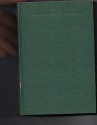
Ransome, Arthur & Blackett, Miss Nancy (Illus) & Spurrier, Steven (Maps)
Swallows and Amazons
London: Jonathan Cape. Good with no dust jacket. 1960. New reser; Second Printing. Hardcover. 022460631X . 8vo hardback; wear to edges of green cloth boards - worn thro cloth at board edges in places; Steven Spurrier Maps to endpapers; prize sticker on half title page; foxing to blocked page edges; spurrier map of wild cat island; G; a decent reading copy of this less common edition; ; Swallows & Amazons Series; 8vo 8" - 9" tall; 351 pages . Jonathan Cape hardcover
Referenz des Buchhändlers : 98113 ISBN : 022460631X 9780224606318
|
|
|
Hermann Kinder and Werner Hilgemann; translated by Ernest A. Menze; with maps designed by Harald and Ruth Bukor
The Penguin atlas of world history v. 1 Penguin reference books
Penguin Books N.A. Soft Cover. Fine. Page size: 2 v. Size: 18 cm New book size Penguin Books paperback
Referenz des Buchhändlers : 2080202103703542
|
|
|
National Geographic Maps
Colorado Trail Map Pack Bundle National Geographic Trails Illustrated Map
Map. New. Brand New. unknown
Referenz des Buchhändlers : 1566957400.S ISBN : 1566957400 9781566957403

|
|
|
Hagedorn, Hermann; Frank Godwin (Illust) & Edwin Eirich (Maps)
The Book of Courage
Philadelphia: The John C. Winston Company. Very Good. 1929. First Edition; First Printing. Hardcover. Color Plates; B&W drawings and pictorial maps; Small 4to 9" - 11" tall; 408 pages; 1929 The John C. Winston Company. Larger stout HC in original blue cloth with decorative pictorial borders in red and gold and a color pictorial panel on paper mounted to the cover inside a double gilt border. Illustrated with color and b&w plates and drawings by Frank Godwin and with pictorial maps by Eirich. Bright solid and neat. No marks. Mild crimping to cloth at spine ends and superficial shelf tapping to corner tips. Light silverfish tracing/patches to top edge of the page block; a few pages with straightened corner creases. VG or better. . Oversize book may require additional charges for expedited or international shipping. . The John C. Winston Company hardcover
Referenz des Buchhändlers : 47781
|
|
|
Walks and maps compiled by Joan Deacon
Isle of Wight: Second 12 Favourite Walks second series
Isle of Wight Great Britain: Isle of Wight Area of the Ramblers' Association 1989. First Edition First Printing . Soft cover. Good. 8vo - over 7¾ - 9¾" tall. drawings by Iris Evans. Illustrated stapled booklet with some fading on the cover. <br/> <br/> Isle of Wight Area of the Ramblers' Association paperback
Referenz des Buchhändlers : 075062
|
|
|
Davis, William C.; Maps, 46 Illus & 8
Battle At Bull Run A History of the First Major Campaign of the Civil War
Norwalk CT: Easton Press. Fine with no dust jacket. 1996. Full Leather. Fine full leather edition no names or other marks. ; 8vo 8" - 9" tall; 298 pages . Easton Press hardcover
Referenz des Buchhändlers : 23672

|
|
|
Philip's Maps
Philip's Street Atlas North Yorkshire
Paperback. Like New. paperback
Referenz des Buchhändlers : GOR012308588 ISBN : 0540087645 9780540087648

|
|
|
Speck, Gordon; Over 50 Illus in b/w and 15 Maps [Illustrator]
Breeds and Half-Breeds
generic 1969-01-01. Hardcover. Very Good. generic hardcover
Referenz des Buchhändlers : 220124012
|
|
|
Lord, Walter; b/w photos/maps [Illustrator]
Day of Infamy Pearl Harbor
Henry Holt & Co 1957. Hardcover. Very Good. Henry Holt & Co hardcover
Referenz des Buchhändlers : 211004140
|
|
|
Davidson B.; photos maps drawings Illustrator
THE LOST CITIES OF AFRICA K4
Little Brown and Company 1959-01-01. Paperback. Very Good. Little, Brown and Company paperback
Referenz des Buchhändlers : 200605031
|
|
|
Sherman, Henry A & Kent, Charles Foster; Illustrated by 158 Maps/Charts & 8 Photos [Illustrator]
The Children's Bible Scribner's Illustrated Editions Series
Charles Scribner's Sons 1922. Hardcover. Good. Charles Scribner's Sons hardcover
Referenz des Buchhändlers : 191229237
|
|
|
Emerson, Edwin and Marion Mills Miller; Illustrated by Maps, 8 Colored Plates, Eng [Illustrator]
NINETEENTH CENTURY AND AFTER A History Year by Year from A. D. 1800 to the Present Vol I 1800-1821
P. F. Collier & Son 1906-01-01. Hardcover. Good. P. F. Collier & Son hardcover
Referenz des Buchhändlers : 190515005
|
|
|
Reader's Digest; line drawings/photos/maps [Illustrator]
Practical Guide to Home Landscaping
Reader's Digest 1972-01-01. Hardcover. Very Good. Reader's Digest hardcover
Referenz des Buchhändlers : 180503051 ISBN : 0888500270 9780888500274
|
|
|
Rand McNally Editors; Color Maps [Illustrator]
Rand McNally Country Atlas Presented By Newsweek
Rand McNally 1995-01-01. Paperback. New. Rand McNally paperback
Referenz des Buchhändlers : 180314151
|
|
|
Muzzey, David Saville; b&w drawings, photos and pictures. Some color Maps [Illustrator]
A History of Our Country
Ginn and Co 1936-01-01. Hardcover. Good. Ginn and Co hardcover
Referenz des Buchhändlers : 161107143
|
|
|
Text by Joseph P. Cullen; Maps by William C. David; Design by Frederic Ray [Preface]
From the Editors of Civil War Times Illustrated - THE SIEGE OF PETERSBURG! Volume IX Number 5 August 1970
Historical Times Inc 1970-01-01. Single Issue Magazine. Like New. Historical Times, Inc unknown
Referenz des Buchhändlers : 151028046
|
|
|
Walks and maps compiled by Joan Deacon
Isle of Wight: Second 12 Favourite Walks Second Series
Isle of Wight Great Britain: Isle of Wight Area of the Ramblers' Association 1989. First Edition First Printing . Soft cover. Good. 8vo - over 7¾ - 9¾" tall. Drawings by Iris Evans. Stapled booklet. Dust spotting and fading on cover. <br/> <br/> Isle of Wight Area of the Ramblers' Association paperback
Referenz des Buchhändlers : 074611
|
|
|
BOSE, Mihir with Sunil Gavaskar (foreword) and Leslie Robinson (maps)
A History of Indian Cricket
Andre Deutsch 1990. Hbk 571pp illustr bw photos maps an unread copy excellent clean tight unmarked in fine unclipped and sleeve-protected dj as new Andre Deutsch, 1990 unknown
Referenz des Buchhändlers : Cri10
|
|
|
Ralph Flenley; Illustrator-8 Maps and Other Drawings in the Text 16 Pages of Photos
Modern German History with Two Additional Chapters Covering WWII and the Post-WWII Years
Dent 1959-01-01. Hardcover. Acceptable. 1959 revised edition hardcover ex-library book with usual stamps and stickerspoor condition spine is broken edges are worn No dust jacket b129 Dent hardcover
Referenz des Buchhändlers : 021310002
|
|
|
Charles Ian maps; Howard Alastair concept.
Royal National Park.
Sydney Hurstville: NSW National Parks and Wildlife Service 2000. 1st ed. Pamphlet foldout tall narrow trade very good plus condition colour text-photos black & white drawings maps. Folded 12 pp. This pamphlet is about Royal National Park southern Sydney New South Wales. It was established as The National Park in 1879 the first to be gazetted in the world. The name was changed to Royal National Park following Queen Elizabeth's visit to Australia in 1954. The pamphlet opens out to show a large map with details about the Park on one side and photos and drawings with the history and information on the other side. It folds into six sections. NSW National Parks and Wildlife Service unknown
Referenz des Buchhändlers : 40689
|
|
|
Mitton, Jacqueline; Balit, Christina (illustrator); Tirion, Wil (star maps).
Zoo in the Sky: A Book of Animal Constellations.
Sydney Mascot: Koala Book Company 1998. 1st Australian ed. Hardback oblong quarto very good condition pictorial cover illustrated endpapers colour drawings few light creases last page minor edgewear. 24 pp. Zoo in the Sky. A children's picture book by Jacqueline Mitton being a magical tour of the skies featuring 19 constellations named after animals birds and fishes. The poetic text supplemented by sky maps and background information about the stars combines with the beautiful incandescent paintings by Christina Balit to create a book that will fascinate children of all ages. Australian edition. Koala Book Company hardcover
Referenz des Buchhändlers : 26621 ISBN : 0864611374 9780864611376
|
|
|
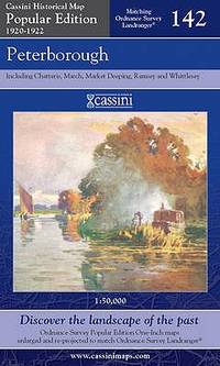
Cassini Maps
Peterborough Cassini Popular Edition Historical Map
Cassini Publishing Ltd 2007. Paperback. Fine. Fine copy with no previous ownership markings and no creases. Cassini Publishing Ltd paperback
Referenz des Buchhändlers : 095936 ISBN : 1847361668 9781847361660
|
|
|
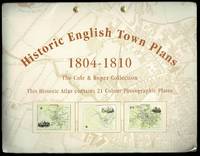
Mercia Maps
Cole and Roper Historic English Town Plans Atlas 1804-1810
Mercia Publications Ltd. Lightly creased corners to covers. 21 colour photographic plates in Fine condition. . Very Good. Soft cover. 2003. Mercia Publications Ltd paperback
Referenz des Buchhändlers : M371 ISBN : 1844912485 9781844912483
|
|
|
PopOut Maps
Tokyo Popout Map Popout Maps
Paperback. Like New. paperback
Referenz des Buchhändlers : GOR011060574 ISBN : 191021812X 9781910218129

|
|
|
Don Mcfall and Jean Karnes (Editors), Illustrated by Maps
A Directory of Illinois Nature Preserves 2 Volumes
Springfield IL U.S.A.: Illinois Department of Natural Resources Division of Natural Heritage 1995 1995. Soft cover. Very Good. 4to - over 9¾" - 12" tall. Very good large soft cover editions. Volume 1: Northeastern Illinois 189 pages. Volume 2: Northwestern Central and Southern Illinois 321 pages. Maps and descriptions throughout. Springfield, IL, U.S.A.: Illinois Department of Natural Resources, Division of Natural Heritage, 1995 paperback
Referenz des Buchhändlers : 001455
|
|
|
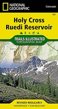
National Geographic Maps
Holy Cross/Reudi Reservoir : Trails Illustrated National Geographic Trails Illustrated Map
Paperback. Very Good. paperback
Referenz des Buchhändlers : GOR011066759 ISBN : 1566952921 9781566952927
|
|
|
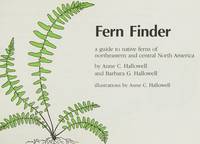
Hallowell, A. & B.; Drawings & Maps [Illustrator]
Fern Finder
Nature Study Guild 1981-01-01. Paperback. Very Good. Very nice book. Minor wear to cover edges and corners. Nature Study Guild paperback
Referenz des Buchhändlers : 123021010 ISBN : 0912550112 9780912550114
|
|
|
Hema Maps Pty LTD
Queensland state NP handy r/v r hema: State Handy Map / camping/Rest areas / National parks / Fully indexed
Paperback. Very Good. paperback
Referenz des Buchhändlers : GOR007642131 ISBN : 1865007145 9781865007144

|
|
|
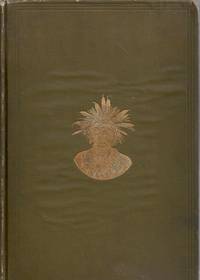
Walcott, Charles D. (Secretary Of The Smithsonian Institution); Holmes, W. H. (Chief); B&W Photographs/Maps [Illustrator]
Twenty-Ninth Bureau of American Ethnology to the Secretary of the Smithsonian Instittuion 1907-1908: Tewa Indians
Smithsonian Institution 1916-01-01. Hardcover. Good. 636 pages with 21 plates 31 maps 1 diagram and index. Quarto 11 1/2" x 8 1/4" issued in olive green with gilt lettering to spine and pictorial to cover. Previous owner's name and address is on inside front board. Red price number on fep. Hinges cracked and pages yellowing. Corners worn to board and bent. Worn edges and wavy cloth on boards. Inside pages clean and binding is tight. Smithsonian Institution hardcover
Referenz des Buchhändlers : b2-4-3
|
|
|
Syers, William Edward; Maps [Illustrator]
Off the Beaten Trail
Texian Press 1976-01-01. Sixth Printing. Hardcover. Like New/Missing. Sixth printing. Small stain on front cover. Inside pages clean and binding is tight. Texian Press hardcover
Referenz des Buchhändlers : 3-5-922

|
|
|
Brooks, Alfred H., et al. and Illustrated by Folding maps
Mineral Resources of Alaska: Report on Progress of Investigation in 1912.
Hardcover. Very Good. 1913 edition minor cover and edge wear. Previous owner's name on front flyleaf. Inside clean with no markings or writing all pull-out charts and maps very good. Nice copy satisfaction guaranteed. hardcover
Referenz des Buchhändlers : SHB-ALASKA-03-21-19
|
|
|
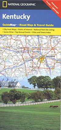
Maps, National Geographic
Kentucky State Guide Map Np Ng R Wp: State Guide Maps National Geographic Guide Map
Paperback. Very Good. paperback
Referenz des Buchhändlers : GOR011853373 ISBN : 1597751596 9781597751599
|
|
|
Philip's Maps
Philip's Red Books Shetland and Orkney
Paperback. Very Good. paperback
Referenz des Buchhändlers : GOR008173216 ISBN : 0540094242 9780540094240

|
|
|
National Geographic Maps
Myanmar Burma National Geographic Adventure Map 3025
National Geographic Maps 2019-01-01. 2019. Map. New. Distributor bookstore overstock. Unused. Light shelfware. National Geographic Maps unknown
Referenz des Buchhändlers : 21-09-12-gw-3859-jm ISBN : 1597756237 9781597756235

|
|
|
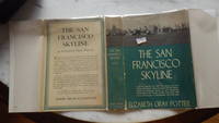
Elizabeth Gray Potter , WITH B/W GLOSSY Frontispiece of Golden Gate Bridge 23 Pgs of Fotos & 9 Maps by Author & Gabriel Moulin
The San Francisco Skyline by Elizabeth Gray Potter in Dustjacket 1939 A Journey Thru the City Chinatown Latin Quarter Portsmouth Plaza Telegraph Hill Embarcadero Shopping Disttrict Civic Center Mission District Presidio Golden Gate Park
HBDJ 1939 on title & Copyright Pg 1st edition VG/VG- PRICECLIPPED But $3 on back of DJ Contains two folding maps Clean lightly-worn copy in Green Cloth with Gold Illustration & Titles DJ has rub Wear Spine & Tiny TEARS & Extremities Chips Lightly worn hardcover in the original dust cover. Book shows very light wear Dust cover is price-clipped and shows wear/chipping to spine ends. A very clean copy that I will call Very Good. Measures 6 1/8 X 8 3/4 284 pages. Contains two folding maps.<br /> Dodd, Mead and Co. hardcover
Referenz des Buchhändlers : 29724
|
|
|
International Travel maps
1. Sri Lanka & South India 1:475000/1:1820000 2008 International Travel Maps
International Travel maps 2008-01-01. Fol Map. Map. New. Distributor bookstore overstock. Unused. Light shelfware. International Travel maps unknown
Referenz des Buchhändlers : 21-10-10-gw-6073-jm ISBN : 1553414128 9781553414124

|
|
|
Luncas Maps
Indexed Map of Lynn Swampscott-Nahant Massachusetts
Reading MA: Lucas Maps 1951. Revised. Paperback. Good Plus. Foled map with green paper covers shows soiling open to 28 x 40 b/w with street names some handling wear o/w very good. <br/><br/>Questions welcome. Images can be made upon request. Lucas Maps paperback
Referenz des Buchhändlers : 13293
|
|
 Per e-mail erhalten
 Als pdf-Dokument herunterladen
 RSS feed


