|
National Geographic Maps (Corporate Author)
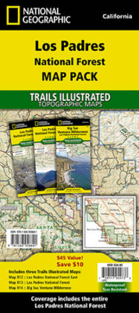
Los Padres National Forest Map Pack Bundle
Natl Geographic Society Maps 2020. Paperback. New. fol map il edition. 6 pages. 9.25x4.25x0.71 inches. Natl Geographic Society Maps paperback
Référence libraire : 1-1566958695 ISBN : 1566958695 9781566958691
|
|
|
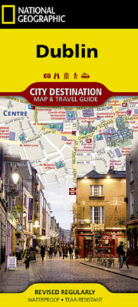
National Geographic Maps (Corporate Author)
National Geographic City Destination Map Dublin
Natl Geographic Maps 2022. Paperback. New. fol map edition. 2 pages. 8.75x4.25x0.25 inches. Natl Geographic Maps paperback
Référence libraire : 1-1566957710 ISBN : 1566957710 9781566957717
|
|
|
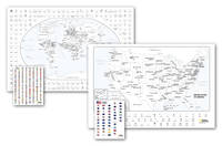
National Geographic Maps
National Geographic World and United States Coloring Map Pack
NATL GEOGRAPHIC MAPS 2020. Paperback. New. map edition. 24.00x36.00x2.00 inches. NATL GEOGRAPHIC MAPS paperback
Référence libraire : 1-1566958555 ISBN : 1566958555 9781566958554
|
|
|
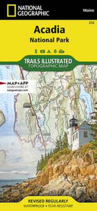
National Geographic Maps - Trails Illustrated
Acadia National Park Map National Geographic Trails Illustrated Map 212
Natl Geographic Society Maps. 2019. Good. It's a preowned item in good condition and includes all the pages. It may have some general signs of wear and tear such as markings highlighting slight damage to the cover minimal wear to the binding etc. but they will not affect the overall reading experience. Natl Geographic Society Maps unknown
Référence libraire : 1566953529-11-1 ISBN : 1566953529 9781566953528
|
|
|
Philip's Maps
Philip's Spain and Portugal Road Map Philip's Sheet Maps
Philip's. Very Good. It's a well-cared-for item that has seen limited use. The item may show minor signs of wear. All the text is legible with all pages included. It may have slight markings and/or highlighting. Philip's unknown
Référence libraire : 1849075433-8-1 ISBN : 1849075433 9781849075435
|
|
|
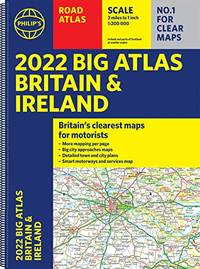
Philip's Maps
2022 Philip's Big Road Atlas Britain and Ireland: A3 Spiral binding Philip's Road Atlases
Paperback. Very Good. paperback
Référence libraire : GOR013431161 ISBN : 1849075654 9781849075657
|
|
|
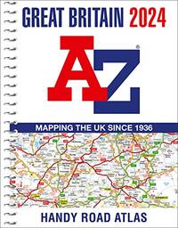
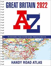
AaZ maps
Great Britain A-Z Handy Road Atlas 2024 A5 Spiral
Paperback. Very Good. paperback
Référence libraire : GOR013434399 ISBN : 0008597634 9780008597634
|
|
|
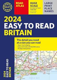
Philip's Maps
2024 Philip's Easy to Read Britain Road Atlas: A4 Paperback Philip's Road Atlases
Paperback. Very Good. paperback
Référence libraire : GOR013450340 ISBN : 1849076200 9781849076203
|
|
|
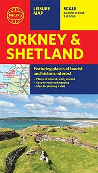
Philip's Maps
Philip's Orkney and Shetland: Leisure and Tourist Map: Leisure and Tourist Map Philip's Red Books
Paperback. Very Good. paperback
Référence libraire : GOR013487229 ISBN : 1849075751 9781849075756
|
|
|
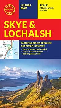
Philip's Maps
Philip's Skye and Lochalsh: Leisure and Tourist Map: Leisure and Tourist Map Philip's Red Books
Paperback. Very Good. paperback
Référence libraire : GOR013501502 ISBN : 1849075735 9781849075732
|
|
|
Collins Maps
Wales Pocket Map: The Perfect Way to Explore Wales
Paperback. Very Good. paperback
Référence libraire : GOR013346197 ISBN : 0008580022 9780008580025

|
|
|
HECKSCHER, AUGUST & ROBINSON, PHYLLIS & FLEDDERUS, DYCK (Maps)
Open Spaces: The Life of American Cities
Harper & Row 1977. Tidy ex-library super octavo hardcover VG in d/w VG; all our specials have minimal description to keep listing them viable. They are at least reading copies complete and in reasonable condition but usually secondhand; frequently they are superior examples. Ordering more than one book may reduce your overall postage costs. Harper & Row 1977 hardcover
Référence libraire : 309741
|
|
|
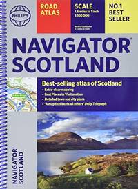
Philip's Maps
Philip's Navigator Scotland Philip's Road Atlases
Paperback. Good. paperback
Référence libraire : GOR013246077 ISBN : 184907545X 9781849075459
|
|
|
Collins Maps
Collins World Atlas: Paperback Edition
Collins 2016-05-01. paperback. Good. 12x9x0. Collins paperback
Référence libraire : 0008158517-3-29386634 ISBN : 0008158517 9780008158514

|
|
|
CLUNIES-ROSS, Major A. et al (Ed) McKENNA, Private P. T. (Maps) & NICHOLSON, Private D. J. (Maps)
The Grey Eight in Vietnam: The History of Eighth Battalion the Royal Australian Regiment November 1969-November 1970
Eighth Battalion the Royal Australian Regiment N/D c.1970. Quarto grey textured buckram boards gilt lettering to spine & front board 160pp illus/photos VG light scuffing & bruising to spine & extrems sl discolouration to boards light tanning to page edges & eps Eighth Battalion the Royal Australian Regiment N/D (c.1970) hardcover
Référence libraire : 303089
|
|
|
Holmes, Sherlock; Wolff, Dr. Julian [Maps]
THE SHERLOCK HOLMES MAP OF ENGLAND: Greeting Card No. 7
London: Graphis Press Limited printer 1964. Single fold card with coloured map by Julian Wolff introductory commentary by Lord Donegall Christmas/New Year greeting and 'An incomplete gazetteer'. 16.2 cm. x 20.3 cm.; within blank envelope edges lightly chipped and browned; Graphis Press Limited printer London 1964. De Waal World Bibliography #4820. 'Julian Wolff who became head of the Baker Street Irregulars in 1960 created an attractive and imaginative series of canonical locations some of which originally appeared in Edgar W. Smith's 'Baker Street and Beyond' other in 'The Baker Street Journal'. In 1984 they were collected and printed as 'The Sherlockian Atlas'. They depict London England Europe the United States Dartmoor and other significant sites including a layout of the interior of 221B Baker Street. In the 1960s Wolff also hand-coloured a set for Lord Donegall editor of 'The Sherlock Holmes Journal' who had them printed as Christmas Cards. These cards are now highly collectible as are the original maps.' The Sherlock Holmes Miscellany Roger Johnson Jean Upton. Graphis Press Limited (printer) unknown
Référence libraire : 141900
|
|
|
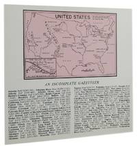
Holmes, Sherlock; Wolff, Dr. Julian [Maps]
THE SHERLOCK HOLMES MAP OF THE UNITED STATES: Greeting Card No. 9
London: N 1966. Double fold card with coloured illustration across inside panels 'Operation House-moving from Baker Street to Chateau de Lucens Switzerland' with key to contents commentary by Lord Donegall brief "The compliments of the season" The Blue Carbuncle message and a smaller map of the United Stated by Julian Wolff above 'An incomplete gazetteer'; 14.9 cm. x 15.9 cm.; within large blank envelope edges lightly browned; London 1967. De Waal World Bibliography #4820. 'Julian Wolff who became head of the Baker Street Irregulars in 1960 created an attractive and imaginative series of canonical locations some of which originally appeared in Edgar W. Smith's 'Baker Street and Beyond' other in 'The Baker Street Journal'. In 1984 they were collected and printed as 'The Sherlockian Atlas'. They depict London England Europe the United States Dartmoor and other significant sites including a layout of the interior of 221B Baker Street. In the 1960s Wolff also hand-coloured a set for Lord Donegall editor of 'The Sherlock Holmes Journal' who had them printed as Christmas Cards. These cards are now highly collectible as are the original maps.' The Sherlock Holmes Miscellany Roger Johnson Jean Upton. N unknown
Référence libraire : 141901
|
|
|
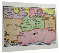
Holmes, Sherlock; Wolff, Dr. Julian [Maps]
THE SHERLOCK HOLMES MAP OF ENGLISH COUNTIES: Greeting Card No. 10
London: Graphis Press Limited printer 1967. Single fold card with coloured map by Julian Wolff 'It is full of old houses' introductory commentary by Lord Donegall Christmas/New Year greeting and 'An incomplete gazetteer'; 16.2 cm. x 20.3 cm.; within blank envelope lightly browned top and bottom edges chipped; Graphis Press Limited printer London 1967. De Waal World Bibliography #4820. 'Julian Wolff who became head of the Baker Street Irregulars in 1960 created an attractive and imaginative series of canonical locations some of which originally appeared in Edgar W. Smith's 'Baker Street and Beyond' other in 'The Baker Street Journal'. In 1984 they were collected and printed as 'The Sherlockian Atlas'. They depict London England Europe the United States Dartmoor and other significant sites including a layout of the interior of 221B Baker Street. In the 1960s Wolff also hand-coloured a set for Lord Donegall editor of 'The Sherlock Holmes Journal' who had them printed as Christmas Cards. These cards are now highly collectible as are the original maps.' The Sherlock Holmes Miscellany Roger Johnson Jean Upton. Graphis Press Limited (printer) unknown
Référence libraire : 141902
|
|
|
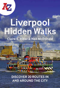
A?Z Maps
A-Z Liverpool Hidden Walks: Discover 20 routes in and around the city
paperback. Good. Access codes and supplements are not guaranteed with used items. May be an ex-library book. paperback
Référence libraire : 0008564965.G ISBN : 0008564965 9780008564964
|
|
|
GRICE-HUTCHINSON, MARJORIE & BENEYTEZ, Fr LUIS RAMIREZ et al (Photos) & VON REISWITZ, STEFAN (Maps)
Children of the Vega: Growing Up on a Farm in Spain
Whitcombe & Tombs 1963. Super octavo hardcover VG in d/w VG-; all our specials have minimal description to keep listing them viable. They are at least reading copies complete and in reasonable condition but usually secondhand; frequently they are superior examples. Ordering more than one book may reduce your overall postage costs Whitcombe & Tombs 1963 hardcover
Référence libraire : 300161
|
|
|
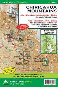
Green Trails Maps (Corporate Author)
Chiricahua Mountains Az Map
Green Trails Maps 2019. Paperback. New. fol map edition. 9.00x6.00x0.20 inches. Green Trails Maps paperback
Référence libraire : 1-1680513672 ISBN : 1680513672 9781680513677
|
|
|
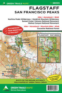
Green Trails Maps (Corporate Author)
Flagstaff Az Map
Green Trails Maps 2019. Paperback. New. fol map edition. 9.00x6.00x0.16 inches. Green Trails Maps paperback
Référence libraire : 1-1680513850 ISBN : 1680513850 9781680513851
|
|
|
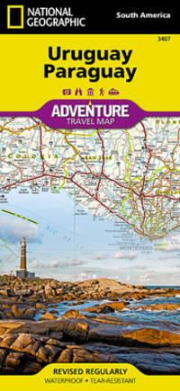
National Geographic Maps (Corporate Author)
Uruguay Paraguay
Natl Geographic Maps 2018. Paperback. New. map edition. 2 pages. 9.25x4.25x0.24 inches. Natl Geographic Maps paperback
Référence libraire : 1-1566957591 ISBN : 1566957591 9781566957595
|
|
|
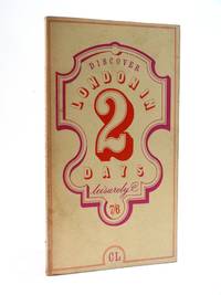
Charles Loewenthal, (text), black & white maps by Michael Hoad, drawings by Andrew Dodds
Discover London in 2 Days Leisurely
London: Loewenthal / Carney 1969. 1st Edition . Soft cover. Very Good. First edition. Card covers. 18 × 10cm 69pp. A charming pocket guide to London with three suggested walks and sections on music opera ballet jazz theatre window-shopping pubs restaurants with prices etc. Illustrated with pen and ink maps and drawings and a large fold-out colour map to the rear. Condition: Very good condition for age but with a little surface tanning to the covers. <br/> <br/> Loewenthal / Carney paperback
Référence libraire : 013631
|
|
|
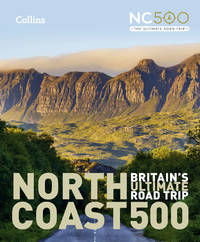
Collins Maps
North Coast 500: Britains ultimate road trip
hardcover. Good. Access codes and supplements are not guaranteed with used items. May be an ex-library book. hardcover
Référence libraire : 000854705X.G ISBN : 000854705X 9780008547059
|
|
|
Franko Maps Ltd.
Red Rock Canyon Nevada Adventure Guide Topographic Trail Map Franko Maps Waterproof Map
Franko Maps Ltd. 2013. Map. New. 2 pages. 12.00x6.00x5.80 inches. Franko Maps Ltd. unknown
Référence libraire : 1-1601909594 ISBN : 1601909594 9781601909596
|
|
|
Franko Maps Ltd.
Guam Adventure & Dive Guide Laminated Map Poster
Franko Maps Ltd. 2017. Map. New. 2 pages. 18.90x2.01x1.89 inches. Franko Maps Ltd. unknown
Référence libraire : 1-1601900910 ISBN : 1601900910 9781601900913
|
|
|
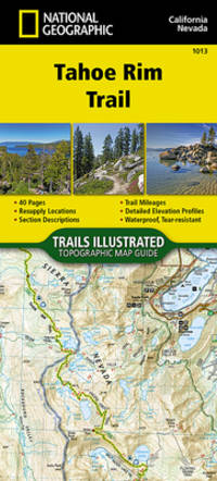
National Geographic Maps (Corporate Author)
Tahoe Rim Trail
Natl Geographic Maps 2018. Paperback. New. pamphlet edition. 40 pages. 9.38x4.25x0.08 inches. Natl Geographic Maps paperback
Référence libraire : 1-1566957494 ISBN : 1566957494 9781566957496
|
|
|
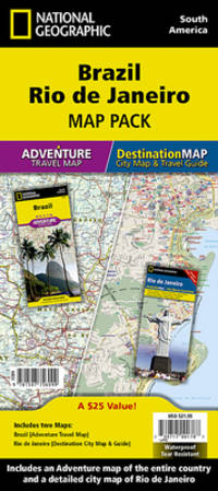
National Geographic Maps - Adventure (Corporate Author)
Brazil Rio De Janeiro: Map Pack Bundle
Natl Geographic Maps 2015. Map. New. fol map edition. 4 pages. 9.90x4.90x0.60 inches. Natl Geographic Maps unknown
Référence libraire : 1-1597756091 ISBN : 1597756091 9781597756099
|
|
|
Seeger Maps
Oshkosh WI
Seeger Maps 2010. Map. New. 1 pages. 8.80x3.70x0.20 inches. Seeger Maps unknown
Référence libraire : 1-1598624016 ISBN : 1598624016 9781598624014
|
|
|
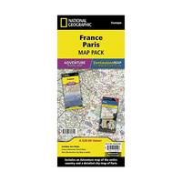
National Geographic Maps - Adventure (Corporate Author)
France Paris Map Pack: France Adventure Travel Map Paris Destination City Map & Guide
Natl Geographic Maps 2015. Map. New. 2015 edition. 4 pages. 4.25x9.00x0.25 inches. Natl Geographic Maps unknown
Référence libraire : 1-1597756113 ISBN : 1597756113 9781597756112
|
|
|
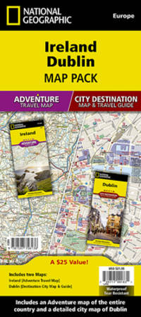
National Geographic Maps - Adventure (Corporate Author)
Ireland Dublin: Map Pack Bundle
Natl Geographic Maps 2015. Paperback. New. fol map edition. 4 pages. 9.10x4.40x0.40 inches. Natl Geographic Maps paperback
Référence libraire : 1-159775613X ISBN : 159775613X 9781597756136
|
|
|
Philip's Maps
2022 Philip's Road Atlas Britain and Ireland: A4 Spiral binding Philip's Road Atlases
Paperback. Very Good. paperback
Référence libraire : GOR012937173 ISBN : 1849075662 9781849075664
|
|
|
National Geographic Maps
Executive Word Map Political Planokarte 3 Tle.: 1 : 14.287.000
National Geographic 2013. Map. New. map edition. 1 pages. 40.50x5.00x5.00 inches. National Geographic unknown
Référence libraire : 1-0792230345 ISBN : 0792230345 9780792230342
|
|
|
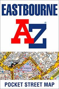
A-Z Maps
Eastbourne A-Z Pocket Street Map
Paperback. Very Good. paperback
Référence libraire : GOR012854603 ISBN : 000839105X 9780008391058
|
|
|
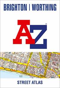
A-Z Maps
Brighton and Worthing A-Z Street Atlas
Paperback. Good. paperback
Référence libraire : GOR012913451 ISBN : 0008445230 9780008445232
|
|
|
Trakker Maps, Inc.
Trakker Map of Tampa Florida Includes St. Petersburg and Plant City Florida
Miami Florida: Trakker Maps Inc. 1999. No Binding. Fine. A plasticized fold out color map 10" x20" which folds to 4" x10". This is a Trakker City Slicker map of the city streets and metro roads of Tampa with major roads of the metropolitan St Pete-Tampa Bay area including St. Petersburg Clearwater Tarpon Springs and Plant City on the reverse. Dozens of points of interest are numbered and a brief street index is included. Available for immediate shipment carefully packed! <br/> <br/> Trakker Maps, Inc. unknown
Référence libraire : 012706 ISBN : 1579520448 9781579520441
|
|
|
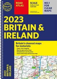
Philip's Maps
2023 Philip's Road Atlas Britain and Ireland: A4 Spiral Philip's Road Atlases
Paperback. Very Good. paperback
Référence libraire : GOR012622468 ISBN : 184907609X 9781849076098
|
|
|
Philips Maps
2020 Philips Big Road Atlas Europe: A3 Spiral binding Philips Road Atlases
Philips 04/04/2019. Paperback. Used; Good. WE SHIP WITHIN 24 HRS FROM LONDON UK 98% OF OUR ORDERS ARE RECEIVED WITHIN 7-10 DAYS. We believe you will be completely satisfied with our quick and reliable service. All orders are dispatched as swiftly as possible! Buy with confidence! Greener Books. Philips paperback
Référence libraire : 4278898 ISBN : 184907500x 9781849075008
|
|
|
AaZ maps
Great Britain A-Z Handy Road Atlas 2022 A5 Spiral
Paperback. Very Good. paperback
Référence libraire : GOR012651455 ISBN : 0008445060 9780008445065
|
|
|
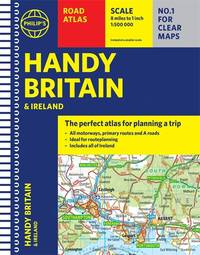
Philip's Maps
Philip's Handy Road Atlas Britain: Spiral A5 Philip's Road Atlases
Paperback. Very Good. paperback
Référence libraire : GOR012689051 ISBN : 1849075778 9781849075770
|
|
|
Philip's Maps
2023 Philip's Big Road Atlas Europe: A3 Spiral binding Philip's Road Atlases
Paperback. Very Good. paperback
Référence libraire : GOR012484772 ISBN : 1849075530 9781849075534

|
|
|
LOCKE, ELSIE & DAWSON, KEN & OATES, JEAN (Illus) & BROWN, CATH (Maps)
The Boy With the Snowgrass Hair
Whitcoulls Publishers 1976. Octavo hardcover VG in d/w VG; all our specials have minimal description to keep listing them viable. They are at least reading copies complete and in reasonable condition but usually secondhand; frequently they are superior examples. Ordering more than one book may reduce your overall postage costs Whitcoulls Publishers 1976 hardcover
Référence libraire : 289268
|
|
|
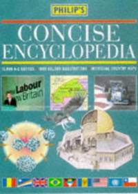
Philip's Maps
Philip's Concise Encyclopedia
Paperback. Very Good. paperback
Référence libraire : GOR012551109 ISBN : 0540064211 9780540064212
|
|
|
Thomas Bros. Maps
San Diego County including Imperial County street guide & directory
Thomas Bros. Maps 1988-01-01. Paperback. New. 1989 Dust cover has some shelf wear. ~ BOOK: New inside and Out! Clean & Crisp Pages. Email for more info/pics Thomas Bros. Maps paperback
Référence libraire : 221009039 ISBN : 0881303070 9780881303070
|
|
|
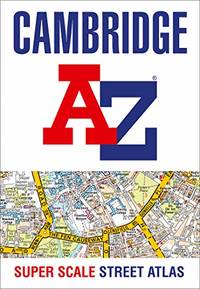
A-Z Maps
Cambridge A-Z Super Scale Street Atlas: A4 paperback
Paperback. Very Good. paperback
Référence libraire : GOR012592570 ISBN : 0008436738 9780008436735
|
|
|
Philip's Maps
2021 Philip's Multiscale Road Atlas Europe: A4 Spiral binding Philip's Road Atlases
Paperback. Very Good. paperback
Référence libraire : GOR012418727 ISBN : 1849075298 9781849075299
|
|
|
Philip's Maps
Philip's Street Atlas Nottinghamshire
Paperback. Good. paperback
Référence libraire : GOR012468120 ISBN : 1849074526 9781849074520
|
|
|
Philip's Maps
2022 Philip's Big Easy to Read Britain Road Atlas: A3 Spiral binding Philip's Road Atlases
Paperback. Very Good. paperback
Référence libraire : GOR012469492 ISBN : 1849075638 9781849075633
|
|
|
Michelin Maps
Italy Atlas Michelin Tourist and Motoring Atlases
Michelin Maps 2005-01-01. Hardcover. Acceptable. 1.1991 in x 29.7774 in x 22.7827 in. NOT an ex-library book. Well read with some wear but still very useable. Michelin Maps hardcover
Référence libraire : mon0000308657 ISBN : 2067112295 9782067112292
|
|
 Recevoir par e-mail
 Télécharger en PDF
 Flux RSS


