2331 risultati
1929rif. 302295Los Angeles 1929. 100 pp of typed documents and an additional 50 album leaves mounted with approximately 50 photographs various sizes and processes and various documents. Folio. Limp leatherette with title and recipient name stamped in gilt to upper cover. Large black quarter morocco clamshell box gilt. 100 pp of typed documents and an additional 50 album leaves mounted with approximately 50 photographs various sizes and processes and various documents. Folio. "It is proposed that a COMPLETE ZOOLOGICAL GARDENS be opened to the public on a fifty cent admission basis which is to be properly laid out as an attractive Zoological and Botanical Garden with the finest and largest private collection of animals birds and reptiles to be seen anywhere on the continent." The advent of the motion picture industry in California had many wide-ranging ramifications on the business world and one was that it created a new market for firms who traditionally supplied animals to circuses and zoos both public and private owned by the likes of William Randolph Hearst. This archive is a report by the Investment Auditors of California for the Horne Corporation that was looking to expand by establishing a zoological garden in the environs of Los Angeles. The Horne Corporation was the largest and most successful of its type at the time apparently the only company in the US that could completely outfit a circus with both animals and show equipment. They were to purchase the Los Angeles Zoological Garden and Jungle Studio for $250000 and thereby sought to provide a similarly complete service to the film studios with both animals and suitable locations for film sets. The head of the company I.S. Horne for whom this report was compiled commenced trading in animals from Kansas City MO around 1914. The range of animals at the their disposal included big game birds reptiles and many of the documents concern the prospect of importing reindeer from Alaska. The material is held in a presentation album and includes the certificate of incorporation in Wilmington Delaware May 13 1929 as well as the by-laws of the corporation minutes of the first meeting the proposal for Los Angeles Zoological Garden and Jungle Studio and a balance sheet. At this stage the company had total assets of $57700 & liabilities of $625388.46; an enumeration of the various animals in inventory including wildebeest sables leopard lynx Rhodesian baboons bushbaby and a large aardvark. Of real interest are the plans for the park including artist's impressions which would be furnished with circus attractions "Monkey Island" jungle setting for motion pictures and an acknowledgment that "before the introduction of the motion picture industry the art of showmanship was not quite so highly developed as it is today." In fact one of the first pictures they supplied animals for was - appropriately enough - Trader Horn which was nominated for the 1931 Academy Award for Best Picture. On a more practical level there is a "Descriptive Classification of Principal Commercial Wild Animals" which lists 340 different animals in some details. There is also an account of hunting wild animals in East Africa as well as a section on animals that have been trained to hunt by man. Furthermore there is also much correspondence which provides much insight into the game industry its clients and the prospects for its future. Horne's venture subsequently became known as the World Jungle Compound in Thousand Oaks California eventually being acquired by 20th Century Fox studios. This archive is a record of a new phase of the entertainment industry. unknown
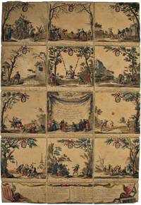
rif. 53336Paris: Crépy 1783. Original hand-coloured engraving overall 72 x 48 cm comprising 15 sections the game occupying 12 sections each 16 x 16 cm. plus 3 half-panels at the bottom for the title and rules of the Nouvelle Combinaison each 8 x 16 cm. Contemporary linen backing. Framed with museum quality glass 99% UV filter - less than 2% reflection. Easily removable from frame Joints holding although fragile wear to corners minor loss to inside margin of lower left title panel light browning a few hanging pin holes at margins. Scarce especially when coloured. Without imprint or date as normal. The 12 panels depict 12 traditional games La Main Chaude Le Balon La Crosse etc which follow the 12 months of the year. Rules for advancing around the board underneath each illustration and a second method of playing in the bottom three panels. [Paris: Crépy, 1783]. unknown
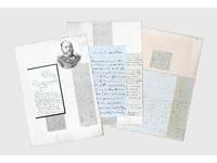
1837rif. 156409Kabul and elsewhere: 1837-41 & 1859. Correspondence chess A carefully assembled collection of material connected to players in the "great game" including Colonel Stoddart and Captain Arthur Conolly both famously beheaded at Bukhara Major Henry Rawlinson the political agent at Kandahar and Captain Sir Alexander "Bukhara" Burns. The material mounted on album leaves with accompanying newspaper clippings and other ephemera is tied together by Connolly and Stoddart's dramatic death. Sent on a mission to secure an agreement of friendship between Britain and the Emir of Bukhara in 1838 Stoddart was arrested by the emir on charges of spying and imprisoned. Conolly the intelligence agent credited with coining the term "great game" in an 1840 letter to Rawlinson arrived in Bukhara in late 1841 to negotiate his compatriot's release. Both men were killed in June 1842 and became household names back home. In the first two letters Burns writing about a year before he was killed by a mob in Kabul shares his views with Rawlinson on the latest moves in the "great game". He writes of Stoddart's short-lived release from prison and of the importance of Conolly's current intelligence-gathering in Central Asia. Shah Shuja "is surrounded by a parcel of harpies" and Burns advises caution about the use of British troops to prop up the Shah's rule: "Nothing contributes so much to lower the King's power as the employment of our troops against Afghans & I would avoid it if possible." As for Lord Auckland the governor-general "does not have great faith in the sincerity of Russia in abandoning her Khiva designs but it gives us time." The third letter from Conolly to Rawlinson discusses local news and offers a lighter-hearted window onto the life of a political agent far from home. He has swapped the diplomatic chessboard for the card table: "We miss you very much - especially at whist" the previous night's rubber being "stale and flat but not unprofitable for I won 9 rupees." This letter is mounted with a page of Stoddart's notes on taking navigational bearings which Stoddart gave to Rawlinson before departing for Central Asia in 1837. The final piece touches on the wider appeal of the Stoddart-Conolly story. Writing to the Cornish baronet Sir Hugh Molesworth almost two decades later Dr Joseph Wolff mentions his second expedition to Bokhara mounted to ascertain the fate of the two men and how the profits from the two editions of his best-selling Narrative of a mission to Bokhara 1845 were sufficient to finance a parsonage and schoolhouse in his living. a Sir Alexander Burns to Major Henry Rawlinson 21 December 1840 Kabul. ALS bifolium written across all sides. b Sir Alexander Burns to Major Henry Rawlinson 20 January 1841 Kabul. ALS bifolium written across all sides. c Captain Arthur Conolly to Major Henry Rawlinson 1840 Kabul. ALS bifolium and single sheet written across 5 sides addressed on final side remains of wax seal. d Colonel Stoddart's autograph notes on taking navigational bearings single sheet written one side. Endorsed on verso by Rawlinson "Given to me by Col. Stoddart on his departure for Bokhara in 1837. H. Rawlinson"; later note to the same effect but in a different hand below. e Revd Dr Joseph Wolff to Revd Sir Hugh H. Molesworth 31 August 1859 Taunton Somerset. ALS bifolium written across 3 sides. 4 autograph letters and single sheet of notes totalling 17 sides of manuscript tipped to or mounted on stubs to card album leaves 370 x 265 mm with laid-down material 11 newspaper clippings 2 printed illustrations sheet of manuscript later brief captions in manuscript. Letters and sheet of notes generally well preserved staining and creasing as expected stubs occasionally just touching text but no loss to sense: a very good collection. unknown
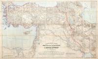
1899rif. 155664Dehra Dún India & Berlin: Photozincographed at the Office of the Trigonometrical Branch Survey of India & Dietrich Reimer 1899-1904. Remarkable assemblage of three important and superbly detailed maps A rare opportunity to acquire three exceptionally impressive and uncommon maps together forming the finest contemporary cartographic overview of the Great Game's central theatre. Spanning from the Mediterranean to Afghanistan and from the Caspian to Sir Baniyas Island they present a striking synoptic view of the region at a moment of intense strategic interest. All three share the same provenance each bearing the distinguished bookplate of the officers' mess library of the 85th Foot later part of The King's Light Infantry. Likely acquired as a group by an officer attuned to imperial affairs in the run-up to or immediate aftermath of the 1907 Anglo-Russian Convention they reflect the period's effort as Hopkirk notes to resolve regional rivalries and curb Germany's eastward ambitions. The Persia map is a landmark Survey of India production and the most comprehensive rendering of the region then available incorporating the latest British and Russian surveys and reconnoitres. Only 300 copies of this August 1904 issue were printed and institutional locations are limited to the British Library Deutsche Nationalbibliothek and Sächsische Landesbibliothek. The impressive wall map of Afghanistan June 1901 produced under Strahan and Gore and executed at the Frontier Drawing Office under Colonel R. A. Wahab is equally rare with copies recorded only at the British Library Wisconsin and the Bayerische Staatsbibliothek. Its authority rests on extensive British and Russian sources including work by Robertson Trotter Sykes Ney Elias and the Afghan Boundary Commission. These maps exemplify the Survey of India's exacting standards during the era of photozincographic production when officers were required to vet every detail under magnification. Kiepert's map of the Ottoman Empire complements the two Survey of India sheets representing the best contemporary mapping of a region Britain could not itself survey. Kiepert one of the foremost scholarly cartographers of the 19th century travelled widely in Ottoman territories producing clear and remarkably accurate maps that remain valuable records of the period. This map is comparatively well represented institutionally with around 17 holdings recorded in Europe the US and the UK. Persia: scale 1:1013760 six-sheet coloured map divided into four linen-backed quadrants each measuring approx. 976 x 963 mm when assembled measuring 1952 x 1926 mm North West North East South West South East each backed with Nonpareil pattern marbled paper each section dissected into 20; Afghanistan: scale 1:1013760 coloured map dissected into 45 sections linen backed measuring approx. 1035 x 1640 mm; Turkey: scale 1:1500000 coloured map dissected into 65 sections linen backed measuring approx. 1016 x 1700 mm; together with the "Apercu general" measuring 412 x 570 mm showing the administrative division of the same area intended to accompany the map; dissected into 10 sections linen backed. Each map housed in the original dull purple morocco-grain cloth case Stanford's printed label to front. Cases a little worn with some loss of fabric light toning to maps otherwise in excellent condition. Cases a little worn with some loss of fabric occasional light toning to maps otherwise in excellent condition. Kourosh Ahmadi Islands and International Politics in the Persian Gulf: Abu Musa and the Tunbs in Strategic Perspective 2008; Kyle J. Gardner The Frontier Complex: Geopolitics and the Making of the Indo-China Border 1846-1962 2021; Peter Hopkirk The Great Game: On Secret Service in High Asia 1992. hardcover
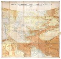
1881rif. 149774St Petersburg: Cartographic Institute of the Military-Topographic Department of the General Staff 1881. The cartographic climax of the "great game" Second edition significantly improved from the first edition 1877 to incorporate the latest military intelligence from field surveys. This magisterial work of "great game" cartography was presented at Russia's Tashkent military headquarters to the daring French explorer Stanislas Benoist-Méchin during his epic 1881-3 overland journey from Beijing to Europe. We have traced no other copies. A presentation inscription on the verso of the map reads in French "To Mr Baron Benoist-Méchin from Generals Kouropatkine and Levaschew October 1882 Tashkent." Benoist-Méchin 1854-1923 began travelling the world as a young man and then served as the French cultural attaché in Tokyo 1880-1. In 1881 he decided to return to Europe via the daring route through Central Asia. Leaving Beijing on 15 September with his regular travelling companion Comte Humbert Adrien de Mailly-Chalon 1853-1921 he journeyed through Manchuria and across Russian Siberia. In 1882 having reached Kashgar they received permission to cross Russian Turkestan spending six weeks in Tashkent as the honoured guests of General Mikhail Tchernayev the architect of Russian's expansion across Central Asia General Aleksey Nikolayevich Kuropatkin 1848-1925 and the aforementioned General Levaschov likely the artillery officer Vladimir Levaschov 1834-1898. After reaching Samarkand they travelled in extreme cold through Bukhara and via Khiva to Tehran reaching Moscow in October 1883 where they were accorded a hero's welcome. Their descriptions of this feat of exploration were published in 1885 in the Bulletin de la Société de géographie. This map was made for the use of the Russian military high command in St Petersburg and in the Turkestan Military District which had been established in the 1860s amid the occupation of Tashkent and Bokhara and dates from a period following the Second Anglo-Afghan War and the Battle of Geok Tepe when tensions were at their height. It encompasses almost the entire playing surface of the "great game" extending east-west from Xinjiang and Tibet to the Caspian Sea and Afghanistan and north-south from Siberia to northern India. Unparalleled in terms of accuracy and detail it names every city town and village and the legend has entries for such features as fortifications railways mail and caravan roads and mines. Spot heights are given in feet and deserts are marked with a light red pattern. It is much improved on the first edition which had only 48 panels and did not extend as far south. Chromolithograph map 195 x 200 cm dissected onto 64 sections and mounted on linen as issued laid-down printed slip stating "corrected up to 1881" small folding tab at right edge. Folding away to 28.5 x 28 cm. Housed in green quarter morocco solander box with chemise by the Chelsea Bindery. Map surface generally clean and brighta few stains toning and soiling at edges small repair at top-left edge verso foxed and with couple of areas of linen reinforcement: very good. unknown
1979rif. mon0000031013The Pennsylvania State Universit 1979. Paperback. Good. in x in x in. The Pennsylvania State Universit paperback