942 résultats
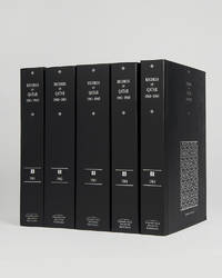
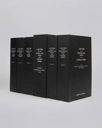
réf. 121953Cambridge Cambridge Archive Editions 2021. . 4 vols 8vo 25.5 x 16.5 cm; 5 large folding maps loose in rear pocket; publisher's original black cloth silver gilt lettering a fine set. A comprehensive collection of documents recording the history of Qatar between the years 1966 and 1971 which saw the withdrawal of Britain from the region and the eventual establishment of Qatar as an independent nation rather than joining the Emirates in a confederation. Cambridge, Cambridge Archive Editions, 2021. hardcover
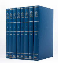
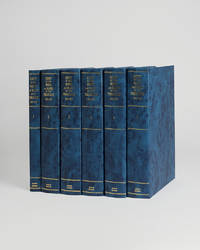
réf. 121085London Archive Editions 1989. . 8 vols 8vo; original blue cloth gilt a fine set. A complete set of this handsome facsimile edition of all eight Persian Gulf pilots published between 1870 to 1932. Invaluable not only for sailing directions but also for descriptions of the coast and its towns and villages and how they have grown over the period. London, Archive Editions, 1989. hardcover
1807réf. ST12145Edinburgh: Printed for Peter Hill et al. 1807. FIRST EDITION. 197 x 114 mm. 7 3/4 x 4 1/2". 2 p.l. v-viii 244 pp. PUBLISHER'S ORIGINAL BLUE BOARDS paper label on spine edges untrimmed. In a felt-lined morocco-backed folding box. Four engraved plates three views and a city plan. Front free endpaper inscribed "Edin. 27th April 1807 / Agnes Cockburn / in memory / of the author." Donovan & Murdoch 270. Boards a little soiled front joint cracked rear joint starting at tail extremities with the expected considerable wear spine label chipped with a fourth of the letters gone but the boards still attached and the extremely insubstantial publisher's binding still appealing because of its original materials. Title page with a bit of offsetting from frontispiece isolated minor foxing in text other trivial imperfections but an excellent copy internally the untrimmed leaves bright fresh and clean with all of their ample margins intact. This is an invaluable early book on the history of St. Andrews in general and more specifically on St. Andrews as the home of the game of golf offered here in the publisher's original boards. It is the first work by the clergyman and polymath James Grierson M. D. 1768-1844 and the first printing of the first work on the ultimate destination of all those who consider golf sacred.The final chapter here entitled "The Company of Golfers" gives a short history of golf provides "an idea of the nature of this elegant amusement" and describes how the earliest golf balls called "featheries" on account of their stuffing were made. The book is dedicated to Lady Elizabeth Moncreiffe the daughter of the renowned military leader and politician George Ramsay 9th Earl of Dalhousie Governor General of British North America and later Commander-in-Chief of India wife to Sir Thomas Moncreiffe and a woman of considerable wealth. Grierson had served as tutor to her son Sir David Moncreiffe 6th Baronet 1788-1830 early in his career and apparently maintained a connection to the family. Our first edition is uncommonly found in publisher's boards. Printed for Peter Hill, et al. unknown
1876réf. 173034London: Printed by Harrison and Sons 1876. We should no longer be looked on as the friendly protectors of the maritime Arabs First edition traced in only five libraries. The opening section centres on the important political implications of receiving fugitives on vessels in the Gulf and reproduces correspondence to and from Edward Charles Ross the Acting Political Resident concerning HMS May Frere whose commanding officer granted safe harbour to a slave from a pearl boat while anchored near Abu Dhabi. London saw curtailing the slave trade in the Indian Ocean and Arabian Sea as a means to consolidate Britain's power in the region and signed anti-slavery treaties with the sultans of Muscat and Zanzibar in 1873. Although guidance from 1871 stated that slaves who were accepted onto naval vessels gained freedom Ross understood the inherent dangers of such an emancipatory approach: "It is however necessary to consider the consequences which would ensue on an excessive exercise in the Persian Gulf of the powers vested in Commanders of vessels-of-war. Nowhere would these be more serious than on the Pearl Banks where the diving is carried on almost entirely by domestic slaves. If the slave should find an opportunity to run off to a British vessel one can easily understand the dismay of the master and the general feeling of consternation and disgust that would be caused by a frequent recurrence of such incidents. We should no longer by looked on as the friendly protectors of the maritime Arabs" p. 2. In Ross's view commanders were best advised not to accept runaways and protect Britain's superior position. We have traced copies at the Senate House Library NYU Abu Dhabi Harvard Florida International University and Leiden. Quarto 315 x 205 mm. Recent blue wrappers. Leaves paginated on verso at top-right. Some rust-marking light creasing and short closed tears internally: about very good. unknown
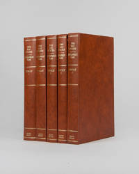
réf. 121996London Archive Editions 1994. . 5 vols 8vo 25.5 x 16.5 cm; numerous charts maps plans graphs and tables; publisher's original orange-brown cloth gilt lettering to spines top edges gilt a fine set. The full development plan for Kuwait of 196/7-1971/2 as well as master plan for the city studies for the National Physical Plan and of urban development the statistics and figures for the years 1963-1988 and the statistical abstract for 1990-91. With numerous maps graphs and charts illustrating the reports as well as the full first five year plan reproduced in Arabic. London, Archive Editions, 1994. hardcover
réf. 121951Cambridge Cambridge Archive Editions 2021. . 5 vols 25.5 x 16.5 cm; publisher's original black cloth silver gilt lettering a fine set. A very important collection of documents charting the the history of Qatar during the years 1961 to 1965 including the rise of the National Unity Front the growth of the Qatar Petroleum Company and the decline of British-Qatari relations. Chapters divide the documents into sections: the Royal Court Council of Ministers communications economy foreign affairs internal affairs judiciary labour and oil among others. Cambridge, Cambridge Archive Editions, 2021. hardcover
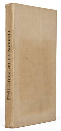
réf. 119766London Hydrographic Department Admiralty 1942. . Ninth edition with the fourth supplement dated 1948; 8vo 24.5 x 16 cm; supplement tipped to front pastedown 2 maps acting as an index for admiralty charts folding meteorological chart 21 plates showing numerous coastal views with additional view of Abu Dhabi fort tipped in from supplement further in-text weather diagrams notice of supplement tipped in to face title numerous annotations making good the corrections from the supplement; publisher's tan cloth lettered in black touch of rubbing to spine very good copy; xxvi 286 pp. A scarce pilot guide of the Persian gulf describing Bahrain Kuwait Qatar Dubai and Abu Dhabi and numerous other villages and towns along the Arabian coast. Includes coastal views of Ras Al Hadd Sur Qalhat As Suwaiq Sohar Fujairah Khasab the Tunb Islands Abu Musa the Doha Fort Bahrain Harbour and Tarut Island amongst others. The guide was published to give accurate sailing directions to the ports towns and safe anchorages along the Arabian coast from Ras al Hadd on the eastern peninsular of Oman to Shatt al Arab in the North and back along the coast of Iran to Bandar Abbas and beyond. With much early information on the principal settlements of the United Arab Emirates Qatar Bahrain Kuwait and Oman and an interesting glossary of Arabic-English key terms. Dubai is described as well as Daira: 'Daira is a large suburb consisting of mat huts amongst which stand a number of well-built houses.' 'Dibai Dubai contains the residence of the Shaikh. There are several tall towers in Dibai; the fort is a conspicuous square building with a round tower. from which the Shaikh's flag is displayed.' Abu Dhabi is similarly described: 'This town consists for the most part of huts and extends along the coast for nearly two miles. In the town there is a small fort partially surrounded by trees with five towers close together. The coast in the vicinity of Abu Dhabi is very low and the beach is of white sand'. There are two views of Qasr Al Hosn one of which appears here with the 1948 supplement for the first time. The great pearl bank is also given attention: 'this extensive bank. fills the great bight in the southern part of the Persian Gulf.' 'Many islands both close to the coast and far offshore lie on the bank. With the exception of Dalma none has permanent inhabitants though they are frequented by the pearl boats during the summer and by fisherman from Abu Dhabi in the winter.' 'The best pilots for the coast are to be obtained at Abu Dhabi.' Much of the information of Qatar and Doha is amended by the supplement and appropriately altered by the annotations showing its quickly changing nature. Bahrain is also described and there is also note of the health of the region: 'Manama. is more liable to epidemics than the smaller ports; since 1920 however there have been no more epidemics in Bahrain than in any other of the larger Gulf ports.' Kuwait is described 'The Shaikh's palace. has a small roof which is the highest point of any building in the town.' 'The principal export is pearls; the chief imports are rice sugar tea flour piece goods matches hardware wheat and barley.' London, Hydrographic Department, Admiralty, 1942. hardcover
réf. 121956London Archive editions 1990. . 5 vols 8vo; 1 vol. text with index map & 4 vols map portfolios containing 55 maps charts and views; original blue cloth gilt a fine set. The first systematic examination of the coastal topography of the Arabian Gulf. A remarkable collection of sea charts harbour plans coastal views and topographical descriptions produced during the survey of the shores and islands of the Persian Gulf carried out between 1820 and 1829 by officers of the Bombay Marine on the orders of the Bombay government. London, Archive editions, 1990. hardcover
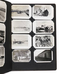
1943réf. ABC_484281943. Contemporary embossed brown cloth with the title embossed in silver on the front board and the green shoulder sleeve insignia of the Persian Gulf Command embedded in the front board. Ca. 32.5 x 26 cm. With 150 gelatin silver photographs various sizes. Unusual military photo album with 150 photographs of the activities of the Persian Gulf Command PGC at the base in Andimeshk Iran. The PGC was a branch of the United States Army established to facilitate the supply of material from the U.S. Lend-Lease programme through the Persian Corridor. This material was sent to the Soviet Union to strengthen it so it could help defeat Nazi Germany. The photographs in this album which cannot be found anywhere else offer a visual documentation of this time. However they show the simple soldiers; the men tasked with driving trucks maintaining oil supply lines or working alongside Iranians at the two factories producing trucks for the war effort. The work therefore offers a fascinating insight into daily life of PCG members in Persia in the Second World War.This album was compiled by John Stefano dates unknown a technician fourth grade in the PGC. It includes photographs of the Tehran conference in 1943 the first World War II conference between the Soviet Union the United States and the United Kingdom where it was decided to open a second front against Germany. Other than this there are photographs of the barracks the men lived in the military vehicles they used the marches and excercises they partook in but also the surrounding landscape and the local people.Inserted in the album is a booklet with images and information about Persia with a letter by PCG commander Donald Prentice Booth 1902-1993 which was sent to PCG members after the war to congratulate them on a job well done. He hoped the booklet would serve as a memento. Together with the album it continues to do so until this day.With the shoulder sleeve insignia of the Persian Gulf command mounted on the inside of the frfont board some of the photographs are captioned on the back. The eyelets for the string on the front board have come loose. The corners of the leaves are slightly creased. Overall in very good condition. hardcover
réf. 122010London Archive Editions 2003. . 6 vols 8vo 25.5 x 16.5 cm; includes maps & genealogical tables; publisher's original black cloth white lettering to upper board and spine a fine set. Lorimer's Gazetteer of the Persian Gulf was compiled by officials of the British Government in India during the decade after Lord Curzon's Vice-Regal tour of the Gulf in 1903. When first issued in 1915 it was classified as Secret and for Official Use Only and just a few dozen copies were printed for circulation to British Government departments and agencies. The work was planned in two parts; the first comprising a history of the Gulf region the second being a geographical dictionary but grew to encompass all aspects of Gulf life culture cities towns tribes and topography. Lorimer was an official of the India Civil Service who had spent most of his career on the North West Frontier. He was placed on 'special duty' to compile the Gulf handbook which was intended to be completed in six months but due to Lorimer's dedication and extensive field trips the work took some ten years to complete. The present edition printed from the India Office Records makes available one of the most important primary sources for the study of the Gulf region from the seventeenth to the early twentieth century. London, Archive Editions, 2003. hardcover
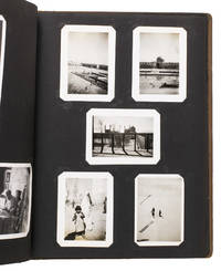
1943réf. ABC_484291943. Contemporary embossed brown cloth with the title embossed in silver on the front board the name of the owner painted in silver and the green shoulder sleeve insignia of the Persian Gulf Command embedded in the front board. Ca. 32.5 x 26 cm. With 76 gelatin silver photographs various sizes. Remarkable military photo album with 76 photographs of the activities of the Persian Gulf Command PGC at various locations in Iran. The PGC was a branch of the United States Army established in 1941 to assure the supply of U.S. Lend-Lease war material to the Soviet Union through the Persian Corridor. After the war members of the PCG received an empty album to fill with personal memories of their time in Iran. These albums are now relatively rare. The present one was compiled by Colonel S. Morgan Thomas dates unknown a PGC member who carried out inspections of the railroads. It includes various photographs of him at work.This album also contains photographs of PCG commander Donald Prentice Booth 1902-1993 a visit by Soviet soldiers and a young child military activity in Teheran locals and soldiers sending telegrams. Loosely inserted in the album are maps of Iran the lands surrounding Hamadan and the Trans Iranian Railroad which would have been important to carry for someone who inspected the railroads. The work offers a rare insight into life of a PGC member stationed in Iran.The corners of the boards are somewhat scuffed. One of the inserted maps is somewhat foxed and another has a tear that has been repaired with tape in the lower margin not affecting the image some leaves are missing one of the corner mounts the photographs are mounted on possibly missing a photograph on the verso of leaf 4. Otherwise in very good condition. hardcover
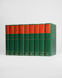
réf. 121954London Archive Editions 1991. . 8 vols 8vo 25.5 x 16.5 cm; 7 vols text & map portfolio containing 12 large folding maps; publisher's original green cloth gilt arms of Qatar to upper boards gilt lettering to spines with red lettering pieces top edges gilt a fine set. An unrivalled collection of material revealing the history of Qatar from 1820 to 1960 focussing on primary documents charting the history of the peninsular from Qatar's first maritime treaty with Britain in 1820 up to the abdication of Ali bin Abdullah in 1960. Many of the documents within are published for the first time. London, Archive Editions, 1991. hardcover
réf. 121947Cambridge Cambridge Archive Editions 2020. . 2 works in 8 vols 25.5 x 16.5 cm; publisher's original black cloth silver gilt lettering a fine set. An extensive collection of documents and letters covering the reign of King Abdulaziz also known as Ibn Saud and the first king of a unified Saudi Arabia from the reconquest of Riyadh in 1902 until his death in 1953. Many of the documents and letters here are published for the first time and many of the letters are reproduced in facsimile in King Abdulaziz's own hand. Cambridge, Cambridge Archive Editions, 2020. hardcover
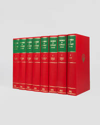
réf. 121949London Archive Editions 1989. . 8 vols 8vo 25.5 x 16.5 cm; 7 vols text & map portfolio containing 9 large folding maps and 2 tables; publisher's original red cloth gilt royal arms of Kuwait to upper boards spines in gilt with green labels top edges gilt a fine set. An impressive set of records documenting the history of Kuwait from 1899 to 1961 covering the period from the first treaty signed between Britain and Mubarak Al-Sabah to the establshiment of Kuwait as an independent state in 1961. London, Archive Editions, 1989. hardcover
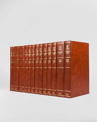
réf. 121946London Archive Editions 1994. . 14 vols 8vo 25.5 x 16.5 cm; includes maps charts & diagrams; publisher's original orange-brown cloth gilt lettering to spines top edges gilt a fine set. The complete development plans of Saudi Arabia from 1970 to 1995 with supplementary documents and reports including the master plans for Jeddah. London, Archive Editions, 1994. hardcover
1955réf. 188201On board HMS Loch Alvie: South Asia and Arabian Gulf 1955-56. Striking visual record of the Gulf at the dawn of the oil boom An attractive photograph album compiled by a Royal Navy rating during service in the Gulf in 1955-56 notable for its early views of Abu Dhabi and other sites in the present-day UAE on the eve of the oil transformation. Drawn to the stark coastline and improvised shore installations he recorded places that within a decade would be reshaped by petroleum infrastructure and urban expansion. Several images relate to Abu Dhabi. A view of Das Island dated 11 April 1956 shows a bare shoreline with oil drums and rudimentary structures in the first phase of development linked to the Umm Shaif field. At Khawr al Bazm 19 April 1956 he photographed the coast from the ship and the firing of a 21-gun salute for the Queen's birthday juxtaposing imperial ceremony with an undeveloped littoral. Four deckle-edged photographs depict Dalma Island - then a remote outpost - including a grave the remains of a wrecked dhow and the stretch of coast where the vessel was driven ashore in bad weather. Today Dalma is recognised as a major archaeological site within Abu Dhabi emirate. Dubai appears in a 22 April 1956 view of water taxis and the souq along Dubai Creek still a modest mercantile settlement. The following day Lord and Lady Mountbatten paused there during their return from Asia and Australasia an event marked by guards of honour and captured in the album. A coastal view of Dibba on the Musandam Peninsula - now divided between Oman and the UAE - records the rugged shoreline before modern development. Although centred on the Gulf the album also includes related regional material - Bahrain including Juffair naval base Qatar's early oil installations at Umm Said and Halul Island and shipboard scenes - placing the UAE images within the wider strategic network of Britain's post-war naval presence east of Suez. The volume concludes with an official photograph of HMS Loch Alvie and a track chart of her cruise under Captain C. J. Matthews sailing from Chatham in July 1955 and returning in July 1956. Landscape folio 270 × 390 mm. 88 mounted silver gelatine photographs the majority personal rather than purchase and 24 of which relate to the Gulf various formats mostly 105 x 80 mm the great majority captioned in white ink leaves additionally decorated with small sketches and various ephemera. Asian black lacquer album silk ties at the spine typical of those available at the Liberty Stores Aden lettered "Souvenir of Aden" on the front cover with a hand-painted map of the Arabian Peninsula and Red Sea surrounded by images of a mosque camel dhow and local inhabitants HMS Loch Alvie cap tally pasted to spine edges gilt decorative gold and silver leaf spackled endpapers; black card mounting leaves. Corners a little bumped and worn a couple of cracks to the lacquer to the back cover; some tissue guards a little creased contents otherwise clean sound and complete; very good. unknown
1917réf. 000214We believe this to be the first complete collection of its kind including several items that we have not encountered in public libraries or archival sources. In any case it represents the most comprehensive collection of issues that we have traced over a period of twenty-five years of Ottoman state publications many of which are difficult to assemble. The collection essentially consists of official reports most of which were prepared by the two ambassadors Fakhr al-Din Rûm Bey Oğlu and Muhammad Nâbi. These reports are highly restricted official documents. Description of the Collection The reports were prepared in Ottoman Turkish except for four items written in modern Turkish after the alphabet reform; these were prepared by İsmail Hakkı Tevfik and Abdulgani Seni Bey. 1. Najd Issue Najd Question Ottoman Turkish report published by the Ministry of Foreign Affairs Istanbul 1918. 15 pages octavo. Prepared by Ambassador Fakhr al-Din Rûm Bey Oğlu and the Ottoman Ambassador in Rome Muhammad Nâbi dated 11 March 1917. The report discusses the political borders of Ottoman Najd; the treaty signed between Süleyman Şefik Pasha and Abdulaziz ibn Saud; the Ottoman–British treaty concerning Najd including Qatar; and the Ottoman treaty with Ibn Saud converting Najd from a mutasarrifate into a province vilayet appointing Ibn Saud as governor and commander-in-chief including military organization. Topics include: Midhat Pasha's report; Wahhabis; the conflict between Saud and Abdullah ibn Faisal; the sheikhs of Muscat Mukalla Oman Hadhramaut and Bahrain and their relations with Britain; Saudi movements along eastern Najd; Ottoman naval response under Midhat Pasha; the administrative difficulty of Najd; support of Mubarak al-Sabah for the Ottomans; coercion of Abdullah al-Faisal to sign the al-Ahsa treaty; Ibn Rashid's advances; tribal dynamics; British support of Al-Sabah; British protection; Ibn Saud and the Muntafiq sheikh; Ottoman–Wahhabi agreements 10 April 1905; British protests regarding Ibn Saud's border violations and interference in Qatar and Oman; the 12-article Ottoman–Ibn Saud treaty of 12 July 1913 including the separation of Qatar from Najd; maritime boundaries; recognition of Jasim Al Thani; compensation to the Sheikh of Bahrain. 2. Muscat Issue Ottoman Turkish report Ministry of Foreign Affairs Istanbul 1918. 6 pages. Prepared by Fakhr al-Din Rûm Bey Oğlu and Muhammad Nâbi dated 27 November 1916. Covers Muscat modern Oman the Imamate foreign involvement Ottoman views rejecting Muscat's independence from the Arabian Peninsula; relations between Najd Muscat and British India; strategic location; occupation history; Al-Sa'id relations with Wahhabis; British and French recognition of Omani independence in 1862; Ottoman perspective on Oman's connection to Arabia. 3. Qatar Coasts Issue Prepared 8 January 1917. Printed at the Imperial Press. 7 pages plus 9 pages of French appendices. Topics include British expansion from Bahrain to Qatar; Ottoman claims; British intervention since 1891; correspondence with the Ottoman state; Bahrain–Qatar disputes over Zubarah and al-'Udayd; appointment of Abd al-Rahman Al Thani; British encroachments; Qatar within the Kuwait treaty framework; confirmation of Jassim Al Thani's authority in 1913. 4. Kuwait Issue Fakhr al-Din Rûm Bey Oğlu & Muhammad Nâbi. Imperial Press Istanbul 1334 AH. 34 pages. Geography population sect history of Al-Sabah; Ottoman administration of Baghdad and Basra; British policy; secret treaties 1899–1904; borders; railways; maritime flags; taxation refusal; British attempts to place Kuwait under protection; Ottoman responses; oil islands Bubiyan Khor Abdullah; Sheikh's declaration of being an officer in the British army. Dated 31 August 1918. 5. Basra Gulf Issue Bahrain Qatar Pirate Coast/Emirates İsmail Hakkı Tevfik. Ankara 1931. 32 pages. Political tribal and documentary history in Turkish English and French. 6. Irrigation in Arabia Fakhr al-Din Rûm Bey Oğlu & Muhammad Nâbi. 14 pages. Ottoman irrigation projects; British interference since 1910; German involvement. 7. Asir Revolt of 1911 Report by Consul General İsmail Hakkı. 31 pages. Ottoman military actions; Idrisi revolt; tribal loyalties; Wahhabi involvement; detailed military maps. 8. Aqaba Issue By Rashdi Infantry Brigade Commander. Istanbul 1326 AH. 154 pages. Ottoman–British relations; Egypt's role; Hijaz railway; Aqaba dispute. 9. War in Arabia between Ibn Saud and the Imam of Yemen By Abdülgani Sünni Bey. Ankara 1934. 20 pages. Unique copy. Covers causes tribal alignments Asir Aden Najran foreign involvement. 10. Guide to the Gulf of Aden Ottoman Turkish. Istanbul 1310 AH. 276 pages. Includes maps; authored by naval officer Süleyman Nutqi. 11. Tripoli Benghazi and the Twelve Islands Issue Report dated 27 November 1916. 24 pages French treaty texts. Ottoman North Africa American conflicts Italian ambitions Lausanne Treaty. 12. Sheikh Sa'id Island Issue Istanbul 1916. 4 pages. Strategic Bab al-Mandab island dispute with France. 13. Palestine Issue – Zionist Claims Istanbul 3 March 1918. 43 pages. Origins of Zionism; European diplomacy; Jerusalem administration. 14. Notes on the Iraq War Military Press 1333 AH. 88 pages. Translated from English for official use only. Rare. 15. Bahrain Issue Report dated 8 January 1917. 12 pages French texts. History British protection treaties 1820–1898 inclusion in 1913 Gulf treaty. 16. Muhammarah Issue Report dated 1 March 1917. 8 pages. Borders oil Sheikh Khaz'al Anglo-Iranian-Ottoman relations. 17. Oil Concessions in Arabia Report dated 26 March 1917. 9 pages English treaty. Mosul Baghdad Basra Shell Najd Kuwait. 18. Baghdad Issue Report dated 31 August 1917. 53 pages French texts. Baghdad Railway; British–Ottoman rivalry; Gulf politics. 19. Farasan Islands Issue Report dated 28 November 1916. 8 pages. German coal depot request; British occupation; oil and gas. 20. Hadhramaut Issue Report dated 11 March 1917. 6 pages. Tribal governance; British relations via Aden. 21. Aden and the Nine Districts Report dated 27 November 1916. 39 pages French annexes. Portuguese Ottoman British rule; Yemen administration; sovereignty claims. 22. Memorandum on British Claims Regarding the Baghdad Line and Basra Gulf Istanbul 21 January 1911. 35 pages appendices. Detailed diplomatic negotiations since 1903. 23. Guide to the Red Sea Istanbul 1307 AH. 459 pages. Comprehensive nautical and railway guide with ports and routes. 24. South Arabia Issue Hadhramaut Socotra etc. İsmail Hakkı Tevfik. Bulgaria 1935. 132 pages with photographs and maps. 25. The Egyptian Issue Prepared March 1918. 186 pages. Ottoman legal and political analysis of Egypt from Muhammad Ali to British occupation. 26. Shatt al-Arab Issue Istanbul 1917. 30 pages. 1913 treaty with Britain; navigation borders Iran Muhammarah. Note İsmail Hakkı Tevfik was a senior Ottoman and Republican diplomat and son-in-law of Sultan Mehmed VI. Fakhr al-Din Rûm Bey Oğlu and Muhammad Nâbi were leading Ottoman statesmen. Other contributors include Süleyman Nutqi naval officer and Abdulgani Seni Bey later a key Republican thinker. 26 items Ottoman Ministry of Foreign Affairs paperback