[ARABIAN GULF]; JARMAN, Robert LBiblio.com
3 923 résultats
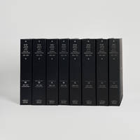
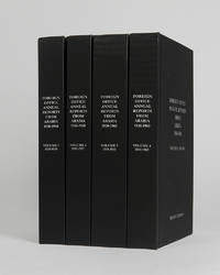
réf. 122002Minneapolis East View 2026. . 4 vols 8vo 25.5 x 16.5; publisher's black cloth lettered white to boards and spines a fine copy. A comprehensive collection of annual reports produced by the British Foreign Office concerning the major regions of Arabia often intended as internal circulars and never for direct publication. Minneapolis, East View, 2026. hardcover
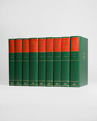
réf. 121954London Archive Editions 1991. . 8 vols 8vo 25.5 x 16.5 cm; 7 vols text & map portfolio containing 12 large folding maps; publisher's original green cloth gilt arms of Qatar to upper boards gilt lettering to spines with red lettering pieces top edges gilt a fine set. An unrivalled collection of material revealing the history of Qatar from 1820 to 1960 focussing on primary documents charting the history of the peninsular from Qatar's first maritime treaty with Britain in 1820 up to the abdication of Ali bin Abdullah in 1960. Many of the documents within are published for the first time. London, Archive Editions, 1991. hardcover
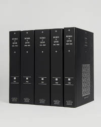
réf. 121953Cambridge Cambridge Archive Editions 2021. . 4 vols 8vo 25.5 x 16.5 cm; 5 large folding maps loose in rear pocket; publisher's original black cloth silver gilt lettering a fine set. A comprehensive collection of documents recording the history of Qatar between the years 1966 and 1971 which saw the withdrawal of Britain from the region and the eventual establishment of Qatar as an independent nation rather than joining the Emirates in a confederation. Cambridge, Cambridge Archive Editions, 2021. hardcover
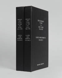
réf. 121999Minneapolis East View 2026. . 2 vols 8vo 25.5 x 16.5 cm; includes maps charts & tables; publisher's black cloth lettered white to boards and spines a fine copy. The complete collection of planning documents for Abu Dhabi from 1962 to 1979 the development plan review for Dubai of 1971 and the Federal Economic and Social Development Plan 1975 to 1980. Minneapolis, East View, 2026. hardcover
réf. 121951Cambridge Cambridge Archive Editions 2021. . 5 vols 25.5 x 16.5 cm; publisher's original black cloth silver gilt lettering a fine set. A very important collection of documents charting the the history of Qatar during the years 1961 to 1965 including the rise of the National Unity Front the growth of the Qatar Petroleum Company and the decline of British-Qatari relations. Chapters divide the documents into sections: the Royal Court Council of Ministers communications economy foreign affairs internal affairs judiciary labour and oil among others. Cambridge, Cambridge Archive Editions, 2021. hardcover
réf. 121943Cambridge Cambridge Archive Editions 2020. . 4 vols 8vo 25.5. x 16.5 cm; publisher's original black cloth lettered in silver a fine set. A valuable collection of records detailing the development and growth of the cities of Kuwait Manama Doha Abu Dhabi Dubai Sharjah Muscat and Mattrah from as early as 1818 right the way through until the mid-1960s before the Gulf War. Chapters are divided into: topography municipality water electricity health education communication lines urban development port development and social history with many royal decrees reproduced. Cambridge, Cambridge Archive Editions, 2020. hardcover
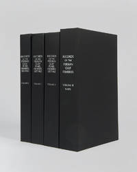
réf. 122017London Archive editions 2026. . 4 vols 8vo; includes a map portfolio with 7 maps original black cloth lettered in white a fine set. A very important work on the pearl fisheries of the Arabian Gulf bringing together in a single research collection all relevant documents from British government records relating to the pearl industry the most important economic activity in the Gulf before the oil era. London, Archive editions, 2026. hardcover
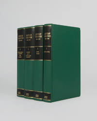
réf. 121944London Archive Editions 1992. . 4 vols 8vo 25 x 16.5 cm; includes maps and tables; publisher's original green cloth gilt lettering pieces to spines top edges gilt a fine set. Extensive collection of international and governmental treaties of the Gulf states of Iraq Kuwait Bahrain Qatar the United Arab Emirates Oman Yemen and Saudi Arabia. Improves on the previous work of Aitchison by including inter-regional and inter-state treaties rather than ones specifically related to Britain. London, Archive Editions, 1992. hardcover
1948réf. GB009AE8MLQI4N00A.S. Barnes and Company 1948. Paperback. Very Good. May have limited writing in cover pages. Pages are unmarked. ~ ThriftBooks: Read More Spend Less.Dust jacket quality is not guaranteed. A.S. Barnes and Company paperback
1942réf. 191335Washington DC: Army Map Service April 1942. The Gulf when America joined the war An expansive wartime flight chart "the advance edition" classified as "Restricted" for use by the U.S. Army Air Forces. It covers the whole of the Arabian Gulf and a substantial part of the Arabian Peninsula including Saudi Arabia Trucial Oman and Kuwait. After the United States joined the Allies in December 1941 they began operations in the Middle East most notably by providing support in North Africa as part of the Second Battle of El Alamein and Operation Torch. Over the following years the American government began to recognise the importance of Middle Eastern resources extending the Lend-Lease programme to Saudi Arabia Iran and Israel as well as indirectly supporting British colonies in the region. To protect these resources they set up Persian Gulf Command and manned the "Persian Corridor" from Iran through to Azerbaijan. They also participated in the Tehran Conference in late 1943. Further west the Ninth Air Force ran regular sorties out of Egypt and Libya to assist in the European theatre securing air dominance and denying the enemy the opportunity to replenish their supplies. The reverse of the chart features three inset maps of Bahrain Cyprus and Rhodes. They are accompanied by sectional views of their coastlines. The first two countries were host to RAF and Royal Navy bases while Rhodes was occupied by Italy and later Germany after the Battle of Rhodes in 1943. We have traced no copies of this map in institutions and one copy of a 1944 coloured edition in commerce. Single sheet 965 x 1305 mm maps and sectional views printed both sides highlights and compass roses printed in blue key on recto. Rolled tidemarks and creasing in upper margin not past neatlines: a very good copy. unknown
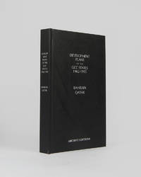
réf. 121997Minneapolis East View 2026. . 8vo 25.5 x 17 cm; includes many maps tables graphs and charts text in English and Arabic; publisher's black cloth lettered white to board and spine a fine copy. The complete development plan of Bahrain in 1982-85 including the report of the same and the development plan of Qatar of 1977 as well as planning studies and long term plans. Minneapolis, East View, 2026. hardcover
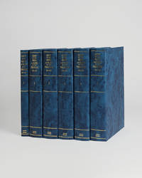
réf. 121956London Archive editions 1990. . 5 vols 8vo; 1 vol. text with index map & 4 vols map portfolios containing 55 maps charts and views; original blue cloth gilt a fine set. The first systematic examination of the coastal topography of the Arabian Gulf. A remarkable collection of sea charts harbour plans coastal views and topographical descriptions produced during the survey of the shores and islands of the Persian Gulf carried out between 1820 and 1829 by officers of the Bombay Marine on the orders of the Bombay government. London, Archive editions, 1990. hardcover
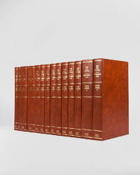
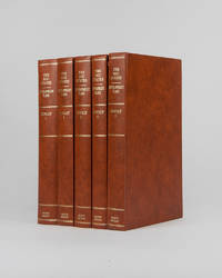
réf. 121946London Archive Editions 1994. . 14 vols 8vo 25.5 x 16.5 cm; includes maps charts & diagrams; publisher's original orange-brown cloth gilt lettering to spines top edges gilt a fine set. The complete development plans of Saudi Arabia from 1970 to 1995 with supplementary documents and reports including the master plans for Jeddah. London, Archive Editions, 1994. hardcover
réf. 121947Cambridge Cambridge Archive Editions 2020. . 2 works in 8 vols 25.5 x 16.5 cm; publisher's original black cloth silver gilt lettering a fine set. An extensive collection of documents and letters covering the reign of King Abdulaziz also known as Ibn Saud and the first king of a unified Saudi Arabia from the reconquest of Riyadh in 1902 until his death in 1953. Many of the documents and letters here are published for the first time and many of the letters are reproduced in facsimile in King Abdulaziz's own hand. Cambridge, Cambridge Archive Editions, 2020. hardcover
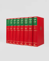
réf. 121949London Archive Editions 1989. . 8 vols 8vo 25.5 x 16.5 cm; 7 vols text & map portfolio containing 9 large folding maps and 2 tables; publisher's original red cloth gilt royal arms of Kuwait to upper boards spines in gilt with green labels top edges gilt a fine set. An impressive set of records documenting the history of Kuwait from 1899 to 1961 covering the period from the first treaty signed between Britain and Mubarak Al-Sabah to the establshiment of Kuwait as an independent state in 1961. London, Archive Editions, 1989. hardcover
réf. 121996London Archive Editions 1994. . 5 vols 8vo 25.5 x 16.5 cm; numerous charts maps plans graphs and tables; publisher's original orange-brown cloth gilt lettering to spines top edges gilt a fine set. The full development plan for Kuwait of 196/7-1971/2 as well as master plan for the city studies for the National Physical Plan and of urban development the statistics and figures for the years 1963-1988 and the statistical abstract for 1990-91. With numerous maps graphs and charts illustrating the reports as well as the full first five year plan reproduced in Arabic. London, Archive Editions, 1994. hardcover
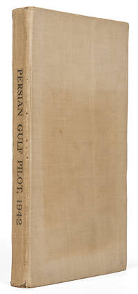
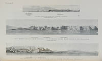
réf. 119766London Hydrographic Department Admiralty 1942. . Ninth edition with the fourth supplement dated 1948; 8vo 24.5 x 16 cm; supplement tipped to front pastedown 2 maps acting as an index for admiralty charts folding meteorological chart 21 plates showing numerous coastal views with additional view of Abu Dhabi fort tipped in from supplement further in-text weather diagrams notice of supplement tipped in to face title numerous annotations making good the corrections from the supplement; publisher's tan cloth lettered in black touch of rubbing to spine very good copy; xxvi 286 pp. A scarce pilot guide of the Persian gulf describing Bahrain Kuwait Qatar Dubai and Abu Dhabi and numerous other villages and towns along the Arabian coast. Includes coastal views of Ras Al Hadd Sur Qalhat As Suwaiq Sohar Fujairah Khasab the Tunb Islands Abu Musa the Doha Fort Bahrain Harbour and Tarut Island amongst others. The guide was published to give accurate sailing directions to the ports towns and safe anchorages along the Arabian coast from Ras al Hadd on the eastern peninsular of Oman to Shatt al Arab in the North and back along the coast of Iran to Bandar Abbas and beyond. With much early information on the principal settlements of the United Arab Emirates Qatar Bahrain Kuwait and Oman and an interesting glossary of Arabic-English key terms. Dubai is described as well as Daira: 'Daira is a large suburb consisting of mat huts amongst which stand a number of well-built houses.' 'Dibai Dubai contains the residence of the Shaikh. There are several tall towers in Dibai; the fort is a conspicuous square building with a round tower. from which the Shaikh's flag is displayed.' Abu Dhabi is similarly described: 'This town consists for the most part of huts and extends along the coast for nearly two miles. In the town there is a small fort partially surrounded by trees with five towers close together. The coast in the vicinity of Abu Dhabi is very low and the beach is of white sand'. There are two views of Qasr Al Hosn one of which appears here with the 1948 supplement for the first time. The great pearl bank is also given attention: 'this extensive bank. fills the great bight in the southern part of the Persian Gulf.' 'Many islands both close to the coast and far offshore lie on the bank. With the exception of Dalma none has permanent inhabitants though they are frequented by the pearl boats during the summer and by fisherman from Abu Dhabi in the winter.' 'The best pilots for the coast are to be obtained at Abu Dhabi.' Much of the information of Qatar and Doha is amended by the supplement and appropriately altered by the annotations showing its quickly changing nature. Bahrain is also described and there is also note of the health of the region: 'Manama. is more liable to epidemics than the smaller ports; since 1920 however there have been no more epidemics in Bahrain than in any other of the larger Gulf ports.' Kuwait is described 'The Shaikh's palace. has a small roof which is the highest point of any building in the town.' 'The principal export is pearls; the chief imports are rice sugar tea flour piece goods matches hardware wheat and barley.' London, Hydrographic Department, Admiralty, 1942. hardcover
1969réf. SBBI-L-BBS01265-RAG-20251Pelham Books 1969. hardcover. Acceptable. Please see the condition note after this for details if this is missing please consider Acceptable to mean poor quality that could include major staining water damage writing missing dustjacket etc etc. Our books are dispatched from a Yorkshire former cotton mill. We list via barcode/ISBN so please note that the images are stock images and may not be the exact copy you receive furthermore the details about edition and year might not be accurate as many publishers reuse the same ISBN for multiple editions and as we simply scan a barcode or enter an ISBN we do not check the validity of the edition data when listing. If you're looking for an exact edition please don't order at least not without checking with us first although we don't always have time to check. We aim to dispatch prompty the service used will depend on order value and book size. We can ship to most countries see our shipping policies. Payment is via Abe only. Pelham Books hardcover
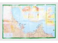
réf. 181557Saudi Arabia: Kruger for I.P.A. International Bookshops Dharan Airport 1977. Road construction faster than map production A folding road map of the Gulf and an interesting snapshot of its natural and human geography in the 1970s with 25 attractive photographs of Dubai. The map extends from Kuwait to Oman's Jabal al-Akhdar showing primary metalled roads roads under construction secondary roads towns wadis oil wells and pipelines oilfields and the morphology of the terrain. It also features 7 inset maps of the city centres of Manama Doha Abu Dhabi Kuwait Dubai Mutrah and Muscat. The small print in the reference section explains that "all roads under construction are being completed as the progress was faster than our production". The photos of Dubai include views of Dubai Creek dhows dromedaries and camels local inhabitants and the main heritage sites. Colour printed map folded 295 x 157 mm; unfolded 585 x 910 mm. Text in Arabic and English. Seven inset maps of Gulf capital cities verso with 25 colour photograph views of Dubai by Said Salah. Original colour self-wrappers printed in yellow black and white on a red and green ground. A few tiny chips or light wear to some folds couple of minor creases to outer corners: a very good exemplar. unknown
2011réf. 1-1603203990Time Home Entertainment Inc 2011. Hardcover. New. hardback/dvd edition. 556 pages. 10.00x10.25x2.50 inches. Time Home Entertainment Inc hardcover
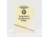
1985réf. 177401Bahrain: Printed by the Arab Printing and Publishing Establishment 1985. Second edition of this booklet produced to showcase the Arab Thought Forum held in Riyadh in April 1985. The first part comprises "Arab Unity: A General Outlook" a speech delivered by Prince Saud al-Faisal Foreign Minister of the Kingdom of Saudi Arabia. It is concerned with the difference between the "failed" concepts of Arab unity and Arab nationalism and their relationship with Islamic doctrines. The second part is devoted to a research paper by the GCC Secretary General concerning the role of the GCC in the achievement of Arab unity. It analyzes regional changes in the decade 1971-1981 and the "Arab degeneration and decline and the downfall of the unity of Arab security" before the establishment of the GCC. Octavo 240 x 165 mm. Text in English and Arabic. Original yellow printed wrappers wire-stitched as issued. Extremities and covers a bit rubbed sunned and foxed first recto and last verso toned: a very good copy. unknown
réf. 112658London Hydrographic Department Admiralty 1955. . Tenth edition with the second supplement dated 1959; 8vo 24.5 x 16 cm; supplement loosely inserted at rear 4 coloured plates of diagrams two maps acting as an index for admiralty charts 16 double-sided plates showing numerous coastal views further in-text weather diagrams notice of supplement tipped in to face title; publisher's blue cloth lettered in yellow spine a little sunned joints professionally restored very good copy; l 312 1 pp. A scarce pilot guide of the Persian gulf describing Bahrain Kuwait Qatar Dubai and Abu Dhabi and numerous other villages and towns along the Arabian coast. Includes coastal views of Ras Al Hadd Sur Qalhat As Suwaiq Sohar Fujairah Khasab the Tunb Islands Abu Musa Sirri Island Al Jazirah Al Hamra Al Shebeakah Rams Ajman Qasr Al Hosn in Abu Dhabi Sir Bani Yas the Doha Fort Bahrain Harbour and Tarut Island amongst others. The guide was published to give accurate sailing directions to the ports towns and safe anchorages along the Arabian coast from Ras al Hadd on the eastern peninsular of Oman to Shatt al Arab in the North and back along the coast of Iran to Bandar Abbas and beyond. With much early information on the principal settlements of the United Arab Emirates Qatar Bahrain Kuwait and Oman and an interesting glossary of Arabic-English key terms. By 1955 it was clear how the oil boom had changed the economy of the region. The first chapter gives an overview and includes the character of the sea and ports description of major towns and cities and their respective populations for example 18000 in Qatar the main economic imports and exports of each locale and considerable weather information. Dubai is described as well as Daira: 'Daira is a large suburb consisting of mat huts amongst which stand a number of well-built houses.' 'Dibai Dubai contains the residence of the Shaikh. There are several tall towers in Dibai; the fort is a conspicuous square building with a round tower. from which the Shaikh's flag is displayed. There is a hospital.' Abu Dhabi is similarly described: 'This town consists for the most part of huts and extends along the coast for nearly two miles. In the town there is a small fort partially surrounded by trees with five towers close together. The coast in the vicinity of Abu Dhabi is very low and the beach is of white sand'. The fort is given it's own view on one of the plates. The great pearl bank is also given attention: 'this extensive bank. fills the great bight in the southern part of the Persian Gulf.' 'Many islands both close to the coast and far offshore lie on the bank. With the exception of Dalma none has permanent inhabitants though they are frequented by the pearl boats during the summer and by fisherman from Abu Dhabi in the winter.' 'The best pilots for the coast are to be obtained at Abu Dhabi.' Much detail is also given to Qatar and Doha: 'This town situated on the southern side of the harbour is the capital of Al Qatar peninsula and had a population in 1947 of about 12000.' ' The Shaik's palace. is a large building with many colonnades and an open balustrade round its roof.' ' The chief exports are gutch fish and pearls; imports are food timber and manufactured goods.' Bahrain is also described with Manama being called the 'principal town and port' and as well as the trade being described there is also note of the health of the region: 'Manama is more liable to epidemics than the smaller ports; since 1920 however there have been no more epidemics in Bahrain than in any other of the larger Gulf ports.' It is interesting also that one of the major changes of the supplement is changing the name 'Bahrein' to 'Bahrain'. Kuwait is described as greatly altered by the oil wealth: ' Wealth derived from oil revenues is being spent on completely replanning and rebuilding the town. Government offices schools hospitals electric generating and water distillation stations private houses and blocks of flats are all being built in the most modern style'. 'Pearl fishing is now practically extinct. There are to all intents and purposes no exports. The chief imports are food of all kinds machinery motor vehicles and building materials.' London, Hydrographic Department, Admiralty, 1955. hardcover
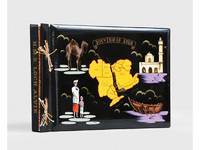
1955réf. 188201On board HMS Loch Alvie: South Asia and Arabian Gulf 1955-56. Striking visual record of the Gulf at the dawn of the oil boom An attractive photograph album compiled by a Royal Navy rating during service in the Gulf in 1955-56 notable for its early views of Abu Dhabi and other sites in the present-day UAE on the eve of the oil transformation. Drawn to the stark coastline and improvised shore installations he recorded places that within a decade would be reshaped by petroleum infrastructure and urban expansion. Several images relate to Abu Dhabi. A view of Das Island dated 11 April 1956 shows a bare shoreline with oil drums and rudimentary structures in the first phase of development linked to the Umm Shaif field. At Khawr al Bazm 19 April 1956 he photographed the coast from the ship and the firing of a 21-gun salute for the Queen's birthday juxtaposing imperial ceremony with an undeveloped littoral. Four deckle-edged photographs depict Dalma Island - then a remote outpost - including a grave the remains of a wrecked dhow and the stretch of coast where the vessel was driven ashore in bad weather. Today Dalma is recognised as a major archaeological site within Abu Dhabi emirate. Dubai appears in a 22 April 1956 view of water taxis and the souq along Dubai Creek still a modest mercantile settlement. The following day Lord and Lady Mountbatten paused there during their return from Asia and Australasia an event marked by guards of honour and captured in the album. A coastal view of Dibba on the Musandam Peninsula - now divided between Oman and the UAE - records the rugged shoreline before modern development. Although centred on the Gulf the album also includes related regional material - Bahrain including Juffair naval base Qatar's early oil installations at Umm Said and Halul Island and shipboard scenes - placing the UAE images within the wider strategic network of Britain's post-war naval presence east of Suez. The volume concludes with an official photograph of HMS Loch Alvie and a track chart of her cruise under Captain C. J. Matthews sailing from Chatham in July 1955 and returning in July 1956. Landscape folio 270 × 390 mm. 88 mounted silver gelatine photographs the majority personal rather than purchase and 24 of which relate to the Gulf various formats mostly 105 x 80 mm the great majority captioned in white ink leaves additionally decorated with small sketches and various ephemera. Asian black lacquer album silk ties at the spine typical of those available at the Liberty Stores Aden lettered "Souvenir of Aden" on the front cover with a hand-painted map of the Arabian Peninsula and Red Sea surrounded by images of a mosque camel dhow and local inhabitants HMS Loch Alvie cap tally pasted to spine edges gilt decorative gold and silver leaf spackled endpapers; black card mounting leaves. Corners a little bumped and worn a couple of cracks to the lacquer to the back cover; some tissue guards a little creased contents otherwise clean sound and complete; very good. unknown
2006réf. 1-0810955423Harry N Abrams Inc 2006. Paperback. New. 303 pages. 10.50x8.00x1.25 inches. Harry N Abrams Inc paperback
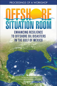
2022réf. x-030926913XNational Academies Press 2022. Paperback. New. 86 pages. 9.02x5.98x0.79 inches. National Academies Press paperback