Gulf Research Program (Corporate Author)/ Olsen, LeighAnne (Editor)/ Olson, Steve (Editor)Biblio.com

3928 risultati
2015rif. x-0309368529Natl Academy Pr 2015. Paperback. New. 1st edition. 75 pages. 10.75x8.25x0.25 inches. Natl Academy Pr paperback
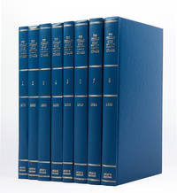
rif. 121085London Archive Editions 1989. . 8 vols 8vo; original blue cloth gilt a fine set. A complete set of this handsome facsimile edition of all eight Persian Gulf pilots published between 1870 to 1932. Invaluable not only for sailing directions but also for descriptions of the coast and its towns and villages and how they have grown over the period. London, Archive Editions, 1989. hardcover
1995rif. 182920Kuwait: Markaz al-buhuth wa-al-dirasat al-Kuwaytiyah 1995. First edition of this well-illustrated study on the environmental impact of the destruction of oil wells in Kuwait based on government documents issued by the Iraqi government during the Gulf War. The work presents this damage substantiated by copious data as a main goal of the Iraqi war strategy of delayed sabotage. An appendix lists names of Iraqi officers accused of being "environmental criminals" as they took part in the identification of targets and methods and the execution of the plan - phases which are carefully described in the first part. The second part discusses subsequent damages to the economy public health and the environment including air and water pollution and their impact on living organisms. The third part describes the strategies employed to limit the damage such as the efforts of firefighters in extinguishing burning oil wells. Quarto. With facsimiles of documents colour illustrations and maps. Text in Arabic. Original pictorial wrappers wire-stitched as issued. Pencilled Arabic word at head of last verso. Extremities a trifle rubbed or creased contents clean: a very good copy. unknown
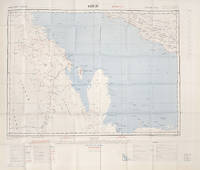
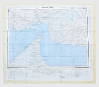
rif. 112618London War Office printed for D. Survey WO and AM by Balding and Mansell Ltd. 1957. . Coloured double-sided map of the Arabian Gulf on 1 sheet printed on silk; edition I-GSGS; sheet size: 64 x 72.5 cm; scale 1:1000000 text in English very slight fading to outer margin otherwise near fine. An excellent example of a double-sided coloured escape map of the Arabian Gulf showing the UAE and Oman to recto and Qatar to verso. With a key to topographical features railways main roads and important settlements including the tribal and official names of provinces and a useful Arabic-English glossary translating key terms such as 'Bir' for 'Well' 'Ain' for Spring' 'Qasr' for 'Fort/Castle'. The recto extends from Kumzat in the North to Hafit in the South and Abu Dhabi in the West to al-Qasbiyat in the East showing the six remaining emirates of Dibai Dubai Sharja Ajman Umm al-Qaiwan Ras al-Khaima and Fujaira. The verso runs South from Ras es Safaniya to Ei Abd and from Awania in the West to Rudaim in the East including the principal settlements of Jubail Bahrein Hofuf showing Doha Wakra and Lusail on the Qatar Peninsular. [London], War Office, printed for D. Survey (WO and AM) by Balding and Mansell Ltd., 1957. unknown
1957rif. 182684London: War Office; Printed for D. Survey WO and AM by Balding and Mansell Ltd 1957. A bright example of this detailed Gulf map Classified "restricted" and issued for military use at the time of the Jebel Akhdar War this double-sided sheet shows much of the modern-day UAE extending northwards from the latitude of Abu Dhabi and the Buraimi Oasis as well as the eastern Arabian Peninsula from the Trucial Coast to Jubail. As with other contemporary GSGS maps the sheet covers six degrees of longitude and highlights towns of significance and other standout features for example oil pipelines and wells water systems and roads and railways. Rayon sheet 630 x 710 mm printed both sides in colour folded as issued. A fine example. unknown
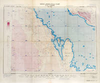
rif. 113506London War Office Geographical section 1951. . First edition GSGS 4622 Sheet 2547; Coloured printed map of Bahrain and Qatar on single sheet with extensive legend printed on reverse size: 62.5 x 77 cm; scale 1:1000000 text in English a little faded along folds a very good copy. First edition of the 1951 issue of the R.A.F. Aeronautical map of Bahrain and Qatar. The War office issued the R.A.F. series alongside a separate US Airforce Series: the R.A.F. series only covers Europe Africa Arabia and up to the end of 1951 had only covered Britain the east coast of Africa and this sheet of Arabia. The odd selection of this region aside from east Africa is made clearer by looking at the content of the map. The map does not show the 'delineation of international boundaries' or 'danger zones' but the topography largely the elevation and depression of the terrain with indications of marshy areas. The only indicated features other than towns and roads are of oil fields and pipelines. In 1941 Britain had gained control of much of Iraq's oil after the Anglo-Iraqi War and sought to expand its influence. The allies had seen the strategical benefits of Bahrain and after the discovery of oil in the region in 1932 it became even more pertinent to grow relations with the entire Middle Eastern command moving from Bushehr in Iran to Bahrain in 1935. But after the war relations had soured with the 1947 anti-Jewish riots in Manama Bahrain largely in reaction to Britain's disastrous orchestration of the Partition of Palestine. At the same time Iran had sought to break free of British control of their oil and in March 1951 voted to nationalise their oil production: in response Britain boycotted Iranian exports. It was in that same month that this map was finalised and published in July in the midst of the tense negotiations Iran was conducting with both Britain and the USA. In 1951 Britain was clearly searching for new regions to extract oil from and this map is captivating evidence of the fractious relationship Britain had fostered with the state of the Arabian Gulf. [London], War Office, Geographical section, 1951. unknown
2008rif. 1-1602393265Skyhorse Pub Co Inc 2008. Hardcover. New. 225 pages. 11.30x9.00x1.20 inches. Skyhorse Pub Co Inc hardcover
2012rif. 1-1618930214Time Home Entertainment Inc 2012. Hardcover. New. expanded edition. 224 pages. 10.00x10.25x1.00 inches. Time Home Entertainment Inc hardcover
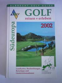
rif. 5d5818Albrecht Golf Verlag München 2001. 783 S. in getrennter Zählung mit zahlreichen Abbildungen Pappband quart. - gutes Exemplar / Landkarten Beschreibungen Reisetipps und Länderinformationen - unknown
rif. 5c4699Volkswagen Wolfsburg 1979. 21 Seiten kartoniert Stempel auf Vorsatz. - Beiliegt eine Preisliste Stand 01.05.1979. - unknown
rif. 5h3029Gulf Craft United Arab Emirates 2017. 143 S. mit zahlreichen Abbildungen Pappband quart. - gutes Exemplar / good condition / Text englisch - unknown
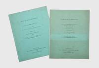
1958rif. 174959Oxford: Distributed for the Royal institute of International Affairs by Oxford University Press 1958-59. Revised edition of Western Powers updated from the 1958 briefing including a length section on the "British position in the Arabian Peninsula and the Persian Gulf" framing six decades of British foreign policy within the context of Lord Curzon's 1899 analysis of the Gulf. "This memorandum had its origin in the need to put together for immediate use during the summer of 1958 documents and statements relating to the latest of the recurring crises in the Middle East". It outlines treaty commitments to different Gulf states and provides a documentary chronology of Britain's diplomatic relationships. The memorandum on Libya discusses topics such as defence population agriculture and fisheries transportation and budgets and finance. Two works quarto. Mimeographed typescript in both vols. Original green wrappers wire-stitched as issued front covers lettered in black. Pencilled price on front wrapper of Libya. Light sunning contents clean: near-fine copies. unknown
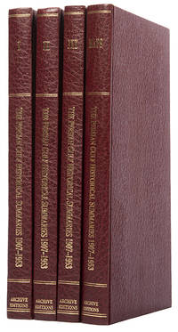
rif. 113476London Archive Editions 1987. . First edition; 4 vols 8vo includes a volume of maps and genealogical tables original brown cloth gilt a fine set. An historical summary of events in the Arabian Gulf concerning British interests from 1907. also includes oil agreements and concessions in the region particularly Muscat and Oman. London, Archive Editions, 1987. hardcover
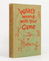
1930rif. 142034London: John Lane The Bodley Head Limited 1930. First Edition. Hardcover. Near fine/Good. London John Lane The Bodley Head Limited 1930. Octavo viii 240 8 publisher's list pages with numerous line illustrations by the author. Green cloth lettered and decorated in red; top edge dyed green; endpapers unevenly tanned; a near-fine copy with the very good dustwrapper the spine sunned marked and a little chipped. The 'main feature of the book is its constructive advice to golfers on their personal faults in playing the game' dustwrapper blurb. John Lane The Bodley Head Limited hardcover
2018rif. __1726743268Independently published 2018. Paperback. New. 406 pages. 11.00x8.50x0.92 inches. Independently published paperback
2018rif. __1726708551Independently published 2018. Paperback. New. 341 pages. 10.90x8.40x0.90 inches. Independently published paperback
1986rif. G0671612905I3N01Simon & Schuster 1986. Hardcover. Good. Missing dust jacket; Pages can have notes/highlighting. Spine may show signs of wear. ~ ThriftBooks: Read More Spend Less.Dust jacket quality is not guaranteed. Simon & Schuster hardcover
2018rif. __1726703843Independently published 2018. Paperback. New. 438 pages. 8.43x5.85x0.73 inches. Independently published paperback
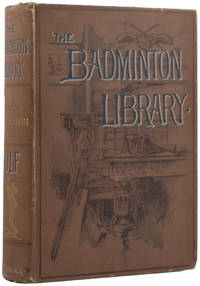
rif. 54413London: Longmans Green and Co. 1895. Sport NEW EDITION. Octavo 18 x 13cm pp.xiv; 480. Illustrated with 28 plates and many line drawings in the text by Thomas Hodge and Harry Furniss. Publisher's original decorated and titled brown cloth green swan-patterned endpapers. Armorial bookplate of MacFarlane Digby contents a little spotted old tape mark to flyleaf cloth a little rubbed and handled one small nick to spine. Very good. First published in 1890 this definitive guide to golf was 'thoroughly revised with additions' in 1895. This printing is entirely reset and the text considerably longer. London: Longmans, Green, and Co., 1895 unknown
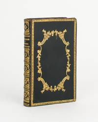
1838rif. 111804Cupar: G.S. Tullis and St Andrews Melville Fletcher Printed by G.S. Tullis Printer to the University of St Andrews 1838. 3rd Edition. Hardcover. Very Good. Cupar G.S. Tullis and St Andrews Melville Fletcher Printed by G.S. Tullis Printer to the University of St Andrews 1838 third edition/ 1807. Duodecimo xii last blank 264 pages with several tables plus 12 full-page engraved plates including an additional title page. Early gilt-decorated polished black calf all edges gilt endpapers marbled; top corners a little bumped with the extremities a little rubbed; light stain to the blank bottom corner of the last 40 leaves gradually reducing in extent from the rear and not affecting the printed surfaces; early ownership signature James Astle at the head of the engraved title page slightly cropped; a very good copy. Not least 'The Company of Golfers' pages 237-247. G.S. Tullis, and St Andrews, Melville Fletcher (Printed by G.S. Tullis, Printer to the University of St Andrews) hardcover
2012rif. DADAX1618930214Brand: Golf 2012-04-24. Expanded. hardcover. New. 10.25x0.75x10.00. Buy with confidence. Excellent Customer Service & Return policy. Brand: Golf hardcover
2006rif. DADAX1400016290Fodor's Travel 2006-05-16. 7. paperback. New. 5.16x1.22x9.10. Buy with confidence. Excellent Customer Service & Return policy. Fodor's Travel paperback
rif. DADAX1572433159Brand: Triumph Books 0000-00-00. 2nd. hardcover. New. 4.75x1.50x8.75. Buy with confidence. Excellent Customer Service & Return policy. Brand: Triumph Books hardcover
2003rif. DADAX1579652379Artisan 2003-04-06. Reprint. paperback. New. 9.88x1.00x9.88. Buy with confidence. Excellent Customer Service & Return policy. Artisan paperback
2010rif. DADAX1603201483Liberty Street 2010-10-26. Har/DVD. hardcover. New. 10.00x0.75x10.00. Buy with confidence. Excellent Customer Service & Return policy. Liberty Street hardcover