Tiger Woods, editors Of Golf DigestBiblio.com

3,979 results
2001ref. 102495New York: Warner Books 2001. First Edition; First Printing. Hardcover. Near Fine in a Very Good dust jacket. Light edge wear.; 10.90 X 9 X 1.30 inches; 320 pages. Warner Books hardcover
2012ref. DADAX1618930214Brand: Golf 2012-04-24. Expanded. hardcover. New. 10.25x0.75x10.00. Buy with confidence. Excellent Customer Service & Return policy. Brand: Golf hardcover
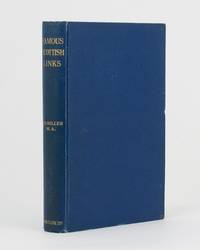
1911ref. 75830Edinburgh: R. and R. Clark 1911. First Edition. Hardcover. Very Good. Edinburgh R. and R. Clark 1911. Octavo viii 150 pages plus 2 plates. Original blue cloth slightly rubbed at the extremities and lightly marked; tiny bump to the leading edge of the front cover; bottom corner of the rear board cracked creating a ripple in the cloth along the fracture and cracking the pastedown but the corner is firm and stable; edges endpapers and first and last pages foxed; a very good copy. Inscribed and dated 26 December 1913 by the author. R. and R. Clark hardcover
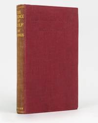
1922ref. 74414London: Methuen 1922. First Edition. Hardcover. Very Good. London Methuen 1922. Octavo xii 128 8 publisher's catalogue pages plus a frontispiece and 7 pages of plates. Cloth lightly bumped on the front bottom edge; spine sunned and a little rubbed; endpapers lightly offset; inner margin of the title leaf and the adjacent leaf a little glue discoloured with trifling adhesion blemishes to the inner margin of the frontispiece and title page; a very good copy. Methuen hardcover
1942ref. 191335Washington DC: Army Map Service April 1942. The Gulf when America joined the war An expansive wartime flight chart "the advance edition" classified as "Restricted" for use by the U.S. Army Air Forces. It covers the whole of the Arabian Gulf and a substantial part of the Arabian Peninsula including Saudi Arabia Trucial Oman and Kuwait. After the United States joined the Allies in December 1941 they began operations in the Middle East most notably by providing support in North Africa as part of the Second Battle of El Alamein and Operation Torch. Over the following years the American government began to recognise the importance of Middle Eastern resources extending the Lend-Lease programme to Saudi Arabia Iran and Israel as well as indirectly supporting British colonies in the region. To protect these resources they set up Persian Gulf Command and manned the "Persian Corridor" from Iran through to Azerbaijan. They also participated in the Tehran Conference in late 1943. Further west the Ninth Air Force ran regular sorties out of Egypt and Libya to assist in the European theatre securing air dominance and denying the enemy the opportunity to replenish their supplies. The reverse of the chart features three inset maps of Bahrain Cyprus and Rhodes. They are accompanied by sectional views of their coastlines. The first two countries were host to RAF and Royal Navy bases while Rhodes was occupied by Italy and later Germany after the Battle of Rhodes in 1943. We have traced no copies of this map in institutions and one copy of a 1944 coloured edition in commerce. Single sheet 965 x 1305 mm maps and sectional views printed both sides highlights and compass roses printed in blue key on recto. Rolled tidemarks and creasing in upper margin not past neatlines: a very good copy. unknown
1955ref. 188201On board HMS Loch Alvie: South Asia and Arabian Gulf 1955-56. Striking visual record of the Gulf at the dawn of the oil boom An attractive photograph album compiled by a Royal Navy rating during service in the Gulf in 1955-56 notable for its early views of Abu Dhabi and other sites in the present-day UAE on the eve of the oil transformation. Drawn to the stark coastline and improvised shore installations he recorded places that within a decade would be reshaped by petroleum infrastructure and urban expansion. Several images relate to Abu Dhabi. A view of Das Island dated 11 April 1956 shows a bare shoreline with oil drums and rudimentary structures in the first phase of development linked to the Umm Shaif field. At Khawr al Bazm 19 April 1956 he photographed the coast from the ship and the firing of a 21-gun salute for the Queen's birthday juxtaposing imperial ceremony with an undeveloped littoral. Four deckle-edged photographs depict Dalma Island - then a remote outpost - including a grave the remains of a wrecked dhow and the stretch of coast where the vessel was driven ashore in bad weather. Today Dalma is recognised as a major archaeological site within Abu Dhabi emirate. Dubai appears in a 22 April 1956 view of water taxis and the souq along Dubai Creek still a modest mercantile settlement. The following day Lord and Lady Mountbatten paused there during their return from Asia and Australasia an event marked by guards of honour and captured in the album. A coastal view of Dibba on the Musandam Peninsula - now divided between Oman and the UAE - records the rugged shoreline before modern development. Although centred on the Gulf the album also includes related regional material - Bahrain including Juffair naval base Qatar's early oil installations at Umm Said and Halul Island and shipboard scenes - placing the UAE images within the wider strategic network of Britain's post-war naval presence east of Suez. The volume concludes with an official photograph of HMS Loch Alvie and a track chart of her cruise under Captain C. J. Matthews sailing from Chatham in July 1955 and returning in July 1956. Landscape folio 270 × 390 mm. 88 mounted silver gelatine photographs the majority personal rather than purchase and 24 of which relate to the Gulf various formats mostly 105 x 80 mm the great majority captioned in white ink leaves additionally decorated with small sketches and various ephemera. Asian black lacquer album silk ties at the spine typical of those available at the Liberty Stores Aden lettered "Souvenir of Aden" on the front cover with a hand-painted map of the Arabian Peninsula and Red Sea surrounded by images of a mosque camel dhow and local inhabitants HMS Loch Alvie cap tally pasted to spine edges gilt decorative gold and silver leaf spackled endpapers; black card mounting leaves. Corners a little bumped and worn a couple of cracks to the lacquer to the back cover; some tissue guards a little creased contents otherwise clean sound and complete; very good. unknown
2006ref. 1-0810955423Harry N Abrams Inc 2006. Paperback. New. 303 pages. 10.50x8.00x1.25 inches. Harry N Abrams Inc paperback
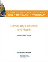
2022ref. x-030926913XNational Academies Press 2022. Paperback. New. 86 pages. 9.02x5.98x0.79 inches. National Academies Press paperback
2015ref. x-0309368529Natl Academy Pr 2015. Paperback. New. 1st edition. 75 pages. 10.75x8.25x0.25 inches. Natl Academy Pr paperback
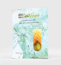
1995ref. 182920Kuwait: Markaz al-buhuth wa-al-dirasat al-Kuwaytiyah 1995. First edition of this well-illustrated study on the environmental impact of the destruction of oil wells in Kuwait based on government documents issued by the Iraqi government during the Gulf War. The work presents this damage substantiated by copious data as a main goal of the Iraqi war strategy of delayed sabotage. An appendix lists names of Iraqi officers accused of being "environmental criminals" as they took part in the identification of targets and methods and the execution of the plan - phases which are carefully described in the first part. The second part discusses subsequent damages to the economy public health and the environment including air and water pollution and their impact on living organisms. The third part describes the strategies employed to limit the damage such as the efforts of firefighters in extinguishing burning oil wells. Quarto. With facsimiles of documents colour illustrations and maps. Text in Arabic. Original pictorial wrappers wire-stitched as issued. Pencilled Arabic word at head of last verso. Extremities a trifle rubbed or creased contents clean: a very good copy. unknown
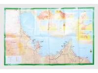
ref. 181557Saudi Arabia: Kruger for I.P.A. International Bookshops Dharan Airport 1977. Road construction faster than map production A folding road map of the Gulf and an interesting snapshot of its natural and human geography in the 1970s with 25 attractive photographs of Dubai. The map extends from Kuwait to Oman's Jabal al-Akhdar showing primary metalled roads roads under construction secondary roads towns wadis oil wells and pipelines oilfields and the morphology of the terrain. It also features 7 inset maps of the city centres of Manama Doha Abu Dhabi Kuwait Dubai Mutrah and Muscat. The small print in the reference section explains that "all roads under construction are being completed as the progress was faster than our production". The photos of Dubai include views of Dubai Creek dhows dromedaries and camels local inhabitants and the main heritage sites. Colour printed map folded 295 x 157 mm; unfolded 585 x 910 mm. Text in Arabic and English. Seven inset maps of Gulf capital cities verso with 25 colour photograph views of Dubai by Said Salah. Original colour self-wrappers printed in yellow black and white on a red and green ground. A few tiny chips or light wear to some folds couple of minor creases to outer corners: a very good exemplar. unknown
2011ref. 1-1603203990Time Home Entertainment Inc 2011. Hardcover. New. hardback/dvd edition. 556 pages. 10.00x10.25x2.50 inches. Time Home Entertainment Inc hardcover
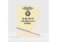
1985ref. 177401Bahrain: Printed by the Arab Printing and Publishing Establishment 1985. Second edition of this booklet produced to showcase the Arab Thought Forum held in Riyadh in April 1985. The first part comprises "Arab Unity: A General Outlook" a speech delivered by Prince Saud al-Faisal Foreign Minister of the Kingdom of Saudi Arabia. It is concerned with the difference between the "failed" concepts of Arab unity and Arab nationalism and their relationship with Islamic doctrines. The second part is devoted to a research paper by the GCC Secretary General concerning the role of the GCC in the achievement of Arab unity. It analyzes regional changes in the decade 1971-1981 and the "Arab degeneration and decline and the downfall of the unity of Arab security" before the establishment of the GCC. Octavo 240 x 165 mm. Text in English and Arabic. Original yellow printed wrappers wire-stitched as issued. Extremities and covers a bit rubbed sunned and foxed first recto and last verso toned: a very good copy. unknown
1957ref. 182684London: War Office; Printed for D. Survey WO and AM by Balding and Mansell Ltd 1957. A bright example of this detailed Gulf map Classified "restricted" and issued for military use at the time of the Jebel Akhdar War this double-sided sheet shows much of the modern-day UAE extending northwards from the latitude of Abu Dhabi and the Buraimi Oasis as well as the eastern Arabian Peninsula from the Trucial Coast to Jubail. As with other contemporary GSGS maps the sheet covers six degrees of longitude and highlights towns of significance and other standout features for example oil pipelines and wells water systems and roads and railways. Rayon sheet 630 x 710 mm printed both sides in colour folded as issued. A fine example. unknown
2008ref. 1-1602393265Skyhorse Pub Co Inc 2008. Hardcover. New. 225 pages. 11.30x9.00x1.20 inches. Skyhorse Pub Co Inc hardcover
2012ref. 1-1618930214Time Home Entertainment Inc 2012. Hardcover. New. expanded edition. 224 pages. 10.00x10.25x1.00 inches. Time Home Entertainment Inc hardcover
ref. 2g8571Gulf Coast Research Laboratory Museum Ocean Springs 1972. 328 S. Halbleinen Name auf Titel. - Text englisch - unknown
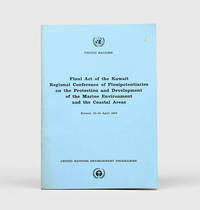
1978ref. 172055Perhaps Kuwait: United Nations Environment Programme 1978. First and sole edition untraced in Middle Eastern libraries of this plan enshrining environmental protection as a priority for future development along the Arabian coast. The regional conference highlighted the dangers posed by oil spills and committed to pollution-control measures for future projects. Participants included delegates from Bahrain Iran Iraq Kuwait Oman Qatar Saudi Arabia and the UAE. Attendees also agreed on a regional trust fund funded in different proportions by eight governments including the UAE and Saudi Arabia to finance initiatives. In the United Kingdom copies can be found at the universities of Oxford Durham and Southampton. We have also located three each in the US and Canada two in Germany two in Switzerland and one each in Austria and Sweden. Octavo. Original pale blue wrappers wire-stitched as issued front cover lettered in black. Light peripheral toning to covers small rust mark at top corner of front cover back cover slightly creased: a very good copy. unknown
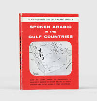
1971ref. 171721al-Khobar: The International Publications Industries 1971. Keep the following in mind and everything will be easy Fourth printing of this institutionally rare phrasebook which adopts "a short cut method simple and easy enough for a businessman to teach himself the spoken Arabic while relaxing in the Aircraft or in his Hotel room. Many of the oil industry people in Arabia owe their local friendship to this book". Arranged by topic the book has sections on greetings shopping food and drink and other practicalities such as taking one's car to a mechanic. The unnamed author places a premium on language as a key to understanding local culture: "you will find the Gulf Arabs intensely loyal to their friends as well as to their families. Most of them are blessed with a keen sense of humor. For these and other reasons such as their hospitality and courtesy you will enjoy getting acquainted with them". Further sections discuss the etiquette of being a guest at a traditional wedding and how to behave if invited to a private house as a guest. WorldCat lists only four copies in institutions Oxford National Library of Wales National Library of Israel Bilkent University. Small octavo 115 x 117 mm. Wire stitched in the original printed wrappers spine lettered in black. Minor wear to wrappers contents lightly toned not affecting text. A very good copy. unknown
2005ref. 1-0792238729Natl Geographic Society 2005. Hardcover. New. new title edition. 160 pages. 10.75x9.25x0.75 inches. Natl Geographic Society hardcover
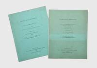
1958ref. 174959Oxford: Distributed for the Royal institute of International Affairs by Oxford University Press 1958-59. Revised edition of Western Powers updated from the 1958 briefing including a length section on the "British position in the Arabian Peninsula and the Persian Gulf" framing six decades of British foreign policy within the context of Lord Curzon's 1899 analysis of the Gulf. "This memorandum had its origin in the need to put together for immediate use during the summer of 1958 documents and statements relating to the latest of the recurring crises in the Middle East". It outlines treaty commitments to different Gulf states and provides a documentary chronology of Britain's diplomatic relationships. The memorandum on Libya discusses topics such as defence population agriculture and fisheries transportation and budgets and finance. Two works quarto. Mimeographed typescript in both vols. Original green wrappers wire-stitched as issued front covers lettered in black. Pencilled price on front wrapper of Libya. Light sunning contents clean: near-fine copies. unknown
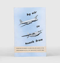
1955ref. 171428Malta: Trade Commissioner to the Malta Government 1955. A rare promotional guide to the air route from London to Basra produced for travellers destined for the Anglo-Iranian Oil Company's refinery at Abadan in Iran. A map shows the route passing through the eastern Mediterranean and Egypt before arriving in Iraq. The text attempts to give the impression of a well-organized journey: "At Basra you will be met by a representative of the Company who will help you with the Customs and other formalities. After a meal at the Airport Hotel you will find that arrangements have been made for your onward journey to your destination". The map to the verso shows critical infrastructure across the Middle East including oil pipelines and railways. Octavo. With 4 photographs and 2 colour maps. Folding colour printed pamphlet 140 x 215 mm when folded 420 x 215 mm when open. Minor scuffing creased at centre a touch foxed at front. A very good copy. unknown
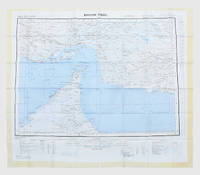
1963ref. 153757London: Geographical Section General Staff 1963. Scarce charts of Bahrain and the Straits of Hormuz A rare and historically interesting pair of adjacent maps of the Arabian Gulf covering six degrees of longitude each the geographical area encompassing the whole of Qatar Bahrain and part of what was to become the United Arab Emirates Al-Hofuf being the major city in the Al-Ahsa Oasis Eastern Province Saudi Arabia; sixth and fifth editions respectively. Maps of the period issued by the GSGS Geographical Section General Staff use a 7-colour tint scale to distinguish altitude and a glossary that highlights towns of significance and other standout features which provided steady references for army personnel to aid navigation in the challenging conditions of the region. The Bander Abbas map was compiled by the US Army Map Service Corps of Engineers from a number of sources including USAF Aeronautical Approach Charts of 1951-55 and the US Geological Survey of the Arabian Peninsula 1958. The Hofuf chart is based inter alia on 512 Field Survey Royal Engineers charts 1942-4. WorldCat lists just three individual copies for Hofuf NG39 SUNY at Buffalo University of Notre Dame and Eastern Illinois University alongside four copies of Bandar Abbas NG40 University of Exeter University of Notre Dame Eastern Illinois University and University of South Florida. It should be noted that major national institutions - BL for example - will have holdings of these maps within the complete GSGS series. Most copies would be discarded on supersession making these an important record of cartographic progress in the region. Two two-colour printed maps 1:1000000 scale 690 x 610 & 750 x 610 mm respectively. Ex- libris stamp of Arizona State Library both stamped "superseded" in blank margin and "withdrawn" on verso some pencilled marginalia; both in excellent condition. unknown
1956ref. 153759London: Geographical Section General Staff 1956 & 1957. Scarce maps of Oman and south-east Arabia dating to the Jebel Akhdar War A pair of decidedly uncommon and impressively sized regional maps both second editions Muscat-Musira following the first of 1945 S. E. Arabia first published in 1956. The Muscat-Masira map drawn up by D Survey of the Ministry of Defence reaches as far north as Khaburah Oman on the coast south beyond Masirah Island and westward reaching beyond Lahus and Hadhi. It is based on several mappings including Bertram Thomas's map of Rub' al Khali the "Empty Quarter" 1931 the sand desert covering most of the southern third of the Arabian Peninsula Samuel Barrett Miles 1910 map of Oman and Captain F. F. Hunter's map of Arabia 1935 revision. The aeronautical chart goes into greater detail reaching beyond Sur in the North South to Masirah Island and Manadhif and West to Uruq ash Shaybah UAE; this was drawn up by No. 1 SPC.RE i.e. Survey Production Centre Royal Engineers and is based largely on the USAF Aeronautical Approach Charts 1956 and World Aeronautical Chart 563 1951. During the mid to late-1950s Britain was involved in a number of disputes in Oman perhaps the most serious involving the Imam Ghalib al-Hinai and his brother Talib bin Ali who led the Imamate's revolt against Sultan Said bin Taimur which resulted in the Jebel Akhdar or Oman War 1954-1959. In this the RAF played a leading role not least because aircraft could at the same time expedite oil exploration operations in the interior of Oman. Pembrokes light transport aircraft and heavier Avro Ansons from 1417 Communication Flight RAF carried out reconnaissance "and other tasks during this operation against the Imamate and were the first aircraft ever to land at Nizwa marked "Nazwa" on the chart on a roughly cleared strip which proved extremely hazardous for the pilots but which was later transformed into a passable airfield" Lee p. 22. The present chart has two pencilled lines radiating from Masira airfield one of which passes through Nizwa near which is marked the "approx. position" of an airstrip. The chart bear the proviso that they should "not be taken as an authority on names" and that "the alignment of all tracks is approximate". Users were also directed to update information and highlight errors which were to be directly sent to the Director of the Military Survey in the War Office. There are noticeable graphical variations between the chart and map as fitting their usage. Before the Second World War pilots flew using landmarks - such as train tracks or roads - as pointers which meant that they relied on perfect weather conditions. However technological advances in aviation alongside the use of radio for more accurate navigation meant that to a degree pilots could work in more challenging conditions. This meant that maps with their focus on terrain and details relevant from the perspective of ground troops would become irrelevant when observed from a plane's altitude. Therefore a number of countries started to produce charts highlighting key information by reducing the contour structure and focusing on key landmarks necessary for aviators. The Muscat-Masira map uses a five-colour tint scale to distinguish altitude includes a glossary and key the latter identifying towns given four categories of importance significant ruins geographical features such as mountains hills marshes saddles and passes rivers water holes and man-made features such as railways roads tracks telegraph lines pipelines and pumping stations mosques and temples; tribal and regional names are also given. However reflecting the simplification required by pilots the S. E. Arabia chart only uses fives tones to highlight land mountains paths and the sea. These maps intended for use in the field would have had a high rate of attrition; WorldCat locates just a handful of copies of the Muscat-Masira map whilst S.E. Arabia 4802 is well represented institutionally but decidedly uncommon on the market. Two colour printed maps the first 1: 1000000 scale 860 x 640 mm the second 1:500000 scale 1100 x 825 mm. Both with creases from old folds and some minor marginal splits and spots the second with pencil lines marking a flight route from Masira Island and a notation in the margin; both remain very good. Sir David Lee The RAF in the Mediterranean and Middle East 1945-71 1978. unknown
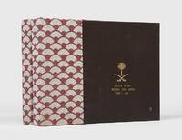
ref. 163098Jeddah: Kingdom of Saudi Arabia Ministry of Defense and Aviation; Lockheed Aircraft International 1983. The Saudi approach is unique Unrecorded institutionally and commercially this attractive set of albums celebrates Lockheed's role in augmenting Saudi Arabia's air traffic control systems both commercial and military over the period 1972-82. They comprise a total of 80 leaves covering summaries of developments "information flow" diagrams for Kaia Riyadh International Dhahran and Jeddah airports colour maps charts and photographs of facilities operatives and aircraft. Writing in Arabian Studies in 1976 aviation expert Elda I. Stifani notes: "By virtue of its geographical position and the strategic economic and political interests of both local and worldwide powers the Middle East plays a major role in civil aviation operations The Saudi approach is unique. No other country in the Arabian Peninsula has an equally determined and precise policy of national aviation development" Arabian Studies III p. 36. Interestingly he also notes that "Bahrain handles air traffic for all the UAA United Arabian Airlines Qatar part of Oman of Kuwait and of Saudi Arabia Dhahran". In March 1974 the Saudi airline Saudia ordered two of Lockheed's new TriStar airliners specially fitted with increased wing fuel tankage. By 1978 Saudia had increased its fleet of TriStars to thirteen. Provenance: presented to Clifford G. Fay of Lockheed Saudi Arabia 1980-82 with his name and dates of service on the front covers. Loosely inserted is a typed letter from Lockheed to Fay presenting the volumes and mentioning that they have been supplied by Joe Akers who was a Lockheed veteran with 28-years' experience at the company retiring as chairman in 1988 26 June 1983 Jeddah letterhead in English and Arabic. 2 vols landscape quarto 235 x 320 mm. With 80 sheets presented recto and verso in clear plastic pockets. Original ring binders fan-patterned cloth spines brown morocco-grain faux leather sides upper covers and front flaps with gilt arms of Saudi Arabia. Cloth sides just a little rubbed tear to first pocket in vol. II not affecting image minor creasing to presentation letter. An excellent set. Elda I Stifani "Civil Aviation in the Gulf: The Role of Commercial Interests in the Issue of Traffic Rights" Arabian Studies III 1976. hardcover