Iliies, FlorianAntiquariat.de
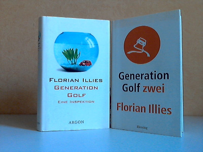
2003Best.-Nr. 40159Berlin, Argon Verlag GmbH + München, Karl Blessing Verlag GmbH, 2000, 2003. 217, 256 Seiten , 19 cm, Hardcover/Pappeinband
4 topographic maps, colour-printed. 70 x 58 cm (1:1,000,000), 66 x 55.5 cm (1:500,000), ca. 54 x 45 cm (1:200,000). Constant ratio linear horizontal scale. In Russian (Cyrillic). The Soviet Union's 1:1,000,000, 1:500,000, and 1:200,000 General Staff map quadrangles showing Al-`Ula: from the Russian series of military maps produced during the Cold War, based on high-quality satellite imagery, but usually also ground reconnaissance. The information was compiled during the years 1982, 1967-70, and 1972-75; the editors were V. R. Iost, Ju. V. Chekusov, and N. D. Yarema, respectively. The smaller-scale maps cover the northwestern coastal portion of the Arabian Peninsula, the large-scale maps provides an astonishing degree of detail. The oasis town Al-`Ula, on the historical Incense Road, is depicted in the Wadi Al-'Ula; nearby landmarks include the Jabal al Mijdar, Khuraybah, and Bi'r 'Udhayb. - Products of a massive, clandestine cartographic project begun under Stalin and ultimately encompassing the entire globe, the Soviet General Staff maps are today noted for their extreme precision. Indeed, even in post-Soviet times they provide the most reliable mapping for many remoter parts of the world: "Soviet-era military maps were so good that when the United States first invaded Afghanistan in late 2001, American pilots relied on old Russian maps of Afghanistan. For almost a month after the United States began a bombing campaign to help oust the Taliban government, American pilots were guided by Russian maps dating back to the Soviet occupation of Afghanistan in the 1980s" (Davies/Kent, p. xi). - Although the details of the cartographic programme evolved over the decades, its overall system and plan remained remarkably constant. "The basic quadrangle is the 1:1,000,000 sheet spanning 4° latitude by 6° longitude. The quadrangles are identified by lettered bands north from the equator and by numbered zones east from longitude 180° [...] Each 1:1,000,000 sheet is subdivided into four 1:500,000 sheets (from northwest to southeast), labeled [by] the first four letters of the Russian alphabet [...] Each 1:1,000,000 sheet is [also] subdivided into 36 1:200,000 sheets in a six-by-six grid [... They] normally contain on the reverse side a detailed written description of the districts (towns, communications, topography, geology, hydrology, vegetation, and climate) together with a geological sketch map" (ibid., p. 19-21). "Printing such large-format plans in so many colors with near-perfect print registration itself testifies to the skill of the printers in the military map printing factories across the former Soviet Union. The quality of printing reflects the level of training and the reliability of humidity-control equipment and the electricity supply at the time" (ibid., p. 6f.). The 1:200,000-scale maps are specifically labelled "For Offical Use". Although the general terrain evaluation maps and operational maps produced at the smaller scales of 1:1,000,000 and 1:500,000 were not separately marked as classified, all General Staff maps de facto constituted closely guarded military material, none of which became available in the West before the end of the Cold War in the early 1990s. - Light traces of folds; some very insignificant wrinkling in places, but altogether in excellent condition. Cf. J. Davies / A. J. Kent, The Red Atlas (Chicago/London, 2017).
2 topographic maps, colour-printed. Lambert conformal conic projection, scale 1:1,000,000. In Russian (Cyrillic). Ca. 86 x 107 cm each. Extremely rare: the two massively-sized synoptic 1:1,000,000 maps covering the Arabian Gulf in its entirety, as published by the Soviet Union's General Staff of the army. Not to be confused with the Soviet Union's vastly smaller General Staff map quadrangles of the same scale which are aligned along the graticules, spanning 4° latitude by 6° longitude and covering only roughly half the area shown by each of the present sheets. - Edited from information sourced during the years 1972-1983 by D. D. Trushin and I. A. Medvedev. Although not specifically marked as classified, all General Staff maps de facto constituted closely guarded military material, none of which became available in the West before the end of the Cold War in the early 1990s. - A few insignificant edge flaws, but generally in perfect condition.
A total of 86 topographic maps, colour-printed, ca. 58 x 45 cm. Constant ratio linear horizontal scale. In Russian (Cyrillic). Nearly all of the Soviet Union's 1:200,000 General Staff map quadrangles showing the Red Sea coast of the Arabian Peninsula: from the Russian series of maps produced during the Cold War, based on high-quality satellite imagery, but usually also ground reconnaissance. While there are a few lacunae in Yemen near the south-western tip of the Peninsula, most of the area is well-covered. Assembled continuously, the quadrangles would form an enormous map spanning ca. 8 x 4 metres. - Products of a massive, clandestine cartographic project begun under Stalin and ultimately encompassing the entire globe, the Soviet General Staff maps are today noted for their extreme precision. Indeed, even in post-Soviet times they provide the most reliable mapping for many remoter parts of the world: "Soviet-era military maps were so good that when the United States first invaded Afghanistan in late 2001, American pilots relied on old Russian maps of Afghanistan. For almost a month after the United States began a bombing campaign to help oust the Taliban government, American pilots were guided by Russian maps dating back to the Soviet occupation of Afghanistan in the 1980s" (Davies/Kent, p. xi). - Although the details of the cartographic programme evolved over the decades, its overall system and plan remained remarkably constant. "The basic quadrangle is the 1:1,000,000 sheet spanning 4° latitude by 6° longitude [...] Each 1:1,000,000 sheet is [...] subdivided into 36 1:200,000 sheets in a six-by-six grid [... They] normally contain on the reverse side a detailed written description of the districts (towns, communications, topography, geology, hydrology, vegetation, and climate) together with a geological sketch map" (ibid., p. 19-21). "Printing such large-format plans in so many colors with near-perfect print registration itself testifies to the skill of the printers in the military map printing factories across the former Soviet Union. The quality of printing reflects the level of training and the reliability of humidity-control equipment and the electricity supply at the time" (ibid., p. 6f.). - The 1:200,000-scale maps are specifically labelled "For Offical Use". Indeed, all General Staff maps de facto constituted closely guarded military material, none of which became available in the West before the end of the Cold War in the early 1990s. - Light traces of folds, occasional wrinkles and a few odd edge flaws, but altogether in excellent condition. Cf. J. Davies / A. J. Kent, The Red Atlas (Chicago/London, 2017).
A total of 49 topographic maps, colour-printed, ca. 70 x 60 cm. Constant ratio linear horizontal scale. In Russian (Cyrillic). The Soviet Union's 1:500,000 General Staff map quadrangles showing Iran, Iraq and the countries of the Levant: Palestine and Israel, southern Lebanon, parts of Syria and Jordan. From the Russian series of maps produced during the Cold War, based on high-quality satellite imagery, but usually also ground reconnaissance. Nearly complete, with only a few lacunae at Iran's easternmost fringes and at Bandar Abbas. Assembled continuously, the quadrangles would form an enormous map spanning roughly 6 x 3.5 metres!. - Products of a massive, clandestine cartographic project begun under Stalin and ultimately encompassing the entire globe, the Soviet General Staff maps are today noted for their extreme precision. Indeed, even in post-Soviet times they provide the most reliable mapping for many remoter parts of the world: "Soviet-era military maps were so good that when the United States first invaded Afghanistan in late 2001, American pilots relied on old Russian maps of Afghanistan. For almost a month after the United States began a bombing campaign to help oust the Taliban government, American pilots were guided by Russian maps dating back to the Soviet occupation of Afghanistan in the 1980s" (Davies/Kent, p. xi). - Although the details of the cartographic programme evolved over the decades, its overall system and plan remained remarkably constant. "The basic quadrangle is the 1:1,000,000 sheet spanning 4° latitude by 6° longitude. The quadrangles are identified by lettered bands north from the equator and by numbered zones east from longitude 180° [...] Each 1:1,000,000 sheet is subdivided into four 1:500,000 sheets (from northwest to southeast), labeled [by] the first four letters of the Russian alphabet" (ibid., p. 19-21). "Printing such large-format plans in so many colors with near-perfect print registration itself testifies to the skill of the printers in the military map printing factories across the former Soviet Union. The quality of printing reflects the level of training and the reliability of humidity-control equipment and the electricity supply at the time" (ibid., p. 6f.). - Two of the maps carry the Russian air defense grid ("setka PVO") printed in pink. Although the general terrain evaluation maps and operational maps produced at the smaller scales of 1:1,000,000 and 1:500,000 were not usually marked as classified (larger-scale maps were routinely labelled "Secret" or "For Offical Use"), all General Staff maps de facto constituted closely guarded military material, none of which became available in the West before the end of the Cold War in the early 1990s. - Light traces of folds and occasional wrinkles and small edge flaws, but altogether in excellent condition. Cf. J. Davies / A. J. Kent, The Red Atlas (Chicago/London, 2017).
A total of 350 topographic maps, colour-printed, ca. 52 x 47 cm. Constant ratio linear horizontal scale. In Russian (Cyrillic). The Soviet Union's 1:200,000 General Staff map quadrangles showing Iran, Iraq and the countries of the Levant: Palestine and Israel, southern Lebanon, parts of Syria and Jordan. From the Russian series of maps produced during the Cold War, based on high-quality satellite imagery, but usually also ground reconnaissance. Nearly complete, only a few quadrangles missing along the south-western border regions and two lacunae on the very north-eastern fringe. Assembled continuously, the quadrangles would form an enormous map spanning nearly 14 x 9 metres!. - Products of a massive, clandestine cartographic project begun under Stalin and ultimately encompassing the entire globe, the Soviet General Staff maps are today noted for their extreme precision. Indeed, even in post-Soviet times they provide the most reliable mapping for many remoter parts of the world: "Soviet-era military maps were so good that when the United States first invaded Afghanistan in late 2001, American pilots relied on old Russian maps of Afghanistan. For almost a month after the United States began a bombing campaign to help oust the Taliban government, American pilots were guided by Russian maps dating back to the Soviet occupation of Afghanistan in the 1980s" (Davies/Kent, p. xi). - Although the details of the cartographic programme evolved over the decades, its overall system and plan remained remarkably constant. "The basic quadrangle is the 1:1,000,000 sheet spanning 4° latitude by 6° longitude. The quadrangles are identified by lettered bands north from the equator and by numbered zones east from longitude 180° [...] Each 1:1,000,000 sheet is subdivided into four 1:500,000 sheets (from northwest to southeast), labeled [by] the first four letters of the Russian alphabet" (ibid., p. 19-21). "Printing such large-format plans in so many colors with near-perfect print registration itself testifies to the skill of the printers in the military map printing factories across the former Soviet Union. The quality of printing reflects the level of training and the reliability of humidity-control equipment and the electricity supply at the time" (ibid., p. 6f.). - The 1:200,000-scale maps are specifically labelled "Secret" or "For Offical Use". Indeed, all General Staff maps de facto constituted closely guarded military material, none of which became available in the West before the end of the Cold War in the early 1990s. - Light traces of folds and occasional wrinkles and small edge flaws, but altogether in excellent condition. Cf. J. Davies / A. J. Kent, The Red Atlas (Chicago/London, 2017).
A total of 382 topographic maps, colour-printed, ca. 58 x 45 cm. Constant ratio linear horizontal scale. In Russian (Cyrillic). Most of the Soviet Union's 1:200,000 General Staff map quadrangles showing the Arabian Peninsula: from the Russian series of maps produced during the Cold War, based on high-quality satellite imagery, but usually also ground reconnaissance. While there are a few lacunae in the eastern and central part of the Peninsula, mainly concerning Oman and the UAE, and a few Saudi Arabian quadrangles are lacking, most of the area is well-covered. Assembled continuously, the quadrangles would form an enormous map spanning ca. 13 x 11 metres!. - Products of a massive, clandestine cartographic project begun under Stalin and ultimately encompassing the entire globe, the Soviet General Staff maps are today noted for their extreme precision. Indeed, even in post-Soviet times they provide the most reliable mapping for many remoter parts of the world: "Soviet-era military maps were so good that when the United States first invaded Afghanistan in late 2001, American pilots relied on old Russian maps of Afghanistan. For almost a month after the United States began a bombing campaign to help oust the Taliban government, American pilots were guided by Russian maps dating back to the Soviet occupation of Afghanistan in the 1980s" (Davies/Kent, p. xi). - Although the details of the cartographic programme evolved over the decades, its overall system and plan remained remarkably constant. "The basic quadrangle is the 1:1,000,000 sheet spanning 4° latitude by 6° longitude [...] Each 1:1,000,000 sheet is [...] subdivided into 36 1:200,000 sheets in a six-by-six grid [... They] normally contain on the reverse side a detailed written description of the districts (towns, communications, topography, geology, hydrology, vegetation, and climate) together with a geological sketch map" (ibid., p. 19-21). "Printing such large-format plans in so many colors with near-perfect print registration itself testifies to the skill of the printers in the military map printing factories across the former Soviet Union. The quality of printing reflects the level of training and the reliability of humidity-control equipment and the electricity supply at the time" (ibid., p. 6f.). - The 1:200,000-scale maps are specifically labelled "For Offical Use". Indeed, all General Staff maps de facto constituted closely guarded military material, none of which became available in the West before the end of the Cold War in the early 1990s. - Light traces of folds, occasional wrinkles and a few odd edge flaws, but altogether in excellent condition. Cf. J. Davies / A. J. Kent, The Red Atlas (Chicago/London, 2017).
Large folding chromolithographed map (map size 65.5 × 88 cm). Original publisher's printed paper wrappers. Large folding map of the world, completely in colour, showing the areas containing oil and where oil/gas wells are located. Inserted around the margins of the map are several more detailed inset maps of Europe, Poland, California, Kansas, Oklahoma, Texas, Mexico, Venezuela, Trinidad, Apsheron (Azerbeidzjan), Sumatra, Japan, Egypt and Borneo. Also included is a large diagram illustrating the world's oil production, from 1860 to 1924. - Only very slightly worn along a few folds. Paper wrappers slightly damaged, otherwise in very good condition.
1864Best.-Nr. 94849New Orleans 1864. Paperback. Very Good. 8 unnumbered pages. 21 cm. Modest foxing and some light staining on outer leaves. Small stitchmarks indicates that this was previously sewed. "Invalid Battalion Corps d'Afrique" printed in small type in upper left corner of first page. Authorized establishment of an Invalid battalion for the Corps d'Afrique to be composed of "colored" tropps who by reason of wounds or sickness contracted in the line of duty are unfit for further field service. Most of this rare general order reprints the War Department's General Orders Nos 105 dated 4.28/63 and 139 dated 5/15/63. Most of General Order 139 consisted of lists of physical infirmities that did or didn't disqualify soldiers from serving in the Invalid Corps. The final provision in General Order No. 139 states that no officer or enlisted man would be entitled to any pension premium or bounty for enlistment or service in the Invalid Corps although such soldiers would receive other pay and allowances authorized for the U.S Infantry. paperback books
1864Best.-Nr. 94849New Orleans 1864. Paperback. Very Good. 8 unnumbered pages. 21 cm. Modest foxing and some light staining on outer leaves. Small stitchmarks indicates that this was previously sewed. "Invalid Battalion Corps d'Afrique" printed in small type in upper left corner of first page. Authorized establishment of an Invalid battalion for the Corps d'Afrique to be composed of "colored" tropps who by reason of wounds or sickness contracted in the line of duty are unfit for further field service. Most of this rare general order reprints the War Department's General Orders Nos 105 dated 4.28/63 and 139 dated 5/15/63. Most of General Order 139 consisted of lists of physical infirmities that did or didn't disqualify soldiers from serving in the Invalid Corps. The final provision in General Order No. 139 states that no officer or enlisted man would be entitled to any pension premium or bounty for enlistment or service in the Invalid Corps although such soldiers would receive other pay and allowances authorized for the U.S Infantry. paperback
Folio. 3 parts in one volume. (4), 144 (last blank) ff. with 32 woodcut illustrations; 94, (2), 45 (3) (last blank) ff. First title-page printed in red and black; 3 (repeated) printer's devices. Contemporary blindstamped leather over wooden boards with one metal clasp (out of 2). A collection of three works published by Feyerabend, issued jointly with separate title-pages each. The first work contains a translation of the famous travel account of Francisco Alvarez (ca. 1470-1540), who accompanied as a chaplain the 1520-26 Portuguese expedition to Ethiopia under Rodrigo de Lima. The embassy was occasioned by a letter by Helen, Empress of Ethiopia, the grandmother of Lebna Dengel (David II). The journey began in Massaua in 1520, leading the party to Shewa and Dabra Libanos before they reached Lebna Dengel's camp near Taguelat. Alvarez made at least four journeys to Shewa before leaving Ethiopia in 1526, bound for India. According to Ramusio, this was the earliest account of Etiopia, and for at least a century it would remain the principal published source on the country. The first edition appeared in Portuguese in 1540, comprising merely a part of Alvarez's lost five books. Alvarez describes the country's churches, including the rock-hewn churches, and also the towns and the agriculture. Historical geography owes to him the story of the invasion of the Somal and Galla. Alvarez also gives accounts of the countries surrounding the rule of Prester John, such as Danakil and Godjam. It is unfortunate that Alvarez was unable to perform cartographical and topographical localisations, and yet his influence on cartography remained evident until the days of d'Anville and J. Bruce (cf. Henze I, 62ff.). The account is prefixed by two letters by Andrea Corsal, previously published in 1516. The Florentine traveller Corsal describes, on 24 ff., mainly the area of the Red Sea, Southern Arabia (with descriptions of Aden, Hormuz, Bahrein, Socotra, Muscat, and Oman), India, Ethiopia, Persia (the city of Balsera and King Sophi), as well as Malacca. - Binding somewhat rubbed; wants one clasp. Title-page clipped and remargined; old ownerships to title and flyleaf; a small worm-hole to 35 ff. (touching a single line); evenly browned throughout. A very good copy. Kainbacher 15f; Lockot 711, 732; Gay 186; Sabin 974. Cox I, 3 & 22. Gay 3321 (French ed.). The second work is a translation of Orosius's world history; the third work is a translation of the text from Ortelius's 1580 world atlas. - Schweiger 622 (Orosius). Not in Adams.
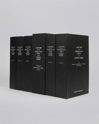
Best.-Nr. 122010London Archive Editions 2003. . 6 vols 8vo 25.5 x 16.5 cm; includes maps & genealogical tables; publisher's original black cloth white lettering to upper board and spine a fine set. Lorimer's Gazetteer of the Persian Gulf was compiled by officials of the British Government in India during the decade after Lord Curzon's Vice-Regal tour of the Gulf in 1903. When first issued in 1915 it was classified as Secret and for Official Use Only and just a few dozen copies were printed for circulation to British Government departments and agencies. The work was planned in two parts; the first comprising a history of the Gulf region the second being a geographical dictionary but grew to encompass all aspects of Gulf life culture cities towns tribes and topography. Lorimer was an official of the India Civil Service who had spent most of his career on the North West Frontier. He was placed on 'special duty' to compile the Gulf handbook which was intended to be completed in six months but due to Lorimer's dedication and extensive field trips the work took some ten years to complete. The present edition printed from the India Office Records makes available one of the most important primary sources for the study of the Gulf region from the seventeenth to the early twentieth century. London, Archive Editions, 2003. hardcover
Best.-Nr. 506G M & O. n.d. 18 1/4 x 13 inches. Very good condition. See pic. Center map with the GM&O trackage laid out in the Central U.S. On both side are towns and cities listed with connections to other railroads. The GM&O was well connected! G M & O. unknown
1997347 pages including index and notes. Author's signature upon title page. The first book about Gulf War Syndrome. An intensely personal account of the struggle of two dedicated public servants to expose one of the largest government cover-ups of modern history. A former CIA analyst exposes the officially sanctioned deceptions that have made Gulf War veterans the walking wounded of Desert Storm. "Demolishes the Pentagon's contention that Iraqi chemical weapons were not present during the Gulf War and the U.S servicemen and women were not exposed to chemical agents." - Raymond L. McGovern, retired after 27 years at CIA and recipient of the Intelligence Commendation Medal. Includes several black and white photographic plates. Spine leaning otherwise book in excellent clean, unmarked condition with minimal wear. Dust jacket excellent with very light wear. Very nice copy. Book
Engraved view (265 x 215 mm) in contemporary hand-colour. Beautifully hand-coloured decorative view of Bandar Abbas (Gamrun) in the Arabian Gulf. Slightly age-toned and stained; repaired tears in the lower blank margin and in the text, otherwise in good condition. Alai, Special maps E.538. Not in Al Ankary. Al-Qasimi.
1700Best.-Nr. 17344Amsterdam, de Wit, 1675 (recte um 1700). Ca. 49,5 cm x 57 cm. [4 Warenabbildungen]
Folio (288 x 351 mm). 192 pp., profusely illustrated throughout, with 48 full-page Woodburytype plates mounted within printed borders on sturdy cardboard, 24 mounted Woodburytype plates in the text, and 2 plates printed in red. Bound in sumptuous red morocco for Ismail Pasha, Khedive of Egypt, elaborately giltstamped on spine and both covers. Leading edges gilt, inner dentelle gilt, marbled endpapers. All edges gilt. A striking collection of 72 woodburytype portraits of great artists and reproductions of their art, with accompanying biographical sketches, issued in undated instalments, then bound for and dedicated to Ismail Pasha, Khedive of Egypt and Sudan from 1863 to 1879. The portraits include famous authors and officers such as Victor Hugo, Thiers, Georges Sand, Sarah Bernhardt, Alexander Dumas fils, Gounod, Daudet, Erckmann-Chatrian, Mac-Mahon, Coppée, Jules Janin, Velpeau etc. - but also Ferdinand de Lesseps, the French engineer whose Suez Canal was constructed and opened under Ismail's khedivate. The photographs are by Mulnier, Nadar, Carjat, Petit, and others, and printed by Goupil. The woodburytype is a photomechanical process capable of reproducing the continuous tones of photography with pigmented gelatin molded to a varying thickness. The speed and economy of woodburytypes, as well as their permanence (unlike traditional photographic processes that were subject to fading), made them a highly practical substitute for albumen silver prints in book publication or other situations where mass production was desirable. - Occasional slight foxing, but very well preserved altogether. The upper cover of the luxuriant red morocco binding bears the dedication: "A Son Altesse Ismaïl Pacha Khédive d'Égypte". Sharing the ambitious outlook of his grandfather, Muhammad Ali Pasha, Ismail greatly modernized Egypt and Sudan during his reign, investing heavily in industrial and economic development, urbanisation, and the expansion of the country's boundaries in Africa. OCLC 17984963. Cf. Lucien Goldschmidt and Weston J. Naef, The Truthful Lens (1980).
8vo. 2 parts in 1 vol. XVI, 340 pp. (3)-136 pp. With engr. frontispiece by Wentzel (counted in the pagination) and 40 folding costume plates by Endler, in original hand colour. Modern marbled boards retaining original giltstamped red spine label. First edition. - A frequently loose account of oriental conditions and excesses; "based exclusively on earlier travel publications" (cf. Chatzipanagioti-S.). The appendix of pt. 2 has a separate title: "History of a noble Turkish lady who, dressed as a man, found her fortune and death amongst weaponry in Europe". The prologue admits that this appendix "bears no connexion with the preceding matter" - indeed, it has nothing to to with Ottoman history at all, but is a satire on German conditions during the Seven Years' War, replete with allusions which would bear closer study. The author, Christian Wilhelm Kindleben (1748-85), was sometime assistant to Basedow at the Philanthropinum reform school in Dessau. - The engravings show costumes for gentlemen and ladies; "the images of the Sultana combine elements drawn from various illustrations found in Ferriol's 'Recueil'" (cf. Chatzipanagioti-S.). - Evenly browned throughout. German postwar trade records cite a single coloured copy. Chatzipanagioti-S. 481 (= 482; citing merely 39 plates). Frauen reisen 316. Lipperheide 1419 (Lb 3). Colas 1607. Hiler 496. Hayn/Gotendorf III, 559 (and V, 111; VII, 723). Goedeke IV/1, 929, 33.
8vo. VII, (1), 126 pp., final blank f. With lithogr. map at the end of the volume; printed notes of a Bedouin melody within the text. Contemporary green half calf with giltstamped spine title and marbled sides, original printed yellow wrappers bound within with wood-engraved desert illustration on back cover. First edition, published posthumously. - Extremely rare account of Wallin's principal journey through Arabia, unknown to most bibliographers: "It was not until two years after his death", writes Henze, "that the report of his first (and most important) journey (performed in 1845, a year before the appearance of the first volume of Carl Ritter's 'Arabia') was published". This refers to the English "Narrative of a Journey from Cairo to Medina and Mecca", which was printed in the Journal of the Royal Geographical Society in 1854. In fact, an extensive account of the first leg of this highly significant journey was first given to the world in December 1853, but little more than a year after the author's passing. Of this Swedish-language book, edited by Berndt Otto Schauman, less than two dozen copies are known worldwide, 12 of which are in Finnish libraries (the remainder distributed throughout Sweden [4 copies], Germany [2 copies], Denmark, France, and the U.S.A. [a single copy each]). In contrast with the later JRGS publication, the present work includes an appendix rendering Arabic terms and phrases that occur throughout the text in the original language and script. - Like his more famous contemporary J. L. Burckhardt, Wallin was fluent in Arabic and, in local costume, was capable of passing for a scholarly sheikh. Indeed, the two explorers are often compared: "I see many points of resemblance between them, the same iron constitution, the same versatility, the same indomitable energy, the same imperturbable temper" (H. C. Rawlinson, quoted in Henze). Financially backed by his alma mater, the University of Helsinki, Wallin departed for the Middle East in 1843 and set out on his expeditions from Cairo under the name of Abd al-Wali. "In 1845, proceeding southeast across the wastelands of the Nafud Desert, he reached Ha'il then continued by force of circumstances southward to Medina and Mecca. From there he returned to Egypt" (Howgego). More precisely, he "moved eastwards from Wadi al-Araba, first touching upon the upper regions of Wadi Sirhan, then on to the oasis of Djuf ('Algawf') and crossed the central regions of Shammar, via Djobbah ('Gubbi'), the Great Nefud ('Nufood'), and Hail [...] Of Shammar and its inhabitants he provided the fullest account, unsurpassed by later travellers in its scholarly precision" (Henze). After his return to Europe in 1850, Wallin was made Professor of oriental languages at Helsingfors. His notes provide a detailed overview of the political and religious movements and the role of the different tribes in Palestine and especially in Saudi Arabia. - Occasional brownstaining; binding somewhat rubbed, but a fine copy on the whole. Provenance: contemp. ownership "Bergelin" to front wrapper cover; bookplate of the journalist Kurt Bergengren (1920-85) on pastedown. K.-E. Henriksson (A Wallin Bibliography), in: Studia orientalia 17 (1952), p. 13-16, at p. 13. OCLC 551923531. Cf. Macro 2262. Howgego II (1800-50), W12, p. 627. Henze V, 452 (all citing only the 1854 JRGS publication). Cf. Fück 198 (mentioning the journey). Not in Gay or Ibrahim-Hilmy.
8vo. VII, (1), 126 pp., final blank f. With lithographed map at the end of the volume; printed notes of a Bedouin melody within the text. Green half calf with contemporary marbled boards and giltstamped title to rebacked spine. First edition, published posthumously. - Extremely rare account of Wallin's principal journey through Arabia, unknown to most bibliographers: "It was not until two years after his death", writes Henze, "that the report of his first (and most important) journey (performed in 1845, a year before the appearance of the first volume of Carl Ritter's 'Arabia') was published". This refers to the English "Narrative of a Journey from Cairo to Medina and Mecca", which was printed in the Journal of the Royal Geographical Society in 1854. In fact, an extensive account of the first leg of this highly significant journey was first given to the world in December 1853, but little more than a year after the author's passing. Of this Swedish-language book, edited by Berndt Otto Schauman, fewer than two dozen copies are known worldwide, 12 of which are in Finnish libraries (the remainder distributed throughout Sweden [4 copies], Germany [2 copies], Denmark, France, and the U.S.A. [a single copy each]). In contrast with the later JRGS publication, the present work includes an appendix rendering Arabic terms and phrases that occur throughout the text in the original language and script. - Like his more famous contemporary J. L. Burckhardt, Wallin was fluent in Arabic and, in local costume, was capable of passing for a scholarly sheikh. Indeed, the two explorers are often compared: "I see many points of resemblance between them, the same iron constitution, the same versatility, the same indomitable energy, the same imperturbable temper" (H. C. Rawlinson, quoted in Henze). Financially backed by his alma mater, the University of Helsinki, Wallin departed for the Middle East in 1843 and set out on his expeditions from Cairo under the name of Abd al-Wali. "In 1845, proceeding southeast across the wastelands of the Nafud Desert, he reached Ha'il then continued by force of circumstances southward to Medina and Mecca. From there he returned to Egypt" (Howgego). More precisely, he "moved eastwards from Wadi al-Araba, first touching upon the upper regions of Wadi Sirhan, then on to the oasis of Djuf ('Algawf') and crossed the central regions of Shammar, via Djobbah ('Gubbi'), the Great Nefud ('Nufood'), and Hail [...] Of Shammar and its inhabitants he provided the fullest account, unsurpassed by later travellers in its scholarly precision" (Henze). After his return to Europe in 1850, Wallin was made Professor of oriental languages at Helsingfors. His notes provide a detailed overview of the political and religious movements and the role of the different tribes in Palestine and especially in Saudi Arabia. - Stamped ownership "L. L. Cygnaeus, Helsingfors" to flyleaf. A fine, largely unbrowned copy. K.-E. Henriksson (A Wallin Bibliography), in: Studia orientalia 17 (1952), p. 13-16, at p. 13. OCLC 551923531. Cf. Macro 2262. Howgego II (1800-50), W12, p. 627. Henze V, 452 (all citing only the 1854 JRGS publication). Cf. Fück 198 (mentioning the journey). Not in Gay or Ibrahim-Hilmy.
Royal folio (380 x 506 mm). Persian manuscript on paper. 140 pp., 9 lines in 2 columns to the page, first leaf and final 3 pp. blank save for the borders. Large Nasta'liq calligraphy in black ink, chapter headings in red. Text enclosed within blue, black, gilt and red borders. Title in red to fol. 2r, large 'unwan headpiece on fol. 2v, column separator decorated with gilt floral designs on fols. 2v-3r, 2 meticulous gilt and coloured colophon decoration on fol. 69r. With a total of 18 coloured illustrations of the Holy Sites (7 full-page, the remainder half-page or larger). Splendidly ornamented embroidered cloth binding with pink morocco edges and pastedowns and fore-edge flap. Monumental manuscript copy of the first Islamic guidebook for the pilgrimage to Mecca and Medina, which Muhi al-Din Lari (d. 1526/27) completed in India in 1505/06. The book provides instructions on the Hajj pilgrimage rituals and descriptions of important sites that Muslim pilgrims can visit, including of the Kaaba in Mecca. Whilst no early illustrated Indian copies are known, the work began to be widely copied with often lavish illustrations from the later 16th century onwards, mostly in in Ottoman Turkey. - The 18 large-scale illuminations in the present manuscript show the holy sites, locations between Medina and Mecca, and the various stages of the Hajj. The illustration of the Masjid al-Haram in Mecca shows the Kaaba, the areas assigned for worship by the various branches of Islam, as well as the doors to the sanctum, minarets, and two rows of colonnades. - In excellent state of preservation throughout.
Folio. 24, (2) pp. With a map within the text. Sewn. Correspondence relative to the execution of several treaties respecting the slave trade and to the repression of the illicit traffic in slaves, including extracts of letters from Governor Sir R. T. Farquhar to the Earl Bathurst regarding the seizure of "Arab vessels laden with slaves" on the "coasts of Arabia" (p. 22) and the compliance of the Imaum of Muscat with the treaty between the British Government and the Imaum, with a copy of that treaty inserted. - Paginated "251-275" by a contemporary hand. Well-preserved.
Folio (255 x 390 mm). VI, 26 pp. - (Bound with) II: Fundgruben des Orients I. [Ibid., 1809]. 85-190 pp. With 1 engraved plate. - III: Fundgruben des Orients VI. [Ibid., 1818]. 221-340 pp. With 1 engraved plate. Contemporary half calf over marbled boards with giltstamped spine label. Only edition, printed in Arabic and German parallel text. Critical edition and translation of the famous 13th century ode "Al-Burda", a religious poem in praise of the Prophet Muhammad written by Busiri, produced by the Austrian orientalist von Rosenzweig (1791-1865). Translated into many European languages since the 18th century, starting with the 1761 Latin edtion, the "Al-Burda" saw several German translations, including a lyrical translation by another prominent orientalist, Joseph von Hammer-Purgstall, in 1822, none of which, however, were as successful as this edition. It launched Rosenzweig as an editor and translator whose extensive work culminated with his three-volume edition of Hafiz' "Diwan", published from 1858 to 1864. - Bound with the Al-Burda are extracts from Hammer-Purgstall's six-volume "Fundgruben des Orients", taken from vols. I and VI, including extracts from the Quran and from the works of Ibn Chaldun, as well as a catalogue of Arabic, Persian and Turkish books held by the Vienna Imperial Library. - Extremities lightly bumped; binding loosened. Paper continuously browned throughout; occasionally brownstained and waterstained. Pages 241-244 of volume VI transposed between pp. 260 and 261. Some handwritten marginal notes in ink and pencil near the end. The spine label does not correspond to the title of the main work, reading: "Freitag Dissertation de la Angueara". - Rarely seen at auction. GAL II, 149. OCLC 311499210. Goedeke XVI, 628, 7, 2.
18228vo. XVI, 390, VI pp. Contemporary marbled half calf with label to gilt spine. First edition of Oberleitner's linguistic course. The orientalist and theologian at the Benedictine "Schottenstift" was Professor of Arabic, Syrian, and Chaldaic Languages and Exegesis at the University of Vienna. "Oberleitner's independent editing of the 'Fundamenta' constitutes an important achievement" (cf. ÖBL). The Viennese printer Schmid specialized in Arabic, Persian, and Syrian works, and his was the only printing shop in Austria that could handle such texts. Aboussouan 693. Mayer II, 145. ÖBL VII, 188. Script. Ord. S. Benedicti 324, II. Wurzbach XX, 455. Brunet IV, 143. Graesse V, 1.
1974Features: Lafitte's lost galleon; More legends of Gulf Coast adventure; The Wildcatters - long article with many great photos of oil's early history; Kit Carson's Grandson, who is also Tom Tobin's grandson!; Pool Rooms and Horse Racing - early gambling; Recapture Creek's Mystery Gold; Fifty-Six Miles from a doctor - life in early Montana; Comanche Trail - when horses were treasure; Owens Valley - Playground for earthquakes; the Cumbres and Toltec Railroad; Stetson Scrapbook; Little Joe, the loner; and more. Clean and unmarked with light wear. Nice copy. Magazine