3.979 Ergebnisse
8vo. (2), 160 pp. With a portrait of Eduard Glaser, 8 numbered plates and 2 large folding maps. Later half cloth, with the original front wrapper mounted on the front board. First separate publication (offprint) of "an extremely important article" (Smith) on the geography of north-west Yemen, based on the results of the unpublished journals of Eduard Glaser, who explored a region that still had to be visited by any other European. It includes a history of exploration of the region, a biography of Glaser, a description of the expedition of his expeditions and two large maps of region (the second a version of the same map in Arabic). The article was originally published in the Bulletin de la Société Royale de Géographie d'Egypte XX. - A very good copy. Smith, The Yemens 40. Cf. Macro 2288.
Folio (245 x 362 mm). 6 vols. (12), LXXII, (4), 668, (1) pp. (4), 743, (1) pp. 793, (1) pp. (2), IV, 5-780 pp. (4), 708 pp. 824, (104) pp. Title printed in red and black. With 187 engraved plates (many folding) and 9 engravings in the text (showing maps, plans, views, costumes, flora, fauna, scenes, portraits etc., including 2 bound as frontispieces), as well as numerous woodcuts in the text (showing arms, seals, devices, coastal views, details, machinery etc.). Uniform full calf with red labels to spine (gilding oxydized). Third and best edition of this important and profusely illustrated collection of travel reports, compiled by the brothers Awnsham and John Churchill, based on Hakluyt and Purchas. It includes the accounts of Martin Baumgarten (Egypt, Arabia, Palestine, Syria), Thomas Roe, Philipp Balde and Johan Nieuhoff (East Indies, including a detailed account of the north-eastern coast of Arabia, with a description of pearl fishing in Bahrain and mentioning Julfar, Qatar, Sir Bani Yas, Dubai, Sharjah, Ajman, Ras al-Khaimah, Amalgavine, and other places of interest along the coastline), J. Gemelli Careri (Turkey, Persia, India), Nicholas Rolamb (Constantinople), John Barbot (West Africa, with a chapter on "Mahomet and his Alcoran"), as well as of Yemen and various journeys to China, Korea, Greenland, Iceland, Africa, North and South America (including Columbus). - "This is a very valuable collection, both for its range of coverage and for the fact that it gives the original accounts [...] The third edition is considered to be best because of its greater inclusiveness and its copious index" (Hill). Two further volumes were issued separately in 1745, republished in 1752. - The count of the illustrations is notoriously complicated: the "List of the Copper Plates" counts 305 illustrations and maps, of which as many as four are placed on a single plate, and some are placed within the text. Compared to this list, the present set lacks 52 illustrations, or ca. 20 plates, whereas the first volume contains 5 additional plates not called for in the List. Three of the maps (Africa, Asia, America) which the List announces for the first volume are in fact bound in volumes IV-VI. The introduction, a "History of Navigation from its Original to this time", is likely one of the final works of the philosopher John Locke, whose publisher and financial manager Awnsham Churchill had been (while the attribution has been called into question, the text was included in Locke's Complete Works). - Provenance: Byrdie McNeill, Mt. Edgecumbe, Alaska (her stamps). Bindings professionally repaired. Some browning; some edge defects, tears and paper flaws, but generally well-preserved. Cox, I, 10. Hill 295. Sabin 13017. Shirley G.CHUR-1d. Alden/L. 744/62. Borba de Moraes I, 158. Landwehr, VOC 260 (note). Cf. National Maritime Museum Cat. I, 33.

Large 8vo. (2), XII, 283, (3), XII, XXIII, (1) pp. Contemporary half cloth over buckram boards. Forming part of the fifth edition of this important government-issued series (incorporating revisions to 1929), this 12th volume records the treaties made with the countries on the fringes of the British Raj, most importantly those made with Burma, but also such entered into with Jammu and Kashmir in the northwest as well as with Sikkim and Assam in the northeast. The first of these recorded is a commercial arrangement with the King of Ava in 1795, and those that follow demonstrate the steady progress of English intervention with a Treaty "for the establishment of a Court at Mandalay" and various arrangements between the British and Chinese with regard to the Burmese frontier. - Edges somewhat rubbed, front hinge beginning to split, but still a good, well-preserved copy. Provenance: Foreign and Commonwealth Office stamp (Commonwealth Relations Offfice Library) to title-page and cancellation stamp to verso; "Council Reading Room" stamp to flyleaf with pencil note "Amendments made to to 25. 2. 35". OCLC 454612923.
4to (150 x 206 mm). Arabic manuscript on paper. 102 (but: 99) numbered pages (pp. 75-77 skipped). Black and red ink, 15 lines, per extensum, with a few ink diagrams in the margins. Half leather over papered boards. A collection of six treatises on sections, chronology, and astronomy, indexed on a cover label and, in pencil, on the inside front cover. Text in black ink with extensive commentary in red throughout the margins. - Binding loosened, gutters reinforced. Paper browned and brittle, but on the whole well-preserved with only very minor edge chipping.
36 vintage small format silver gelatin photographs, plus a photographic postcard of Faisal II as a boy. A small collection of highly accomplished amateur photos of inter-war Iraq. With a handful of exceptions, the photographs show the local population, often children, recorded with a sensitive and sympathetic eye. - Though there is no material evidence to support the attribution, they came from a collection of similar material said to belong to Christopher Warren, who worked as an Intelligence Officer in Iraq, Lebanon and Kuwait in the 1930s. Other photographs, offered for sale at the same time as these, show that he was active in those locations and was, at one point, based at Dar Al Qamar (Moon House), Karradat Mariam, Baghdad. - The many intimate and beautiful portraits would suggest the photographer spoke Arabic and understood enough about his subjects to foment the mutual comfort necessary for such candid images. Several show young people from both the city and the countryside: the sons of shop-owners at ease in the hustle and bustle of Baghdad and children gathering crops, hunting and playing reed flutes in the open expanse of the desert. Some, such as the portrait of a suited young man in a local boat, potentially imply a professional relationship. Viewed together, the images express a peacefulness far removed from the tensions of the interwar period, in which protests against British influence were common, even after the independence of the country in 1932. Only a photographic postcard, present with the images, reminds one of the broader historical context: a portrait of Faisal II, still a child but standing upright in military dress. - All photographs clearly removed from an album, with residual scraps of brown album paper to versos.
Correspondence, memoranda, and notes in English and Arabic. 2 typescript pp. in-folio, 15 handwritten pp. in-4to, 32 handwritten pp. in-8vo. A collection of prewar and wartime notes and correspondence, some labelled "secret", from the desk of the longtime First Assistant Resident in Aden, Lt. Col. Harold F. Jacob, who served in this capacity from 1910 to 1917 (and, once the War started, was also Chief Political Officer to the Aden Field Force). - In a classified report to a superior concerning tribal allegiances in Yemen and the threat of an Ottoman incursion, dated 30 June 1915, he writes: "Interviewed the Abdali Sultan at Lahej yesterday and the following is what I have been able to elicit. 1. The Sheikh Ibn Nasir Mukbil appears to be particularly anxious to secure our armed presence on the Haushabi border and Sheikh Husen Saleh the Azraki (our stipendiary) and Ali Ba Saleh the Haushabi Sultan's Minister seem to be willing tools in his hand to effect that purpose. It must be remembered that Ibn Nasir Mukbil is still friendly to us or rather his unfriendliness is not proved. [...] It is hard to prophesy correctly in Arabia, and from a distance, since Arab politics change in so kaleidoscopic a fashion, but I am inclined to believe, even if there be certain hostile Turks and Arabs at Al Dareja, that the situation is not so critical as our friend the Abdali Sultan would have us believe. [...] [A]s the Sultan of Lahej is able to procure at this stage 600 camels in 2 days I am strongly in favour of our engaging them since, if hostilities open, he will find it extremely difficult to raise these numbers [...]". - A telegram draft of 10 January 1917 to the General Officer Commanding Aden, likewise "secret", Jacob writes: "Idrisi quite ready conclude supplementary agreement as outlined by Secretary of State (stop) [...] Says Farasan is part & parcel his sea-board and expects British protection from all outside interference (stop) Says British flag, however, as repugnant on Farasan as would be at Jizan and likely draw Turkish vengeance as implying cession of Islands to us; further will preclude future favours qua arms from France and Italy (stop) I fully sympathize with both agreements and believe presence of flag will place Farasan in category of annexation subject to 'post-bellum' adjudication (stop) [...]". - Also, several items of Arabic correspondence, often with Jacob's handwritten translation into English underneath. Also, a quantity of 8vo pencil notes in English and Arabic, some in the hand of another officer (possibly the Aden Resident) and as early as 1911, often not easily legible, apparently referring among other subjects to "Philby", "How Turks lost the Yemen", etc. - Jacob spoke Arabic fluently and knew the Qur'an intimately. As Political Agent in Aden and in the Hinterland he served on Lord Allenby's staff as an advisor on South West Arabia, where he became acquainted with Lawrence of Arabia. In 1915 he published a book on Southern Arabia, "Perfumes of Araby. Silhouettes of Al Yemen". - Edges brittle; some browning and folds, but altogether a well-preserved survival.
A set of nine volumes, 8vo and 4to. A rare survival: an ensemble of books, mainly medical, formerly in the library of Sultan Abdul Hamid II of the Ottoman Empire, whose famous collection was dispersed following his deposition in 1909. - Of the nine volumes in the present collection, more than half a devoted to medicine. They include a rare account of Turkish military and civil hospitals by the French physician Paul Aubry (1887), constituting an exceptional documentation of health care infrastructure in the Ottoman world. Further, there is a detailed account of the outbreak of the plague in the Levant by the Swedish polymath Jacques Graberg (1841), also describing the situation in Tangier in 1818 and 1819, which the author had witnessed himself. Finally, the collection comprises three rare volumes from the Ottoman Turkish translation of Adolf von Strümpell's medical textbook on internal diseases (1888-91), here focusing on diseases of the heart and the arteries, diseases of the brain, and diseases of the kidneys and bladder. - Additional volumes discuss the political and religious history of Japan, or the Greek Ten Thousand and their march to the Battle of Cunaxa and back in 401 BC. Other titles are more immediately connected with Turkey, giving a capsule history of the Ottoman Empire in French and Turkish verse, or and extremely rare political analysis of the Turkey's position in the critical months preceding the outbreak of the Russo-Turkish War of 1877/78. - The volumes bear the requisite traces of the Sultan's library marks. All are presentation volumes inscribed to the Sultan by the author (some even inscribed in Turkish and Arabic), or are bound in special presentation bindings, or the in Sultan's personal library bindings with his tughra on the covers. - Sultan Abdul Hamid (Abdülhamid) II (1842-1918) was the last Sultan of the Ottoman Empire to exert effective contol over the fracturing state and also remembered as a poet, translator and one of the dynasty's greatest bibliophiles. While his passion for books is memorialized by the many precious donations he gave to libraries all over the world and which mostly have remained intact to this day (including the 400-volume "Abdul-Hamid II Collection of Books and Serials" gifted to the Library of Congress), his own library was dispersed in the years following his deposition: books were removed to other palaces and even sold to Western collectors; the greatest part of his collection is today preserved in the Chester Beatty Library in Dublin. - Detailed catalogue available upon request.
A total of 267 photographs of construction work on the Aswan Dam. Comprises 190 large photographs (ca 25 x 30 cm), frequently with captions in the negative, mainly by D. S. George but also including A. Gianny and G. Kemble Bolam of Cairo (56 tipped in to an album and captioned, 21 loosely inserted within another album, 108 stored loosely within a portfolio, and 5 separately matted). Also, 77 smaller photographs (gelatin prints) of the dam and its environs, ca 15 x 18 cm (including a few duplicates), in an envelope. An impressive collection of photographs detailing the construction and opening of the Aswan Low Dam between 1899 and 1902 and of the work to raise it in 1907-1912. The images (frequently captioned in English on reverse) include views of the navigation channel in various stages of completion, the countless hundreds of local workers toiling in the unfinished West Channel and on the masonry of Bab el Maroum, the locks, trenches, Asyut Barrage, the accumulator house, the inauguration ceremony, but also a friendly football match between the "10th Soudanese Regiment (Blacks)" and the "Whites" (final score: Blacks 0, Whites 5). A stark panoramic shot shows the solar eclipse of 28 May 1900 above the Mohammed Ali Channel, seen from Awad. - Owing to its rainless climate Egypt has always depended on the annual flooding of the Nile for irrigation. The Aswan dam was designed by eminent British engineers to provide storage of annual floodwater and to augment dry season flows; construction about 1000 kilometres up the river from Cairo was begun in February 1899 by the London-based contractor John Aird & Co. Nothing of its scale had ever been attempted; on completion, it was the largest masonry dam in the world. It created an artificial lake extending 200 miles up the valley, partly submerging Ptolemy's temple on the island of Philae. The 1.25 mile-long dam with 180 sluice gates cost 3 million pounds sterling. It was opened by the Khedive on 10 December 1902. Originally limited in height by conservation concerns, the dam worked as designed but provided inadequate storage capacity for planned development and was raised between 1907 and 1912. The heightening still did not meet irrigation demands, and in the 1960s the Aswan High Dam was built 6 kilometres upstream. - A few nicks along the edges, some gelatin prints somewhat faded and with occasional creases. Mats generally foxed, with some foxing to the matted images, but on the whole an outstandingly preserved ensemble printed in rich, crisp detail.
Five oblong albums (445 x 315 mm), consecutively numbered with 847 vintage albumen prints (various formats, 115 x 85 to 280 x 205 mm) laid down and captioned on thick cream card. Contemporary red half sheepskin, title and year stamped in gilt lettering to front covers of each volume. Spine and edges ruled in gilt, silk-watered endpapers, album sheets edged in gilt. An exceptional trove of early exploration and travel photographs, documenting a two-year tour around the coast of Africa and Yemen, through the Gulf from Muscat to Bahrein, then on by the Arabian Sea to Karachi and finally back to Syria and Jerusalem. The collection is preserved in its original massive oblong albums with each of the partly large-format photographs meticulously captioned in the traveller's own hand. Numerous photographs of himself are included within the albums and witness the transformation of a well-groomed English gentleman at the beginning of the tour in East Africa, in early 1900 ("being carried to small boat at Majunga"), into a bearded explorer camping with the Bedouins in 1901(showing him in front of "My camp at El Bagdadi on the Euphrates"). - The unidentified traveller was hosted by local dignitaries and had an obvious special interest in architecture and archeological excavations. His photographs provide extraordinary insights into the social and cultural life of the British protectorates he visited. Indeed, his journey to the Gulf, documented here, pre-dates Hermann Burchardt's 1903/04 expedition, famed for providing the first visual records of many places in the region, and the numerous previously unrecorded photographs of Muscat, Bahrein and other places in the Gulf contained in the present albums are therefore a particularly important find. - Apart from the views of Muscat castle and port there are highly unusual snapshots of street life both outside and within Muscat's city walls, a stunning double portrait of "Men with Hawks belonging to the son of the Sheikh of Bahrein", a view of Bahrein harbour, captioned the "Head Quarters of Pearl Fishing", the Bahrein Post Office, the market in Bandar Abbas, the Quarantine Station at Basra, as well as photos of horse dealers, women selling salt or just date palms. The 1901 photograph of the Arch of Ctesiphon is captioned "Left wing fell in April 1887 the rest will probably soon follow", also recording height and length of the remaining structure, as well as the width of the entrance. A photo of the "British Residents Wife's Bay Arabian" documents the rare occasion of a "Ladies' nomination Race", also recording the names of the winners of this race held in Bagdad. "Dr. Robert Koldewey from the German expedition" is met and photographed in Babylon at the Temple of the Venus. Visits to several ships at sea are documented in photos of the vessels themselves, as well as by group portraits of their captains and crews on board. A remarkable photograph shows the warship Persepolis returning from its campaign under Daria Begi against the shores of the Trucial States. - Bindings a little rubbed, boards partly stained, some of the album leaves affected by minor waterstaining and some foxing. Photographs mostly unfaded with good, strong contrast and in excellent condition throughout. An extraordinary record and a unique collection.
40 volumes, mainly 4to. Mostly printed in the second half of the 18th century, the present collection includes the works of the principal Swedish orientalists of their time, mainly teaching and publishing at the universities of Uppsala and Lund, many by the great Matthias Norberg (1747-1826). Among the topics covered are medicine in the Middle East, history, linguistics and literature, education, and the learnedness of Middle Eastern rulers. - Detailed list of all titles available upon request.
27 silver prints, various sizes (from 195 x 250 to 95 x 133 mm). Includes three coloured postcards of Mecca. A set of rare photographs, most probably taken by professional photographers travelling to Bahrain around 1955-60. Most of the images are captioned in pencil, showing sites in Al-Muharraq and Manama (a tailor's shop, tobacco shop, hospital court yard Muharraq, Arab windows in Muharraq, wind towers, etc.) and everyday scenes (loading a sheep onto a raft, a falconer, etc.).
22 pieces of 19 different fabrics, mounted on thin paper (the last piece loose), mostly ca. 10-15 x 12-15 cm, some larger. Within a 1930s cloth binder (220 x 280 mm). - (Includes): Lamm, Carl Johan. Jordfundne tekstiler fra Aegypten. Særtryk af "Tilskueren" 1938. (Copenhagen, 1938). 333-350 pp. With 7 text illustrations. Contemporary cloth with title label to spine. A fine collection of Egyptian Coptic textile fragments compiled in the 1930s, comprising samples of multi-coloured embroidery and hand-printed linen. Most are of Coptic origin: hand-woven embroideries on linen wraps dated to the 5th and 6th centuries, originally used in tunics or other clothing. The fragments are decorated with human figures, animals and birds, mythical creatures, and floral designs, as well as with geometrical patterns. There are also six scarce blue "Arabic" samples, beautifully hand-printed on linen, from ca 1300 CE, and one woven silk tissue with an arabesque pattern from the 11th century. Four of the Arabic specimens are larger. - Carl Johan Lamm studied archaeology at the University of Stockholm. He wrote about the glass excavated at Samarra in 1928 and became a leading scholar on Islamic arts and crafts, notably in glass and carpets. He was on the staff of the Stockholm Museum and taught at Uppsala University. - Ancient Coptic material of this kind was typically removed from Egyptian graves around the turn of the twentieth century. Lamm may have acquired these specimens while living in Cairo in 1934-37 while assembling a large collection of ancient Coptic textiles, and it would appear that the binder containing the fragments dates from those years. Parts of Lamm's Coptic textile collection are now housed in two Swedish museums; Kulturen museet in Lund and Röhsska museet in Göteborg. - Stored in a worn craft binder, the samples are sewn on paper with hand-written ink annotations and typed descriptions and dates. Several fragments show small losses, but overall most are in fairly good condition. - Includes a printed article by Lamm on "excavated textiles from Egypt", an offprint from the Danish journal "Tilskueren" ("Spectator"). With a few changes, this text was delivered as a speech at the Copenhagen Kunstindustrimuseet in connection with an exhibition arranged by Lamm. The textiles exhibited belonged to Lamm himself, the National Museum in Stockholm, and the Danish Kunstindustrimuseet. This is Lamm's personal copy with his bookplate to front pastedown.
Engraved map. 60 x 84 cm. Constant ratio linear horizontal scale ca. 1:1,500,000. With insert maps: "A Plan of the Harbour of Suez" and "A Plan of the Harbour of Tor". Rare map covering the Red Sea from Jeddah in the south to the Gulf of Suez in the north. Published as part of Robert Sayer's "Complete East-India pilot or Oriental Navigator" (1778ff., subsequently reissued by Laurie & Whittle), it is based on D'Après de Mannevillette's "Neptune Oriental" (1745), incorporating information gleaned from the 1762-63 surveys of Carsten Niebuhr. - A few professionally repaired edge tears. OCLC 733624449.
Partially engraved sea chart, 1 sheet of 6 sheets only. 940 x 675 mm. Updated 1852 edition of Norie's very rare and monumental sea chart of the Indian Ocean, one of the 19th century's greatest works of maritime cartography. The present sheet embraces the southern coasts of the Arabian Peninsula, including the coasts of Oman, Yemen, and much of the Red Sea coast of Saudi Arabia, up as far as Yanbu, including the Jeddah-Mecca area. In Africa the chart includes the coasts of Eritrea, Djibouti, Somalia, Kenya, and Tanzania, while the Seychelles appear within the Indian Ocean itself. The quality of the hydrography and engraving is exquisite. The antecedent chart of the present work was first issued by William Heather in 1799 but was re-engraved and dramatically updated in 1833 by Heather's successor J. W. Norie. The present edition was issued by Norie's successor firm, Norie & Wilson, featuring the latest updates. - Pronounced staining and crackling with minor loss to middle of left blank margin, some light staining in other areas, some short tears emanating from the margins; some offsetting in lower part of chart. Altogether well preserved. Cf. OCLC 498106078 (1833 edition).
1998Best.-Nr. Q-1886947368Sleeping Bear Pr 1998-11-01. Hardcover. New. In shrink wrap. Looks like an interesting title! Sleeping Bear Pr hardcover
1998Best.-Nr. 007319Scotland: Cruden Bay Golf Club 1998. Book. Fine. Hardcover. Signed by Authors. 1st Edition. First UK Edition First Printing. 159pp. Colour Frontis. Illustrated B&W. This true first edition first printing first impression in a original jacket. A fine unread copy signed by the 2003 captain Chris McVay Some ephemera laid in loosely a 2003 Tarriffs Repairing your Ball Pitch Mark Association of golf Club Secretaries dinner menu and a Cruden Bay brochure. Cruden Bay Golf Club Hardcover
Best.-Nr. 1578648149.Ghardcover. Good. Access codes and supplements are not guaranteed with used items. May be an ex-library book. hardcover
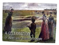
Best.-Nr. 424810Gloucestershire Ladies' County Golf Association. Hardcover. Good. A Celebration of Ladies' Golf in Gloucestershire 2003 In very good condition with a few tiny tears to edges of dust jacket. Bright gilt on cloth all pages very good. Gloucestershire Ladies' County Golf Association hardcover
4to. 22 pp. Stitched, untrimmed. First edition of a rare pamphlet on the monsoon winds in the Indian Ocean, of crucial importance for East India Company ships sailing to and from the East Indies. - As Dalrymple states in the introduction, the text for the pamphlet has been translated by him from Jean Baptiste d'Après de Mannevillette's "Mémoire sur la navigation de France aux Indies". Dalrymple had extensive correspondence with Mannevillette, hydrographer to the French East India Company and Dépôt de la Marine, from 1767 to 1780, much of which is preserved in Paris in the Archives nationales and the Bibliothèque de l'institut de France. Dalrymple had such high regard for d'Après - the author of the "Neptune Oriental" in 1745, at the time the most authoritative work on oriental navigation - that he often sent charts for comment and inclusion into his work, as the following letter attests: "You have full consent to make what use you please of the Charts I have sent you [...] You will undoubtedly find many mistakes which escaped my observation; And therefore you will do me a favour in communicating your remarks to me" (10 Nov. 1772). In the present work Dalrymple has augmented the d'Après text with information from a Mr. William Woodville of Liverpool, and a Captain Jones of the ship Mary, "whom we met at Grenville 5th June 1775, to the Westward of Sierra Leon. It is obvious Mr Woodville's Account differs considerably from M. D'Aprés but I cannot presume to decide who is right". - The extract not only shows Dalrymple's continuing quest for any and all sources of information regarding a passage to the East Indies, and the rather ad hoc nature in which he obtained it, but also his willingness to question Mannevillette's findings, at the time the leading authority on such matters. - Some waterstaining to title with marginal fraying. Rare: we are only able to trace one other example appearing at auction since the war (Sotheby's, the Franklin Brooke-Hitching sale 2014). ESTC T74284.
Small folio (227 x 294 mm). (6), 113, (1) pp. With Allenby's portrait frontispiece on cloth and 56 coloured maps (facing explanatory texts printed on versos). Original printed wrappers with printed cloth spine. First edition, edited by Harry Pirie-Gordon as a souvenir album: an account of the 1917-19 campaign in the Middle East. Contains two reports written by T. E. Lawrence, "Sherifian Co-Operation in September" and "Story of the Arab Movement", in which he details the Ashraf contribution to the War effort and narrates his own involvement in a third-person report. - Rubbed and stained, with occasional edge flaws. Endpapers have pencil ownership of O. A. Holstius, attached to Headquarters, 19th Brigade, Royal Field Artillery. Loosely inserted is a typed extract from "The Honourable Artillery Company in the Great War, 1914-1919" by George Goold Walker (1930), detailing living conditions in the Jordan Valley during the Great War (torn and frayed at edges). O'Brien A011.
Oblong folio (305 x 220 mm). 12 ff. 40 silver gelatin photographs mounted on leaves; sizes range from 177 x 120 mm to 85 x 65 mm. Contemporary plaid cloth with a small brass label on front cover, saddle-stitched binding. Unique photograph album of early Zionist military presence in British Mandatory Palestine, focussing on the Hapoel companies: a sports movement that in the early 1930s was developed into an organizational labour militia intended to stand up against revisionist and right-wing movements as well as against communists. Promoted by David Ben-Gurion, they served as an executive-political arm of the Histadrut until the 1960s. - The photographs show numerous scenes of training and daily life: both male and female soldiers pose in uniform, eat their lunches, hold athletic competitions such as tug-of-war and wheelbarrow races on the beach, meet in the canteen, and line up in formation. Largely presenting an idyllic picture of soldier life, scenes of more serious military drills include soldiers scaling high walls and practicing their army crawl, grappling, and sniper positioning. A handful of early photos also give glimpses of political events in the 1930s: two speeches are shown, one of Ben-Gurion, the other of Hapoel leaders with a military guard, and a packed street scene of what appears to be a parade, judging by the rows of onlookers clustered on balconies. - The brass dedication label on the upper cover is engraved in Hebrew "To Samuel, from the commanders of the Hapoel companies. Haifa, Kiryat Haim, 13-30 August 37". Occasional fading to photographs, but quite well preserved.
8vo. (8), 86 pp., final blank f. Contemporary vellum. Second edition of Victorius's introduction to the Ethiopian language, first published in 1552. This is the first printing with the newly designed and cut Ethiopic types; an "Alphabetum" appeared one year later. In his preface, Venerius relates how the types were cut after designd received from Jesuit missionaries in Ethiopia. One set of types was sent to them, one was kept for the Propaganda Press. - Front inner hinge broken; title loosened. Some browning throughout. Ms. ownership of Joseph Venturi in Hebrew and Latin on title page, with his note "rara" and date of acquisition "3 Oct. 1785" on pastedown opposite. Smitskamp, PO 218. Vater/Jülg 7. Fumagalli 1173. Leslau 610. De Gubernatis 173. Silvestre de Sacy 2874. OCLC 50572132.
Small 4to. (2), XIII, (3), 267, (1) pp. Printed original wrappers, bound within contemporary green half calf over marbled boards with giltstamped title to spine. First edition, inscribed by the translator and several pencil corrections to the text. Rabenlechner praises this sumptuous edition of the 11th century narrative poem long attributed to the Persian epic poet Firdawsi: "the initial - gilt on blue background - shows Cufic character; each of the book's 17 gatherings is in a different colour" (cf. p. 125). Schlechta's autograph inscription is on the inside upper cover: "Zur freundlichen Erinnerung. Baden, 3.7.1889. Der Übersetzer". Rabenlechner I,125. ÖBL X,175. Rypka 782.
8vo. (4), 49, (1) pp. With woodcut printer's device on title page (Christ sending the Apostles forth to spread the Gospel). Modern wrappers. Very rare translation of Bellarmino's "Dottrina Cristiana breve" (the abridgement of his abridged catechism) into Syriac, translated by Ya'kubh Binyamin. With the exception of the imprint, the text surrounding the printer's device on title page, and the imprimatur on the t. p. verso, which are in Latin, the text is entirely in Syriac printed in the Estrangelo alphabet. In 1613, the Arabic version of Bellarmino's "Doctrina Christiana" had inaugurated the famous Typographia Savariana as their first book printed with Arabic types. - Only 4 copies listed by OCLC. BL Italian (17th cent.) II, 755. OCLC 792777103. This edition not in de Backer/Sommervogel, Schnurrer, or Smitskamp.
Ten watercolour coastal profiles in grey and blue, of widely varying sizes (30 to 119 cm long), with contemporary captions and other notes in pencil or black ink. 20th-century brown cloth with the artist's original laid-paper wrappers bound at the end, spine title: "East Indian views by N. Pocock taken on the ship Worcester 1798". A series of ten lovely coastal profiles drawn in watercolour by the English artist Nicholas Pocock (1740-1821), showing coasts and mountains in the East Indies, both coasts of the Indian Ocean, China and the South Atlantic. In the first drawing Mount Agung, an active volcano and the highest mountain on Bali, appears prominently, with its pointed peak reaching above the clouds. - Pocock, son of a Bristol merchant mariner, pursued a career in the merchant marine but had been an amateur painter since childhood. As master mariner of the ship Lloyd, owned by the Quaker merchant Richard Champion, he illustrated his logbooks with fine ink and wash coastal profiles and other drawings (some now in the National Maritime Museum in Greenwich). When Champion went bankrupt in 1778 in the wake of the American Revolution, Pocock devoted himself to painting. His first professional efforts drew praise from Joshua Reynolds, and he exhibited at the Royal Academy beginning in 1782. Pocock soon became a celebrated maritime artist and painter to King George III, moving to London in 1789, where the rate books record him at Great George Street from that year to 1816. He sometimes accompanied naval ships to make sketches and notes that he developed into paintings when back in London. When he painted maritime scenes he had not witnessed live, he interviewed sailors and others to ensure the accuracy of details such as weather conditions, his practical experience as a master mariner aiding him considerably. - The present drawings are not signed individually, but the wrappers (bound at the end) are signed "... Pocock Esqr / Gt George Street". The captions identify the views, some with additional notes about directions, distances, latitudes or soundings. A few topographical names are difficult to read or show irregular spellings (the coordinates help identify some), but they appear to show coasts in Bali, Karimata, Serutu and Lombok (all in the East Indies), Coromandel (the southeast coast of India), Joanna Island (off Madagascar), Macao (across the bay from Hong Kong), Martin Vaz Islands (near Trinidad off the coast of Brazil), Srikakulam (on the east coast of India: 'Frycacoel' may be a misreading of the alternative spelling Ticacoel. The caption gives a latitude of 18° 4' and the ship Worcester stopped in Bengal ten days later: The Asiatic annual register ... for the year 1799, London, 1800, p. 53) and perhaps Burma (Myanmar) and Pondicherry (on the Coromandel coast). The captions identify them as follows (we add numbers giving the order as bound, the probable bibliographical formats and the dimensions): 1. Island of Bally. Oblong agenda 8vo (12 × 30 cm). 2. Caremata & Souroutou nearly in one. 20 fathoms soft ground, oblong agenda. 8vo (12 × 30 cm). 3. Extremes of Lombek ... southward. 3 oblong agenda 8vo leaves pasted together to make a panorama (12 × 87 cm). 4. Caremata & Sourontou. Oblong agenda 8vo (12 × 30 cm). 5. On the coast of Coromandel. 4 oblong 6mo leaves pasted together to make a panorama (16 × 119 cm). 6. Islands Joanna from N to NE. Oblong agenda 8vo (12 × 30 cm). 7. N Macoa. Oblong 4to (19 × 33 cm). 8. View of Martin Vos Rocks distant 7 leagues, Oblong 4to (20.5 × 28.5 cm). 9. The highland on both sides of Chicacul & Frycacoel ... taken on board the ship Worcester August 17th. 1798. Copy N[icholas] P[ocock]. Oblong agenda folio (24 × 59.5 cm). 10. The land of Barma ... The land on both sides - Pondy ... Oblong folio, with the profile rendered in three bands above one another (31.5 × 46 cm). - Only drawing 9 includes a date in the caption, indicating that it is Pocock's copy of a drawing of a scene from 17 August 1798. All the profiles are drawn on wove paper, probably all on pieces from sheets of Royal format made by James Whatman and his successors, who continued to use his name. Only two drawings show watermarks. Drawing 4 is watermarked: "J WHATMAN | 1804" centred along the right half of one long edge of the sheet, the caps and small caps about 19 and 12 mm tall. The other 4 drawings on one or more oblong agenda 8vo leaves are similar in style and may have been made at the same time. Drawing 10 is watermarked: "J WHATMAN", centred along the left half of one short edge of the sheet, the caps and small caps about 20 and 13 mm tall. Nearly all high quality English paper included a year in the watermark for several decades beginning in 1794, and Whatman's successors generally centred the date below the name, but no date appears under the name here. Moreover, the style of the lettering is older than that of the 1804 watermark, resembling Heawood 3458 (London 1784), 3459 (London post-1791), 3461 (n.p. 1781?), including the distinctive M of these marks (the diagonal joining the right vertical well below its top) but with clearer serifs than any of Heawood's (perhaps not very accurate) drawings. This paper seems likely to have been made before 1794. The paper of the ten drawings together contain about the equivalent of three whole sheets, but they would have to have been taken from at least four sheets. The wrappers are made of coarse laid paper and show no watermark. - With a small tear at the head of drawing 9, not approaching the image, drawing 7 spotted and slightly dirty, but further in very good condition. Coastal profiles, mostly in the East Indies and the Indian Ocean, by the maritime painter to King George III. For Pocock: ODNB 22425.