[ARABIAN GULF; UAE].Biblio.com
4.079 resultados
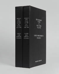
ref. 121999Minneapolis East View 2026. . 2 vols 8vo 25.5 x 16.5 cm; includes maps charts & tables; publisher's black cloth lettered white to boards and spines a fine copy. The complete collection of planning documents for Abu Dhabi from 1962 to 1979 the development plan review for Dubai of 1971 and the Federal Economic and Social Development Plan 1975 to 1980. Minneapolis, East View, 2026. hardcover
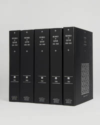
ref. 121951Cambridge Cambridge Archive Editions 2021. . 5 vols 25.5 x 16.5 cm; publisher's original black cloth silver gilt lettering a fine set. A very important collection of documents charting the the history of Qatar during the years 1961 to 1965 including the rise of the National Unity Front the growth of the Qatar Petroleum Company and the decline of British-Qatari relations. Chapters divide the documents into sections: the Royal Court Council of Ministers communications economy foreign affairs internal affairs judiciary labour and oil among others. Cambridge, Cambridge Archive Editions, 2021. hardcover
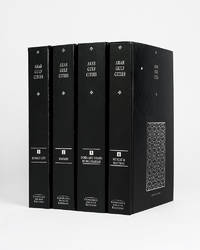
ref. 121943Cambridge Cambridge Archive Editions 2020. . 4 vols 8vo 25.5. x 16.5 cm; publisher's original black cloth lettered in silver a fine set. A valuable collection of records detailing the development and growth of the cities of Kuwait Manama Doha Abu Dhabi Dubai Sharjah Muscat and Mattrah from as early as 1818 right the way through until the mid-1960s before the Gulf War. Chapters are divided into: topography municipality water electricity health education communication lines urban development port development and social history with many royal decrees reproduced. Cambridge, Cambridge Archive Editions, 2020. hardcover
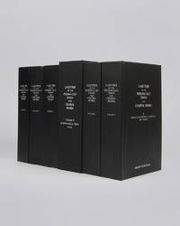
ref. 122010London Archive Editions 2003. . 6 vols 8vo 25.5 x 16.5 cm; includes maps & genealogical tables; publisher's original black cloth white lettering to upper board and spine a fine set. Lorimer's Gazetteer of the Persian Gulf was compiled by officials of the British Government in India during the decade after Lord Curzon's Vice-Regal tour of the Gulf in 1903. When first issued in 1915 it was classified as Secret and for Official Use Only and just a few dozen copies were printed for circulation to British Government departments and agencies. The work was planned in two parts; the first comprising a history of the Gulf region the second being a geographical dictionary but grew to encompass all aspects of Gulf life culture cities towns tribes and topography. Lorimer was an official of the India Civil Service who had spent most of his career on the North West Frontier. He was placed on 'special duty' to compile the Gulf handbook which was intended to be completed in six months but due to Lorimer's dedication and extensive field trips the work took some ten years to complete. The present edition printed from the India Office Records makes available one of the most important primary sources for the study of the Gulf region from the seventeenth to the early twentieth century. London, Archive Editions, 2003. hardcover
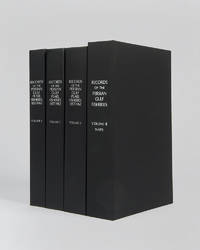
ref. 122017London Archive editions 2026. . 4 vols 8vo; includes a map portfolio with 7 maps original black cloth lettered in white a fine set. A very important work on the pearl fisheries of the Arabian Gulf bringing together in a single research collection all relevant documents from British government records relating to the pearl industry the most important economic activity in the Gulf before the oil era. London, Archive editions, 2026. hardcover
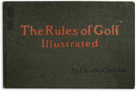
ref. 117551London Perrier / Golf Illustrated 1905. . First edition; landscape folio 29.5 x 45.5 cm; 1 half-size sheet detailing sales information 1 copyright page "Copyright of Perrier" 24 colour plates each with Perrier copyright and details to verso 1 advertising leaf at rear a couple small marginal nicks to rules XVI and XXIII plates fresh and bright; publisher's green cloth-backed boards upper board lettered in red and black boards lightly rubbed a very good copy. Crombie's amusing look at golf in a bygone age. London, Perrier / Golf Illustrated, [1905]. hardcover
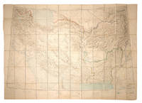
ref. 108381Calcutta Survey of India Office 1912-1923. . Heliozincographed colour map four sheets dissected and mounted on linen as one folding out to 108 x 152 cm in size scale 1:2000000 1.014 inches to 32 miles original paper covers with manuscript title label faint crayon lines confined to the area around Quetta a couple minor marginal tears repaired linen a little fragile in a few places but still a sturdy and attractive copy. Four sheets of the Survey of India Southern Asia Series 1912-1945 covering the Gulf Persia Afghanistan Boluchistan and western India stretching from Riyadh in the south-west to Bukhara in the north-east. The sheet covering the Arabian Gulf titled 'Southern Persia' is dated 1912 and shows the main travel routes along the Gulf and into the interior as far as Riyadh with none of the roads being depicted as suitable for wheeled vehicles and totally absent of railways or telegraph lines. Kuwait Bahrain Qatar Abu Dhabi and Dubai are all identified. Sir Sidney Gerald Burrard 1860-1943 initially served in the Survey offices at Dehra Dun before being made Surveyor General in 1908. In 1912 it was his decision to produce a new set of maps which would correct trigonometric errors in previous surveys and give a totally accurate mapping of Arabia and Central Asia centred on the oil reserves in Persia which Britain had a controlling interest in. Calcutta, Survey of India Office, 1912-1923. unknown
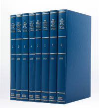
ref. 121085London Archive Editions 1989. . 8 vols 8vo; original blue cloth gilt a fine set. A complete set of this handsome facsimile edition of all eight Persian Gulf pilots published between 1870 to 1932. Invaluable not only for sailing directions but also for descriptions of the coast and its towns and villages and how they have grown over the period. London, Archive Editions, 1989. hardcover
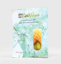
1995ref. 182920Kuwait: Markaz al-buhuth wa-al-dirasat al-Kuwaytiyah 1995. First edition of this well-illustrated study on the environmental impact of the destruction of oil wells in Kuwait based on government documents issued by the Iraqi government during the Gulf War. The work presents this damage substantiated by copious data as a main goal of the Iraqi war strategy of delayed sabotage. An appendix lists names of Iraqi officers accused of being "environmental criminals" as they took part in the identification of targets and methods and the execution of the plan - phases which are carefully described in the first part. The second part discusses subsequent damages to the economy public health and the environment including air and water pollution and their impact on living organisms. The third part describes the strategies employed to limit the damage such as the efforts of firefighters in extinguishing burning oil wells. Quarto. With facsimiles of documents colour illustrations and maps. Text in Arabic. Original pictorial wrappers wire-stitched as issued. Pencilled Arabic word at head of last verso. Extremities a trifle rubbed or creased contents clean: a very good copy. unknown
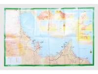
ref. 181557Saudi Arabia: Kruger for I.P.A. International Bookshops Dharan Airport 1977. Road construction faster than map production A folding road map of the Gulf and an interesting snapshot of its natural and human geography in the 1970s with 25 attractive photographs of Dubai. The map extends from Kuwait to Oman's Jabal al-Akhdar showing primary metalled roads roads under construction secondary roads towns wadis oil wells and pipelines oilfields and the morphology of the terrain. It also features 7 inset maps of the city centres of Manama Doha Abu Dhabi Kuwait Dubai Mutrah and Muscat. The small print in the reference section explains that "all roads under construction are being completed as the progress was faster than our production". The photos of Dubai include views of Dubai Creek dhows dromedaries and camels local inhabitants and the main heritage sites. Colour printed map folded 295 x 157 mm; unfolded 585 x 910 mm. Text in Arabic and English. Seven inset maps of Gulf capital cities verso with 25 colour photograph views of Dubai by Said Salah. Original colour self-wrappers printed in yellow black and white on a red and green ground. A few tiny chips or light wear to some folds couple of minor creases to outer corners: a very good exemplar. unknown
2011ref. 1-1603203990Time Home Entertainment Inc 2011. Hardcover. New. hardback/dvd edition. 556 pages. 10.00x10.25x2.50 inches. Time Home Entertainment Inc hardcover
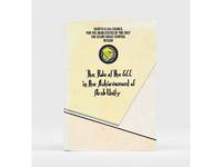
1985ref. 177401Bahrain: Printed by the Arab Printing and Publishing Establishment 1985. Second edition of this booklet produced to showcase the Arab Thought Forum held in Riyadh in April 1985. The first part comprises "Arab Unity: A General Outlook" a speech delivered by Prince Saud al-Faisal Foreign Minister of the Kingdom of Saudi Arabia. It is concerned with the difference between the "failed" concepts of Arab unity and Arab nationalism and their relationship with Islamic doctrines. The second part is devoted to a research paper by the GCC Secretary General concerning the role of the GCC in the achievement of Arab unity. It analyzes regional changes in the decade 1971-1981 and the "Arab degeneration and decline and the downfall of the unity of Arab security" before the establishment of the GCC. Octavo 240 x 165 mm. Text in English and Arabic. Original yellow printed wrappers wire-stitched as issued. Extremities and covers a bit rubbed sunned and foxed first recto and last verso toned: a very good copy. unknown
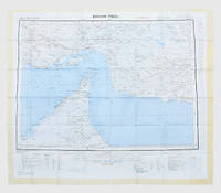
ref. 112618London War Office printed for D. Survey WO and AM by Balding and Mansell Ltd. 1957. . Coloured double-sided map of the Arabian Gulf on 1 sheet printed on silk; edition I-GSGS; sheet size: 64 x 72.5 cm; scale 1:1000000 text in English very slight fading to outer margin otherwise near fine. An excellent example of a double-sided coloured escape map of the Arabian Gulf showing the UAE and Oman to recto and Qatar to verso. With a key to topographical features railways main roads and important settlements including the tribal and official names of provinces and a useful Arabic-English glossary translating key terms such as 'Bir' for 'Well' 'Ain' for Spring' 'Qasr' for 'Fort/Castle'. The recto extends from Kumzat in the North to Hafit in the South and Abu Dhabi in the West to al-Qasbiyat in the East showing the six remaining emirates of Dibai Dubai Sharja Ajman Umm al-Qaiwan Ras al-Khaima and Fujaira. The verso runs South from Ras es Safaniya to Ei Abd and from Awania in the West to Rudaim in the East including the principal settlements of Jubail Bahrein Hofuf showing Doha Wakra and Lusail on the Qatar Peninsular. [London], War Office, printed for D. Survey (WO and AM) by Balding and Mansell Ltd., 1957. unknown
1957ref. 182684London: War Office; Printed for D. Survey WO and AM by Balding and Mansell Ltd 1957. A bright example of this detailed Gulf map Classified "restricted" and issued for military use at the time of the Jebel Akhdar War this double-sided sheet shows much of the modern-day UAE extending northwards from the latitude of Abu Dhabi and the Buraimi Oasis as well as the eastern Arabian Peninsula from the Trucial Coast to Jubail. As with other contemporary GSGS maps the sheet covers six degrees of longitude and highlights towns of significance and other standout features for example oil pipelines and wells water systems and roads and railways. Rayon sheet 630 x 710 mm printed both sides in colour folded as issued. A fine example. unknown
2008ref. 1-1602393265Skyhorse Pub Co Inc 2008. Hardcover. New. 225 pages. 11.30x9.00x1.20 inches. Skyhorse Pub Co Inc hardcover
2012ref. 1-1618930214Time Home Entertainment Inc 2012. Hardcover. New. expanded edition. 224 pages. 10.00x10.25x1.00 inches. Time Home Entertainment Inc hardcover
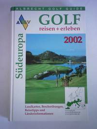
ref. 5d5818Albrecht Golf Verlag München 2001. 783 S. in getrennter Zählung mit zahlreichen Abbildungen Pappband quart. - gutes Exemplar / Landkarten Beschreibungen Reisetipps und Länderinformationen - unknown
ref. 5h3029Gulf Craft United Arab Emirates 2017. 143 S. mit zahlreichen Abbildungen Pappband quart. - gutes Exemplar / good condition / Text englisch - unknown
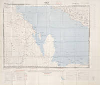
ref. 113506London War Office Geographical section 1951. . First edition GSGS 4622 Sheet 2547; Coloured printed map of Bahrain and Qatar on single sheet with extensive legend printed on reverse size: 62.5 x 77 cm; scale 1:1000000 text in English a little faded along folds a very good copy. First edition of the 1951 issue of the R.A.F. Aeronautical map of Bahrain and Qatar. The War office issued the R.A.F. series alongside a separate US Airforce Series: the R.A.F. series only covers Europe Africa Arabia and up to the end of 1951 had only covered Britain the east coast of Africa and this sheet of Arabia. The odd selection of this region aside from east Africa is made clearer by looking at the content of the map. The map does not show the 'delineation of international boundaries' or 'danger zones' but the topography largely the elevation and depression of the terrain with indications of marshy areas. The only indicated features other than towns and roads are of oil fields and pipelines. In 1941 Britain had gained control of much of Iraq's oil after the Anglo-Iraqi War and sought to expand its influence. The allies had seen the strategical benefits of Bahrain and after the discovery of oil in the region in 1932 it became even more pertinent to grow relations with the entire Middle Eastern command moving from Bushehr in Iran to Bahrain in 1935. But after the war relations had soured with the 1947 anti-Jewish riots in Manama Bahrain largely in reaction to Britain's disastrous orchestration of the Partition of Palestine. At the same time Iran had sought to break free of British control of their oil and in March 1951 voted to nationalise their oil production: in response Britain boycotted Iranian exports. It was in that same month that this map was finalised and published in July in the midst of the tense negotiations Iran was conducting with both Britain and the USA. In 1951 Britain was clearly searching for new regions to extract oil from and this map is captivating evidence of the fractious relationship Britain had fostered with the state of the Arabian Gulf. [London], War Office, Geographical section, 1951. unknown
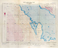
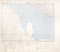
ref. 112628London War Office printed for D. Survey WO and AM by Balding and Mansell Ltd. 1957. . Coloured double-sided map of the Arabian Gulf on 1 sheet printed on silk; edition I-GSGS; sheet size: 64 x 72.5 cm; scale 1:1000000 text in English slight fading to creases otherwise near fine. An excellent example of a double-sided coloured escape map of the Arabian Gulf showing the UAE and Oman to recto and Qatar to verso. With a key to topographical features railways main roads and important settlements including the tribal and official names of provinces and a useful Arabic-English glossary translating key terms such as 'Bir' for 'Well' 'Ain' for Spring' 'Qasr' for 'Fort/Castle'. The recto extends from Kumzat in the North to Hafit in the South and Abu Dhabi in the West to al-Qasbiyat in the East showing the six remaining emirates of Dibai Dubai Sharja Ajman Umm al-Qaiwan Ras al-Khaima and Fujaira. The verso runs South from Ras es Safaniya to Ei Abd and from Awania in the West to Rudaim in the East including the principal settlements of Jubail Bahrein Hofuf showing Doha Wakra and Lusail on the Qatar Peninsular.Arabian Gulf Fabric Map of Hofuf and Bandar Abbas 1957 [London], War Office, printed for D. Survey (WO and AM) by Balding and Mansell Ltd., 1957. unknown
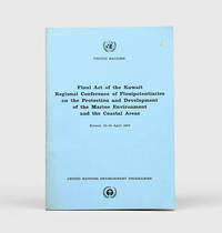
1978ref. 172055Perhaps Kuwait: United Nations Environment Programme 1978. First and sole edition untraced in Middle Eastern libraries of this plan enshrining environmental protection as a priority for future development along the Arabian coast. The regional conference highlighted the dangers posed by oil spills and committed to pollution-control measures for future projects. Participants included delegates from Bahrain Iran Iraq Kuwait Oman Qatar Saudi Arabia and the UAE. Attendees also agreed on a regional trust fund funded in different proportions by eight governments including the UAE and Saudi Arabia to finance initiatives. In the United Kingdom copies can be found at the universities of Oxford Durham and Southampton. We have also located three each in the US and Canada two in Germany two in Switzerland and one each in Austria and Sweden. Octavo. Original pale blue wrappers wire-stitched as issued front cover lettered in black. Light peripheral toning to covers small rust mark at top corner of front cover back cover slightly creased: a very good copy. unknown
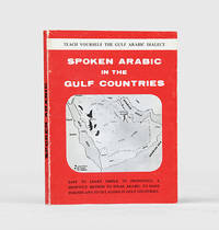
1971ref. 171721al-Khobar: The International Publications Industries 1971. Keep the following in mind and everything will be easy Fourth printing of this institutionally rare phrasebook which adopts "a short cut method simple and easy enough for a businessman to teach himself the spoken Arabic while relaxing in the Aircraft or in his Hotel room. Many of the oil industry people in Arabia owe their local friendship to this book". Arranged by topic the book has sections on greetings shopping food and drink and other practicalities such as taking one's car to a mechanic. The unnamed author places a premium on language as a key to understanding local culture: "you will find the Gulf Arabs intensely loyal to their friends as well as to their families. Most of them are blessed with a keen sense of humor. For these and other reasons such as their hospitality and courtesy you will enjoy getting acquainted with them". Further sections discuss the etiquette of being a guest at a traditional wedding and how to behave if invited to a private house as a guest. WorldCat lists only four copies in institutions Oxford National Library of Wales National Library of Israel Bilkent University. Small octavo 115 x 117 mm. Wire stitched in the original printed wrappers spine lettered in black. Minor wear to wrappers contents lightly toned not affecting text. A very good copy. unknown
ref. DADAX1461425689New unknown
ref. DADAX1782747540New unknown
1958ref. 174959Oxford: Distributed for the Royal institute of International Affairs by Oxford University Press 1958-59. Revised edition of Western Powers updated from the 1958 briefing including a length section on the "British position in the Arabian Peninsula and the Persian Gulf" framing six decades of British foreign policy within the context of Lord Curzon's 1899 analysis of the Gulf. "This memorandum had its origin in the need to put together for immediate use during the summer of 1958 documents and statements relating to the latest of the recurring crises in the Middle East". It outlines treaty commitments to different Gulf states and provides a documentary chronology of Britain's diplomatic relationships. The memorandum on Libya discusses topics such as defence population agriculture and fisheries transportation and budgets and finance. Two works quarto. Mimeographed typescript in both vols. Original green wrappers wire-stitched as issued front covers lettered in black. Pencilled price on front wrapper of Libya. Light sunning contents clean: near-fine copies. unknown