L'Isle, Guillaume de / Buache, Philippe.MareMagnum

4.114 resultados
Hand-coloured engraved map (635 x 505 mm). A fine example of Philippe Buache's edition of Guillaume de l'Isles highly detailed map of the region centered on the Red Sea. The map extends west to include Sicily, the Southeastern Mediterreanean, Barbaria, Nigritie, and a Guinea on the West Coast of Africa. To the east, the map includes the Persian Gulf, Saudi Arabia, the Gulf of Aden and the Kingdom of Ajan and Dadel. De l'Isle's maps provided the first truly scientific mapping of the regions covered, showing the flamboyant Dutch style of illustrations and adopting a highly detailed and decorative approach to the printed map. The result is a combination of spectacular detail and accuracy, not approached by the Dutch or any other 17th Century map makers. The detail in this map reflects this Renaissance of style and accuracy. Tibbetts 199. Cf. Al-Qasimi 268 (1707 ed.).
425:525 mm. Engraved map. Shows the Arabian Peninsula in great detail and includes "a detailed diagram of the caravan routes to Mecca and Medina from across the Ottoman Empire" (Al Ankary). - With traces of fold. Al Ankary 132. Tibbetts 220. Not in the Al-Quasimi collection.
Engraved map in contemporary hand colouring (35 x 26.5 cm). The Dutch edition of Jacques-Nicolas Bellin’s map, from Prévost's "Histoire générale des voyages (Paris, 1746). "This map is perhaps the original of the maps appearing in Prévost" (Tibbetts). Map of Arabia and the Red Sea emphasizes the coastlines and the interior is primarily left blank. The shoals and navigational hazards in the Red Sea and the pearl banks off the coast of Bahrain are also noted. Decorated with a title cartouche. - Well preserved. Tibbetts 267. Al Ankary 173. Not in Al-Qasimi.
Hand-coloured engraved map (260 x 243 mm). Dutch title beneath lower margin. No scale. The Dutch edition of Jacques-Nicolas Bellin’s map, from Prévost's "Histoire générale des voyages (Paris, 1746). "This map is perhaps the original of the maps appearing in Prévost" (Tibbetts). Map of Arabia and the Red Sea emphasizes the coastlines and the interior is primarily left blank. The shoals and navigational hazards in the Red Sea and the pearl banks off the coast of Bahrain are also noted. Decorated with a title cartouche. - Well preserved. Tibbetts 267. Al Ankary 173. Not in Al-Qasimi.
Engraved map (260 x 243 mm). The Dutch edition of Jacques-Nicolas Bellin’s map, from Prévost's "Histoire générale des voyages (Paris, 1746). "This map is perhaps the original of the maps appearing in Prévost" (Tibbetts). Map of Arabia and the Red Sea emphasizes the coastlines and the interior is primarily left blank. The shoals and navigational hazards in the Red Sea and the pearl banks off the coast of Bahrain are also noted. Decorated with a title cartouche. - Well preserved. Tibbetts 267. Al Ankary 173. Not in Al-Qasimi.
Hand-coloured engraved map (260 x 243 mm). Scale ca. 1:13,000,000. The Dutch edition of Jacques-Nicolas Bellin’s map, from Prévost's "Histoire générale des voyages (Paris, 1746). "This map is perhaps the original of the maps appearing in Prévost" (Tibbetts). Map of Arabia and the Red Sea emphasizes the coastlines and the interior is primarily left blank. The shoals and navigational hazards in the Red Sea and the pearl banks off the coast of Bahrain are also noted. Decorated with a title cartouche. - Well preserved. Tibbetts 267. Al Ankary 173. Not in Al-Qasimi. Cf. OCLC 164354184.
Hand-coloured engraved map (56 x 49 cm). Matted. Large detailed map with elaborate figurative cartouche. Al-Qasimi 207.
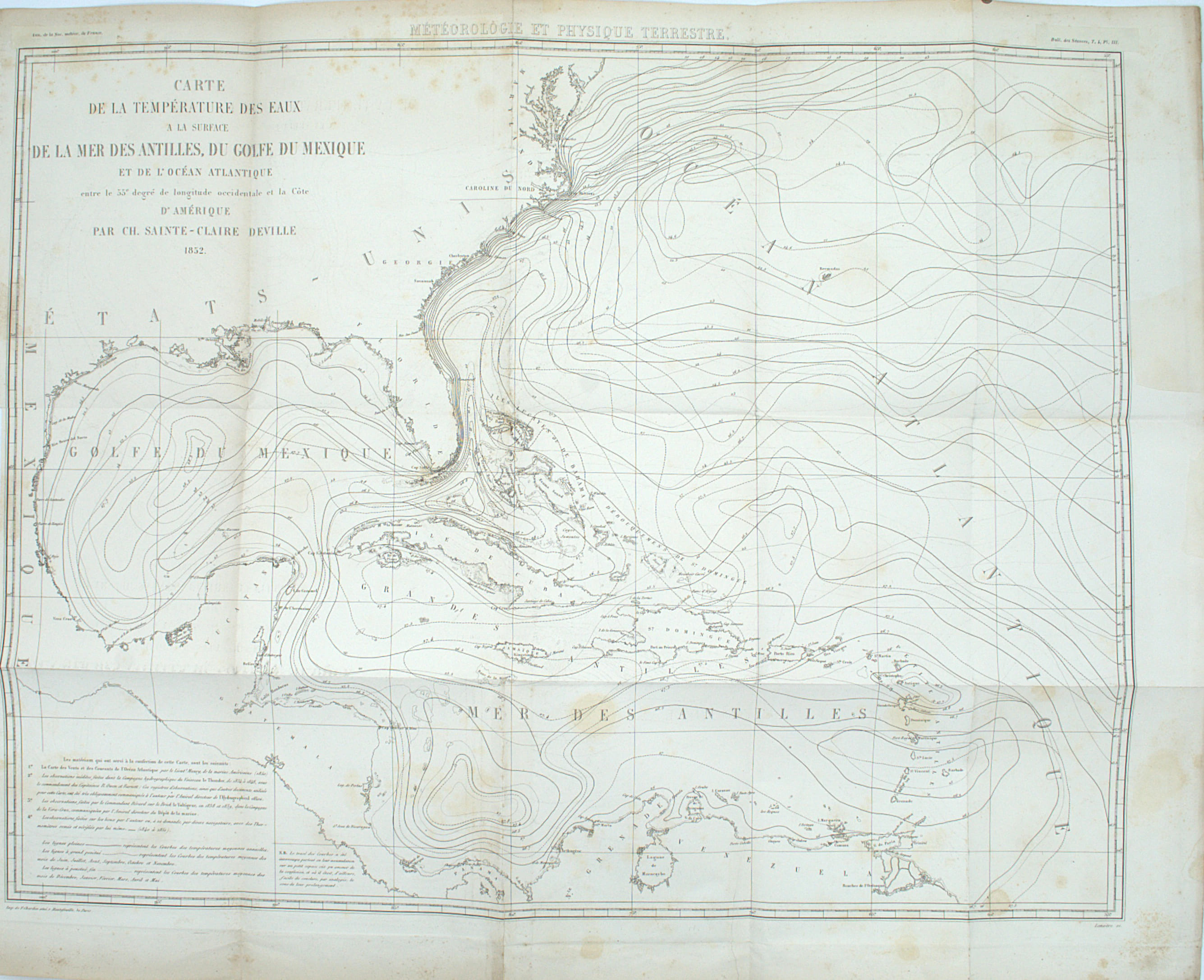
1852ref. PHO-2529Paris, imprimerie de F. Chardon aîné, 1852. Grand in-8 (260x170mm), 6pp., accompagné par une grande carte dépliante (550 × 658 mm), gravée par G. Lemaître. Relié demi toile, auteur et titre au dos. Carte volante.
Copper-plate engraving (515 x 415 mm). Superbly engraved map of region from the Mediterranean to the Indian Ocean, based upon Guillaume de l'Isles map of the same title. The scientific information for this map was taken from the maps of Guillaume de l'Isle. It shows a detailed diagram of the caravan routes to Mecca and Medina from across the Ottoman Empire. A note on the lower left corner gives a description of Turkey, Arabia and Persia. Tibbetts 221. Al-Qasimi 124. Al Ankary 287.
12 sheets joined and mounted on cloth; total dimensions 1190 x 1300 mm. Engraved map in original outline colour. In the original marbled paper box with manuscript title on cartouche and a 19th century bookseller’s label. A large map coving from the Balkans to the Ukraine, the Caspian Sea, Western Persia, Arabia and the Nile. Unusually, the map uses stipple engraving to give texture to the open areas, especially in Arabia. It is also an uncommonly international publication, published in France by the engraver, with the assistance of publishers in other countries: James Wyld and John Cary in London; Artaria & Fontaine in Mannheim; Villardi in Milan; Bouffa & Fils in Amsterdam; and Brunin in Glasgow (a publisher not listed in Tooley’s Dictionary). - Minor defects to the box, slight browning, otherwise in fine condition. OCLC 1061136095.
Engraved chart (87 x 59 cm), hand-coloured in outline. Chart of the Arabian Sea. From Eastern Arabia, the Gulf, the coast of Beluchistan to the Western coast of India. Alai, Special maps E.294. Not in Al Ankary; Al-Qasimi.
Engraved map, scale ca. 1:1 900,000. 714 x 529 mm. Original outline colour. Includes a smaller inset map: Plan des Isles Karak et Korgo et de la Baye de Bundereek. This fine, rare nautical map of the Arabian Gulf forms part of the famous "Neptune Oriental", a highly regarded collection of maps of the Middle and Far Eastern coasts which the author, the French hydrographer d’Après de Mannevillette (1707-80), had mapped during his time as captain for the French East India Company. The collection was first published in 1745, but redrawn and newly engraved by Guillaume-Nicolas Delahaye for the 1775 edition. The chart (plate 28 in the volume) is stated to be based on information collected by captain René Julien Le Floch de La Carriere and in many respects resembles the roughly contemporaneous works of William Herbert (Al Ankary no. 190) and d'Anville (Al Ankary no. 211). About the present map (in its 1745 version), Zoltán Biedermann writes, "It is interesting to note that, despite the fact that the shape of the Gulf is rooted in the Dutch tradition that we have come to name after Cornelis Roobacker, there are many new place names that were not there in the earlier decades. Like some other items from this period, this map is thus a precious document of the shifting commercial geography of Persia and the Persian Gulf" (Historical Atlas of the Persian Gulf, p. 290). Although the 1775 issue departs but little from its release three decades earlier, there are a number of differences: most notably, the new inset plan of the Kharg and Kharko Islands, and the inclusion of an island near Bahrain identified as "Deh-Rogn" - in fact, an early reference to Qatar; while "deh" means "village", "Rogn" signifies Ras Rakan at the northern tip of the Qatar peninsula, a prominent navigational landmark. - Evenly browned, with traces of insignificant waterstaining. A good copy. Cordier (Sinica) col. 134 ("superbe ouvrage"). OCLC 165808168. Cf. Tooley I, p. 40. Tibbetts no. 265. Historical Atlas of the Persian Gulf (Brepols 2006) no. 74 (the 1745 edition, unidentified, pictured in two sizes: p. 290 and pp. 292f.). Not in Al-Qasimi (2nd ed.). Not in Al Ankary (but cf. nos. 208f. for two other maps by Mannevillette - the Gulf of Aden and the port of Jeddah - hailed as "extremely accurate" and supplying "detailed information").
Chromo-lithographed map, c. 60 x 48 cm, folded in original printed wrapper (with portrait of Sultan Abdulaziz). With text and 9 engr. illustrations printed on the reverse. Louis Vivien de Saint-Martin's map of Morocco, drawn by Chesneau and Weinreb. With topographical notes by Franz Schrader. - Edges slightly frayed; some tears to folds; wrapper dusty and waterstained. OCLC 163347954.
Original outline colour. Dissected and laid on linen in two sections, together 940 x 1540 mm. A two-sheet wall map showing Prussia, Turkey, Egypt and Abyssinia in the west, and the Aral Sea in Kazakhstan, Persia, Arabia and Somalia in the east. Two inset maps show the routes from Siré to Gondar and from Gondar to the sources of the Nile. According to the inscription, the map is based on that of "the late J. B. Laborde" (Jean-Benjamin de Laborde [1734-94], a traveller and musician), with amendments; however we have been unable to trace a map of the region by him. - The vast map was published to satisfy French interest when their seemingly-unstoppable General Bonaparte turned his attention to the conquest of Egypt in 1798. Napoleon had captured Malta en route to Egypt, and the oval title vignette shows him overseeing the burial of the French dead under Pompey's Pillar after the capture of the important port city of Alexandria (July 1798). - After the defeat of the Mameluk army at the Battle of the Pyramids it was Napoleon's intention to subdue the rest of the Ottoman Empire before moving to threaten British interests in India. However, as the political situation in Paris was deteriorating, Napoleon decided to leave his army in Egypt in 1799, returning to France to become First Consul. His army was less fortunate, surrendering to the British at Alexandria in 1801. - This map is very scarce: the French citizens' interest in maps of the Orient evaporated as quickly as Napoleon's.
Engraved map (680 x 535 mm), coloured in outline colour. This very detailed map gives an surprisingly precise overview of the regions surrounding Arabia and the cities located on Arabian Gulf. Alai, General maps E.139 (note). Al-Qasimi 231.
Oblong 4to. 20 pp. on 20 ff. The story of Sinbad (Sindbad) comes from the "Arabian Nights", where he is as-Sindbad al-bahri" in Arabic.' The present group comprises twenty hand-coloured cartoon slides of Sinbad's adventures, telling the story very nicely with captions in English. - In excellent condition. - From the Collection of John Herzog.
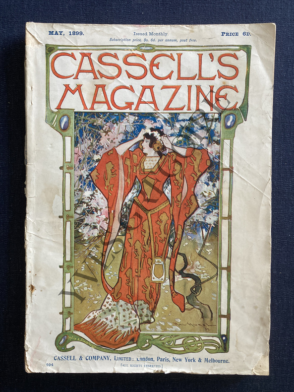
1899ref. ABE-164874439535718 CM X 25,5 CM-THAT SIMPLE GAME, GOLF, TEXTE ET DESSINS NOIR ET BLANC SUR 2 PAGES-STORIES OF MONTE CARLO-RAILWAYS IN FRANCE, 7 PAGES-(17D)
1850ref. 49608Karlsruhe, Kunst-Verlag, um 1850. Darstellung ca. 10,5 x 15,5 cm, Blatt ca. 13 x 21 cm. 1 Blatt, verso weiß.
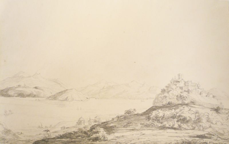
1824ref. 1702361824. Verso bezeichnet mit "Castello di Ischia, 1824" Auf festem Velin. 25,5 x 39,5 cm (blattgoß).
4to. 20 volumes: 14 bound in original wrappers, 4 in half calf over marbled boards with giltstamped spine title, and 2 in half calf with giltstamped spine title. Illustrated throughout. Extensive set, comprising 20 of the first 32 issues of the still-published series that catalogues and describes in detail the treasures of the famous Egyptian Museum, which houses the world's largest collection of Pharaonic antiquities. - Printed in Cairo: W. E. Crum, Nos. 8001-8741 Coptic Monuments (1902); M. Quibell, Nos. 11001-1200 & 14001-14754 Archaic objects t. II (1904); M. Quibell. Nos. 11001-12000 & 14001-14754 Archaic objects t. I (1905); Gaillard & Daressy, Nos. 29501-29733 & 29751-29834 La faune momifiée (1905); Ahmed Bey Kamal, Nos. 23001-23246 Tables d'offrandes t. II (1906); C. C. Edgar, Nos. 33301-33506 Sculptors' studies (1906); Arthur E. P. Weigall, Nos. 31271-31670 Weights and Balances (1908); Ahmed Bey Kamal, Nos. 23001-23256 Tables d'offrandes t. I (1909); Georges Daressy, Nos. 61001-61044 Cercueils des cachettes royales (1909); Georges Bénédite, Nos. 44301-44638 Objets de toilette Iere partie peignes etc. (1911); Henri Gauthier, Nos. 41042-41048 Cercueils anthropoides, premier fascicule (1912); Henri Gauthier, Nos. 41048-41072 Cercueils anthropoides, second fascicule (1913); G. A. Reisner, Nos. 4798-4976 & 5034-5200 Models of ships and boats (1913); Charles T. Currelly, Nos. 63001-64906 Stone implements (1913); Henri Munier, Nos. 9201-9304 Manuscrits Coptes (1916); Charles Kuentz, Nos. 1308-1315 & 17001-17036 Obélisques (1932). - Printed in Vienna: W. von Bissing, Nos. 3426-3587 Metallgefäße (1901); W. von Bissing, Nos. 3618-4000, 18001-18037, 18600, 18603 Fayencegefässe (1902); Josef Strzygowski, Nos. 7001-7394 & 8742-9200 Koptische Kunst (1904); W. von Bissing, Tongefäße. 1. Teil: Bis zum Beginn des Alten Reiches (1913). - Some browning throughout as common. Wrappers rubbed but professionally repaired. Rare. ZDB-ID 441756-2.
8vo. XV, (1), 303, (1) pp. With 2 folding engr. plates (all, foxed, some dampstaining on one plate). Later paper-covered boards, rebacked in cloth. First edition. This important catalogue was formed by the Italian excavator Giuseppe Passalacqua (1797-1865) at Trieste. It was "produced for the sale of the collection in Paris and it was bought by Friedrich Wilhelm IV of Prussia for the Berlin museum, of which Passalacqua later became curator. It includes notes and articles on the objects by a number of distinguished academies in addition to those by Passalacqua himself" (Blackmer). From the library of Swedish antiquarian bookdealer Björn Löwendahl (1941-2013). - Some foxing throughout, particularly at beginning and end. Small waterstain affecting lower corner of last portion of text. Blackmer 1264. Gay 2178. Ibrahim-Hilmy II, 95.
Small 4to. (6), 74 pp. With a woodcut garland of fruits, leaves and nuts on the title-page, 1 woodcut headpiece and 1 woodcut decorated initial. Set in roman, italic, Arabic and Greek type. Later paper wrapper. Catalogue of the collection of 126 Persian, Arabian, Turkish, Greek, Latin and other books and manuscripts donated to the Library of the University of Uppsala by the diplomat Johan Gabriel Sparwenfeld (1655-1727). It was compiled by the Swedish scholars Eric Benzelius the younger (1670-1756) and Olaus Celsius the elder (1675-1743). The main series of manuscripts, described in great detail, includes 41 in Arabic, Persian and Turkish, 8 in Greek (one dating back to the eighth century) and 12 in Latin and modern European languages. These are followed by 42 printed books including 2 in Chinese, several in Arabic, the 1581 Ostrog Bible and several other exotic languages, including Irish (set in Anglo-Saxon type). A few more manuscripts (mostly Arabic) are added at the end, plus an unnumbered geographic manuscript in Chinese (3 volumes). This is the earliest catalogue of the Uppsala University Library's collections. The Arabic, Persian and Turkish titles are set in a large Arabic type cut for the physician and orientalist Peter Kirsten by the Swedish punchcutter Peter von Selow (who served his apprenticeship under Tycho Brahe) and first used at Breslau in 1608. Werner, printer to the university at Uppsala since 1701, seems to have been the first Swedish printer to use types by Nicolaus Kis, two of his italics and one roman appearing in the present book, though not the roman used for the main text. After finishing his studies at Uppsala, Sparwenfeld travelled throughout Europe and accompanied the Swedish ambassador to Moscow, where he took an interest in Slavonic languages. On his travels he collected many precious books and manuscripts. In 1687 he returned to Stockholm, where he carried out a study of manuscripts from the ancient Goths. He travelled to Holland, France and Spain, dealing with the Blaeu printing office and mediating in the production of Georgian type cut by Nicolaus Kis for the exiled King of Georgia. In 1691 he travelled to Egypt, Syria and Tunis. Though a Protestant, he presented the manuscript of his Slavonic lexicon to Pope Innocent XII, who granted him access to the Vatican library, a rare honour for a Protestant. He returned to Sweden in 1694. He continued to correspond with scholars throughout Europe even after he retired to his estate 1712. He wrote and spoke 14 languages. - In very good condition, with only occasional very slight foxing, wholly untrimmed, preserving the deckles and point holes and with the bolts unopened. A remarkable catalogue of an extraordinary library, especially rich in Arabic manuscripts. Almqvist, Sveriges bibliogr. litteratur 2838. Smitskamp 113 (note).
4to. (6), 74 pp. With woodcut title vignette. modern boards. Extensively annotated catalogue of 115 Arabic, Persian and Turkish works, mostly manuscripts which Sparvenveldt had acquired in Egypt, Syria, and Tunisia in 1691. Edited with the help of Erik Benzelius and Olof Celsius. The titles are rendered in the original languages in Kirsten's fine Arabic types, brought with him to Sweden from Breslau in 1636. - Insignificant edge staining to title page; reverse shows old library stamp of Upsala College, East Orange, NJ, dissolved in 1995. Untrimmed copy. Smitskamp, PO 113d. Schnurrer 17 & 25. Besterman 152. Warmholtz 9270.
4to. [6], 74 pp. With a woodcut garland of fruits, leaves and nuts on the title-page, 1 woodcut headpiece and 1 woodcut decorated initial. Set in roman, italic, Arabic and Greek type. Later paper wrappers. Catalogue of the collection of 126 Persian, Arabian, Turkish, Greek, Latin and other books and manuscripts donated to the Library of the University of Uppsala by Johan Gabriel Sparwenfeld (1655-1727). It was compiled by the Swedish scholars Eric Benzelius the younger (1670-1756) and Olaus Celsius the elder (1675-1743). The main series of manuscripts (items I-LXI), described in great detail, includes 41 in Arabic, Persian and Turkish, 8 in Greek (one dating back to the eighth century) and 12 in Latin and modern European languages. These are followed by 42 printed books (LXII-CIII) including 2 in Chinese, several in Arabic, the 1581 Ostrog Bible (the first Bible printed in Old Slavonic) and several other exotic languages, including Irish (set in Anglo-Saxon type). A few more manuscripts (mostly Arabic) are added at the end, numbered I-VI and I-XV, plus an unnumbered geographic manuscript in Chinese (3 volumes). This is the earliest catalogue of the Uppsala University Library's collections. The Arabic, Persian and Turkish titles are set in a large Arabic type cut for the physician and orientalist Peter Kirsten by the Swedish punchcutter Peter von Selow (who served his apprenticeship under Tycho Brahe) and first used at Breslau in 1608. Werner, printer to the university at Uppsala sice 1701, seems to have been the first Swedish printer to use types by Nicolaus Kis, two of his italics and one roman appearing in the present book, though not the roman used for the main text. - After finishing his studies at Uppsala, Sparwenfeld travelled throughout Europe and accompanied the Swedish ambassador to Moscow, where he took an interest in Slavonic languages. On his travels he collected many precious books and manuscripts. In 1687 he returned to Stockholm, where he carried out a study of manuscripts from the ancient Goths. He travelled to Holland, France and Spain, dealing with the Blaeu printing office and mediating in the production of Georgian type cut by Nicolaus Kis for the exiled King of Georgia. In 1691 he travelled to Egypt, Syria and Tunis. Though a Protestant, he presented the manuscript of his Slavonic lexicon to Pope Innocent XII, who granted him access to the Vatican library, a rare honour for a Protestant. He returned to Sweden in 1694. He continued to correspond with scholars throughout Europe even after he retired to his estate in 1712. He wrote and spoke 14 languages. - In very good condition, with only occasional very slight foxing, wholly untrimmed, preserving the deckles and point holes and with the bolts unopened. A remarkable catalogue of an extraordinary library, especially rich in Arabic manuscripts. Almqvist, Sveriges bibliogr. litteratur 2838. Smitskamp, PO 113 (note).
8vo. 55, (1) pp. With woodcut printer's device on title page (Christ sending the Apostles forth to spread the Gospel). Unbound as issued. Very scarce catalogue of oriental books printed by the Propaganda Fide press. Pages 10-12 list no fewer than 28 publications in Arabic, many of which (such as Scialac's and Sionita's 1613 version of the "Doctrica Christiana") are still considered milestones of Arabic typography. Prints in other languages such as Chaldaean, Persian, Syriac, and Ottoman Turkish bear further witness to the unrivalled excellence of the Propaganda Press in the field of Middle Eastern typography. A first such catalogue had appeared in 1765; of this second, expanded edition OCLC lists no more than two copies (Tübingen and Copenhagen). - Well-preserved throughout. OCLC 465974789. Not in Besterman.