1912Scholar's name to ffep (Albert Merriman). Pencil notes and marginalia to some pages while 6 pages have light underlining in blue pencil. Notes to back endpaper in pencil and ink. Fraying to spine ends. Bottom corners edgeworn. Tears along sides of backstrip and fraying. ; [ii], x, [282] p. Preface dated 1911.; Oxford Classical Texts Oct (Scriptorum Classicorum Bibliotheca Oxoniensis); 282 pages
1910Very Good Turkish, Ottoman (1500-1928) Original registry book in its original grey art nouveau cloth. All edges marbled. 'The English manufactory of book and register' written on end-papers. 'Zugologion' written in Greek letters on front cover. Slightly faded. A fine copy. Demy 8vo. (22 x 15 cm). In Ottoman script. 52 p. is written of which apprx. 200 p., but it's finished and complete; one folding hand-drawn color map, and 3 tables. [MANUSCRIPT] [Ottoman Prokopi sanitary report] Konya Sihhiye Müfettisligi'nin 16 Tesrinievvel 1327 tarihli mezkûr müfettislige takdim olunan rapordur ki 327 senesi Ürgüp'te zuhur eden koleraya dairdir.; Vilâyetin topografya-yi sihhiye ve harita-yi sihhiyesi. The report on the cholera occurring in Ürgüp in 1910, which was presented to the Inspectorate of Konya Sihhiye on October 16, 1910. Besides cholera, it contains information about diseases such as measles. 1329 (Hegira) written at the end of first 10-paged report. The second part contains title: Mecelle-i Memâlik-i Osmaniye'ye ait minvallere cevabât yazilarak Üsküp Kaymakamligi'na takdim olunan 'Müslüman Sihhiye' raporu [= Muslim health report submitted to the Ürgüp (Prokopi) District Governor]. This and following next chapters include general health and sanity registers on epidemics like 'frengi' (syphilis, pox), all kinds of 'humma' (pyrexia) and several others (almost more 15 titles) and give information about how often diseases are encountered in the region of Prokopi and Cappadocia. One folded map which is hand-drawn includes color markers as 'Ürgüp Bölgesi saglik haritasi' [= Prokopi region sanity and epidemic map]. Also it shows demographic and historical info about region. There are 3 statistical tables contain demographic, historical, religious info such 'Muslim' and 'Non-Muslim'. Maps and tables are perfectly drawn. Another chapter is 'Usul-i sihhiye', has all epidemics and their historical and demographic contexts, their cures etc. Book was written in a very nice hand-writing. Used black, blue, and red inks. Report was not published before such as that. Roumi: 1327 = Gregorian: 1910. The Ottoman land represented a bridge between Asia and Europe, which was destroyed by epidemic diseases that emerged in different periods. In the 19th century, the main source of epidemic was the cholera morbus that emerged in India in the lower Bengal delta between the Ganges and Brahmaputra rivers. At the beginning of the 19th century, the disease became a global threat. Cholera epidemic appeared for the first time in the Ottoman territory in 1822, and continued to emerge into intermediate outbreaks. Due to its geographical location, the cholera epidemic was easily spread to the Ottoman territory and caused great losses in the 19th century, when it became a global threat. At the beginning of the 20th century, still cholera was a serious problem. Prokopi is a settlement in Central Asia Minor, built on a plateau at an altitude of 1,200 m above sea level. It lies near the confluence of four tributary rivers of the Alys River (Kizilirmak), which flows to the north of Ürgüp, within about 10 km from the settlement. It has been claimed that the word Ürgüp is the Turkish version of the Greek name Prokopi. The latter is supposed to refer to St. Prokopios, although there is no evidence suggesting the existence of a namesake church. Levidis supported that the ancient name of the settlement was Osiana, which the traveller Texier (Charles) adopted as well. Ürgüp was inhabited by Muslims, Turkish-speaking Greek-Orthodox and some Armenians. Several conflicting opinions have been stated about the population. Farasopoulos talks about 15,000 Muslims and 5,000 Christians. According to an inventory carried out by the state in 1919, Ürgüp was inhabited by 12,500 Muslims, 6,000 Christian-Orthodox and 15-20 Armenian families.
1957Endpapers tanned. Spine a little faded. Corners somewhat edgeworn. Pen marginalia and underlining to some pages. ; Greek Text with Latin introduction and apparatus. V1 (1957) Lxviii, 152 pp; ; Bibliotheca Scriptorum Graecorum Et Romanorum Teubneriana TEUBNER; Vol. 1; 260 pages
1957Scholar's bookplate to inner cover (G. P. Goold). Corners edgeworn. Pages lightly tanned. Else VG. ; Greek Text with Latin introduction and apparatus. V1 (1957) Lxviii, 152 pp; ; Bibliotheca Scriptorum Graecorum Et Romanorum Teubneriana TEUBNER; Vol. 1; 260 pages
1959Light bump to base of spine. Clean text. Scholar's name to ffep (Martin Cropp). ; Greek Text with Latin introduction and apparatus. Xvi, 398pp; Bibliotheca Scriptorum Graecorum Et Romanorum Teubneriana TEUBNER; Vol. 2; 398 pages
1912Endpapers browned. Former owner's name in ink to front board and ffep. Small bookseller's label to inner cover. Some fraying to spine ends. Small stain along part of bottom edge of front board. ; Greek Text with Latin introduction and apparatus. Vi, 145 pp; Bibliotheca Scriptorum Graecorum Et Romanorum Teubneriana TEUBNER; 145 pages
1910Some browning to titlepage. Very light pencil marginalia. Top of spine and bottom corners bumped. Some fraying to spine ends. Spine a bit darkened. Former owner's name to inner cover. Closed tears to ffep. ; Greek Text with Latin introduction and apparatus. LViii, 260 pp; Bibliotheca Scriptorum Graecorum Et Romanorum Teubneriana TEUBNER; 260 pages
1912Light rubbing to boards. Small circle stamp to titlepage. Minor shelfwear. Light pencilling to a few pages. ; Greek Text with Latin introduction and apparatus. Lxiv, 192 pp; Bibliotheca Scriptorum Graecorum Et Romanorum Teubneriana TEUBNER; 192 pages
1910Light rubbing to boards. Tear to upper corner of titlepage. Light ink marginalia to a few pages. ; Greek Text with Latin introduction and apparatus. Lviii, 230 pp; Bibliotheca Scriptorum Graecorum Et Romanorum Teubneriana TEUBNER; 230 pages
1960Scholar's name to titlepage (A. Merriman). Spine faded. Bubbling along edges of boards (likely water damage) internally VG. DJ is browned and chipped. ; Greek Text and Latin apparatus and introduction. ; Oxford Classical Texts Oct (Scriptorum Classicorum Bibliotheca Oxoniensis); 84 pages
19701 cm tear to head of spine. Foxing to textblock. Light pencil underlining and marginalia to some pages. DJ spine is browned with chipping. Tears to head of DJ spine. ; Greek Text and Latin apparatus and introduction. ; Oxford Classical Texts Oct (Scriptorum Classicorum Bibliotheca Oxoniensis); 84 pages
1967Neat pen notes to greek text. Former owner's name to ffep (Richard A. LaFleur). Else VG. DJ spine is browned with a couple of tiny chips. ; Greek Text and Latin apparatus and introduction. ; Oxford Classical Texts Oct (Scriptorum Classicorum Bibliotheca Oxoniensis); 84 pages
1967Many pencil notes. Foxing to textblock. DJ is browned. ; Greek Text and Latin apparatus and introduction. ; Oxford Classical Texts Oct (Scriptorum Classicorum Bibliotheca Oxoniensis); 84 pages
1967Very light shelfwear. ; Greek Text and Latin apparatus and introduction. ; Oxford Classical Texts Oct (Scriptorum Classicorum Bibliotheca Oxoniensis); 84 pages
1972Scholar's name to ffep (Martin Cropp). Minor shelfwear to book. Pencil marginalia (Cropp's) on a few pages. Writing to rear inner cover in pen. DJ has chipping and small tears along upper edge. DJ spine browned. ; Greek Text and Latin apparatus and introduction. ; Oxford Classical Texts Oct (Scriptorum Classicorum Bibliotheca Oxoniensis); 340 pages
1976Scholars' bookplate to inner cover. Minor shelfwear to book. DJ spine slightly browned with one small tear. DJ is price-clipped. ; Greek Text and Latin apparatus and introduction. ; Oxford Classical Texts Oct (Scriptorum Classicorum Bibliotheca Oxoniensis); 340 pages
1976Minor shelfwear to book. Faint foxing to top of textblock. Scholar's bookplate to inner cover (G. P. Goold). DJ has a few tears with a few strips of tape applied. DJ spine browned. ; Greek Text and Latin apparatus and introduction. ; Oxford Classical Texts Oct (Scriptorum Classicorum Bibliotheca Oxoniensis); 340 pages
1913Very Good Turkish, Ottoman (1500-1928) Original wrappers. Foolscap 8vo. (18 x 12 cm). In Ottoman script (Old Turkish with Arabic letters). 142, [4] p. Some pages are untrimmed and unopened. Foxing on extremities. Overall a good copy. First and only edition of this uncommon first-hand account in verse of the Siege of Scutari, also referred to as the Siege of Shkodër (Shkodra), took place from 28 October 1912 to 23 April 1913 when the army of the Kingdom of Montenegro defeated the forces of the Ottoman Empire and invaded Shkodër, written by Mehmed Fahri Pasha, who served in Serbia as the chief physician of Shkodra by participating in the Balkan Wars (1912-1913). On 8 October 1912, Turkish General Hasan Riza Pasha announced that Montenegro had declared war on the Ottoman Empire in order to erase 600 years of oppression by the "Turkish foot", as the enemy claimed, and that its troops were crossing the border between Montenegro and Albania. Two hours after the news, the Montenegrin troops, as expected, approached Scutari. As much as 70% of the Turkish army in the interior of the Balkans was composed of Muslim Albanians conscripted during the freedom struggle from the Ottoman Empire. Özege 12224.
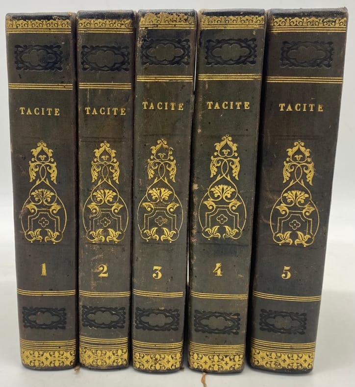
rif. 202961Paris, Giguet et Michaud, H. Nicolle [Imprimerie des frères Mame], 1808 5 vol. in-8, vij-lxiv-415 pp., [4]-417 pp., [4]-405 pp., [4]-491 pp., [4]-582 pp., texte latin et traduction française en regard, avec une grande carte dépliante, demi-basane violine, dos lise orné de filets et guirlandes dorés ainsi que de fleurons à froid, tranches marbrées (rel. de la Restauration). Ex-libris manuscrit (illisible) sur la page de titre. Bon exemplaire.
1860Rebound in half black cloth with gilt lettering and banding with brown marbled boards. Former owner's name on ffep. Pp 4-6 have brown spots (coffee? ). Browning to endpapers. Light foxing. Top of spine edgeworn. Edgewear to 1 corner. Pages tanned. ; Text in Ancient Greek; with latin introduction. Li, 63 pp. Onasander's Strategikos is one of the most important treatises on ancient military matters and provides information not commonly available in other ancient works on Greek military tactics, especially concerning the use of the light infantry in battle. ; Bibliotheca Scriptorum Graecorum Et Romanorum Teubneriana TEUBNER; 12mo 7" - 7½" tall; 63 pages
rif. 187233Paris, Nicolas Louis Achaintre, 1806 in-8, XXXVI-484-32 pp., avec un frontispice allégorique, veau fauve raciné, dos lisse, pièce de tire cerise, encadrement de simple filet à froid sur les plats, simple filet doré sur les coupes, tranches citron mouchetées de rouge (reliure de l'époque). Dos frotté.
1940Very Good English 18 original b/w photographs. 12mo. (14 x 10 cm). Descriptions in English, French, and Greek. A bright and very clean 18 photos showing architectural buildings, towns, shores, archaeological ruins etc.: 1. Museum. 2. The walls of the town. 3. Philerimos. 4. Government palace. 5. Cameros. 6. Liberty's cafe. 7. Palace of Knights. 8. Philerimos. 9. Colymdia. 10. The Aguarium. 11. Museum. 12. Ancient theater. 13. The walls of the town. 14. Mandraki. 15. Cromotil. 16. Th prophet Helios. 17. View of the town. 18. Mira Mare.
1916Very Good Turkish, Ottoman (1500-1928) Original color map. Folded. Oblong atlas folio. (50 x 60 cm). In Ottoman script. Shows Rhodes and Tilos Islands. Scale: 1/200.000. Hegira: 1332 = Gregorian: 1916. Not description on map-maker. This is one of the series of the Bonn projection maps which are the first map series in modern techniques in Turkey and the Ottoman Empire. This is one of the series of the Bonn projection maps which are the first map series in modern techniques in Turkey and the Ottoman Empire. In order to produce these maps covering Turkish territory, Reconnaissance Branch was incorporated into The Mapping Commission. The maps were produced in the datum based on the latitude and longitude of Ayasofya Mosque in an equal area Bonn Projection. The field works for the 123 sheets covering the country were conducted by 76 staff. The production was completed in 18 years starting from east-west. Fieldworks continued without stopping except in the years 1914 and 1920. This map series called also reconnaissance maps contributed a lot to producing 1:25.000 scale maps. A very detailed and attractive map of Rhodes Island showing its harbors and Ottoman place names.
1924Very Good Turkish, Ottoman (1500-1928) Original manuscript document sent to the Ottoman court with postal stamps "OPDA" (Ottoman Public Debt Administration) [= Osmanli Kamu Borç Idaresi] ve "HJZ" (Hejaz Railway) [= Hicaz Demiryollari]. 28x21,5 cm. In Arabic. 1 p. 11 lines. On a paper with Grifon and "W" initial and "Original" watermarks. Paper probably from a British paper manufacturer produced the paper for the Middle Eastern market. It starts with "Yüksek Islâm Meclisi Re'isi Âlîsi'ne". There is talk of a deal made by the Safed mufti and the person concerned - stating that he has been waiting for two years for an unpaid amount after an agreement with a certain amount of Egyptian junaihs, Safed mufti demands that the rest of the money. Sayyidî, who states that he is getting older and that the money must be kept in order to be able to do the title deeds from the foundations, says that otherwise the title deed procedures will not be completed. Signed by Safed mufti named Seyyidî. On the bottom, signed by/as "Reisü'l Camiü'l Islâmiü'l Âlî, Mehmed (or, Muhammed) Sehvî]. "Safed is a city in the Northern District of Israel. Located at an elevation of 900 meters (2,953 ft), Safed is the highest city in the Galilee and in Israel. Safed has been identified with Sepph, a fortified town in the Upper Galilee mentioned in the writings of the Roman Jewish historian Josephus. The Jerusalem Talmud mentions it as one of five elevated spots where fires were lit to announce the New Moon and festivals during the Second Temple period. Safed attained local prominence under the Crusaders, who built a large fortress there in 1168. It was conquered by Saladin 20 years later, and demolished by his grandnephew al-Mu'azzam Isa in 1219. After reverting to the Crusaders in a treaty in 1240, a larger fortress was erected, which was expanded and reinforced in 1268 by the Mamluk sultan Baybars, who developed Safed into a major town and the capital of a new province spanning the Galilee. After a century of general decline, the stability brought by the Ottoman conquest in 1517 ushered in nearly a century of growth and prosperity in Safed, during which time Jewish immigrants from across Europe developed the city into a center for wool and textile production and the mystical Kabbalah movement. It became known as one of the Four Holy Cities of Judaism. As the capital of the Safad Sanjak, it was the main population center of the Galilee, with large Muslim and Jewish communities.".
1968Very Good French Original b/w press photo of Pipinelis. 16,5x12 cm. Dated 3-6-1968. Panagiotis Pipinelis, (1899-1970), was a Greek politician and diplomat.