Turner, Bryan S/ Samson, ColinBiblio.com

3 004 résultats
1995réf. x-0803975996Sage Pubns 1995. Paperback. New. 2nd edition. 288 pages. 9.50x6.25x0.75 inches. Sage Pubns paperback
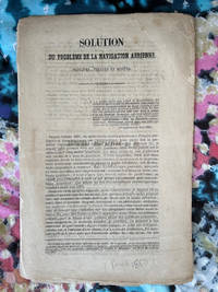
1850réf. 1240111.28Ledoyon Paris 1850. Good. Two ballooning pamphlets/flyers: Sanson's "Solution du probleme de la navigation aerienne" and: Lettre-Journel de Paris November 19 1870 with an account of a military balloon flight with a manuscript letter attached with stamp and corresponding verso text excised but with a "Par Ballon Monte" cancellation hand stamp and London-received postal hand stamp intact: an early airmail letter; from Wikipedia: "Historically balloons were used to transport mail from Paris during the Siege of Paris of 1870-1871. About 66 unguided mail balloons were released from Paris ." Few such letters have survived. Ledoyon, Paris
2011réf. DADAX0197264832British Academy 2011-11-07. 1. hardcover. New. 9.20x1.30x6.20. Buy with confidence. Excellent Customer Service & Return policy. British Academy hardcover
réf. A9781032186412Hardback. New. This book showcases inspirational Australian case studies in order to inspire Australian and non-Australian organisations to undertake the challenge. This book synthesises the key learnings and contrasts those with the conventional wisdom on this topic. hardcover
réf. A9781409465737Hardback. New. hardcover
réf. A9780367521066Hardback. New. This book provides the latest cutting-edge technology on the development of new green composite materials and advanced manufacturing processes along with concepts and applications. hardcover
réf. A9780415881654Hardback. New. hardcover
réf. 36429322-nnew. unknown
réf. 36429322like new. unknown
2012réf. SONG0821849239Brand: American Mathematical Society 2012-07-19. hardcover. Used: Good. 7.75x0.75x10.50. Buy with confidence. Excellent Customer Service & Return policy. Brand: American Mathematical Society hardcover
1893réf. 70475Paris: Librairie Agricole De La Maison Rustique 1893. Quarter-leather. G/No Jacket as issued. 5 volumes published 1893-1901. Library markings; marbled boards; covers edge-rubbed with wear at corners; small scuff on front cover of volume 1; 401 386 366 376 350p illus indexes. NB: This is a heavy set which may incur a non-standard postage charge. Size: 12mo - over 6¾" - 7¾" tall Librairie Agricole De La Maison Rustique hardcover
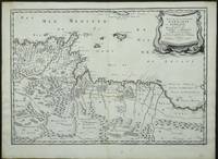
réf. 3952Paris: 1655. No binding. Very Good. 370 x 530 mm. in early outline colour in very good condition. Engraved by Joannes Somer and published in Paris by Pierre Mariette this attractive map of central north Africa bears an ornate title cartouche top right. It is centred on Tunisia and Libya and includes the island of Malta in the Mediterranean. It comes from Sanson's 'Cartes Generales de Toutes les Parties du Monde'. Pastoureau Sanson V A no. 16. 1655 unknown
1700réf. 54377Nicolas Bion: L'Usage des Globes. Amsterdam: Francois Halma. 1700. An armillary sphere perused by three scholars at a table. Nicolas Sanson was founder of the French school of mapmakers at a time when the leadership in European cartography passed from the Low Countries to France. This map was published in Bion's treatise on globes. Nicolas Bion was a famous French mathematical and scientific instrument maker. Size: 125 x 175 mm. Copper engraving. Original colour. Mounted size: 295 x 360 mm. Fine condition. unknown
1689réf. 52354Paris. 1689. The map covers the area from the Moselle in NW to Worms in SE. ornamental cartouche at lower left. Copper engraving. Good condition though map is slightly discolured and stained. Original colour. Size: 56 x 43 cm. unknown
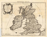
1696réf. 23767Amsterdam: Covens 1696 -1700. Other. In very good to excellent condition. A small tear at the left side. 392 by 517mm 15½ by 20¼ inches. 392 by 517mm 15½ by 20¼ inches. Copper engraving uncolored as published. Covens unknown
réf. A9781349113026Paperback / softback. New. It examines several musical dimensions of the bourgeois cultural ascendancy of the second half of the 19th century - the growth of independent institutions of music-making the consolidation of a standard classical repertory and the emergence of increasingly specific repertories of popular music professional and amateur. paperback
réf. ria9780333516027_inpHardcover. New. New Book; Fast Shipping from UK; Not signed; Not First Edition; It examines several musical dimensions of the bourgeois cultural ascendancy of the second half of the 19th century - the growth of independent institutions of music-making the consolidation of a standard classical repertory and the eme hardcover
2008réf. x-0521700779Cambridge Univ Pr 2008. Paperback. New. 1st edition. 550 pages. 9.50x6.75x1.25 inches. Cambridge Univ Pr paperback
2000réf. Q-9058231593CRC Press 2000-10-31. Hardcover. New. New. In shrink wrap. Looks like an interesting title! CRC Press hardcover
réf. 6656598Oxford University Press OUP . Hardback. New. pp. xxvii 445 Oxford University Press OUP hardcover
réf. __3110030977De Gruyter 1959. Hardcover. New. reprint edition. 384 pages. German language. 6.14x0.88x9.21 inches. De Gruyter hardcover
réf. 6612597Cambridge University Press CUP . Papeback. New. pp. 578 Map Index Cambridge University Press CUP unknown
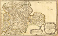
1654réf. 17463Paris: N. Sanson 1654. Other. In very good condition. 365 by 580mm 14¼ by 22¾ inches. 365 by 580mm 14¼ by 22¾ inches. Copper-engraving handcolored in outline when published. Fine and strong impression of this early decorative mid-seventeenth century map of this English regional map covering the area Chester Darbing Nottingham. by the famous French cartographer Nicolaus Sanson. Very detailled and naming many cities and villages as well many places along the coastline. Showing prominently the eastern part of central England. In the lower right corner with a large floral title cartouche and milage scale. N. Sanson unknown
2024réf. x-0198891423Oxford Univ Pr 2024. Hardcover. New. 376 pages. 6.30x1.02x9.53 inches. Oxford Univ Pr hardcover
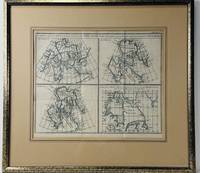
1772réf. 67785Printed in Switzerland: Chez les Sociétés Typographiques 1772. First edition first state. Framed engraved map. Very Good. Framed. Local pick up or will ship without frame for mailing 30 x 38 cm. Hand coloured in blue. A set of four maps showing the Northwest Passage and demonstrating changes in cartological knowledge over time. Originally created by Didier Robert de Vaugondy using the maps of three other cartographers for the supplement to Diderot's Encyclopédie. A clean impression with noticable fold lines. Very light age toning. French text. Chez les Sociétés Typographiques unknown