Glazer, Samson VolfovichBiblio.com
2 971 résultats
réf. 9279965Short description: In Russian. Glazer Samson Volfovich. The merry winter of sport. Moscow: Physical culture and tourism 1934: 16 type of trust Polygraphbook. Please feel free to contact us for a detailed description of the copies available. SKU9279965 unknown
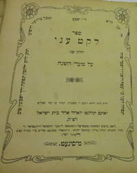
réf. 000118472Moshe ben Yakov Shimshon Hager meKosov. Leket Oni. Sighet 1910. Publisher: Yerachmiel Roizenthal. In Hebrew. The listing price is for a single volume of this title. The copy is in fair condition without binding. Some imperfections are among the following common defects: holes damaged pages tears water stains foxing worm holes or tracers age spots frayed margins handwritten notes inscriptions censorship stamps. Please contact us for more details on the condition of the book. SKU000118472 unknown
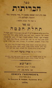
réf. 000180944Shimshon. Sefer haKritot. Warsaw 1884. Publisher: Yitzhak Goldman. In Hebrew. The listing price is for a single volume of this title. The copy is in fair condition without binding. Some imperfections are among the following common defects: holes damaged pages tears water stains foxing worm holes or tracers age spots frayed margins handwritten notes inscriptions censorship stamps. Please contact us for more details on the condition of the book. SKU000180944 unknown
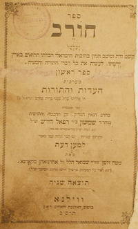
réf. 000127001Shimshon bemn Rafael Hirsh of Frankfurt-Main. Sefer Chorev. Vilna 1901. Publisher: Widow and brothers Romm. In Hebrew. The listing price is for a single volume of this title. The copy is in fair condition without binding. Some imperfections are among the following common defects: holes damaged pages tears water stains foxing worm holes or tracers age spots frayed margins handwritten notes inscriptions censorship stamps. Please contact us for more details on the condition of the book. SKU000127001 unknown
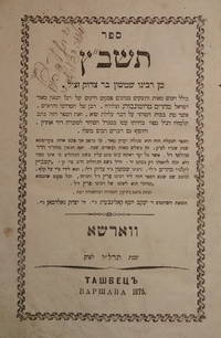
réf. 000176326Shimshon Bar Tsedek. Tashbats. Warsaw 1875. Publisher: Yakov Yosef Kaliberg Yitzhak Goldman. In Hebrew. The listing price is for a single volume of this title. The copy is in fair condition without binding. Some imperfections are among the following common defects: holes damaged pages tears water stains foxing worm holes or tracers age spots frayed margins handwritten notes inscriptions censorship stamps. Please contact us for more details on the condition of the book. SKU000176326 unknown
réf. 000115921Yair Chaim ben Moshe Shimshon Vermeysha. Chavat Yair. Sudilkov 1834. Publisher: Yitzhak ben Eliezer. In Hebrew. The listing price is for a single volume of this title. The copy is in fair condition without binding. Some imperfections are among the following common defects: holes damaged pages tears water stains foxing worm holes or tracers age spots frayed margins handwritten notes inscriptions censorship stamps. Please contact us for more details on the condition of the book. SKU000115921 unknown
1650réf. 24869London 1650. 1 vols. 13" x 8 3/4. Contemporary. hand-coloring. Fine condition. 1 vols. 13" x 8 3/4 ". unknown
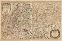
1675réf. 33301Paris: Hubert Jaillot 1675. Blatt gebräunt Mittelfalz mit nicht säurebeständigem Tape hinterlegt heller Streifen. . 803 by 560mm 31 by 22 inches. Hand-Colored Original Copperplate Engraving by Alexis-Hubert Jaillot & N. Sanson depicting Le Cercle de Souabe subdivisé en tous les Estats qui le Composent Tire ´sur les Memoires les plus noueaux Par le S. Sanson Geographe Ordinaire du Roy. A Paris Ches H. Laillot joingnant les Augustins aux deux Globes Auec Priuilege du Roy pour Vingt Ans. Published Paris Hubert Jaillot 1675. Sheet: 803 by 560mm 31 by 22 inches. A fine and original hand-colored example of Jaillot's celebrated cartographic work documenting this region of Germany with the precision and decorative artistry characteristic of the 16700s. Alexis-Hubert Jaillot c.1632-1712 was one of the foremost French cartographers of the late 17th and early 18th centuries. Working in Paris he produced magnificent large-format maps of European territories often in collaboration with Nicolas Sanson -- considered the father of French cartography. Jaillot's maps are known for their striking decorative cartouches generous size and fine hand coloring representing the pinnacle of French Baroque cartography.This original copperplate engraving with original hand coloring depicts the region of Le Cercle de Souabe subdivisé en tous les Estats qui le Composent Tire ´sur les Memoires les plus noueaux Par le S. Sanson Geographe Ordinaire du Roy. A Paris Ches H. Laillot joingnant les Augustins aux deux Globes Auec Priuilege du Roy pour Vingt Ans. published in Paris Hubert Jaillot 1675. The map records the political and geographic boundaries of the region as understood in 1675 offering a fascinating window into the history of German territorial organization. Sheet measures 803 by 560mm 31 by 22 inches. In good condition overall with minor signs of age appropriate for a 17th-century engraving. Ready to frame. Hubert Jaillot unknown
1845réf. 14123Paris 1845. Pen ink and watercolour. Good condition apart from some overall light soiling and minor foxing mild creasing and a few light brownish stains in the image and top margin. A skillfully repaired 5 7/8" tear traveling from the top margin into the top of the image. The design instructions on the print read: "Jardiniere cabossée" A rare example of an original watercolour design for porcelain by the Samson factory of Paris. This finished design was intended as a reference source from which the porcelain painters could work using the design as a guide for the colours and image to be transformed from paper into fine porcelain. The French porcelain manufactory of Samson & Cie. was established by "Edmé Samson b. Paris 1810; d. Paris 1891 at 7 Rue Vendôme later Rue Béranger in Paris. The intention of the firm was to reproduce ceramics from museums and private collections and it claimed that all such reproductions would be distinctly marked to avoid confusion with the originals. In 1864 the factory was moved to Montreuil by Samson's son Emile Samson 1837-1913. The range of wares included copies of 18th-century porcelain from such factories as Sèvres Chelsea Meissen and Derby Chinese export-wares especially armorial wares decorated with famille rose colours and mugs decorated with the Fitzhugh pattern Delftware Iznikware maiolica and faience." Grove Dictionary of Art. unknown
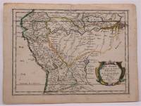
1657réf. W2347Paris: Chez Sanson 1657. Image is 8 1/8 inches by 11 inches on a folded sheet measuring 9 inches by 12 13/16 inches. Original hand-colored copper-engraved map from Sanson's atlas of maps of the Americas: L'Amerique en Plusieurs Cartes. It is a map of the Viceroyalty of Peru that displays the Amazon River and its many tributaries. Nicolas Sanson 1600-1667 was the official geographer for the king of France. His map of Peru and the Amazon became the standard that was copied by almost all geographers/cartographers--even reproduced by Bion for his 1700 treatise on globes. Cintra and Oliveira argue that Sanson's map was a scientific one that holds up well even when compared to 21st century maps of the region. The map is in about very good condition: clean with bright original outline color; minimal foxing ; some edgewear and soiling in the margins. . First Edition. Single Sheet. Very Good-. 8 1/8 inches by 11 Inches. Map. Chez Sanson
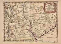
1657réf. 326341Paris 1657. unbound. Map. Original outline coloring. Sheet measures 8 3/4" x 12 1/8". Image measures 8" x 10 5/8". Paris: Nicolas Sanson 1657. This rare 17th century map by Nicolas Sanson with original color depicts the region showing present day Paraguay Uruguay with parts of Brazil and Argentina. Mountains are rendered pictorially and cities rivers and notations describing indigenous populations are labeled. In very good condition. Nicolas Sanson 1600-1667 is considered the founder of the French school of cartography. In reaction to the prevailing trend of Dutch lavishness Sanson favored minimal details focusing rather on accurate cartography than ornament. unknown
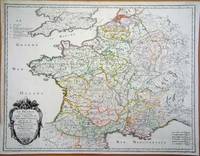
1700réf. 104160Copper engraved map double page 24" x 20" hand colored and large uncolored title cartouches. Some minor soiling a little wear along centerfold with old verso repair normal aging; very good. Samson 1600-1667 is often referred to as the father of French cartography. Louis XIII was impressed with his work and appointed him "Geographe Ordinaire du Roi". During his career Sanson would produce about 300 maps and his major atlas "Cartes Generales de Toutes les Parties du Monde" would represent an important part of his body of work. While two of his sons continued publication of his maps after his death Pieter Schenk 1655-1718 an important publisher and engraver in his own right published this map. The map is attractively colored and gives a detailed view of the provinces of France. The map is also decorated with a large title cartouche. Bagrow p. 185. map hist website.
1683réf. 297468Paris 1683. unbound. Map. Copper engraving with hand coloring. Image measures 7 5/8 x 11 1/4 inches. This map published in Paris in Afrique en plusieurs cartes is one of Sanson's small atlas maps of depicting various African regions. This map offers extensive detail on the cities of North Africa as well as topographical and geographical features with mountains beautifully rendered in profile. Nicolas Sanson 1600-1667 is considered the founder of the French school of cartography. In reaction to the prevailing trend of Dutch lavishness Sanson favored minimal details focusing rather on accurate cartography than ornament. This map is a fine example of his work. unknown
réf. 4198760-nnew. unknown
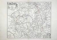
réf. 5579Paris: 1658-79. No binding. Very Good. 370 x 440 mm. early outline colour in good condition. This map of the Champagne and Brie region of France was published in Paris by Pierre Mariette. It appears in the first edition of Nicolas Sanson's ""Les Cartes Generales"" in 1658. Sanson was France's premier cartographer and helped to lift French work in this area to another level. His atlas is the first full world atlas to be produced in France. This work had been in development for several years as the dates on the various maps attest. Pastoureau 1984 Sanson Va no. 11; Phillips P.L. 1909- 4260 no. 11. 1658-[79] unknown
réf. 6420Paris: 1693. No binding. Good. 440 x 570 mm. early outline colour in good condition. A particularly attractive map of France or ancient Gaul. It famously depicts the country before Louis XIV lost a third of his territory to mapmakers who concluded that the longitudinal width of the country was not as great as was depicted! Not in Pastoureau 1984. 1693 unknown
1990réf. DADAX0306435160Springer 1990-07-31. 1990. hardcover. New. 6.14x1.06x9.21. Buy with confidence. Excellent Customer Service & Return policy. Springer hardcover
réf. 44410490-nnew. unknown
2006réf. DADAX0754640876Routledge 2006-09-28. hardcover. New. 6.25x0.75x9.25. Buy with confidence. Excellent Customer Service & Return policy. Routledge hardcover
1992réf. DADAX0333516028MACMILLAN 1992-01-09. 1991. hardcover. New. 5.50x1.19x8.50. Buy with confidence. Excellent Customer Service & Return policy. MACMILLAN hardcover
réf. 6133606411MacMillan . Hardback. New. pp. 476 MacMillan hardcover
2022réf. x-3030739228Springer 2022. Paperback. New. 254 pages. 9.25x6.10x0.71 inches. Springer paperback
1933réf. mon0000151358John Murray 1933T. unknown_binding. Very Good. in x in x in. 1933 first edition with dust jacket John Murray unknown
2021réf. x-3030739198Springer 2021. Hardcover. New. 254 pages. 9.25x6.10x0.83 inches. Springer hardcover
1999réf. x-0631201890Blackwell Pub 1999. Hardcover. New. 377 pages. 10.25x7.25x1.25 inches. Blackwell Pub hardcover