2 971 résultats
2024réf. Adhya-9780357976876CENGAGE 2024. PB. New. CENGAGE paperback
1691réf. 43500Amsterdam Huguetan & Mortier 1691. 56x85 cm. Large engraved map of Terra Sancta with original colours in outline. With two large engraved cartouches. Small repairs to lower part of centerfold. This is Jaillot's large version of Sanson's map of Palaestine divided into tribes. unknown
1778réf. M4133Paris: Fortin 1778. Very Good. Notes: Map showing Bohemia Silesia Moravia and Lusatia. Size : 420x545 mm 16.5x21.5 Inches Coloring: Hand Colored Category: Maps Europe Poland Lithuania Fortin unknown
réf. 69481London: Bloomsbury Circus 2020. Fiction FIRST EDITION with SIGNED bookplate and DOUBLE-SIGNED photo. Octavo 24 x 16cm pp.348; 12 Endmatter. Publisher's cloth hardcovers in photographic dust-jacket priced £14.99. Fine throughout. On February 12th 2020 a launch tour was announced for this novel published on 2nd April. Entitled 'A Theatre for Dreamers - An Evening of Words and Music with Polly Samson and David Gilmour' the event was to feature Polly Samson in conversation with journalist Rosie Boycott readings film and live music including a new song "Yes I Have Ghosts" written by David Gilmour and Polly Samson. Due to Covid 19 the tour was cancelled but ticket holders for the launch event still received the signed book and a double-singed photograph albeit through the post rather than at the live event. London: Bloomsbury Circus, 2020 unknown
2007réf. x-0849398185CRC Pr I Llc 2007. Hardcover. New. 1st edition. 403 pages. 10.50x7.50x1.00 inches. CRC Pr I Llc hardcover
2001réf. x-9058231593Harwood Academic Pub 2001. Hardcover. New. 1st edition. 524 pages. 9.75x7.00x1.25 inches. Harwood Academic Pub hardcover
2013réf. BN128508Olms Verlag 2013. 2013. Hardcover. Opferritus und Voropfer der Griechen und Römer Opferritus und Voropfer der Griechen und Römer Samson Eitrem Olms Verlag hardcover
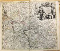
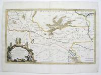
1692réf. 28137Paris 1692. Other. Schönes tadelloses Exemplar. . 803 by 560mm 31 by 22 inches. Hand-Colored Original Copperplate Engraving by Alexis-Hubert Jaillot & N. Sanson depicting Le Cours de la Riviere du Rhein depuis sa Source jusques a son Emboucheure ou sont distingues Tout les Estats et Souverainetes qui sont dessus et aux enuirons. Tire de tous les Memoires les plus Nouveaux Parle Sr. Sanson Geopgraphe Ordinaire du Roy. Published Paris 1692. Sheet: 803 by 560mm 31 by 22 inches. A fine and original hand-colored example of Jaillot's celebrated cartographic work documenting this region of Germany with the precision and decorative artistry characteristic of the 16900s. Alexis-Hubert Jaillot c.1632-1712 was one of the foremost French cartographers of the late 17th and early 18th centuries. Working in Paris he produced magnificent large-format maps of European territories often in collaboration with Nicolas Sanson -- considered the father of French cartography. Jaillot's maps are known for their striking decorative cartouches generous size and fine hand coloring representing the pinnacle of French Baroque cartography.This original copperplate engraving with original hand coloring depicts the region of Le Cours de la Riviere du Rhein depuis sa Source jusques a son Emboucheure ou sont distingues Tout les Estats et Souverainetes qui sont dessus et aux enuirons. Tire de tous les Memoires les plus Nouveaux Parle Sr. Sanson Geopgraphe Ordinaire du Roy published in Paris 1692. The map records the political and geographic boundaries of the region as understood in 1692 offering a fascinating window into the history of German territorial organization. Sheet measures 803 by 560mm 31 by 22 inches. In good condition consistent with its age of over 330 years. Ready to frame. unknown
2008réf. BN676821Foundation Books 2008. 2008. Interface: v. 2: English for Bcom/BBA/BCA Semester II Thiruvalluvar University Interface: English for Bcom/BBA/BCA Semester II Thiruvalluvar University Interface: v. 2: English for Bcom/BBA/BCA Semester II Thiruvalluvar University Interface: English for Bcom/BBA/BCA Semester II Thiruvalluvar University T Samson Foundation Books unknown
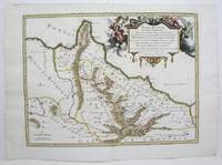
1719réf. E7CG2ENMSWHRParis: Hubert Jaillot 1719. Engraved map on 2 assembled sheets 54.5 x 88 cm. With title in decorated cartouche signed F.C. in upper right corner and scalebars in decorated cartouche in the lower left corner. Coloured in outline. Large map of the Pyrenees a mountain range on the border between France and Spain after Nicolas Sanson 1600-1675. Apparently printed from the original plates differing from the map issued in Mortier's "Jaillot-Atlas".Very good copy slightly browned.l Pastoureau Jail. II C map 166. Hubert Jaillot, unknown
réf. 3239Americas: Amsterdam Francois Halma 1705. Copper engraved map of Canada by N. Sanson from Halma's Algemeene Werelde Beschryving Vol. 3 Black and white; title in Dutch; verso blank; strapwork title cartouche. Attractive small map of Canada and the Great Lakes a reduced version of one of the most influential seventeenth century maps of the French and English colonies in North America. It concentrates on the region of greatest French interest. The entire Great Lakes basin and the St. Lawrence River are shown in great detail. The most important aspect of the map is the first appearance of L. Erie ou du Chat as a recognizable lake on an atlas map. This delineation influenced the cartography of the region for more than 100 years and was not superceded until Delisle's "Carte du Canada" in 1703. The map is also an outstanding source for Indian tribal names and locations. Two names:Aouentsiouaeron and Attiouandarons appear here for the first time. Lake Superior and Michigan Lac du Puans are left open-end to the west. Embellished with a nice title cartouche and engraved by Anthoine d'Winter. This is the third state. Published in Francois Halma's Dutch edition of A. Pherotee de la Croix's Nouvelle Methode Pour Apprendre facilement la Geographie Universelle. Dark impression; dampstaining to lower margin just entering plate; centrefold and 2 further folds to fit in binding. Nicolas Sanson d'Abbeville.1600-67 ' father of the French cartography' and founder of the Sanson firm. Atlas ' Cartes générales de toutes les parties du Monde' 1658-70 and a pocket atlas in 4 parts 1652-1705. Sanson's small maps from A. Phérotée de la Croix's Nouvelle Methode Pour Apprendre Facilement la Geographie Universelle. first published in 1652 and engraved by A. Peyrounin were copied several times by various map publishers. Johann David Zunners made copies of Sanson's maps for his German translation of Die Gantze Erd-Kugel in 1679. Johannes Ribbius and Simon de Vries published copies in 1682 and 1683 with new maps engraved by Antoine d'Winter. The plates were later sold to Francois Halma who used them in 1699 and then again in 1705 with the titles re-engraved in Dutch. François Halma 1653 - 1722 Dutch publisher/printer; dealer/auction house. Cartographer and publisher of maps active in Utrecht Amsterdam Franeker and Leeuwarden. Published 'Description de l'Univers' 1700; 'Algemene Wereldtbescrijving' 1705; 'Corpus Inscriptionum' 1707 and 'Lexicon Philosophicum' 1713. Keoman: Hal 1; Phillips 528; Burden #575; Kershaw #138; McCorkle #683.5. Americas Canada Great Lakes New France Niew Vrankryk Amsterdam Francois Halma 1705 unknown
réf. 3240Americas: Amsterdam Francois Halma 1705. Copper engraved map of Florida by N. Sanson from Halma's Algemeene Werelde Beschryving Vol. 3 Black and white; title in Dutch; verso blank; strapwork title cartouche. This influential map shows the Spanish and French possessions in the southern part of the United States. The map extends from the southernmost part of Virginia to the coast of what is now Texas. When first introduced by Sanson in 1657 this map was the first to use the name L. Erie in an atlas and to introduce several new rivers in Virginia. The French claims in the Carolinas are reasserted with the region named Floride Francoise despite the region not having had any French presence for nearly 100 years. The place name Caroline is not related to the future English colony of Carolina. Instead it is a confusion between the French Fort Caroline on the St. Johns River and Charlefort that was located near Port Royal. According to Burden this is the third state of the map. Published in Francois Halma's Dutch edition of A. Pherotee de la Croix's Nouvelle Methode Pour Apprendre facilement la Geographie Universelle. Dark impression; pin hole paper fault to upper right below latitude 40. Nicolas Sanson d'Abbeville.1600-67 ' father of the French cartography' and founder of the Sanson firm. Atlas ' Cartes générales de toutes les parties du Monde' 1658-70 and a pocket atlas in 4 parts 1652-1705. Sanson's small maps from A. Phérotée de la Croix's Nouvelle Methode Pour Apprendre Facilement la Geographie Universelle. first published in 1652 and engraved by A. Peyrounin were copied several times by various map publishers. Johann David Zunners made copies of Sanson's maps for his German translation of Die Gantze Erd-Kugel in 1679. Johannes Ribbius and Simon de Vries published copies in 1682 and 1683 with new maps engraved by Antoine d'Winter. The plates were later sold to Francois Halma who used them in 1699 and then again in 1705 with the titles re-engraved in Dutch. François Halma 1653 - 1722 Dutch publisher/printer; dealer/auction house. Cartographer and publisher of maps active in Utrecht Amsterdam Franeker and Leeuwarden. Published 'Description de l'Univers' 1700; 'Algemene Wereldtbescrijving' 1705; 'Corpus Inscriptionum' 1707 and 'Lexicon Philosophicum' 1713. Keoman: Hal 1; Phillips 528; Burden #546; Cumming SE #53. Americas Florida Amsterdam Francois Halma 1705 unknown
1690réf. M9575Paris c. 1690. Very Good. Notes: A charming map of Negroponte Chalcis Greece during the late 17th century. Size : 104x154 mm 4.09x6.06 Inches Coloring: Hand Colored Category: Maps Europe Greece Macedonia; unknown
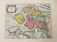
1693réf. M10774Paris 1693. Very Good. Notes: Map of the county of Zeeland. Size : 440x575 mm 17.32x22.64 Inches Coloring: Original Hand Coloring Category: Maps Europe Benelux; unknown
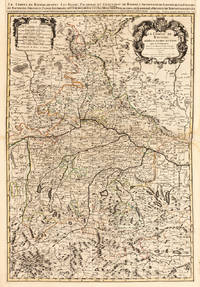
1708réf. M10193Amsterdam: Pierre Mortier c.1708. Very Good. Notes: "Theatre de la Guerre" Theater of War maps covering the battles raging in Europe and the Americas during the Spanish War of Succession 1701-1713 and the Northern War 1700-1721. The atlas maps are large folio size with most maps made of two sheets and many maps combining 4 or 6 sheets those also issued as wall maps separately. The atlas is most impressive for its large size and number of maps as well as being up to date for its time. Size : 517x585 mm 20.35x23.03 Inches Coloring: Original Outline Coloring Category: Maps Europe Germany; Pierre Mortier unknown
1700réf. M7994Paris c. 1700. Very Good. Notes: Engraved by Cordier. A map of Central Germany. Frankfurt appears at the south-center of the map. Size : 457x648 mm 17.99x25.51 Inches Coloring: Original Hand Coloring Category: Maps Europe Germany; unknown
1700réf. M7991Paris: S. Jallot c. 1700. Very Good. Notes: Map of Northern Germany Size : 650x460 mm 25.59x18.11 Inches Coloring: Original Hand Coloring Category: Maps Europe Germany; S. Jallot unknown
1655réf. M5583Paris 1655. Very Good. Size : 385x535 mm 15.125x21 Inches Coloring: Hand Colored Category: Maps Africa North unknown
1678réf. M3431Paris: Mariette Pierre 1678. Excellent. Size : 357x595 mm 14x23.375 Inches Coloring: Original Outline with later cartouche coloring Category: ; Maps Asia Near East Turkey Mariette, Pierre unknown
1678réf. M3434Paris: Mariette Pierre 1678. Excellent. Size : 390x522 mm 15.375x20.5 Inches Coloring: Original Outline with later cartouche coloring Category: ; Maps Asia Near East Turkey Mariette, Pierre unknown
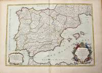
1710réf. M10278Paris: H. Jaillot c.1710. Very Good. Size : 465x655 mm 18.31x25.79 Inches Coloring: Original Hand Coloring Category: Maps Europe Portugal; Maps Europe Spain; H. Jaillot unknown
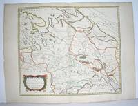
1654réf. M2853Paris 1654. Excellent. Size : 415x483 mm 16.375x19 Inches Coloring: Original Outline Coloring Category: Maps Russia unknown
réf. Bloomsbury-9781780761190I.B.Tauris. Hardback. New. 328 pages I.B.Tauris hardcover