2.284 Ergebnisse
2008Best.-Nr. DBS-9780387363189Springer 2008. 1st. Hardcover. New. Springer hardcover
2004Best.-Nr. SONG0714655538Routledge 2004-08-26. 1. hardcover. Used: Good. 6.12x0.69x9.44. Buy with confidence. Excellent Customer Service & Return policy. Routledge hardcover
2008Best.-Nr. NJan2018--1118Pearson 2008-03-07. Hardcover. New. 0x0x0. New US Edition Textbook Ships with Emailed Tracking from USA Pearson hardcover
2022Best.-Nr. x-0357657845Cengage Learning 2022. Hardcover. New. 9th edition. 784 pages. 10.80x9.30x1.00 inches. Cengage Learning hardcover
2012Best.-Nr. x-1841849855Informa Healthcare 2012. Hardcover. New. 1st edition. 239 pages. 10.00x7.25x0.75 inches. Informa Healthcare hardcover
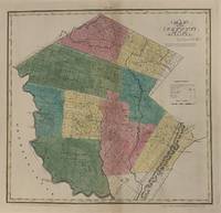
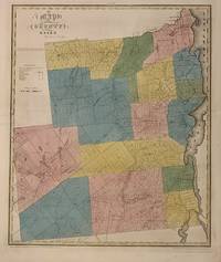
1829Best.-Nr. 337485New York: David H. Burr 1829. unbound. Rawdon Clark & Co. Map. Copper plate engraving with original hand-colored outline. Image measures 16 3/4" x 17 1/2" This map depicts Sullivan County in New York State hand-colored by town. The map denotes major routes rivers and creeks and other topographical details. Flouring mills saw mills manufactories forges and churches are indicated. The Delaware & Hudson Canal is shown. This first edition of Burr's county map appeared in his "Atlas of the State of New York" of the same year which was the second atlas of an individual state ever published. The map is in very good condition. Some foxing. Full original margins. David H. Burr 1803-1875 served as Topographer to the United States Post Office and Geographer to the House of Representatives and was widely known for his accuracy and attention to detail. His "Universal Atlas" was the first to map each of the United States individually. This map is a lovely rendering of a hard-to-find county in New York State. David H. Burr unknown
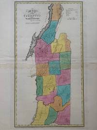
1829Best.-Nr. 337502New York: David H. Burr 1829. unbound. Rawdon Clark & Co. Map. Copper plate engraving with original hand-colored outline. Image measures 17 1/4" x 18 3/4" This map depicts Washington County in New York State hand-colored by town. The map denotes major routes rivers and creeks and other topographical details. Flouring mills saw mills manufactories forges and churches are indicated. Includes Lake George and Lake Champlain and the Champlain Canal is shown. This first edition of Burr's county map appeared in his "Atlas of the State of New York" of the same year which was the second atlas of an individual state ever published. The map is in very good condition. Some foxing. Full original margins. David H. Burr 1803-1875 served as Topographer to the United States Post Office and Geographer to the House of Representatives and was widely known for his accuracy and attention to detail. His "Universal Atlas" was the first to map each of the United States individually. This map is a lovely rendering of a hard-to-find county in New York State. David H. Burr unknown
1829Best.-Nr. 337485New York: David H. Burr 1829. unbound. Rawdon Clark & Co. Map. Copper plate engraving with original hand-colored outline. Image measures 16 3/4" x 17 1/2" This map depicts Sullivan County in New York State hand-colored by town. The map denotes major routes rivers and creeks and other topographical details. Flouring mills saw mills manufactories forges and churches are indicated. The Delaware & Hudson Canal is shown. This first edition of Burr's county map appeared in his "Atlas of the State of New York" of the same year which was the second atlas of an individual state ever published. The map is in very good condition. Some foxing. Full original margins. David H. Burr 1803-1875 served as Topographer to the United States Post Office and Geographer to the House of Representatives and was widely known for his accuracy and attention to detail. His "Universal Atlas" was the first to map each of the United States individually. This map is a lovely rendering of a hard-to-find county in New York State. David H. Burr unknown books
1829Best.-Nr. 337502New York: David H. Burr 1829. unbound. Rawdon Clark & Co. Map. Copper plate engraving with original hand-colored outline. Image measures 17 1/4" x 18 3/4" This map depicts Washington County in New York State hand-colored by town. The map denotes major routes rivers and creeks and other topographical details. Flouring mills saw mills manufactories forges and churches are indicated. Includes Lake George and Lake Champlain and the Champlain Canal is shown. This first edition of Burr's county map appeared in his "Atlas of the State of New York" of the same year which was the second atlas of an individual state ever published. The map is in very good condition. Some foxing. Full original margins. David H. Burr 1803-1875 served as Topographer to the United States Post Office and Geographer to the House of Representatives and was widely known for his accuracy and attention to detail. His "Universal Atlas" was the first to map each of the United States individually. This map is a lovely rendering of a hard-to-find county in New York State. David H. Burr unknown books
1998Best.-Nr. DADAX0471968064Wiley 1998-10-15. 1. hardcover. New. 6.36x0.93x9.37. Buy with confidence. Excellent Customer Service & Return policy. Wiley hardcover
1993Best.-Nr. DADAX0805814124Routledge 1993-09-01. hardcover. New. 6.46x1.27x9.22. Buy with confidence. Excellent Customer Service & Return policy. Routledge hardcover
1993Best.-Nr. DADAX0306441748Springer 1993-03-31. 1993. hardcover. New. 6.34x1.36x9.50. Buy with confidence. Excellent Customer Service & Return policy. Springer hardcover
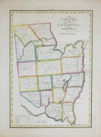
1829Best.-Nr. 264493New York: David H. Burr 1829. unbound. Rawdon Clark & Co. Map. Copper plate engraving with original hand-coloring. Image measures 12 x 17 1/2". This map depicts Saratoga County in eastern New York divided into 18 towns outlined in vivid color. The county is bordered by the Hudson River in the east and the Mohawk River in the south. Saratoga Springs is identified. The map denotes major routes waterways and topographical details and icons label villages flouring mills factories forges saw mills and churches. This first edition of Burr's county map appeared in his "Atlas of the State of New York" of the same year which was the second atlas of an individual state ever published. The map is in good condition with light foxing throughout. Full original margins. David H. Burr 1803-1875 served as Topographer to the United States Post Office and Geographer to the House of Representatives and was widely known for his accuracy and attention to detail. His "Universal Atlas" was the first to map each of the United States individually. This map is a lovely rendering of a hard-to-find county in New York State. David H. Burr unknown
1829Best.-Nr. 264493New York: David H. Burr 1829. unbound. Rawdon Clark & Co. Map. Copper plate engraving with original hand-coloring. Image measures 12 x 17 1/2". This map depicts Saratoga County in eastern New York divided into 18 towns outlined in vivid color. The county is bordered by the Hudson River in the east and the Mohawk River in the south. Saratoga Springs is identified. The map denotes major routes waterways and topographical details and icons label villages flouring mills factories forges saw mills and churches. This first edition of Burr's county map appeared in his "Atlas of the State of New York" of the same year which was the second atlas of an individual state ever published. The map is in good condition with light foxing throughout. Full original margins. David H. Burr 1803-1875 served as Topographer to the United States Post Office and Geographer to the House of Representatives and was widely known for his accuracy and attention to detail. His "Universal Atlas" was the first to map each of the United States individually. This map is a lovely rendering of a hard-to-find county in New York State. David H. Burr unknown books
2022Best.-Nr. 1-0357720636Cengage Learning 2022. Paperback. New. 14 edition. 576 pages. 10.00x8.50x0.94 inches. Cengage Learning paperback
2023Best.-Nr. 1-0323810411Elsevier Science Health Science 2023. Hardcover. New. 5th edition. 560 pages. 10.88x8.50x1.38 inches. Elsevier Science Health Science hardcover
Best.-Nr. M2743New York: Thomas Illman 1836. Two tears in lower margin repaired otherwise in very good condition. Size : 270x310 mm 10.625x12.25 Inches Coloring: Original Hand Coloring Category: Maps United States New England States; Thomas Illman unknown
Best.-Nr. Z1-K-036-01618The Guilford Press. Used - Good. Ships from UK in 48 hours or less usually same day. Your purchase helps support Sri Lankan Children's Charity 'The Rainbow Centre'. Ex-library so some stamps and wear but in good overall condition. 100% money back guarantee. We are a world class secondhand bookstore based in Hertfordshire United Kingdom and specialize in high quality textbooks across an enormous variety of subjects. We aim to provide a vast range of textbooks rare and collectible books at a great price. Our donations to The Rainbow Centre have helped provide an education and a safe haven to hundreds of children who live in appalling conditions. We provide a 100% money back guarantee and are dedicated to providing our customers with the highest standards of service in the bookselling industry. The Guilford Press unknown
Best.-Nr. Z1-M-009-01133University Press of America. Used - Good. Used - Good. Ships from UK in 48 hours or less usually same day.Your purchase helps support Sri Lankan Children's Charity 'The Rainbow Centre.' Ex-library but has been well cared for. 100% money back guarantee. We are a world class secondhand bookstore based in Hertfordshire United Kingdom and specialize in high quality textbooks across an enormous variety of subjects. We aim to provide a vast range of textbooks rare and collectible books at a great price. Our donations to The Rainbow Centre have helped provide an education and a safe haven to hundreds of children who live in appalling conditions. We provide a 100% money back guarantee and are dedicated to providing our customers with the highest standards of service in the bookselling industry. University Press of America unknown
Best.-Nr. Z1-T-020-02213Croom Helm. Used - Good. Ships from UK in 48 hours or less usually same day. Your purchase helps support Sri Lankan Children's Charity 'The Rainbow Centre'. Ex-library so some stamps and wear but in good overall condition. 100% money back guarantee. We are a world class secondhand bookstore based in Hertfordshire United Kingdom and specialize in high quality textbooks across an enormous variety of subjects. We aim to provide a vast range of textbooks rare and collectible books at a great price. Our donations to The Rainbow Centre have helped provide an education and a safe haven to hundreds of children who live in appalling conditions. We provide a 100% money back guarantee and are dedicated to providing our customers with the highest standards of service in the bookselling industry. Croom Helm unknown
Best.-Nr. 468Paris, Creuzevault, 1943. Petit in-4 en feuilles, couverture, chemise et étui. Illustré par Hermine David d'un frontispice et de 52 pointes-sèches originales. Tiré à 450 exemplaires sur vélin, un des 50 exemplaires comprenant une suite et un dessin original
Best.-Nr. 58000587-6ALM Global LLC. Used - Good. Pages intact with minimal writing/highlighting. The binding may be loose and creased. Dust jackets/supplements are not included. Stock photo provided. Product includes identifying sticker. Better World Books: Buy Books. Do Good. ALM Global, LLC unknown
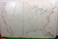
1855Best.-Nr. 102New York: Ackerman Lith 1855. First edition thus. Map. Near Fine. A Near Fine map. 33 x 49 inches. Black and white engraving with hand-colored borders in yellow and red. Original folds present. A near fine example of a rare large size pre-civil war map. David H. Burr is listed as draftsman U.S. SENATE. Burr was 'Geographer and Draftsman to the Senate' between 1855-59 1855 Large map of the United States issued after the Gadsden Purchase and prior to the Pacific Railroad Survey. Shows Kansas and Nebraska possibly the first government map to do so. West Virginia is not separated from Virginia. . Ackerman Lith unknown
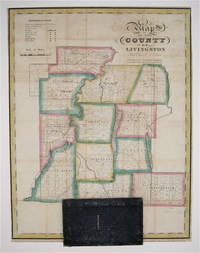
1829Best.-Nr. 233726New York: David Burr 1829. First. unbound. Pocket map. Copper plate engraving with original hand-coloring. Map attached to blue leather binding as issued title stamped in gold. Image measures 15 1/2 x 12". This rare fold-out pocket map depicts Livingston County in the Finger Lakes region of New York divided into 12 towns outlined in vivid color. The map is centered around the town of Geneseo and denotes major routes waterways and topographical details. Icons label villages flouring mills factories forges saw mills and churches. The map is in excellent condition with no tears of any kind. Some scattered staining especially along original folds. It is attached to its original leather cover and the watermark of the paper is visible. David H. Burr 1803-1875 served as Topographer to the United States Post Office and Geographer to the House of Representatives and was widely known for his accuracy and attention to detail. Burr was one of the first cartographers to map each of the United States individually. Issued separately rather than included in his seminal "Universal Atlas" this pocket map is a scarce version of Burr's celebrated work. David Burr unknown
1829Best.-Nr. 300575New York 1829. unbound. Rawdon Clark & Co. Map. Engraving with original hand outline color. Image measures 22 x 18 1/4 inches. Some chips to margins and repairs to left centerfold but otherwise in good condition. This 1829 map depicts Essex County in the high peaks region of the Adirondacks divided into 17 towns in full vivid color. Lake Champlain forms the right border of the region and Lake Placid yet unnamed appears in the upper left. The map denotes major routes waterways and topographical details and icons label villages flouring mills factories forges saw mills and churches. This first edition of Burr's county map appeared in his "Atlas of the State of New York" of the same year which was the second atlas of an individual state ever published. The map is in good condition with light foxing throughout and some ink stains in the lower right margin not affecting the image. Full original margins. David H. Burr 1803-1875 served as Topographer to the United States Post Office and Geographer to the House of Representatives and was widely known for his accuracy and attention to detail. His "Universal Atlas" was the first to map each of the United States individually. This map is a lovely rendering of a scenic area in New York State. unknown books