Flaherty, David HBiblio.com

2 902 résultats
1979réf. SONG0720109302UNKNO 1979-01-01. Ex-library o/wise good no markings to text. Sca. hardcover. Used: Good. 0.00x0.00x0.00. Buy with confidence. Excellent Customer Service & Return policy. UNKNO hardcover
2024réf. x-1666970700Lexington Books 2024. Hardcover. New. 226 pages. 9.01x6.01x9.30 inches. Lexington Books hardcover
2021réf. SKU0636314CRC Press 2021-06-16. paperback. New. 7x1x9. New Textbook Ships with Tracking CRC Press paperback
1994réf. DADAX0521451094Cambridge University Press 1994-08-26. 1. hardcover. New. 6.50x1.00x9.75. Buy with confidence. Excellent Customer Service & Return policy. Cambridge University Press hardcover
2010réf. DADAX0739146033Lexington Books 2010-12-22. 1. hardcover. New. 6.38x0.93x9.48. Buy with confidence. Excellent Customer Service & Return policy. Lexington Books hardcover
2013réf. ANAIS-0415885779Routledge 2013-08-30. 1. paperback. Good. 10X7.1X1.6. Buy with confidence. Excellent Customer Service & Return policy. Routledge paperback
réf. 0888390408New. paperback. New. Satisfaction Guaranteed or your money back. paperback
2012réf. G145042631XI3N00Human Kinetics Publishers 2012. Paperback. Good. Pages can have notes/highlighting. Spine may show signs of wear. ~ ThriftBooks: Read More Spend Less.Dust jacket quality is not guaranteed. Human Kinetics Publishers paperback
réf. 0870714880New. New. Satisfaction Guaranteed or your money back. unknown
1949réf. 50338Philadelphia: Prime Press. Fine in Near Fine dust jacket. 1949. First Edition. Hardcover. Cloth/gilt. Limited edition #86 of 112 copies signed by Keller to the limitation page. Fine condition. The DJ in mylar is slightly sunned to spine. The slipcase is a bit worn about the opening. ; 8vo 8" - 9" tall; Signed by Author . Prime Press hardcover
réf. 0844734500New. paperback. New. Satisfaction Guaranteed or your money back. paperback
réf. biblio951347New hardcover
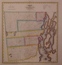
1829réf. 203497New York: DeWitt Simeon 1829. unbound. very good. Rawdon Clark & Co. Map. Copper plate engraving with original hand coloring. Image measures 18.5" x 17". Includes data text description. Fine antique map of Clinton County in northern New York State including part of Lake Champlain. Denotes townships major routes waterways and towns. In very good condition with some wear to corners. David H. Burr 1803-1875 served as Topographer to the United States Post Office and Geographer to the House of Representatives and was widely known for his accuracy and attention to detail. This atlas was among the first to map each of the United States individually. Included is a separate page with statistical information and a historical description of Clinton County. Please visit our Gallery for more Burr New York county maps. DeWitt, Simeon unknown
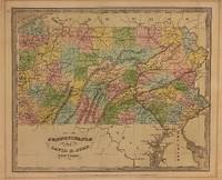
1834réf. 310002New York: Illman and Pilbrow 1834. unbound. Thomas Illman. Map. Engraving with original hand coloring. Image measures 10 1/2" x 12 5/8" Early map of Pennsylvania beautifully hand colored to show county divisions. Cities towns major routes topograhical features islands and waterways are labeled. In very good condition. Mat burn to margins. David H. Burr 1803-1875 served as Topographer to the United States Post Office and Geographer to the House of Representatives and was widely known for his accuracy and attention to detail. His "Universal Atlas" was the first to map each of the United States individually. Illman and Pilbrow unknown
1835réf. 324308New York: Illman & Pilbrow 1835. unbound. Map. Engravings with original hand coloring. 15" x 12 1/4". The first edition of this map features a polar projection of the Southern Hemisphere omitting the entirety of the Antarctic continent. Includes much of South America the southern half of Africa and Oceania - with Australia labeled as "New Holland." Dozens of islands are extensively labeled. The Pacific Ocean is mislabeled as Atlantic. In very good condition. David H. Burr 1803-1875 served as Topographer to the United States Post Office and Geographer to the House of Representatives and was widely known for his accuracy and attention to detail. His "Universal Atlas" was the first to map each of the United States individually. Illman & Pilbrow unknown
1829réf. 203497New York: DeWitt Simeon 1829. unbound. very good. Rawdon Clark & Co. Map. Copper plate engraving with original hand coloring. Image measures 18.5" x 17". Includes data text description. Fine antique map of Clinton County in northern New York State including part of Lake Champlain. Denotes townships major routes waterways and towns. In very good condition with some wear to corners. David H. Burr 1803-1875 served as Topographer to the United States Post Office and Geographer to the House of Representatives and was widely known for his accuracy and attention to detail. This atlas was among the first to map each of the United States individually. Included is a separate page with statistical information and a historical description of Clinton County. Please visit our Gallery for more Burr New York county maps. DeWitt, Simeon unknown books
1834réf. 310002New York: Illman and Pilbrow 1834. unbound. Thomas Illman. Map. Engraving with original hand coloring. Image measures 10 1/2" x 12 5/8" Early map of Pennsylvania beautifully hand colored to show county divisions. Cities towns major routes topograhical features islands and waterways are labeled. In very good condition. Mat burn to margins. David H. Burr 1803-1875 served as Topographer to the United States Post Office and Geographer to the House of Representatives and was widely known for his accuracy and attention to detail. His "Universal Atlas" was the first to map each of the United States individually. Illman and Pilbrow unknown books
1835réf. 324308New York: Illman & Pilbrow 1835. unbound. Map. Engravings with original hand coloring. 15" x 12 1/4". The first edition of this map features a polar projection of the Southern Hemisphere omitting the entirety of the Antarctic continent. Includes much of South America the southern half of Africa and Oceania - with Australia labeled as "New Holland." Dozens of islands are extensively labeled. The Pacific Ocean is mislabeled as Atlantic. In very good condition. David H. Burr 1803-1875 served as Topographer to the United States Post Office and Geographer to the House of Representatives and was widely known for his accuracy and attention to detail. His "Universal Atlas" was the first to map each of the United States individually. Illman & Pilbrow unknown books
réf. biblio730New book Pearson
2011réf. DADAX144197623XSpringer 2011-02-18. 2nd ed. 2011. paperback. New. 8.00x1.50x10.50. Buy with confidence. Excellent Customer Service & Return policy. Springer paperback
réf. BN296207Additive and Polynomial Representations: 1 Foundations of Measurement Additive and Polynomial Representations: 1 Foundations of Measurement Krantz David H. unknown
2022réf. SKU1748563Elsevier 2022-06-07. paperback. New. 7x0x10. New Book Ships with Tracking Elsevier paperback
2022réf. SKU0636338Elsevier 2022-06-07. paperback. New. 7x0x10. New Textbook Ships with Tracking Elsevier paperback
2011réf. __1846314879Liverpool Univ Pr 2011. Hardcover. New. 1st edition. 288 pages. 9.25x6.25x1.00 inches. Liverpool Univ Pr hardcover
réf. 0071844872-11-1McGraw Hill / Medical. 5. Very Good. It's a well-cared-for item that has seen limited use. The item may show minor signs of wear. All the text is legible with all pages included. It may have slight markings and/or highlighting. McGraw Hill / Medical unknown