2980 risultati
rif. 47927615-nnew. unknown
2024rif. SKU0561534McGraw Hill 2024-02-02. loose_leaf. Good. 11x9x0. Textbook May Have Highlights Notes and/or Underlining BOOK ONLY-NO ACCESS CODE NO CD Ships with Tracking McGraw Hill unknown
2024rif. SKU0609041McGraw Hill 2024-02-02. loose_leaf. New. 11x9x0. New Textbook Ships with Tracking McGraw Hill unknown
1992rif. Q-1563470136AIAA American Institute of Aeronautics & Astronautics 1992-01-01. Hardcover. New. In shrink wrap. Looks like an interesting title! AIAA (American Institute of Aeronautics & Astronautics) hardcover
2020rif. x-147446372XEdinburgh Univ Pr 2020. Hardcover. New. 316 pages. 9.25x6.25x0.25 inches. Edinburgh Univ Pr hardcover
rif. 35576120-nnew. unknown
rif. 35576120like new. unknown
2012rif. SKU1753195Routledge 2022-01-28. paperback. New. 7x1x9. New Book Ships with Tracking Routledge paperback
2012rif. SKU0644399Routledge 2022-01-28. paperback. New. 7x1x9. New Textbook Ships with Tracking Routledge paperback
rif. 42813548-nnew. unknown
2021rif. SKU0611845McGraw Hill 2021-02-01. loose_leaf. New. 9x1x10. New Textbook Ships with Tracking McGraw Hill unknown
rif. DADAX1626161429Georgetown University Press 2014-11-01. Second. hardcover. New. 6.00x0.69x9.00. Buy with confidence. Excellent Customer Service & Return policy. Georgetown University Press hardcover
1989rif. 2-0412267004Kluwer Academic Pub 1989. Paperback. New. 1st edition. 272 pages. 9.50x6.50x0.75 inches. Kluwer Academic Pub paperback
rif. 18954466-nnew. unknown
1863rif. 002489London: Lovell Reeve & Co. 1863. First . Hardcover. Good/No Jacket. 12mo - over 6¾" - 7¾. vii 584 with publisher's 16 pp list for 1863; publisher's green cloth gilt titles to spine chocolate eps. A little eadge wear ffep removed and title page foxed in consequence. Translations of Latin and Greek terms used in the Natural Sciences Botany Medicine etc. Owner signature on title margin 12mo - over 6¾" - 7¾ Lovell, Reeve & Co. hardcover
2023rif. x-0231210000Columbia Univ Pr 2023. Hardcover. New. 456 pages. 9.00x6.00x1.42 inches. Columbia Univ Pr hardcover
rif. MASTER240197IOLYMPIA WA.: DAVID H. SCHLOTTMANN. G STAPLED MIMEOGRAPHED PAGES. SOME ISSUES 3-HOLE PUNCHED. Pages: 17 ISSUES. . TRADE PAPERBACK. LIGHTLY WORN A FEW CREASED CORNERS. LIMITED EDITION NEWSLETTERS RELATING TO JACK LONDON. . DAVID H. SCHLOTTMANN paperback
1986rif. 014529Troy New York U.S.A.: Rensselaer Polytechnic Institute School of Architecture 1986. Book. About Fine. Oversized Paperback. Limited Edition. Limited to 1000 copies this is the first issue of this architectural journal. Quite scarce. Rensselaer Polytechnic Institute, School of Architecture Paperback
rif. 0842024204New. hardcover. New. Satisfaction Guaranteed or your money back. hardcover
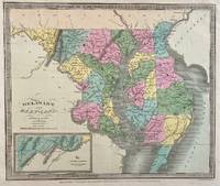
1833rif. 309705New York: Illman and Pilbrow 1833. unbound. Thomas Illman. Map. Engraving with original hand coloring. Image measures 10 1/2" x 12 5/8" Early map of Delaware and Maryland beautifully hand colored to show county divisions. Cities towns major routes topograhical features islands and waterways are labeled. An inset in the lower left shows the Western Part of Maryland. David H. Burr 1803-1875 served as Topographer to the United States Post Office and Geographer to the House of Representatives and was widely known for his accuracy and attention to detail. His "Universal Atlas" was the first to map each of the United States individually. Illman and Pilbrow unknown
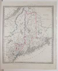
1836rif. M2563New York: Illman Thomas 1836. Excellent. Notes: From David Burr's "A new Universal Atlas comprising Separate Maps of all the Principal Empires Kingdoms & States Throughought the World" 1836 New York. Size : 304x268 mm 12x10.5 Inches Coloring: Original Outline Coloring Category: Maps United States New England States; Illman, Thomas unknown
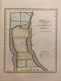
1829rif. 293671New York: David H. Burr 1829. unbound. Rawdon Clark & Co. Map. Copper plate engraving with original hand-coloring. Image measures 11 3/4 x 14 1/2 inches. This map depicts Seneca County in eastern New York divided into 9 towns outlined in vivid color. Seneca Falls is named as is the Cayuga%u2013Seneca Canal. The map denotes major routes waterways and topographical details and icons label villages flouring mills factories forges saw mills and churches. This first edition of Burr's county map appeared in his "Atlas of the State of New York" of the same year which was the second atlas of an individual state ever published. The map is in good condition with light foxing throughout. Full original margins. David H. Burr 1803-1875 served as Topographer to the United States Post Office and Geographer to the House of Representatives and was widely known for his accuracy and attention to detail. His "Universal Atlas" was the first to map each of the United States individually. This map is a lovely rendering of a hard-to-find county in New York State. David H. Burr unknown
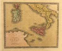
1835rif. 329965New York: Thomas Illman 1835. unbound. Map. Engraving with original hand coloring. Image measures 10 3/8" x 12 5/8" Unusual map of Italy depicting the Kingdom of Naples the islands of Sicily and Sardinia and parts of Corsica. The map extends from the northern coast of Africa to the Papal states. Major cities rivers roads and topographical features are labeled. Topography is depicted by hachure. In good condition with minor staining throughout. David H. Burr 1803-1875 served as Topographer to the United States Post Office and Geographer to the House of Representatives and was widely known for his accuracy and attention to detail. Burr was one of the first cartographers to map each of the United States individually. Thomas Illman unknown
1833rif. 309705New York: Illman and Pilbrow 1833. unbound. Thomas Illman. Map. Engraving with original hand coloring. Image measures 10 1/2" x 12 5/8" Early map of Delaware and Maryland beautifully hand colored to show county divisions. Cities towns major routes topograhical features islands and waterways are labeled. An inset in the lower left shows the Western Part of Maryland. David H. Burr 1803-1875 served as Topographer to the United States Post Office and Geographer to the House of Representatives and was widely known for his accuracy and attention to detail. His "Universal Atlas" was the first to map each of the United States individually. Illman and Pilbrow unknown books
1829rif. 293671New York: David H. Burr 1829. unbound. Rawdon Clark & Co. Map. Copper plate engraving with original hand-coloring. Image measures 11 3/4 x 14 1/2 inches. This map depicts Seneca County in eastern New York divided into 9 towns outlined in vivid color. Seneca Falls is named as is the Cayuga%u2013Seneca Canal. The map denotes major routes waterways and topographical details and icons label villages flouring mills factories forges saw mills and churches. This first edition of Burr's county map appeared in his "Atlas of the State of New York" of the same year which was the second atlas of an individual state ever published. The map is in good condition with light foxing throughout. Full original margins. David H. Burr 1803-1875 served as Topographer to the United States Post Office and Geographer to the House of Representatives and was widely known for his accuracy and attention to detail. His "Universal Atlas" was the first to map each of the United States individually. This map is a lovely rendering of a hard-to-find county in New York State. David H. Burr unknown books