2 980 résultats
1964réf. 6qdvuShuter and Shooter Pty Ltd 1964. Limited . Hardcover. Very Good/No Jacket. Signed. Signed by the author David H. Davies. Limited edition of 250 copies this is No. 135. 1/4 Leather. Publication of 237 pages. There is gilt on the spine of the book. The boards are a little shelf rubbed. There are old tape residue marks on the endpapers. Internally the pages are clean and complete. The binding is excellent. GK. Our orders are shipped using tracked courier delivery services. Shuter and Shooter (Pty) Ltd hardcover
2014réf. x-1138022233Routledge 2014. Hardcover. New. reprint edition. 308 pages. 9.25x6.50x0.75 inches. Routledge hardcover
2012réf. DADAX0367356481Routledge 2020-12-31. 1. hardcover. New. 6.15x0.72x9.21. Buy with confidence. Excellent Customer Service & Return policy. Routledge hardcover
2013réf. DADAX1466556234Routledge 2013-02-26. 1. hardcover. New. 7.25x1.00x10.00. Buy with confidence. Excellent Customer Service & Return policy. Routledge hardcover
réf. 19835993like new. unknown
réf. 19835993-nnew. unknown
réf. 2063538like new. unknown
réf. 2448649-nnew. unknown
réf. 29305986-nnew. unknown
réf. 29305986like new. unknown
2003réf. DADAX0471467995Wiley 2003-06-12. 1. hardcover. New. 6.30x0.55x9.55. Buy with confidence. Excellent Customer Service & Return policy. Wiley hardcover
1996réf. Q-0471037060Wiley 1996-11-22. Hardcover. New. In shrink wrap. Looks like an interesting title! Wiley hardcover
1980réf. BN176934Allyn & Bacon 1980. 1980. Softcover. Cognition: Mental Structures and Processes Cognition: Mental Structures and Processes Dodd David H.; White Raymond M. Allyn & Bacon paperback
1987réf. BN530028Naval Institute Press 1987. 1987. U.S. Army Ships and Watercraft of World War II U.S. Army Ships and Watercraft of World War II Grover David H. Naval Institute Press unknown
2010réf. BN176633Society for Industrial and Applied Mathematics SIAM 2010. 2010. Hardcover. Primer on Optimal Control Theory Primer on Optimal Control Theory Jacobson David H Society for Industrial and Applied Mathematics (SIAM) hardcover
1999réf. Q-0847692663Rowman & Littlefield Publishers 1999-03-01. Hardcover. New. New. In shrink wrap. Looks like an interesting title! Rowman & Littlefield Publishers hardcover
réf. SKU1751677Elsevier 2019-04-17. hardcover. New. 9x1x11. New Book Ships with Tracking Elsevier hardcover
réf. SKU1751485Elsevier 2019-04-17. hardcover. New. 9x1x11. New Book Ships with Tracking Elsevier hardcover
2010réf. SKU0618334Lexington Books 2010-12-22. hardcover. New. 6x0x9. New Textbook Ships with Tracking Lexington Books hardcover
2012réf. x-178052708XEmerald Group Pub Ltd 2012. Hardcover. New. 345 pages. 9.00x6.00x1.25 inches. Emerald Group Pub Ltd hardcover
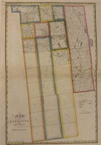
1829réf. 337483New York: David H. Burr 1829. unbound. Rawdon Clark & Co. Map. Copper plate engraving with original hand-colored outline. Image measures 24 1/2" x 16 3/8" This map depicts Franklin County in New York State hand-colored by town. The map denotes major routes rivers and creeks and other topographical details. Franklin County sits entirely within Macomb's Purchase a massive 1791 land transaction where the state sold millions of acres to speculator Alexander Macomb. This purchase was carved into giant sections called Great Tracts. Franklin County encompasses Great Tract No. One which was then was systematically surveyed and subdivided into 27 survey townships containing roughly 32000 acres each. These townships are numbered and outlined. Some of these townships are further subdivided into a grid of smaller numbered parcels meant for sale to individual pioneer farmers. Several of these tracts show their proprietor's names. Most of the townships have yet to be divided at the time of this map's publication. Established villages created prior to the land surveys are labeled and an Indian reservation is depicted in the upper left corner of the county. Flouring mills saw mills manufactories forges and churches are indicated. This first edition of Burr's county map appeared in his "Atlas of the State of New York" of the same year which was the second atlas of an individual state ever published. The map is in very good condition. Some foxing. Full original margins. David H. Burr 1803-1875 served as Topographer to the United States Post Office and Geographer to the House of Representatives and was widely known for his accuracy and attention to detail. His "Universal Atlas" was the first to map each of the United States individually. This map is a lovely rendering of a hard-to-find county in New York State. David H. Burr unknown
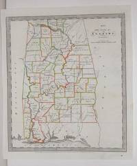
1836réf. M2575New York: Illman Thomas & Pilbrow 1836. Excellent; Some scratching along the left side of the map. Notes: From David Burr's "A new Universal Atlas comprising Separate Maps of all the Principal Empires Kingdoms & States Throughought the World" 1836 New York. Size : 322x285 mm 12.625x11.25 Inches Coloring: Original Outline Coloring Category: Maps United States South States; Illman, Thomas & Pilbrow unknown
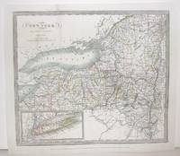
1836réf. M2572New York: Burr David H. 1836. Very Good small tear 1" entering image in the upper left corner professionally repaired. Notes: From David Burr's "A new Universal Atlas comprising Separate Maps of all the Principal Empires Kingdoms & States Throughought the World" 1836 New York. Size : 261x298 mm 10.25x11.75 Inches Coloring: Original Outline Coloring Category: ; Maps United States East New York Burr, David H. unknown
1829réf. 337483New York: David H. Burr 1829. unbound. Rawdon Clark & Co. Map. Copper plate engraving with original hand-colored outline. Image measures 24 1/2" x 16 3/8" This map depicts Franklin County in New York State hand-colored by town. The map denotes major routes rivers and creeks and other topographical details. Franklin County sits entirely within Macomb's Purchase a massive 1791 land transaction where the state sold millions of acres to speculator Alexander Macomb. This purchase was carved into giant sections called Great Tracts. Franklin County encompasses Great Tract No. One which was then was systematically surveyed and subdivided into 27 survey townships containing roughly 32000 acres each. These townships are numbered and outlined. Some of these townships are further subdivided into a grid of smaller numbered parcels meant for sale to individual pioneer farmers. Several of these tracts show their proprietor's names. Most of the townships have yet to be divided at the time of this map's publication. Established villages created prior to the land surveys are labeled and an Indian reservation is depicted in the upper left corner of the county. Flouring mills saw mills manufactories forges and churches are indicated. This first edition of Burr's county map appeared in his "Atlas of the State of New York" of the same year which was the second atlas of an individual state ever published. The map is in very good condition. Some foxing. Full original margins. David H. Burr 1803-1875 served as Topographer to the United States Post Office and Geographer to the House of Representatives and was widely known for his accuracy and attention to detail. His "Universal Atlas" was the first to map each of the United States individually. This map is a lovely rendering of a hard-to-find county in New York State. David H. Burr unknown books
réf. DADAX0894800523Workman Pub Co 0000-00-00. Microcomputer ed. paperback. New. 0.00x0.00x0.00. Buy with confidence. Excellent Customer Service & Return policy. Workman Pub Co paperback