BURR, David HBiblio.com
2.963 resultados
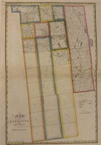
1829ref. 337483New York: David H. Burr 1829. unbound. Rawdon Clark & Co. Map. Copper plate engraving with original hand-colored outline. Image measures 24 1/2" x 16 3/8" This map depicts Franklin County in New York State hand-colored by town. The map denotes major routes rivers and creeks and other topographical details. Franklin County sits entirely within Macomb's Purchase a massive 1791 land transaction where the state sold millions of acres to speculator Alexander Macomb. This purchase was carved into giant sections called Great Tracts. Franklin County encompasses Great Tract No. One which was then was systematically surveyed and subdivided into 27 survey townships containing roughly 32000 acres each. These townships are numbered and outlined. Some of these townships are further subdivided into a grid of smaller numbered parcels meant for sale to individual pioneer farmers. Several of these tracts show their proprietor's names. Most of the townships have yet to be divided at the time of this map's publication. Established villages created prior to the land surveys are labeled and an Indian reservation is depicted in the upper left corner of the county. Flouring mills saw mills manufactories forges and churches are indicated. This first edition of Burr's county map appeared in his "Atlas of the State of New York" of the same year which was the second atlas of an individual state ever published. The map is in very good condition. Some foxing. Full original margins. David H. Burr 1803-1875 served as Topographer to the United States Post Office and Geographer to the House of Representatives and was widely known for his accuracy and attention to detail. His "Universal Atlas" was the first to map each of the United States individually. This map is a lovely rendering of a hard-to-find county in New York State. David H. Burr unknown
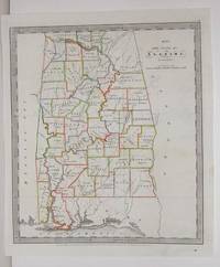
1836ref. M2575New York: Illman Thomas & Pilbrow 1836. Excellent; Some scratching along the left side of the map. Notes: From David Burr's "A new Universal Atlas comprising Separate Maps of all the Principal Empires Kingdoms & States Throughought the World" 1836 New York. Size : 322x285 mm 12.625x11.25 Inches Coloring: Original Outline Coloring Category: Maps United States South States; Illman, Thomas & Pilbrow unknown
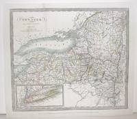
1836ref. M2572New York: Burr David H. 1836. Very Good small tear 1" entering image in the upper left corner professionally repaired. Notes: From David Burr's "A new Universal Atlas comprising Separate Maps of all the Principal Empires Kingdoms & States Throughought the World" 1836 New York. Size : 261x298 mm 10.25x11.75 Inches Coloring: Original Outline Coloring Category: ; Maps United States East New York Burr, David H. unknown
1829ref. 337483New York: David H. Burr 1829. unbound. Rawdon Clark & Co. Map. Copper plate engraving with original hand-colored outline. Image measures 24 1/2" x 16 3/8" This map depicts Franklin County in New York State hand-colored by town. The map denotes major routes rivers and creeks and other topographical details. Franklin County sits entirely within Macomb's Purchase a massive 1791 land transaction where the state sold millions of acres to speculator Alexander Macomb. This purchase was carved into giant sections called Great Tracts. Franklin County encompasses Great Tract No. One which was then was systematically surveyed and subdivided into 27 survey townships containing roughly 32000 acres each. These townships are numbered and outlined. Some of these townships are further subdivided into a grid of smaller numbered parcels meant for sale to individual pioneer farmers. Several of these tracts show their proprietor's names. Most of the townships have yet to be divided at the time of this map's publication. Established villages created prior to the land surveys are labeled and an Indian reservation is depicted in the upper left corner of the county. Flouring mills saw mills manufactories forges and churches are indicated. This first edition of Burr's county map appeared in his "Atlas of the State of New York" of the same year which was the second atlas of an individual state ever published. The map is in very good condition. Some foxing. Full original margins. David H. Burr 1803-1875 served as Topographer to the United States Post Office and Geographer to the House of Representatives and was widely known for his accuracy and attention to detail. His "Universal Atlas" was the first to map each of the United States individually. This map is a lovely rendering of a hard-to-find county in New York State. David H. Burr unknown books
2011ref. SONG1111345511Brand: Cengage Learning 2011-02-07. 6. loose_leaf. Used: Good. 9.00x1.25x11.00. Buy with confidence. Excellent Customer Service & Return policy. Brand: Cengage Learning unknown
ref. 2448649-nnew. unknown
1998ref. DADAX0124176453Academic Press 1998-09-25. 1. hardcover. New. 6.29x1.05x9.25. Buy with confidence. Excellent Customer Service & Return policy. Academic Press hardcover
ref. 34937817-nnew. unknown
ref. 34937817like new. unknown
2000ref. DADAX0521430313Cambridge University Press 2000-04-13. 1. hardcover. New. 6.25x2.00x9.25. Buy with confidence. Excellent Customer Service & Return policy. Cambridge University Press hardcover
2011ref. x-144197623XSpringer Verlag 2011. Paperback. New. 2nd edition. 614 pages. 10.50x8.00x1.50 inches. Springer Verlag paperback
1926ref. 2021Au Sans Pareil, Paris, 1926, in-12 (190x145mm), 88pp., relié 1/ 2 chagrin bleu nuit, dos orné de filets dorés encadrant titre et nom d'auteur (dorés également), tranche supérieure dorée (petit manque à la coiffe supérieure, couverture et dos conservés).
2008ref. __0205474551Allyn & Bacon 2008. Paperback. New. 3rd edition. 464 pages. 9.00x5.50x1.00 inches. Allyn & Bacon paperback
ref. 1671165-nnew. unknown
1996ref. DADAX0582227747Routledge 1996-10-16. 1. paperback. New. 5.43x0.56x8.50. Buy with confidence. Excellent Customer Service & Return policy. Routledge paperback
2012ref. DADAX3642273424Springer 2012-09-14. 2012. hardcover. New. 6.10x1.00x9.20. Buy with confidence. Excellent Customer Service & Return policy. Springer hardcover
ref. NOCT17-9780393913484-348W. W. Norton & Company 2015-01-05. Hardcover. New. 0x0x0. NEW TEXTBOOK SHIPS WITH EMAILED TRACKING FROM USA W. W. Norton & Company hardcover
ref. DADAX1501302744Bloomsbury 2017-04-20. hardcover. New. 6.00x0.75x9.00. Buy with confidence. Excellent Customer Service & Return policy. Bloomsbury hardcover
2016ref. 1-130597171XWadsworth Pub Co 2016. Paperback. New. 5th edition. 302 pages. 9.00x6.25x0.50 inches. Wadsworth Pub Co paperback
ref. 45800705like new. unknown
ref. SKU1751677Elsevier 2019-04-17. hardcover. New. 9x1x11. New Book Ships with Tracking Elsevier hardcover
ref. SKU1751485Elsevier 2019-04-17. hardcover. New. 9x1x11. New Book Ships with Tracking Elsevier hardcover
1999ref. Q-0205180981Pearson 1999-01-25. Paperback. New. New. In shrink wrap. Looks like an interesting title! Pearson paperback
2014ref. x-1138836427Routledge 2014. Hardcover. New. 256 pages. 8.50x5.70x0.80 inches. Routledge hardcover
2019ref. 1-032356688XElsevier Science Health Science 2019. Hardcover. New. 6th har/psc edition. 1365 pages. 11.50x9.00x1.75 inches. Elsevier Science Health Science hardcover