[ALGÉRIE].Livre Rare Book
[Forêts de chênes-liège].
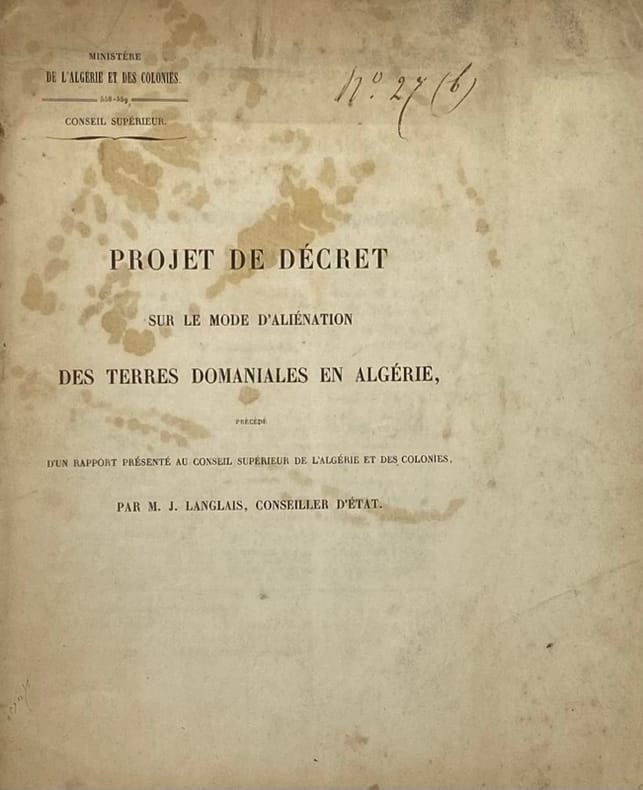
rif. 233598Paris et Constantine, 1859 - 1872 8 pièces in-4 ou in-8, brochées.
Librairie Historique Fabrice Teissèdre · Sauve, Francia300,00 €
2522 risultati
1927Very Good Turkish, Ottoman (1500-1928) Original wrappers. Cr. 8vo. (20 x 14 cm). In Ottoman script (Old Turkish with Arabic letters). 15 p., b/w portrait of Charles Darwin, (1809-1882) on front cover. Taken from a volume including multiple booklets. Minor wear on spine. Small tear on pages' extremities. Slightly faded on pages. Otherwise a good copy. First and only edition of the first Darwin biography in the Ottoman / Turkish world. "Büyük Adamlar Serisi" [i.e. The "Big Men" series], consisting of about 41 small books, all of which were published in 1927, by a delegation under the presidency of the body and some of which were written by him personally, filled an important gap on 'biography' field in its period. This delegation includes Ali Resat, Tezer Agaoglu, Galip Ata Ataç besides Gövsa. This small book is the first and ever biography of Darwin in Ottoman literature. Gövsa was an Ottoman / Turkish writer and poet who is known for his biography and encyclopedia studies. Extremely rare. Özege 3636.; Not in OCLC.
1928Very Good Turkish, Ottoman (1500-1928) Contemporary fine dark green cloth bdg. Art-nouveau decorations embossed on boards. Roy. 8vo. (24 x 17 cm). In Ottoman script. 734, [2], [1] p., index. The Scopes trial (1925) fuelled discussion in the United States on the social and political implications of Darwinism. For the defenders of the 1925 Tennessee law - which prohibited the teaching of Darwinism in schools - Darwinism was, amongst other things, responsible for the German militarism which eventually led to the First World War. This view was supported by Ismail Fennî, a late Ottoman intellectual, who authored this book immediately after the trial which aimed to debunk scientific materialism. In it, he claimed that Darwinism blurred the distinction between man and beast and thus destroyed the foundations of morality. However, despite his anti-Darwinist stance, Ismail Fennî argued against laws forbidding the teaching of Darwinism in schools and emphasized that even false theories contributed to the scientific improvement. Indeed, because of his belief in science, he claimed that Muslims should not reject Darwinism if it were supported by future scientific evidence. It is composed of 7+1 chapters to criticize the materialist and positivist philosophical movements and especially the work of the positivist German philosopher Ludwig Bücher 'Kraft und Stoff'. The first part of the book focuses on the evidence presented of the proof of god in the Western and Islamic philosophies. In the second chapter, the issue of immortality of soul and spirit is addressed. In the third chapter, 'the wahdat al-wujud' (vahdet-i vücûd) current is examined. The fourth chapter, examined some famous scholars' thoughts about the matter, materialism, laws of nature, etc. In the fifth chapter, the work of the positivist German philosopher Büchner 'Kraft und Stoff', in the sixth chapter, monism (monism), in the seventh ch. positivism is criticized. In the last ch., there are descriptions and some thoughts on the theory of evolution and the Indian fakirs (fakers). Ismail Fenni Ertugrul was a Turkish mystic, philosopher, writer, musician, lyricist, and composer. He studied traditional madrasah education and learned Arabic and Persian. He was in various state posts. After the retirement, he began to be interested in poetry, music, and philosophy. Before his death, he donated his library including 9050 books to the Library of Beyazit. (Source: An Ottoman response to Darwinism: Ismail Fennî on Islam and evolution, Bilgili). First and Only Edition. Extremely rare. Özege 11879. Alper 195.
rif. 233598Paris et Constantine, 1859 - 1872 8 pièces in-4 ou in-8, brochées.
1936Very Good Greek, Modern (post 1453) Original b/w city map of Byzantine Constantinople printed in 1936, Noemvrios (November). Oblong: 32x46 cm. In Greek (Modern). Folded. Scale: 1:2000. [GREEK MAP of BYZANTINE CONSTANTINOPLE] Byzantion Konstantinoupolis: To petrion kai ta peristh autou. Khartis topographikos - arkhaiologikos ikpointheis kai katartistheis upo Misn. It show Haliç (The Golden Horn) section and shores of Constantinople.
1922Very Good Arabic Original wrappers. Roy. 8vo. (24 x 17 cm). In Arabic. 50 p., b/w plates. First edition of this rare excerpt book to "Masâlik al-absâr fi mamâlik al- amsâr" by Arab-Mamluk statesman, geographer and historian Shihâb al-Dîn Ah?mad ibn Yahyâ al-'Umarî al-ma'rûf bi-Ibn Fadl Allâh al-Kâtib al-Dimashqî, (1301-1349). "Masâlik al-absâr fi mamâlik al- amsâr" is an account of the Mohammedan kingdoms of the west, excluding Egypt, by Shihâb al-Dîn, who was descended from an old Arab family. The countries described in the book are Abyssinia, Kanem, Nubia, Mali, the Kingdom of the Berber mountains, Ifriqiya, Morocco, and Andalusia. This rare pamphlet includes North Africa (Maghreb) and Andalusia sections of Shihâb al-Dîn's book with a commentary by Al-Wahhâb. Al-Wahhâb was a polygraph and scholar born into a family of dignitaries and high officials of the Tunisian state. OCLC 78694883, 235966687, 863484408.
1915Very Good Italian Original leaflet printed for Italian students. 20,5 x 14,5 cm. (Open size: 20,5 x 28 cm). In Italian. Two illustrations from Borghi's illustrations. Includes inside 'Orario settimanale delle lezioni' [i.e. Weekly timetable of lessons] and 'Tavola Pitagorica' [i.e. Pythagorean table]. A transparent tape on folded place. Unused. Written nothing on the section of 'Quaderno di...'. [ITALIAN PROPAGANDA / TRIPOLI / PAPER] Print leaflet for students: Guerra Italo-Turca. [i.e. Italian-Turkish War in Tripoli]. Guerra Italo-Turca: Piccola battaglia nell'oasi di Tripoli fra una pattuglia del 84 fanteria ed un'orda di arabi.
1913Very Good Turkish, Ottoman (1500-1928) Original color map on cloth. Folded. Wrinkled on paper. Stains on cloth. 12 sheets on paper. Oblong atlas folio. (50 x 60 cm). In Ottoman script.[MAP of ALEXANDRETTA] Iskenderun - Tayakadin. It shows villages and settlements in Tayakadin of Iskenderiye. Scale: 1/25.000. Hegira: 1329 = Gregorian: 1913. This is one the serie of the Bonn projection maps which are the first map series in modern techniques in Turkey and the Ottoman Empire. In order to produce these maps covering Turkish territory, Reconnaissance Branch was incorporated into The Mapping Commission. The maps were produced in the datum based on the latitude and longitude of Ayasofya Mosque in equal area Bonn Projection. The field works for the 123 sheets covering the country were conducted by 76 staff. The production was completed in 18 years starting from east west. Field works continued without stopping except in years 1914 and 1920. This map series called also reconnaissance maps contributed a lot to producing 1:25.000 scale maps. Not description on map-maker. A very detailed map. Extremely rare.
1917Very Good Turkish, Ottoman (1500-1928) Original color map. Folded. Oblong atlas folio. (50 x 60 cm). In Ottoman script. Shows Southeastern parts of Asia Minor and Syria; Siverek, Sard (Iraq) and Ras Al-Ayn (Rasulayn - Resualyn) in Syria. Hegira: 1333 = Gregorian: 1917. Not description on map-maker. Scale: 1: 200.000. This is one the serie of the Bonn projection maps which are the first map series in modern techniques in Turkey and the Ottoman Empire. In order to produce these maps covering Turkish territory, Reconnaissance Branch was incorporated into The Mapping Commission. The maps were produced in the datum based on the latitude and longitude of Ayasofya Mosque in equal area Bonn Projection. The field works for the 123 sheets covering the country were conducted by 76 staff. The production was completed in 18 years starting from east west. Field works continued without stopping except in years 1914 and 1920. This map series called also reconnaissance maps contributed a lot to producing 1:25.000 scale maps. According to Türkezer & Çobanoglu: History of Mapping in Turkey-1:200.000 Scale Maps, last cartographer of Diyarbakir regio is M. Sait Malatyali. No his biographic material and info in 'Savaslarda Haritacilar'. Rare.
1909Very Good Turkish, Ottoman (1500-1928) Extremely rare huge chromo-lithograph map in 24 sheets mounted on canvas, showing a large zone including Midyat (Mardin), Mosul, Mt. Cilo (Resko-Buzul) on the southeast; Kahta (Adiyaman), Munzur Mt., Divrigi (Sivas) on the west; the Black Sea on north and Turkish borders to Armenia, Azerbaijan on the east, and to Russia on the northeast. In addition shows in separate little portions, roads, mountains and hills, lakes, and telegraph and post ways and borders in that zone. Not in any libraries and any collection. An attractive map with its huge size and decorative surface. Several toponyms are underlined in red ink. Otherwise a very good example. Original folded map mounted on canvas. 118x112 cm. In Ottoman script (Turkish with Arabic letters). Scale: 1/630.000.
1917Very Good Turkish, Ottoman (1500-1928) Original color map. Folded. Oblong atlas folio. (50 x 60 cm). In Ottoman script. Shows Eastern and Southeastern parts of Anatolia; Maras, Elbistan, Birecik and Kilis areas. Hegira: 1333 = Gregorian: 1917. Not description on map-maker.
1916Very Good Turkish, Ottoman (1500-1928) Original color map. Folded. Oblong atlas folio. (50 x 60 cm). In Ottoman script. [MAP of EAST ANATOLIA and ARTVIN] Oltu, Artvin, Ispir, Hasankale. Shows Artvin, Ispir, Hasankale and Kars city. Scale: 1/200.000. This is one the serie of the Bonn projection maps which are the first map series in modern techniques in Turkey and the Ottoman Empire. In order to produce these maps covering Turkish territory, Reconnaissance Branch was incorporated into The Mapping Commission. The maps were produced in the datum based on the latitude and longitude of Ayasofya Mosque in equal area Bonn Projection. The field works for the 123 sheets covering the country were conducted by 76 staff. The production was completed in 18 years starting from east west. Field works continued without stopping except in years 1914 and 1920. This map series called also reconnaissance maps contributed a lot to producing 1:25.000 scale maps. Hegira: 1332 = Gregorian: 1916. Not description on map-maker.
1914Very Good Turkish, Ottoman (1500-1928) Original color map. Folded. Oblong atlas folio. (50 x 60 cm). In Ottoman script. [MAP of EAST ANATOLIA] Hozat, Dersim. Shows Eastern parts of Anatolia; Dersim-Horat and border of Erzincan city; Divrigi; Harput (Kharpout); Kilis; and Munzur Mountains, et alli. Scale: 1/200.000. Hegira: 1330 = Gregorian: 1914. Not description on map-maker.
1916Very Good Turkish, Ottoman (1500-1928) Original color map. Folded. Oblong atlas folio. (50 x 60 cm). In Ottoman script. [MAP of EAST ANATOLIA] Malatya - Divrigi, Mancinik, Adiyaman, Harput. Shows Malatya, Adiyaman and Kharpout region; Firat River (Euphrates), Yazi Düzü, Erguvan etc. Scale: 1/200.000. This is one the serie of the Bonn projection maps which are the first map series in modern techniques in Turkey and the Ottoman Empire. In order to produce these maps covering Turkish territory, Reconnaissance Branch was incorporated into The Mapping Commission. The maps were produced in the datum based on the latitude and longitude of Ayasofya Mosque in equal area Bonn Projection. The field works for the 123 sheets covering the country were conducted by 76 staff. The production was completed in 18 years starting from east west. Field works continued without stopping except in years 1914 and 1920. This map series called also reconnaissance maps contributed a lot to producing 1:25.000 scale maps. Hegira: 1332 = Gregorian: 1916. Not description on map-maker. According to Türkezer & Çobanoglu: History of Mapping in Turkey-1:200.000 Scale Maps, cartographer of this map is Kambay, Cemal.
1917Very Good Turkish, Ottoman (1500-1928) Original color map. Folded. Oblong atlas folio. (50 x 60 cm). In Ottoman script. Shows Eastern parts of Anatolia; Siverek, Urfa city and border of Diyarbakir and Adiyaman cities; Siverek; Harput (Kharpout); et alli. Scale: 1/200.000. Hegira: 1333 = Gregorian: 1917. Not description on map-maker. This is one the serie of the Bonn projection maps which are the first map series in modern techniques in Turkey and the Ottoman Empire. This is one the serie of the Bonn projection maps which are the first map series in modern techniques in Turkey and the Ottoman Empire. In order to produce these maps covering Turkish territory, Reconnaissance Branch was incorporated into The Mapping Commission. The maps were produced in the datum based on the latitude and longitude of Ayasofya Mosque in equal area Bonn Projection. The field works for the 123 sheets covering the country were conducted by 76 staff. The production was completed in 18 years starting from east west. Field works continued without stopping except in years 1914 and 1920. This map series called also reconnaissance maps contributed a lot to producing 1:25.000 scale maps. Subasi is cartographer of this map according to Türkezer - Cobanoglu: History of Mapping in Turkey-1:200.000 Scale Maps.
1914Good Turkish, Ottoman (1500-1928) Original color map. Folded. Tears in margins. Slightly stained. Otherwise a good copy. Oblong atlas folio. (50 x 60 cm). In Ottoman script. [MAP of EAST BLACK SEA] Artvin, Rize, Oltu. Shows Artvin and Georgian borders, Rize (Rizeon - Rizunda - Rizini) and Oltu cities and regions. Scale: 1/200.000. Hegira: 1330 = Gregorian: 1914. This is one the serie of the Bonn projection maps which are the first map series in modern techniques in Turkey and the Ottoman Empire. In order to produce these maps covering Turkish territory, Reconnaissance Branch was incorporated into The Mapping Commission. The maps were produced in the datum based on the latitude and longitude of Ayasofya Mosque in equal area Bonn Projection. The field works for the 123 sheets covering the country were conducted by 76 staff. The production was completed in 18 years starting from east west. Field works continued without stopping except in years 1914 and 1920. This map series called also reconnaissance maps contributed a lot to producing 1:25.000 scale maps. Not description on map-maker. Extremely rare.
1920Very Good Turkish, Ottoman (1500-1928) Original color map. Folded. Oblong atlas folio. (50 x 60 cm). In Ottoman script. [MAP of EAST BLACK SEA] Trabzon, Giresun, Erzincan, Ispir. Shows Trebizond, Cerasonte, Erzingan (Eriza), Suspiritis (Sper) of Erzurum (Erzeron city); mostly Black Sea shores of Trabzon and Giresun. . Scale: 1/200.000. This is one the serie of the Bonn projection maps which are the first map series in modern techniques in Turkey and the Ottoman Empire. In order to produce these maps covering Turkish territory, Reconnaissance Branch was incorporated into The Mapping Commission. The maps were produced in the datum based on the latitude and longitude of Ayasofya Mosque in equal area Bonn Projection. The field works for the 123 sheets covering the country were conducted by 76 staff. The production was completed in 18 years starting from east west. Field works continued without stopping except in years 1914 and 1920. This map series called also reconnaissance maps contributed a lot to producing 1:25.000 scale maps. Hegira: 1336 = Gregorian: 1920. Not description on map-maker. Extremely rare.
1926Very Good Turkish, Ottoman (1500-1928) Original color map on cloth. Folded. Oblong atlas folio. (50 x 60 cm). In Ottoman script. Shows Konya city and around, Alaiye at south. Not description on map-maker. Scale: 1: 200.000. This is one the serie of the Bonn projection maps which are the first map series in modern techniques in Turkey and the Ottoman Empire. In order to produce these maps covering Turkish territory, Reconnaissance Branch was incorporated into The Mapping Commission. The maps were produced in the datum based on the latitude and longitude of Ayasofya Mosque in equal area Bonn Projection. The field works for the 123 sheets covering the country were conducted by 76 staff. The production was completed in 18 years starting from east west. Field works continued without stopping except in years 1914 and 1920. This map series called also reconnaissance maps contributed a lot to producing 1:25.000 scale maps. Rare.
1912Very Good Turkish, Ottoman (1500-1928) Original color map on cloth. Folded. Oblong atlas folio. (50 x 60 cm). In Ottoman script. [MAP of MAGNESIA - AEGEAN REGION] Manisa - Soma, Izmir, Aydin cities (Magnesia, Smyrna and Tralleis) in Aegean region. It shows villages and settlements in Tayakadin of Iskenderiye. Scale: 1/25.000. Hegira: 1328 = Gregorian: 1912. This is one the serie of the Bonn projection maps which are the first map series in modern techniques in Turkey and the Ottoman Empire. In order to produce these maps covering Turkish territory, Reconnaissance Branch was incorporated into The Mapping Commission. The maps were produced in the datum based on the latitude and longitude of Ayasofya Mosque in equal area Bonn Projection. The field works for the 123 sheets covering the country were conducted by 76 staff. The production was completed in 18 years starting from east west. Field works continued without stopping except in years 1914 and 1920. This map series called also reconnaissance maps contributed a lot to producing 1:25.000 scale maps. Not description on map-maker. A very detailed map showing lakes, rivers and mountains. Extremely rare.
1730Very Good Turkish, Ottoman (1500-1928) Original b/w map from Kitab-i Cihannuma which is one of the most important Turkish incunabula. Oblong large 4to. (31 x 37 cm). In Ottoman script. It shows Venice and Venetian Bay and Algerian shores at North Africa (Maghrib). Toponyms are in Turkish with Arabic letters. Written directions (Simal, Cenûb, Sark and Garb) on corners of the map, and decorative compass on Mediterranean Sea. Scale can be seen at left upper side (El-mikyas: Mil-i Islâmiyân Mil-i Frençe, and Mil-i Italiya]. It's one of the thirteen maps and plates from the book of Cihannuma. The story of Cihannuma can be considered as an effort to keep up with the speed that knowledge spread around the world at a time when literacy was highly limited. Kâtip Çelebi began to rewrite Cihannuma in 1654. During the next six years, he added to his books the knowledge he gained from the books he read. Kâtip Çelebi was vastly influenced by nonreligious positive knowledge, especially by the Atlas and later the Atlas Minor of Gerardus Mercator. He had the book translated from Latin to Turkish by a French recruit andenriched his own book with the new information. He brought together in Cihannuma the knowledge of geography and astronomy existing in Western sources (1654). Cihannüma has 13 charts and 27 maps. Mercator's maps are distinguished by their distinct properties. However, there are such maps which depict Istanbul, Anatolia, the Caucasus and the Orient that have to have been borrowed from other sources and there are those with relatively less detail that might have been prepared by Muslim geographers. Sources cite Ahmed El Kirimî (Ahmed the Crimean) and Galatali Migirdich as mapmakers for Cihannüma. Their names are placed on the maps. Another name that is mentioned is Tophaneli Ibrahim. Researchers agree on the fact that he is Ibrahim Müteferrika. Perhaps he wished to hasten the printing of the book. Perhaps he enjoyed making this contribution to a book he half owned. There is one map in Cihannüma which definitely does not belong to Mercator. Nor is there any information that it was originally charted by Müteferrika's team. Historians state that the 'invertedness' can be found in other maps made by Muslim cartographers. Since it is amap of Turkey, the difference can easily be perceived. The Mediterranean coasts of Turkey are at the top of the map while the Black Sea coasts are at the bottom. The compass on the map correctly indicates the North. The map seems to be inverted but it is not considered scientifically wrong to draw maps in this fashion...". (Source: Boyut; Kitab-i Cihannuma). Extremely rare.
1920Very Good Turkish, Ottoman (1500-1928) Original color map of Erzurum city center and it environment. Folded. 69x42,5 cm. In Ottoman script. One sheet. Shows center of Erzurum city and topography environment. No scale info. Hegira: 1336 = Gregorian: 1920. Not description on map-maker. This is one the serie of the Bonn projection maps which are the first map series in modern techniques in Turkey and the Ottoman Empire. In order to produce these maps covering Turkish territory, Reconnaissance Branch was incorporated into The Mapping Commission. The maps were produced in the datum based on the latitude and longitude of Ayasofya Mosque in equal area Bonn Projection. The field works for the 123 sheets covering the country were conducted by 76 staff. The production was completed in 18 years starting from east west. Field works continued without stopping except in years 1914 and 1920. This map series called also reconnaissance maps contributed a lot to producing 1:25.000 scale maps. Extremely rare.
1910Very Good Turkish, Ottoman (1500-1928) Original illustrated wrappers. Cr. 8vo. (20 x 13 cm). In Ottoman script (Old Turkish with Arabic letters). 220, [2] p., 41 unnumbered plates (incl. 68 b/w photos), and 3 maps. Pages are partly untrimmed and uncut. Slight stains on cover and wear at spine. Overall a good copy. Roumi: 1326 = Hegira: 1327 = Gregorian: 1910. First and only edition of this extremely rare book, including a historically significant eyewitness account of Cami Baykurt, who was an Ottoman officer during the Tripoli War (1911-1912), describing the flora, and the fauna in the Sahara desert and around Libya; the Bedouins and their customs with their social life, their culinary culture and their special drinks in his book during his travels to the south of Libya, to the Fezzan region, to participate in the Ottoman military operations at the fortress of Ghat, serving as a commander and governor. This book was prepared to present Tripoli, located in the Libyan lands today, Fezzan in the south, and the desert roads in between to the Ottoman court as well as the intelligentsia. Baykurt was a Turkish politician and soldier who served as deputy of the first period of the Turkish Republican Parliament. He was the first minister of Turkish foreign affairs in the Republican period. He had participated as an officer in the Battle of Tripoli back in the day. The provinces of Tripoli and Fezzan were accepted as destinations of exile in the last period of the Ottoman Empire. The province of Tripoli, the last center of a few Ottoman sanjaks, had been the granary of ancient Rome in the past with its large villages. Özege 21177.; Kursun p. 294.; Not in ATYB I (Askeri Tarih Yayinlari Bibliyografyasi).; OCLC 165148162 (with some misread and misspelled words; Kursun mentioned in his bibliography those misread words, especially 'Kazan mebusu -deputy of Kazan- instead of a deputy of Fizan about his title in some catalogs like OCLC. Kursun has a short but useful biography of Câmî).
Very Good Turkish, Ottoman (1500-1928) Original b/w city map of Byzantine Constantinople printed in ??? by Tüccarzâde Ibrahim Hilmi Çigiraçan, (1876-1963). Oblong: 37x50 cm. In Ottoman script. Folded. Scale is not described. Toponyms are Turkish besides some of old Byzantine. [OTTOMAN MAP of BYZANTINE CONSTANTINOPLE] Kurun-u vustâ inhâsinda Kostantiniyye. Doktor Moritma'nin tetkikâtina göre kable'l-feth-i sehrin plâni. Feth-i Kostantiniyye asârina aiddir. Published by Ibrahim Hilmi. Ibrahim Hilmi Çigiraçan was a Turkish publisher and author. He is one of the first Turkish publishers of the Ottoman Empire. He published more than 1000 books on history, literature, politics, religion and social issues and maps in the printing house he founded in 1896.
1914Very Good Turkish, Ottoman (1500-1928) Original color map of Eastern Anatolia, Dogu Beyazit, Bayazid, Bargiri, Nakhchevan, Karakilise, Van, etc. 50x60 cm. In Ottoman script (Enverî). 1 p. Scale: 1:200.000. Slightly toned, several small holes on paper. Otherwise a very good copy. Enverî script is the war minister Enver Pasha's alphabet and writing amendment, which he tried to implement within the Ministry of War between 12 March 1914 and 10 August 1914. Starting from the Tanzimat (Westernization) period in the Ottoman Empire, the discussions on simplification in language, writing, alphabet and reading-writing had increased and at the end of the 19th century, military necessities also became one of the concerns. The problems such as the low rate of literacy among the recruited soldiers, the need to teach the soldiers how to read and write in a short time, and their misconceptions about the spelling of proper nouns led Enver Pasha to add the writing problem to his reform agenda, once he took office. Enver Pasha's reform is based on the principle of writing the Ottoman letters, which take different forms in the beginning, in the middle and at the end according to their unification with the other letters, separately in their original state without merging them. While this new alphabet was being created, the existing 32 letters in the Ottoman were preserved. The 8 vowels in the Turkish language, which could not be written with the old letters, was shown by placing small marks on the existing vowels and by doing so a new alphabet consisting of a total of 40 letters was created. With this alphabet, officially called 'Ordu Elifbasi', rules were adopted such as writing of the letters without merging them, writing the words as they are pronounced. At first glance, Enver Pasha's writing reform, which appeared as a definite solution to the theory of the solution of the ongoing debates on the alphabet and the spelling, formed a wide experiment field in the military. It was not possible to use Ordu Elifbasi, which essentially is a transliteration alphabet that allows transferring the sounds of these three different languages (Turkish, Arabic, Persian) to a single alphabet, in the daily life. Thanks to this new alphabet and spelling, learning to read and write were accelerated to some extent. However, it was seen that the literacy rate of the well-educated, literate people fell to the spelling and did not even progress. This alphabet and spelling reform, which Enver Pasha thought of spreading to the whole country, caused much more problems as it was experienced in the army. Although it was postponed until the end of the mobilization period following the declaration of the mobilization, Ordu Elifbasi, which remained in force for 152 days, eventually failed to be realized. (Source: Karakus: Enver Pasha's Alphabet And Spelling Attempt: Ordu Elifbasi (Army Alphabet)).In this extremely rare document, there are some articles and thoughts on a case. This is one the serie of the Bonn projection maps which are the first map series in modern techniques in Turkey and the Ottoman Empire. In order to produce these maps covering Turkish territory, Reconnaissance Branch was incorporated into The Mapping Commission. The maps were produced in the datum based on the latitude and longitude of Ayasofya Mosque in equal area Bonn Projection. The field works for the 123 sheets covering the country were conducted by 76 staff. The production was completed in 18 years starting from east west. Field works continued without stopping except in years 1914 and 1920. This map series called also reconnaissance maps contributed a lot to producing 1:25.000 scale maps. Extremely rare. KW: "Harfleri Islah Cemiyeti" Hurûf-i munfasila Reform Turkish Letter revolution First World War WW 1 Map Geography Military maps.
1916Very Good Turkish, Ottoman (1500-1928) Original color map. Folded. Oblong atlas folio. (50 x 60 cm). In Ottoman script. Shows Rhodes and Tilos Islands. Scale: 1/200.000. Hegira: 1332 = Gregorian: 1916. Not description on map-maker. This is one of the series of the Bonn projection maps which are the first map series in modern techniques in Turkey and the Ottoman Empire. This is one of the series of the Bonn projection maps which are the first map series in modern techniques in Turkey and the Ottoman Empire. In order to produce these maps covering Turkish territory, Reconnaissance Branch was incorporated into The Mapping Commission. The maps were produced in the datum based on the latitude and longitude of Ayasofya Mosque in an equal area Bonn Projection. The field works for the 123 sheets covering the country were conducted by 76 staff. The production was completed in 18 years starting from east-west. Fieldworks continued without stopping except in the years 1914 and 1920. This map series called also reconnaissance maps contributed a lot to producing 1:25.000 scale maps. A very detailed and attractive map of Rhodes Island showing its harbors and Ottoman place names.
1911Very Good Turkish, Ottoman (1500-1928) Original color postcard shows Tripoli War in 1911 and Arabic / Libyan tribes organized by Ottoman Turks and Italian soldiers. Can be seen Turkish / Ottoman flags. 9x14 cm. In Ottoman script and French on verso. Some traces of folding. Otherwise a good copy. [OTTOMAN PROPAGANDA / TRIPOLI / POSTCARD] Osmanlilar ile Italyanlar Trabluss muharebesinde. [i.e. Tripoli War with the Ottoman Turks and Italians]. La guerre Turco-Italienne - La bataille de Taraboulous.