VERDUN DE LA CRENNE (JEAN-RENE DE. 1741-1805).Livre Rare Book

929 resultados
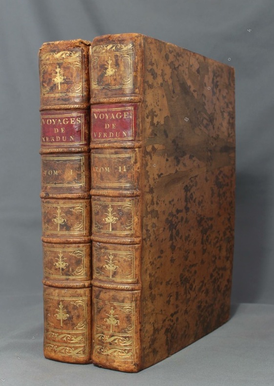
1778ref. 3127A PARIS. DE L'IMPRIMERIE ROYALE. 1778. 2 VOLUMES IN-4 (20,5 X 25,5 X 11 CENTIMETRES ENVIRON) DE (4) + 389 + XIX + (2) ET (6) + 500 + XXXI + (1) PAGES, RELIURE D'EPOQUE PLEIN VEAU MARBRE, DOS LISSE ORNE DE CAISSONS A FLEURONS DORES, TITRE DORE SUR ETIQUETTE MAROQUIN ROUGE, TRANCHES ROUGES. PREMIER TOME ILLUSTRE DE 28 PLANCHES GRAVEES HORS TEXTE, LA PLUPART REPLIEES. LE SECOND TOME A ETE RELIE D'ORIGINE SANS SES 3 CARTES REPLIEES. EDITION ORIGINALE. (POLAK. 939898). QUELQUES DEFAUTS EXTERIEURS, SINON BON EXEMPLAIRE. PRIX ETABLI EN FONCTION DU MANQUE SIGNALE.
1778ref. 56629Paris L'Imprimerie Royale 1778. 4to. 2 contemp. Full mottled calf. Raised bands. Richly gilt spines. Titlelabels with gilt lettering. Volume one rebacked preserving nearly all of original spines and endpapers renewed. Neath repairs to edges. Stamp on title-pages. 4389XIX3;6500XXX2 pp. 28 mostly folded engraved plates and 3 large folded engraved maps. The maps strenghtened in foldings on verso and slightly brownspotted. Wide-margined. A few scattered brownspots. First edition. In the years 1771-1772 the French government sent a scientific expedition led by Verdun de la Crenne to the North Atlantic. Their commission was to explore the ocean coasts and islands and correct errors on existing charts and test various ways of measuring latitude and longitude. One of the most significant corrections they made was in the location of Iceland; based on their measurements they moved the country three and a half degrees eastwards. It comprises the large sea chart of the northern Atlantic 58 x 88 cm. which is centered roughly on Iceland. It covers from Labrador Newfoundland and Baffin Island Ile James to Norway and includes Greenland Great Britain Denmark and part of the coast France inland to Paris.Sabin 98960. hardcover
1778ref. 56629Paris, L'Imprimerie Royale, 1778. 4to. 2 contemp. Full mottled calf. Raised bands. Richly gilt spines. Titlelabels with gilt lettering. Volume one rebacked, preserving nearly all of original spines and endpapers renewed. Neath repairs to edges. Stamp on title-pages. (4),389,XIX,(3)(6),500,XXX,(2) pp., 28 mostly folded engraved plates and 3 large folded engraved maps. The maps strenghtened in foldings on verso and slightly brownspotted. Wide-margined. A few scattered brownspots.
1778ref. 8670Paris, de l'Imprimerie Royale, 1778. 2 volumes in-4 de [4]-389-[1]-XIX-[3]; [8]-500-XXXII pages, plein veau marbré brun, dos à nerfs ornés de filets et fleurons dorés, pièces de titre en maroquin rouge, tranches mouchetées, petits accrocs aux coiffes supérieures, épidermures, coupes et coins frottés, tampon sur les pages de titre, quelques pâles rousseurs.