15 778 résultats
1870réf. 5448York PA: E J Evans ca. 1870. Edition Unknown. As issued - cover title. Fine. 4to 4 pp. one leaf insert on yellow paper printed recto only. The catalog is not illustrated. A handsome closely printed nursery catalog with a single sheet laid in insert printed on yellow paper listing small fruits including at least 25 grape varieties and flowering bulbs. The 4 page catalog lists vegetables. Unlocated. E J Evans unknown books
1801réf. 10389Dentu Paris An IX (1801) 1 vol. Fort in-8 broché de VIII 490 pp., couverture muette de l'époque, pièce de titre papier.
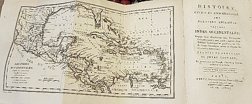
1794réf. PHO-1886John Stockdale, Londres, 1794-1801, 3 volumes in-4 (275 X 225 mm), reliés plein veau marbré époque (restauration ancienne), pièce de titre rouge et de tomaison vert. Tome I, liv-494 pp., Tome II 520 pp, Tome III (1801) xix 443 pp., illustré de 3 frontispices, 11 cartes dont une en double feuille et dépliante (720 X 620) (cartes des Indes occidentales), 2 dépliantes Saint Domingo (250 X 225) et Jamaïque et 8 planches h.t., ex-libris en page de garde, déchirures aux pliures et brunissures en marge de la grande carte, frottements, griffures, pièces de titre et tomaison avec petits manques, quelques brunissures sur les titres et quelques feuillets.
réf. 10960Scroll 385 x 8560 mm. with fine colored paintings using brush ink & various colors of wash of the route and major features along the way. Japan: mid-Edo. The route from Edo today’s Tokyo to Nagasaki and vice versa by land and by sea was one of the major thoroughfares and trade routes of Edo-period Japan. The Dutch and Chinese had been allowed to establish exclusive trading outposts in Nagasaki and Edo was the heart of domestic commerce and administration. Foreign goods especially silks other luxury items raw materials useful to the military and medicinal goods flowed through Nagasaki to Edo and the rest of Japan while Japanese goods including copper silver and porcelain were transported to Nagasaki for export. Most of the silver was sent to China to settle the trade balance. From the late 1670s to the 1740s Japan was the world’s largest copper producer and exporter. This route also carried the head of Nagasaki’s Dejima trading post to Edo for frequent mandatory ceremonial audiences with the shogun. The beginning of our scroll depicts the land route from Edo to Kyoto and then on to Osaka. The famous battleship Atake Maru is seen docked at the mouth of the Sumida River. Starting from Edo Castle in the great capital the scroll proceeds to Nagoya and Kyoto along the TÅkaidÅ road which was the most important highway of the Edo period. It depicts in great detail and with manuscript labels: stations on the route; bridges; major castles temples and shrines; the palace at Kyoto; other notable buildings; important geographical features including Mount Fuji partly shrouded in clouds; and towns and villages along the way. Distances are given and travellers are well-depicted showing their various clothing. Also shown are ships and skiffs in the nearby sea. We see more landmarks along the TÅkaidÅ road from Kyoto to the commercial hub and port city of Osaka an extension built in the 1620s. Arriving at Osaka we view the great castle the city’s canals and other sites. The rest of the scroll shows the hazardous passage from Osaka to Nagasaki through the 400 km. long Inland Sea Seto Naikai. The accomplished artist depicts the two main routes and alternate routes depending on the weather one for summertime in the open sea and the other hugging the coast for wintertime. Another route is shown that involved landing in the Bungo area of Kyūshū island and crossing overland to Nagasaki. Navigating through the Inland Sea with its 3000 plus islands and rocky outcroppings presented enormous problems in the era before modern navigation systems. Shown in very great detail are areas of turbulence including famous whirlpools numerous islands rock formations landscapes for orientation anchorages harbors along the way and fishing areas. The route then passes through the narrow Kanmon Strait the stretch of water separating the main island of Honshu and Kyūshū to the Sea of Japan finally arriving in Nagasaki. Dejima is prominently shown. A foreign ship is shown passing the GotÅ islands making its way to Nagasaki. Our scroll is finely drawn in black ink and heightened with wash in green blue gray pink and red. The routes are drawn from a partial “bird’s-eye” perspective with lovely vistas of mountains and islands and villages and towns. In fine condition preserved in an oldish wooden box which has the inscription on the outside of the lid 江戸長崎海陸é“ä¸çµµå›³ “From Edo to Nagasaki Travel by Land and by Sea Illustrated”. Inside this lid is the ownership inscription of RyÅra Gakuto. unknown books
réf. 10960Scroll 385 x 8560 mm. with fine colored paintings using brush ink & various colors of wash of the route and major features along the way. Japan: mid-Edo. The route from Edo today’s Tokyo to Nagasaki and vice versa by land and by sea was one of the major thoroughfares and trade routes of Edo-period Japan. The Dutch and Chinese had been allowed to establish exclusive trading outposts in Nagasaki and Edo was the heart of domestic commerce and administration. Foreign goods especially silks other luxury items raw materials useful to the military and medicinal goods flowed through Nagasaki to Edo and the rest of Japan while Japanese goods including copper silver and porcelain were transported to Nagasaki for export. Most of the silver was sent to China to settle the trade balance. From the late 1670s to the 1740s Japan was the world’s largest copper producer and exporter. This route also carried the head of Nagasaki’s Dejima trading post to Edo for frequent mandatory ceremonial audiences with the shogun. The beginning of our scroll depicts the land route from Edo to Kyoto and then on to Osaka. The famous battleship Atake Maru is seen docked at the mouth of the Sumida River. Starting from Edo Castle in the great capital the scroll proceeds to Nagoya and Kyoto along the TÅkaidÅ road which was the most important highway of the Edo period. It depicts in great detail and with manuscript labels: stations on the route; bridges; major castles temples and shrines; the palace at Kyoto; other notable buildings; important geographical features including Mount Fuji partly shrouded in clouds; and towns and villages along the way. Distances are given and travellers are well-depicted showing their various clothing. Also shown are ships and skiffs in the nearby sea. We see more landmarks along the TÅkaidÅ road from Kyoto to the commercial hub and port city of Osaka an extension built in the 1620s. Arriving at Osaka we view the great castle the city’s canals and other sites. The rest of the scroll shows the hazardous passage from Osaka to Nagasaki through the 400 km. long Inland Sea Seto Naikai. The accomplished artist depicts the two main routes and alternate routes depending on the weather one for summertime in the open sea and the other hugging the coast for wintertime. Another route is shown that involved landing in the Bungo area of Kyūshū island and crossing overland to Nagasaki. Navigating through the Inland Sea with its 3000 plus islands and rocky outcroppings presented enormous problems in the era before modern navigation systems. Shown in very great detail are areas of turbulence including famous whirlpools numerous islands rock formations landscapes for orientation anchorages harbors along the way and fishing areas. The route then passes through the narrow Kanmon Strait the stretch of water separating the main island of Honshu and Kyūshū to the Sea of Japan finally arriving in Nagasaki. Dejima is prominently shown. A foreign ship is shown passing the GotÅ islands making its way to Nagasaki. Our scroll is finely drawn in black ink and heightened with wash in green blue gray pink and red. The routes are drawn from a partial “bird’s-eye” perspective with lovely vistas of mountains and islands and villages and towns. In fine condition preserved in an oldish wooden box which has the inscription on the outside of the lid 江戸長崎海陸é“ä¸çµµå›³ “From Edo to Nagasaki Travel by Land and by Sea Illustrated”. Inside this lid is the ownership inscription of RyÅra Gakuto. unknown
1973réf. 8349Édouard Privat Éditeur 1973 512 pages in8. 1973. Reliure Editeur avec jaquette. 512 pages. Ouvrage historique de référence sur la ville de Marseille publié sous la direction de l'historien et archiviste spécialiste de la Provence Édouard Baratier. L'ouvrage est décrit comme bien illustré s'appuyant sur des documents publiés à la fois utile pour le travail et agréable à lire avec un ton parfois enthousiaste
réf. 1396219625.Ghardcover. Good. Access codes and supplements are not guaranteed with used items. May be an ex-library book. hardcover
1867réf. GITc125paris Dentu 1867. Grand in-8 II 383pp. Demi basane verte, dos lisse orné de filets dorés gras en place des nerfs, reliure de l'époque. Orné de 4 belles planches hors texte dont le portrait en frontispice d'Ismaël Pacha, 1 grand plan dépliant de mouvements douaniers. Bel exemplaire frais et bien relié, complet de toutes ses planches.
1936réf. 3559Stockholm. Caslon Press. 1936. 3 Blätter, 46, (1), 15, (1) Seiten. Mit zahlreichen Abbildungen. Originalbroschur.-Hefter. (Ein Blatt mit geringem Bildverlust durch Papierabrieb) 26x20 cm
réf. S25O-00329n.p. Used - Good. Good condition. English. puerto rico history n.p. unknown
1942réf. 032884New York NY: McGraw-Hill Book Company Inc. 1942. Revised Edition 1st Printing. Hardcover. Good/Good. 4to - over 9¾ - 12" tall. Good/good used v-x 267pp. Interior clean no marks binding tight. Shelf rubbing to dj small tear to bottom edge of the upper near fore-corner tiny tear to bottom edge of the lower near center small tear to top edge of the lower near spine. The boards have a slight bow to them. McGraw-Hill Book Company, Inc. hardcover
1931réf. 034709Cheyenne WY: Cheyenne Chamber of Commerce 1931. 1st Edition 1st Printing. Soft cover. Very Good/No Jacket. 4to - over 9¾ - 12" tall. Photographs. Very good/none used illustrated stiff paper wraps 64pp. Interior clean no marks binding tight. Slight rubbing to wraps no chips or tears corners lightly rubbed. laid in loose at rear is a fold out print of a photograph of the gathered contestants print is 10 1/2" X 42 Cheyenne Chamber of Commerce paperback
1934réf. 2080502106511605Toyama bo 1934. Soft Cover. Fine. Volume: 1 Toyama bo paperback
1934réf. 2080502106511569Toyama bo 1934. Soft Cover. Fine. Volume: 1 Toyama bo paperback
1932réf. 2080502106511626Toyama bo 1932. Soft Cover. Fine. Volume: 1 Toyama bo paperback
1937réf. 2080502106511572Toyama bo 1937. Soft Cover. Fine. Volume: 1 Toyama bo paperback
1935réf. 2080502106511092Toyama bo 1935. Soft Cover. Fine. Volume: 1 Toyama bo paperback
réf. 2080202102500216Okinawa Culture Promotion Association N.A. Soft Cover. Fine. The book is in fine condition. Okinawa Culture Promotion Association paperback
1999réf. 2090502124500147Trade and Industry Research Association Publishing Department 1999. Soft Cover. Fine. The book is in fine condition. Trade and Industry Research Association Publishing Department paperback
2016New English Paperback. Pbo. 4to. (27 x 20 cm). In English. 548 p., color and b/w ills. Trade in Byzantium: Papers from the Third International Sevgi Gönül Byzantine Studies Symposium. In the Byzantine Empire, Constantinople served not only as an administrative, military, and religious center, but also as one of trade and commerce. The city was selected as the new imperial capital due to its geographical advantages, its vasthinterland, its situation as an ideal vantage point for travel by land and sea, and its safe natural harbors, making it a perfect location fo trade. Considering that medieval Anatolia, and especially Constantinople, was located at the center of a broad trade network and was a center of both production and consumption, trade is rightfully a continuing subject matter of Byzantine studies. In addition, since 2004, the Directorate of the Istanbul Archaeological Museums has carried out archaeological research in Üsküdar, Sirkeci, and Yenikapi, as part of the Marmaray and Metro projects. The excavations have revealed spectacular artifacts and new knowledge on Byzantine trade, ship-building technology, and ships and their cargo. Inlight of harbor excavation results and information accumulated from other ongoing research, it wastheright time to re-evaluatetrade in Byzantium. New findings and knowledge arising from the Yenikapi excavations, in particular, gave reason to revisit issues of trade in Byzantium again.The articles collected in this volume derive from papers presented at the Third International Sevgi Gönül Byzantine Studies Symposium on 'Trade in Byzantium' held in Istanbul on 24¿27 June 2013.
2013New New English Original bdg. Dust wrapper. 4to. (29 x 21 cm). In Turkish. 304 p., b/w and color ills. A very heavy volume. Osmanli deniz ticaretinin yükselen degeri Mersin, 1822-1922. OTTOMANIA Urban history Levant Mediterranean 19th Century.
1977tela edit. con titoli oro al dorso e sovrac. ill., timbri e catalogazioni di biblioteca estinta, fioriture ai tagli - volume in lingua inglese
2017New English Paperback. 4to. (31 x 24 cm). In English and Turkish. 63, [5] p., color and b/w ills., 1 folding page. From black trains to high speed trains: 161-year history of Turkish railways, 1856-2017.= Osmanli'dan bugüne kara trenden yüksek hizli trenlere: Türk demiryollarinin 161 yillik öyküsü, 1856-2017.
2011New New English Original bdg. Dust wrapper. 4to. (29 x 21 cm). In Turkish. [iv], 363 p., color and b/w ills. Türk Deniz Ticareti Tarihi Sempozyumu III: Mersin ve Dogu Akdeniz, 7-8 Nisan 2011. MEDITERRANEAN Commerce Turkish history East Mediterranean Levant International relations Mersin Republican Turkey.
2018New English Paperback. Roy. 8vo. (24 x 17 cm). In English. 145 p. Istanbul and the Black Sea coast: Shipping and trade, (1770-1920). Introduction by Edhem Eldem and Sophia Laiou Part One: Istanbul between the Black Sea and the Mediterranean Sophia Laiou, "The Ottoman state and the Black Sea trade, end of the eighteenth - beginning of the nineteenth century" Gerassimos D. Pagkratis, "The Ottoman Empire and Ionian maritime enterprises in the late 18th and early 19th Centuries" Christos Hadziiossif, "Parallel lives: Greek shipping and the port of Istanbul" Katerina Galani, "The Galata bankers and the international banking of the Greek business group in the 19th century" Part Two: Aspects of the Black Sea economy: Edhem Eldem, "Scanning the Ottoman Black Sea in 1900 through the Revue commerciale du Levant" Ekin Mahmuzlu, "Transformation of mercantile shipping in southeast Black Sea ports between 1834 and 1914" Evrydiki Sifneos, "'Was the extraction of coal at Kozlu and Zonguldak mines profitable?' An attempt at an answer from the Courdgi papers" Vangelis Kechriotis, "Greek-Orthodox in politics and the economy of the Black Sea port cities at the end of the Empire".