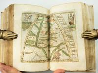
2014réf. UALEMAP00tpmSimon & Schuster 2014. Very Good. Alexander Eben. The Map of Heaven: How Science Religion and Ordinary People are Proving the Afterlife. Tompkins Ptolemy. NY: Simon & Schuster 2014. 165pp. Indexed. Bibliography. 8vo. Hardcover. Book condition: Very good with gently bumped edges. The front free endsheet and the top edge have faint stains from dampness. Dust Jacket Condition: Very good with lightly rubbed and bumped edges. Simon & Schuster hardcover books
2017réf. 80870Ann Arbor MI: The Clenents Library. Very Good. 2017. Hardcover in Dust Jacket. This book is hard-bound in black cloth with a very nice dust jacket. The binding is solid. The contents are bright and clean. This book is "like new" still in the original shrink wrap. . The Clenents Library hardcover books
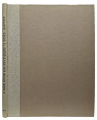
1901réf. TK0545London:: Printed for the Bibliographical Society at the Chiswick Press 1901. 1901. Bibliographical Society Series: Illustrated Monographs no. IX. 4to. 27 3 pp. 3 chromolithographic plates 1 folding tissue guards; title-page with related offsetting. Original linen-backed gray boards printed brown dust-jacket bound in at rear. Fine. The geography of Ptolemy’s called Cosmographia 1490 an illuminated manuscript a book of elegance showing the highest form of craftsmanship. / George Frederick Barwick was a prominent British librarian author and translator who served as the Keeper of Printed Books at the British Museum from 1914 to 1919. Printed for the Bibliographical Society at the Chiswick Press, 1901. hardcover books
2017réf. 131308Ann Arbor MI: William L. Clements Library 2017. hardcover dust jacket. 8.75 x 11 inches. hardcover dust jacket. 230 pages. "A handsome and well-illustrated book on a worthwhile subject at a reasonable price. Graffagnino Austin Ptolemy and Dunnigan shed light on sixteen fascinating figures whose contribution to our understanding of American History is inestimable and often underrated. I have a hard time finding fault with The Pioneer Americanists except to wish it were twice as long." - William Butts Manuscripts The Pioneer Americanists is a captivating look at the lives and careers of eight generations of outstanding Americanists prior to 1900. Here are autobiographical and contemporary biographical sketches of White Kennett Isaiah Thomas James Lenox Joseph Sabin John Carter Brown Lyman Copeland Draper George Brinley Jr. and the other noteworthy specialists who created and nurtured the Americana field from the late seventeenth through the nineteenth centuries. Illustrations from the remarkable collections of the William L. Clements Library and other leading institutional archives complement the texts to provide a panoramic window on the early story of Americana appreciation collecting and description. Anyone with a professional or avocational interest in antiquarian Americana will find The Pioneer Americanists a fascinating treasury of information enlightenment and inspiration. William L. Clements Library unknown books
1794réf. 40805London: Printed for A. Strahan and T. Cadell Edinburgh E. Balfour 1794. A very good copy small marginal tear just touching a blank section of map. 31 x 52 cm. Removed from: Robertson William Historical Disquisition concerning the knowledge which the ancients had of India. [Printed for A. Strahan and T. Cadell] [Edinburgh] [E. Balfour] unknown books
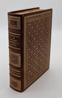
1985réf. 72190Franklin Center PA: The Franklin Library 1985. Franklin Library Limited Edition. Leather Bound. Very Good. 1085pp. Octavo 24 cm Full brown leather with four raised bands. Gilt stamped title on spine. Gilt stamped designs on the spine and covers. All edges gilt. Moire endpapers. Silk ribbon page-marker. Text in English. Previous owner's circular blind embossed stamp is present on many of the preliminary and terminal pages and on several of the pages throughout the text as well-otherwise this is a nice clean and sharp copy. Published exclusively for subscribers to the 25th Anniversary Limited Edition of The Great Books of the Western World. The Franklin Library unknown books
1956réf. DL1160Louvain:: Bibliotheque de l'Universite Bureaux de Recueil 1956. 1956. Series: Universite de Louvain Recueil de Travaux d'Histoire et de Philologie 4th ser. fasc. 8. First edition. 8vo. 131 358 pp. 100 figs. Original printed wrappers. Ownership ink signature of David C. Lindberg. Very good. Bibliotheque de l'Universite Bureaux de Recueil, 1956. unknown books
1985réf. 1342780Franklin Center PA: The Franklin Library 1985. Limited Edition. Hardcover. Octavo 1085 pages; VG-; full genuine brown leather binding; spine paneled with bright gilt lettering and design; mild shelf wear and soiling; all edges bright gilt; silk moire end papers; satin ribbon bookmark; pages clean; shelved Case 9 3/4. 1342780. Shelved Dupont Bookstore. The Franklin Library hardcover books
1915réf. 181190Munich: J.B. Obernetter 1915. Hardcover. VG- covers have heavy wear but pages of text and illustrations are clean and clear. Front cover is unnattached and heavy chipping to spine. Tan boards with brown lettering 2 preliminary leaves 180 pp many uncut bw illustrations and diagrams. Text is in Portuguese. Title translates to: "Treaty of the sphera with Theorica of the sun and the moon and the first book of Geographia by Claudio Ptolomeo." History of Portuguese nautical science at the time of the great discoveries. J.B. Obernetter hardcover books
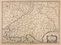
1730réf. 332605Amsterdam: R. & W. Wetstein William Smith 1730. unbound. Map. Copper plate engraving. Image measures 13.25" x 18". Printed circa 1730 this map of the Indian subcontinent was based on Ptolemy's 2nd century map and refined by Mercator beginning in the 16th century. This 1730 edition features graticule lines and a cartouche with a cherub. Covering an area from the Himalayan Mountains south to the Indian Ocean the map names many cities and topographical features. The map is in good condition wear to edges small tear to top of original center fold line. Gerard Mercator 1512-1594 was an accomplished mathematician cartographer globe maker and engraver best known for the Mercator Projection. Incorporating the newly accepted fact that the world is round Mercator was able to render longitude lines consistently straight on a chart. Although this requires some distortion it was of great use for navigators; furthermore it has since become historically important as it is still the most commonly used projection today. R. & W. Wetstein, William Smith unknown books
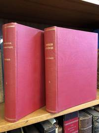
1813réf. 1346487Paris: Chez Henri Grand 1813 1816. First French Edition. Hardcover. Octavo Two Volumes. In Very Good condition. Bound in full 20th-century red library bindings with gilt lettering to spine. Boards show mild shelf wear and soiling. Very mild age toning to text blocks. Facing text in Greek and French. Contains mathematical diagrams. Shelved in Case 10. 1346487. Shelved Dupont Bookstore. Chez Henri Grand hardcover books
1562réf. 220508Venice: Vincenzo Valgrisi 1562. hardcover. very good-. Venice: Vincenzo Valgrisi 1562. 2 parts with separate pagination. Short thick 4to bound in 19th century vellum with red edges. Features 64 double page maps: 27 Ptolemaic maps showing the ancient world as Ptolemy knew it including one world map 37 "modern" maps with two world maps and several woodcut diagrams illustrations and decorative initials. Text in Latin. Staining throughout affecting some of the maps. Title page cropped .5" at right margin. Bookplate of Otto Orren Fisher and ink inscription of Charles Singer. Giuseppe Moleto Josephus Moletius 1531-1588 was an Italian mathematician who based the text of this edition on the 1525 translation by Wilibald Pirckheimer. Moleto's draws upon Ruscelli's enlarged maps of his 1561 edition which in turn were based upon those by Jacopo Gastaldi. Moleto has also included some of Girolamo Ruscelli's innovations from his own edition: the double hemisphere world map and "Carta Marina Nuova Tavola" a rare sea chart of the world. Also from Ruscelli is a revised version of the Zeno map of the Arctic first published in 1558. The Zeno map describes the purported journey of the author's ancestors in the 1390s to Greenland Iceland the mythical islands of Frisland and Icaria and what is now thought to be Newfoundland and Labrador. While Zeno shows Greenland connected to Norway Ruscelli updated the map by eliminating this land bridge. Despite its inaccuracies and inclusion of mythical lands the Zeno map persisted as the prevailing map of the Arctic and Greenland for many years. Six other New World maps include the South American continent Brazil Central America and the Baja Peninsula the eastern coast of North America Cuba and Hispaniola. Moleto juxtaposes the Ptolemaic maps with the contemporary offering easy comparison between ancient and new. Claudius Ptolemy 90-168 CE was a Roman geographer and mathematician living in Egypt who compiled his knowledge and theories about the world's geography into one seminal work. Although his maps did not survive his mathematical projections and location coordinates did. During the Renaissance revival of Greek and Roman works "Geographia" was rediscovered by monks and based upon Ptolemy's detailed instructions the maps were recreated. The first printed edition of "Geographia" with maps was published in Bologna in 1477. A rare and exciting edition for any collector. Vincenzo Valgrisi unknown books
1564réf. 265015Venice: Giordano Ziletti 1564. hardcover. very good. 3 parts in 1. Each part has a separate title page with large printer's device. Part 2: Espositioni et Introduttioni Universali di Girolamo Ruscelli sopra tutta la Geografia di Tolomeo. Part 3: Discorso Universale di M. Gioseppe Moleto mathematico. Illustrated with 63 of 64 fine double-leaf copper engraved maps including the rare "World in Hemispheres". Additional large in-text engravings and decorative initials throughout. 8 358 110 204 48 index 47 pages. Short thick 4to bound in old calf with gilt devices on covers neatly re-cased binding well-rubbed but very sound; very clean copy virtually free of foxing; one map ink stained; lacks the final world map "Carta Marina" a.e.g. Venetia: Appresso Giordano Ziletti 1564. Text in Italian. Bookplate of Otto Orren Fisher pasted on inside cover. Manuscript note in ink on title page reads: Ex Libris Stephan Tiapas. Second edition of Ruscelli's Italian translation very similar to the edition of 1561 and containing the same series of maps. The double- page maps are partly based on those of Jacopo Gastaldi in the edition of 1548 but on a larger scale. According to Nordenskiold two important innovations were introduced by the 1561 edition into cartographical literature. One: the division of the Map of the World in two hemispheres. Two: The re-issue of the Zeno Map of the Arctic Regions which had appeared first 3 years before. "If the remarkable map in this little work had not received extensive circulation under the sanction of Ptolemy's name it would probably have been forgotten. During nearly a whole century it exercised an influence on the mapping of the northern countries to which there are few parallels in the history of cartography". Girolamo Ruscelli c. 1504-1566 was a Venetian editor whose maps are primarily based on those by Jacopo Gastaldi 1548 but with many of his own additions and reproduced on a larger scale. Ruscelli introduces several important innovations in this volume through his 37 "modern" maps which cover Europe Africa Asia and the New World. Ruscelli includes a double hemisphere world map which was the first of its kind to be used in an atlas and "Carta Marina Nuova Tavola" a rare sea chart of the world. He includes a revised version of the Zeno map of the Arctic first published in 1558. The Zeno map describes the purported journey of the author's ancestors in the 1390s to Greenland Iceland the mythical islands of Frisland and Icaria and what is now thought to be Newfoundland and Labrador. While Zeno shows Greenland connected to Norway Ruscelli has updated the map by eliminating this land bridge. Despite its inaccuracies and inclusion of mythical lands the Zeno map persisted as the prevailing map of the Arctic and Greenland for many years. Six other New World maps include the South American continent Brazil Central America and the Baja Peninsula the eastern coast of North America Cuba and Hispaniola. Claudius Ptolemy 90-168 CE was a Roman geographer and mathematician living in Egypt who compiled his knowledge and theories about the world's geography into one seminal work. Although his maps did not survive his mathematical projections and location coordinates did. During the Renaissance revival of Greek and Roman works "Geographia" was rediscovered by monks and based upon Ptolemy's detailed instructions the maps were recreated. The first printed edition of "Geographia" with maps was published in Bologna in 1477. A rare and exciting edition for any collector. Sabin 66504 Giordano Ziletti unknown books
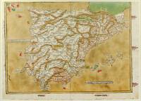
1486réf. 1271161486. Ulm: Johann Reger 1486. Original woodcut map hand-colored printed on a double-page sheet 570 x 407 mm with a central vertical fold verso blank. Upper margin closely trimmed with some loss of the printed border but no loss of the map central fold reinforced on verso a little inkwash and light soiling in the margins; a strong impression with bright contemporary coloring. Matted. § A "modern" map of the Iberian Peninsula Spain and Portugal by the 15th century German cartographer Nicolas Germanus who updated Ptolemy's Geography to show contemporary kingdoms and place names with towns marked by small circles and mountain ranges with brown ridges. The engraving was done by Johannes de Armsheim the first woodcut artist to sign his maps on this map his mark is the backwards "N" in the woodcut text. The map was first published by Lienhart Holle in his atlas of 1482 possibly a ruinous venture as Holle went bankrupt soon afterwards and the sheets and plates were bought by Johann Reger who reissued the atlas in 1486. The two issues can be distinguished by the coloring of the sea: a blue was in 1482 a tan wash in 1486. unknown books
1548réf. ST20876Venice: Giovanni Baptista Pedrezano 1548. First Complete Edition in Italian. Translated by Pietro Andrea Mattioli. Binding size: 175 x 116 mm. 6 7/8 x 4 5/8". ENTIRELY COMPLETE: binder's blank 816 pp. collating as dagger8 A-DD8 DD8 being blank 240 pp. as maps a-h8. Modern 19th century vellum over flexible boards three raised double bands new pastedowns and free endpapers. Woodcut initials throughout occasional diagrams one full-page decorative woodcut side-borders to title-page fine woodcut portrait of Ptolemy observing the heavens and 60 DOUBLE-PAGE COPPER-ENGRAVED MAPS BY GIACOMO GASTALDI ALL COLORED BY A CONTEMPORARY HAND the land masses enhanced with small depictions of ships mermaids sea monsters strange human figures wild and domestic animals including fish an elephant leopard and chicken and other charming embellishments Pedrezano's large woodcut device on colophon leaf 2D7r and verso of final leaf the maps with landmarks and place names each map guarded by a thin vellum strip taken from a 14th century manuscript executed in a fine scribal hand. Front flyleaf with the early signature of Lelio Capilupi presumably belonging to the book's first or at least early owner and very possibly being that of the Mantuan poet humanist and courtier Lelio Capilupi 1497-1560 known for his "Centones ex Virgilio." Adams P-2234; Alden & Landis 548/31; Burden North America 16 & 17; EDIT16 CNCE 47524; Harrisse BAV 285; JCB3 I:153; Mortimer Italian 404; Nordenskiold 2:214; Phillips Atlases 369; Sabin 66502; Shirley Mapping of the World 87 & 88; Streeter sale 1. Spine and part of the covers with some darkening apparently as an antiquing effect but the binding completely solid and entirely harmless. Intermittent faint dampstain at various places on the page though the vast majority of leaves unaffected map of British Isles with very small repaired hole caused by acidic paint only visible if you look for it bottom margin of three maps and one left margin of another neatly reinforced a handful of margins a bit smudged other trivial imperfections but an extremely attractive copy internally the paper remarkably strong and fresh and with virtually none of the signs of use so often seen with early atlases. Because of its innovative size its extensive use of copper engravings instead of woodcuts its introduction of nearly three dozen modern maps and especially its new images of the Americas this is a landmark cartographical publication--and the copy we offer is an extremely rare example of the work enriched with full contemporary hand coloring. It is the first complete printing in Italian following Berlinghieri’s verse paraphrase of 1482 of Ptolemy's universally recognized atlas of the classical world and much more important it is the first version of the work small enough to be practicably carried by hand or in a purse or pocket. In addition although a very small number of earlier atlases exist with copper engravings no previous one is engraved to the extent seen here with five dozen double-page maps presenting dramatically finer detail for example in more refined coastlines and more cleanly realized decorative elements than was possible with images cut from wood. As Nordenskiold notes our 1548 edition was a kind of rediscovery of the virtues of the intaglio cartographic image with no engraved atlas having been printed in the 16th century before ours. In terms of content of central importance here are first engraved maps of parts of North and South America providing legitimacy to Nordenskiold's characterization of our work as "the very first atlas of the New World." There are seven major America-related cartographical achievements in our Pedrezano edition five of them being the modern World map map 59; the other world map "Carta marina" which is the first sea chart depicting the modern world map 60; "Tierra nova" the first separate map of the South American Continent map 54; "Nueva Hispania" the earliest separate map of the Gulf Coast Mexico and the present American Southwest map 55; and "Tierra nueva" the earliest individual map of the east coast of North America from north Florida to Labrador map 56 showing the discoveries of Giovanni da Verrazzano and Jacques Cartier. These last three plus a map of Cuba and one of Hispaniola represent the earliest printed American regional maps. Beyond the American images the 1548 "Geografia" also includes an atypically exo-European eclecticism highlighted by what is apparently the first separate map of the Indian peninsula along with the first separate map devoted to Arabia and the first reference to Singapore on a printed map. The maps were the work of Giacomo Gastaldi ca. 1500 - 1566 Cosmographer to the Venetian Republic and the most prominent Italian cartographer of the period known especially for keeping up to date with the latest geographical discoveries and incorporating them into his maps. While 26 of the 60 maps are based on Ptolemy distinctive here and in other editions within their trapezoidal frames the greater number 34 are the modern work of Gastaldi. The book is consequently one of the very best examples of the integration of the period's Age of Discovery with the groundwork laid by Classical writers. Gastaldi was also responsible for updating and adding modern place names an enormous undertaking as is reflected in the 127-page index here. The history of world exploration owes an immeasurable debt to Claudio Tolomeo ca. 90 - ca. 168 AD who included in his "Geografia" what was known about the geography of the world during the Roman Empire of his lifetime and except for some excavated carved maps Ptolemy's are essentially all we have as a source for the world trodden by the ancients. Manuscripts of his work are known to date as early as ca. 1300 and there were multiple 15th century printings. But all incunabular editions were very large books volumes to be beheld rather than be held and used in any portable context. Waldseemuller's 1513 Strassburg edition was just as weighty. By contrast our edition offered its owner a much more practical format and yet because of its broadening world of 60 maps it was nevertheless the most comprehensive atlas--and the most important one--published between Waldseemuller's and the monumental Ortelius "Theatrum" of 1570. Copies of the 1548 Ptolemy appear on the market from time to time though they typically are beset with condition problems. What seems never to appear--at least so far as we've been able to ascertain--are copies of the book with contemporary coloring. Surely even with a small format atlas issued for functional purposes there must have been copies that were colored on occasion. The Morgan Library does own a copy--apparently once possessed by Marie de Medici--that is colored and it is possible that such copies silently reside in other admittedly sometimes very brief records of institutional holdings but we were unable to find any evidence of such. Likewise and perhaps more telling we were unable to find any copies with period color in auction records which certainly would have prominently announced such an important feature. The Streeter copy and the Wardington copy for example were uncolored. In sum this is a cartographic work of signal importance in especially attractive condition with no small amount of charm in its maps' various real and imagined inhabitants and offered in a colored state that seems virtually never to appear for sale. Giovanni Baptista Pedrezano unknown books