Gotha GothaBiblio.com

560 résultats
réf. 1391186966.Ghardcover. Good. Access codes and supplements are not guaranteed with used items. May be an ex-library book. hardcover
réf. 0656602406.Gpaperback. Good. Access codes and supplements are not guaranteed with used items. May be an ex-library book. paperback
réf. 1391718380.Ghardcover. Good. Access codes and supplements are not guaranteed with used items. May be an ex-library book. hardcover
réf. 366No vopyright date printed. Tight square uncreased spine. Clean unmarked interior. Some very gentle edge-wear and a four-inch crease to the back cover at the fore-edge head but else no notable wear. 64 pp. Oversized. European Pictures Publishing paperback
2001réf. SKU1084999Last Gasp of San Francisco 2001. paperback. Very Good. 8x0x11. Last Gasp of San Francisco 2001. Trade paperback in VG condition; a nice clean copy. This is Part Two. Last Gasp of San Francisco paperback
1769réf. 4793Gotha Germany: Joh. Christian Dieterich 1769. Hardcover. Very Good. 24mo 74 176 pages; printed decorated covers stained rubber stamp on title-page all edges gilt. Scarce. Copperplate engravings folding plate. Joh. Christian Dieterich hardcover
réf. 25470Dated from Rugby 26 February with '1862' noted in blue pencil. An amusing piece of Victorian memorabilia. Written in pencil on one side of a slip of paper roughly 14 x 7 cm torn from the bottom of a leaf. Both sides of the paper are ruled with the ruling on the reverse wider spaced. Confirming the fact that the item is a telegram is the fact that the word ‘Clerk.’ is printed at bottom right of the reverse with the word ‘Railway’ in pencil at top right. The puzzling text of the telegram no doubt in the hand of the telegram clerk reads with annotation ‘1862’: ‘Rugby / From Prince Alfred to The Queen / Osborne / I hope to be at Southampton about nine o clock. And wish the Fairy to be sent there to wait for me. / 26 Feby’. See Image. Dated from Rugby, 26 February, with '1862' noted in blue pencil. unknown
1867réf. 019545Gotha Justus Perthes. 1867. This is a portfolio of 81 maps and drawings. No previous owner's names not exlibrary. Hand colored in outline. Overall in VERY GOOD condition. Photos available upon request. Size: 18.5 x 15 inches 46 x 31 cms. LARGE. Hand colored in outline. Overall in GOOD condition. Photos available upon request. Size: 18.5 x 15 inches 46 x 31 cms. LARGE. This portfolio has 3 extra maps variants of other ones present and it is lacking the following 6 maps: #12. Europa zur Ubersicht der politischen Verhaltnisse; #39. Asia. Generalkarte; #41a. America. Generalkarte; #43c. China ostl. Theil Korea und Japan; #44c. Di Ostindischen Inseln; #51. Polynesian und der Grosse Ocean. Westl. Theil. JOHAN GEORG JUSTUS PERTHES 1749-1816 German publisher was born at Rudolstadt on the Iith of September 1 749. In 1785 he founded at Gotha the business which bears his name Justus Perthes. In this he was joined in 1814 by his son Wilhelm 1793-1853 who had been in the establishment of Justus' nephew Friedrich Christoph Perthes at Hamburg. On the death of Justus at Gotha on the 2nd of May 1816 Wilhelm took entire control of the firm. He laid the foundation of the geographical branch of the business for which it is chiefly famous by publishing the Hand-atlas 1817-1823 of Adolf Stieler 1775-1836. Wilhelm Perthes engaged the collaboration of the most eminent German geographers of the time including Heinrich Berghaus Christian Gottlieb Reichard 1758-1837 who was associated with Stieler in the compilation of the atlas Karl Spruner 1803-1892 and Emil von Sydow 1812-1873. The business passed to his son Bernard Wilhelm Perthes 1821-1857 who was associated with August Petermann under whose direction the well-known periodical Petermanns Mitteilungen was founded and Bruno Hassenstein 1839-1902; and subsequently to his son Bernard 1857-. In 1863 the firm first issued the Almanach de Gotha a statistical historical and genealogical annual in French of the various countries of the world; and in 1866 the elaborate Geographisches Jahrbuch was produced under the editorship of Ernst Behm 1830-1884 on whose death it was continued under that of Professor Hermann Wagner. . Disbound. Very Good. Elephant Folio - over 15" - 23" tall. Hardcover. Gotha Justus Perthes. Paperback
réf. 17826Ida Villa 7 Lyndhurst Road Hampstead NW on cancelled letterhead of 16 New Burlington Street London . 28 November 1867. 1p. 12mo. In good condition lightly-aged with traces of glue from mounting on blank reverse. Reads: 'Sir In reply to your polite note of the 22nd. inst: I am quite prepared to receive the "Camel Coats" with which my friend Mr: Morris has kindly bethought me and I shall thank you for their delivery.' Ida Villa, 7 Lyndhurst Road, Hampstead, NW, on cancelled letterhead of 16 New Burlington Street [ London ]. 28 November 1867. unknown
réf. 1358350396.Ghardcover. Good. Access codes and supplements are not guaranteed with used items. May be an ex-library book. hardcover
réf. 1016754388.Ghardcover. Good. Access codes and supplements are not guaranteed with used items. May be an ex-library book. hardcover
réf. 1018814620.Ghardcover. Good. Access codes and supplements are not guaranteed with used items. May be an ex-library book. hardcover
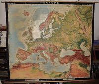
1964réf. 2309210067A.J. Nystrom ; Justus Perthes Chicago Darmstadt Germany 1964. Maps. Very Good. Large pull down topographic color map of modern Europe. Fitted with metal rod for wall mounting. 185 x 208 cm. 73 1/2 x 81 1/2 inches. Mounted on muslin and fitted with rods. Relief shown by shading gradient tints and spot heights. Depths shown by gradient tints. Shows direction of ocean currents in the Mediterranean Sea and in the Atlantic Ocean. Note: This is a large heavy map. Additional postage will apply depending on delivery location. A.J. Nystrom ; Justus Perthes, Chicago, Darmstadt, Germany unknown
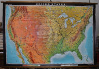
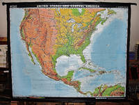
1964réf. 2309280003Hermann Haack Geographisch-Kartographische Anstalt Gotha 1964. Maps. Very Good. Large physical map of the United States with state boundaries capitals and principal cities. 132 x 198 cm. Mounted on muslin wood rods top and bottom. Small tear crumbled edge on right outer margin. Scale 1:2500000. Denoyer-Geppert no. 15501. Note: This is a large heavy map. Additional postage will apply depending on delivery location Hermann Haack Geographisch-Kartographische Anstalt Gotha unknown
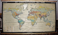
1967réf. 2309280029Haack Gotha 1967. Maps. Very Good. 122 x 210 cm. Color map mounted on muslin wood rods top and bottom. Cartography by Olbricht and Haefke. Relief shown by contours shading gradient tints and spot heights. Depths shown by gradient tints and soundings. "VLN 1001 . Nr.8/64/67-10/67-1000." Scale 1:20000000. Note: This is a large heavy map. Additional postage will apply depending on delivery location Haack, Gotha unknown
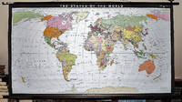
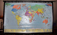
1993réf. 2309280035Haack-Painke Firm Justus Perthes Gotha Germany 1993. Maps. Very Good. Political Map of the World in vivid color 146 x 78 cm. Color map mounted on rods top and bottom. Scale 1:24000000 W 180--E 180/N 80--S 70. "Best.-Nr. 362331144." Note: This is a large heavy map. Additional postage will apply depending on delivery location. Haack-Painke (Firm), Justus Perthes (Gotha, Germany) unknown
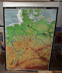
1968réf. 2310050066VEB Hermann Haack Geographisch-Kartographische Anstalt Gotha 1968. Maps. Very Good. 20th Century Germany 160 x 225 cm. Mounted on muslin wood rods top and bottom Scale of sectional maps 1:450000. Relief shown by spot heights. Area includes part of the neighbouring countries in outline. Shows international boundaries administrative divisions towns by population symbols roads classified railways classified and landmarks. Editors: 1953-56 H.R. Fischer with W. Steinbruck; 1958-59 K. Witthauer; 1961- W. Steinbruck. VEB Hermann Haack Geographisch-Kartographische Anstalt, Gotha, unknown
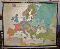
1963réf. 2309280023Hermann Haack Geographisch-Kartographische Anstalt Gotha 1963. Maps. Good. Early Modern Europe in the 16th century 158 x 197 cm. Color map mounted on muslin wood rods top and bottom. Scale 1:3 000 000. Note: This is a large heavy map. Additional postage will apply depending on delivery location Hermann Haack, Geographisch-Kartographische Anstalt, Gotha unknown
2002réf. 2309210164Justus Perthes Verlag Gotha GmbH Gotha 2002. Maps. Like New. 122 x 188 cm. Color map mounted on wood rods top and bottom. Scale 1:18000000. 362333043 Note: This is a large heavy map. Additional postage will apply depending on delivery location. Justus Perthes Verlag Gotha GmbH, Gotha unknown
2001réf. 2309210166Klett Perthes 2001. Maps. Like New. 149 x 193 cm. Color map mounted on wood rods top and bottom. 1:3500000. Physical map features detailed topographic relief shading as well as ocean depths. Mountain ranges peaks rivers swamps and urban areas are all indicated on the map. Note: This is a large heavy map. Additional postage will apply depending on delivery location. Klett Perthes unknown
1936réf. 46240Godwin Publishers 1936. Hardcover. Good. Good Hardcover no DJ. First Edition. Very scarce title. Ex-library with only markings being stamps on end papers. Text is unmarked. Front hinge is cracked binding is tight. Covers show some fraying at extremities and some soiling.; 100% Satisfaction Guaranteed! Ships same or next business day! Godwin, Publishers hardcover
Cm. 7x11, tela editoriale, pp. XIV,852, con 6 ritratti. Con lievi fioriture, peraltro ben conservato (slightly foxed, otherwise good condition).
Cm. 7x11, tela editoriale, pp. XXII,906, con 6 ritratti. Con lievi fioriture, peraltro ben conservato (slightly foxed, otherwise good condition).
Cm. 7x11, tela editoriale, pp. L,984, con 6 ritratti. Con lievi fioriture, peraltro ben conservato (slightly foxed, otherwise good condition).
Cm. 7x11, tela editoriale, pp. XVI,1022, con 6 ritratti. Con lievi fioriture, peraltro ben conservato (slightly foxed, otherwise good condition).