Flori JeanLivre Rare Book

789 résultats
2012réf. 100155463PERRIN 2012 521 pages 15 4x4 4x23 4cm. 2012. Broché. 521 pages. Jean Flori médiéviste et directeur de recherches au CNRS analyse dans cet ouvrage les mécanismes de prédication et de propagande qui ont poussé des milliers d'Occidentaux à partir en croisade entre le XIe et le XIIIe siècle. Il explore les motivations des prédicateurs et des participants ainsi que le rôle de l'idéologie dans cette mobilisation massive
réf. 24382Salon de 1841 lithographie originale en noir, d'aprés Eugène Delacroix,image 17,5x 21,5 cm,vers 1841
2009réf. LFA-126721686Revue de 66 pages, format 210 x 295 mm, illustrée, brochée couverture couleurs, bon état
2015réf. 100143015Routledge 2015 352 pages in8. 2015. Cartonné. 352 pages.
réf. 89895Cambridge, Cambridge University Press 1995, 220x140mm, X - 201pages, editor's binding with jacket. Exemplar as new.
1913réf. 90743-C1037Casterman, 1913. 1 vol. cart. ed. de 172 pages.
1988réf. 115774Felin 1988 In-8 broché 20,5 cm sur 14,2. 397 pages. Bon état d’occasion.
réf. 70436, Brepols, 2026 Hardback, Pages: 336, Size:156 x 234 mm, Language(s):English, Latin. ISBN 9782503614304.
1983240p. Hardcover Very good condition good
1991P., la Manufacture, 1991. In-8 broché, 318 pp. , quelques illustrations en hors texte.
réf. 15299Besançon, Editions de la Manufacture, 1965 ; in-8, broché. 319 pp.-2 ff. - 6 ff. hors-texte d'illustrations en noir. Parfait état.
1965réf. 182353La manufacture Besançon, Editions de la Manufacture, 1965. In-8 broché de 319 pages. Illustrations hors texte en noir et blanc. Bon état.
1896réf. GITj546Paris Librairie Emile Bouillon 1896. In-8 broché XXXV 555pp 1 feuillet non chiffré table. Couverture poussiéreuse avec petits manques de papier en bordure, intérieur en bon état, complet et non coupé.
réf. CZC-12627Contient; Poésies, pour les blessés, les pigeons de la République, Bonjour bon an !, Henri regnault, Les absents, l'obus, délivrance, etc. Bel envoi aux écoles professionnelles Lerm (?), offrande et souvenir de l'auteur.. " Vol, in-8, relié, 19x15, trace de mouillure ancienne, bel exemplaire, 190pp. Paris, Calmann Lévy, 1877 ref/293
réf. CZC-12627Contient; Poésies, pour les blessés, les pigeons de la République, Bonjour bon an !, Henri regnault, Les absents, l'obus, délivrance, etc. Bel envoi aux écoles professionnelles Lerm (?), offrande et souvenir de l'auteur.. " Vol, in-8, relié, 19x15, trace de mouillure ancienne, bel exemplaire, 190pp. Paris, Calmann Lévy, 1877 ref/293
réf. 23489Paris, La Librairie Illustree, 1886 In-4, relie cart. polychrome ill. ed. (de Souze), dos et tranches dores, 646pp. Ouvrage illustre d'un nombre considerable des gravures h. et in-t. et d'une carte de la Palestine.
réf. 64427, Brepols, 2023 Paperback, 449 pages, Size:156 x 234 mm, Illustrations:24 b/w, 149 col., 3 maps b/w, 2 maps color, Language: English. ISBN 9782503602684.
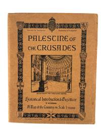
1946réf. 217431946. Palestine of the Crusades. Jerusalem: Survey of Palestine Department of Antiquities 1946. Printed by the British Mandate Survey of Palestine. Third edition. 43 pages in original printed tan wrappers illustrated with medieval heraldic devices and a vignette engraving of the Church of the Holy Sepulchre. Includes two maps one of Jerusalem in 13th century and the other of medieval Acre. A rare and richly detailed British Mandate-era gazetteer documenting the sites and historical geography of the Latin Kingdom of Jerusalem and the broader Crusader presence in the Levant. Published by the Survey of Palestine's Department of Antiquities this pamphlet opens with a comprehensive historical introduction contextualizing the Crusader kingdoms within a medieval geopolitical framework. The map "covers the greater part of the Latin Kingdom of Jerusalem one of the four European states which came into existence as a result of the armed pilgrimages to the Holy Land which is known as the First Crusade 1097-1099." It notes that the Crusader states at their height extended from the Gulf of Alexandretta to El Arish a zone approximately fifty miles deep describing how the region had long served as a cultural and military frontier: "the frontier between the Hellenic or Roman world and the Asiatic was for nearly two centuries the frontier between Christian Europe and Moslem Asia." Detailed entries trace the rise of Crusader fortifications towns and ecclesiastical sites with significant attention to the role of Saladin and the Ayyubid reconquest. One chapter details Baldwin IV's fortifications in 1178 at Jacob's Ford and the Templar castle at Beaurvoir Kawkab al-Hawa noting that it "was soon to be the focus of attention." The narrative follows Saladin's subsequent campaigns including the "brilliant victory over the Crusaders at Merj 'Ayn" and his eventual conquest of Jerusalem in 1187. The pamphlet includes multiple inset town plans reproduced from 19th-century maps e.g. a Crusader-era plan of Jerusalem and another of St. Jean d'Acre. It closes with a list of "Additions to Map" highlighting recently identified ruins or Crusader-linked locations. Light edgewear to wrappers minor foxing and soil to cover and page edges some pencil marginalia. One fold-out map present; the second larger map not included. Despite the missing map this remains a scarce and important document of British Mandate-era archaeological and historical scholarship reflecting colonial interest in medieval Christian heritage in Palestine on the eve of Israel's independence. unknown books
1946réf. 217431946. Palestine of the Crusades. Jerusalem: Survey of Palestine Department of Antiquities 1946. Printed by the British Mandate Survey of Palestine. Third edition. 43 pages in original printed tan wrappers illustrated with medieval heraldic devices and a vignette engraving of the Church of the Holy Sepulchre. Includes two maps one of Jerusalem in 13th century and the other of medieval Acre. A rare and richly detailed British Mandate-era gazetteer documenting the sites and historical geography of the Latin Kingdom of Jerusalem and the broader Crusader presence in the Levant. Published by the Survey of Palestine's Department of Antiquities this pamphlet opens with a comprehensive historical introduction contextualizing the Crusader kingdoms within a medieval geopolitical framework. The map "covers the greater part of the Latin Kingdom of Jerusalem one of the four European states which came into existence as a result of the armed pilgrimages to the Holy Land which is known as the First Crusade 1097-1099." It notes that the Crusader states at their height extended from the Gulf of Alexandretta to El Arish a zone approximately fifty miles deep describing how the region had long served as a cultural and military frontier: "the frontier between the Hellenic or Roman world and the Asiatic was for nearly two centuries the frontier between Christian Europe and Moslem Asia." Detailed entries trace the rise of Crusader fortifications towns and ecclesiastical sites with significant attention to the role of Saladin and the Ayyubid reconquest. One chapter details Baldwin IV's fortifications in 1178 at Jacob's Ford and the Templar castle at Beaurvoir Kawkab al-Hawa noting that it "was soon to be the focus of attention." The narrative follows Saladin's subsequent campaigns including the "brilliant victory over the Crusaders at Merj 'Ayn" and his eventual conquest of Jerusalem in 1187. The pamphlet includes multiple inset town plans reproduced from 19th-century maps e.g. a Crusader-era plan of Jerusalem and another of St. Jean d'Acre. It closes with a list of "Additions to Map" highlighting recently identified ruins or Crusader-linked locations. Light edgewear to wrappers minor foxing and soil to cover and page edges some pencil marginalia. One fold-out map present; the second larger map not included. Despite the missing map this remains a scarce and important document of British Mandate-era archaeological and historical scholarship reflecting colonial interest in medieval Christian heritage in Palestine on the eve of Israel's independence. unknown
1986réf. 19318Fayard, 1986, in-8°, 199 pp, une carte hors texte, broché, couv. illustrée, bon état (Coll. Les Inconnus de l'histoire)
2018New Turkish Paperback. Demy 8vo. (21 x 14 cm). In Turkish. 312 p. Ortaçagdan günümüze hiristiyan müslüman iliskileri tarihi. Turkish edition of 'A history of christian-muslim relations' by Goddard.
1611réf. PHO-2274Hanau, Typis Wechelianis apud Claudium Marnium & haeredes Ioan. Aubrii, 1611. In-folio, [16]-1196-[76] pp. + [4]-285-[3] pp., 5 cartes gravées sur cuivre dont 3 grandes dépliantes. Plein veau, dos à nerfs aux armes de la famille de Montholon, restauration à la reliure, brunissures importantes par endroits, légères rousseurs aux cartes, léger pli au titre. Exemplaire complet. Provenance : reliure aux armes de la famille de Montholon ; étiquette de la librairie Dorbon-Ainé. En deux parties avec chacune son titre propre.
2000réf. 127186Aubier, 2000, in-8°, 302 pp, notes, biblio, index, broché, couv. illustrée, bon état
réf. 91786aafLimoges, Barbou, 1838, pt. in-8vo, frontispice gravé -St. Louis-, 284 p., orné de 2 gravures hors-texte (Richard -Saladin -, pages légèrement brunies, reliure en plein-cuir légèrement usée, dos lisse orné en or, coiffes touchées (l’inf. manque), plats ornés en relief, tranches marbrées. Exemplaire rare.
1989réf. LFA-126739832N° 58 (Juillet-août 1989) 66 pages, format 205 x 285 mm, illustré, broché couverture couleurs, bon état