Sanson, LJ L JABAA
29 Ergebnisse
1834Best.-Nr. 1415500Paris: J. B. Baillière Libraire 1834. First Edition. Softcover. Octavo 4 115 pages. In Very Good condition. Rebound in modern blue paper wraps. Moderate to heavy toning to covers with spine area nearly toned to white; a small vertical crease to rear cover. Text block has soiling to edges light penciling to half-title page a few scattered stains and age-toning and light foxing throughout. Text in French. Shelved in Room A octavo overflow. 1415500. Special Collections - Upstairs. J. B. Baillière, Libraire unknown books
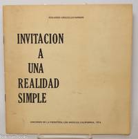
1974Best.-Nr. 343576Los Angeles: Ediciones de la Frontera 1974. Pamphlet. 20 pages staplebound pamphlet. 8.75x8.5 in. Author's presentation inscription on title page: "Para Enrique mi buen amigo y profesor con el aprecio de su ex-alumno signed Eduardo Arguello Sanson." Covers dustsoiled bottom corner bumped. Scarce book of poems by the Nicaraguan-born writer. WorldCat lists only four locations three in the US one in the UK as of January 2026. Ediciones de la Frontera unknown books
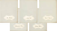
1950Best.-Nr. 158225Rome: Unitalia Film / IFE 1950. Collection of 14 vintage oversize promotional brochures for Italian and international actresses. Each brochure features a one-page biography in Italian and a full-page black-and-white photograph of each actress. Actresses represented are Sylvana Mangano Isa Miranda Annamaria Gerrero Yvonne Sanson Alida Valli Delia Scala Ingrid Bergman Silvana Pampanini Lea Padovani Lucia Bose Eleanora Rossi Gina Lollobrigida Carla Del Poggio and Anna Magnani. 11 x 14.25 inches folded once vertically as issued with a company statement on the verso. Very Good plus overall some with light toning and foxing and a few with short tears. Unitalia Film / IFE unknown books
1650Best.-Nr. 24869London 1650. 1 vols. 13" x 8 3/4. Contemporary. hand-coloring. Fine condition. 1 vols. 13" x 8 3/4 ". unknown books
1700Best.-Nr. 104160Copper engraved map double page 24" x 20" hand colored and large uncolored title cartouches. Some minor soiling a little wear along centerfold with old verso repair normal aging; very good. Samson 1600-1667 is often referred to as the father of French cartography. Louis XIII was impressed with his work and appointed him "Geographe Ordinaire du Roi". During his career Sanson would produce about 300 maps and his major atlas "Cartes Generales de Toutes les Parties du Monde" would represent an important part of his body of work. While two of his sons continued publication of his maps after his death Pieter Schenk 1655-1718 an important publisher and engraver in his own right published this map. The map is attractively colored and gives a detailed view of the provinces of France. The map is also decorated with a large title cartouche. Bagrow p. 185. map hist website. books
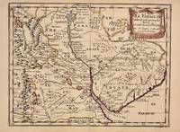
1657Best.-Nr. 326341Paris 1657. unbound. Map. Original outline coloring. Sheet measures 8 3/4" x 12 1/8". Image measures 8" x 10 5/8". Paris: Nicolas Sanson 1657. This rare 17th century map by Nicolas Sanson with original color depicts the region showing present day Paraguay Uruguay with parts of Brazil and Argentina. Mountains are rendered pictorially and cities rivers and notations describing indigenous populations are labeled. In very good condition. Nicolas Sanson 1600-1667 is considered the founder of the French school of cartography. In reaction to the prevailing trend of Dutch lavishness Sanson favored minimal details focusing rather on accurate cartography than ornament. unknown books
1683Best.-Nr. 297468Paris 1683. unbound. Map. Copper engraving with hand coloring. Image measures 7 5/8 x 11 1/4 inches. This map published in Paris in Afrique en plusieurs cartes is one of Sanson's small atlas maps of depicting various African regions. This map offers extensive detail on the cities of North Africa as well as topographical and geographical features with mountains beautifully rendered in profile. Nicolas Sanson 1600-1667 is considered the founder of the French school of cartography. In reaction to the prevailing trend of Dutch lavishness Sanson favored minimal details focusing rather on accurate cartography than ornament. This map is a fine example of his work. unknown books
1723Best.-Nr. 202384Amsterdam: Mortier Pieter II 1723. unbound. very good. Map. Engraving with hand coloring. Image measures 14.5" x 19.25". Includes parts of modern day Morocco Algeria Tunisia and Libya. Nicolas Sanson 1600-1667 is considered the founder of the French school of cartography. In reaction to the prevailing trend of Dutch lavishness Sanson favored minimal details focusing rather on accurate cartography than ornament. Large decorative title cartouche. Map is in good condition with ample margins. Staining along centerfold. Chipped near edges along centerfold. Mortier, Pieter II unknown books
1648Best.-Nr. 251162Paris 1648. unbound. Map. Engraving with hand outline color. Image measures 14.5 x 21.5 inches. This map of Switzerland centers on Lucerne covering approximately the area from Lake Constance south to Lake Como in Italy. Published in 1648 the map dates to the period of the Old Swiss Confederacy. Furthermore it predates by only a few years the Swiss Peasant War of 1653 a siege of Lucerne and Bern that demonstrated the significance of the rural population to the confederacy's stability. Hand-colored outlines on the map indicate the various independent states that made up the confederacy. A title cartouche with elaborate scrollwork adorns the lower right corner of the map. The map is in good condition with full margins and no chips or tears. Wear to lower margin. Nicolas Sanson 1600-1667 is considered the founder of the French school of cartography. In reaction to the prevailing trend of Dutch lavishness Sanson favored minimal details focusing rather on accurate cartography than ornament. This map demonstrates the skill that made him such a valuable asset to the French monarchy. unknown books
Best.-Nr. 215370Amsterdam: Pierre Mortier. unbound. very good. Map. Engraving with hand outline. Image measures 13 3/4" x 22 1/2". Rare map of Galatia an ancient region of northern Anatolia present-day Turkey along the southern coast of the Black Sea. Published circa 1705 this map is centered on Ankara and shows provinces inhabited by Trocmi Tectosages and Tolistobogi - three Celtic tribes who inhabited the region from the 3rd century BC. Neighboring historical regions of Paphlagonia Pontus Phyrgia Cappadocia and Lycaonia are labeled. Mountains and cities are depicted pictorially. The map shows major roads connecting cities throughout the region. A decorative cartouche features lively figures celebrating with percussion and wind instruments. Full original margins minor offsetting. Based on earlier plates by Sanson. This map appeared in "Atlas Antiquus Sacer Ecclesiasticus et Profanus" published in Amsterdam by Pieter Mortier. Nicolas Sanson 1600-1667 who is considered the founder of the French school of cartography. In reaction to the prevailing trend of Dutch lavishness Sanson favored minimal details focusing rather on accurate cartography than ornament. Pierre Mortier 1661-1711 was a Dutch cartographer engraver and printseller who worked in Amsterdam. He used advanced Dutch printing methods to produce high quality editions of contemporary French maps by cartographers such as De L'Isle Sanson Jaillot de Fer and De Wit. This map is a lovely example of his work. Pierre Mortier unknown books
1713Best.-Nr. 215454Amsterdam: Mortier Pieter 1713. unbound. very good. Map. Engraving with original hand outline. Image measures 14.5" x 18.75". Rare map of Paphlagonia an ancient region of northern Anatolia present-day Turkey along the southern coast of the Black Sea. Highlighting the capital city of Sinope this map depicts the region as defined by Strabo: bound by the Parthenius River in the west extending to the Hays river in the east. Sanson depicts the region comprising the Kingdom of Pontus during the rule of Mithridates IV. Neighboring historical regions of Gallatia and Bithynia et Pontus are labeled. Full original margins light scattered foxing. Based on earlier plates by Sanson. This map appeared in "Atlas Antiquus Sacer Ecclesiasticus et Profanus" published in Amsterdam by Pieter Mortier. Nicolas Sanson 1600-1667 who is considered the founder of the French school of cartography. In reaction to the prevailing trend of Dutch lavishness Sanson favored minimal details focusing rather on accurate cartography than ornament. Pierre Mortier 1661-1711 was a Dutch cartographer engraver and printseller who worked in Amsterdam. He used advanced Dutch printing methods to produce high quality editions of contemporary French maps by cartographers such as De L'Isle Sanson Jaillot de Fer and De Wit. His greatest feat was the nautical atlas "Le Neptune Francois" or "Suite de Neptune Francois" considered to contain the most beautiful examples of cartographic art. After his death his widow Amelia continued publishing in partnership with her brother-in-law David until her death in 1719. This map was published during Amelia's tenure at the firm. Mortier, Pieter unknown books
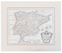
1710Best.-Nr. 13749441710. A map of Spain by French cartographer Nicolas Sanson 1600-1667 in a later Italian edition dated 1710. In Excellent condition with even age toning. Double matted. Mat: w 28.25 in. x h 23.5; Map: w 24.25 in. x h 19 in. Shelved at DuPont. 1374944. Arts & Antiques. unknown books
1862Best.-Nr. 1862SansonEXECUTIONS IN FRANCE Sept Générations d'Exécuteurs 1688-1847: Mémoires des Sanson mis en ordre rédigés et publiés par H. Sanson. Paris: Dupray de la Mahérie 1862-1863. Six volumes each complete with half-title and probably large-paper copies but IV 67/68 with partial loss in lower blank. Tall 8vo unusually clean with hardly any spotting; gilt-stamped leather spines with matching black boards. First edition of this apocryphal memoir of the Sanson family based on family diaries and correspondence by the journalist D'Olbreuse detailing all the major executions from the late 17th century thru middle 19th century. The most famous member of the family is Charles-Henri Sanson 1739–1806 who served as the chief executioner of Paris during the French Revolution. He executed thousands of people—including King Louis XVI Marie Antoinette Danton and Robespierre. He was also closely involved in testing and adopting the guillotine as a more humane method of execution. The family's tenure ended in 1847 when Charles-Henri's grandson Henri-Clément Sanson was dismissed from office and arrested after pawning the family's official guillotine to cover mounting debts and gambling losses. Tulard 1316 - Fierro 1315. Dupray de la Mahérie hardcover books
1658Best.-Nr. MEE1132Paris:: Chez l'Autheur 1658. 1658. PRINT: 390 x 520 mm. Paper: 457 x 610 mm. Creased cross-ways. Map outlined with original coloring. Excellent condition. First printing of this map. Nicolas Sanson 1600-1667 the "Father of French Cartography" was educated by the Jesuits at Amiens. He was soon recognized as having a gift for map drawing. As such by the age of ten he has produced his first map. "In 1627 he attracted the attention of Richelieu by a map of Gaul which he had constructed or at least begun while only eighteen." "Active from 1627 Sanson issued his first map of importance the "Postes de France" which was published by Melchior Tavernier in 1632. After publishing several general atlases himself he became the associate of Pierre Mariette a publisher of prints." Wikip. In 1630 he was appointed Geographe Ordinaire du Roy by King Louis XIII. As a geographer his most important work was his maps of the world Cartes generales de toutes les parties du monde issued in 1658 with later editions to follow. He died in 1667. Two younger sons Adrien d. 1708 and Guillaume d. 1703 succeeded him as geographers to the king. / Nicolas Sanson's map was issued "by the author" this version and another version where his printer-publisher Pierre Mariette issued the map with his own imprint on the cartouche. Chez l'Autheur, [1658]. unknown books
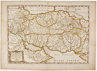
1723Best.-Nr. 209708Amsterdam: Mortier Pieter 1723. unbound. very good. Map. Engraving with hand outline. Image measures 14" x 18.75". Beautifully detailed map showing the area between the the Black and Caspian Seas including modern day Russia Georgia Azerbaijan Armenia and Turkey. Full original margins have minor stains. Based on the plates by Nicolas Sanson 1600-1667 who is considered the founder of the French school of cartography. In reaction to the prevailing trend of Dutch lavishness Sanson favored minimal details focusing rather on accurate cartography than ornament. Mortier, Pieter unknown books
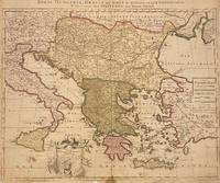
1705Best.-Nr. 311838Amsterdam: Petrus Schenk 1705. unbound. Map. Engraving with original hand outline. Image measures 18 7/8" x 22 3/4" Beautiful map of southeastern Europe extending from Italy to Turkey and from Hungary to Cyprus. Published circa 1705 this map depicts the region during the Ottoman-Habsburg wars. In fair condition. Wear to original centerfold with tape repair and stain at bottom edge. Lower margin worn and frayed not affecting the image. Minor cracking and small loss near center due to oxidization of original viridian green coloring. Some foxing. Publisher's crease to upper right corner. Sold as-is. Petrus Schenk c.1660--1711 was a German engraver and cartographer. He began his training in Amsterdam in the art of mezzotint and soon began working closely with Gerard Valck. The two took advantage of the bustling cartographic trade in the city and quickly expanded their business from portraits and prints into maps and globes. In 1700 Schenk grew the business further by moving to Leipzig Germany and opening a shop. As his sons and grandson returned to the Netherlands to become active engravers as well the Schenk firm developed into one of the best-known publishing houses in 18th-century Amsterdam. This map attests to Schenk's prolific production and skill in both cartographic artistry and business. Petrus Schenk unknown books
1663Best.-Nr. 283501Paris 1663. unbound. very good. Map. Hand-colored engraving. 15" x 23". This map of Sicily from the 17th century shows the entire island as well as the southwesternmost tip of the Italian peninsula. The names of the surrounding bodies of water are named in Latin and rivers mountains lakes and towns are noted on the map. Nicolas Sanson 1600-1667 is considered the founder of the French school of cartography. In reaction to the prevailing trend of Dutch lavishness Sanson favored minimal details focusing rather on accurate cartography than ornament. This map is a fine example of his work. unknown books
1667Best.-Nr. 10027Paris 1667. No Binding. Near Fine. 12 ½ x 17 inches. Original outline color; excellent. Earliest map of Martinique listed in Phillips featuring attractive original color and an elegant cartouche. This map depicts the situation on the island before 1660 when it was still largely inhabited by natives and only about half of it had been claimed by colonists for sugar cane farming. The map goes so far as to mark with a printed line the partition dividing the "demeure des François" and the "demeure des savages." However by 1660 the entirety of the native population was either dead expelled or in slavery and Martinique was a full-fledged sugar cane-farming European colony. Phillips Maps P. 389. unknown books
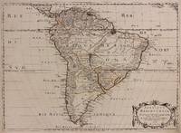
1650Best.-Nr. 309461Paris: Pierre Mariette 1650. unbound. Abraham Peyrounin. Map. Engraving with original outline color. Image measures 15 3/4" x 21 3/4" This exceptionally fine map of South America covers the continent in fine detail. Coastlines are extensively labeled and mountains beautifully rendered in profile. The Orinoco and Amazon Rivers as well as Rio de la Plata are prominently rendered. Sanson refrains from drawing a southern coastline to Tierra del Fuego and the relatively unknown Amazon region is depicted in minimal detail. Sanson does however include the mythical lake "Lac de Parime" and the city of gold "Manoa del Dora" between the Orinoco and Amazon rivers. Nice dark impression. In very good condition. Minor dampstain to lower margin not affecting the image and some faint stains near the center of the map - otherwise clean and bright. Hard to find. Nicolas Sanson 1600-1667 is considered the founder of the French school of cartography. In reaction to the prevailing trend of Dutch lavishness Sanson favored minimal details focusing rather on accurate cartography than ornament. Pierre Mariette unknown books
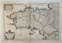
1693Best.-Nr. 324404Paris: Alexis-Hubert Jaillot 1693. Map. Engraving with hand colored outline. Image measures 21" x 31" This large 17th century double-page map features the Brittany region of France. Cities towns abbeys government buildings rivers ports and harbors are labeled. Mountains forests and wetlands are depicted pictorially. The attention to detail in topography and population centers hints at the abundance of the region known for its production of Muscadet wine cheese boar seafood and other agricultural products. Executed by Nicolas Sanson in dedication to his son this map was published by Alexis-Hubert Jaillot in Paris and later reproduced in Amsterdam by Jaillot and Pierre Mortier. This early edition is scarce and hard to find. In very good condition with some offsetting to left side and a spot in the right margin. Nicolas Sanson 1600-1667 is considered the founder of the French school of cartography. In reaction to the prevailing trend of Dutch lavishness Sanson favored minimal details focusing rather on accurate cartography than ornament. Alexis-Hubert Jaillot unknown books
1696Best.-Nr. 206066Amsterdam: Alexis-Hubert Jaillot 1696. unbound. very good. Map. Engraving with hand outline. Image measures 23" x 35". Stunning map showing the vast extent of the German Empire including parts of Poland Bohemia Hungary Austria Croatia Italy France and the Netherlands. Exquisite and subtle coloring beautifully detailed. Based on a plate by Nicolas Sanson reworked and published in "Atlas Nouveau" by Jaillot. Severe toning due to early acid backing chipping to edges and corners and some tears. Priced as is. Alexis-Hubert Jaillot 1632--1712 was a French sculptor engraver publisher and cartographer. He served as official geographer to King Louis XIV and worked with other prominent mapmakers of the period such as Nicolas Sanson He is best known for his Atlas Nouveau of 1674. Alexis-Hubert Jaillot unknown books
Best.-Nr. 04086London: S.W. Fores 1801. Three of George Moutard Woodward's Hand-Colored Prints from "Symptoms of the Shop" WOODWARD George Moutard artist SANSON Francis printmaker. Symptoms of the Shop. London: S.W. Fores 1801. First edition. Quarto 10 1/8 x 8 1/16 inches; 257 x 265 mm. Three of twelve hand colored 'Satirical' stipple engravings on wove paper drawn by Woodward and etched by Sanson numbers 7 8 and 10. Each with the plate number at the top right margin and with lithographed text at the top of the image. On each of the lower margins is "Pub. June 1st 1801 by S.W. Fores No.50 Piccadilly Prints and Drawings lent on the plan of a Library Folio's of Caricature lent out for the Evening." / Symptoms of the Shop" / "Drawn by G. Woodward Etchd by F. Sansom". Some light marginal soiling otherwise near fine. Plate #7. "After all there is nothing like the true old orthodox principles." Plate #8. "I have brought your Honor home your new suit." Plate #10. "Madam - I was once a Minister and used to negotiations." Very rare. According to OCLC there are only two complete set in libraries and institutions worldwide The Lewis Walpole Library CT. has a complete colored set Princeton NJ also has a complete set but does not mention 'colored'. Yale university has nine of the twelve colored plates missing numbers 1 7 & 8. Harvard MA has one plate. These two artists previously collaborated on Every Body in Town BC-28 Every Body Out of Town BC-29 and Pigmy Revels: All Alive in Lilliput BC-62 all published by Fores. Each plate depicts two persons engaged in humorous wordplay relating to the characteristics of a trade or calling. William Gordon. A catalogue of the Books Drawings Prints and Periodicals forming the William A. Gordon Library of British Caricature. The three images present here include: Plate 7. A man sitting in a wooden chair lifts his hand for emphasis and declares: "After all there is nothing like the true old orthodox principles." An obese clergyman in a padded armchair on the right responds: "Orthodox principles - ah my dear friend you put me in mind of old times - when I was but a simple vicar. How I used to charm my congregation - slim as a Bedles wand - & delicate as a new wash'd surplice - but since I have been raised to higher dignities I do nothing but remain in my chair; bulky & unweildy as a Folio Church Service. - oh how elegantly I used to manage my discourses - fifteen minutes to a point by the clock under the gallery - never exceeded - short praye - text - and devision - one - two - three & away - that was my method." Plate 8. A man with a parcel under his arm bows slightly and says: "I have brought your Honor home your new suit." A stout bespectacled lawyer replies: "Suit - ah - Mr. Buckram you did not know me when I practiced in the Courts - I could have shewn you suits that would have puzzled Judge Blackstone himself - none of your simple matters - brim full of Law as a brief bag - intricate as the Temple avenues -& long as Westminster Hall - Shy Clients sometimes - but it would not do with Paul Parchment - sure to have them on way or other. - Once in never out that was my motto." Plate 10. A former Minister holding his hat wearing a bag-wig and with his pocket filled with scrolls addresses a woman: "Madam - I was once a Minister and used to Negotiations I shall therefore be happy to treat with you on Matrimonial Speculation - I have ample credentials ready to ratify my powers and if you please will enter into preliminaries immediately - but let me have a sight glance at your project and be assured I will deliver to you my contre projet as soon as the definitive treaty is concluded and duly guaranteed." The woman who is short and plump looks aghast at the proposition. London: S.W. Fores, 1801 unknown books
1696Best.-Nr. 16269Paris: Alexis Hubert Jaillot 1696. Copper-engraved map with full original colour and gold embellishment in excellent condition. A stunning map of Normandy by Alexis Jaillot an exceptional example with gilt embellishments. One of the most important figures in French cartography Nicolas Sanson initiated the great school of French geographers. Born in Abbeville in 1600 Sanson established his first printing house in Paris in 1638. He soon became geographer to the king establishing himself as one of the most influential cartographers on the Continent. He was succeeded by his sons Adrien and Guillaume and by his son-in-law Pierre Duval who continued to publish a wealth of maps using Sanson's name. At the close of the seventeenth century Sanson's plates were purchased by the influential cartographer Alexis Hubert Jaillot who continued to publish his maps and atlases under Sanson's title. This stunning map of Normandy is based on Sanson's map published in 1650 but was redrawn and enlarged by Jaillot. It shows the provinces of Normandy as well as the northern tip of Brittany and part of the English Channel. Both Jersey and Guernsey are included as is Mont St. Michel off the coast of St. Malo. In keeping with all of Sanson's and Jaillot's superb maps forests rivers and towns are meticulously identified and named. The map includes an ornate cartouche in the upper section as well as a scale and key. Tooley Maps & Map-Makers pp. 40-41. Alexis Hubert Jaillot unknown books
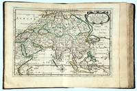
1662Best.-Nr. 16493Paris: chez l’Autheur 1662. SECOND EDITION. Complete with 17 double-page engraved maps hand-colored in outline. Contemporary mottled calf corner edges neatly repaired interior has some minor dampstaining mainly on text and on blank verso of maps last blank leaf torn on lower fore-edge. A contemporary signature on first blank leaf. Similar to L’Amerique this atlas of the continent of Asia was first printed in 1652 and reprinted here with a new title page. The maps are all dated 1652 with only one dated 1653 and do not include the address of Mariette. The atlas features maps of India Persia China Japan the Maldives Arabia and the Philippines among others. Just prior to publication of this series of works which also included atlases of Europe and Africa Sanson formed a partnership with Pierre Mariette an engraver and printseller. Pursuant to their contract Sanson drew the maps and Mariette engraved and printed them. Each maintained possession of half of the plates and they were allowed to exchange and/or buy from one another. Some bore the address of Sanson others Mariette. But Sanson allowed Mariette to store his plates and Mariette without prior agreement started placing his address on Sanson’s plates. In time a lawsuit which had been prosecuted was settled when both died and their respective sons took over the business. This atlas is a fine examples of French mapping by the foremost French cartographer of the seventeenth century. Sanson 1600-1667 “Geographe Ordinaire du Roi” to Louis XIII is considered the founder of French cartography and is generally acknowledged as the originator of the great age of French cartography. chez l’Autheur unknown books
1656Best.-Nr. 006682Paris: Chez l'Autheur 1656. First Edition. Full Calf. Very Good. 4to. 23.5 by 17.5 cm. Unpaginated 100 pages of text plus 2 pp. of ads. With 18 copper engraved maps all two page plates each with hand-colored of boundaries. Maps include one of the entire continent then of its various regions as then known plus the islands off the continent. Also a map of Malta. Bound in contemporary calf. Condition: calf dry and rubbed on spine and joints and edges rubbed. Light to moderate soiling in the margins of the pages. Two bookplates -- one of the Marquis of Lothian the other the Newbattle Abbey Library. Chez l'Autheur unknown books