SANSON, NicolasBiblio.com
484 Ergebnisse
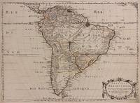
1650Best.-Nr. 309461Paris: Pierre Mariette 1650. unbound. Abraham Peyrounin. Map. Engraving with original outline color. Image measures 15 3/4" x 21 3/4" This exceptionally fine map of South America covers the continent in fine detail. Coastlines are extensively labeled and mountains beautifully rendered in profile. The Orinoco and Amazon Rivers as well as Rio de la Plata are prominently rendered. Sanson refrains from drawing a southern coastline to Tierra del Fuego and the relatively unknown Amazon region is depicted in minimal detail. Sanson does however include the mythical lake "Lac de Parime" and the city of gold "Manoa del Dora" between the Orinoco and Amazon rivers. Nice dark impression. In very good condition. Minor dampstain to lower margin not affecting the image and some faint stains near the center of the map - otherwise clean and bright. Hard to find. Nicolas Sanson 1600-1667 is considered the founder of the French school of cartography. In reaction to the prevailing trend of Dutch lavishness Sanson favored minimal details focusing rather on accurate cartography than ornament. Pierre Mariette unknown
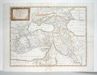
1660Best.-Nr. M2926Paris: Mariette Pierre 1660. Very Good; some browning on the lower margin near the fold. Size : 407x517 mm 16x20.375 Inches Coloring: Hand Colored Category: ; Maps Mediterranean Sea; Maps Asia Near East Turkey; Mariette, Pierre unknown
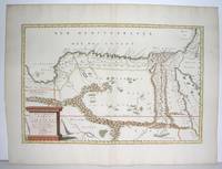
1655Best.-Nr. M2801Paris: Mariette Pierre 1655. Excellent. Size : 345x523 mm 13.625x20.625 Inches Coloring: Original Outline Coloring Category: Maps Africa North Egypt Mariette, Pierre unknown
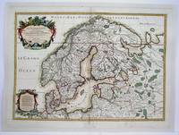
1708Best.-Nr. M4264Paris 1708. Very Good central fold reinforced mounted on acid free canvas. Size : 474x655 mm 18.625x25.75 Inches Coloring: Hand Colored in Outline Category: ; Maps Europe Scandinavia unknown
Best.-Nr. 3238Americas: Amsterdam Francois Halma 1705. Copper engraved map of North America by N. Sanson from Halma's Algemeene Werelde Beschryving Vol. 3 Black and white; title in Dutch; verso blank; strapwork title cartouche. Attractive small map showing North America with California as an Island California is shown with an indented northern coastline in the Foxe form. The detached coastline to the northwest of California is named Terre de Iesso ou Ieco rather than reflecting Sanson's earlier belief that it was an extension of the American continent. The R. de Nort drains into the Gulf of California from a large interior lake in the country of Les Apaches. The two western-most Great Lakes are left open-ended and Lake Erie remains unnamed. Engraved by Antoine d'Winter. This is the third state which includes a peninsula inserted northeast of California the Carolinas attributed to the French N. Iork added below N. Amstredam and an umlaut over the "Roy" in the title. This map appeared in Algemeene Weereld-Beschryving nae de Rechte Verdeeling der Landschappen Plaetsen Zeeën Rivieren &c. Geographisch Politisch Historisch Chronologisch en Genealogisch a Dutch edition of A. Phérotée de la Croix's Nouvelle Methode Pour Apprendre Facilement la Geographie Universelle which first appeared in 1690. Dark impression; dampstaining to edges not entering image. Nicolas Sanson d'Abbeville.1600-67 ' father of the French cartography' and founder of the Sanson firm. Atlas ' Cartes générales de toutes les parties du Monde' 1658-70 and a pocket atlas in 4 parts 1652-1705. Sanson's small maps from A. Phérotée de la Croix's Nouvelle Methode Pour Apprendre Facilement la Geographie Universelle. first published in 1652 and engraved by A. Peyrounin were copied several times by various map publishers. Johann David Zunners made copies of Sanson's maps for his German translation of Die Gantze Erd-Kugel in 1679. Johannes Ribbius and Simon de Vries published copies in 1682 and 1683 with new maps engraved by Antoine d'Winter. The plates were later sold to Francois Halma who used them in 1699 and then again in 1705 with the titles re-engraved in Dutch. François Halma 1653 - 1722 Dutch publisher/printer; dealer/auction house. Cartographer and publisher of maps active in Utrecht Amsterdam Franeker and Leeuwarden. Published 'Description de l'Univers' 1700; 'Algemene Wereldtbescrijving' 1705; 'Corpus Inscriptionum' 1707 and 'Lexicon Philosophicum' 1713. Keoman: Hal 1; Phillips 528; Burden #545; McLaughlin #89-3. Americas North America California as Island Amsterdam Francois Halma 1705 unknown
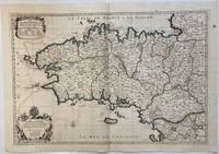
1693Best.-Nr. 324404Paris: Alexis-Hubert Jaillot 1693. Map. Engraving with hand colored outline. Image measures 21" x 31" This large 17th century double-page map features the Brittany region of France. Cities towns abbeys government buildings rivers ports and harbors are labeled. Mountains forests and wetlands are depicted pictorially. The attention to detail in topography and population centers hints at the abundance of the region known for its production of Muscadet wine cheese boar seafood and other agricultural products. Executed by Nicolas Sanson in dedication to his son this map was published by Alexis-Hubert Jaillot in Paris and later reproduced in Amsterdam by Jaillot and Pierre Mortier. This early edition is scarce and hard to find. In very good condition with some offsetting to left side and a spot in the right margin. Nicolas Sanson 1600-1667 is considered the founder of the French school of cartography. In reaction to the prevailing trend of Dutch lavishness Sanson favored minimal details focusing rather on accurate cartography than ornament. Alexis-Hubert Jaillot unknown
1692Best.-Nr. 31056Paris/Amsterdam Hubert Jaillot 1692. 585x885 cm. Kobberstukket Danmarkskort med Nordtyskland Skåne Halland og Blekinge i fuld håndkolorering med 2 store barok-kartoucher titelkartouche & målestokskartouche. Lille revnedannelse i foldningen øverst og nederst. nederste bladkant repareret uden tab. På kraftigt papir sammensat af to pladetryk. Dette store Jaillot-kort er det største af det 17.århundredes Danmarkskort udfærdiget med forlæg i Sanson's Danmarkskort i mindre format. "Jaillot-typen" er kendt for den pukkelryggede fremstilling af Jylland. - Bramsen gengiver trykket fra 1674 og omtaler p. 114 at kartouchen med en kvinde på en sky først forekommer 1696. Her foreligger både kvinden skyen og dateringen 1692. unknown
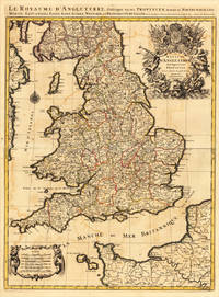
1693Best.-Nr. 17484Paris: H. Jaillot 1693. Other. In very good condition. 757 by 582mm 29¾ by 23 inches. 757 by 582mm 29¾ by 23 inches. Copper-engraving handcolored in outline when published. Minor offsetting of the old outline colors to the paper. Printed around 1693 by Hubert Jaillot in Paris printed from two plates and published in his great atlas the Atlas Noveau.. Large and decorative map of England by the French cartographer Nicolaus Sanson and Hubert Jaillot. Published in the 'Atlas Noveau.' this atlas was a masterpiece in the French cartography in the 17th century. The atlas was specially designed for Louis XIV and due of the very large size of the plates most maps were printed from two plates it took Hubert Jaillot over 12 years to complete the 'Atlas Noveau.'. England is very detailled shown on the map as well the various counties are shown in engraved territory borders. The maps are rich in detail with many cities and place names rivers mountains castles etc. The map is ornated with a very large fine allegoric title cartouche with coat of arms in the upper right corner as well a decorative cartouche with a milage scale in the lower left corner. H. Jaillot unknown
1654Best.-Nr. 6117740.1 x 56 cm original outline hand-colour copper engraving. EXTREMELY RARE map probably from ''Cartes generales de toutes les parties du monde' . Condition: with folds as issued with water stains and professionally repaired tear on lower left margin not affecting plate. Reference: Quirino p. 83; BMC Printed Maps XII col.867; Cat.Nat.mar.Mus.271 map 15; Nordenskiöld 275 vol.1 map 17; pastoureau Sanson V map 12. Pierre Mariette, Paris.
Best.-Nr. 17757London: J. Hooke at the Flower-de-Luce in Fleet Street & 2 others 1720. title continued: Being a Collection of Letters That passed between an English Lady and an English Gentleman in France who took an affection to each other by reading accidentally one another's Occasional Compositions both in Prose and Verse.First edtion First Issue. Engraved head and tail pieces. 8vo 7 3/4 x 4 3/4 inches pages: xxiv Dedication to Sir Richard Steele:xxv-lxviii A Critical Essay.by way of Letter from Mr. John Porter.:131 contemporary full panelled tan calf 20th Century very neat reback in tan calf with lettering piece. Contemporary signature 'Nichs Marshall' on front fly. Anon. Rare. Clio was Fowke's "literary" name for herself while Strephon was the poet and journalist William Bond. The work is an exchange of letters in verse and prose. Fowke's poetry sometimes expresses her frustration with the conventional expectations of a woman's place in 18th Century society; her former friend and fellow-writer Eliza Haywood attacked Fowke in a scandalous account of her relationships which affected the poet's reputation badly. London: J. Hooke, at the Flower-de-Luce, in Fleet Street [& 2 others], 1720. unknown
1696Best.-Nr. M8798Paris : Pierre Mariette c. 1696. Very Good. Notes: Fine detailed map of the straight of the Bosphorus and the city of Constantinople. Size : 405x528 mm 15.94x20.79 Inches Coloring: Hand Colored Category: Maps Asia Near East Turkey; Pierre Mariette unknown
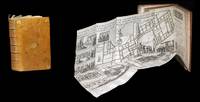
1643Best.-Nr. 309321643. S.l. chez l'Autheur sic 1643 - A Paris de l'Imprimerie de Robert Mansion 1636 - A Paris chez Antoine de Sommaville 1655 - A Paris s.. 1604 pour le troisiÂme texte ; divis en trois parties pagination spare. 3 ouvrages le dernier compos de 3 parties relis en un fort vol. au format in-12 173 x 112 mm de 1 f. bl. 3 ff. n.fol. et 106 pp. ; 1 f. bl. ; 4 ff. n.fol. et 111 pp. ; 3 ff. n.fol. et 50 pp. ; 3 ff. n.fol. et 63 pp. ; 72 pp. et 2 ff. n.fol. de PrivilÂge in fine. Reliure de l'poque de plein veau glac blond larges fleurons angulaires et fleuron central dors ports sur chacun des plats dos nerfs orn de filets gras froid roulette dore sur les nerfs caissons d'encadrement dors filets verticaux dors filets en pointills dors larges fleurons dors semis de pointills dors piÂce de titre de maroquin fauve titre dor palette dore en tÂte et queue roulette dore sur les coupes tranches mouchetes. Le prsent exemplaire renferme trois textes ; relis en un volume. Le Crmonial de l'lection des Papes closant le prsent volume est ici bien complet de ses 3 parties ainsi que de ses deux grandes planches dpliantes graves. Les deux premiers ouvrages sont l'oeuvre de Nicolas Sanson d'Abbeville clÂbre cartographe s'il en est. Coiffe infrieure arase. Quelques tches brunes sur les plats. Contre-gardes absentes. Quelques feuillets lgÂrement oxyds et rousseurs dans les corps d'ouvrages. Restauration ancienne au revers de chacun des planches. Du reste belle condition. Rare. b42961 unknown
1696Best.-Nr. M10189Amsterdam: Covens & Mortier c.1696. Very Good. Size : 420x540 mm 16.54x21.26 Inches Coloring: Hand Colored Category: Maps Mediterranean Islands; Covens & Mortier unknown
1692Best.-Nr. 001000Paris: Chez H. Jaillot 1692. First edition thus. Map. Good/No jacket as issued. Large double page copper engraved map 23" x 34 1/2". Contains wide margins and a decorative cartouche. Hand-colored boundaries and cartouche. General age-toning with minor browning. Nicely framed in modern rope effected matte gold frame 32" x 42" with gilt bordered white mat and acrylic glaze. A good copy of this scarce map. All text in French Printed just 9 years after the Ottomans besieged Vienna. Extra shipping may apply for foreign orders. Chez H. Jaillot unknown
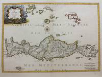
1658Best.-Nr. M9417Paris: Nicolas Sanson c.1658. Very Good upper fold area expertly repaired. Notes: A fine map of Crete from the mid 17th century. The map also shows nearby islands such as Santorini Stampalia and Milo. The map has a decorative cartouche and details cities borders and geographical features. Size : 394x553 mm 15.51x21.77 Inches Coloring: Hand Colored Category: Maps Europe Greece Macedonia; Nicolas Sanson unknown
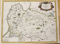
1659Best.-Nr. M4916Paris 1659. Very Good. Notes: Map of Baltic region of Estonia Latvia including Riga to Vilnius Wilna and parts of Lithuania. Nicolas Sanson 1600–1667 was a renowned French cartographer termed by some as the "father of French cartography." His works are known for their incorporation of the most up to date information of the time and their clean modern style. Size : 410x535 mm 16.125x21 Inches Coloring: Original Outline Coloring Reference: Category: Maps Europe Estonia Latvia unknown
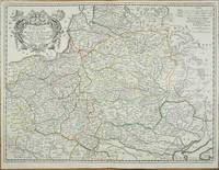
Best.-Nr. 11195Paris: 1655-1703. No binding. Good. 435 x 580 mm. early outline colour in good condition. A fine detailed map of Poland Lithuania Latvia present day Belarus and Ukraine published by Nicolas Sanson 1600-67. The map was first published in 1655 with at least one later state dated 1663. Here it is dated 1703 upper right. Sanson was to bring about the rise of French cartography although the fierce competition of the Dutch would last until the end of the century. This shift in cartographic centres shadowed the relative fortunes of the two countries; France under Louis XIV was a growing power in Europe. Born in Abbeville in the Picardy region of France 1600 Sanson studied history and turned to cartography as a means of recording it. In 1630 he was made Géographe Ordinaire du Roi and was to become one of the tutors to Louis XIV. However his future success was partly owing to the partnership he made with the publisher Pierre Mariette. In 1644 the latter had purchased the business of Melchoir Tavernier and helped Sanson with financial support in producing the maps for the planned atlas. In 1657 Pierre Mariette died which delayed publication of Sanson's atlas. However his son also named Pierre co-published Les Cartes Générales de toutes les parties du Monde the following year. It was the first folio French produced world atlas. Pastoureau 1984 Sanson V A 65. 1655-1703 unknown
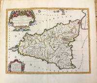
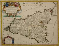
1692Best.-Nr. M7516Paris: Hubert Jaillot c. 1692. Very Good. Notes: Title cartouche in upper left features Sicilian coat of arms winged angels and merpeople while the scale in the lower left is held on each side by allegorical figures of labour and harvest. Mount Etna is represented pictorially. Size : 418x530 mm 16.46x20.87 Inches Coloring: Hand Colored in Outline Category: Maps Mediterranean Islands; Hubert Jaillot unknown
1696Best.-Nr. 206066Amsterdam: Alexis-Hubert Jaillot 1696. unbound. very good. Map. Engraving with hand outline. Image measures 23" x 35". Stunning map showing the vast extent of the German Empire including parts of Poland Bohemia Hungary Austria Croatia Italy France and the Netherlands. Exquisite and subtle coloring beautifully detailed. Based on a plate by Nicolas Sanson reworked and published in "Atlas Nouveau" by Jaillot. Severe toning due to early acid backing chipping to edges and corners and some tears. Priced as is. Alexis-Hubert Jaillot 1632--1712 was a French sculptor engraver publisher and cartographer. He served as official geographer to King Louis XIV and worked with other prominent mapmakers of the period such as Nicolas Sanson He is best known for his Atlas Nouveau of 1674. Alexis-Hubert Jaillot unknown
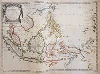
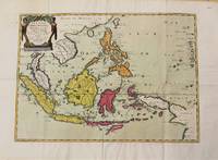
1654Best.-Nr. M10780Paris 1654. Very Good. Notes: Detailed map of Southeast Asia by Nicholas Sanson 1600-1667 renowned French cartographer. Size : 402x560 mm 15.83x22.05 Inches Coloring: Original Hand Coloring Category: Maps Asia South East Indonesia & Papua New Guinea; Maps Asia South East Thailand Laos Vietnam Cambodia & Burma / Myanmar; Maps Asia South East Philippines; unknown
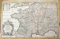
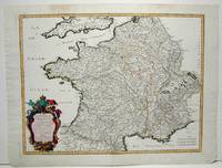
1690Best.-Nr. M10380Paris: H. Jaillot c.1690. Very Good backed on acid free tissue paper for long term preservation. Notes: Large and detailed map of France with a large decorative cartouche in the lower left two sheets joined. Size : 565x896 mm 22.24x35.28 Inches Coloring: Original Outline Coloring Category: Maps Europe France; H. Jaillot unknown
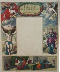
1650Best.-Nr. M2494Paris 1650. Very Good; light age toning; some browning on lower half of the map. Size : 547x433 mm 21.5x17 Inches Coloring: Original Hand Coloring Category: ; Maps Misc Curiosities Title Pages Games etc. unknown
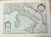
1783Best.-Nr. M10279Paris: H. Jaillot c.1783. Very Good. Size : 469x655 mm 18.46x25.79 Inches Coloring: Original Hand Coloring Category: Maps Europe Italy; Maps Mediterranean Islands; H. Jaillot unknown
1665Best.-Nr. M1736Paris: Mariette Pierre 1665. Excellent; some light browning on upper margin. Size : 410x535 mm 16.125x21 Inches Coloring: Original Hand Coloring Category: ; Maps Europe France Mariette, Pierre unknown
1780Best.-Nr. M5125Paris 1780. Excellent. Size : 490x690 mm 19.25x27.125 Inches Coloring: Hand Colored in Outline Category: ; Maps Asia Middle East Holy Land & Palestine unknown