138 risultati
1824rif. 349851824. hardcover. very good. 8 volumes. Thick 12mo 1/2 brown calf marbled boards and endpapers. Paris: Depot du Memorial 1824. Very good. Classic exhaustively detailed account of the Little Corporal's last months in exile. unknown books
1827rif. 721701 vol. grand in-folio (58,5 x 40 cm) reliure de l'époque demi-veau violine, dos lisse orné, plats de percaline orné de filets dorés, P. J. de Mat, Bruxelles, 1827, 2 ff. (titre et "Fastes Napoléens"), 36 tableaux doubles (souvent illustrés de cartes rehaussées en couleurs), 6 ff. n. ch. ("Histoire des Pays-Bas" par J. Marchal de Bruxelles, "Exposé préliminaire de l'éditeur français", "Addition importante à l'atlas de Le Sage" et "Table raisonnée des matières").
rif. elala5617London: Printed For Henri Colburn 1824. Second and Best Edition. Las Cases a French officer accompanied Napoleon into exile at St. Helena in 1815. There he fulfilled the role of secretary recording Napoleon's conversations which he later published in the present work. 8 Parts in 4 Volumes. 8vo. pp. x 395 1; vi 375 1; v 1 378; iv 376; iv 319 1; vi 384; v 1errata 334; iv 318. 2 engraved portraits 3 of 4 hand-coloured aquatints 1 engraved plate 1 folding engraved plan & 3 folding engraved maps 1 in duplicate. contemporary calf neatly rebacked gilt tooled spines all edges gilt some light wear to joints & extremities occasional light foxing. elala5617 London: Printed For Henri Colburn, 1824
1825rif. 4775CBKarlsruhe, J. Velten, 1825-28. Atlas-folio. Doppelblattgr. Titel und Widmung, 3 Bl. Vorrede und Inhalt, 43 Doppelblatt mit 24 kol. Karten im Text. Halbleder d. Zt.
1808rif. 55974(Paris, Didot L'Ainé), 1808 (1805-06). Folio. (54 x 39 cm.). Contemp. hcalf. Wear to spine. Spine-ends repaired. Corners bumped.Titlelabel with gilt lettering on upper cover. (2) pp. , (recto: Atlas historique.- verso: Index, listing 32), Engraved frontispiece: Les Fastes Napoléens de 1796, a 1808, with a small handcoloured map, dated 1808. With 34 double-page uncut sheets (ca. 53 x 72 cm.) of which 16 are in letterpress text, handcoloured, 18 sheets are maps surrounded by text, all handcoloured. Internally clean and fine in original colouring. Map-sheets dated 1805-06. The frontispiece having a dampstain.
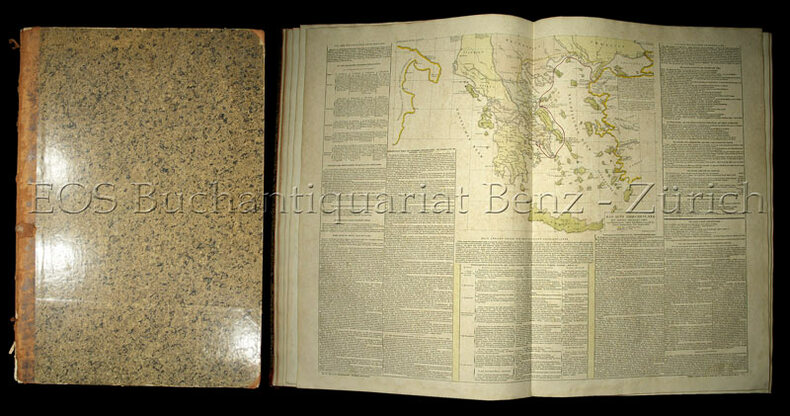
1826rif. 48018Carlsruhe: Johan Velten 1826. hardcover. very good. Folio. Worn but sturdy marbled boards with expert repairs in cloth to spine and corners; some hinges have also been restored. Includes elaborate title page dedication page preface to German edition 43 hinged hand-colored sheets 24 maps and 19 tables. Some light toning and foxing throughout. Carlsruhe: Johann Velten 1826. First German edition of the popular French atlas. Phillips List of Geographical Atlases #3550. Title translates to: "Historical-genealogical-geographical Atlas of Le Sage Count Las Cases in three and thirty-fold surveys translated from French of the latest edition into German and augmented with two political-geographical surveys by Alexandre von Dusch". Emmanuel-Augustin-Dieudonné-Joseph comte de Las Cases 1766-1842 was a French atlas-maker aka Le-Sage and author. Johan Velten unknown
1826rif. 48018Carlsruhe: Johan Velten 1826. hardcover. very good. Folio. Worn but sturdy marbled boards with expert repairs in cloth to spine and corners; some hinges have also been restored. Includes elaborate title page dedication page preface to German edition 43 hinged hand-colored sheets 24 maps and 19 tables. Some light toning and foxing throughout. Carlsruhe: Johann Velten 1826. First German edition of the popular French atlas. Phillips List of Geographical Atlases #3550. Title translates to: "Historical-genealogical-geographical Atlas of Le Sage Count Las Cases in three and thirty-fold surveys translated from French of the latest edition into German and augmented with two political-geographical surveys by Alexandre von Dusch". Emmanuel-Augustin-Dieudonné-Joseph comte de Las Cases 1766-1842 was a French atlas-maker aka Le-Sage and author. Johan Velten unknown books
1818rif. 316794London: Printed by R. Juigné 17 Margaret Street Cavendish Square 1818. Second Edition augmented with a map of Europe Showing its presewnt divisons as settled by the Congress of Vienna. With 39 double page plates and with six additional maps tipped in. Title page not present plate XIII America bound out of order. 1 vols. Folio 18 x 16 inches approx. Recent half deerskin and marbled boards. Original printed title label Price £4.4s mounted on upper board. Second Edition augmented with a map of Europe Showing its presewnt divisons as settled by the Congress of Vienna. With 39 double page plates and with six additional maps tipped in. Title page not present plate XIII America bound out of order. 1 vols. Folio 18 x 16 inches approx. Attractively bound copy of this standard early nineteenth century compendium of historical charts and historical geography. With six additional historical maps tipped in: Map of Great Britain according to the Itereray of Antoninus T. Lodge sculp. ca. 1750. Alexander's Expedition E. Bowen sculp. Expedition of Cyrus E. Bowen sculp. A Map of the Retreat of the Ten Thousand. Asia Minor for the Ancient History of Mr. Rollin R.W. Seale sculp. A map of the Nordic lands. Printed by R. Juigné, 17, Margaret Street, Cavendish Square unknown
1818rif. 316794London: Printed by R. Juigné 17 Margaret Street Cavendish Square 1818. Second Edition augmented with a map of Europe Showing its presewnt divisons as settled by the Congress of Vienna. With 39 double page plates and with six additional maps tipped in. Title page not present plate XIII America bound out of order. 1 vols. Folio 18 x 16 inches approx. Recent half deerskin and marbled boards. Original printed title label Price £4.4s mounted on upper board. Second Edition augmented with a map of Europe Showing its presewnt divisons as settled by the Congress of Vienna. With 39 double page plates and with six additional maps tipped in. Title page not present plate XIII America bound out of order. 1 vols. Folio 18 x 16 inches approx. Attractively bound copy of this standard early nineteenth century compendium of historical charts and historical geography. With six additional historical maps tipped in: Map of Great Britain according to the Itereray of Antoninus T. Lodge sculp. ca. 1750. Alexander's Expedition E. Bowen sculp. Expedition of Cyrus E. Bowen sculp. A Map of the Retreat of the Ten Thousand. Asia Minor for the Ancient History of Mr. Rollin R.W. Seale sculp. A map of the Nordic lands. Printed by R. Juigné, 17, Margaret Street, Cavendish Square unknown books
1807rif. 32723Florence: Cheze Molini Landi. Near Fine with no dust jacket. 1807. Hardcover. Color Illustrations; Elephant Folio 23" ; Contemp. 1/2 calf & marbled bds. blind & gilt-decorated gilt-lettered spine marbled endpapers & edges; scuffed corners slightly rubbed. Hand-colored double-page Hemisphere maps 35 hand-colored double-page engraved maps & tables on sheets with letterpress. Scattered generally light foxing. Armorial bookplate of Baron Northwick on front pastedown. Ex-library - ink stamp at foot of preface. A little rubbing to extremities otherwise quite nice. . Cheze Molini, Landi, hardcover
rif. 8492[Paris]: De Sourdon, rue de la Jussienne No 15, [1808-1809]. Un grand volume in-folio : 36,5 x 58 cm. 2 ff. [Exposé, Préliminaire, classification et nature des tableaux / Les Fastes napoléoniens 1796 à 1806], suivi de 33 cartes et tableaux à double-page, à savoir: 1. Tableau général de l'histoire universelle ancienne; 2. Tableau général de l'histoire universelle moderne; 3. Développement des dix premiers siècles de l'ère chrétienne; 4. Développement depuis de dixième siècle jusqu'à nos jours ; 5. Le monde connu des anciens; 6. La Grèce antique; expéditions de Xerxes ; 7. L'Empire romain; 8. L'invasion des Barbares; 9. Généalogie générale de France; 10. Détails généalogiques des Capétiens, Valois, etc. ; 11. Détails généalogiques des Capétiens, Bourbons, etc. 12. Carte géographique de France; 13. Carte historique et généalogique d'Angleterre; 14. Carte géographique d'Angleterre. 15. Généalogie de Savoie. 16. Carte géographique d'Italie; 17. Tableau généalogique des rois de Portugale, etc.; 18. Géographie d'Espagne et de Portugal; 19. De l'Allemagne, 1ère Partie; 20. Généalogie de la Maison de Habsbourg; 21. De l'Allemagne complété; 22. Généalogie de Lorraine; 23. Généalogie de la Maison de Prusse; 24. Généalogie de Saxe, Bavière, etc. 25. Généalogie de Brunswick, Bade, Hesse, etc. 26. Contrées transrhénanes; 27. Maison de Holstein; 28. Carte géographique, historique de la Russie; 29. Mappemonde: voyageurs; 30. De l'Europe géographique; 31. Géographie de l'Asie; 32. Géographie de l'Afrique; 33. Géographie de l'Amérique. Quatrième édition du célèbre atlas de Lesage, imprimé par Pierre Didot l'Aîné, comportant notamment des tableaux généalogiques et des cartes délicatement relevées à l'aquarelle, ainsi qu'une page de titre gravée par Moisy. La première édition remonte à 1804 et fera largement connaître son auteur, le comte de Las Cases (1766-1842), qui écrit ici sous un nom de plume (Quérard, IV, pp. 586-589). Le prospectus de la librairie de Sourdon précise : "Cet ouvrage est indispensablement nécessaire pour lire l'histoire avec fruit et l'apprendre avec facilité ; il est tout à la fois élémentaire et de recherches, également propre aux écoles et aux bibliothèques ; il a été déclaré classique dans plusieurs pays, et avec son secours il n'est pas de parents qui ne puissent enseigner leurs enfants, ni de jeunes gens qui ne puissent s'instruire eux-mêmes : il s'en est vendu plus de 4000 exemplaires en 5 ans (...). Toutes les Feuilles ou les Tableaux de cet ouvrage peuvent s'acheter separément, à 4 fr. pap. ordinaire, ou 5 fr. pap. fin". (Dreux du Radier, Mémoires historiques, critiques et anecdotes des reines, VI, p. 403). Le volume est vendu ici sans les cartes supplémentaires parues après 1809. Ouvrage relié postérieurement en demi chagrin marron. Coiffe supérieure largement endommagée, éraflures avec manques au dos, coins émoussés, la couverture est partiellement désolidarisée de l'ensemble. Rousseurs et salissures occasionnelles, papier légèrement jauni, déchirure sur deux plans (sans manque), sinon ouvrage toujours impressionnant, bien complet des plans annoncés pour cette édition.
1821rif. 25077Philadelphia: M. Carey and Sons Printed by T.H. Palmer on Ramage's Ruthven Press and on J. & T. Gilpin's Machine Paper 1821. Handsome American Atlas "From the last London edition.enlarged by the addition of several new maps of American History and Geography extended to the beginning of the year 1821. Third American edition carefully revised and corrected." A massive work attempting to chronicle the history of the world region by region including brief accounts of important navigations and maps of the various regions and of the world. Contains a handsome double-page map of the United States by John Melish with Texas shown as a separate territory. Folio. Modern half morocco and marbled boards. Titlepage soiled and somewhat chipped at edge with library perforation stamp. Neat reinforcements in gutters of most leaves. Maps and charts are very clean. Except for the titlepage just about very good. SABIN 39125. PHILLIPS ATLASES 132. hardcover
1821rif. 25077Philadelphia: M. Carey and Sons Printed by T.H. Palmer on Ramage's Ruthven Press and on J. & T. Gilpin's Machine Paper 1821. Handsome American Atlas "From the last London edition.enlarged by the addition of several new maps of American History and Geography extended to the beginning of the year 1821. Third American edition carefully revised and corrected." A massive work attempting to chronicle the history of the world region by region including brief accounts of important navigations and maps of the various regions and of the world. Contains a handsome double-page map of the United States by John Melish with Texas shown as a separate territory. Folio. Modern half morocco and marbled boards. Titlepage soiled and somewhat chipped at edge with library perforation stamp. Neat reinforcements in gutters of most leaves. Maps and charts are very clean. Except for the titlepage just about very good. SABIN 39125. PHILLIPS ATLASES 132. hardcover books