121 risultati
rif. 9782019327200Hachette pratique
1929rif. 36646Milano: Rizzoli 1929. Due volumi di cm. 27 pp. 1300 ca. complessive. Con moltissime illustrazioni. Leg. edit. in tela blu con titoli in oro. Qualche fioritura ai tagli peraltro ottimo stato di conservazione. Rizzoli hardcover
rif. 3-58785Milano Rizzoli 1930 due volumi in-4to rilegati in mezza pelle marrone con titoli e fregi dorati ai dorsi copertina originale illustrata a colori applicata al piatto anteriore del primo volume pp. 606 766 con numerosissime illustrazioni nel testo. unknown
rif. 9782017300045Hachette pratique
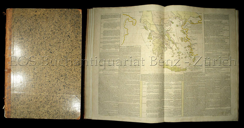
1826rif. 48018Carlsruhe: Johan Velten 1826. hardcover. very good. Folio. Worn but sturdy marbled boards with expert repairs in cloth to spine and corners; some hinges have also been restored. Includes elaborate title page dedication page preface to German edition 43 hinged hand-colored sheets 24 maps and 19 tables. Some light toning and foxing throughout. Carlsruhe: Johann Velten 1826. First German edition of the popular French atlas. Phillips List of Geographical Atlases #3550. Title translates to: "Historical-genealogical-geographical Atlas of Le Sage Count Las Cases in three and thirty-fold surveys translated from French of the latest edition into German and augmented with two political-geographical surveys by Alexandre von Dusch". Emmanuel-Augustin-Dieudonné-Joseph comte de Las Cases 1766-1842 was a French atlas-maker aka Le-Sage and author. Johan Velten unknown books
1825rif. 4775CBKarlsruhe, J. Velten, 1825-28. Atlas-folio. Doppelblattgr. Titel und Widmung, 3 Bl. Vorrede und Inhalt, 43 Doppelblatt mit 24 kol. Karten im Text. Halbleder d. Zt.
1826rif. 48018Carlsruhe: Johan Velten 1826. hardcover. very good. Folio. Worn but sturdy marbled boards with expert repairs in cloth to spine and corners; some hinges have also been restored. Includes elaborate title page dedication page preface to German edition 43 hinged hand-colored sheets 24 maps and 19 tables. Some light toning and foxing throughout. Carlsruhe: Johann Velten 1826. First German edition of the popular French atlas. Phillips List of Geographical Atlases #3550. Title translates to: "Historical-genealogical-geographical Atlas of Le Sage Count Las Cases in three and thirty-fold surveys translated from French of the latest edition into German and augmented with two political-geographical surveys by Alexandre von Dusch". Emmanuel-Augustin-Dieudonné-Joseph comte de Las Cases 1766-1842 was a French atlas-maker aka Le-Sage and author. Johan Velten unknown
rif. 9782017300472Hachette pratique
rif. 9782017300380Hachette pratique
rif. 9782019327194Hachette pratique
1853rif. 682521 vol. in-12 reliure postérieure demi-basane verte, Garnier Frères, Paris, 1853, 2 ff., 101 pp.
rif. 9782017300038Hachette pratique
rif. 9782017300397Hachette pratique
rif. 9782017300465Hachette pratique
rif. 9782017300052Hachette pratique
rif. R200079456HENRI GAUTIER. NON DATE. In-12. En feuillets. Bon état, Couv. convenable, Dos satisfaisant, Intérieur frais. 36 pages. Quelques rousseurs.. . . . Classification Dewey : 840-Littératures des langues romanes. Littérature française
1808rif. 55974(Paris, Didot L'Ainé), 1808 (1805-06). Folio. (54 x 39 cm.). Contemp. hcalf. Wear to spine. Spine-ends repaired. Corners bumped.Titlelabel with gilt lettering on upper cover. (2) pp. , (recto: Atlas historique.- verso: Index, listing 32), Engraved frontispiece: Les Fastes Napoléens de 1796, a 1808, with a small handcoloured map, dated 1808. With 34 double-page uncut sheets (ca. 53 x 72 cm.) of which 16 are in letterpress text, handcoloured, 18 sheets are maps surrounded by text, all handcoloured. Internally clean and fine in original colouring. Map-sheets dated 1805-06. The frontispiece having a dampstain.
1827rif. 721701 vol. grand in-folio (58,5 x 40 cm) reliure de l'époque demi-veau violine, dos lisse orné, plats de percaline orné de filets dorés, P. J. de Mat, Bruxelles, 1827, 2 ff. (titre et "Fastes Napoléens"), 36 tableaux doubles (souvent illustrés de cartes rehaussées en couleurs), 6 ff. n. ch. ("Histoire des Pays-Bas" par J. Marchal de Bruxelles, "Exposé préliminaire de l'éditeur français", "Addition importante à l'atlas de Le Sage" et "Table raisonnée des matières").
1807rif. 32723Florence: Cheze Molini Landi. Near Fine with no dust jacket. 1807. Hardcover. Color Illustrations; Elephant Folio 23" ; Contemp. 1/2 calf & marbled bds. blind & gilt-decorated gilt-lettered spine marbled endpapers & edges; scuffed corners slightly rubbed. Hand-colored double-page Hemisphere maps 35 hand-colored double-page engraved maps & tables on sheets with letterpress. Scattered generally light foxing. Armorial bookplate of Baron Northwick on front pastedown. Ex-library - ink stamp at foot of preface. A little rubbing to extremities otherwise quite nice. . Cheze Molini, Landi, hardcover
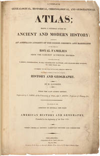
1821rif. 25077Philadelphia: M. Carey and Sons Printed by T.H. Palmer on Ramage's Ruthven Press and on J. & T. Gilpin's Machine Paper 1821. Handsome American Atlas "From the last London edition.enlarged by the addition of several new maps of American History and Geography extended to the beginning of the year 1821. Third American edition carefully revised and corrected." A massive work attempting to chronicle the history of the world region by region including brief accounts of important navigations and maps of the various regions and of the world. Contains a handsome double-page map of the United States by John Melish with Texas shown as a separate territory. Folio. Modern half morocco and marbled boards. Titlepage soiled and somewhat chipped at edge with library perforation stamp. Neat reinforcements in gutters of most leaves. Maps and charts are very clean. Except for the titlepage just about very good. SABIN 39125. PHILLIPS ATLASES 132. hardcover books
1821rif. 25077Philadelphia: M. Carey and Sons Printed by T.H. Palmer on Ramage's Ruthven Press and on J. & T. Gilpin's Machine Paper 1821. Handsome American Atlas "From the last London edition.enlarged by the addition of several new maps of American History and Geography extended to the beginning of the year 1821. Third American edition carefully revised and corrected." A massive work attempting to chronicle the history of the world region by region including brief accounts of important navigations and maps of the various regions and of the world. Contains a handsome double-page map of the United States by John Melish with Texas shown as a separate territory. Folio. Modern half morocco and marbled boards. Titlepage soiled and somewhat chipped at edge with library perforation stamp. Neat reinforcements in gutters of most leaves. Maps and charts are very clean. Except for the titlepage just about very good. SABIN 39125. PHILLIPS ATLASES 132. hardcover