RAMA, Jean-PierreMareMagnum

17.248 Ergebnisse
Relie, cartonnage d'editeur, 215 x 305mm., 384pp., illustration profonde en couleurs et en n/b. ISBN 2851010190. Historique de la fonderie d'Art - Le moulage au sable - La fonte a pieces - Le tirage d'epaisseur - La medaille - La fonte tiree ou fonte a figure - Le remmoulage - La cire perdue - Les alliages cuivreux - La fusion ( metallurgie ) - La fusion ( presentation et conduites des fours ) - La finition des pieces - La patine - Materiel et materiaux. Excellent etat.
1920Best.-Nr. 007532Paris Édition de la Nouvelle Revue Française 1920 In-12 Broché, couverture illustrée rempliée Edition originale
1959Edizioni Paoline, settembre 1959. Collana " Rossazzurro ". Titolo originale: Die Glocken von Hochwald. Rilegato con copertina rigida e sovraccoperta. Spedizioni tracciabili con raccomandata entro 24 ore dall'ordine. Hardback cover with dust jacket in fine conditions, no price clipped, no inscriptions or markings inside. Worldwide delivery.
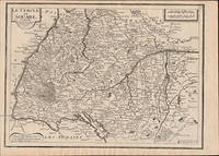
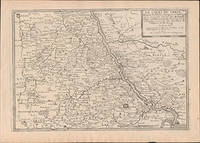
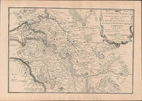
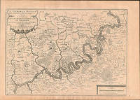
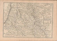
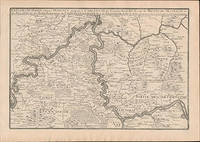
Best.-Nr. 51-6463Paris: chez l'auteur dans l'Isle du Palais sur le quay de l'orloge a la Sphére Royale avec privilége du Roy 1705-1717. Engraved map. 27.3 x 38cm. Contemporary laid paper uniformly time aged.Published in "L'atlas curieux ou le monde reÌpreseÌnteÌ dans des cartes geÌneÌrales et particulieres du ciel et de la terre : diviseÌ tant en ses quatre principales parties que par eÌtats et provinces et orneÌ par des plans et descriptions des villes capitales et principales et des plus superbes edifices qui les embelissent comme sont les eglises les palais les maisons de plaisance les iardins les fontaines &c. ". OCLC Number / Unique Identifier:79022119.LThe Atlas Curieux is geographic encyclopedia of images and maps of France with detailed views of the grand waterworks at Marly views of the great palaces and chateaux views and plans of the Paris Observatory and samples of military architecture. Issued in six annual parts from 1700-1705 the maps are based on the new observations of the Académie des Sciences and drawn up with the assistance of Philipe de La Hire.ibrary of Congress:The French cartographer and engraver Nicolas de Fer was a master at creating maps that were works of art. The maps that he published were printed during the Baroque period when the decorative arts were characterized by ornate detail. De Fer’s detailed maps and atlases were valued more for their decorative content than their geographical accuracy.Nicolas de Fer was born in 1646. His father Antoine de Fer owned a mapmaking firm. At the age of twelve Nicolas was apprenticed to a Parisian engraver named Louis Spirinx. The family business was starting to decline when his father died in 1673. Nicolas de Fer’s mother Genevieve took over the business after the death of her husband. In 1687 the business was passed on to Nicolas and the profits increased after he took over the firm. Nicolas de Fer was a prolific cartographer who produced atlases and hundreds of single maps. He eventually became the official geographer to King Louis XIV of France and King Philip V of Spain.One of de Fer’s major works is an atlas titled L’atlas curieux The curious atlas. Paris: chez l'auteur dans l'Isle du Palais sur le quay de l'orloge a la Sphére Royale avec privilége du Roy, 1705-1717 unknown
Best.-Nr. 201808016Paris, Editions gp , 1962 ; in-8, 186 pp., cartonnage de l'éditeur. Avec jaquette n°136.
1957Best.-Nr. 23590ABLausanne, André et Pierre Gonin, (1957). 4°. 23 Bl. Mit zahlr. farb., z.T. ganzs. Textillust. von Hans Fischer. Lose Lagen in Orig.-Umschlag, Halbpergament-Chemise u. Schuber.
1957Best.-Nr. 23590ABLausanne, André et Pierre Gonin, (1957). 4°. 23 Bl. Mit zahlr. farb., z.T. ganzs. Textillust. von Hans Fischer. Lose Lagen in Orig.-Umschlag, Halbpergament-Chemise u. Schuber. + Wichtig: Für unsere Kunden in der EU erfolgt der Versand alle 14 Tage verzollt ab Deutschland / Postbank-Konto in Deutschland vorhanden +
Best.-Nr. 201808049Paris, Editions gp , 1957 ; in-8, 186 pp., cartonnage de l'éditeur. Avec jaquette n°121 avec point.
Best.-Nr. 19829Roquemaure (Gard), chez l'auteur, 1876, 1 demi chagrin, dos à nerfs, tête jaspée, couverture conservée. in-8 de XII-491 pages ;
1944Best.-Nr. 40131944 MONTROUGE, novembre 1944, DRAEGER frères, volume in-4 catonné, couverture illustré de DELFAU, 40 pages, un des 1000 exemplaires numerotés sur velin . parfait état .
Best.-Nr. 200711074Paris, Editions G.P., 1959 ; in-12, 250 pp., cartonnage de l'éditeur. 34e vol de la série - illustrations de Sainte-Croix.
1947Best.-Nr. 000645quéméré Edtions G.P. Claire Rigide Illustrée 1947 dessins en couleurs hors texte
Best.-Nr. 6138445341.Gpaperback. Good. Access codes and supplements are not guaranteed with used items. May be an ex-library book. paperback
Best.-Nr. ria9786138445340_inpPaperback. New. New Book; Fast Shipping from UK; Not signed; Not First Edition; Le conflit d'intérêts constitue aujourd'hui une réelle menace et un immense défi à l'efficacité de la gouvernance de l'Etat. Ayant pris conscience de son impact négatif sur la procédure de gestion de la commande publique le Togo a mis paperback
Best.-Nr. 51-6457Paris: chez l'auteur dans l'Isle du Palais sur le quay de l'orloge a la Sphére Royale avec privilége du Roy 1705-1717. Engraved map. 27.3 x 38 cm. Contemporary laid paper uniformly time aged.Published in "L'atlas curieux ou Le monde reÌpreseÌnteÌ dans des cartes geÌneÌrales et particulieres du ciel et de la terre : diviseÌ tant en ses quatre principales parties que par eÌtats et provinces et orneÌ par des plans et descriptions des villes capitales et principales et des plus superbes edifices qui les embelissent comme sont les eglises les palais les maisons de plaisance les iardins les fontaines &c. ". OCLC Number / Unique Identifier:79022119.LThe Atlas Curieux is geographic encyclopedia of images and maps of France with detailed views of the grand waterworks at Marly views of the great palaces and chateaux views and plans of the Paris Observatory and samples of military architecture. Issued in six annual parts from 1700-1705 the maps are based on the new observations of the Académie des Sciences and drawn up with the assistance of Philipe de La Hire.ibrary of Congress:The French cartographer and engraver Nicolas de Fer was a master at creating maps that were works of art. The maps that he published were printed during the Baroque period when the decorative arts were characterized by ornate detail. De Fer’s detailed maps and atlases were valued more for their decorative content than their geographical accuracy.Nicolas de Fer was born in 1646. His father Antoine de Fer owned a mapmaking firm. At the age of twelve Nicolas was apprenticed to a Parisian engraver named Louis Spirinx. The family business was starting to decline when his father died in 1673. Nicolas de Fer’s mother Genevieve took over the business after the death of her husband. In 1687 the business was passed on to Nicolas and the profits increased after he took over the firm. Nicolas de Fer was a prolific cartographer who produced atlases and hundreds of single maps. He eventually became the official geographer to King Louis XIV of France and King Philip V of Spain.One of de Fer’s major works is an atlas titled L’atlas curieux The curious atlas. Paris: chez l'auteur dans l'Isle du Palais sur le quay de l'orloge a la Sphére Royale avec privilége du Roy, 1705-1717 unknown
Best.-Nr. 51-6459Paris: chez l'auteur dans l'Isle du Palais sur le quay de l'orloge a la Sphére Royale avec privilége du Roy 1705-1717. Engraved map. 27.3 x 38 cm. Contemporary laid paper uniformly time aged.Published in "L'atlas curieux ou Le monde reÌpreseÌnteÌ dans des cartes geÌneÌrales et particulieres du ciel et de la terre : diviseÌ tant en ses quatre principales parties que par eÌtats et provinces et orneÌ par des plans et descriptions des villes capitales et principales et des plus superbes edifices qui les embelissent comme sont les eglises les palais les maisons de plaisance les iardins les fontaines &c. ". OCLC Number / Unique Identifier:79022119.LThe Atlas Curieux is geographic encyclopedia of images and maps of France with detailed views of the grand waterworks at Marly views of the great palaces and chateaux views and plans of the Paris Observatory and samples of military architecture. Issued in six annual parts from 1700-1705 the maps are based on the new observations of the Académie des Sciences and drawn up with the assistance of Philipe de La Hire.ibrary of Congress:The French cartographer and engraver Nicolas de Fer was a master at creating maps that were works of art. The maps that he published were printed during the Baroque period when the decorative arts were characterized by ornate detail. De Fer’s detailed maps and atlases were valued more for their decorative content than their geographical accuracy.Nicolas de Fer was born in 1646. His father Antoine de Fer owned a mapmaking firm. At the age of twelve Nicolas was apprenticed to a Parisian engraver named Louis Spirinx. The family business was starting to decline when his father died in 1673. Nicolas de Fer’s mother Genevieve took over the business after the death of her husband. In 1687 the business was passed on to Nicolas and the profits increased after he took over the firm. Nicolas de Fer was a prolific cartographer who produced atlases and hundreds of single maps. He eventually became the official geographer to King Louis XIV of France and King Philip V of Spain.One of de Fer’s major works is an atlas titled L’atlas curieux The curious atlas. Paris: chez l'auteur dans l'Isle du Palais sur le quay de l'orloge a la Sphére Royale avec privilége du Roy, 1705-1717 unknown
Best.-Nr. 51-6461Paris: chez l'auteur dans l'Isle du Palais sur le quay de l'orloge a la Sphére Royale avec privilége du Roy 1705-1717. Engraved map. 27.3 x 38cm. Contemporary laid paper uniformly time aged.Published in "L'atlas curieux ou le monde reÌpreseÌnteÌ dans des cartes geÌneÌrales et particulieres du ciel et de la terre : diviseÌ tant en ses quatre principales parties que par eÌtats et provinces et orneÌ par des plans et descriptions des villes capitales et principales et des plus superbes edifices qui les embelissent comme sont les eglises les palais les maisons de plaisance les iardins les fontaines &c. ". OCLC Number / Unique Identifier:79022119.LThe Atlas Curieux is geographic encyclopedia of images and maps of France with detailed views of the grand waterworks at Marly views of the great palaces and chateaux views and plans of the Paris Observatory and samples of military architecture. Issued in six annual parts from 1700-1705 the maps are based on the new observations of the Académie des Sciences and drawn up with the assistance of Philipe de La Hire.ibrary of Congress:The French cartographer and engraver Nicolas de Fer was a master at creating maps that were works of art. The maps that he published were printed during the Baroque period when the decorative arts were characterized by ornate detail. De Fer’s detailed maps and atlases were valued more for their decorative content than their geographical accuracy.Nicolas de Fer was born in 1646. His father Antoine de Fer owned a mapmaking firm. At the age of twelve Nicolas was apprenticed to a Parisian engraver named Louis Spirinx. The family business was starting to decline when his father died in 1673. Nicolas de Fer’s mother Genevieve took over the business after the death of her husband. In 1687 the business was passed on to Nicolas and the profits increased after he took over the firm. Nicolas de Fer was a prolific cartographer who produced atlases and hundreds of single maps. He eventually became the official geographer to King Louis XIV of France and King Philip V of Spain.One of de Fer’s major works is an atlas titled L’atlas curieux The curious atlas. Paris: chez l'auteur dans l'Isle du Palais sur le quay de l'orloge a la Sphére Royale avec privilége du Roy, 1705-1717 unknown
Best.-Nr. 51-6458Paris: chez l'auteur dans l'Isle du Palais sur le quay de l'orloge a la Sphére Royale avec privilége du Roy 1705-1717. Engraved map. 27.3 x 38 cm. Contemporary laid paper uniformly time aged.Published in "L'atlas curieux ou Le monde reÌpreseÌnteÌ dans des cartes geÌneÌrales et particulieres du ciel et de la terre : diviseÌ tant en ses quatre principales parties que par eÌtats et provinces et orneÌ par des plans et descriptions des villes capitales et principales et des plus superbes edifices qui les embelissent comme sont les eglises les palais les maisons de plaisance les iardins les fontaines &c. ". OCLC Number / Unique Identifier:79022119.LThe Atlas Curieux is geographic encyclopedia of images and maps of France with detailed views of the grand waterworks at Marly views of the great palaces and chateaux views and plans of the Paris Observatory and samples of military architecture. Issued in six annual parts from 1700-1705 the maps are based on the new observations of the Académie des Sciences and drawn up with the assistance of Philipe de La Hire.ibrary of Congress:The French cartographer and engraver Nicolas de Fer was a master at creating maps that were works of art. The maps that he published were printed during the Baroque period when the decorative arts were characterized by ornate detail. De Fer’s detailed maps and atlases were valued more for their decorative content than their geographical accuracy.Nicolas de Fer was born in 1646. His father Antoine de Fer owned a mapmaking firm. At the age of twelve Nicolas was apprenticed to a Parisian engraver named Louis Spirinx. The family business was starting to decline when his father died in 1673. Nicolas de Fer’s mother Genevieve took over the business after the death of her husband. In 1687 the business was passed on to Nicolas and the profits increased after he took over the firm. Nicolas de Fer was a prolific cartographer who produced atlases and hundreds of single maps. He eventually became the official geographer to King Louis XIV of France and King Philip V of Spain.One of de Fer’s major works is an atlas titled L’atlas curieux The curious atlas. Paris: chez l'auteur dans l'Isle du Palais sur le quay de l'orloge a la Sphére Royale avec privilége du Roy, 1705-1717 unknown
Best.-Nr. 51-6456Paris: chez l'auteur dans l'Isle du Palais sur le quay de l'orloge a la Sphére Royale avec privilége du Roy 1705-1717. Engraved map. 27.3 x 38 cm. Contemporary laid paper uniformly time aged.Published in "L'atlas curieux ou Le monde reÌpreseÌnteÌ dans des cartes geÌneÌrales et particulieres du ciel et de la terre : diviseÌ tant en ses quatre principales parties que par eÌtats et provinces et orneÌ par des plans et descriptions des villes capitales et principales et des plus superbes edifices qui les embelissent comme sont les eglises les palais les maisons de plaisance les iardins les fontaines &c. ". OCLC Number / Unique Identifier:79022119.LThe Atlas Curieux is geographic encyclopedia of images and maps of France with detailed views of the grand waterworks at Marly views of the great palaces and chateaux views and plans of the Paris Observatory and samples of military architecture. Issued in six annual parts from 1700-1705 the maps are based on the new observations of the Académie des Sciences and drawn up with the assistance of Philipe de La Hire.ibrary of Congress:The French cartographer and engraver Nicolas de Fer was a master at creating maps that were works of art. The maps that he published were printed during the Baroque period when the decorative arts were characterized by ornate detail. De Fer’s detailed maps and atlases were valued more for their decorative content than their geographical accuracy.Nicolas de Fer was born in 1646. His father Antoine de Fer owned a mapmaking firm. At the age of twelve Nicolas was apprenticed to a Parisian engraver named Louis Spirinx. The family business was starting to decline when his father died in 1673. Nicolas de Fer’s mother Genevieve took over the business after the death of her husband. In 1687 the business was passed on to Nicolas and the profits increased after he took over the firm. Nicolas de Fer was a prolific cartographer who produced atlases and hundreds of single maps. He eventually became the official geographer to King Louis XIV of France and King Philip V of Spain.One of de Fer’s major works is an atlas titled L’atlas curieux The curious atlas. Paris: chez l'auteur dans l'Isle du Palais sur le quay de l'orloge a la Sphére Royale avec privilége du Roy, 1705-1717 unknown
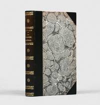
1806Best.-Nr. 145411Paris: Barba 1806. A beautiful copy Scarce first edition of this essential culinary encyclopaedia the most popular work published by a professional cook in the 19th century. Viard a worthy competitor to Carême in terms of celebrity dedicated his book to the famed gourmand and restaurant reviewer Grimod de La Reynière praising Grimod and his fellow food enthusiasts for having elevated culinary discourse. "To judge from his practical knowledge Viard must have been a professional cook at one time thought to have been chef de cuisine to Louis Philippe comte de Ségur and Francis Egerton 8th Earl of Bridgewater but he described himself simply as an homme de bouche food expert probably someone in charge of catering for a large household. Despite his book's impressive title Viard declared he was writing for 'all levels of fortune' in this egalitarian society of citoyens and indeed the polished text includes such basics as pea soup quick-cooked rabbit and salt cod provençale. At a higher level he was the first cook to describe the classic puffy soufflé flavoured with chestnuts frangipane white coffee vanilla or potato still a novelty that became such a symbol of France. The book did well even when the restoration of the French monarchy required a hasty title change to Le cuisinier royale and the 'year of revolutions' in 1848 precipitated another change this time to Le cuisinier national. only to revert to impérial once more under Emperor Napoleon III. The text too underwent hundreds of additions first by Viard and later by colleagues allowing it to remain in print until 1875" Willan running to at least thirty-two editions. Food scholar Darra Goldstein notes that Le cuisinier impérial also contains the first published recipe for apple charlotte. Hector Dubois d'Enghien was a trade bookbinder son of the prominent Brussels binder Joseph-François Dubois d'Enghien 1841-1923. He took over his father's workshop c.1918 and partnered with Edmond Dooms a gilder from De Samblanx in 1923. An accomplished scholar Hector Dubois d'Enghien wrote a history of bookbinding in Belgium published in 1954. The first edition of Le cuisinier impérial is rare both institutionally and commercially. WorldCat Library Hub and KVK locate just six copies institutionally: three copies in Germany Badische LB LB Rheinland-Pfalz Sächsische LB two in the US Harvard Schlesinger Indiana and one in France BnF. We can trace four copies at auction since the 1920s only one of which is dated from within the last 45 years. Octavo 192 x 122 mm. Beautifully bound by Dubois d'Enghien-Dooms in early 20th-century dark green straight-grain half morocco smooth spine lettered in gilt separated into compartments with gilt scrollwork rolls and double fillets floral motifs to first third fourth and fifth compartments marbled boards edges sprinkled blue. Bound like Cagle without the first leaf half-title verso a publisher's advertisement. Fine externally; binder's stamp to front pastedown contents evenly browned and generally clean central gatherings foxed and single stain to sig. 7.7 small spot to p. 387 partly obscuring one word a few ink marks to Index. An excellent copy. Cagle 433; Vicaire 860; Willan pp. 258-9. Not in Bitting see note on p. 478 for later editions. Darra Goldstein The Oxford Companion to Sugar and Sweets 2015. hardcover
Best.-Nr. 201226065Paris, Edition gp bibliotheque rouge et or , 1956 ; in-8, 188 pp., cartonnage de l'éditeur. Avec jaquette.
Best.-Nr. 202100126Paris, Editions gp , 1959 ; in-8, 188 pp., cartonnage de l'éditeur. Avec jaquette.
1926Best.-Nr. RO50021211Les Editions Carlton. 1926. In-8. En feuillets. Bon état, Couv. légèrement passée, Dos satisfaisant, Intérieur frais. Non paginé. 3 pages environ. Photo bleue et blanche de Vorelli en couverture. Déchirure entre les pages.. . . . Classification Dewey : 780.26-Partitions
Best.-Nr. 201808039Paris, Editions gp , 1958 ; in-8, 186 pp., cartonnage de l'éditeur. Avec jaquette n°126 (jaquette 574).
1925Best.-Nr. 014743Paris Bruxelles Le Disque vert, René Van den Berg 1925 In-8 Broché