2.184 Ergebnisse
1728Best.-Nr. 268137London: James and John Knapton 1728. unbound. Sea Chart. Uncolored engraving.19 x 22 1/2 inches. This beautiful early sea chart of the Coromandel coast in Southeast India covers the entire eastern coast of India as well as the western coast of Burma Myanmar and southern Thailand. Extends from modern day Kanyakumari north to include the Ganges River Delta the coast of Bangladesh and then south along western coast of Burma or Myanmar to Thailand. The northern parts of Sri Lanka or Ceylon are also included. The chart notes several villages and settlements along the coast. Islands coastal features rhumb lines and other geographical features are also noted. The Coromandel Coast was one of the most important regions for the British Dutch French Danish and Portuguese during this time as much of the Indian trade was controlled through its various harbors and ports. This chart was made by Senex for the 1728 issued of "Atlas maritimus & commercialis or A general view of the world so far as relates to trade and navigation". The atlas which was meant to compete with Mount and Page's popular "English Pilot" was a collaboration between some of the leading cartographers of the time including Sir Edmund Halley John Senex Nathaniel Cutler Steven Parker and Daniel Defoe. The atlas unfortunately failed to achieve commercial success as great as its rival making this a hard-to-find map. The map is in good condition with minor wear along the original centerfold and overall toning. Map is lined with archival paper. John Senex 1678-1740 was a kind of Renaissance man of the 18th-century map world working at times as a scholar surveyor engraver astrologer book seller and publisher of maps atlases and globes. In a short period he developed from an apprentice into one of the most important cartographers of the period and became a Fellow of the Royal Society of London as well as Official Geographer to Queen Anne of Great Britain. Although well regarded for his pocket-size maps Senex is probably best known for his globes which display a knowledge of astronomy equal to the skill of their craftsmanship. After his death in 1740 his wife Mary continued his business and continued to produce and sell cartographic works of high quality. Together their work represents a successful and valuable partnership in 18th-century mapmaking and publishing. Sir Edmond Halley 1656--1742 was an English astronomer geophysicist mathematician meteorologist and physicist known for computing the orbit of the eponymous Halley's Comet. He was the second Astronomer Royal in Britain after John Flamsteed. Globular Projection maps were invented by Halley Harris and Senex. This is a wonderful example of their collaborative work. James and John Knapton unknown
1728Best.-Nr. 268137London: James and John Knapton 1728. unbound. Sea Chart. Uncolored engraving.19 x 22 1/2 inches. This beautiful early sea chart of the Coromandel coast in Southeast India covers the entire eastern coast of India as well as the western coast of Burma Myanmar and southern Thailand. Extends from modern day Kanyakumari north to include the Ganges River Delta the coast of Bangladesh and then south along western coast of Burma or Myanmar to Thailand. The northern parts of Sri Lanka or Ceylon are also included. The chart notes several villages and settlements along the coast. Islands coastal features rhumb lines and other geographical features are also noted. The Coromandel Coast was one of the most important regions for the British Dutch French Danish and Portuguese during this time as much of the Indian trade was controlled through its various harbors and ports. This chart was made by Senex for the 1728 issued of "Atlas maritimus & commercialis or A general view of the world so far as relates to trade and navigation". The atlas which was meant to compete with Mount and Page's popular "English Pilot" was a collaboration between some of the leading cartographers of the time including Sir Edmund Halley John Senex Nathaniel Cutler Steven Parker and Daniel Defoe. The atlas unfortunately failed to achieve commercial success as great as its rival making this a hard-to-find map. The map is in good condition with minor wear along the original centerfold and overall toning. Map is lined with archival paper. John Senex 1678-1740 was a kind of Renaissance man of the 18th-century map world working at times as a scholar surveyor engraver astrologer book seller and publisher of maps atlases and globes. In a short period he developed from an apprentice into one of the most important cartographers of the period and became a Fellow of the Royal Society of London as well as Official Geographer to Queen Anne of Great Britain. Although well regarded for his pocket-size maps Senex is probably best known for his globes which display a knowledge of astronomy equal to the skill of their craftsmanship. After his death in 1740 his wife Mary continued his business and continued to produce and sell cartographic works of high quality. Together their work represents a successful and valuable partnership in 18th-century mapmaking and publishing. Sir Edmond Halley 1656--1742 was an English astronomer geophysicist mathematician meteorologist and physicist known for computing the orbit of the eponymous Halley's Comet. He was the second Astronomer Royal in Britain after John Flamsteed. Globular Projection maps were invented by Halley Harris and Senex. This is a wonderful example of their collaborative work. James and John Knapton unknown books
2008Best.-Nr. Star-9788131214442Elsevier India 2008. Hardcover. New. Elsevier India hardcover
2008Best.-Nr. Star-9788131214442Elsevier India 2008. Hardcover. New. Elsevier India hardcover
1997Best.-Nr. __185898386XEdward Elgar Pub 1997. Hardcover. New. 777 pages. 10.00x7.25x2.75 inches. Edward Elgar Pub hardcover
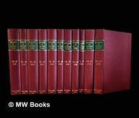
1985Best.-Nr. 482752Abingdon Oxon : Professional Books 1985. Facsimile Edition. Hardcover. Near fine copies on the whole in the original gilt-blocked burgundy cloth boards showing faint shelfwear only and with edges faintly dust-toned. Vol. 76 very good with surface wear to spine title. Remains a well-preserved set overall; tight bright clean and especially sharp-cornered. Physical description; 11 volumes ; 27 cm. Contents; Vols. 32 1915 35 1918 51-2 1934-5 65 1948 69 1952 73 1956 76-77 1959-60 Vol. 81 1964 83 1966. Notes; Crown copyright 1915-1964. Reprinted by permission of the Controller of Her Majesty's Stationery Office. Subjects; Patent laws and legislation — Great Britain — Cases. Trademarks — Law and legislation. Designs Industrial. Abingdon, Oxon : Professional Books hardcover
2009Best.-Nr. SBS-9780754659495ASHGATE 2009. Hardcover. New. ASHGATE hardcover
2009Best.-Nr. SBS-9780754659495ASHGATE 2009. Hardcover. New. ASHGATE hardcover
1999Best.-Nr. DADAX0967616808Brand: Andrew Hall Cutler 1999-06-21. First Edition. paperback. New. 8.50x0.50x10.75. Buy with confidence. Excellent Customer Service & Return policy. Brand: Andrew Hall Cutler paperback
2004Best.-Nr. CBS-9781588290670Sp Springer 2004. New. Sp Springer unknown
2004Best.-Nr. CBS-9781588290670Sp Springer 2004. New. Sp Springer unknown
Best.-Nr. CA06AA-00098The Evening Post Job Printing Office. Collectible - Good. Signed Copy Collectible - Good. INSCRIBED! Fulton St.: New York The Evening Post Job Printing Office 1915. Sm 4to Hardcover. 92pp. Inscribed by author on front free endpaper. Good book. Covers scuffed edgeworn and slightly dampstained. In polypropylene bag. medical care physicians The Evening Post Job Printing Office hardcover
2008Best.-Nr. DBS-9781412951890SAGE PUBLICATION 2008. 1st. Hardcover. New. SAGE PUBLICATION hardcover
2008Best.-Nr. DBS-9781412951890SAGE PUBLICATION 2008. 1st. Hardcover. New. SAGE PUBLICATION hardcover
1975Best.-Nr. BN554206Marcel Dekker 1975. 1975. Hardcover. Surfactant Science Series - 5: Detergency: Theory and Test Methods Part II Surfactant Science Series - 5: Detergency: Theory and Test Methods Part II W. G. Cutler Marcel Dekker hardcover
Best.-Nr. BOOK_9780471950394New. unknown
1969Best.-Nr. mon0003207374Beacon Press 1969T. paperback. Good. 0.5000 7.8000 5.4000. Cover and edges may have some wear. Has some writing/underlining. Previous owner's name on first page. Beacon Press paperback
1929Best.-Nr. 51499San Francisco:: John Henry Nash 1929. First edition. One of 300 copies. original full gilt-ruled and lettered vellum. . Very fine. Folio. The printer's own copy with his bookplate; furthermore an association copy warmly inscribed by Leland W. Cutler for John Henry Nash in 1943. John Henry Nash, hardcover
1999Best.-Nr. SKU0617537Andrew Hall Cutler 1999-06-21. paperback. New. 8x0x10. New Textbook Ships with Tracking Andrew Hall Cutler paperback
Best.-Nr. Z1-T-039-01621HarperCollins Publishers. Used - Good. Ships from UK in 48 hours or less usually same day. Your purchase helps support Sri Lankan Children's Charity 'The Rainbow Centre'. Ex-library so some stamps and wear but in good overall condition. 100% money back guarantee. We are a world class secondhand bookstore based in Hertfordshire United Kingdom and specialize in high quality textbooks across an enormous variety of subjects. We aim to provide a vast range of textbooks rare and collectible books at a great price. Our donations to The Rainbow Centre have helped provide an education and a safe haven to hundreds of children who live in appalling conditions. We provide a 100% money back guarantee and are dedicated to providing our customers with the highest standards of service in the bookselling industry. HarperCollins Publishers unknown
1994Best.-Nr. DADAX0471950521Wiley 1994-01-15. 1. hardcover. New. 6.30x1.34x9.33. Buy with confidence. Excellent Customer Service & Return policy. Wiley hardcover
1986Best.-Nr. x-0824775031Marcel Dekker Inc 1986. Hardcover. New. 1st edition. 568 pages. 9.25x6.50x1.50 inches. Marcel Dekker Inc hardcover
1994Best.-Nr. x-0471950521John Wiley & Sons Inc 1994. Hardcover. New. 1st edition. 491 pages. 9.75x6.50x1.50 inches. John Wiley & Sons Inc hardcover
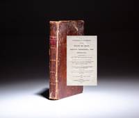
1812Best.-Nr. 12378Boston: Charles Williams 1812. First Edition. Full leather. Good. First edition of A Topographical Description of the State of Ohio by Major Jervis Cutler. Twelvemo v 1 7-219pp. Full leather title in gilt over red morocco spine label five gilt-ruled bands. Boards rubbed edges lightly worn. Toning to pages occasional foxing. Both hinges solid but starting to separate. Missing a single leaf pages 97-98. Lacking errata slip as is common. Complete with 5 full-page illustrated plates including the first engraved view of Cincinnati in 1809. Sabin 18170 Howes C984 Thomson 298 Graff 963 A scarce work on early Ohio. Charles Williams unknown
1812Best.-Nr. 12378Boston: Charles Williams 1812. First Edition. Full leather. Good. First edition of A Topographical Description of the State of Ohio by Major Jervis Cutler. Twelvemo v 1 7-219pp. Full leather title in gilt over red morocco spine label five gilt-ruled bands. Boards rubbed edges lightly worn. Toning to pages occasional foxing. Both hinges solid but starting to separate. Missing a single leaf pages 97-98. Lacking errata slip as is common. Complete with 5 full-page illustrated plates including the first engraved view of Cincinnati in 1809. Sabin 18170 Howes C984 Thomson 298 Graff 963 A scarce work on early Ohio. Charles Williams unknown books