Weld, Jr, IsaacBiblio.com

1800réf. 7600London: John Stockdale 1800. Hard Cover. Very Good binding. Octavo. Vol I: xx 427; II: viii 376 pp. fold plates map. Third edition. In early 20th century cloth; lacking the advertisements called for by Howes; all plates are present. Bindings are a little worn at the spine ends with some fraying to head of the spine of Volume I otherwise only light edgewear; endpaper split at the hinges but have been discreetly and neat reglued and are strong; early pencil markings—mostly small hands with pointing fingers in the margins; list of places with pencil check marks probably more recent; light and foxing throughout but more so around the folding plates and maps even here it is not very distracting. This is a fairly nice copy in 20th century binding of a very good early travel narrative. Originally issued by Stockdale in 1799 this is an early edition of a frequently reprinted travel narrative this edition with striking views of Niagra Falls Hudson River Natural Bridge in Virginia and more. Clark writes "It is obvious from this volume that he was a loyal Englishman with enough aristocratic prejudice not to understand the American frontiersmen. His attitude is indicated by his closing remarks that he left the United States 'without a sigh and without entertaining the slightest wish to revisit ti.' In the cities he mixed with the best society and met the important leaders of the country including Washington and Jefferson. Of them he was less critical" Clark Old South II 132. Sabin 102541; Howes W-235. John Stockdale unknown
1801réf. D13028Haage: J. C. Leeuwestijn 1801. Hardcover. Very Good. Nineteenth-century half brown morocco and marbled paper gilt-stamped lettering in spine compartments 5 raised bands; 3 volumes 8vo 223x135mmwith folding engraved plates and maps; pp. xxxii 391 plus 5 plates and 1 map Washington D.C. see below; xv 1 425 plus 5 plates and 3 maps; xii 340 with 1 plate and 1 map this one larger than the others and hand-colored. Bindings a bit scuffed but tight and square. Library inkstamps NYPL duplicate stamps - dated 1898 - on verso of title-pages and verso of plates; ink does not leak through; some browning and off-setting but generally text blocks are nice and clean. The map of Washington D.C. is early and rare unrecorded in Baynton-Williams Phillips and Verner. J. C. Leeuwestijn hardcover books
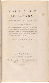
1800réf. 50821Paris. 1800. First French Translation with Plates and Map The scarce first French translation of Weld's Travels Through the States of North America and the Provinces of Upper and Lower Canada During the Years 1795 1796 and 1797. The date on the titlepages is given as "8" referring to the eighth year of the new French Republic after the Revolution. Weld an Irishman arrived in Philadelphia in late 1795 at the age of nineteen. His observations during two years of travels through eastern North America and Canada told through a series of letters comprise one of the most popular narratives of the day. Story wrote that "his account of Canada letters 21-25 is a clear and sustained description of an area and a way of life that pleased him more than had the United States." The engraved plates are after sketches by the author. The map shows the east coast of America south through North Carolina and west through the Great Lakes region with an inset map of the Great Lakes area as well. Contemporary marbled paper-covered boards gilt leather labels. Minor shelf wear spines sunned. Contemporary French bookplate on pastedown of first volume. Internally clean. Very good. TPL 710. HOWES W235. LANDE 890 ref. CLARK II:132 ref. GAGNON I:3701 ref. JCB II:4062 ref. SABIN 192541 ref. hardcover books
1799réf. 58181London: Printed for John Stockdale 1799. Travels in the United States and Canada in the 1790s Weld an Irishman arrived in Philadelphia in late 1795 at the age of nineteen. His observations during two years of travels through eastern North America and Canada told through a series of letters comprise one of the most popular narratives of the day. Story wrote that "his account of Canada letters 21-25 is a clear and sustained description of an area and a way of life that pleased him more than had the United States." Weld made one trip south as far as Virginia as well as crossing Pennsylvania and New York. He said that he left the United States "without a sigh and without entertaining the slightest wish to revisit it." The engraved plates are after sketches by the author. The map with its borders and those of the states colored by hand shows the East Coast of America south through North Carolina with an inset map of South Carolina and west through the Great Lakes region. Quarto. Contemporary tree calf spine gilt in compartments with green morocco gilt label. Wear to extremities and edges of boards joints just starting but still strong. One-inch closed tear to right margin of folding map no loss of text a few fingerprints occasional light foxing heavier in margins of plates. Very good. CLARK II:132. ESTC T110539. GAGNON I:3701. HOWES W235. LANDE 890. JCB II:4062. SABIN 192541. SCHEIDLEY 170. TPL 708. REESE FEDERAL HUNDRED 78. hardcover books
1799réf. 41787London: Printed for John Stockdale 1799. Quarto. 10 7/16 x 8 1/8 inches. xxiv 464 pp. 11 engraved plates including the frontispiece 2 plans and 3 maps one of which is hand colored in outline. Complete with the rare erratum slip mounted at the foot of the plate list. Contemporary full calf. Spine gilt with black morocco lettering piece. Neat repairs to joints First edition of the travel narrative that influenced a generation of British emigrants to the Canadian provinces. Isaac Weld traveled through North America in the late 18th century and recorded his adventures in this wry series of letters. He arrived in America in 1795 at the age of 19 accompanied by a servant and traveled the continent on horseback on foot and by canoe. His distaste for American frontiersmen and the coarseness of manners in the United States would prove typical of English travelers for decades to come. Between July and November 1796 he travelled from Lake Champlain to Montréal and Québec returning through Montréal and continuing his journey to Kingston Newark Niagara-on-the-Lake Malden Amherstburg Detroit and Fort Erie. He declared the scenery from the Upper Town of Québec to surpass 'all that I have hitherto seen in America or indeed in any other part of the globe' and felt that travelling conditions between Québec and Montréal were the best in North America. Based on these observations he concluded that 'a man of moderate property could provide for his family with much more ease in Canada than in the United States' because of the abundance of affordable land. Like many other British travellers then and later Weld felt most at home in the Canadian provinces. Weld's narrative was reprinted more than that of any other European traveler to North America in the later 18th-century. The engraved plates are after sketches by the author. 'A New Map of Upper & Lower Canada' dated 1798 extends from James's Bay to the north Lake Winnipeg to the west and New Brunswick to the east with the territory of the United States below the Candian border left undefined by blank space. Cox 176; Stanton and Tremaine 708; Lowndes 2868; Gagnon I: 3701; Lande 890; JCB II: 4062; Clark II: 132; Rich 1799; Allibone 2636; Sabin 102541; ESTC T110539; Howes W-235; Story p. 103; Vlach 754; Winsor V p.284 & VIII 174 191. Printed for John Stockdale unknown books
1800réf. 1005852 vols. 8vo modern half morocco & marbled boards spine ruled in gilt raised bands morocco lettering pieces new endpapers. Illustrated with 16 folding views plans and maps; xix 1 427; viii 376 pp. Minor aging and some darkening to a few pages and some foxing to one plate. Near fine condition. Weld an Irishman came to America in 1795 when he was nineteen. This work narrates his travels through the former colonies along the eastern seaboard and the Canadian provinces. Very popular at the time it was published Weld comments on the population and social habits and customs of the people he saw. According to Howes Weld seemed to prefer Canada to the States. Compared to the similar works of this period Weld seems to be fairly objective on most things. However whether or not his observation that Americans lose their teeth prematurely is accurate would be hard to substantiate. Contains several interesting views of Niagara Falls Mt. Vernon Bethlehem PA and a large map of the northern portion of the United States with inset of the southern States. John Stockdale hardcover books
1799réf. 16287London: John Stockdale 1799. First Edition First Issue. Full leather. Near fine. The first edition first issue of Travels Through The States Of North America by Isaac Weld published in London in 1799 and complete with 16 maps and plates. Quarto 2 xxiv 464pp 8pp catalogue. Full calf raised bands six compartments title in gilt over red morocco label on spine. Includes the publisher's catalogue but lacking the errata slip. Even toning to leaves throughout a few leaves of text with transference. Contemporary gray endpapers. From the library of noted abolitionist and antiquarian collector George Head Head of Rickerby with his bookplate affixed to the front pastedown. The first issue with the index incorrectly identifying the fourth plate as: "The Patowmac River from Mount Vernon." This work is complete with 12 copper engraved plates including a frontispiece a large fold-out map of the eastern United States hand-colored map of Upper and Lower Canada and two plans for Quebec and Washington D.C. A few plates with light toning and scatter foxing. All plates and maps with solid hinges tissue covers and vibrant imagery. Sabin 102541 Howes W235 Lowndes 2868 Clark II 132 Includes a handwritten note from Arthur H. Masten to the recipient of this copy. An attractive work. Isaac Weld 1774-1856 conducted a survey of the United States from 1795 to 1797 covering the Eastern Seaboard and parts of the American frontier including Virginia Pennsylvania New York and the Carolinas. Weld traveled by horseback boat and on foot observing the social political and economic conditions of the newly formed nation. In "Travels" he commented on the vast natural beauty of the American landscape the state of infrastructure and the way of life of settlers and Native American tribes he encountered. Weld was critical of the rough manners and egalitarianism he witnessed contrasting it with European refinement yet he admired the industrious spirit of Americans. His narrative of the nascent United States helped to shape European opinions of the new nation during the Revolutionary period. John Stockdale unknown books
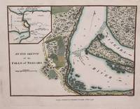
1798réf. M8902London: J. Stockdale 1798. Very Good. Notes: Map of Niagara Falls showing surrounding lands and vicinity in fine detail. Included is an inset map of the Niagara Straits detailing how Lake Ontario connects with Lake Erie. Size : 163x226 mm 6.42x8.90 Inches Coloring: Hand Colored Category: Maps Canada Ontario South; J. Stockdale unknown
réf. 1348039213.Ghardcover. Good. Access codes and supplements are not guaranteed with used items. May be an ex-library book. hardcover
réf. elala4872London: Longman Hurst Rees & Orme and James Carpenter October 1806. First Edition First Issue dated 1806. 4to. pp. vii 223 1platelist. engraved title by J.Landseer 2 engraved maps 17 engraved plates 1 folding & 1 engraved vignette after drawings by the author. later full blind & gilt-paneled green morocco by Woolstencroft Warrington t.e.g. others uncut gilt inside dentelles small chip to foot of spine some mainly light foxing but first map first leaf of text & folding plate more significantly affected. armorial bookplate of John Platt London: Longman, Hurst, Rees & Orme, and James Carpenter, October 1806 unknown
réf. 0428658008.Ghardcover. Good. Access codes and supplements are not guaranteed with used items. May be an ex-library book. hardcover
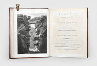
réf. H354Berlin Oehmigke 1805. Archiv für die neuesten und merkwürdigsten Reisebeschreibungen aus fremden Sprachen übersetzt. Band 1-2. 8°. 4 Bll. 1 Titelkupfer XII 395 Seiten mit 3 gefaltete Kupfertafeln 1 Bl. 1 Titelkupfer 352 Seiten mit 1 gefaltete Kupfertafel. Pappbände der Zeit mit Rückenschild etwas berieben Die Tafel mit der Felsenbrücke mit größerem Einriss ein gutes Set. Sabin 102538; Cox II 176 - Frühe deutsche Ausgabe der Reisebriefe des Isaac Weld welcher von 1795-97 durch Pennsylvania Delaware Maryland Virginia New Jersey und New York sowie Ober – und Unter-Kanada reiste. Ziel seiner Reise war die Beurteilung der Länder im Blick auf irische Auswanderer. Weld gibt in seinem Werk eindeutig Kanada den Vorzug vor den Vereinigten Staaten. – Die Tafeln zeigen eine Ansicht der Felsenbrücke Rockbridge im Shenandoah Tal den Hudson irrtümlich Patowmac benannt das Diamanten-Vorgebirge bei Quebec und die Niagarafälle. unknown
1801réf. D13028Haage: J. C. Leeuwestijn 1801. Hardcover. Very Good. Nineteenth-century half brown morocco and marbled paper gilt-stamped lettering in spine compartments 5 raised bands; 3 volumes 8vo 223x135mmwith folding engraved plates and maps; pp. xxxii 391 plus 5 plates and 1 map Washington D.C. see below; xv 1 425 plus 5 plates and 3 maps; xii 340 with 1 plate and 1 map this one larger than the others and hand-colored. Bindings a bit scuffed but tight and square. Library inkstamps NYPL duplicate stamps - dated 1898 - on verso of title-pages and verso of plates; ink does not leak through; some browning and off-setting but generally text blocks are nice and clean. The map of Washington D.C. is early and rare unrecorded in Baynton-Williams Phillips and Verner. J. C. Leeuwestijn hardcover
1801réf. elala1539The Hague: J.C.Leeuwestijn 1801-02. 1801. 3 Volumes. 8vo. pp. 2 p.l. vii-xxxii 391; 2 p.l. xv 1 425; 2 p.l. vii-xii 340. with half-titles. 5 folding engraved maps & plans 1 partially coloured & 11 folding engraved plates by H.Roosing. 19th century half morocco rubbed library rubberstamps on verso of titles & plates periodic light browning & foxing. First Edition of the Dutch Translation by S. Van Hoek of one of the most popular American travel narratives. Weld came to North America with the hope of finding more cheerful prospects than those offered by war-torn Europe but after two years he left "without a sigh and without entertaining the slightest wish to revisit it." Story notes that "his account of Canada letters 21-25 is a clear and sustained description of an area and a way of life that pleased him more than had the United States." The plates are engraved after original sketches by the author. Clark II 132 10. Howes W-235 mentioned only. Sabin 192539. TPL 711. This edition not in Gagnon Lande or Vlach. Story p. 103. Winsor V p. 284 & VIII pp. 174 & 491. 1st Edition. The Hague: J.C.Leeuwestijn, 1801-02. unknown
1799réf. 58181London: Printed for John Stockdale 1799. Travels in the United States and Canada in the 1790s Weld an Irishman arrived in Philadelphia in late 1795 at the age of nineteen. His observations during two years of travels through eastern North America and Canada told through a series of letters comprise one of the most popular narratives of the day. Story wrote that "his account of Canada letters 21-25 is a clear and sustained description of an area and a way of life that pleased him more than had the United States." Weld made one trip south as far as Virginia as well as crossing Pennsylvania and New York. He said that he left the United States "without a sigh and without entertaining the slightest wish to revisit it." The engraved plates are after sketches by the author. The map with its borders and those of the states colored by hand shows the East Coast of America south through North Carolina with an inset map of South Carolina and west through the Great Lakes region. Quarto. Contemporary tree calf spine gilt in compartments with green morocco gilt label. Wear to extremities and edges of boards joints just starting but still strong. One-inch closed tear to right margin of folding map no loss of text a few fingerprints occasional light foxing heavier in margins of plates. Very good. CLARK II:132. ESTC T110539. GAGNON I:3701. HOWES W235. LANDE 890. JCB II:4062. SABIN 192541. SCHEIDLEY 170. TPL 708. REESE FEDERAL HUNDRED 78. hardcover
2026réf. LRB36011811Paris: Editions Recreasoft 2026 Language: English. Approximately 552 pages. English: Print-on-demand reprint. Original edition : 1800. Text in English. This work by Isaac Weld recounts his travels through the United States and the Canadian provinces of Upper and Lower Canada during the years 1795 to 1797. The narrative provides detailed observations on the geography society and politics of the regions offering valuable insights into the early history of North America. Weld's account is particularly notable for its vivid descriptions and firsthand perspectives on the landscapes and cultures he encountered. Book images are non-contractual. Editions Recreasoft. Softcover. New. Editions Recreasoft paperback
1800réf. 67414Printed in the UK: John Stockdale 1800. Third edition. Leather over boards. Good. Two volume set. Full leather dark brown over boards. 8vo. Pagination: volume I -- xx 427 pp; volume II -- viii 376. Illustration: volume I -- a hand coloured engraved map of the northern states of America a b/w engraved map of Upper and Lower Canada 2 b/w engraved city plans and 7 b/w engraved drawings; volume II -- 5 b/w engraved drawings. All plates are tipped in and fold out. Uniform binding. Six compartment spine with five raised ribs. Dark brown leather labels with gilt short title and volume number in compartments two and four. Single rule gilt border on the front and back boards. Gilt ornamental rulings on the spine. Heads darkened. Very light foxing throughout both volumes. Minor worming in the gutter of the front endpapers of volume II. Ink stain along the foot edge of volume I. List of illustrations in volume I has pencil marks next to each listing. Generally the text blocks are clean bright and square with a strong binding. The boards and spines of both are worn and rubbed some of the gilt has been lost with minor cracks in the hinges of volume I. Good condition overall. John Stockdale unknown
1807réf. 43181London: Printed for John Stockdale 1807. 8vo 21cm in 2 volumes xix427 & viii376pp. with 16 engraved folding plates including 2 maps 3 plans 11 views in half modern brown morocco grain fabrikoid match marbled boards new endpapers some occasional light foxing a very good set. very good. ~ Weld's travels is one of the best known works on North America; it was very favorably received and passed through a number of editions and translations within a short period of time. Weld an Irish topographer came to North America with the hope of finding more cheerful prospects than those offered by war-torn Europe but after two years he left "without a sigh and without entertaining the slightest wish to revisit it". Story notes that "his account of Canada is a clear and sustained description of an area and a way of life that pleased him more than had the United States". The attractive plates are engraved after original sketches by the author and are dated 1798 reduced in size from the first 4to edition of 1798. Printed for John Stockdale unknown
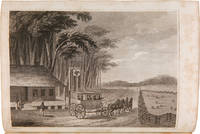
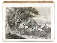
1799réf. 162628London: John Stockdale 1799. An enthusiastic admirer of the beauties of nature First edition with the index incorrectly identifying the fourth plate. This work handsomely illustrated from the author's sketches "was regarded as the great authority of the period on American subjects. There can be no question that the colonization of Canada was mainly promoted and influenced by this book" Bibliotheca Americana. Isaac Weld 1774-1856 left Dublin for Philadelphia in 1795 and "accompanied by a faithful servant sometimes on horseback sometimes on foot or in a canoe he made his way often under the guidance of Native Americans through the vast forests and along the great rivers. He narrowly escaped shipwreck on Lake Erie and experienced all the adventure incident to passing through an unsettled country while in the towns he mixed in the best society and had the privilege of meeting George Washington" ODNB. Aside from the attractive folding map the work includes plans of Washington DC and Quebec; maps of Canada and the Niagara Falls; three views of the Falls; and an illustration of an "American stage waggon" leaving a staging post. The work proved popular going through four editions by 1807 and being translated into French German and Dutch. The plate showing the Hudson River is labelled as "View of the Patowmac River from Mount Vernon". The index of the second edition is corrected. Quarto 270 x 207 mm pp. xxiv 464 8. Engraved frontispiece and 14 plates views and plates one folding map hand-coloured in outline; 8 pp. publisher's advertisements at end. Contemporary speckled calf smooth spine with gilt bands red morocco spine label covers ruled in blind. Brent Gration-Maxfield 1916-1983 book collector and scholar with his ownership signature dated 1969 on front pastedown and extensive neatly pencilled bibliographic notes on the front free endpaper; contemporary gift note loosely inserted. Binding refurbished with gilt retouched superficial abrasions to covers folding map with short tear at stub small paper tears to b3 and G1. A very good copy. Bibliotheca Americana 3282; Howes W235; Lowndes 2868; Sabin 102541. unknown
réf. 1023468921.Ghardcover. Good. Access codes and supplements are not guaranteed with used items. May be an ex-library book. hardcover
réf. 1023464322.Ghardcover. Good. Access codes and supplements are not guaranteed with used items. May be an ex-library book. hardcover
1799réf. 16287London: John Stockdale 1799. First Edition First Issue. Full leather. Near fine. The first edition first issue of Travels Through The States Of North America by Isaac Weld published in London in 1799 and complete with 16 maps and plates. Quarto 2 xxiv 464pp 8pp catalogue. Full calf raised bands six compartments title in gilt over red morocco label on spine. Includes the publisher's catalogue but lacking the errata slip. Even toning to leaves throughout a few leaves of text with transference. Contemporary gray endpapers. From the library of noted abolitionist and antiquarian collector George Head Head of Rickerby with his bookplate affixed to the front pastedown. The first issue with the index incorrectly identifying the fourth plate as: "The Patowmac River from Mount Vernon." This work is complete with 12 copper engraved plates including a frontispiece a large fold-out map of the eastern United States hand-colored map of Upper and Lower Canada and two plans for Quebec and Washington D.C. A few plates with light toning and scatter foxing. All plates and maps with solid hinges tissue covers and vibrant imagery. Sabin 102541 Howes W235 Lowndes 2868 Clark II 132 Includes a handwritten note from Arthur H. Masten to the recipient of this copy. An attractive work. Isaac Weld 1774-1856 conducted a survey of the United States from 1795 to 1797 covering the Eastern Seaboard and parts of the American frontier including Virginia Pennsylvania New York and the Carolinas. Weld traveled by horseback boat and on foot observing the social political and economic conditions of the newly formed nation. In "Travels" he commented on the vast natural beauty of the American landscape the state of infrastructure and the way of life of settlers and Native American tribes he encountered. Weld was critical of the rough manners and egalitarianism he witnessed contrasting it with European refinement yet he admired the industrious spirit of Americans. His narrative of the nascent United States helped to shape European opinions of the new nation during the Revolutionary period. John Stockdale unknown