ERKÂN-I HARBIYE-I UMUMIYE].MareMagnum
Louis PiesseAntiquariat.de
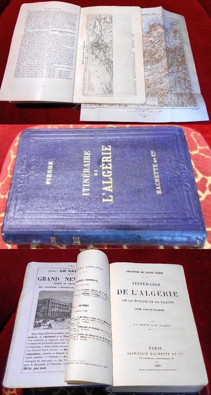
Itinéraire de l'Algérie de la Tunisie et de Tanger. 9 Cartes & 10 Plans.
1885réf. 023901Hachette, Paris 1885. Leinen Gut
Antiquariat Clement · Allemagne95,00 €
2 529 résultats
1916Very Good Turkish, Ottoman (1500-1928) Original color map. Folded. Oblong atlas folio. (50 x 60 cm). In Ottoman script. [MAP of EAST ANATOLIA and ARTVIN] Oltu, Artvin, Ispir, Hasankale. Shows Artvin, Ispir, Hasankale and Kars city. Scale: 1/200.000. This is one the serie of the Bonn projection maps which are the first map series in modern techniques in Turkey and the Ottoman Empire. In order to produce these maps covering Turkish territory, Reconnaissance Branch was incorporated into The Mapping Commission. The maps were produced in the datum based on the latitude and longitude of Ayasofya Mosque in equal area Bonn Projection. The field works for the 123 sheets covering the country were conducted by 76 staff. The production was completed in 18 years starting from east west. Field works continued without stopping except in years 1914 and 1920. This map series called also reconnaissance maps contributed a lot to producing 1:25.000 scale maps. Hegira: 1332 = Gregorian: 1916. Not description on map-maker.
1914Very Good Turkish, Ottoman (1500-1928) Original color map. Folded. Oblong atlas folio. (50 x 60 cm). In Ottoman script. [MAP of EAST ANATOLIA] Hozat, Dersim. Shows Eastern parts of Anatolia; Dersim-Horat and border of Erzincan city; Divrigi; Harput (Kharpout); Kilis; and Munzur Mountains, et alli. Scale: 1/200.000. Hegira: 1330 = Gregorian: 1914. Not description on map-maker.
1920Very Good Turkish, Ottoman (1500-1928) Original color map. Folded. Oblong atlas folio. (50 x 60 cm). In Ottoman script. [MAP of EAST BLACK SEA] Trabzon, Giresun, Erzincan, Ispir. Shows Trebizond, Cerasonte, Erzingan (Eriza), Suspiritis (Sper) of Erzurum (Erzeron city); mostly Black Sea shores of Trabzon and Giresun. . Scale: 1/200.000. This is one the serie of the Bonn projection maps which are the first map series in modern techniques in Turkey and the Ottoman Empire. In order to produce these maps covering Turkish territory, Reconnaissance Branch was incorporated into The Mapping Commission. The maps were produced in the datum based on the latitude and longitude of Ayasofya Mosque in equal area Bonn Projection. The field works for the 123 sheets covering the country were conducted by 76 staff. The production was completed in 18 years starting from east west. Field works continued without stopping except in years 1914 and 1920. This map series called also reconnaissance maps contributed a lot to producing 1:25.000 scale maps. Hegira: 1336 = Gregorian: 1920. Not description on map-maker. Extremely rare.
1926Very Good Turkish, Ottoman (1500-1928) Original color map on cloth. Folded. Oblong atlas folio. (50 x 60 cm). In Ottoman script. Shows Konya city and around, Alaiye at south. Not description on map-maker. Scale: 1: 200.000. This is one the serie of the Bonn projection maps which are the first map series in modern techniques in Turkey and the Ottoman Empire. In order to produce these maps covering Turkish territory, Reconnaissance Branch was incorporated into The Mapping Commission. The maps were produced in the datum based on the latitude and longitude of Ayasofya Mosque in equal area Bonn Projection. The field works for the 123 sheets covering the country were conducted by 76 staff. The production was completed in 18 years starting from east west. Field works continued without stopping except in years 1914 and 1920. This map series called also reconnaissance maps contributed a lot to producing 1:25.000 scale maps. Rare.
1912Very Good Turkish, Ottoman (1500-1928) Original color map on cloth. Folded. Oblong atlas folio. (50 x 60 cm). In Ottoman script. [MAP of MAGNESIA - AEGEAN REGION] Manisa - Soma, Izmir, Aydin cities (Magnesia, Smyrna and Tralleis) in Aegean region. It shows villages and settlements in Tayakadin of Iskenderiye. Scale: 1/25.000. Hegira: 1328 = Gregorian: 1912. This is one the serie of the Bonn projection maps which are the first map series in modern techniques in Turkey and the Ottoman Empire. In order to produce these maps covering Turkish territory, Reconnaissance Branch was incorporated into The Mapping Commission. The maps were produced in the datum based on the latitude and longitude of Ayasofya Mosque in equal area Bonn Projection. The field works for the 123 sheets covering the country were conducted by 76 staff. The production was completed in 18 years starting from east west. Field works continued without stopping except in years 1914 and 1920. This map series called also reconnaissance maps contributed a lot to producing 1:25.000 scale maps. Not description on map-maker. A very detailed map showing lakes, rivers and mountains. Extremely rare.
1917Very Good Turkish, Ottoman (1500-1928) Original color map. Folded. Oblong atlas folio. (50 x 60 cm). In Ottoman script. Shows Eastern parts of Anatolia; Siverek, Urfa city and border of Diyarbakir and Adiyaman cities; Siverek; Harput (Kharpout); et alli. Scale: 1/200.000. Hegira: 1333 = Gregorian: 1917. Not description on map-maker. This is one the serie of the Bonn projection maps which are the first map series in modern techniques in Turkey and the Ottoman Empire. This is one the serie of the Bonn projection maps which are the first map series in modern techniques in Turkey and the Ottoman Empire. In order to produce these maps covering Turkish territory, Reconnaissance Branch was incorporated into The Mapping Commission. The maps were produced in the datum based on the latitude and longitude of Ayasofya Mosque in equal area Bonn Projection. The field works for the 123 sheets covering the country were conducted by 76 staff. The production was completed in 18 years starting from east west. Field works continued without stopping except in years 1914 and 1920. This map series called also reconnaissance maps contributed a lot to producing 1:25.000 scale maps. Subasi is cartographer of this map according to Türkezer - Cobanoglu: History of Mapping in Turkey-1:200.000 Scale Maps.
1911Very Good Turkish, Ottoman (1500-1928) Original color postcard shows Tripoli War in 1911 and Arabic / Libyan tribes organized by Ottoman Turks and Italian soldiers. Can be seen Turkish / Ottoman flags. 9x14 cm. In Ottoman script and French on verso. Some traces of folding. Otherwise a good copy. [OTTOMAN PROPAGANDA / TRIPOLI / POSTCARD] Osmanlilar ile Italyanlar Trabluss muharebesinde. [i.e. Tripoli War with the Ottoman Turks and Italians]. La guerre Turco-Italienne - La bataille de Taraboulous.
réf. 29785Paris - Alger Chez Ch. Douniol, Libraire / Chez Bastide, Libraire 1857 in 8 (22x14) 1 volume broché, XVI et 366 pages. Envoi autographe signé par l'auteur à sa fille. Baillet Noël-Bernard, ancien avoué à Rouen, membre de la Société Orientale de France. Bon exemplaire ( Photographies sur demande / We can send pictures of this book on simple request )
réf. 38540Paris Librairie de L. Hachette et Cie 1855 in 12 (18,5x12) 1 volume broché, LX et 372 pages, avec une grande carte dépliante in fine, timbre humide bleu de colportage sur le faux-titre, petit renfort ancien à l'intérieur du dos de la couverture. Bon exemplaire
1885réf. 023901Hachette, Paris 1885. Leinen Gut
1995xiv + 604pp.+ 5 folding maps loosely inserted, text in French, publisher's hardcover (green cloth with gilt lettering), dustwrapper, 25cm., in the series "Orientalia Lovaniensia Analecta" volume 72, fine condition, C88948
1947réf. 2312Paris, Plon, 1947. Ganzledereinband mit Goldprägung, 4°, unpaginiert, mit 55 ganzseitigen s/w-Abbildungen; Einband berieben, Papier etwas wellig - Plein cuir rouge use.
1900réf. 37604Félix Juven, sd (ca 1900) 1900 Pet. in-4, demi-toile rouge à coins de l’éditeur, dos lisse, caissons dorés, ornements à froid des plats, 237 pp. Nombreuses photogravures in & hors texte. Quelques rousseurs. Reliure fanée, charnières fendillées.
réf. 12790Vienne, Savigné, 1882, 1 br., dos cassé, 4ème de couverture détachée, exempalire à relier. in-8, f.t., titre, 324 pages non coupées + 20 planches dont certaines dépliantes ;
2011réf. 49272Ceres editions, 2011. Reliure editeur sous jaquette illustrée, format 23x29 cm, 253 pages. Etat neuf.
1930réf. WOC-2081:L'Algérie jusqu'à la Pénétration Saharienne, par M. J.-M. Bourget. 2:La Pacification du Sahara(1852-1930), par Le Général O. Meynier. 3:L'Évolution de L'Algérie de 1830 à 1930, par M.E.F.Gautier. 4:Les Grands Soldats de L'Algérie, par M. le général Paul Azan. 5:Le Gouvernement de L'Algérie, par M. Louis Milliot. 6:Art Antique et Art Musulman en Algérie, par A. Berque. 7:L'Algérie Touristique, par M. le Général De Bonneval. 8:Les Liaisons maritimes, aériennes et terrestres de l'Algérie, par le Colonel Dhé et M. Jean Denizet. 9:Les Productions Algériennes, par M. Jean Blottiere. 10:La Vie et Les Moeurs en Algérie, par M. Pierre Deloncle. 11:La France et Les Oeuvres Indigènes en Algérie, par M. Jean Mirante. 12:Cartes-Index, Glossaire, Documents, Annexes, Rapport Général. Nombreuses illustrations et cartes. Publications du Comité National Métropolitain du Centenaire de L'Algérie, 1930. Soit 12 fascicules in-8 brochés. 96pp.+63pp.+96pp.+128pp.+48pp.+144pp.+64pp.+62pp.+ 96pp.+125pp.+112pp.+72pp.
In-8, broché, couverture imprimée, 23 p. Édition originale. Précoce plaidoyer pour le renforcement de la colonisation que l'auteur tente d'envisager sous une forme "moderne". Il réfute les affirmations d'un rapport selon lequel les indigènes auraient été dépouillés de leurs biens et traite largement des conditions de collaboration avec ces populations. L'auteur Paul-Ambroise Volland, dit "Baron Volland" était intendant militaire de l'Algérie et délégué des colons d'Alger. (Tailliart, 2579). Bel exemplaire, à l'état de parution.
réf. 195926Paris, Plon, 1891 in-8, II-487 pp., demi-chagrin bleu, dos à nerfs orné, tête dorée (reliure de l'époque). Dos légèrement passé. Bon exemplaire.
réf. 220260Paris, Plon, 1891 in-8, VIII-487 pp., demi-vélin ivoire (reliure de l'époque). Rousseurs.
1855réf. GITg360Paris Michel Lévy Frères 1855. In-12 177pp. Demi percaline acajou, dos lisse orné de filets dorés, reliure de l'époque. Dos de la reliure légèrement éclairci, quelques pâles rousseurs par endroits. Exemplaire bien complet, reliure sobre de l'époque bien solide.
réf. 199465Paris, Hachette, 1911 fort gr. in-8, XII-419 pp., portrait-frontispice, 100 planches, carte dépliante, demi-basane brune, dos lisse orné de fleurons dorés (reliure de l'époque). Epidermures, mors supérieur, coupes et coins abîmés. Qqs rousseurs. La page de faux-titre et le frontispice ont été rongées avec manques. Déchirure sur la carte.
1919réf. 408Ed. Maison de la Bonne Presse, Paris : 1919 . Première édition. In- 8 ( 26 X 18 cm), demi-reliure de maroquin rouge, mention d’auteur, de titre et 7 triples filets dorés. 365 pp. Ill. Photogr. Ces souvenirs de trois années au Maroc sont entrecoupés de 9 poèmes de Marie Barrère - Affre . Son ouvrage en deux parties (Trois ans de ma vie ...là-bas.. parmi les meskines... puis Dans le charme du Bled et la grâce des Villes ..) reçut le prix Montyon de l’Académie française en 1921 . Ces croquis marocains , un peu comme un journal de voyage , nous livrent les coutumes et le quotidien du Maroc.
1892réf. C81627Paris, Lecène, Oudin et cie. 1892 330pp., signé avec dédicace autographe de l'auteur à G. de Molinari, 19cm., br.orig., bon état, dans la série "Nouvelle bibliothèque variée", rare, C81627
1892330pp., signé avec dédicace autographe de l'auteur à G. de Molinari, 19cm., br.orig., bon état, dans la série "Nouvelle bibliothèque variée", rare, C81627
2001français Ensemble de 3 tomes en 3 volumes in-8 de XXII-563, VIII-480 et 353 pp.; cartonné toile bleue ornée à la Bradel de l'éditeur, sous coffret.


