SAINT-ARNAUD (Armand-Jacques Leroy de)Livre Rare Book

2513 resultados
ref. 206201Paris, Michel Lévy frères, 1855 2 vol. in-8, XXVI-[2]-572 pp. ; [2] ff. n. ch., 606 pp., avec un portrait-frontispice lithographié et un fac-similé dépliant, chagrin noir, dos à nerfs ornés de pointillés, filets, guirlandes et caissons dorés, encadrement de triple filet et guirlande dorés sur les plats, pointillé doré sur les coupes, tranches dorées, dentelle intérieure (reliure de l'époque).
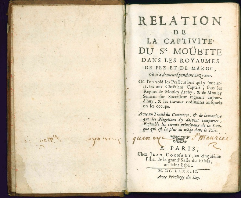
1683ref. 4663Paris, Jean Cochart, 1683. 1683 1 vol. in-12° de: [6] ff. ; 362 pp. (dont 33 pp. de dictionnaire de langue arabe) ; [5] ff. Ex-libris manuscrit à l'encre brune sur le titre "Quincy St Maurice". (ff. 59 à 62 anciennement maintenu par une épingle, petite trace de mouillure claire à l'angle inférieur des 20 premiers ff., quelques rares taches, sinon frais). Plein veau d'époque, dos à nerfs orné et titré à l'or, roulette dorée sur les coupes, tranches jaspées rouges.
1871Very Good Turkish, Ottoman (1500-1928) Original cloth bdg. with marbled boards. Cr. 8vo. (20 x 13,5 cm). In Ottoman script (Old Turkish with Arabic letters). 176, [1] p. Lithographed edition. Extremely rare first and only edition of this guide to the distances and meridian calculations of some cities from Batumi located on the shores of Black Sea, Europe until Great Britain, Asia, and Africa shores, prepared for Turkish naval officers, mariners, and vessels, describing the shores of the countries located on these routes. ABOUT THE AUTHOR: Ibrahim Edhem Pasha was an Ottoman statesman, who held the office of Grand Vizier at the beginning of Abdul Hamid II's reign between 5 February 1877 and 11 January 1878. He resigned from that post after the Ottoman chances of winning the Russo-Turkish War (1877-1878) had decreased. He furthermore served in numerous administrative positions in the Ottoman Empire including minister of foreign affairs in 1856, then ambassador to Berlin in 1876, and to Vienna from 1879 to 1882. He also served as a military engineer and as Minister of Interior from 1883 to 1885. In 1876-1877, he represented the Ottoman Government at the Constantinople Conference. He was born in Chios of Greek ancestry, in a Christian Greek Orthodox village on the island of Chios. Strangely, his connection to Chios is not well-documented: his son Osman Hamdi Bey claimed that he was a member of the Scaramanga family, but Edhem Pasha himself tried to efface his Greek connections. As a young boy in 1822, he was orphaned and captured by Ottoman soldiers during the massacre of the Greek population of Chios. He was sold into slavery, brought to Constantinople, and adopted by the (later) grand vizier Hüsrev Pasha. Lacking his own children and family, Hüsrev Pasha raised about ten children who had been orphaned or bought as slaves, many of whom ascended to important positions. The child, now named Ibrahim Edhem, quickly distinguished himself with his intelligence and after having attended schools in the Ottoman Empire, he was dispatched along with a number of his peers, and under the supervision of his father, then grand vizier, and of the sultan Mahmud II himself, to Paris to pursue his studies under state scholarship. There he returned with a Bachelor of Arts and was one of the top pupils at the École des Mines. He was a classmate and a friend of Louis Pasteur. He thus became Turkey's first mining engineer in the modern sense, and he started his career in this field. Edhem Pasha was the father of Osman Hamdi Bey, a well-known archaeologist, and painter, as well as the founder of the Istanbul Archaeology Museum and the Mimar Sinan Fine Arts University. Another son, Halil Edhem Eldem took up the archaeology museum after Osman Hamdi Bey's death and has been a deputy for ten years under the newly founded Turkish Republic. Yet another son, Ismail Galib Bey, is considered the founder of numismatics as a scientific discipline in Turkey. Later generations of the family also produced illustrious names. The architect Sedat Hakki Eldem, a cousin, is one of the pillars of the search for modern architectural styles adopted by the Republic of Turkey (called the Republican style in the Turkish context) in its early years and which marks many important buildings dating from the period of the 1920s and the 1930s. A great-grandson, Burak Eldem, is a writer while another, Edhem Eldem, is a renowned historian. More names include Erol Eldem, Tiana Eldem, Levent Eldem, and Ercan Eldem, an architect. (Source: Wikipedia). Özege 4522.; Only one copy in OCLC: 162837008 (Bayerische Staatsbibliothek).
1909Very Good Turkish, Ottoman (1500-1928) Extremely rare huge chromo-lithograph map in 24 sheets mounted on canvas, showing a large zone including Midyat (Mardin), Mosul, Mt. Cilo (Resko-Buzul) on the southeast; Kahta (Adiyaman), Munzur Mt., Divrigi (Sivas) on the west; the Black Sea on north and Turkish borders to Armenia, Azerbaijan on the east, and to Russia on the northeast. In addition shows in separate little portions, roads, mountains and hills, lakes, and telegraph and post ways and borders in that zone. Not in any libraries and any collection. An attractive map with its huge size and decorative surface. Several toponyms are underlined in red ink. Otherwise a very good example. Original folded map mounted on canvas. 118x112 cm. In Ottoman script (Turkish with Arabic letters). Scale: 1/630.000.
ref. 14367Paris Albert Lévy, Editeur. Librairie Centrale des Beaux-Arts (sans date, vers 1920) 1920 in folio (37x27) 1 volume en faux-feuillets sous chemise à lacets de l'éditeur, dos de percaline violette, page de faux-titre et page de titre, 4 pages de texte, suivies de 50 planches en couleurs montées sur papier fort, avec légendes imprimées (50 mounted plates in color). Collationné complet (complete). Très bel exemplaire
1730Very Good Turkish, Ottoman (1500-1928) Original b/w map from Kitab-i Cihannuma which is one of the most important Turkish incunabula. Oblong large 4to. (31 x 37 cm). In Ottoman script. It shows Venice and Venetian Bay and Algerian shores at North Africa (Maghrib). Toponyms are in Turkish with Arabic letters. Written directions (Simal, Cenûb, Sark and Garb) on corners of the map, and decorative compass on Mediterranean Sea. Scale can be seen at left upper side (El-mikyas: Mil-i Islâmiyân Mil-i Frençe, and Mil-i Italiya]. It's one of the thirteen maps and plates from the book of Cihannuma. The story of Cihannuma can be considered as an effort to keep up with the speed that knowledge spread around the world at a time when literacy was highly limited. Kâtip Çelebi began to rewrite Cihannuma in 1654. During the next six years, he added to his books the knowledge he gained from the books he read. Kâtip Çelebi was vastly influenced by nonreligious positive knowledge, especially by the Atlas and later the Atlas Minor of Gerardus Mercator. He had the book translated from Latin to Turkish by a French recruit andenriched his own book with the new information. He brought together in Cihannuma the knowledge of geography and astronomy existing in Western sources (1654). Cihannüma has 13 charts and 27 maps. Mercator's maps are distinguished by their distinct properties. However, there are such maps which depict Istanbul, Anatolia, the Caucasus and the Orient that have to have been borrowed from other sources and there are those with relatively less detail that might have been prepared by Muslim geographers. Sources cite Ahmed El Kirimî (Ahmed the Crimean) and Galatali Migirdich as mapmakers for Cihannüma. Their names are placed on the maps. Another name that is mentioned is Tophaneli Ibrahim. Researchers agree on the fact that he is Ibrahim Müteferrika. Perhaps he wished to hasten the printing of the book. Perhaps he enjoyed making this contribution to a book he half owned. There is one map in Cihannüma which definitely does not belong to Mercator. Nor is there any information that it was originally charted by Müteferrika's team. Historians state that the 'invertedness' can be found in other maps made by Muslim cartographers. Since it is amap of Turkey, the difference can easily be perceived. The Mediterranean coasts of Turkey are at the top of the map while the Black Sea coasts are at the bottom. The compass on the map correctly indicates the North. The map seems to be inverted but it is not considered scientifically wrong to draw maps in this fashion...". (Source: Boyut; Kitab-i Cihannuma). Extremely rare.
ref. 2313261836 12.5 x 44.5 cm - 15.9 x 26.5 cm - 14.6 cm x 27 cm , Encadrement contemporain.
1950ref. 80276Casablanca Editions de la Cigogne 1950 In-4, en feuilles, couverture rempliée, chemise et étui paille restauration du dos, 147 pp. Texte inédit d'Henri Bosco comportant 47 illustrations d'Albert Marquet, soit 24 aquarelles et 23 dessins gravés sur bois par Pierre Bouchet. Très bon exempalire.
ref. 208115S.l., s.d. (1839) in-4 oblong, titre calligraphié dans un encadrement de volutes orientalisant, 16 planches manuscrites (dont 13 aquarelles en couleurs), [5] ff. vierges, demi-chagrin cerise, dos lisse muet (reliure de l'époque). Coiffes, coupes et coins abîmés.
ref. 242762S.l., s.d. (1900-1902) in-4 oblong (29 x 36 cm), [24] ff. n. ch. de papier fort, montés sur onglets, regroupant 161 petits tirages argentiques (la plupart de 7 x 8 cm) contrecollés, généralement légendés à l'encre rouge, basane noire, dos lisse muet orné de tortillons et filets dorés, double encadrement de double filet doré [à froid] sur le plat supérieur [inférieur], titre poussé en lettres dorées au centre du plat supérieur, tranches dorées, encadrement de simple filet doré sur les contreplats, gardes de papier gaufré blanc (reliure de l'époque). Épidermures au dos et sur les plats.
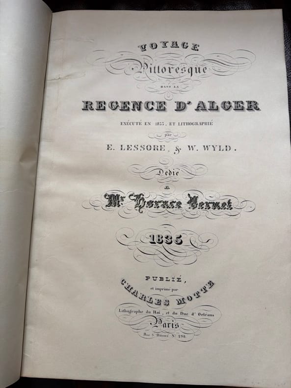
ref. 244274Paris, Charles Motte, Imprimeur et Lithographe du Roi, (1835) in-folio, page de titre, 20 pp., 50 planches, demi-basane havane clair à coins, dos à nerfs (reliure du XXe siècle).
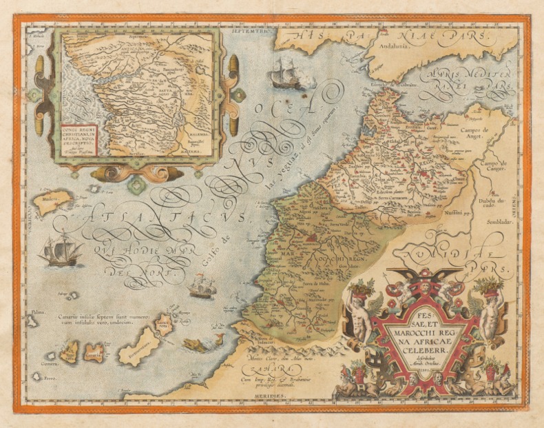
1595ref. 0044291595 [Anvers], Ortelius, 1595. Deux cartes (51 X 39 cm) et (50 X 33 cm) sous cadres en pichepin.
1841Very Good Arabic Original autograph document/letter sealed by Ahmad I of Tunisia. 54x42 cm. 1 p. 6 long lines. The letter includes full of poetic praise. It must be sent after successful diplomatic intercourse with Naples. Ferdinand II (Ferdinando Carlo) was King of the Two Sicilies from 1830 until his early death in 1859. It starts with 'Thank God alone', and goes on 'From poor Ahmad Pasha to Lord Almighty Field Marshal Amîr [ruler]. Sealed by the seal of Ahmad Basha Beg including an impressive qasidah in Arabic. Ahmed I (ibn Mustafa), born 2 December 1805 in Tunis died May 1855 at La Goulette, was the tenth Husainid Bey of Tunis, ruling from 1837 until his death. He was responsible for the abolition of slavery in Tunisia in 1846. He succeeded his father Mustafa Bey on 10 October 1837. He had grand ambitions - to expand his army and create a modern navy; to build a new royal residence, a mint and modern institutions of education but neither he nor his brother-in-law the young Mustapha Khaznadar who served as his finance minister, had a clear idea of what such initiatives would cost. As a result, many of his projects became expensive failures which damaged the financial health of the country. Soon after his accession, Ahmad Bey received the traditional Firman from the Sublime Porte which formally invested him with authority to rule from the Ottoman Empire and furnished him with the insignia of office. The Ottoman envoy, Osman Bey, arrived in la Goulette on 15 May 1838 onboard a frigate. The following day, Osman Bey made his official entry into Tunis on horseback, preceded by all the ministers of the beylical cabinet who went before him until he was two leagues from the city. Before he were carried the sword of honor and the caftan to be presented to the Bey. He was escorted by spahis and followed by a large contingent of regular troops an Arab cavalry. Three days after his official entry into the city, the envoy presented himself at the Bardo Palace to formally invest Ahmad Bey with his insignia of office and present gifts. Named as a Divisional General in the Ottoman army in May 1838, he was later promoted by the Sultan to the rank of Marshal on 14 August 1840. This was the first time that a Bey of Tunis had held a rank higher than Divisional General. The purpose of these honors was to emphasize the supremacy of the Ottoman Empire over the Regency of Tunis. Under a treaty with France signed in 1830 by Hussein Bey, a piece of land in Carthage had been ceded to allow the erection of a monument to Louis IX of France who had died there during the Eighth Crusade. On 25 August 1840, the first stone was laid in the cathedral of Carthage. Ahmad Bey also permitted the Christian community of Tunis, consisting mainly of European merchants, to enlarge their small church near the Bab el Bhar. In June and July 1846 the Duke of Montpensier, son of King Louis Philippe of France visited Tunis and Carthage. He was received with great solemnity by Ahmad Bey. According to the Tunisian historian Mohamed Bayram V, Bey's reforms were focused on state structures, the army, and education. He established a modern structure of government and gave his high officials the title of 'minister'. His senior ministers were his Grand Vizier Mustafa Sahib at-Taba'a, Mustapha Khaznadar, Minister of Finance and of the Interior, Mustafa Agha as Minister of War, Mahmoud Khodja as Minister of the Navy and Giuseppe Raffo as Foreign Minister. At certain times Mahmoud Ben Ayed also served as Trade Minister, Kuchuk Muhammad in the honorific post of Minister in charge of the security home of Ahmad Bey's reforms wasted money, such as the large frigate built at La Goulette that could not make it through the channel to the sea. of Tunis and Mohamed Lasram IV as Minister of the Pen. The historian Ibn Abi Dhiaf was the Bey's private secretary. Among Ahmad Bey's successes may be counted as the abolition of slavery in January 1846. To this may be added the formation of the military academy at...