889 resultados
1885ref. 187509Australia: The Geographical Society of Australasia 1885 & 1886. Two elaborately decorated manuscripts presented to Captain Henry Charles Everill congratulating him and the members of the New Guinea Exploratory Expedition on a successful voyage. The quarto manuscript was presented by the Geographical Society of Australasia who funded the expedition and the folio by the Victorian Branch of the Geographical Society specifically 12 members of which have signed it at the end. Everill's party left Sydney on 10 June 1885 and returned home on 3 December 1885 having spent five months in New Guinea. The object of the expedition was to map unexplored territory in the Fly river region to gather information on local flora and fauna and to perform an anthropological investigation into the indigenous people. However the underlying motivations of the expedition were likely linked to Australian state expansion into the Pacific. In 1883 the Colony of Queensland attempted to annex the east of the island of New Guinea and then again shortly after the federation of Australia in 1901. The expedition left Sydney in the steamer Bonito journeying to New Guinea and up the Fly river into the Strickland River. The river was named during the expedition in honour of Sir Edward Strickland the president of the Geographical Society. The Bonito was stranded in the Strickland at which point Everill led a party another 80 miles up the river in a whaleboat. Purchased by Martin Schøyen b. 1940 the Norwegian collector of rare books and manuscripts Two manuscripts on paper quarto 335 x 265 mm 2 pages and folio 460 x 385 mm single page text in gothic and cursive script in black ink illuminated initials and titles intricate border designs in multiple colours all heightened in gilt. Contemporary black and brown morocco the folio by Thedel and Co. of Melbourne and with silk moiré doublure the quarto by John Sands of Sydney is rebacked lettered and decorated in gilt. Refurbished a few corners restored covers lightly scuffed and marked silverfishing with loss of several words in both texts heavier in the folio affecting signatures light damp staining. A very good set. unknown
1680Incisione in rame (mm. 525x630), abilmente dipinta da mano coeva, verso velato da finissimo foglio di carta Giappone. Bella e rara carta nautica, tratta dal celebre atlante di De Witt ''Orbis Maritimus ofte Zee Atlas": la mappa si estende dal Senegal a nord fino all'Angola a sud, centrata sulla Baia di Guinea. Le indicazioni toponimiche e le caratteristiche geografiche sono strettamente limitate alle coste. Rosa dei venti, linee lossodromiche e splendido cartiglio, in alto, dove commercianti olandesi contrattano per gli schiavi ammanettati con i capi indigeni. Sullo sfondo si può vedere una fornace che fonde quello che presumibilmente è oro. L'abile rinforzo con carta Giappone evita il deperimento da acidità ai verdi e marroni; quindi l'esemplare si presenta in ottimo stato, anche grazie alla splendida coloritura del cartiglio. "Frederick de Wit deve essere considerato uno dei più importanti editori di mappe della seconda metà del XVII secolo. La maggior parte delle sue mappe sono di ottima qualità, sono caratterizzate da un'incisione chiara e bella, dall'attualità e ricchezza dell'immagine cartografica nonché dall'equilibrio delle decorazioni cartografiche". (Lexikon der Kartographie II, p. 899), Koeman M. Wit 1, 27. Koeman, Atlantes Neerlandici, IV, pp.191 e 518-519. Shirley 444. Putnam, Early sea charts, 75.. .
1802ref. PHO-1460Paris, Henri Agasse, 1802 , TEXTE et ATLAS , texte : 2 vol. in-8 de LVI-359-[1]-383pp. ,relié demi cuir , dos lisse avec titre et tomaison, plats frottés , coins et coupes usés , manque la page de titre ,XXXI,XXXV à XLVIII , 334 à 337 au tome 1 et les page 245 à 252 au tome 2 et Un ATLAS in-4°, viii-[4]-67 pp.; 43 planches (44), relié demi veau , dos lisse , quelques défauts à la reliure , petites rousseurs à l’atlas et papier légèrement bruni.
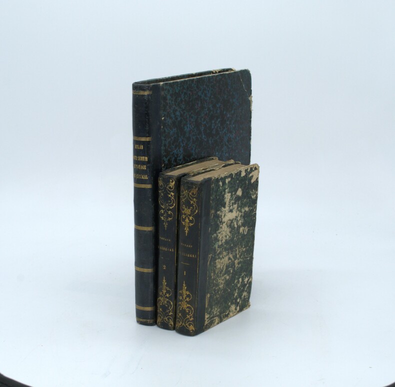
ref. 210600Paris, Durand, Pissot, 1751 2 parties en un vol. in-12, x-258-[2]-314 pp., avec 5 planches zoologiques hors-texte, basane fauve marbrée, dos à nerfs orné de fleurons à froid, armes en pied, encadrement de simple filet à froid sur les plats, armes au centre, tranches mouchetées (reliure de l'époque). Coiffes et mors restaurés.
1714ref. 11152A Paris, chez Arnoul Seneuze et chez Raoul Morel, 1714. In-12 de [12]-298 pages, pleine basane mouchetée, dos à 5 nerfs orné de fleurons, étoiles, roulettes, filets et titre dorés, étiquette de titre bordeaux, tranches mouchetées. Ex-libris Abraham Diodati au verso du titre. Mors fendus en tête et en queue, quelques rousseurs.
ref. PE68Oblong Large Octavo album ca. 165x24 cm or 6 ½ x 9 ¼ in. 56 paper leaves. With 80 mounted original gelatin silver photos including over thirty larger images from ca. 125x175 cm 4 ¾ x 6 ¾ in to ca. 115x135 cm 5 ¼ x 4 ½ in; the rest of the photos are from ca. 8x9 cm 3 ¼ x 3 ½ in to ca. 45x8 cm 1 ¾ x 3 ¼ in. Ca. 40 images with period ink captions in French on the mounts. Period grey quarter cloth album with papered boards; marbled endpapers. Binding rubbed on extremities spine soiled some photos with various degrees of fading or mild silvering but overall a very good album of interesting strong photos. Interesting collection of eighty original gelatin silver photographs – mostly ethnographic portraits and scenes with the native people of French colonial Guinea modern-day Republic of Guinea. Taken by a French resident of the colony the photos resemble images taken by François-Edmon Fortier 1862-1928 a prolific documentary photographer of French West Africa. The images in the album portray “Foulah” Fula “Soussou” Susu and “Cogniaghi” Conagui people – individuals and groups of men young women families and children; the photos allow to see traditional costumes decorations and hair styles. There are also portraits of “Femmes Tirailleurs” inhabitants of a Guinean forest women washing laundry in a river a family from Rio Pongo women from Kourussa a chief with his wives scenes at a Conakry market in a local village at a well in a “caravanserail” a views of “case de Sokbi à Kipé” a river wharf with a group of native people on a pier &c. Three photos feature Frenchmen posing with native people and youth in Kippe Kipe or watching Guinean farm workers. Overall an interesting collection of original portraits of the indigenous people of Guinea in the early 20th century. hardcover
ref. 31190Pita 12 février 1907 in-4 débroché
1904ref. 6480[Mali, Côte d'Ivoire, Guinée], 1904. 1904 1 vol in-8 oblong (210 x 265 mm) de : [24] ff. comportant chacun 4 photographies (95 x 65 mm) et 1 supplémentaire (110 x 65 mm) collée au dos sur dernier plat. Un total de 97 photographies. Pleine toile de percaline rouge à dos et à coin estampés à froid, titre orné Kodak Souvenirs sur le premier plat, dos muet.
ref. PA66Oblong Quarto album ca. 215x28 cm or 8 ½ x 11 ¼ in. 26 card stock leaves. With 43 gelatin silver photos 42 mounted one loosely inserted including sixteen larger photos one photo in two copies ca. 105x15 cm 4x6 in; the rest of the photos are from ca. 7x115 cm 2 ¾ x 4 ½ in to ca. 6x85 cm 2 ¼ x 3 ¼ in. With seventeen mounted printed photo reproductions ca. 7x11 cm 2 ¾ x 4 ¼ in. No captions. Sixteen large photos with period ink stamps “Commonwealth of Australia. Department of Information” on versos. Period white ink manuscript title on the inner side of the front cover. Period olive green full cloth binding fastened with a string. Boards rubbed and soiled on extremities binding loosened on the hinges several images with minor creases on the corners but overall a very good album of strong rare photos. Interesting album with official and amateur gelatin silver photos most likely taken and collected by an Australian military man during his service in the New Guinea Campaign of WW2 January 1942 – August 1945. According to the manuscript title the album covers the period of 1943-1944 when the Allied Australian and American forces drove Japanese troops off the eastern New Guinea then the Australian-administrated Territory of New Guinea along the Kokoda Track and fought for the interior and coastal villages of Wau Salamaua Buna Gona &c. The album opens with sixteen official photographs issued by the Department of Information of the Australian Commonwealth. Among the images is a portrait of General Sir Thomas Blamey 1884-1951 then Commander of the Allied Land Forces in the Southwest Pacific Area and General Robert L. Eichelberger 1886-1951 Commander of the Eighth U.S. Army in the Southwest Pacific Area taken next to a Japanese pillbox in the Buna area Australian War Memorial. Another photo portrays General Blamey talking with Australian military officers. There are also photos of a detachment of the Royal Papuan Constabulary State Library of New South Wales scenes with Australian soldiers and Papuans transporting the wounded in the Papuan jungle women on service in the U.S. Army bathing in a stream see more Australian soldiers crossing jungle resting in a tent taking part in a Papuan celebration Papuans carrying loads or taking them in canoes portraits of Papuan people &c. The amateur snapshot photos show Australian soldiers posing with the Papuans in native villages portraits of local families dancers girls a Papuan boy reading the issue of the New York “Variety” Magazine with the headline “D-Day Biggest Radio Story” Vol. 154 No. 13 June 7 1944 views of coastal defence structures &c. Seventeen photo reproductions include portraits of Papuans views of jungle bridges roads a village destroyed by the Japanese &c. Overall an interesting collection of original photos illustrating the New Guinea Campaign of WW2. hardcover
ref. 13981678Ansterdam: J. L. de Lorme, Libraire sur le Rockin à l'enseigne de la Liberté, 1698 1 volume in-12 (16,5 x 11 cm), frontispice sur cuivre gravé par B. Picart, page de titre, (8)-402 p. [la relation de voyage du sieur de Montauban occupe les p.360-402] , (2) p. (catalogue de livres nouveaux qui se trouvent chez J. L. De Lorme); page de titre (L'Art de Voyager Utilement), (2)-51 p. Reliure d'ép. dos à 4 nerfs orné, coiffe sup. et coins usés, rel. frottée, bon état. Sabin 11274.
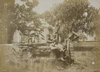
ref. PF4Oblong Folio album ca. 27 x 33 cm or 10 ½ x 13 in. 24 card stock leaves. With 138 original gelatin silver photos mostly ca. 8 x 12 cm 3 x 4 ¾ in. With 17 printed postcards ca. 9x13 cm 3 ½ x 5 in; all mounted in windows. All postcards withprinted captions on the margins. Some of the photos are captioned in German on versos. Period green full cloth album; red gilt-tooled ornamental border and generic title in German on the front board. Binding slightly rubbed on extremities several images previously removed from the album a few photos mildy faded but overall a very good album. A historically interesting extensive collection of original gelatin silver vernacular photos and printed postcards taken and collected by a German traveller to the colonies of German New Guinea and German Samoa in the early 20th century before both were occupied by Australia and New Zealand during WW1. The album opens with twenty-one photos and seven printed postcards dating back to the compiler’s voyage to the South Pacific through the Dutch East Indies modern-day Indonesia showing streets and waterfront of Makassar Sulawesi volcanoes and settlements of Banda Islands Banda Neira Banda Api Banda Papenberg peak the ocean steamer which transported the travelling party anchored in harbours the steamer crew and native Indonesians on board the steamer &c. Over forty photos and five postcards show the views and people of German New Guinea - mostly of the Bismarck Archipelago modern-day Islands Region of Papua New Guinea: native children and families from “Matupi” and “Neu Pommern Bismarck Archipel” views of Ralum and Herbertshöhe Kokopo “Landschaft bei Nusa” harbours with the travellers’ steamship cutter boats and native outrigger canoes villages and palm groves a large communal building in construction portraits of Papuan farmers members of local militia people wearing traditional costumes decorations and headdresses Papuan men listening to a gramophone on board the steamer a native couple captioned “Gruss aus dem Bismarck Archipel” on the mount &c. Very interesting are over sixty original photos and a printed postcard of German Samoa. About seventeen photographs document a public ceremony of hoisting a German Imperial flag at an open space likely in the colonial capital Apia with government officials colonial troops and a crowd of spectators. Two scenes with colonial residents feature Wilhelm Solf the first Governor of German Samoa in office: 1900-1911 wearing a white uniform and peaked cap. Two photos portray an elderly Samoan chief - most likely Mata’afa Josefo ca. 1832-1912 a Paramount Chief of German Samoa posing with a colonial resident in front of a German Imperial flag. There is also a view of the wreck of SMS “Adler” in Apia harbour which was destroyed alongside several German and U.S. warships during the 1889 Apia cyclone. Other photos show Samoan rivers coastal views portraits of Samoans in traditional costumes families children German residents &c. The printed postcard is a view of “Samoa Inseln – Apia nach Süden zu.” The album also contains several printed postcards and original photos of Fiji showing “A peep of Suva” “Fijian canoe” “Village scene – Fiji” “Attacked” “Cannibal feast – Fiji” portraits of native warriors and young women &c. Overall an historically interesting extensive collection of original gelatin silver amateur photos documenting life in German New Guinea and German Samoa in the early 20th century. hardcover
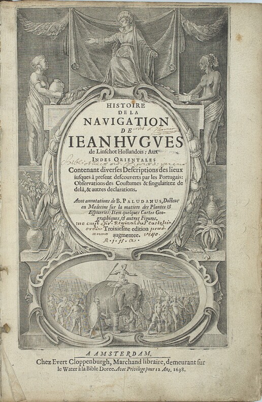
1638ref. PHO-2460Amsterdam : J.E. Cloppenburch, 1638, in-folio, 315 x 220mm, 4pp. (titre, préface, indice des chapitres) 206pp., titre avec des figures allégoriques (Asie, Afrique Europe) et une scène d’un roi sur éléphant, illustré du portrait de l’auteur, 29 (sur 36 ) planches gravées dépliantes à double page et vues de Johann et Baptiste ven Doetecom d'aprés Linschoten , les cartes sont absentes. Titre empoussiéré, quelques taches et mouillures, le dernier feuillet détaché. Reliure en partie détachée du corps de l’ouvrage. Provenance - « Fr. Reginaldus Castelin (?) ordin. 1740 » (ex-libris manuscrit ancien). – L. Hennion (ex-libris manuscrit ancien sur une garde). Bibliographie Sabin, n°20128. Leclerc, n°363. Cordier Japonica, 222. Gay, 260
ref. est381T10Hand Colored 21 x 15.5 inches Typus orarum maritimarum Guineæ, Manicongo, & Angôlæ... - Delineatio orarum maritimarum, terræ vulgo indigetatæ Terra do Natal. [Amsterdam, 1596]. 2 feuilles, chacune de 390 x 530 mm. Superbe exemplaire de l'une des cartes les plus décoratives figurant la moitié sud du continent africain, gravée par van Langren pour l'Itinerario de Linschoten. Les deux feuilles sont ornées de magnifiques cartouches de titre style Renaissance. Les mers sont traversées de lignes de rhumbs, de roses des vents, de navires et de monstres marins, tandis que les terres sont décorées de petites vignettes figurant des éléphants, des lions, ainsi qu'une scène représentant l'empereur chrétien Prester John. La feuille figurant la partie ouest de l'Afrique est ornée de deux vues des possessions portugaises de Sainte-Hélène et de l'Ascension, et des armoiries du Portugal décorant le cartouche de titre en latin et hollandais. La feuille figurant la partie orientale de l'Afrique est l'une des premières à représenter cette partie de l'Afrique. Elle s'étend de Doara à R. do Infante, et montre l'ile de Madagascar. Très bel exemplaire aquarellé. Tooley, MCC n°29,
1885ref. 4504633Sydney: Thomas Richards Government Printer 1885. Slight rubbing to binding in handsome & original condition; interior lightly foxed in places; map with repaired tear; images all bright and crisp. Large square folio with a folding map three coloured lithograph plates 33 original silver albumen photographs 283 x 212 mm mounted on card with printed captions and borders and two superb panoramas one of them double-page 240 x 553 mm and the other on four sheets 242 x 1053 mm; original dark blue grained morocco binding bevelled edges spine banded and sides with multiple borders in gilt front cover lettered in gilt all edges gilded. This rare and sumptuous album published in very small numbers and illustrated with original photographs has been described as the first example of Australian photo-journalism: "the most magnificent example of an Australian work in this genre the high point in relation to which all other examples can be considered" Holden. It is equally significant as one of the earliest ethnographic photographic albums produced in the South Pacific. The photographs record the 1884 expedition during which Commodore Sir James Erskine proclaimed a British protectorate over the south coast of New Guinea. Although unpublished at the time they were produced by the New South Wales Government Printing Office and were principally the work of Augustine Dyer 1873-1923. Intended as a visual record of the expedition they also reveal the strategic importance attached to the Hood Lagoon region represented by six photographs together forming almost one-sixth of the completed album. Printed and assembled in Sydney in a small presentation edition the album is remarkable in treating photographs not simply as illustrations but as the narrative itself. Official ceremonies are interwoven with topographical views and portraits producing a visual account of first contact between Imperial officers and local communities. Particularly striking is the photograph of Erskine addressing assembled chiefs aboard HMS Nelson one of whom holds an ebony staff distributed by Erskine as an emblem of authority "with a florin let in at the top the Queen's Head being uppermost" Lyne. Although produced to commemorate the proclamation of the British Protectorate the album is equally important as an early ethnographic record of coastal Papua New Guinea. Despite its official purpose its photographs frequently possess an immediacy and humanity uncommon in imperial publications of the period. A complete list of the photographs appears on the Hordern House website. Sir James Erskine R.N. 1838-1911 then Commodore of the Australian Station had assumed command in January 1882. While in Sydney he leased Carthona the grand Gothic Revival house at Darling Point built for the explorer Sir Thomas Mitchell. During the expedition he commanded the Australian Squadron charged with proclaiming British authority over the south coast of New Guinea. The motivation for the expedition was explicitly imperial. As Erskine explained the Imperial Government had resolved to establish a protectorate over the unclaimed southern coast of New Guinea "with the double object of preventing any foreign occupation of the country and of protecting the inhabitants from aggression.". Yet the tone of his published Narrative frequently departs from official language reading more as a travel account than a governmental report. "Picturesque" is among his favourite descriptions while passages celebrating "the striking variety and beauty of the colour in the adjacent water" reveal genuine admiration for the landscape. The same contrast appears in Erskine's address to the assembled chiefs long regarded as a "Declaration of Rights" for New Guinea. Whereas the formal Proclamation speaks in the language of imperial administration Erskine's speech looks instead to the practical benefits of British protection urging the assembled people to "look upon white persons whom the Queen permits to reside amongst you as your friends.". The album's photographs reinforce this more nuanced narrative. Images of proclamation ceremonies are balanced by landscapes villages and portraits creating what is arguably the earliest sustained photographic reportage produced in Australia. Particularly memorable is the scene aboard HMS Nelson showing Erskine addressing the Hood Bay chiefs one grasping the ebony staff symbolising his authority. The photographs comprise: 1 "Port Moresby from the Mission Station." Four-sheet panorama. 2 "H.M.S. 'Nelson' at Port Moresby S.W." 3 "General View of Settlement at Port Moresby N.N.E." 4 "Commodore shaking hands with Native Chief 'OBE Vagi' on board H.M.S. 'Nelson' at Port Moresby." 5 "Native Village Port Moresby W." 6 "Ethel Island and landing-place at Native Village Port Moresby S.W." 7 "Native Houses Port Moresby." 8 "Native Village Port Moresby S." 9 "Native Village Port Moresby N.W." 10 "Hoisting Flag at Port Moresby N.W." 11 "Yule Island from Delena Hall Sound N.W." 12 "Landing-place at Delena Hall Sound N." 13 "Hoisting flag at Delena Hall Sound." 14 "Koloka the Queen of the Lolo Tribe at Delena." 15 "Landing at Motumotu." 16 "Landing at Motumotu." 17 "Firing the Feu de joie Motumotu." 18 "New Guinea Chief Motumotu." 19 "Native Village Kerepunu Hood Lagoon S.W." 20 "Commodore reading Proclamation at Kerepunu Hood Lagoon W." 21 "H.M.S. 'Espiegle' saluting Flag Hood Lagoon." 22 "Scene near Kerepunu Hood Lagoon N.E." 23 "A Chief's House Kerepunu Hood Lagoon S.W." 24 "Commodore addressing Chiefs on board H.M.S. 'Nelson' Hood Bay." 25 "Argyll Bay W.N.W." Two-sheet panorama. 26 "Commodore reading Proclamation at Argyll Bay N.W." 27 "H.M.S. 'Nelson' saluting Flag at Mission Station Suau Stacey Island South Cape." 28 "View from Stacey Island N." 29 "Native Village Suau S.W." 30 "Native House at Suau." 31 "View from Dinner Island China Strait-H.M. Ships 'Nelson' and 'Espiegle' at anchor N.W." 32 "View from Dinner Island S.W." 33 "Natives on board H.M.S. 'Nelson' at Dinner Island." 34 "View from Anchorage N. side of Teste Island W. by N." 35 "West end of Teste Island from Anchorage S.W." A presentation copy was prepared for Queen Victoria noted in the preface as "a keen supporter of photography." . Provenance: A Paré "Elgin" Durban Rd. Wynberg South Africa pencil inscription on front flyleaf. Thomas Richards, Government Printer unknown