961 results
1960ref. 153973London: Contemporary Films 1960. Eight vintage double weight studio still photographs from the 1960s UK re-release of the 1934 French film. Manuscript ink annotations identifying scenes on the versos. From the archive of film historian and author Joel Finler. A classic of French cinema Jean Vigo's only theatrical feature a film that in the minds of many including Francois Truffaut predicted and even helped define the French New Wave that would come 20 years later. Shot on location in Paris Yvelines and Seine-Maritime France. 10 x 8 inches. Four Near Fine four Very Good plus with faint dampstains to the bottom edges. Ebert I. Rosenbaum 1000. Contemporary Films unknown books
1960ref. 153973London: Contemporary Films 1960. Eight vintage double weight studio still photographs from the 1960s UK re-release of the 1934 French film. Manuscript ink annotations identifying scenes on the versos. From the archive of film historian and author Joel Finler. A classic of French cinema Jean Vigo's only theatrical feature a film that in the minds of many including Francois Truffaut predicted and even helped define the French New Wave that would come 20 years later. Shot on location in Paris Yvelines and Seine-Maritime France. 10 x 8 inches. Four Near Fine four Very Good plus with faint dampstains to the bottom edges. Ebert I. Rosenbaum 1000. Contemporary Films unknown
1970334 pages including index. "The thrust of this challenging book is that America is the first society to move beyond the industrial age into the new "technetronic" era, and that this transition affects directly both our international and our domestic problems. Part 1 describes the impact of the scientific revolution on world affairs in general and on the Third World in particular, and exposes the ambiguous position of its principal disseminators, the US. Part 2 examines how this has effected the content, style, and format of man's political outlook on his global reality. Part 3 assesses the contemporary relevance of communism to the problems of modernity. Part 4 focuses upon the US, a society that is both a social pioneer and a guinea pig for mankind, and examines the crisis of American institutions and values during the current transition - as well as the challenge posed by the New Left. Part 5 outlines in broad terms the general direction the US might take in order to make an effective response to its foreign and domestic dilemmas." - from dust jacket (not included). "This is one of the most original books on political and social thought to appear in recent years. The author projects the impact of technology and electronics on the political and social values of the United States, the Soviet Union and other 'post-industrial' states. As a study of global society in transition, this seminal work is bound to elicit major controversy and will be difficult to ignore." - Foreign Affairs. Bit of soiling to fore-edge else clean and unmarked with light wear. Light wear to dust jacket now preserved in archival-grade Brodart. A quality copy. Book
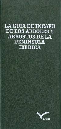
1982ref. BN448924Incafo 1982. 1982. Hardcover. La guia de infaco de los arboles y arbustos de la peninsula Iberica La guia de infaco de los arboles y arbustos de la peninsula Iberica Guinea Lopez Gonzalez Incafo hardcover
ref. 13981087Wien: Seidel & Sohn, 1933 2 vol.in folio (33x26 cm), tome 1: xi-303 page, 12 planches hors texte en couleurs, 67 illustrations dans le texte; tome 2: 400 illustrations hors texte. Reliure toile éditeur, titre doré sur les dos et les premiers plats, infimes usures, légères taches au dos du 2 ème volume, autrement très bon exemplaire. Rare.
1930ref. 57796Paris: Société d'Éditions Géographiques Maritimes et Coloniales 1930. First edition. Folding map. 114 pp plates 350 pp. 1 vols. 4to. Original wrappers. Bottom third of spine missing else Near Fine. First edition. Folding map. 114 pp plates 350 pp. 1 vols. 4to. Société d'Éditions Géographiques, Maritimes et Coloniales unknown books
1930ref. 57796Paris: Société d'Éditions Géographiques Maritimes et Coloniales 1930. First edition. Folding map. 114 pp plates 350 pp. 1 vols. 4to. Original wrappers. Bottom third of spine missing else Near Fine. First edition. Folding map. 114 pp plates 350 pp. 1 vols. 4to. Société d'Éditions Géographiques, Maritimes et Coloniales unknown
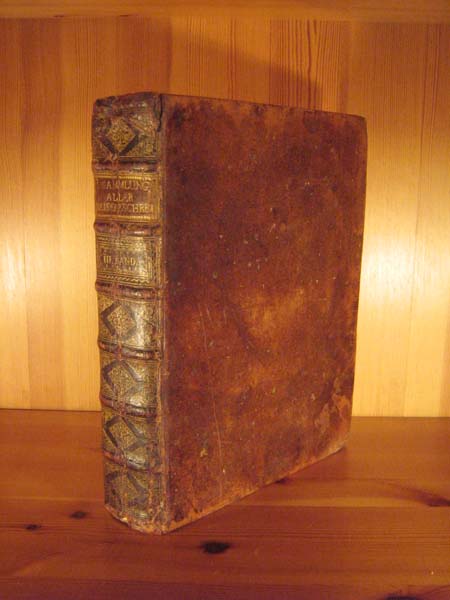
1748ref. SB-06113Leipzig, bey Arkstee und Merkus, 1748. Titelfortsetzung: ... in Ansehung ihrer verschiedenen Reiche und Länder; deren Lage, Größe, Gränzen, Eintheilungen, Himmelsgegenden, Erdreichs, Früchte, Thiere, Flüsse, Seen, Gebirge, großen und kleinen Städte, Häfen, Gebäude u. s. w. wie auch der Sitten und Gebräuche der Einwohner, ihrer Religion, Regierungsart, Künste und Wissenschaften, Handlung und Manufacturen, enthalten ist: Mit nöthigen Landkarten nach den neuesten und richtigten astronomischen Wahrnehmungen und mancherley Abbildungen der Städte, Küsten, Aussichten, Thiere, Gewächse, Kleidungen, und anderer dergleichen Merkwürdigkeiten versehen; Durch eine Gesellschaft gelehrter Männer im Englischen zusammen getragen und aus demselben ins Deutsche übersetzt. Deutsche Ausgabe, basierend auf der in vier Bänden herausgegebenen englischen Originalausgabe "New general collection of voyages and travels" (1745 - 1747) sowie der französischen "Historie generale des voyages", die zwischen 1746 und 1791 in insgesamt 20 Bänden erschien. Mit 35 ganzseitigen bzw. faltbaren Kupfertafeln und -karten (alle vorhanden). 12 Bl., 668 S., Geographisches Verzeichnis der in dem dritten Bande erwähnten Inseln, Länder, Städte und andern Oerter; (5 Bl.); Register der in diesem Bande vorkommenden Sachen ( (23 Bl.). Inhalt: Das VI: Buch: Reisen längst der westlichen Küste von Africa, von dem weißen Vorgebirge bis nach Sierra Leone; welche insbesondere eine Nachricht von der englischen Niederlassung, und ihrer Handlung an dem Flusse Gambra oder Gambia, nebst der Erdbeschreibung der natürlichen Historie der benachbarten Länder enthalten. Das VII. Buch: Reisen nach Guinea und Benin, welche die Küste von Sierra Leone bis zu dem Vorgebirge Lope Gonsalvo in sich fasse. Das VIII. Buch: Beschreibung von Guinea, nebst der Erdbeschreibung, der Natur- und politischen Geschichte. Original-Ganzlederband mit sechs echten Bünden, goldgeprägtem Rückentitel sowie aufwendiger ornamentaler Goldprägung. Großformat 25,5 x 20,5 cm. Marmorierter Buchschnitt. Der prächtige Band befindet sich in sehr schönem stabilen Zustand. Rücken mit kleinen Stoßspuren, ein Gelenk oben etwas eingekerbt, unteres Kapital mit leichtem Abrieb. Auch innen sehr gutes Exemplar, wenige Seiten etwas gebräunt oder geringfügig fleckig, die meisten Seiten fleckenfrei, sehr gute Papierqualität.
1837ref. REIS0786Leipzig, im Industrie-Comptoir (Baumgärtner) 1835-1837. 2 Bde. 4°. IV, VIII S., 408 S., mit 2, davon e. dopplblattgr., gest., Karten, (Taf. 51 u. 72), 1 mehrf. gef., gest. Karte, mit 71 parallel gezählten (V, 1-50. 52-71), ganzseitig illustrierten Seiten mit je vier Motiven; 1 gest. Taf., IV S., 370 S., mit 1 Karte (Taf. 2), 1 mehrf. gef., gest. Karte, mit 69 parallel gezählten (1. 3-70) ganzseitig illustrierten Seiten mit je drei oder vier Motiven bzw. einer Karte, sowie einer Textillustration. Pappbände d. Zeit, mit Rückenbeschriftungen von alter Hand und goldgeprägten Rückenschildchen, Buchschnitte mit verblasster Marmorierung, Ecken bestoßen, berieben, entlang der Gelenke schadhaft, zweiter Band etwas fleckig. Seiten insgesamt wenig vergilbt, vereinzelt gebräunt u. mäßig fleckig, mit wenigen Blatteinrissen. Sabin V,574. Engelmann. Bibliotheca geographica 99 - zweibändige, reich illustrierte, deutsche Übersetzung der 'Voyage pittoresque autour du monde', einer Sammlung von Berichten über berühmte Entdeckungsfahrten und Forschungsreisen, herausgegeben von Jules Dumont d'Urville (1790-1842), französischem Seefahrer und Entdeckungsreisenden. Der Schriftsteller und Redakteur Johann August Diezmann (1805-1869) übersetzte zahlreiche Werke aus dem englischen und französischen und gab zwei Taschenwörterbücher und mehrere Zeitungen und Zeitschriften heraus. Die Landkarten des ersten Bandes zeigen Hawai, Taiti (Tahiti) und eine Weltkarte, die des zweiten die Tonga Inseln, Neuseeland und den Pazifik. [3 Warenabbildungen]
2002ref. Adhya-9781402002281Springer 2002. Paperback. New. Springer paperback
2002ref. Adhya-9781402002281Springer 2002. Paperback. New. Springer paperback
1940ref. 230081940. Photographs of Indigenous communities in New Guinea during World War II document direct encounters between local populations and United States military personnel as Allied forces established operational infrastructure across the island beginning in 1942. Taken in the early to mid 1940s these images record the presence of Indigenous men women and children alongside uniformed servicemen situating them within a major Pacific theater of war where military expansion reshaped local environments and social conditions. The archive supports research into Indigenous history wartime contact zones and the impact of global conflict on colonial territories. Archive consists of 26 original black and white photographic prints likely silver gelatin depicting group portraits staged encounters and environmental views in New Guinea. Multiple images show Indigenous individuals arranged in lines or clusters often positioned with U.S. servicemen standing behind or among them indicating organized or facilitated photographic documentation. Dress and adornment vary with women wearing traditional skirts and beadwork and men and children appearing in customary attire. Several photographs include visible military infrastructure including aircraft fuselages transport planes and trucks suggesting proximity to airstrips supply depots or forward bases. A group of images captures a ceremonial dance or ritual with participants wearing elaborate headdresses and woven garments photographed in mid action. These photographs were produced during a period when New Guinea became a strategic center of Allied military operations in the Pacific bringing new systems of transportation labor demands and administrative control into Indigenous regions. Wartime conditions altered patterns of daily life through the introduction of foreign personnel the construction of military facilities and the expansion of colonial oversight. Visual documentation of these encounters reflects both the logistical realities of military presence and the asymmetrical relationships between Indigenous communities and external authority. Minor handling wear and edge wear with occasional fading; overall very good condition. This archive provides primary visual documentation of wartime contact between Indigenous populations and Allied forces in New Guinea during World War II. unknown books
1940ref. 230081940. Photographs of Indigenous communities in New Guinea during World War II document direct encounters between local populations and United States military personnel as Allied forces established operational infrastructure across the island beginning in 1942. Taken in the early to mid 1940s these images record the presence of Indigenous men women and children alongside uniformed servicemen situating them within a major Pacific theater of war where military expansion reshaped local environments and social conditions. The archive supports research into Indigenous history wartime contact zones and the impact of global conflict on colonial territories. Archive consists of 26 original black and white photographic prints likely silver gelatin depicting group portraits staged encounters and environmental views in New Guinea. Multiple images show Indigenous individuals arranged in lines or clusters often positioned with U.S. servicemen standing behind or among them indicating organized or facilitated photographic documentation. Dress and adornment vary with women wearing traditional skirts and beadwork and men and children appearing in customary attire. Several photographs include visible military infrastructure including aircraft fuselages transport planes and trucks suggesting proximity to airstrips supply depots or forward bases. A group of images captures a ceremonial dance or ritual with participants wearing elaborate headdresses and woven garments photographed in mid action. These photographs were produced during a period when New Guinea became a strategic center of Allied military operations in the Pacific bringing new systems of transportation labor demands and administrative control into Indigenous regions. Wartime conditions altered patterns of daily life through the introduction of foreign personnel the construction of military facilities and the expansion of colonial oversight. Visual documentation of these encounters reflects both the logistical realities of military presence and the asymmetrical relationships between Indigenous communities and external authority. Minor handling wear and edge wear with occasional fading; overall very good condition. This archive provides primary visual documentation of wartime contact between Indigenous populations and Allied forces in New Guinea during World War II. unknown
1936ref. 230101936. Neuendettelsau Mission publisher. Bilder aus der Neuguinea Mission late 1920s-mid 1930s documents German Protestant missionary activity and Indigenous life in New Guinea during the interwar period following the end of formal German colonial rule. Produced as a cigarette card album with printed German captions the work records village life subsistence practices missionary institutions and ceremonial activity situating Indigenous communities within a visual framework shaped by religious and colonial perspectives. The album supports research into Pacific history missionary networks and the role of photography in documenting and interpreting Indigenous societies under colonial influence. Oblong album containing a substantial series of mounted photographic cigarette cards on captioned leaves with printed German text throughout. The cover title reads "Bilder aus der Neuguinea-Mission" and includes a commemorative image captioned "Gedenkt des 50 jährigen Jubiläums der Neuendettelsauer Mission auf Neuguinea!" depicting three Indigenous men in traditional dress with spears. The album includes numerous images of daily life in coastal New Guinea including fishing hunting boat building village environments and ceremonial gatherings with captions such as "Mit Pfeil und Bogen" and "Mit dem Jagenetz" describing subsistence practices. Additional images depict mission infrastructure including churches schools workshops and settlements alongside scenes of education labor and communal activity. Photographs are systematically arranged and mounted presenting both ethnographic subjects and missionary-built environments within a unified visual sequence. The album was produced during a transitional period when German missionary societies continued operations in New Guinea under Australian administration after World War I maintaining institutional presence despite the loss of formal colonial control. The Neuendettelsau Mission founded in Bavaria in the nineteenth century had established networks of religious and educational institutions in the region contributing to broader systems of cultural transformation and documentation. The images reflect both local practices and the interpretive framework imposed by missionary observers revealing how photography functioned within colonial and religious contexts to classify record and disseminate knowledge about Indigenous populations. Mild toning foxing and edge wear to covers and pages; cards remain securely mounted with images largely clean and crisp; overall very good condition. This album provides sustained visual documentation of missionary activity and Indigenous life in New Guinea during the interwar period. unknown books
1936ref. 230101936. Neuendettelsau Mission publisher. Bilder aus der Neuguinea Mission late 1920s-mid 1930s documents German Protestant missionary activity and Indigenous life in New Guinea during the interwar period following the end of formal German colonial rule. Produced as a cigarette card album with printed German captions the work records village life subsistence practices missionary institutions and ceremonial activity situating Indigenous communities within a visual framework shaped by religious and colonial perspectives. The album supports research into Pacific history missionary networks and the role of photography in documenting and interpreting Indigenous societies under colonial influence. Oblong album containing a substantial series of mounted photographic cigarette cards on captioned leaves with printed German text throughout. The cover title reads "Bilder aus der Neuguinea-Mission" and includes a commemorative image captioned "Gedenkt des 50 jährigen Jubiläums der Neuendettelsauer Mission auf Neuguinea!" depicting three Indigenous men in traditional dress with spears. The album includes numerous images of daily life in coastal New Guinea including fishing hunting boat building village environments and ceremonial gatherings with captions such as "Mit Pfeil und Bogen" and "Mit dem Jagenetz" describing subsistence practices. Additional images depict mission infrastructure including churches schools workshops and settlements alongside scenes of education labor and communal activity. Photographs are systematically arranged and mounted presenting both ethnographic subjects and missionary-built environments within a unified visual sequence. The album was produced during a transitional period when German missionary societies continued operations in New Guinea under Australian administration after World War I maintaining institutional presence despite the loss of formal colonial control. The Neuendettelsau Mission founded in Bavaria in the nineteenth century had established networks of religious and educational institutions in the region contributing to broader systems of cultural transformation and documentation. The images reflect both local practices and the interpretive framework imposed by missionary observers revealing how photography functioned within colonial and religious contexts to classify record and disseminate knowledge about Indigenous populations. Mild toning foxing and edge wear to covers and pages; cards remain securely mounted with images largely clean and crisp; overall very good condition. This album provides sustained visual documentation of missionary activity and Indigenous life in New Guinea during the interwar period. unknown
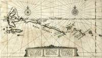
1619ref. 18935Frankfurt: Blaeu 1619. Scarce copper engraved map of the northwest coastline of New Guinea and Moluccas showing the track of the Dutch explorers Le Maire and Schouten in 1616 in the ships Eendracht and Hoorn. The two explorers made the third complete circumnavigation and were the first to round Cape Horn from the east a more efficient way to get to the East Indies and thus a significant threat to the monopoly held by the Dutch East India Company. The expedition was headed for Batavia which it reached in October of 1616. The Dutch governor there obliged them by confiscating their cargo and sending them back to Holland but Schouten published his journals and now the word on the Drake Passage was out. With title cartouche in Dutch Latin and French. With two compass rose and sailing ship. From Schouten's account of his and Le Maire's first rounding of Cape Horn. Slightly toned otherwise very good condition. Blaeu unknown
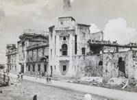
ref. PD10Oblong Octavo album ca.182x295 cm or 7 ¼ x 11 ½ in. 30 card stock leaves with 2 free endpapers. With 105 original gelatin silver photographs including one loose from ca. 104x75 cm 4 x 3 in to 47x64 cm 1 ¾ x 2 ½ in. All photos with white ink captions in English on the mounts seven photos captioned in negatives some photos dated. Period dark green half leather binding with raised bands; guilt-tooled ornaments on the front cover and the spine. Seven photos missing one page lacks fragments at the right margin several pages with minor tears but otherwise a very good album with strong interesting photos. Historically interesting collection of original photographs mostly documenting the technical reconstruction of Manila’s communication networks after the end of World War II. As follows from the photographs the compiler was a technician or lineman with the U.S. Army Signal Corps. First stationed in Pittsburgh in 1943 he likely underwent specialized technical training at one of the city's industrial or academic centers before being deployed to Finschhafen New Guinea. There he was tasked with establishing the communications infrastructure for the Allied base following the recapture of the town from Japanese forces. Finally he was sent to Manila in the fall of 1945 where he assisted in the massive effort to reconstruct the city’s destroyed telephone and telegraph systems during the initial months of the post-war occupation. The album contains 105 rare early photographs from the Pacific Theatre with most images taken in Manila in the fall of 1945. The photos capture Japanese ships sunk by U.S. forces in Manila Bay and the city’s architecture before and after the artillery bombardment Escolta Street Jones Bridge the ruins of City Hall the University of the Philippines the Manila Hotel San Vicente de Paul Parish Department of Finance Building today’s National Museum of Anthropology Commerce & Agriculture Building today’s National Museum of Natural History and Legislative Building today’s National Museum of Fine Arts. Especially interesting are about fifteen candid photographs documenting the technical reconstruction of Manila’s communication networks. Outdoor scenes show the compiler’s companions with climbing spikes and safety belts repairing overhead trunk lines. Interior views depict a “Test Desk” with technicians both American and Philippian operating specialized consoles and patch cords the massive Main Distribution Frame MDF with thousands of line terminations and heavy power panel equipment. The series also includes several photographs from Clark Field showing “Ralph” and “Eddie” posing beside wrecked aircraft. The other interesting photos from the collection show “a Native of New Guinea” posing with American soldiers as well as the compiler and his friends in military uniforms in Finschhafen and Pittsburgh beside their tents barracks and orderly room. Overall historically interesting collection of original gelatin silver photographs illustrating rare scenes from the service of the U.S. Army Signal Corps in the Pacific Theatre of World War II. hardcover
ref. 13979445Paris: chez Durand, chez Pissot, 1751 2 parties en 1 vol. in-12, x-258 et [2]-314 pages, 5 planches se dépliant, 6 planches ajoutées. Reliure plein veau brun d'époque, dos à 5 nerfs orné de caissons et de fleurons dorés, pièce de titre de maroquin rouge, tranches rouges, roulettes dorées sur les coupes, bel exemplaire. Edition originale de la traduction française. Ouvrage enrichi de la suite complète des planches dépliantes gravées sur cuivre par N. B. de Poilly, issue de Histoire de la Jamaïque, par Sloane, publiée la même année. L'auteur fut envoyé en 1726 par la Royal African Company pour lever les plans de ses forts sur la côte de Guinée. (Sabin, 84561).
ref. 5537dans un carton bleu moderne
1885ref. 187509Australia: The Geographical Society of Australasia 1885 & 1886. Two elaborately decorated manuscripts presented to Captain Henry Charles Everill congratulating him and the members of the New Guinea Exploratory Expedition on a successful voyage. The quarto manuscript was presented by the Geographical Society of Australasia who funded the expedition and the folio by the Victorian Branch of the Geographical Society specifically 12 members of which have signed it at the end. Everill's party left Sydney on 10 June 1885 and returned home on 3 December 1885 having spent five months in New Guinea. The object of the expedition was to map unexplored territory in the Fly river region to gather information on local flora and fauna and to perform an anthropological investigation into the indigenous people. However the underlying motivations of the expedition were likely linked to Australian state expansion into the Pacific. In 1883 the Colony of Queensland attempted to annex the east of the island of New Guinea and then again shortly after the federation of Australia in 1901. The expedition left Sydney in the steamer Bonito journeying to New Guinea and up the Fly river into the Strickland River. The river was named during the expedition in honour of Sir Edward Strickland the president of the Geographical Society. The Bonito was stranded in the Strickland at which point Everill led a party another 80 miles up the river in a whaleboat. Purchased by Martin Schøyen b. 1940 the Norwegian collector of rare books and manuscripts Two manuscripts on paper quarto 335 x 265 mm 2 pages and folio 460 x 385 mm single page text in gothic and cursive script in black ink illuminated initials and titles intricate border designs in multiple colours all heightened in gilt. Contemporary black and brown morocco the folio by Thedel and Co. of Melbourne and with silk moiré doublure the quarto by John Sands of Sydney is rebacked lettered and decorated in gilt. Refurbished a few corners restored covers lightly scuffed and marked silverfishing with loss of several words in both texts heavier in the folio affecting signatures light damp staining. A very good set. unknown
1680Incisione in rame (mm. 525x630), abilmente dipinta da mano coeva, verso velato da finissimo foglio di carta Giappone. Bella e rara carta nautica, tratta dal celebre atlante di De Witt ''Orbis Maritimus ofte Zee Atlas": la mappa si estende dal Senegal a nord fino all'Angola a sud, centrata sulla Baia di Guinea. Le indicazioni toponimiche e le caratteristiche geografiche sono strettamente limitate alle coste. Rosa dei venti, linee lossodromiche e splendido cartiglio, in alto, dove commercianti olandesi contrattano per gli schiavi ammanettati con i capi indigeni. Sullo sfondo si può vedere una fornace che fonde quello che presumibilmente è oro. L'abile rinforzo con carta Giappone evita il deperimento da acidità ai verdi e marroni; quindi l'esemplare si presenta in ottimo stato, anche grazie alla splendida coloritura del cartiglio. "Frederick de Wit deve essere considerato uno dei più importanti editori di mappe della seconda metà del XVII secolo. La maggior parte delle sue mappe sono di ottima qualità, sono caratterizzate da un'incisione chiara e bella, dall'attualità e ricchezza dell'immagine cartografica nonché dall'equilibrio delle decorazioni cartografiche". (Lexikon der Kartographie II, p. 899), Koeman M. Wit 1, 27. Koeman, Atlantes Neerlandici, IV, pp.191 e 518-519. Shirley 444. Putnam, Early sea charts, 75.. .
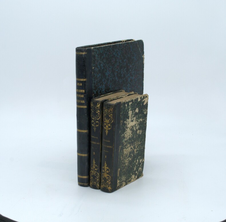
1802ref. PHO-1460Paris, Henri Agasse, 1802 , TEXTE et ATLAS , texte : 2 vol. in-8 de LVI-359-[1]-383pp. ,relié demi cuir , dos lisse avec titre et tomaison, plats frottés , coins et coupes usés , manque la page de titre ,XXXI,XXXV à XLVIII , 334 à 337 au tome 1 et les page 245 à 252 au tome 2 et Un ATLAS in-4°, viii-[4]-67 pp.; 43 planches (44), relié demi veau , dos lisse , quelques défauts à la reliure , petites rousseurs à l’atlas et papier légèrement bruni.