Belgian CongoBiblio.com
3 090 résultats
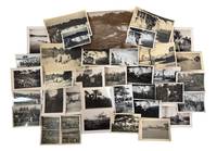
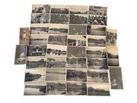
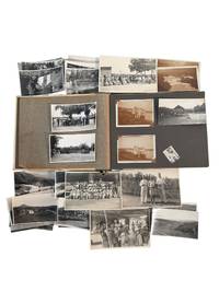
1920réf. 236781920. Belgian Congo colonial residence and indigenous locals photo archive documenting European family life Congolese communities river navigation agricultural districts and travel in the eastern colony circa 1920s to 1930s. The photographs center on Kabalo and related routes through Ituri and Lubero regions integrated into Belgian administration through railways river steamers plantation production and stations built to move personnel and commodities across the interior. European residents appear as travelers hosts sports participants and household members while Congolese people are frequently photographed in large assembled groups at village sites beside transport facilities and within agricultural landscapes shaped by colonial labor demands. Photo album and loose archive of silver gelatin photographs 53 photos with 32 loose most approximately 2.5" x 4" bound in a beige and green board album measuring 7.25" x 10" Belgian Congo circa 1920s to 1930s. Many captioned with name and place identifications. The photographs show European men and women posed in cultivated grounds beside residences on railway platforms and aboard passenger steamers; organized tennis parties and formal gatherings; Congolese crowds assembled beneath palms; workers and families near village buildings; rivers waterfalls upland roads agricultural fields and broad mountain valleys. Several views record launches and larger steam vessels carrying names beginning "Commandant" and "Gouverneur" linking domestic travel to the colonial river fleet. Other images show floodwater submerged or eroded terrain plantation rows administrative or club buildings swimming parties and European visitors observing Congolese gatherings from shaded structures. French inscriptions identify "Kabalo" "Lubero Parc" "Route dans l'Ituri" or "Road in Ituri" and "Petite Halle" or "Small hall." One caption reads in part "L'inondation . de Kabalo mai 1930" or "The flooding . at Kabalo May 1930." Names and surnames visible on versos appear to include Henniger Jordens or Jordaens and possibly Mayenberg; the handwriting does not permit firm identification. Belgian rule after 1908 organized the Congo through concessionary companies missionary institutions administrative posts mines plantations railways and steamer routes intended to extract rubber copper palm products ivory and agricultural commodities while moving European officials and commercial employees through the colony. Kabalo became a strategic junction between the Lualaba River and the rail lines extending toward Lake Tanganyika and the Katanga mining region making it a point where river traffic rail transport labor recruitment and European settlement converged. Minor fading and wear occasional creasing loose photographs and several missing mounts; inscriptions remain generally legible. Overall in good condition. A view at European domestic life in the Belgian Congo depended upon river transport colonial labor agricultural production and the administrative geography of Kabalo and the eastern interior. unknown
1920réf. 236781920. Belgian Congo colonial residence and indigenous locals photo archive documenting European family life Congolese communities river navigation agricultural districts and travel in the eastern colony circa 1920s to 1930s. The photographs center on Kabalo and related routes through Ituri and Lubero regions integrated into Belgian administration through railways river steamers plantation production and stations built to move personnel and commodities across the interior. European residents appear as travelers hosts sports participants and household members while Congolese people are frequently photographed in large assembled groups at village sites beside transport facilities and within agricultural landscapes shaped by colonial labor demands. Photo album and loose archive of silver gelatin photographs 53 photos with 32 loose most approximately 2.5" x 4" bound in a beige and green board album measuring 7.25" x 10" Belgian Congo circa 1920s to 1930s. Many captioned with name and place identifications. The photographs show European men and women posed in cultivated grounds beside residences on railway platforms and aboard passenger steamers; organized tennis parties and formal gatherings; Congolese crowds assembled beneath palms; workers and families near village buildings; rivers waterfalls upland roads agricultural fields and broad mountain valleys. Several views record launches and larger steam vessels carrying names beginning "Commandant" and "Gouverneur" linking domestic travel to the colonial river fleet. Other images show floodwater submerged or eroded terrain plantation rows administrative or club buildings swimming parties and European visitors observing Congolese gatherings from shaded structures. French inscriptions identify "Kabalo" "Lubero Parc" "Route dans l'Ituri" or "Road in Ituri" and "Petite Halle" or "Small hall." One caption reads in part "L'inondation . de Kabalo mai 1930" or "The flooding . at Kabalo May 1930." Names and surnames visible on versos appear to include Henniger Jordens or Jordaens and possibly Mayenberg; the handwriting does not permit firm identification. Belgian rule after 1908 organized the Congo through concessionary companies missionary institutions administrative posts mines plantations railways and steamer routes intended to extract rubber copper palm products ivory and agricultural commodities while moving European officials and commercial employees through the colony. Kabalo became a strategic junction between the Lualaba River and the rail lines extending toward Lake Tanganyika and the Katanga mining region making it a point where river traffic rail transport labor recruitment and European settlement converged. Minor fading and wear occasional creasing loose photographs and several missing mounts; inscriptions remain generally legible. Overall in good condition. A view at European domestic life in the Belgian Congo depended upon river transport colonial labor agricultural production and the administrative geography of Kabalo and the eastern interior. unknown books
1977réf. 010545Repulblique du Zaire 1977 Division des relations publiques de la gécamines Hardcover As New 1st Edition Signed by Author(s)
réf. 13978541Uppsala: Studia Ethnographica Upsaliensia, 1953 - 1957 - 1962 - 1968 4 vol. gr. in-4: viii-155 pages, 25 fig. - (viii)-164 pages, 39 fig., 2 planches hors texte en couleurs - vii-258 pages, 43 fig., 2 planches hors texte en couleurs - vii-198 pages, 29 fig. Broché, le vol. I avec jaquette illustrée en couleurs (dos avec déchirure), couvertures avec marques d'usage, volume 4 non coupé comme neuf, bon état général. Cachets de la bibliothèque de Jacques Kerchache sur les volumes 1,2 et 3. (Studia Ethnographica Upsaliensia IV, VIII, XII, XVI).
1948Complete series of 10 parts, bound in 4 volumes: viii,562 + 350 + 521 + 574pp., with numerous bl/w pictures and maps in text, text in Dutch, 36cm., in the series "Annales du Musée royal du Congo belge. C: Zoologie, série IV" (vol.2 fasc.1-3, vol.3 fasc.1-2, vol.4 fasc.1-2 & vol.5 fasc.1-3), 4 uniform hardcover bindings in good condition, spines in blue cloth with gilt lettering, few stamps on title pages, text clean and bright, Good condition, [Content: Volume I (fasc.1-3): Struthioniformes, Colymbiformes, Procellariiformes, Pelecaniformes, Ciconiiformes, Phoenicopteriformes, Anseriformes, Falconiformes, Galliformes, Turniciformes, Ralliformes, Gruiformes, Charadriiformes, Lariformes, Columbiformes, Cuculiformes, Psittaciformes // Volume II (fasc.4-5): Coraciiformes, Strigiformes, Caprimulgiformes, Cypseliformes // Volume III (fasc.6-7): Passeriformes // Volume IV (fasc.8-10): Passeriformes], weight: 13kg., C99915
1948réf. C99915Tervuren, Museum van Belgisch Congo 1948-1960 Complete series of 10 parts, bound in 4 volumes: viii,562 + 350 + 521 + 574pp., with numerous bl/w pictures and maps in text, text in Dutch, 36cm., in the series "Annales du Musée royal du Congo belge. C: Zoologie, série IV" (vol.2 fasc.1-3, vol.3 fasc.1-2, vol.4 fasc.1-2 & vol.5 fasc.1-3), 4 uniform hardcover bindings in good condition, spines in blue cloth with gilt lettering, few stamps on title pages, text clean and bright, Good condition, [Content: Volume I (fasc.1-3): Struthioniformes, Colymbiformes, Procellariiformes, Pelecaniformes, Ciconiiformes, Phoenicopteriformes, Anseriformes, Falconiformes, Galliformes, Turniciformes, Ralliformes, Gruiformes, Charadriiformes, Lariformes, Columbiformes, Cuculiformes, Psittaciformes // Volume II (fasc.4-5): Coraciiformes, Strigiformes, Caprimulgiformes, Cypseliformes // Volume III (fasc.6-7): Passeriformes // Volume IV (fasc.8-10): Passeriformes], weight: 13kg., C99915
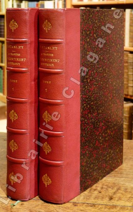
1879réf. 12907Paris, Hachette, 1879 ; 2 tomes in-8 ; demi-chagrin rouge-cerise, fleurons décoratifs et titre dorés (reliure de l'époque) ; (12), IV, 496 ; (4), 544 pp., 2 frontispices, 9 cartes en couleurs dont 2 très grandes dépliantes en fin de chaque volume et 2 dépliantes, dont celle du fleuve Lingstone (Congo) et de ses chutes.
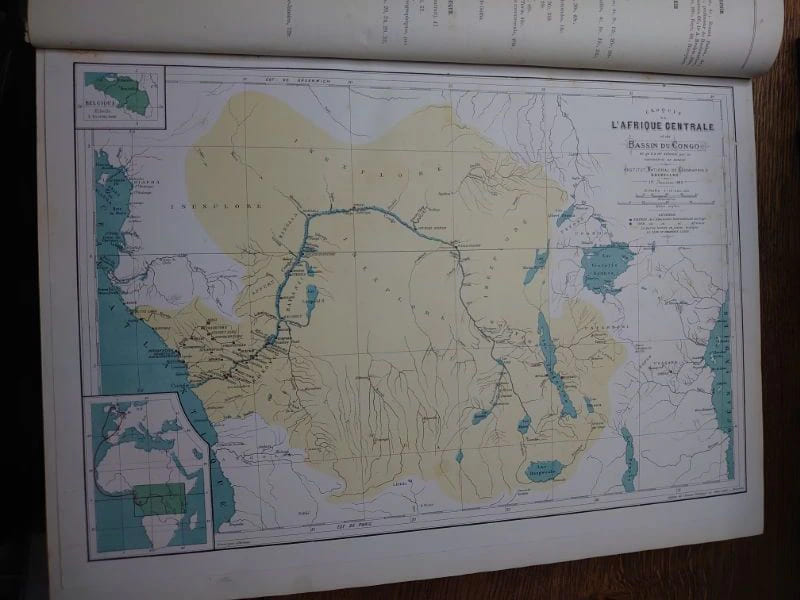
réf. 9129Bruxelles, Institut National de Géographie. 40,5 x 30 cm, iv-88 pp., iv-112 pp., iv-108 pp., 114 pp., 113 pp. et 108 pp. Reliure demi percaline, dos lisse, titre doré. Reliure légèrement usée sinon bon exemplaire. Nombreuses cartes dépliantes. Le premier numéro du Mouvement géographique, sous-titré « Journal Populaire des Sciences Géographiques », parait à Bruxelles le 6 avril 1884. Ce journal, édité par lInstitut national de Géographie de Bruxelles, est fondé par Alphonse-Jules Wauters, dont la personnalité sy exprimera pendant plus de trente ans. Dabord comme rédacteur en chef, puis en qualité de directeur, de 1890 à 1914, il en sera le maitre duvre incontestable. Le mouvement géographique paraîtra en Belgique avec une périodicité bimensuelle, puis hebdomadaire, de 1884 à 1922 avec, toutefois, une interruption en raison de la guerre de 14-18. Au total, 1.485 numéros seront publiés en 34 ans.
réf. 9129Bruxelles, Institut National de Géographie. 40,5 x 30 cm, iv-88 pp., iv-112 pp., iv-108 pp., 114 pp., 113 pp. et 108 pp. Reliure demi percaline, dos lisse, titre doré. Reliure légèrement usée sinon bon exemplaire. Nombreuses cartes dépliantes. Le premier numéro du Mouvement géographique, sous-titré « Journal Populaire des Sciences Géographiques », parait à Bruxelles le 6 avril 1884. Ce journal, édité par lInstitut national de Géographie de Bruxelles, est fondé par Alphonse-Jules Wauters, dont la personnalité sy exprimera pendant plus de trente ans. Dabord comme rédacteur en chef, puis en qualité de directeur, de 1890 à 1914, il en sera le maitre duvre incontestable. Le mouvement géographique paraîtra en Belgique avec une périodicité bimensuelle, puis hebdomadaire, de 1884 à 1922 avec, toutefois, une interruption en raison de la guerre de 14-18. Au total, 1.485 numéros seront publiés en 34 ans.
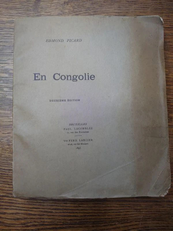
réf. 9167Bruxelles, Paul Lacomblez & Ferdinand Larcier, 1896. In-8°, 211 pp. Broché, entièrement non coupé et non rogné. Couverture d'origine conservée. Bel état malgré une couverture poussiéreuse et un manque au coin du premier plat. Un des 5 exemplaires de tête (hors commerce ?) non numérotés imprimés sur papier de Hollande, au format réimposé.
réf. 9167Bruxelles, Paul Lacomblez & Ferdinand Larcier, 1896. In-8°, 211 pp. Broché, entièrement non coupé et non rogné. Couverture d'origine conservée. Bel état malgré une couverture poussiéreuse et un manque au coin du premier plat. Un des 5 exemplaires de tête (hors commerce ?) non numérotés imprimés sur papier de Hollande, au format réimposé.
1946réf. 232341946. Belgian Congo photo archive documenting colonialism and segregated settlement in Paulis Jadotville and at Kiubo Falls in 1946-1947 while Belgian rule expanded displacing Congolese communities from political power and control over local resources. Made by an unidentified traveler or colonial observer the group moves between industrial sites river traffic town streets waterfalls village compounds and posed encounters with Congolese residents placing daily life beside the infrastructure of empire. Jadotville in Katanga had been built within the orbit of Union Minière du Haut-Katanga and the copper economy that tied the Congo to European industry; Paulis belonged to the northeastern colonial administrative network that extended surveillance mission activity and commercial penetration into local societies. By the later 1940s these systems were producing wealth for Belgium and foreign markets through forced and controlled labor regimes. Photo archive of 36 black and white silver gelatin photographs various sizes ranging from 2.5" x 3.5" to 5" x 7" Belgian Congo 1946-1947. Nine photographs are identified to the Paulis region in 1946 including versos inscribed in French with "Habitations Européens à Paulis" "Pavillon de l'hotel" and "Le Kigoma sur le fleuve." These images show European-style houses set among palms a large riverside or lakeside steamer a broad colonial street with automobiles and low commercial buildings thatched structures and Congolese figures posed near village compounds and along a tree-lined road. The remaining photographs from Jadotville and Kiubo Falls in 1947 include multiple views of the falls from overlooks and near the waterline several repeated compositions of cascades and riverbanks a dense electrical installation with transformers and steel framing public crowd scenes dugout canoes on calm water groups standing beside temporary camp structures and additional views of thatched settlements large shade trees and Congolese men women and children positioned before houses or in open clearings. Several photographs set European-built environments against Congolese dwellings and occupied landscapes making the colonial dichotomy apparent within this grouping. Waterfalls river steamers electric infrastructure and ordered streets mark the channels through which copper labor and administrative authority moved outward to Belgian and international markets while the photographs of Congolese settlements and residents show the populations who bore that reorganization of land and economy. In the late colonial Congo extraction and transport depended on African labor under coercive conditions and urban growth in places such as Jadotville advanced through racially unequal housing wage structures and civic access leaving Congolese people concentrated in subordinate quarters or rural zones even when their work sustained the entire system. Light wear and occasional creasing; several versos inscribed in French; overall very good condition. An intimate look into Belgian colonial rule at the point where industrial wealth infrastructure and local displacement met on the ground. unknown
1946réf. 232341946. Belgian Congo photo archive documenting colonialism and segregated settlement in Paulis Jadotville and at Kiubo Falls in 1946-1947 while Belgian rule expanded displacing Congolese communities from political power and control over local resources. Made by an unidentified traveler or colonial observer the group moves between industrial sites river traffic town streets waterfalls village compounds and posed encounters with Congolese residents placing daily life beside the infrastructure of empire. Jadotville in Katanga had been built within the orbit of Union Minière du Haut-Katanga and the copper economy that tied the Congo to European industry; Paulis belonged to the northeastern colonial administrative network that extended surveillance mission activity and commercial penetration into local societies. By the later 1940s these systems were producing wealth for Belgium and foreign markets through forced and controlled labor regimes. Photo archive of 36 black and white silver gelatin photographs various sizes ranging from 2.5" x 3.5" to 5" x 7" Belgian Congo 1946-1947. Nine photographs are identified to the Paulis region in 1946 including versos inscribed in French with "Habitations Européens à Paulis" "Pavillon de l'hotel" and "Le Kigoma sur le fleuve." These images show European-style houses set among palms a large riverside or lakeside steamer a broad colonial street with automobiles and low commercial buildings thatched structures and Congolese figures posed near village compounds and along a tree-lined road. The remaining photographs from Jadotville and Kiubo Falls in 1947 include multiple views of the falls from overlooks and near the waterline several repeated compositions of cascades and riverbanks a dense electrical installation with transformers and steel framing public crowd scenes dugout canoes on calm water groups standing beside temporary camp structures and additional views of thatched settlements large shade trees and Congolese men women and children positioned before houses or in open clearings. Several photographs set European-built environments against Congolese dwellings and occupied landscapes making the colonial dichotomy apparent within this grouping. Waterfalls river steamers electric infrastructure and ordered streets mark the channels through which copper labor and administrative authority moved outward to Belgian and international markets while the photographs of Congolese settlements and residents show the populations who bore that reorganization of land and economy. In the late colonial Congo extraction and transport depended on African labor under coercive conditions and urban growth in places such as Jadotville advanced through racially unequal housing wage structures and civic access leaving Congolese people concentrated in subordinate quarters or rural zones even when their work sustained the entire system. Light wear and occasional creasing; several versos inscribed in French; overall very good condition. An intimate look into Belgian colonial rule at the point where industrial wealth infrastructure and local displacement met on the ground. unknown books
réf. 13977111Arnouville: Arts d'Afrique Noire, 1996 in-4, 408 pages, nombreuses illustrations en couleurs, cartes, bibliographie, index. Reliure toile, jaquette, bon état d'usage.
1899Série complète des premières 15 années/volumes, ensemble plus de 7000 pages, richement illustré (principalement des photos en n/bl, des cartes et des dessins), 27cm., reliures uniformes d'époque en rouge (dos en cuir avec titré doré, dos à cinq nerfs, charnières peu passées et qqs. traces d'usage), brochures originales conservées et reliées, feuilles de garde marbrées, qqs. vagues taches d'humidité dans les tomes 1 à 4 (dans le marge du texte, pas dans le texte), texte frais, poids: 30 kg., R108410
1899réf. R108410Bruxelles, Charles Bulens 1899-1913 Série complète des premières 15 années/volumes, ensemble plus de 7000 pages, richement illustré (principalement des photos en n/bl, des cartes et des dessins), 27cm., reliures uniformes d'époque en rouge (dos en cuir avec titré doré, dos à cinq nerfs, charnières peu passées et qqs. traces d'usage), brochures originales conservées et reliées, feuilles de garde marbrées, qqs. vagues taches d'humidité dans les tomes 1 à 4 (dans le marge du texte, pas dans le texte), texte frais, poids: 30 kg., R108410
1959réf. 70321959 1959 · Bruxelles, Belgium M.; J. VAN NOTEN,
réf. 13976341Bolobo (Haut Congo, Congo Belge): Baptist Mission Press, 1942 in-8, [xii}-248 page. Cartonnage d'éd., bon état d'occasion. Rare.
1920réf. 235621920. Belgian Congo travel and colonial encounter photo archive June 1929 documenting Western movement through river settlements Congolese communities and transport corridors during the late 1920s expansion of Belgian colonial administration. The archive dates to the period after Belgium took over the Congo Free State in 1908 and after Leopoldville became the colonial capital in 1926 placing the group inside a decade when river rail missionary commercial and administrative routes shaped how European travelers moved through the colony. The photographs record Congolese people and Western visitors in proximity but the camera's position remains that of the outsider turning encounters village life river crossings and gathered groups into a colonial travel record. Photo archive of 37 likely silver gelatin prints each approximately 3 x 5.5 inches Belgian Congo including Leopoldville June 1929. The photos show broad river views with low shorelines and wooded banks; small boats and steam launches moving across open water; river landings with houses palms and distant hills; rough timber walkways and cleared paths through dense vegetation; and several views of Congolese people near water canoes and village structures. Other images show Western travelers or colonial personnel in light clothing and hats including figures posed near vehicles and on board transport while group scenes show Congolese men women and children gathered in circles or facing the camera. Several photographs depict Congolese men wearing body ornaments patterned cloth arm rings and headdresses including one scene with a large gathered crowd and another showing a man with a leopard skin or spotted pelt before a group. A portrait of a small child standing against a large tree shaded picnic or camp scenes and repeated riverbank views broaden the record from formal encounter to travel rest and observation. One verso is inscribed "Leopoldville. Juin 1929" confirming place and date for at least part of the group. Belgian Congo in 1929 stood between the violent reputation of the Congo Free State and the later high colonial period but Belgian rule continued to depend on racial hierarchy forced labor regimes missionary schooling transport expansion and extractive production. Leopoldville's rise as capital shifted administrative focus inland from Boma and tied the colony more tightly to the Congo River and the Matadi rail connection making the river corridor a principal route for officials commercial travelers missionaries and tourists. These photographs belong to that mobile colonial world: they show Westerners entering Congolese spaces by boat road and landing place while Congolese subjects appear as workers hosts spectators performers children and crowds arranged before an external camera. Light surface wear and toning some versos have penciled inscriptions. Overall in very good condition. A concentrated visual record of Belgian colonial travel and encounter along Congo River routes at the moment Leopoldville was becoming the administrative center of the Belgian Congo. unknown
1920réf. 235621920. Belgian Congo travel and colonial encounter photo archive June 1929 documenting Western movement through river settlements Congolese communities and transport corridors during the late 1920s expansion of Belgian colonial administration. The archive dates to the period after Belgium took over the Congo Free State in 1908 and after Leopoldville became the colonial capital in 1926 placing the group inside a decade when river rail missionary commercial and administrative routes shaped how European travelers moved through the colony. The photographs record Congolese people and Western visitors in proximity but the camera's position remains that of the outsider turning encounters village life river crossings and gathered groups into a colonial travel record. Photo archive of 37 likely silver gelatin prints each approximately 3 x 5.5 inches Belgian Congo including Leopoldville June 1929. The photos show broad river views with low shorelines and wooded banks; small boats and steam launches moving across open water; river landings with houses palms and distant hills; rough timber walkways and cleared paths through dense vegetation; and several views of Congolese people near water canoes and village structures. Other images show Western travelers or colonial personnel in light clothing and hats including figures posed near vehicles and on board transport while group scenes show Congolese men women and children gathered in circles or facing the camera. Several photographs depict Congolese men wearing body ornaments patterned cloth arm rings and headdresses including one scene with a large gathered crowd and another showing a man with a leopard skin or spotted pelt before a group. A portrait of a small child standing against a large tree shaded picnic or camp scenes and repeated riverbank views broaden the record from formal encounter to travel rest and observation. One verso is inscribed "Leopoldville. Juin 1929" confirming place and date for at least part of the group. Belgian Congo in 1929 stood between the violent reputation of the Congo Free State and the later high colonial period but Belgian rule continued to depend on racial hierarchy forced labor regimes missionary schooling transport expansion and extractive production. Leopoldville's rise as capital shifted administrative focus inland from Boma and tied the colony more tightly to the Congo River and the Matadi rail connection making the river corridor a principal route for officials commercial travelers missionaries and tourists. These photographs belong to that mobile colonial world: they show Westerners entering Congolese spaces by boat road and landing place while Congolese subjects appear as workers hosts spectators performers children and crowds arranged before an external camera. Light surface wear and toning some versos have penciled inscriptions. Overall in very good condition. A concentrated visual record of Belgian colonial travel and encounter along Congo River routes at the moment Leopoldville was becoming the administrative center of the Belgian Congo. unknown books
1903réf. PHO-1294Masson, 1905. 4 vol. in-4 . Texte : broché (dos très usés avec manques et plats détachés au tome III, avec des défauts aux autres tomes); IV- 1210 pp. 428 reproductions photographiques dans le texte, 30 planches num. in & hors-texte, 2 pl. hors-t. n. ch. Atlas : cartonnage vert éditeur (frotté et tâché, bords des cartes un peu piqués et poussiéreux). 16 planches en couleurs contenant l'itinéraire général de la mission entre Ouargla et Bangui à l'échelle de 1/400.000e avec un levé détaillé du cours du Chari aux basses eaux entre Fort-Lamy et Fort-Archambault, à l'échelle de 1/100.000e.
réf. 13979874Bruxelles: Les Editions de Belgique, 1936 in-8 à grandes marges. Tiré à 28 ex. num. Un des 8 sur Japon. Demi chagrin noir à coins, dos à 5 nerfs terminés à froid sur les plats, titre doré, tête dorée, couverture illustrée et dos conservés, minimes épidermures sur les nerfs, très bel exemplaire.
réf. 13983499Arnouville: Arts d'Afrique Noire, 1980 in-4, 264 pages, 142 illustrations, dessins dans le texte, carte. Bibliographie. Rel. toile d'éd., jaquette, petite déchirure au dos, autrement très bon état.
réf. 13977273Bruxelles: L'Eglantine, 1931 in-4, 90 pages, 11 illustrations. Broché, couverture illustrée, lég. défr., trace de pliure et petites taches de rouille au deuxième plat, bon exemplaire de ce très rare recueil de contes luba, sans doute la première oeuvre écrite par un congolais et illustrée de dessins de l'artiste congolais Djilatendo.
1929réf. 0000491929 Paris, Librairie Gallimard, [1929]. Fort in-quarto demi-chagrin poli havane, dos cinq nerfs sertis de filets à froid, auteur et titre dorés, date en queue, plats et dos de la couverture conservés (Reliure moderne) ; 307 pages, 64 planches et 4 cartes hors-texte.