Farmer, Karen Congo; Fredin, AmyBiblio.com

116 Ergebnisse
Best.-Nr. 1119731860-9-18Wiley. 1. New. The item is brand new never used or read. It's in perfect condition and may include supplements and/or access codes or come shrink-wrapped. Wiley unknown
Best.-Nr. 1119731860-9-18-NAUWiley. 1. Very Good. It's a well-cared-for item that has seen limited use. The item may show minor signs of wear. All the text is legible with all pages included. It may have slight markings and/or highlighting. Wiley unknown
Best.-Nr. 1119731860-9-1-NAUWiley. 1. Very Good. It's a well-cared-for item that has seen limited use. The item may show minor signs of wear. All the text is legible with all pages included. It may have slight markings and/or highlighting. Wiley unknown
Best.-Nr. 1119731860-10-1Wiley. 1. New. The item is brand new never used or read. It's in perfect condition and may include supplements and/or access codes or come shrink-wrapped. Wiley unknown
Best.-Nr. 1119731860-10-1-NAUWiley. 1. Very Good. It's a well-cared-for item that has seen limited use. The item may show minor signs of wear. All the text is legible with all pages included. It may have slight markings and/or highlighting. Wiley unknown
Best.-Nr. 1119731860-9-1Wiley. 1. New. The item is brand new never used or read. It's in perfect condition and may include supplements and/or access codes or come shrink-wrapped. Wiley unknown
Best.-Nr. 1119731860-11-1Wiley. 1. Very Good. It's a well-cared-for item that has seen limited use. The item may show minor signs of wear. All the text is legible with all pages included. It may have slight markings and/or highlighting. Wiley unknown
Best.-Nr. 1119731860-9-15Wiley. 1. New. The item is brand new never used or read. It's in perfect condition and may include supplements and/or access codes or come shrink-wrapped. Wiley unknown
Best.-Nr. 1119731860-9-15-NAUWiley. 1. Very Good. It's a well-cared-for item that has seen limited use. The item may show minor signs of wear. All the text is legible with all pages included. It may have slight markings and/or highlighting. Wiley unknown
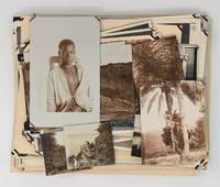
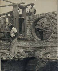
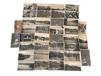
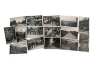
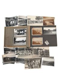
Best.-Nr. PF73123 loose gelatin silver photos including 71 large images ca. 175x235 cm 6 ¾ x 9 in one photo ca. 175x205 cm 7x8 in and over forty images from ca. 13x18 cm 5x7 in to ca. 85x13 cm 3 ¼ x 5 in; five small photos are from ca. 8x105 cm 3 ¼ x 4 ¼ in to ca. 55x6 cm 2 x 2 ¼ in; six images are printed as real photo postcards. Three photos with period pencil captions in French on verso; one photo with an ink stamp “Compagnie Aérienne Française 18 Rue de Nanterre Suresnes” on verso. The images were previously removed from an album so most have remnants of mounting on the corners ca. 15 with minor tears or losses to corners. Several images with minor creases on extremities several slightly faded but overall a very good collection. Historically significant extensive collection of original gelatin silver photos showing a copper ore processing plant of the “Compagnie Minière du Congo Français” on the M’Vouvou River near the town of Mindouli French Congo modern-day Pool Department in the middle Congo region of the Republic of Congo. “Compagnie Minière du Congo Français” or CMCF 1911-1962 was established mainly for the extraction of the mineral resources of the Mindouli district reaching the height of its operations in the 1930s after the construction of the ore processing plant on the M’Vouvou River a tributary of the Loukouni which flows into the Niari – the main regional river in 1929. The company was closed shortly after the Republic of Congo gained independence in 1960. The photos include over twenty photos of the M’Vouvou processing plant and the adjacent French residential compound general and close-up views of the plant and the bungalows including six aerial views the factory French compound native villages and roads. Two photos have period pencil captions on verso reading: “Usine de la C.M.C.F. à Mindouli – M’Vouvou;” “Usine de traitement de minerai <…> à Mindouli Vouvou. Proprieté C.M.C.F…” Over seventy photos depict the Loukouni River one image is captioned “Les gorge de la Loukouni” and also most likely its tributaries M’Vouvou and Mindouli which surrounded the area where the plant was constructed. The photos show river valleys and gorges overhanging cliffs rapids and waterfalls with French residents swimming picnicking on the banks posing on a hanging bridge under the cliffs &c. There are also photos of native villages with thatched-roof houses a Congolese town street with an open-air restaurant the interior of a local infirmary with a Congolese caretaker; a biplane sign “O-BAHT” painted on the side with a group of French colonial residents; views of a capsized rail cart on a slope being examined by Congolese workers; portraits of French residents posing next to their bungalows or pretending to do a boxing match Congolese boatsmen and their pirogues workers and their families posing in front of their cottages women working in a field a young man climbing up a palm tree a mother with child and others. Overall an interesting extensive collection of original gelatin silver photos of the Mindouli ore processing plant and district in the middle Congo River in the 1930s. unknown
Best.-Nr. PD4Seventeen unmounted gelatin silver prints including six larger ones ca. 12x17 cm ca. 4 ¾ x 6 ¾ in and seven smaller ones ca. 65x105 cm 2 ½ x 4 ¼ in with three images in between those sizes. The majority with manuscript pencil captions in French on verso. The photographs are sharp and in very good condition. This collection includes early views of Boma – the capital of Belgian Congo – its streets and the house of the “Chef Batailon” and three views of Fort de Shinkakasa built near Boma in 1891 also a panorama of the Congo river with the fort on the right and Boma in the distance. Several views of Lusambo show its streets river and a church under construction. There are also photos of a small village on the Kwamouth river and images of local people shown next to their houses with ox driven carts during the cotton harvest etc. “Boma is a port town on the Congo River some 100 km upstream from the Atlantic Ocean in the Bas-Congo province of the Democratic Republic of the Congo. Boma was the capital city of the Congo Free State and Belgian Congo the modern Democratic Republic of the Congo from 1 May 1886 to 1926 when the capital was moved to Léopoldville since renamed Kinshasa” Wikipedia. “Lusambo is a town and territory in the Sankuru district of the Kasai-Oriental province Democratic Republic of the Congo. The town lies north of the confluence of the Sankuru River and the Lubi River. In 1890 Lusambo was chosen by Paul Le Marinel as the main Belgian base in the Kasai region to defend against the threat of Arab or Swahili traders in slaves and ivory who were encroaching from the east. The station would soon become one of the most important military posts of the Congo Free State with a permanent staff of seventeen whites six hundred native soldiers and four artillery pieces” Wikipedia. unknown
1911Best.-Nr. 37502Bruxelles: Publiées par le Ministere des Colonies 1911. First edition. Aqurelles par Norman-H. Hardy. 403 photographs and drawings 2 fold-out maps and 29 full- page folio-size plates containing 20 color drawings 15 color plates of raffia designs 53 photographs of carved figures and objects and 14 photographs of 18th century Bombala embroidery. 1 vols. Large 4to. Original tan printed portfilo. Book loose in fasicules. Fine. wrappers slightly worn. First edition. Aqurelles par Norman-H. Hardy. 403 photographs and drawings 2 fold-out maps and 29 full- page folio-size plates containing 20 color drawings 15 color plates of raffia designs 53 photographs of carved figures and objects and 14 photographs of 18th century Bombala embroidery. 1 vols. Large 4to. Publiées par le Ministere des Colonies unknown
Best.-Nr. DADAX0781438195David C Cook 0000-00-00. paperback. New. 6.00x0.25x9.00. Buy with confidence. Excellent Customer Service & Return policy. David C Cook paperback
1947Best.-Nr. ZB402696Bruxelles: 1947. Part 2 only; iv 557-952 pp. illustrated including a small folding map; paper wrappers darkened and chippedat extremities a few brown spots but mostly unopened. - If you are reading this this item is actually physically in our stock and ready for shipment once ordered. We are not bookjackers. Buyer is responsible for any additional duties taxes or fees required by recipient's country. Bruxelles: unknown
Best.-Nr. 55757676Brand New. unknown
Best.-Nr. DADAX1946160105University of Louisiana 2018-02-28. paperback. New. 7.50x0.40x9.00. Buy with confidence. Excellent Customer Service & Return policy. University of Louisiana paperback
1954Best.-Nr. 4520Belgian Congo: Congo Tours 1954. First Edition. Soft cover. Fine. Belgian Congo BIG GAME HUNTING Promotional Brochure issued September 1954. 3 part fold-out brochure. 6 pp 7.5 x 5/1/5 pages. Covering all hunting areas Lake Albert Kamanda Aba Beni Tayala's Semliki River and Gabios. Giving safari rates what they include costs of licenses trophy fees and a full page map. Area hunted is contiguous to Soudan Uganda and Tanganyika i.e. the best big game areas in the Belgian Congo. Fine. Congo Tours unknown
Best.-Nr. DADAX110803134XCambridge University Press 2011-06-02. 1. paperback. New. 5.51x0.72x8.51. Buy with confidence. Excellent Customer Service & Return policy. Cambridge University Press paperback
Best.-Nr. SONG1842770527Bloomsbury 2002-05-03. hardcover. Used: Good. 5.50x0.88x8.50. Buy with confidence. Excellent Customer Service & Return policy. Bloomsbury hardcover
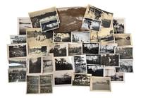
1920Best.-Nr. 235621920. Belgian Congo travel and colonial encounter photo archive June 1929 documenting Western movement through river settlements Congolese communities and transport corridors during the late 1920s expansion of Belgian colonial administration. The archive dates to the period after Belgium took over the Congo Free State in 1908 and after Leopoldville became the colonial capital in 1926 placing the group inside a decade when river rail missionary commercial and administrative routes shaped how European travelers moved through the colony. The photographs record Congolese people and Western visitors in proximity but the camera's position remains that of the outsider turning encounters village life river crossings and gathered groups into a colonial travel record. Photo archive of 37 likely silver gelatin prints each approximately 3 x 5.5 inches Belgian Congo including Leopoldville June 1929. The photos show broad river views with low shorelines and wooded banks; small boats and steam launches moving across open water; river landings with houses palms and distant hills; rough timber walkways and cleared paths through dense vegetation; and several views of Congolese people near water canoes and village structures. Other images show Western travelers or colonial personnel in light clothing and hats including figures posed near vehicles and on board transport while group scenes show Congolese men women and children gathered in circles or facing the camera. Several photographs depict Congolese men wearing body ornaments patterned cloth arm rings and headdresses including one scene with a large gathered crowd and another showing a man with a leopard skin or spotted pelt before a group. A portrait of a small child standing against a large tree shaded picnic or camp scenes and repeated riverbank views broaden the record from formal encounter to travel rest and observation. One verso is inscribed "Leopoldville. Juin 1929" confirming place and date for at least part of the group. Belgian Congo in 1929 stood between the violent reputation of the Congo Free State and the later high colonial period but Belgian rule continued to depend on racial hierarchy forced labor regimes missionary schooling transport expansion and extractive production. Leopoldville's rise as capital shifted administrative focus inland from Boma and tied the colony more tightly to the Congo River and the Matadi rail connection making the river corridor a principal route for officials commercial travelers missionaries and tourists. These photographs belong to that mobile colonial world: they show Westerners entering Congolese spaces by boat road and landing place while Congolese subjects appear as workers hosts spectators performers children and crowds arranged before an external camera. Light surface wear and toning some versos have penciled inscriptions. Overall in very good condition. A concentrated visual record of Belgian colonial travel and encounter along Congo River routes at the moment Leopoldville was becoming the administrative center of the Belgian Congo. unknown
1930Best.-Nr. 236631930. Mbuti community photo archive depicting Indigenous residents of the Ituri Forest in the Belgian Congo circa 1930s during a period when colonial expansion and missionary work drove foreigners deeper into indigenous communities. Several images concentrate on Mbuti adults and children while photographs of a Western woman and man an automobile and newly accessible routes record the external presence surrounding the encounter. The archive highlights the moment under which Indigenous communities were made visible to Western audiences. Photo archive of 14 silver gelatin photographs each 4" x 6" Ituri Forest Belgian Congo circa 1930s. Several photographs depict large groups of Mbuti men women and children standing in extended lines beside a forest settlement; the adults wear bark cloth patterned wraps or minimal garments and children cluster at the front or beside their mothers. A close portrait centers women and children gathered tightly around an older woman recording individual expressions and family proximity more directly than the formal group arrangements. Other images show dense tropical vegetation cultivated clearings narrow dirt roads rolling grassland and a motorcar traveling through the forest. A Western woman appears alone among tall plants beside a vehicle and on forest paths her repeated placement transforming the landscape into the record of an expedition. The Mbuti comprise several Indigenous forest communities through close relationships with the Ituri environment and neighboring communities. Colonial intervention altered those relationships by imposing territorial administration taxation compulsory labor mission education religious conversion and roads that connected previously remote districts to government and commercial centers. Catholic missions held substantial authority within the Belgian colonial system during the 1920s and 1930s while colonial administrators reorganized settlements and political structures throughout the Ituri region. Minor edge wear and scattered surface marks; images generally retain strong contrast and detail. Overall in good condition. A direct visual record of Mbuti communities confronting the movement of Western people vehicles institutions and cameras into the Ituri Forest under Belgian colonial rule. unknown
1920Best.-Nr. 236781920. Belgian Congo colonial residence and indigenous locals photo archive documenting European family life Congolese communities river navigation agricultural districts and travel in the eastern colony circa 1920s to 1930s. The photographs center on Kabalo and related routes through Ituri and Lubero regions integrated into Belgian administration through railways river steamers plantation production and stations built to move personnel and commodities across the interior. European residents appear as travelers hosts sports participants and household members while Congolese people are frequently photographed in large assembled groups at village sites beside transport facilities and within agricultural landscapes shaped by colonial labor demands. Photo album and loose archive of silver gelatin photographs 53 photos with 32 loose most approximately 2.5" x 4" bound in a beige and green board album measuring 7.25" x 10" Belgian Congo circa 1920s to 1930s. Many captioned with name and place identifications. The photographs show European men and women posed in cultivated grounds beside residences on railway platforms and aboard passenger steamers; organized tennis parties and formal gatherings; Congolese crowds assembled beneath palms; workers and families near village buildings; rivers waterfalls upland roads agricultural fields and broad mountain valleys. Several views record launches and larger steam vessels carrying names beginning "Commandant" and "Gouverneur" linking domestic travel to the colonial river fleet. Other images show floodwater submerged or eroded terrain plantation rows administrative or club buildings swimming parties and European visitors observing Congolese gatherings from shaded structures. French inscriptions identify "Kabalo" "Lubero Parc" "Route dans l'Ituri" or "Road in Ituri" and "Petite Halle" or "Small hall." One caption reads in part "L'inondation . de Kabalo mai 1930" or "The flooding . at Kabalo May 1930." Names and surnames visible on versos appear to include Henniger Jordens or Jordaens and possibly Mayenberg; the handwriting does not permit firm identification. Belgian rule after 1908 organized the Congo through concessionary companies missionary institutions administrative posts mines plantations railways and steamer routes intended to extract rubber copper palm products ivory and agricultural commodities while moving European officials and commercial employees through the colony. Kabalo became a strategic junction between the Lualaba River and the rail lines extending toward Lake Tanganyika and the Katanga mining region making it a point where river traffic rail transport labor recruitment and European settlement converged. Minor fading and wear occasional creasing loose photographs and several missing mounts; inscriptions remain generally legible. Overall in good condition. A view at European domestic life in the Belgian Congo depended upon river transport colonial labor agricultural production and the administrative geography of Kabalo and the eastern interior. unknown
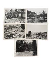
1950Best.-Nr. 235541950. Belgian Congo colonial photo archive circa 1950s documenting how the Belgian state presented the colony to Western viewers through coffee production planned workers' housing road building urban commerce and managed landscape. Issued through the Belgian Government Information Center in New York the photographs translate colonial rule into a sequence of alluring scenes such as African labor inside an industrial coffee facility a rural workers' village at Bosulo automobiles and commercial buildings in Léopoldville road infrastructure through forest and savannah country in the Kibali Ituri district. The group belongs to the late colonial period when Belgium framed the Congo as a development project while its economy remained structured around extractive agriculture mineral wealth compulsory labor histories and racial hierarchy. Photo archive of five silver gelatin photographs New York: Belgian Government Information Center: Belgium and Belgian Congo each 5 x 7 inches Belgian Congo circa 1950s. The photos show workers handling sacks in a coffee facility; a thatched workers' village with a central road palms and surrounding hills captioned "Workers' village - Bosulo"; a busy Léopoldville commercial district filled with cars pedestrians bicycles storefronts and hotel signage captioned "Commercial center at Leopoldville city life vol. 10"; open savannah in the Kibali Ituri district captioned in handwritten script "In the Kibali Ituri district at a height of about 3000 feet there is a plain covered with savannah. Vegetation and countryside vol. 3"; and a forest road captioned "Vegetatikon and Countryside vol. 3 / Road through the jungle." Belgium ruled the Congo from 1908 after the international scandal of King Leopold II's Congo Free State until Congolese independence in 1960. By the mid twentieth century official Belgian publicity emphasized welfare labor housing roads agriculture and urban modernization recasting colonial control as technical improvement and economic order. These images present coffee production labor housing urban commerce and road construction as evidence of Belgian economic development in the Congo. For native Congolese that industrial system meant wage labor in export agriculture and processing residence in employer or state planned settlements movement through colonial transport networks and participation in an urban economy controlled by Belgian administration and business. Light surface wear and scattered verso stamps and annotations; images remain clean and clear. Overall very good condition. An archive of Congolese labor and land as the basis of late colonial industry in Belgian Congo. unknown
1946Best.-Nr. 232341946. Belgian Congo photo archive documenting colonialism and segregated settlement in Paulis Jadotville and at Kiubo Falls in 1946-1947 while Belgian rule expanded displacing Congolese communities from political power and control over local resources. Made by an unidentified traveler or colonial observer the group moves between industrial sites river traffic town streets waterfalls village compounds and posed encounters with Congolese residents placing daily life beside the infrastructure of empire. Jadotville in Katanga had been built within the orbit of Union Minière du Haut-Katanga and the copper economy that tied the Congo to European industry; Paulis belonged to the northeastern colonial administrative network that extended surveillance mission activity and commercial penetration into local societies. By the later 1940s these systems were producing wealth for Belgium and foreign markets through forced and controlled labor regimes. Photo archive of 36 black and white silver gelatin photographs various sizes ranging from 2.5" x 3.5" to 5" x 7" Belgian Congo 1946-1947. Nine photographs are identified to the Paulis region in 1946 including versos inscribed in French with "Habitations Européens à Paulis" "Pavillon de l'hotel" and "Le Kigoma sur le fleuve." These images show European-style houses set among palms a large riverside or lakeside steamer a broad colonial street with automobiles and low commercial buildings thatched structures and Congolese figures posed near village compounds and along a tree-lined road. The remaining photographs from Jadotville and Kiubo Falls in 1947 include multiple views of the falls from overlooks and near the waterline several repeated compositions of cascades and riverbanks a dense electrical installation with transformers and steel framing public crowd scenes dugout canoes on calm water groups standing beside temporary camp structures and additional views of thatched settlements large shade trees and Congolese men women and children positioned before houses or in open clearings. Several photographs set European-built environments against Congolese dwellings and occupied landscapes making the colonial dichotomy apparent within this grouping. Waterfalls river steamers electric infrastructure and ordered streets mark the channels through which copper labor and administrative authority moved outward to Belgian and international markets while the photographs of Congolese settlements and residents show the populations who bore that reorganization of land and economy. In the late colonial Congo extraction and transport depended on African labor under coercive conditions and urban growth in places such as Jadotville advanced through racially unequal housing wage structures and civic access leaving Congolese people concentrated in subordinate quarters or rural zones even when their work sustained the entire system. Light wear and occasional creasing; several versos inscribed in French; overall very good condition. An intimate look into Belgian colonial rule at the point where industrial wealth infrastructure and local displacement met on the ground. unknown
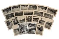
1946Best.-Nr. 235061946. Congolese ceremonial and colonial encounter photo archive showing indigenous ceremonial dance dress and culture uniformed troops and Belgian officials in the Belgian Congo during the late 1940s and early 1950s. Key scenes are tied to the 1947 visit of Prince Regent Charles to Paulis. Belgium ruled the Congo from 1908 until independence on June 30 1960 after the Belgian parliament took over King Leopold II's Congo Free State following international exposure of forced labor and mass abuses. Several captions appear to place the photographs during the governorship of Eugène Jungers Governor General of the Belgian Congo from December 31 1946 to January 1 1952 a period when Belgian rule promoted "paternal" administration while Congolese political pressure and demands for advancement were growing. The strongest scenes center Congolese public ceremony rather than colonial officials alone: men dancing in lines drummers seated before large instruments children gathered for viewing and performers facing crowds in open fields and palm-lined roads. Chief Tongolo and his daughter appear among colonial representatives during the Prince Regent's visit giving the archive a named Indigenous presence within a public ceremony shaped by Belgian authority. Photo archive of 24 silver gelatin photographs measuring approximately 3" x 4" each Belgian Congo 1940s-1950s. Several French captions can be translated; "Governor General Jungers"; "the regiment's standard at the cemetery"; "parade of the veterans"; and "Congolo gives his speech." Congolese men dance in feathered or fiber headdresses body ornaments patterned waist cloths shields and drums sometimes advancing across open ground before lines of onlookers. Belgian men in white suits and pith helmets stand with Congolese adults and children outside official buildings and in outdoor assembly areas while other scenes show African soldiers in formation a ceremony near railroad tracks a colonial cemetery observance and a station or compound with crowds gathered along walls and platforms. After the Second World War Belgium's Congo policy remained formally paternalist while urbanization war service missionary education and wage labor created new Congolese claims to political recognition that colonial rule could not contain;within thirteen years of Prince Regent Charles's 1947 visit the Congo gained it's independence and became Republic of the Congo. Light handling wear toning and minor curling; captions remain legible on several versos images remain clean and clear. Overall in very good condition. The archive records Congolese ceremonial life at the point where public dance veteran commemoration colonial ceremony military display and Belgian administrative power occupied the same public spaces. unknown