6 Ergebnisse
1976Best.-Nr. QB-3S97-X52F1976. Hardcover. Very Good. Little Brown 1976. Jacket is Good with some wear nicks and scratches. Book is VG with moderate wear pages lightly yellowed with an occasional bit of foxing binding firm. hardcover
Best.-Nr. 5050015634.Ghardcover. Good. Access codes and supplements are not guaranteed with used items. May be an ex-library book. hardcover
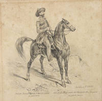
Best.-Nr. 89624Mailand Milan am 8. Juli 1852. . Pencil drawing captioned in Russian and French below 15.5 x 16 cm. 6 1/8 x 6 1/4 in some spotting in contemporary mount. Fine detailed pencil drawing of a mounted officer from the Caucasus Line Cossack Host. Apparently drawn in Milan it is strongly reminiscent of the military plates published in Vienna by Matthäus Trentsenskiy or the costume drawings of François Hippolyte Lalaisse. The Caucasus Linear Cossack Army was established in 1832 in the Northern Caucasus. Along with the Black Sea Cossack army it defended the Caucasus fortified line from the mouth of the Terek River to the mouth of the Kuban. y 1860 following the end of the Caucasus War it had divided into the Kuban and Terek troops. Mailand [Milan], am 8. Juli 1852. unknown
Best.-Nr. 78911Tbilisi Ekspeditsii turisticheskogo otdela geogr. obshschestva SSR Gruzii 1928. . Landscape 8vo 17 x 24.5 cm 56 pp. illustrated with 25 plates text in Georgian with French and Russian epitome; original printed wrappers small tear to lower cover minor rubbing to edges. Fine example of the first-hand account of the expedition to the peak of the mount Kazbek undertaken in November 1927 by a group of eleven mountaineers headed by Simon Dzhaparidze 1897-1929. The group started the ascending at the Gergeti glacier bypassed the cone of the peak from the west and reaching its saddle climbed to the top. Subsequently this path was named after Japaridze. Aslanishvili 1891-1957 the author of the account and a participant of the ascending was the Honoured Physician of the Georgian Republic a scientist and mountaineer. The main text is in Georgian accompanied by a summary in Russian and French. Tbilisi, Ekspeditsii turisticheskogo otdela geogr. obshschestva SSR Gruzii, 1928. unknown
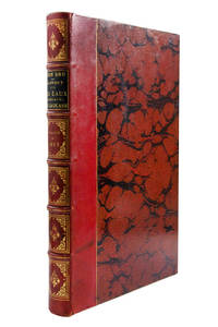
Best.-Nr. 103088Paris Chamerot 1884. . First edition; folio 38.5 x 16 cm; 111p. 55 partly coloured lithographed plates some double page large geological coloured map; contemporary quarter red morocco over marbled boards label and gilt tooling to spine a fine copy. A rare and interesting work on the spa towns of the Caucasus. The plates show plans for fountains bathing houses and pumping stations of in Piatigorsk Zheleznovodsk Yessentuki and Kislovodsk all of which were popular destinations for 19th century Russians to visit. Aristocracy musicians and artists were drawn to these four towns due to the famous healing powers of the mineral waters. Paris, Chamerot, 1884. hardcover
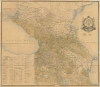
Best.-Nr. 65574Tbilisi: Compiled and Lithographed at the Military Topographical Department of the Caucasus Military District 1870 with corrections to August 1896. Original large-format colour-lithographed map of the Caucasus 132 x 151 cm dissected into 24 panels and backed onto linen text in Cyrillic script folding down to 33.5 x 27 cm. With an extensive key decorative title cartouche and table showing the divisions of the Caucasus. The linen backing is in places dust-soiled and stained some tiny holes in the edges from former wall mounting that have been repaired somewhat browned overall and with a few minor brown spots a few small marginal tears not affecting map repaired with contemporary strips of paper linen edges are slightly frayed in places withal a very good example of this scarce and impressive map. A rare and large-format wall map of the Caucasus region in Russian. The map covers the modern territories of Armenia Georgia Azerbaijan Dagestan Chechnya Kalmykia etc. The map extends south to Tehran and north to Astrakhan. The eastern Black Sea is on the left and the western Caspian Sea is on the right. Beneath the title is a depiction of a railway winding through the mountains and opposite it a galloping horse with a cart crossing the mountains. Later editions were published at least until 1883 and 1903. The later edition is mentioned in 20th-century works dealing with international border disputes in the Caucasus. At the time of its creation it was almost certainly the finest map of the Caucasus produced in the Russian Empire. Tbilisi: Compiled and Lithographed at the Military Topographical Department of the Caucasus Military District, 1870 (with correc unknown