1 370 résultats
2009New English Paperback. Roy. 8vo. (24 x 17 cm). In English. [xvii], [1], 168 p., 4 maps, 42 numerous b/w and color figures. aSufi pilgrims from Central Asia and India in Jerusalem (Kyoto Series of Islamic Area Studies 1). Contents: About the author, List of figures, Acknowledgments, Abbreviations, List of maps, Introduction: 1: Sufi lodges, hospices, and pilgrims.; A network of Sufi lodges? 2: Central Asian and Indian Sufi orders on the pilgrimage routes: The domination of the Naqshbandiyya over the Hajj routes regarding the Qalandars and the Qalandar hospices (Qalandarkhânas). 3: Central Asian and Indian lodges of Jerusalem. The Uzbek lodge, al-Zâwiya al-Uzbakiyya., The Afghan lodge, al-Zâwiya al-Afghâniyya., The Indian lodge, al-Zâwiyya al-Hunûd., Conclusion, Appendix: Visitors to the Zâwiya al-Uzbakiyya for the following years: 1911-1915 / 1924-1928 / 1938-1959., Bibliography., Index.
Very Good Turkish, Ottoman (1500-1928) Original color map. Atlas folio. (66 x 46 cm). In Ottoman script. Scale: 1/400.000. [MAP of GEORGIA - SHORES of BLACK SEA] Batum, Keskim, Kutayisi. [Batoum, Kutaisi, Keskim]. Shows all toponym of shores of Black Sea of Georgia including Ottoman fortresses, villages etc. Not in TBMM Library Map Collection. Extremely rare.
1906réf. 22522Paris Juven [1906] grand in-4 percal. rouge de l'éditeur, décor polychrome au dos et sur le premier plat, tranches dorées, minime accroc à la coiffe
1854In-16 gr. (mm. 199x121), tela editoriale, pp. XIV,253,32 (catalogo), con una veduta generale di Erzeroom all’antiporta, una vignetta al frontespizio che raffigura le rovine di una chiesa armena vicino a Erzeroom, 2 ill. nel testo, 5 tavv. f.t. e in fine una mappa dell’Armenia, tutto inc. su legno. Interessante resoconto di un viaggio fatto dall’A.: si descrivono viaggi, storia, storia naturale, politica e cultura. Robert Curzon, 14° barone Zouche (1810 - 1873), viaggiatore inglese, diplomatico e autore, attivo nel Vicino Oriente. Era responsabile dell'acquisizione di numerosi manoscritti biblici importanti e tardivi dai monasteri ortodossi orientali. Nel 1842-1843 Curzon fu commissario britannico congiunto a Erzurum come parte della commissione di frontiera britannico-turca-persiana-russa, con il compito di stabilire i confini tra la Persia, Russia e Impero Ottomano. Ben conservato.
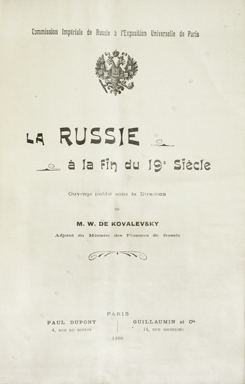
1900réf. 20199Paris, Paul Dupont ; Guillaumin, 1900 ; fort in-8, broché ; 989 pp., [1]f. d'Errata, 22 planches hors-texte lithographiées en couleurs (cartes, tableau et graphiques, dont une grande carte dépliante de Russie).
1834Very Good Turkish, Ottoman (1500-1928) Original 1/6 leather bdg. marbled wrappers in traditional Ottoman style. Demy 8vo. (22 x 14 cm). In Ottoman script. [3], 112 p. Hegira: 1250 = Gregorian: 1834. Özege 15260 / 2. Second Edition. An extremely rare verse dictionary Persian-Turkish. One of the most commented and annotated Persian-Turkish dictionaries.
2012Fine Tatar Original illustrated bdg. HC. Demy 8vo. (21 x 14 cm). In Crimean Tatar (Cyrillic script) and Russian. 638, [1] p., b/w ills. Kirimtatar edebiyati kütüphanesi halk icadi. Masallar, efsaneler, destanlar.= Biblioteka Krimskotatarskoy literaturi. Narodna tvorchist. Kazki, legendi, eposi. Qirim-Tatar folk and fairy tales, legends and epicas. First and Only Edition.
2014New English Original bdg. HC. Roy. 8vo. (25 x 18 cm). In English and Turkish. 790 p. The Central Asiatic roots of Ottoman culture. CIEPO Interim Symposium.
1898Very Good Turkish, Ottoman (1500-1928) Original color map. Folded. Atlas folio. (82 x 57 cm). In Ottoman script. Scale: 1/400000. A clean copy. Including Azerbaijan, Dagestan, Mahaçkala, Tbilisi, Yerevan, Darband, et alli. A fine map of Caucasus and shores of Caspian Sea. Extremely rare.
1926Very Good German Paperback. Demy 8vo. (22 x 15 cm). In German. 189 p., xii numerous plates, 65 numerous b/w photos. Bronzezeit an Jenisei. Ein Beitrag zur Ur geschichte Sibiriens. Bronze Age at Yenisei. A contribution to the ancient history of Siberia. This research on the "Bronze Age" of Yenisey, one of the most important settlement areas of the Central Asian Turks, is a quality that sheds light on the early periods of Turkic / Turkish history, especially with the evaluation of archeological excavations. Rare. First and Only Edition.
Very Good Turkish, Ottoman (1500-1928) Original color map. Elephant folio. (67 x 45 cm). In Ottoman script. Scale: 1/400.000. [OTTOMAN MAP of CAUCASIA] Shores of Black Sea / Batum - Poti. Shows Black Sea shores of Batum and Poti of Georgia. Mostly shown Black Sea in the map, but from southeast to northwest, a coastline reaches from Batum city to Adler (?). Some toponyms are in Turkish, but mostly Russian and Georgian in Arabic (Ottoman) script. A handsome and calligraphic Ottoman map.
2012New New English Original bdg. Dust wrapper. 4to. (30 x 30 cm). In English and Turkish. 526 p., color and b/w ills. The migration of tamga / stamps - kurgan. Ankara Güdül rock engravings.= Damgalarin göçü - kurgan. Ankara Güdül kaya resimleri. ARCHEOLOGY Central Asia Turkology Photography Turkestan Turkic culture Turkic mythology.
2017New Turkish Paperback. 4to. (30 x 22 cm). Papers in English and Turkish. 1109 p., ills. IV. Kahramankazan International Folk Culture Symposium. Proceedings.= IV. Kahramankazan Uluslararasi Halk Kültürü Sempozyumu 29 Eylül - 1 Ekim 2016. Bildiriler. A very heavy set. Extra shipping cost will be requested.
1890réf. AUB-4495Neuchâtel, Attinger frères éd. s.d. (vers 1890). Bel exemplaire broché, couverture ornée d'éd., gd in-8, 347 pages + 22 planches et une carte dépliante.
1915Numerous black and white photographs. Part 28 of a series "...Framed with the object of producing an account of the great contest now in progress, which shall be at once popular and authoritative... An account written by men of great experience in political, military, and naval matters... Will contain a great deal of first-hand material which will be really valuable to historians of the future." - From Preface. Contents: Chapter XLIX The Intervention of Turkey; Chapter L The Turkish Army; Chapter LI The Outbreak of War and the Campaign in the Caucasus. Unmarked. Average wear. Binding intact. Magazine
1860In 8, pp. VIII + 412. T. tl. coeva. Rara edizione delle avventure di viaggio di questa donna, moglie di un ingegnere minerario francese che a lungo viaggio' nelle steppe Russe, Caucasiche e della Crimea. Raro.
1902First edition. Original paper wrappers. 8vo. 36 p. : ill. ; 25 cm. In French with illustrations. Title translates to The Mountain Jews and Georgian Jews: Memories of the Mission. An early ethnographic account of the Jews in the area of Georgia and the Caucasus Mountains. SUBJECTS: Jews in the Caucasus. Jews in Georgia, Russia. Edgewar to wrappers. Pages browning. Overall still in Good Condition. (COMHIST-18-37)
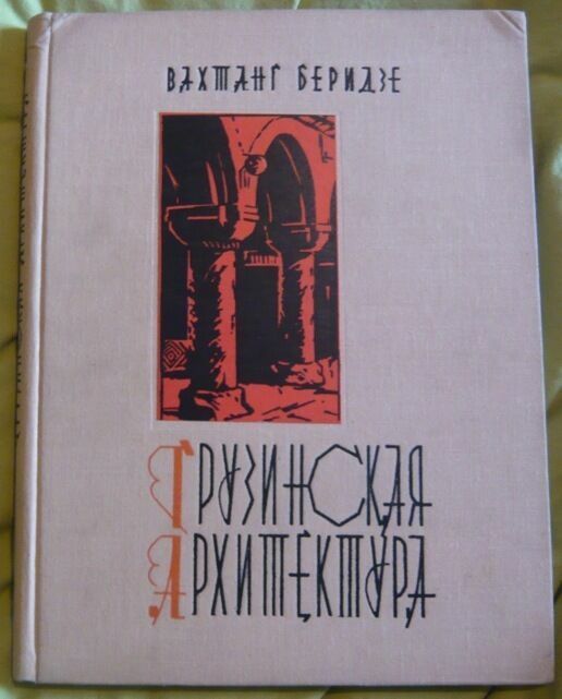
1967réf. 55271967. Tbilissi édition non mentionnée 1967 - Cartonné 23 cm x 30 cm 94 pages - Texte en français et en russe de Wachtang Beridze - 182 photos noir et blanc et 49 figures in-texte - Bon état
2012New New English Original bdg. Dust wrapper. In publisher's special slip-case. Roy. 8vo. (23 x 16 cm). In Turkish. Color and b/w ills., maps and tables. 4 volumes set: ([xx], 686 p.; [xx], 504 p.; [xi], 872 p.; [xxxiv], 302 p.). A very heavy set. Avrasya'da Yeniden Çizilen Sinirlar, Insa Edilen Kimlikler Projesi. 4 volumes set: Vol. I: Bagimsizliklarinin Yirminci yilinda Orta Asya Cumhuriyetleri. Türk dilli halklar - Türkiye ile iliskiler. Vol. II: Bagimsizliklarinin Yirminci yilinda Azerbaycan, Gürcistan ve Ukrayna. Türk dilli halklar - Türkiye ile iliskiler. Vol. III: Sovyetler Birligi'nin dagilmasindan Yirmi yil sonra Rusya Federasyonu. Türk dilli halklar - Türkiye ile iliskiler. Vol. IV: Sovyet sonrasi dönemde Türk dilli halklar, dil sorunu, yeniden biçimlenen kimlikler. [Ataturk Turkish Turkey Türkei Turquie Turchia Turquía Kalkun Turkish Türkisch Turc Turque Turco Tyrkisk of the Turkish language Linguistics Linguistic study Studies Work SSCB USSR The Russian Federation Central Asia Asian culture Foreign affairs Diplomacy Diplomats Diplomat International relations Azerbaijan Georgia Georgian Azerbaijani Ukraine Ukrainian History Social Historical Politics Politica Political Policy Caucasia Kaukasus Caucase Turcology Turcologie Turkic Turkica Turcica Turk Turks Crimea Crimean Kirim].
2008Fine Tatar Original illustrated bdg. HC. Cr. 8vo. (20 x 14 cm). In Crimean Tatar and Crimean Turkish (Cyrillic script). 383, [1] p., b/w ills. Kirimtatar halk masallari. [= Krimsko-Tatarski narodni kazki]. Illustrated by Varfolomeev A. An extremely rare book on Crimean-Tatar fairy tales.
1967Very Good French Paperback. Roy. 8vo. (24 x 17 cm). In French. [vii], [1], 176 p. Documents Anatoliens sur les langues et les traditions du Caucase. IV: Recits Lazes en dialecte d'Arhavi (parler de Senköy). Anatolian documents on the languages and traditions of the Caucasus. IV: Recits Lazes in Arhavi dialect (about Senköy). Georges Edmond Raoul Dumézil was a French philologist, linguist, and religious studies scholar who specialized in comparative linguistics and mythology. He was a professor at Istanbul University, École pratique des hautes études and the Collège de France, and a member of the Académie Française. Dumézil is well known for his formulation of the trifunctional hypothesis on Proto-Indo-European mythology and society. His research has had a major influence on the fields of comparative mythology and Indo-European studies. And he's one of the pioneers who collected Laz fairy and folk tales.
1987Very Good Georgian Original dark green cloth bdg. Large demy 8vo. (22,5 x 15,5 cm). In Georgian, Turkish, Russian, English. 1000 p., b/w plates of original Ottoman documents. Ottoman documentary sources 16th - 18th - centuries: The Turkish text, with Georgian translation, introduction, terminological vocabulary, facsimiles and indexes prepared for publication by Nodar Shengeelia, Book I.= Smaletis dok'ument'uri ts'q'aroebi me -16 - me -18 sauk'uneebshi: Turkuli t'eksi, Kartuli targmanit, shesavali, t'erminologiuri leksik'a, paksimilebi da indeksebi, momzadebuli gamosakve'neblad Nodar Shengelias mier, Ts'igni I.= Osmanskie dokumental'ie istochniki XVI - XVIII vv. 1000 copies were printed.
réf. 2980London, John Murray, 1837 ; in-8°, 303 p., non rogné. demi-cartonnage, pièce de titre, étui. Frontispice gravé, vignette de titre.
1900Very Good German Original decorative cloth bdg. Cr. 8vo. (19 x 13 cm). In German. 1 portrait of Wereschtscagin, [4], 184, [10] p., ills. Owner's name on imprint page, marbled edges. A very good copy. The Battle of Geok Tepe in 1881 was the main event in the 1880/81 Russian campaign to conquer the Teke Turkomans. Its effect was to give the Russian Empire control over most of what is now Turkmenistan, thereby nearly completing the Russian conquest of Central Asia. The battle is also called Denghil-Tepe or Dangil Teppe. Sources are inconsistent, but Denghil-Tepe seems to have been the name of the fort and also the name of a small hill or tumulus in the northwest corner of the fort. Geok Tepe ('Blue Hill') seems to refer to the general area, the modern town, a nearby village, and a mountain to the south. Skrine says that the fort enclosed 2.6 square kilometers (1 sq mi) or more, with mud walls 5.5 m (18 ft) thick and 3 m (10 ft) high on the inside and a 1.2 m (4 ft) dry ditch on the outside, although other dimensions are given. The area was part of the Akhal Oasis where streams coming down from the Kopet Dagh support irrigation agriculture. After Russian forces were defeated in 1879 Russia began to plan for a new campaign. The basic problem was moving up supplies since Akhal was an oasis surrounded by several hundred kilometers of semi-desert. In March 1880 Mikhail Skobelev was put in charge of the Trans-Caspian region. He adopted Lazarev's original plan of a slow and massive advance. Instead of Khoja Kale, he chose a base at Bami on the north side of the Kopet Dagh. At some point, he decided to take Geok Tepe by siege rather than a storm. He arrived at Chikislyar in May, advanced up the Atrek and Sumbar rivers, and by June 11 he occupied Bami. The build-up was slow, partly due to the shortage of camels. In July he made a reconnaissance in force to examine Geok Tepe. By the first half of December, he had enough men and supplies and moved out to occupy a fort he renamed "Samur" a few kilometers west of Geok Tepe. On 27 December Aleksey Kuropatkin arrived with five companies, having made a remarkable march across the desert from Khiva. By the end of the month, Skobelev had 4020 infantry, 750 cavalry as well as artillery, rockets, several machine guns, and heliographs for communications. About 40000 Tekkes were thought to be in the area. On January 1, 1881, he occupied Yanghi-Kala south of the fort to control the water supply and the following day chose the southeast corner as the point of attack and on the following day moved the main camp to Yanghi-Kala. On 4-8 January, the first parallel was built about 600 m (700 yds) from the fort and a second began. To protect this a detachment was sent to capture a small redoubt to the north and General Petrushevich was killed after rushing through the gate. The Tekkes made sorties on the 9th, 11th, and 16th. These were largely successful but cost many Turkoman lives. The camp was twice moved north to make it easier to deal with sorties. The Russians only had enough men to hold a siege line in the southeast corner and the Tekkes were usually allowed to move in and out on the north side of the fort. On January 18 a mine was started on the southeast side and two days later artillery made a breach in the south wall which was quickly repaired. On 23 January the mine was completed and loaded with 1,200 kg (2,600 lb) of powder.
1900Very Good Turkish, Ottoman (1500-1928) Original lithograph map partly colored in brown tones. 82x56 cm. (Map print size: 50x46 cm). This map including four different map blocks on the paper. Three small ones include completely Asia, Baycal Lake, and North Russia. The big one includes a very detailed view of Japan, the Sea of Japan, Korea Strait, Korean Peninsula, Korean Bay, Yellow Sea, Shangai, Mongolia, Manchuria, and East Russian lands. No info about the cartographer. "The Cartographer Plotting School was opened to train the cartographers, especially when they were needed on military issues in the Ottoman State. Since there are differences between land maps and sea maps (in terms of measurements), the institution of surveyors emerged. When surveyors were needed also in the Navy, students at the Naval School were trained on this issue, and the gap for surveyors was covered in this way." (SCHOOL OF MAP DRAWING IN THE OTTOMAN STATE, Derya Geçili). Minor splits on foldings. Map in good condition generally.