[Ireland, Thomas] (attributed).Biblio.com
7 017 résultats
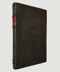
1829réf. 9507Edinburgh; Thomas Ireland Junior 1829. 1829. Hard Cover. FIRST EDITION. Small quarto 5.5" x 8.5" all edges uncut; pp. iv 362. With eight engraved plates including portrait frontispiece of William Burke as called for. Recently rebound in brown full calf with blind fillet borders and centrepiece ornaments to boards 4 raised bands to spine scarlet morocco spine label with gilt spine title leaves uncut. Small closed tear to frontispiece repaired plus two or three short closed tears in text a few small nicks to leaves mild scattered foxing throughout. An sympathetically rebound copy in fine condition. The first and most comprehensive book on the infamous body-snatching serial killers William Burke 1792-1829 and William Hare being published in the same year as the trial and execution for a British audience eager for the macabre details of the sensationalist case. The authorship has been attributed to the publisher Thomas Ireland with the help of various contemporary sources. Contains dramatic trial reports confessions crime scene illustrations a harrowing description of Burke's execution phrenological measurements and descriptions of Burke's public dissection "The quantity of blood that gushed out was enormous that. the classroom had the appearance of a butcher's slaughterhouse from its flowing down and being trodden upon". Cheaply printed on rag pulp paper copies tend not to have survived; those that are found in commerce are either ex-library foxed or as here rebound. Certainly not one for the squeamish but a significant book for true crime enthusiasts and social historians. Rare. Edinburgh; Thomas Ireland, Junior, 1829. hardcover
2008réf. Q-0878392904North Star Press of St. Cloud 2008-09-01. Paperback. New. In shrink wrap. Looks like an interesting title! North Star Press of St. Cloud paperback
1945Arthéme Fayard 1945, In-8 broché, 366 pages. Bon état.
2000réf. SBBIH-KKRVKREPCWURDúchas the Heritage Service 2000. paperback. Good. Our good condition books are generally good for reading but not for gifting or collecting. They could have imperfections such as creasing fanning inscriptions margin notes yellowing staining on edge or cover or pages bumps scuffs etc etc sometimes multiple of these. It's a wide category that encompasses anything that isn't almost-new down to anything that is slightly better than poor. We would NOT recommend gifting Good books - these should be considered reading copies. Our books are dispatched from a Yorkshire former cotton mill. We list via barcode/ISBN so please note that the images are stock images and may not be the exact copy you receive furthermore the details about edition and year might not be accurate as many publishers reuse the same ISBN for multiple editions and as we simply scan a barcode or enter an ISBN we do not check the validity of the edition data when listing. If you're looking for an exact edition please don't order at least not without checking with us first although we don't always have time to check. We aim to dispatch prompty the service used will depend on order value and book size. We can ship to most countries see our shipping policies. Payment is via Abe only. Dúchas the Heritage Service paperback
2010réf. 1-0470569190John Wiley & Sons Inc 2010. Paperback. New. 3rd edition. 704 pages. 10.50x8.75x0.75 inches. John Wiley & Sons Inc paperback
réf. 14954DBLondon., Heni Publ., 2016. 31,5 x 23,5 cm. 335 S. Illustriertes OLeinen., 14954D Erste Auflage. Sehr gutes Exemplar.
1616Carta geografica tratta dal Tabularum Geographicarum contractarum libri septem di Petrus Bertius, edizione latina del 1616. L'opera contiene 219 carte che illustrano questa nuova versione della geografia del Bertius, per la prima volta pubblicata nel 1612 con le carte di Barent Langenes. Le carte derivano dal grande atlante di Mercator/Hondius, delle quali molte rappresentano una semplice riduzione. "After the death of Cornelis Claesz in 1609, Jodocus Hondius II became the new publisher of the work, composed by 7 parts in 1, with engraved title-page and 220 full-page engraved maps in text. All the maps were newly engraved and slightly larger in size, because Hondius was not able to acquire the original plates. With the new plates the work was definitely improved and enjoyed a growing demand of the public, which at that time had the choice between the Atlas Minor by Mercator and Bertius' Tabularum Geographicarum. The 219 plates, with the oval world map appearing twice, were produced to illustrate a new version of the geography of Bertius, published in 1616. According to King, their correct attribution is by Hondius, after Mercator and Hondius, taken from Bertius, who was only responsible for revising his text again" [cfr. G. King, Miniature Antique Maps]. Incisione in rame, perfette condizioni. A superior rival to the pocket Ortelius atlas appeared about 1598, under the imprint of Barent Langenes and Cornelis Claesz. Claesz also published the Tabularum Geographicarum contractarum libri septem, edition with texy by Petrus Bertius, in 1600. After the death of Cornelis Claesz in 1609, Jodocus Hondius II became the new publisher of the work, composed by 7 parts in 1, with engraved title-page and 220 full-page engraved maps in text. All the maps were newly engraved and slightly larger in size, because Hondius was not able to acquire the original plates. With the new plates the work was definitely improved and enjoyed a growing demand of the public, which at that time had the choice between the Atlas Minor by Mercator and Bertius' Tabularum Geographicarum. The 219 plates, with the oval world map appearing twice, were produced to illustrate a new version of the geography of Bertius, published in 1616. According to King, their correct attribution is by Hondius, after Mercator and Hondius, taken from Bertius, who was only responsible for revising his text again. "After the death of Cornelis Claesz in 1609, Jodocus Hondius II became the new publisher of the work, composed by 7 parts in 1, with engraved title-page and 220 full-page engraved maps in text. All the maps were newly engraved and slightly larger in size, because Hondius was not able to acquire the original plates. With the new plates the work was definitely improved and enjoyed a growing demand of the public, which at that time had the choice between the Atlas Minor by Mercator and Bertius' Tabularum Geographicarum. The 219 plates, with the oval world map appearing twice, were produced to illustrate a new version of the geography of Bertius, published in 1616. According to King, their correct attribution is by Hondius, after Mercator and Hondius, taken from Bertius, who was only responsible for revising his text again" [cf. G. King, Miniature Antique Maps]. Copperplate, in very good conditions. Koeman p. 42; King p. 96/99.
réf. 0711008965.Ghardcover. Good. Access codes and supplements are not guaranteed with used items. May be an ex-library book. hardcover
1979réf. Q-0684160617Scribner 1979-01-01. Hardcover. New. New. In shrink wrap. Looks like an interesting title! Scribner hardcover
1996réf. Q-0004708725HarperCollins 1996-05-01. Paperback. New. In shrink wrap. Looks like an interesting title! HarperCollins paperback
2000348pp. 27 cm. Hardcover Very good condition good
1935réf. 004431G. P. Putnam's Sons. DJ in archival cover. . Fine. Hardcover. 1935. G. P. Putnam's Sons hardcover
réf. B39040-M-GENG P Putnam's Sons. Collectible - Very Good. SIGNED/INSCRIBED! NY: G P Putnam's Sons 1935. 1st edition 1st printing with same date on title and copyrt pgs. Hardcover 8vo 452 pgs. B/w frontis and plates b/w map color map. Signed and inscribed by Ireland on front pastedown. Very good in fair dust jacket. Corners lightly worn spine ends bumped and worn. Contents clean and binding sound. Jacket edgeworn chipped and has edge tears. Light soil to jacket and spine is sunned. Far East Eastern Question Japanese Diplomatic Relations Inquire if you need further information. G P Putnam's Sons hardcover
2002réf. 1-030435340XCassell 2002. Hardcover. New. 224 pages. 10.50x8.00x0.75 inches. Cassell hardcover
2002réf. Q-030435340xCassell 2002-10-28. Hardcover. New. In shrink wrap. Looks like an interesting title! Cassell hardcover
réf. 5068Ward, Lock, and Co, London, new York et Melbourne, vers 1875 – in-12, 108 pp – broché, couv. bradel. vert clair, p. vertes au milieu et à la fin, cartes couleur volantes, illustrations n. et b. et lithographies couleur
1799réf. 22661799. Sepia aquatint. 150mm by 225mm sheet. Aquatint published by Samuel Ireland. From his 'Picturesque Views on the River Thames'. Ireland was an author and engraver who published several series of aquatint views in the late 18th century. unknown
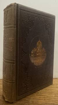
1859réf. 337387New York: S.A. Rollo 1859. First. hardcover. near fine. 72 illustrations from sketches made on the spot by the Author. 531 pages. Large 8vo original mauve pebbled & blind-stamped cloth with a gilt image of the Taj Mahal on the front cover. New York: S.A. Rollo 1859. First Edition. Spine sunned else fine. Includes visits to The Plains of Troy Palmyra Jerusalem Petra Delhi Peshawur The Khyber Pass Afghanistan2 Java China etc. & etc. S.A. Rollo unknown books
1859réf. 337387New York: S.A. Rollo 1859. First. hardcover. near fine. 72 illustrations from sketches made on the spot by the Author. 531 pages. Large 8vo original mauve pebbled & blind-stamped cloth with a gilt image of the Taj Mahal on the front cover. New York: S.A. Rollo 1859. First Edition. Spine sunned else fine. Includes visits to The Plains of Troy Palmyra Jerusalem Petra Delhi Peshawur The Khyber Pass Afghanistan2 Java China etc. & etc. S.A. Rollo unknown
2026réf. LRB20002520Paris: Editions Recreasoft 2026 Language: English. Approximately 531 pages. English : Print-on-demand reprint. Original edition : 1859. A richly detailed travel narrative by John B. Ireland covering journeys across Asia Africa and Europe in the 1850s. The work ranges from classical sites such as Troy Palmyra Jerusalem and Petra to India Kashmir Peshawar the Khyber Pass Java China Mauritius and the places associated with the Indian Mutiny. Of particular interest for readers of 19th-century travel writing imperial history and route literature. Book images are non-contractual. Editions Recreasoft. Softcover. New. Editions Recreasoft paperback
2026réf. LRB48039284Paris: Editions Recreasoft 2026 Hardcover binding. Language: English. Approximately 830 pages. English: Print-on-demand reprint. Original edition : 1859. Text in English. This reprint offers a facsimile edition of John B. Ireland's travelogue documenting his five-year journey across Asia Africa and Europe. The work provides vivid accounts of cultural encounters economic observations and personal reflections making it a valuable resource for historians and scholars of 19th-century exploration. Book images are non-contractual. Editions Recreasoft. Softcover. New. Editions Recreasoft paperback
2026réf. LRB53002906Paris: Editions Recreasoft 2026 Language: English. Approximately 760 pages. English: Print-on-demand reprint. Original edition : 1859. Text in English. This work is a detailed travel journal by John B. Ireland documenting his extensive journeys across Asia Africa and Europe between 1851 and 1856. The narrative covers visits to significant historical and geographical locations including the Danemera Iron Mines the Plain of Troy Palmyra Jerusalem Petra Seringapatam Surat and regions affected by the recent Indian Mutinies. The account also explores Cashmere Peshawur the Khyber Pass Afghanistan Java China and Mauritius offering a vivid portrayal of 19th-century travel and exploration. Book images are non-contractual. Editions Recreasoft. Softcover. New. Editions Recreasoft paperback
réf. 12509799like new. unknown
réf. 124124328X.Gpaperback. Good. Access codes and supplements are not guaranteed with used items. May be an ex-library book. paperback
réf. 1333880278.Gpaperback. Good. Access codes and supplements are not guaranteed with used items. May be an ex-library book. paperback