FRENCH GUIANA Pierre Bernard Baron MILIUS 1773 1829 Auguste Nicolas VAILLANT 1793 1837 & E. BODINABAA

974 résultats
1824réf. 18496French Guiana 1824. Together 12 manuscript maps and views plus one engraved map. Provenance: Baron Pierre-Bernard Milius 1773-1829. A fine manuscript cartographic record of Baron Milius's scheme to establish a settlement near the mouth of the river Mana on the far west coast of French Guiana including survey work by Auguste Vaillant. "Milius first went to sea in 1786 on his father's merchant ships. He joined the navy in 1793 and in 1800 as 'lieutenant de vaisseau' lieutenant commander was appointed to the Australian Expedition of Nicolas Thomas Baudin. He served as Jacques Hamelin's second-in-command on the Naturaliste and at Timor in 1801 was promoted 'capitaine de frigate' commander" Howgego M44. The importance of the Baudin Expedition cannot be overstated. The 1800-1803 French expedition was the first to survey the western coast and much of the southern coast of Australia. The Expedition harbored at Sydney from the end of April to mid-November 1802. On the return Baudin died of illness and command passed to Milius who successfully brought the expedition back to France. Milius subsequently served as director of the port of Venice returning to France in 1814; "after the restoration of the monarchy in 1815 he was appointed director of the port of Brest. He subsequently served as governor of Reunion 1818-21 and Guiana 1823-25 and in 1827 commanded the Scipion at the Battle of Navarino" Howgego. Milius's service as governor of French Guiana was of particular importance. Originally settled by France in the 17th century the South American tropical region had been seized by Portugal in 1809. After its restoration to France a renewed movement began to colonize the area. Milius himself would be influential in seeking to create a penal colony at Mana and to oversee numerous surveys of the region to determine the feasibility and best places for colonization. The present archive from the collection of Baron Milius dates from his time as the colonial governor of French Guiana and includes several magnificent large-scale maps and views including a masterful manuscript plan of Cayenne as well as important manuscript maps of Mana and the Maroni River by Auguste Nicolas Vaillant 1793-1837. Together this collection represents a stunning visual record of the culmination of Milius's storied career. Original primary source manuscript material from Grand Voyage expeditions is of the utmost rarity and almost exclusively exists in French institutions. Such material that does appear on the market is seldom able to leave France. These newly-discovered drawings from a critical period of French exploration are of great historical value. The collection is comprised of: 1 Auguste Nicolas VAILLANT 1793-1837. Pen ink and wash original manuscript map titled 'Plan de la Partie du Maroni Comprise Entre Son Embouchure Et le Parallêle Situé par 5 degrees 7'.46". de latde. N. Dressé par Augte. Niclo. Vaillant Ensgne. de Vau. pendant Son Voyage dant Ce Fleuve pour le Service de la Commission Explorative de la Guyanne Française'. French Guiana: 1824. Pen and black ink with grey watercolor wash on early 19th-century laid paper 'M' in a shield watermark with 'M' countermark. Sheet size: 39 1/4 x 25 1/2 inches. An attractive record of an important early survey of the border between French Guiana and Surinam. Auguste Vaillant served as 'aide de camp' to Baron Milius and would subsequently command a voyage of circumnavigation aboard the corvette Bonite. He produced this detailed record of soundings and observations about habitation and natural features and hazards on the Rio Maroni: the importance of the work was recognised and he produced a 'memoir' describing the exploration. The Maroni which up until this survey was virtually unknown served then and now as French Guiana's border with Surinam on the west bank. The area surveyed includes a 'Grand village Parêtlaii' on the approximate site of present-day Saint-Laurent du Maroni. As the title makes clear this map was one of the results of an extensive survey carried out for the commission commanded by Baron Milius to explore French Guiana. 2 Auguste Nicolas VAILLANT 1793-1837. An original manuscript map titled 'Croquis du cours de l' Acarouani en de ses Affluence par Augte. Vaillant Ensgne. de Vau. Aide de Camp de Mr. le Bon. Milius'. French Guiana: 17 Juillet 1824. Pen and ink on laid French Grand-Aigle paper watermark: a crowned eagle. Sheet size 25 3/4 x 17 3/4 inches. A detailed chart of the course of the Acarouani River from its headwaters to its confluence with the Mana just upstream from the town from where the town of Mana is now situated. 3 H. PARENT. An original manuscript map titled 'Plan de l'ancienne et nouvelle ville de Cayenne.' French Guiana: 1821. Pencil pen-and-ink and watercolour on laid French Grand-Aigle paper watermark of a crowned eagle watermark with indistinct countermark. Sheet size: 24 1/8 x 35 1/16 inches. A beautifully-finished plan showing the proposed new layout for the capital apparently following the plans drawn up by the surveyor Sirdey the 'arpenteur royal.' This plan marks the moment when Cayenne became a modern colonial capital and is a fascinating and important document in the history of the development of Cayenne. The proposed expansion was only possible because of the amount of land that had been reclaimed by the engineering works which began in 1777. Using convict labour the draining of the marshy land around the old town and the resulting Canal Laussat shown on this plan was also finished in 1821. The Old Town "Ancienne Ville" lies at left; the New Town "Nouveau Ville" at right. It is interesting to note how much of the lay out suggested here is still in existence although very few of the streets have retained their names - the 'Rue de Choiseuil' is now the 'Avenue du général de Gaulle' for instance. 4 Captain BONNE. An original manuscript engineering drawing titled 'Plan d'un Débarcadour en charpente projeté pour le Port de Cayenne. Executé sous l'administration de Mr. le Baron Milius'. French Guiana: March 1823. Pen-and-ink and watercolour wash on laid paper watermark of an 'M' in a shield 'M' countermark. Sheet size: 26 3/8 x 40 inches. Further inscribed "Vue et Approuvé" by Baron Milius with his signature and the date '27 Mars 1823' and also signed by Bonne 'Le capn. au corps Royal du genie militaire.' Four engineering drawings on one large sheet of a proposed boat dock in Cayenne: top elevation side elevation and two details. 5 Captain BONNE. An original manuscript engineering drawing titled 'Plan d'un Débarcadour en charpente projeté pour le Port de Cayenne. French Guiana : circa 1823. Pen ink and watercolour wash on laid French Grand-Aigle paper watermark of a crowned eagle clutching thunderbolts in each foot 'Montgolfier / Annonay' countermark. Sheet size: 26 1/4 x 38 ½ inches. A more finished version of the previous drawing. 6 Captain BONNE. An original manuscript engineering drawing titled 'Projet d'un Pont de débarquement en charpente à construire vis-à-vis le Bureau du Port à Cayenne'. French Guiana 1823. Pen ink and watercolour wash on laid French Grand-Aigle paper watermark of a crowned eagle clutching thunderbolts in each foot 'Montgolfier / Annonay' countermark. Signed by Bonne. Sheet size: 25 x 19 1/8 inches. Detailed engineering plan of a bridge from a disembarking point to the mainland near the 'Bureau du Port' in Cayenne. 7 Captain BONNE. An original manuscript architectural drawing titled 'Plan de l'Hôpital militaire projeté à Cayenne'. French Guiana circa 1823. Pen ink and watercolour wash on laid paper watermark of an 'M' in a shield 'M' countermark. Sheet size: 24 3/4 x 38 5/8 inches. Signed by Bonne 'Le capn. du genie.' A fine architectural drawing of the new wing of the military hospital in Cayenne. 5 parts on one sheet as follows: Floor plan of the new and existing wings; elevation of the new and existing wings which shows the changes to the latter; two cross sections and an elevation of the existing wing before modification. 8 Captain BONNE An original manuscript architectural drawing titled 'Caserne pour 6 compagnies d'infanterie projetée a Cayenne'. French Guiana circa 1823. Pen ink and watercolour wash on 19th century wove paper. Sheet size: 20 3/8 x 26 1/4 inches. Expertly drawn architectural plan for a barracks for "six companies of infantry" at Cayenne. Consists of elevations of three facades a cross section and a plan of the main floor. 9 E. BODIN. An original drawing titled in a cartouche 'Vue du Port de la Nouvelle Angoulême'. French Guiana: July 1824. Pencil and brown wash panorama with black ink ruled border on two joined sheets of laid Dutch Royal paper 'Vande Ley' watermark with countermark of the figure of Fortune on a globe with 'VDL' monogram beneath signed 'E. Bodin del.' in black ink in lower right corner. Sheet size: 16 inches x 46 3/4 inches. A beautifully observed and executed view of this newly-established experimental colonial settlement. The village is shown from the opposite bank of the Mana River from approximately eye-level. Shown within a tropical landscape are eight buildings five of which appear to be private dwellings two public buildings and one at far left a store or warehouse. The next plan by Bodin see below includes the information that he was an 'Ingénieur Géographe de Militaire'. 10 Captaine BRACHE. An original pen ink and watercolour map titled 'Crique Portal depuis son embouchure jusqu'a 40 lieues. Exploration de Mr. le Capne. Brache en Juillet en Aout 1824. d'apres les ordres de Mr. le Baron Milius commandt. et administratr. de la Guyane Fe. pour le Roi.' French Guiana: 1824. Pen and ink map of the course of the river with large watercolour vignette of the rapids of St. Bernard within a black wash border on laid French Grand-Aigle paper watermark of a crowned eagle clutching thunderbolts in each foot with 'Montgolfier / Annonay' countermark. Sheet size 25 1/4 x 35 inches. Shows the course of the 'Crique Portal' a tributary of the Rio Maroni that runs roughly from southwest to northeast specifically designed to show in large inset a series of rapids Saul St. Bernard that obstruct navigation on the river. 11 E. BODIN & Mr. LAINÉ. An original chart titled in a cartouche 'Plan de l'embouchure de la Mana levé et dressé par ordre de Monsieur le Baron Milius commandant a la Guyane pour le Roi par les Officiers de la Goelette de sa Majesté l'Artésienne sous la direction de Mr. Lainé commandant la station de Cayenne conjointement avec Mr. Bodin ingénieur géographe militaire'. French Guiana: July 1824. Pen ink and watercolour chart with soundings marked in black and red title cartouche and explanatory index on a trompe-l'oeil 'sheet' of paper all within black ink ruled border on two joined sheets of laid paper watermark: an 'M' in a shield with an 'M' countermark. Sheet size: 24 5/8 x 46 1/8 inches. A finely-presented manuscript nautical chart of an area of the utmost importance to the settlers on the banks of the Mana in the far north west of French Guiana. Numerous soundings are given and the title cartouche is enriched by the inclusion of two 'cornucopias' overflowing with pineapples mangos paw-paw avocado banana and tropical flowers. A preparatory drawing for the following: 12 E. BODIN & Mr. LAINÉ. An original chart titled in a cartouche 'Plan de l'embouchure de la Mana levé et dressé par ordre de Monsieur le Baron Milius commandant a la Guyane pour le Roi par les Officiers de la Goelette de sa Majesté l'Artésienne sous la direction de Mr. Lainé Commandant la Station de Cayenne conjointement avec Mr. Bodin Ingénieur Géographe de Militaire'. French Guiana: July 1824. Pen ink and watercolour chart with soundings marked in black and red title cartouche and explanatory index on a trompe-l'oeil 'sheet' of paper all within black ink ruled border on two joined sheets of laid French Grand-Aigle paper signed 'E. Bodin Direxit.' in red ink in lower right corner crowned eagle with indistinct countermark. Sheet size: 24 1/8 x 44 3/4 inches. A more highly finished variant to the above with additions and corrections and signed by Bodin. 13 GRESSIER. Plan de l'Embouchure de la Rivière de Cayenne et des Mouillages Extérieurs Levé en Mars 1820 dans la Campagne de la Corvette la Bayadère et du Brick Le Favori par M. M. Gressier Ingénieur Hydrographe de la Marine . Sous les Ordres et la Direction de M. le Baron Roussin . Chef de l'Expédition. Paris: Dépòt-général de la Marine 1822. Black and white copper-engraving. Sheet size: 27 1/2 x 40 1/8 inches. A fine engraved marine chart almost contemporary with the manuscript plans and drawings above. It shows Cayenne and its vicinity in detail and includes an inset of the Iles du Salut including the infamous Devil's Island. Howgego M44 & V1. unknown books
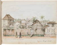
1840réf. 66308Various places in French Guiana and the West Indies as described below. 1840-1876. 19th-Century Watercolors of French Guiana and the West Indies A volume of exceptionally detailed and accomplished ink and watercolor illustrations of landscapes and animal life in French Guiana and its environs in the 1850s as well as landscapes of the West Indies from the same period. These illustrations provide excellent representations of the people and places of Cayenne and the surrounding region showing streetscapes canal scenes military establishments residential neighborhoods homes the flora fauna insects and inhabitants of the region. Several show men women and children of African descent at work and at rest. At least two of these images are dated 1840 eight years before the end of slavery in French Guiana and likely depict enslaved men and women. This volume appears to have been created by Jean Louis Marie Hippolyte de Saint-Quentin 1814-1902 who was the primary assessor of real estate for French Guiana and a valued advisor to successive governors of the colony. In gratitude for his services in 1869 he was named a Knight of the Legion of Honor – the highest decoration that France can bestow on one of its citizens. In addition to his abilities as a government administrator Saint-Quentin was also an artist noted for his jailhouse portrait of D'Chimbo a famous Guianese bandit – created just prior to D'Chimbo's execution by guillotine in 1862. Saint-Quentin later gifted the portrait to the Musée Alexandre-Franconie in Cayenne. This volume of ink and watercolor illustrations and pencil sketches begins with a contemporary photograph of the artist with the following penciled manuscript notation in French: "Ne a Cayenne Ghyana Francaise en 1800 fils de Narcisse Edouard Isdore de Saint Quentin et de Louise Elisabeth-Victoire d'Audiffredy" "Born in Cayenne French Guiana in 1800 son of Narcisse Edouard Isdore de Saint Quentin and Louise Elisabeth-Victoire d'Audiffredy". Narcisse and Louise came from established Creole families based in Cayenne from the 18th century and had five sons of whom only Jean Louis Marie Hippolyte has been identified as an accomplished artist. It should be noted that the historical record differs from the penciled manuscript notation for Jean de Saint-Quentin's date and place of birth: Jean was born in 1814 in Paris rather than 1800 in Cayenne. At the time Jean's parents had moved back to France for a short period when Portugal had captured Guiana but returned to Cayenne within the decade. The photographic portrait dated 1860 at the beginning of the sketchbook shows a man of middle age and Jean de Saint-Quentin would have been forty-six years old at the time. The illustrations in this volume are dated between 1840 and 1876 mostly the 1850s and show the people places and wildlife of French Guiana a century after its initial colonization by the French as well as views of the islands of the West Indies that Saint-Quentin likely created while travelling in the Caribbean. Many of the landscapes include well-known landmarks making them visually comparable to many of the same places today. His remarkably detailed natural history drawings of the animals he encountered in the jungles of French Guiana give the modern viewer a glimpse of some of the species present prior to the time of modern development and habitat destruction. De Saint-Quentin had an eye for architecture and produced precise drawings characterized by rich detail depth realistic color and meticulous presentation. Of the forty-four works in this sketchbook eighteen are pen and watercolor landscapes or views of towns and estates nine are complete or incomplete pencil sketches eight are images of animal life in the Cayenne region three are watercolor sketches three are pencil sketches with a sepia wash and three are contemporary photographs. Following Saint-Quentin's portrait are views of Cayenne French Guiana and their surrounds which start with the landscapes he found right outside his bedroom windows along the Canal Laussat in the center of Cayenne. These are detailed suburban views peopled with locals walking on the canal towpaths – some just enjoying the day while others are hard at work carrying goods atop their heads with one painting showing a soldier in full uniform walking along a street next to a civilian woman. Men are netting fish in the canal while others are punting a flatboat filled with goods along the canal. The backgrounds are full of varied architectural interest with detailed views of the wooden homes and outbuildings of de Saint-Quentin's neighbors as well as a barracks for workers. Other Cayenne views include a street scene with workers paddling a boat while two officers converse with a civilian a view of a military parade ground with a group of men likely recruits being spoken to by an officer a soldier nodding off by the guard house and a worker leading horses nearby. These initial paintings are quite finished with wonderful detail rich color and beautiful depth. The sketchbook continues with a series of views of beaches towns and the jungle including the Kourou coastline with an early settlement the village of Roura surrounded by the jungle on a promontory in the Comte estuary and a wonderful view of men paddling a flatboat along a river through the forests of the Amazon. Following these expansive views of locations near Cayenne de Saint-Quentin focuses his lens to create a series of natural history portraits of the fauna native to the French Guianese portion of the Amazon rainforest including a half-size view of a miniature deer native to the region a full-scale detailed view of a forest tarantula a beautifully colored jungle moth detailed sketches of unusual reptiles and a magnificent and very detailed full-size view of a jungle phasmid one of the largest known species of Amazonian insect. These drawings of native fauna are followed by a sepia view of a home in a jungle clearing with a woman her children and a servant in the yard in front of the house. A series of watercolor and pencil sketches of islands in the West Indies follows starting with a distant view of St. Martin St. Eustatius Saba St. Barthélemy and St. Kitts followed by a two-page illustration of a military installation at the Demerara River in Guyana. Following this are several other views around the Caribbean and Lesser Antilles including a lovely detailed view of the settlement at Barbados a series of unfinished pencil sketches of St. Lucia Dominique and Antigua and a mostly-finished watercolor sketch of St. Thomas. Several more illustrations of French Guiana follow including a view of a plantation in Macouria a delightful close-up of the home of the butcher in Conamama showing two men taking their ease on its front porch as well as an expansive view of a hilltop chalet in Kourou. A mounted contemporary photographic reproduction of an original panoramic photograph of the Penal Colony of St-Laurent-du-Maroni precedes a meticulous watercolor view of the Oyapok River estuary and jungle along its shore. One final natural history painting of a tame parakeet is followed by a pencil and sepia watercolor sketch of Antibes France dated August 1868 from the Mediterranean washed with sepia watercolor. The penultimate leaf of the sketchbook has a mounted contemporary photograph of part human part fish "monstrosity" found in the South Pacific Island of New Caledonia with the final leaf containing a painting of a person walking along a jungle shore between two palms making a very suitable end to the collection. A full list of illustrations follows: 1 Photographic portrait of the artist dated 1860. Portrays a man of middle age in a makeshift photography studio composed of a sheet hung on a line in front of a picket fence; he is holding a cane and cap in his left hand standing beside a chair with his right hand in his coat pocket and his left on the top of the chair. 2 "Le Pont Laussal Panorama autour de ma chambre Cayenne le 30 8bre 1853." A watercolor and ink cityscape of Cayenne along the Canal Laussat with what likely is a small portion of the artist's fenced yard in the immediate foreground the canal in the middle ground with its punts foot bridge and towpaths on either side populated with a horse-drawn wagon foot traffic and a pair of men netting for fish; more homes and the hills surrounding Cayenne are in the background. 3 "L'Etablissement Jambe Panorama autour de ma chambre Cayenne le 3 9bre 1853." Another cityscape along the Canal Laussat at the intersection of a street with one of the towpaths. Across the canal is a fenced yard with a barracks with men loitering in front of it and an open barn. The towpath closest to the viewer has a woman with a parasol and two Africans walking along it; there are three men in a punt plying the canal waters with more homes and the hills around Cayenne in the background. 4 "Les Cases Houget et Bouté Panorama autour de ma chambre Cayenne le 9 9bre 1853." A cityscape with a street in the foreground; a soldier and a woman of at least partial African descent with a colorful dress and kerchief with a large pot balanced on her head walking along a tall wooden fence that fronts the road; an elaborate two-story house and its barn inside the fence and more houses and palm trees in the background. 5 "Vue sur le Parc du Génie Panorama autour de ma chambre 18.9.bre 1853." A streetscape at the crossing of two large roads in a military yard; two officers in uniform speak with a civilian in the street between a house with a small palm in front of it and its barn while on the cross street a group of thirteen civilians drag a large flatboat that has been placed on wheels; there is a well and barracks on the far side of the street and the rooftops of buildings in the background. 6 Unfinished portrait of an elegant African or Creole gentleman in a waistcoat and jacket. 7 "2e Vue sur le Parc du Génie Panorama autour de ma chambre 18 9bre 1853." This second view of the military yard has a crowd of civilians and military personnel standing and listening to a gesticulating officer while a soldier sits at the gate watching the proceedings. A man leading two horses and a gentleman pushing a wheelbarrow are to the right foreground while houses rooftops and ship's masts form the background. 8 "Larivot La Pointe Tangui 9bre 1853 D'áprēs Dupuy." A small view of an area in near Larivot Harbor in Cayenne French Guiana called Tangui Point showing two houses and palm trees on a clearing near the shore with a sloop and a flatboat plying the waters of the North Atlantic in the foreground. 9 "Souvenir de Kourou 2.9.bre 1840." A colorful view of the Kourou coastline with what appears to be the Atlantic in the foreground and a sloop flying French colors. On land are an elaborate two-story house with palm trees to its rear and an outbuilding and two thatched cottages nearby; the background is composed of mountains forest and sky. 10 Unfinished painting of the marble bust of a man. 11 "Roura 31 Xbre1853." A landscape of the village of Roura along the Atlantic coast. The village consists of a church with a steeple and two nearby houses as well as a house along the shore some distance away. A skiff plies the water of the Comte River estuary; the background is of forested hills and a grey cloudy sky. 12 "Caria cou Petite Gazelle de la Guyane dessineé d'aprés nature ½ Grandeur Tibourou 2 Janvier 1854." A half-size profile view of the head of what is likely a Red Brocket Deer Mazama americana a petite deer that is only two-and-a half feet high at the shoulder that is native to the forests surrounding Cayenne. This specimen was likely observed near Crique Tibourou just southwest of Cayenne. 13 "illegible 2 Janvier 1854." A scene of four men and a dog in a flatboat on a river that fronts the rain forest. Some trees in detail are to the right with three dead trees that fell from the forest into the water near shore. 14 "Araignée-crabe male Grandeur naturelle 5 Janvier 1854." A full scale detailed drawing of what is likely a Pinktoe Tarantula Avicularia avicularia a tree-dwelling spider found throughout the rainforests of French Guiana. 15 "Tibourou 5 Janvier 1854 Grandeur naturelle." A full-scale representation of two snakes observed near Crique Tibourou just southwest of Cayenne. The gray and black snake could not be identified while the red and black snake is likely the Tropical Flat Snake Siphlophis compressus. 16 "Cayenne 20 aoūt 1854." A colorful and detailed drawing of a moth with a blue-green abdomen and thorax blue-green forewings and blue hindwings lined in yellow with a red spot. We are unable to identify the genus and species of this insect. 17 A group of two unidentified reptiles one drawn in great detail while the other is an unfinished sketch; an unidentified black insect and an unidentified brown pupa. 18 "Débris d'un Phasme Géant Grandeur naturelle." A full-scale drawing of the remains of an insect likely in the Order Phasmida walkingsticks. As this specimen is even larger than French Guiana's titan beetle Titanus giganteus which is considered one of the largest insects in the world if this insect has yet to be classified it would be an important addition to entomologic studies of French Guiana. 19 "habitation Par Force aux Cascades 25 7bre 1854." A detailed drawing colored in sepia of a two-story wood-framed house within a forest clearing showing women and children of African descent. In the foreground there is a woman walking through the clearing holding the hand of a child while looking at another child that has strayed to her left and another woman in an apron toward the center of the clearing holding a pot on her head. 20 "libourou de Versailles libourou de Cayenne." A mostly-finished drawing of two dogs with a domesticated dog on the right labeled "libourou de Versailles" while the seemingly feral growling dog on the left with a curled tail is labeled "libourou de Cayenne." 21 "Partie Nord de St. Christophe 29 mai 1857." A two-sheet drawing of the northern shore of the West Indies island of Saint Christopher St. Kitts with a view of what is likely Brimstone Hill Fortress in the right foreground and small distant inset views with the captions "St. Martin" "St. Eustache" "Saba" and "St. Barthélémy" on the upper left of the lefthand sheet. 22 Unfinished pencil drawing of a landscape featuring a four-story home. 23 "Acouchis." A drawing of what are likely two red Acouchi Myoprocta acouchy which are herbivore rodents found in the rain forests of French Guiana. The drawing of the acouchis are on three pieces of blue paper that have been adhered along the bottom edge of a page in the sketchbook containing a collection of pencil sketches that include a woman in a gown multiple drawings of faces and a soldier with a sword. 24 "Démérari les Casernes et le Phare 24 mai 1857." A lovely two-sheet landscape of the Georgetown light house and the surrounding military barracks where Guyana's Demerara River meets the Atlantic. The landscape includes the lighthouse and residential buildings on the right page while military barracks occupy the coast drawn on the left page. 25 "Vue prise á la Barbade 27 mai 1857." A landscape of coastal Barbados including what is likely the British diplomatic mission there as well as surrounding homes with a background of empty dunes. 26 An unfinished pencil sketch for a maritime landscape with an island and skiff. 27 An unfinished pencil sketch of homes in the forest. 28 "St. Lucia Le Carénage." An initial unfinished pencil sketch of the capital city of St. Lucia initially called Le Carénage "safe anchorage" and now known as Castries. 29 "indecipherable á St. Lucia." An unfinished pencil sketch of a city or military emplacement on the top of a hill in St. Lucia – possibly Fort Charlotte on Morne Fortune. 30 "Dominique rue indecipherable an Roseau 28 mai likely 1857." An unfinished pencil sketch of view of the capital city of Roseau on the island of Dominique Dominica from the water clearly showing Église de Notre-Dame du Bon Port du Mouillage de Roseau now known as The Cathedral of Our Lady of Fair Haven of Roseau or simply Roseau Cathedral surrounded by city buildings. 31 An unfinished pencil sketch for a maritime landscape with an island and ketch with inset sketches of the islands of Saba and St. Martin. 32 "Antigua 29 mai 57." An unfinished pencil sketch of the west coast of Antigua clearly showing Fort Barrington and Antigua's capitol city of St. Johns St. John's Harbor. 33 "St. Thomas." A mostly-finished watercolor and ink painting of the city of Charlotte Amalie on the south shore of the island of St. Thomas clearly showing Skytsborg Tower now known as "Blackbeard's Castle". 34 "Guyane Quarters sous le Vent Habitation Vigué á Macouria 8bre 1840." A detailed watercolor and ink drawing of an elaborate wooden house and its outbuildings in Macouria French Guiana located between Cayenne and Kourou. The image shows a man standing on the porch of the house and a man and woman conversing in the clearing in front of the house all three of them apparently of African descent. 35 "Habitation Leboucher á Conamama Guyane – quartiers sous le vent 29 8bre 1840." An attractive and colorful ink and watercolor of the home of the butcher of Conamama French Guiana showing a view of the home's porch yard and a small outbuilding. A man of African descent leans against the wall of the house to one side of the front door wearing a tall hat and smoking a pipe while another lies comfortably on the porch with his knees up. There are pieces of pottery on the porch railing a basket on the floor of the porch and a rifle leaning against the railing. The yard is fenced with a gate; there is a view of a coconut palm behind the outbuilding and trees beyond. 36 "Guyane – Quartiers Sous-le-Vent Habitation Pariacabo á Kourou." A detailed painting of wooden houses perched on the hills overlooking Pariacabo Harbor in Kourou French Guiana. The view shows a wooden house with a surrounding porch perched on top of a forested hill with a path curving up the hill to the house's front yard. Another two dwellings are located on lower ground and there is a background of more forested hills. 37 "Guyane Francaise Etablissement pénitentiaire de Saint Louis indecipherable sur le Maroni en 186 parle capitaine F. Ronmy." A contemporary print of an original three-image panoramic photograph of the Penal Colony of St-Laurent-du-Maroni likely taken by Thomas Ferdinand Ronmy n.d. a Captain of Military Engineering in French Guiana during the 19th century. The three photographic prints together measure 2 x 6¼ inches. 38 "Guyane - quartiers au vent Entrée de l'Oyapock." A view of the Oyapok River Estuary south of Cayenne looking toward Oyapok Bay just off the North Atlantic. To the left of the view is a jungled shore and to the middle and right is the river with a steam-powered sloop approaching the viewer with its sails furled. 39 "9 fevrier 1876." A colorful mostly-finished painting of what is possibly a Golden-Capped Conure Aratinga auricapillus sitting on the back of a tall chair. This parakeet is native to the tropical forests of Brazil Colombia Ecuador French Guiana Guyana Peru Suriname and Venezuela. 40 A small sketch of a village in a jungle clearing along the banks of either a river or the ocean on a 2½ x 5-inch slip of paper laid into the sketchbook. 41 "Souvenir du Capo d'antibes 10 aoūt 1863." A pencil and sepia view of the peninsula at Antibes France from the Mediterranean with the Garoupe lighthouse clearly visible at the top of the peninsula; there are dwellings around the lighthouse and scattered down the peninsula. 42 A small unfinished pencil sketch of what looks to be military emplacement. 43 ".du Chateau d"Antibes avec…." An unfinished pencil and sepia view from the Mediterranean of a chateau tucked away into the hills of the Antibes France. 44 "Monstre de la nouvelle caledunie. Photographe en 1866." A carte-de-visite-sized photograph of a fish body with humanoid thorax arms and head with a pencil caption identifying it as from the islands of New Caledonia in the South Pacific. These creatures are commonly referred to as a "Fiji Mermaid" a sort of invented curiosity that was sold to European sailors in Southeast Asian ports through the 18th and 19th centuries. They are usually a desiccated or taxidermized chimera of a fish and a small primate but were believed to be real infant mermaids. Several examples survive in well-known Wunderkammers including the Enlightenment Room at the British Museum. George Cruikshank made an engraving of one that was exhibited in a London coffee house in 1822. They were also a feature of P.T. Barnum's shows etc. 45 Watercolor sketch of a person holding a stick walking up from a beach toward higher land with palm trees and vegetation. A splendid collection of mid-19th-century illustrations of the people places and wildlife of French Guiana and the Caribbean by Jean Louis Marie Hippolyte de Saint-Quentin conveying the artist's admiration of the people and landscapes of French Guiana and its neighboring regions as well as his fascination and wonder at the beauty and diversity of nature found just outside his door. Oblong quarto. Contemporary half sheep and textured paper manuscript title on front board. Boards soiled rubbed and edge worn; front joint split but still attached by cords. Light intermittent soiling and staining to pages occasional adhesive residue faint scattered foxing. Moderate closed tears to margins of a few pages open tear to margin of one page with no loss to illustrations. Illustrations quite clean colors bright and vivid. Very good. In a half morocco clamshell case spine gilt. hardcover
réf. 24987S.l.n.d. [seconde moitié du XVIIIe siècle] in-folio oblong (49 x 67 cm) en feuille
réf. 32704[Première moitié du XIXème siècle] grand in-8 à l'italienne (18,5 x 24,5 cm environ) sous verre, large encadrement bois doré
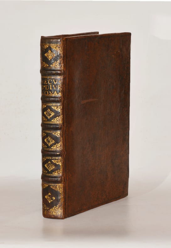
réf. 005460Paris, Louis Billaine, 1674. Cinq parties reliées en un volume in-quarto (180 X 250 mm) basane fauve marbrée, dos brun à nerfs orné de fers dorés, titre doré, tranches mouchetées en rouge (Reliure de l’époque) ; (8) ff. de titre, avis au lecteur, extrait du privilège, 262 pages, 14 planches h.-t. (dont 7 dépliantes) - 23 pages - 49 pages, 3 planches h.-t. - 83 pages [et non 81 pages, il y a en effet deux pages 54/55], 1 planche dépliante h.-t. - 35 pages, 1 planche dépliante h.-t. Discrètes et habiles restaurations à la reliure, épidermures sur les plats, infime travail de ver en fond de cahier sans atteinte au texte du premier tiers de l'ouvrage. SANS le faux titre "Colonies Anglaises" ni la CARTE de la "Description Topographique et mesure de l'Isle des Barbades aux Indes Occidentales" qui manque souvent.
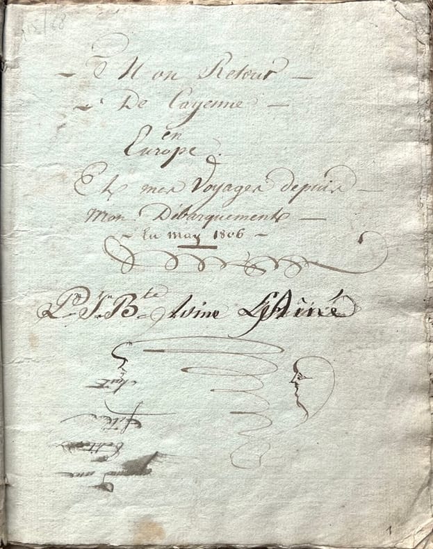
1806réf. 1866, , 1806-1831. Manuscrit in-8 carré de (49) pp., texte copié à l'encre brune, sur papier bleuté et blanc, écriture cursive bien lisible jusqu'en janvier 1818 mais plus difficile à déchiffrer les dernières pp. 47-49, titre et signature inscrits à l'encre sur la première page, deux cahiers cousus, sous couverture d'attente muette, documents conservés dans un emboîtage demi-chagrin bleu moderne. Couverture salie, quelques mouillures.
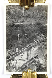
réf. PB4359 loose original gelatin silver photographs five photos identical from ca. 88x144 cm 3 ½ x 5 ¾ in to ca. 87x125 cm 3 ¼ x 5 in. Three photos with period pencil captions in English on the verso. Most photos with stamped negative numbers and/or the “Velox” manufacturer’s mark on the verso; with accompanying manuscript index indicating captions to the photographs 1-82; 101-163. 5 pp. of text. Ca. 316x20 cm 12 ¼ x 8 in. Black ink on yellowish lined paper. Three photos lack small fragments at the corners accompanying index with fold marks one page with small tears at the lower left corner but otherwise a very good collection. Historically important collection of 59 original photographs taken by an American field technician during a six-month resource survey expedition for a New York mining syndicate in the Guianas in 1925. By the 1920s gold mining along the Lawa River borderlands between French and Dutch Guiana present-day Suriname had shifted from the gold rushes of the late nineteenth century to more organized syndicate-financed exploration. As easily accessible surface deposits along tributaries such as Crique Eau Claire were exhausted foreign mining companies introduced systematic survey methods to assess deeper placer deposits. Many of these ventures however proved short-lived because of harsh rainforest conditions and high logistical costs. As follows from the accompanying index the expedition lasted from December 1924 to June 1925. The party first traveled through Grenada and Trinidad before proceeding into the interior of Dutch Guiana and crossing into neighboring French Guiana in January. Its members operated mainly along the Lawa River and its tributary creeks carrying out test drilling timber cutting and placer gold mining. The principal mining activity appears to have been concentrated on the French Guiana side of the border namely along Crique Eau Claire and Crique Rufin while smaller outposts along the Lawa River managed transport and supplies. Among the identified members of the expedition is Fred C. Runckel a driller from Dutch Flat who according to both the index and a 1925 article in the Union sailed for home in April. The compiler appears to have been among the last members of the expedition to remain in the Guianas staying there at least until June and visiting among other places the French penal settlement at Saint-Jean. The collection contains fifty-nine original gelatin silver photographs taken during the expedition between December 1924 and June 1925. Although the accompanying master log lists 163 indexed photographs from the journey only part of the series appears to have been printed or preserved. Furthermore matching individual prints to specific index entries remains difficult due to unnumbered photos. About fifteen lively vernacular photographs likely depict Maroon inhabitants of the Guiana interior most probably Youcas poling long canoes navigating river rapids hunting along the Lawa River etc. At least five candid scenes portray native laborers unloading cargo from boats on the Lawa River while expedition members stand on the shore amid wooden crates hampers and heavy field equipment. Especially interesting are more than fifteen well-executed photos of the New York Syndicate’s gold mining operations likely taken near Rufin Creek and Eau Claire Creek at Revanche Camp in French Guiana. The images show local workers digging open-cut trenches erecting timber flume lines and managing placer mining equipment under the supervision of the syndicate's field engineers. The rest of the photos mostly portray San Fernando in Trinidad Port of Spain; Queen St. with signs “W. S. Robertson & Co.” and “Colonial Bank” “Indians of the Tumuc-Humac Mountains in Brazilian Guiana” landscapes and unidentified street views buildings trams and pedestrians. The collection also contains one photograph apparently taken after the expedition. The image shows open-cut nitrate mining in Chile and an electric mine locomotive operated by the Anglo-Chilean Consolidated Nitrate Corporation for which the compiler appears to have later worked. Overall historically important collection of 59 original gelatin silver photographs taken by an American field technician during a six-month resource survey expedition for a New York mining syndicate in the Guianas in 1925. unknown
1828réf. 30792A Cayenne: L'Imprimerie du Gouvernement 1828. Cayenne Imprint A collection of proposed French administrative documents concerning the establishment of a mortgage and loan office in French Guiana. The various articles are geared toward liberal loan regulations to encourage agricultural development including the allowance of slaves as collateral. Since the restoration of the region to French authority in 1817 via the Treaty of Vienna the promotion of an agrarian economy was a primary concern though the subsequent designation of Cayenne as a penal colony significantly reduced the territory's appeal. Like most Cayenne imprints of this era the present document is quite rare. Not on OCLC. Quarto. Contemporary plain wrappers. Internally clean and bright. Near fine. unknown
1828réf. WRCAM30792A Cayenne: L'Imprimerie du Gouvernement 1828. 54pp. Slim quarto. Contemporary plain wrappers. Internally clean and bright. Near fine. A collection of proposed French administrative documents concerning the establishment of a mortgage and loan office in French Guiana. The various articles are geared toward liberal loan regulations to encourage agricultural development including the allowance of slaves as collateral. Since the restoration of the region to French authority in 1817 via the Treaty of Vienna the promotion of an agrarian economy was a primary concern though the subsequent designation of Cayenne as a penal colony significantly reduced the territory's appeal. Like most Cayenne imprints of this era the present document is quite rare. Not on OCLC. L'Imprimerie du Gouvernement unknown books
1763In-8 (mm. 248x185), elegante legatura in p. pelle bazana coeva, cornice dorata ai piatti, dorso a cordoni con decorazioni floreali e tit. oro su tassello, tagli rossi, pp. (2),XIV,(2),294,(2), inclusa la bella antiporta-frontespizio entro pregevole cornice decorata, incisa da Croisey, e con grande testata alle armi alla Prefazione (pure inc. in rame). Il volume è molto ben illustrato f.t. da 10 tavole che raffigurano indigeni, loro usi e costumi, caccia e pesca, animali, piante e frutta, e da 19 (su 20) carte, tutte inc. in rame (7 più volte ripieg.), di cui 1 con la pianta della città di Paramaribo. Fra le carte geografiche: quella generale della Guiana, del Surinam, della Guiana francese, dell’isola e della città di Cayenne e della Guiana portoghese; le restanti illustrano il percorso dei vari fiumi, a partire dal più importante, l’Orenoco. Manca la carta con la ”grande embouchure de l’Orenoque et partie de son cours”. L’opera contiene “les possessions et les établissemens des François, des Espagnols, des Portugais, des Hollandois dans ces vastes pays. Le climat, les productions de la terre et les animaux. Leurs habitans, leurs moeurs, leurs coutumes, et le commerce qu’on y peut faire. Avec des remarques pour la navigation et des cartes, plans et figures”. "Prima edizione". Jacques Nicolas Bellin, ingegnere idrografo francese (1703-1772) fu il primo “Ingenieur de la Marine et du Depot des Plans de la Marine” (l’ufficio idrografico francese) e venne nominato idrografo ufficiale (capo cartografo) del Re di Francia. Durante tale regno il ‘Depot’ produsse un notevole numero di carte geografiche fra cui un atlante delle coste francesi col titolo di "Nettuno francese"; l’"Idrografia francese" contenente le carte delle coste di tutto il mondo nel 1756, e il "Piccolo atlante marittimo", in 5 volumi, nel 1764. Così Diz. Larousse,II, p.429. Cfr. anche Brunet, I,756 - Tooley’s Dictionary of Mapmakers, p. 49. Con numerosi piccoli fori di tarlo sapientemente restaurati, altrimenti esemplare ben conservato.
1841réf. 39808Paris, Clarey, 1841. In-8 de (4)-III-259 pp. maroquin vert, dos orné à nerfs, triple filet doré d’encadrement sur les plats, dentelle intérieure dorée, tranches dorées sur marbrure, non rogné (Brany).
1797réf. 12434Paris, Du Pont, 1797. In-8 de XXIV-237 pp., 1 planche dépliante, veau raciné, dos lisse orné, pièce de titre en mariquin rouge, tranches mouchetées (reliure de l'époque).
1949réf. 1522British Guiana 1949. Very good. Two volumes. 6633 photographs on 3311pp. Images vary in size most 4.5 x 4.5 or 3.5 x 2.5 inches with some larger. Oblong octavos. Original black paper albums string-tied. Cover of first volume detached wear around edges of covers on each volume. Internally clean and fresh. Some images with light silver mirroring. Captioned throughout. Two photograph albums of the Tikwah gold mine in British Guiana likely compiled by an operative of the company. A Who's Who of British Guiana for 1945-1948 lists Samuel Hirsh Holzman as the mine owner and managing director as well as the vice president of the Mining Association of British Guiana. Gold was discovered in Guiana in the 1880s in the area around the Essequibo River. Crude mining efforts through the next few decades resulted in minimal extraction though there was a renewed effort with technological advancements in mining in the 1940s as shown herein. The present albums document the region as well as the mining camp and its operations much of it with a keen sense of detail. In addition to captions the author has annotated many of the photos in pencil to point out relevant features. For example a photograph captioned "New Winze L. & General View of Mine Looking N.W." has pencil annotations identifying individual buildings such as the Clerk's Quarters and the Tikwah Shaft Building. An image of the foreman's shack and laborers' quarters notes the construction and materials used to build them; roads and rivers used by the company are pictured with complaints about the rough condition as are aerial views of the camp and surrounding area. There are images of the shafts and miners at work; interior shots of the mills and other buildings; and the latter portion of the first volume contains numerous group portraits of the workers and office staff each person identified by name and position. This includes the "Tikwah Ladies" mostly the wives of foremen which shows eight Black women standing together in the mining camp one holding an infant and another holding the hands of a toddler. In addition to images of the camp's operations there are many photographs documenting the difficulties involved with mining in the jungle. A series of images from 1948 shows workmen transporting equipment on the Puruni River. Captions read "Reloading boats to proceed up Puruni ballyhoo in front towed by 'Caroline' to be used at Thomas Island Falls for blasting"; "Pulling 'Caroline' over rapids at mouth"; "Pulling 'Caroline' through part of big falls." All of these images show the difficulty of transporting equipment and supplies in the region with laborers in shorts and loincloths pulling the boat with a rope over difficult terrain. Another series shows the boat caught up on rocks in the river at Kaburi Falls and the workmen endeavoring to dislodge it without capsizing. An altogether fascinating look at life in a mining camp in the jungles of Guiana full of rich detail about those working in the camp and their living environs. unknown books
1837réf. 2252821837. Watercolor on paper. 19 x 26 cm. 7-1/2 x 10-1/4 inches. Matted. Watercolor on paper. 19 x 26 cm. 7-1/2 x 10-1/4 inches. Adriaan David van der Gon Netscher was a member of the Netscher family a Dutch military family that traces its heritage back to the 1600s. Adriaan David was a naval officer honorably discharged in 1848 and a member of the Court of Police in British Guyana where he painted this striking little watercolor of the Public Building. unknown
1730réf. PHO-1650Paris, Saugrain, 1730.4 vol. in-12 de I. xxiv-[2]-381 pp., 15 pl. ; II. [4]-364 pp. 12 pl. ; III. [4]-350 pp., 4 pl.; IV. [4] pp., pp. 345-682, [36] pp., 1 pl., les tomes I à III reliés en basane brune, dos à nerfs ornés, p. de titre en mar. rouge, p. de titre en veau blond ; le tome IV reliés en veau brun, dos à nerfs ornés, p. de titre et de tomaison en mar. grenat (reliures de l'époque).
1837réf. 2252821837. Watercolor on paper. 19 x 26 cm. 7-1/2 x 10-1/4 inches. Matted. Watercolor on paper. 19 x 26 cm. 7-1/2 x 10-1/4 inches. Adriaan David van der Gon Netscher was a member of the Netscher family a Dutch military family that traces its heritage back to the 1600s. Adriaan David was a naval officer honorably discharged in 1848 and a member of the Court of Police in British Guyana where he painted this striking little watercolor of the Public Building. unknown books
1810réf. 30747S.l. [Cayenne] s.d. [1810] petit in-folio en feuille, des trous de vers
1813réf. 30753S.l. [Cayenne] s.d. [1813] in-4 en feuille, sous pochette carton noire, galeries de vers
1813réf. 30751S.l. [Cayenne] s.d. [1813] petit in-folio en feuille, des galeries de vers marginales, sous pochette carton noire
réf. 2290[Cayenne S.n. 20 mars 1813] affichette in-4 38 x 24 cm, papier vergé, verso blanc, rest. marg
1886réf. 43203Paris, Librairie polytechnique Baudry et Cie, 1886. In-8 de (4)-147 pp., figures dans le texte.LAUR (P.). Du gisement et de l'exploitation de l'or en Californie. Paris, Dunod, 1863. In-8 de (4)-89 pp., 6 planches repliées hors texte.Les deux pièces reliées en 1 vol. in-8, demi-chagrin vert, dos orné à nerfs (reliure de l'époque).
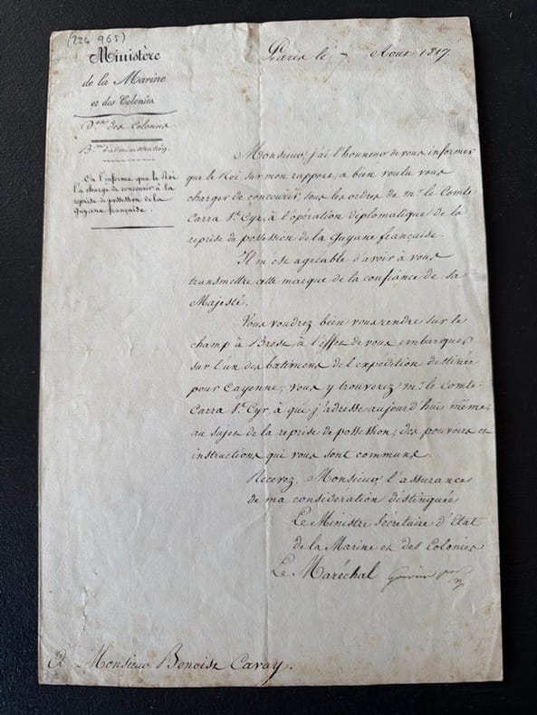
réf. 234965Paris, 7 août 1817 bifeuillet in-folio, écrit sur la première page, en feuille.
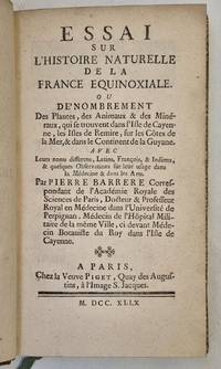
réf. 346FRENCH GUIANA. BARRÈRE Pierre Essai sur l'histoire naturelle de la France équinoxiale ou Dénombrement des Plantes des Animaux & des Minéraux qui se trouvent dans l'Isle de Cayenne les Isles de Remire sur les Côtes de la Mer & dans le Continent de la Guyane Paris Piget 1741. 8° XXIV 216 pages 4 leaves ; contemporary calf. The first monograph on French Guiana's natural history First edition ; one of the scarce large paper copies mentioned by Sabin. Pierre Barrère 1690-1755 was a French physician and botanist from Perpignan. His thesis on the medical uses of botany attracted the attention of Antoine de Jussieu who put forward his name to the French regent Philippe d'Orléans. He was sent to French Guiana "France équinoxiale " as the King's physician and botanist in Cayenne from 1722 to 1725 to look for medecinal plants. During his stay in the colony he collected plants roots fruits and seeds as well as rocks and minerals which were incorporated into Jussieu's herbarium. After an epidemic of yellow fever he returned to France where in 1741 he published this work on the natural history of Cayenne and Remire in which he compiled a very complete alphabetical list of the plants of this part of the world - he referred to the nomenclature of Tournefort and Plumier - as well as the fauna and minerals. This book was followed by another entitled Nouvelle Relation de la France équinoxale in 1743. Provenance: Jean-Baptiste Benoît Eyriès 1767-1846 geographer printer/editor and slave trader printed bookplate; Rémi Valdemar Chardey 1813-1900 collector from Le Havre who purchased part of the former's library at its posthumous sale. Pritzel 425; Sabin 3603; Leclerc 1511: "This work is more difficult to find than the Relation de la France Equinoxiale by the same author."
1820réf. 37526Paris-Strasbourg-Londres Treuttel et Würtz [L.-E. Herhan] 1820-1822 in-8 dérelié
1806réf. PHO-2337A Paris, Colnet, 1806. 3 vol. in-8, 558pp., 469pp., 362pp., demi-basane fauve à coins parchemin ivoire, dos lisse, pièce de titre brune, dos frottés, coins et coupes usés, pièces de tomaisons incomplètes, défauts dont rousseurs, mouillure claire au début de t.3 et fin t.2, petites taches d’encre et fentes sans manque sur la carte). Ouvrage illustré d'une carte dépliante et de 3 plans illustrant la ville de Caracas, le port de la Goayre, la rade et la ville de Porto Cabello.