[Florida]ABAA

2,717 results
1872ref. 31647Tallahassee: Charles H. Walton State Printer 1872. Stitched untrimmed and uncut. 350 2 blanks 76 pp. Except for a spotted title page which is chipped at the blank corners a clean Very Good copy. An informative Journal recounting Floridians' resistance to Radical Reconstruction. Governor Harrison Reed's Message addresses ongoing disturbances and "fatal and disgraceful violence. Nine-tenths of the suffering induced has fallen upon Republicans and mainly upon colored citizens-- giving unerring evidence that these excesses have been strongly tinctured by if they have not entirely originated in political prejudice." Many murders and disruptions had occurred in Calhoun and Jackson Counties forcing citizens to flee their homes and seek shelter in other parts of the State. A Committee of Five was appointed "to examine into the cause of said murders and to ascertain why the perpetrators have not been brought to justice." The Committee concluded that "there exists an organized band whose object is to resist the laws and who are the supposed authors of the many murders and outrages committed in the county." Threats of violence and a "reign of terror" had deterred witnesses from coming forward. In Jackson County "no less than one hundred and eighty -four murders fifteen of the number being women and children and almost the entire number being colored people brutally assassinated by this band of outlaws for daring to think for themselves." Similar outrages occurred in Lafayette and other counties. Governor Reed Florida's governor from 1868-73 faced impeachment charges from this Assembly as he had in 1868 and 1870. He was later charged in sixteen Articles with illegally issuing state bonds embezzlement and bribery. The charges were dismissed. The Assembly treated other matters of government including special elections marred by violence; "an act to incorporate Brown's Theological Institute" now Edward Waters College founded in 1866 to educate former slaves and considered the oldest historically black college in Florida. Senate Bill No 82 "to be entitled an act to incorporate the Buckingham Smith Asylum for the colored people of St. Augustine" was passed. Charles H. Walton, State Printer unknown books
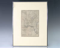
1797ref. 139014Paris: Rigobert Bonne 1797. Rare 18th century map of North America by Royal Hydrographer Rigobert Bonne. One page the engraved map extends from Illinois to Florida with one of the earliest insets of Kansas City. Born in the Lorraine region of France French cartographer Rigobert Bonne 1727-1794 was a skilled cartographer and hydrographer and succeeded Jacques Nicolas Bellin as Royal Hydrographer at the Depot de la Marine in 1773. He published many charts for the Depot including some of those for the Atlas Maritimeof 1762. In near fine condition. Matted and framed. The entire piece measures 17 inches by 16 inches. La Louisiane named after Louis XIV of France became a colony of the Kingdom of France in 1682 before passing to Spain in 1763. Louisiana was formed in part of the became part of the Louisiana Purchase from France in 1803. The U.S. would divide that area into two territories the Territory of Orleans which formed what would become the boundaries of Louisiana and the District of Louisiana. Louisiana was admitted as the 18th state of the United States on April 30 1812. Appointed hydrographer of the French Navy at the age of eighteen Jacques-Nicolas Bellin was appointed Hydrographer to the King in 1741. He published numerous sea atlases and charts which would be reprinted into the nineteenth century as well as many maps depicting French colonial territories in the New World. His craftsmanship and commitment to accuracy earned him a distinguished reputation as one of the world's leading cartographers and many other European mapmakers turned to him for source material. Rigobert Bonne unknown
1916ref. 40686Washington D.C.: Published by the United States Coast and Geodetic Survey 1916. Nautical chart printed on heavy paper stock. Colored. A rare coastal survey of the St. Johns River near Orlando with an inset map of the river continuation in the bottom left corner. Established by President Thomas Jefferson in 1807 as the Survey of the Coast the U.S. Coast and Geodetic Survey was the United States' first civilian scientific agency. This agency has followed its mission to survey the U.S. coastline create nautical charts of the coast and help increase maritime safety since its founding and has often played fascinating roles in significant chapters of U.S. history. It served in all theaters of the Civil War in the service of the Union Army and Navy pioneered acoustic exploration in the wake of the sinking of the Titanic and during WWI it worked to detect enemy submarines. In addition this agency worked to survey and produce detailed maps and renderings of the U.S. coast. These nautical survey maps commonly referred to as "T-sheets" provide fascinating insights into the history of the United States coastline which has and will continue to shift. These maps are the most important data source for understanding the physical and ecological characteristics of the U.S. shoreline. The present map is a highly detailed and accurate sea chart of the St Johns River and an important historical view of a developing Florida. Published by the United States Coast and Geodetic Survey unknown
1916ref. 40686Washington D.C.: Published by the United States Coast and Geodetic Survey 1916. Nautical chart printed on heavy paper stock. Colored. A rare coastal survey of the St. Johns River near Orlando with an inset map of the river continuation in the bottom left corner. Established by President Thomas Jefferson in 1807 as the Survey of the Coast the U.S. Coast and Geodetic Survey was the United States' first civilian scientific agency. This agency has followed its mission to survey the U.S. coastline create nautical charts of the coast and help increase maritime safety since its founding and has often played fascinating roles in significant chapters of U.S. history. It served in all theaters of the Civil War in the service of the Union Army and Navy pioneered acoustic exploration in the wake of the sinking of the Titanic and during WWI it worked to detect enemy submarines. In addition this agency worked to survey and produce detailed maps and renderings of the U.S. coast. These nautical survey maps commonly referred to as "T-sheets" provide fascinating insights into the history of the United States coastline which has and will continue to shift. These maps are the most important data source for understanding the physical and ecological characteristics of the U.S. shoreline. The present map is a highly detailed and accurate sea chart of the St Johns River and an important historical view of a developing Florida. Published by the United States Coast and Geodetic Survey unknown books
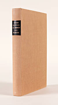
1861ref. 19664Tallahassee. 1861. Floridian Confederate imprint recording the House proceedings at the start of the Civil War. Modern cloth leather label. Very good. PARRISH & WILLINGHAM 2745. SERVIES 4586. hardcover
1861ref. 19664Tallahassee. 1861. Floridian Confederate imprint recording the House proceedings at the start of the Civil War. Modern cloth leather label. Very good. PARRISH & WILLINGHAM 2745. SERVIES 4586. hardcover books
1986ref. x-0471826456Wiley-Interscience 1986. Hardcover. New. 1st edition. 594 pages. 10.00x7.00x1.50 inches. Wiley-Interscience hardcover
Mm 220x320 Cinque volumi rilegati in mezza pelle, titolo e fregi in oro al dorso, piatti con carta marmorizzata con piccole abrasioni alla base. Legature tutte ben salde. Vol. I°, ( 2 Luglio - 24 dicembre 1968 ) di 414 pp. Vol. II°, ( 1° gennaio - 24 giugno 1969 ) di 414 pp. Vol. III°, ( 1° luglio - 30 dicembre 1869 ) di 430 pp. Vol. IV°, ( 6 gennaio - 30 giugno 1870 ) di 414 pp. Vol. V°, ( 7 luglio - 29 dicembre 1870 ). Tutti i volumi sono illustrati da xilografie con immagini anche a piena pagina. Alcune fioriture e bruniture in alcune pagine del testo, peraltro lo stato d'insieme di questo importante settimanale, di forte caratterizzazione eurocentrica, è ottimo. Raccolta di tutto il pubblicato della nota rivista a carattere geografico che seguì la edizione di lusso orientata ad un pubblico più facoltoso e che venne poi continuata e surrogata col nuovo anno dal " Giornale popolare di Viaggi". Spedizione in 24 ore dalla conferma dell'ordine.
ref. DADAX1572482028New unknown
ref. 3242Scarce. Black paper wraps. Photograph and title printed in silver to front cover. Front fly made of silver paper. Organized by architect featuring photographs renderings and floorplans of commercial and residential projects located in South Florida including Miami Miami Beach Coral Gables Ft. Lauderdale and Palm Beach; Hobe Sound and Winter Park circa mid/late 30's. Last third of book consists of advertisements for architects contractors designers landscapers and building materials and manufacturers. A nice clean crisp copy without previous owners' names or other markings. ; 4to 11" - 13" tall; 106 54 pages; All shipments through USPS insured Priority Mail. The Miami Visitor Publishing Co., Inc. paperback
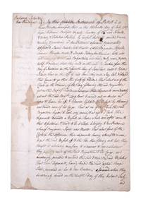
1767ref. 351783New Providence Bahamas 1767. 2pp folded folio sheet with integral blank. Old folds minor staining. 2pp folded folio sheet with integral blank. The Brigatine Apollo left the bay of Honduras on 11 June 1767 bound for Rhode Island on a course through the Gulf of Florida. "That about one of the clock in the morning of the day following the said Brigantine got on the reef of Florida whereupon the deponents immediately got out the said Brig.t's long boat and carried out an anchor in order to heave her off & likewise lightened the vessell by throwing over board some of her cargo: That at six of the clock the said brigatine began to leak very much & at eight o'clock these deponents discovered a vessell in shore which soon after came to their assistance & prov'd to be a sloop belonging to New Providence . having attempted in vain to get the said vessell off & the tide then flowing into her they thought it absolutely necessary to endeavor to save whatever they possibly could of the said Brigatine & her cargo and accordingly proceeded to unbend the sails & strip the said vessell . and do hereby solemnly protest aginst the said reef of Florida for all losses damages & expences hitherto sustained thereby ." The document does not specify the nature of the cargo going from British Honduras to Rhode Island but was perhaps mahogany or other timber used in colonial New England for cabinet making. unknown
1767ref. 351783New Providence Bahamas 1767. 2pp folded folio sheet with integral blank. Old folds minor staining. 2pp folded folio sheet with integral blank. The Brigatine Apollo left the bay of Honduras on 11 June 1767 bound for Rhode Island on a course through the Gulf of Florida. "That about one of the clock in the morning of the day following the said Brigantine got on the reef of Florida whereupon the deponents immediately got out the said Brig.t's long boat and carried out an anchor in order to heave her off & likewise lightened the vessell by throwing over board some of her cargo: That at six of the clock the said brigatine began to leak very much & at eight o'clock these deponents discovered a vessell in shore which soon after came to their assistance & prov'd to be a sloop belonging to New Providence . having attempted in vain to get the said vessell off & the tide then flowing into her they thought it absolutely necessary to endeavor to save whatever they possibly could of the said Brigatine & her cargo and accordingly proceeded to unbend the sails & strip the said vessell . and do hereby solemnly protest aginst the said reef of Florida for all losses damages & expences hitherto sustained thereby ." The document does not specify the nature of the cargo going from British Honduras to Rhode Island but was perhaps mahogany or other timber used in colonial New England for cabinet making. unknown books
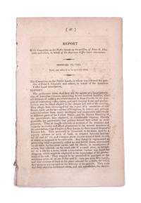
1822ref. 339148Washington D.C.: Gales & Seaton 1822. 17th Congress 1st Session House Report No. 47. 35 1 blankpp. 8vo. Disbound. 17th Congress 1st Session House Report No. 47. 35 1 blankpp. 8vo. A request that the association formed by Chazotte be allowed to purchase land in the Key Largo area for the purpose of cultivating coffee cocoa and tropical fruits. Pages 13 through 30 comprise a separate section with its own caption title: Facts and Observations on the Culture of Vines Olives Capers Almonds &c. in the Southern States and of Coffee Cocoa and Cochineal in East Florida. This section first published separately in Philadelphia in 1821. Shoemaker 11210 [Gales & Seaton] unknown
1822ref. 339148Washington D.C.: Gales & Seaton 1822. 17th Congress 1st Session House Report No. 47. 35 1 blankpp. 8vo. Disbound. 17th Congress 1st Session House Report No. 47. 35 1 blankpp. 8vo. A request that the association formed by Chazotte be allowed to purchase land in the Key Largo area for the purpose of cultivating coffee cocoa and tropical fruits. Pages 13 through 30 comprise a separate section with its own caption title: Facts and Observations on the Culture of Vines Olives Capers Almonds &c. in the Southern States and of Coffee Cocoa and Cochineal in East Florida. This section first published separately in Philadelphia in 1821. Shoemaker 11210 [Gales & Seaton] unknown books
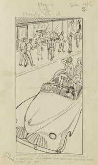
1949ref. 313357Gainesville Fla 1949. Aprox 77 pen and ink drawings with the newspaper cliping done generally for Wednesdays and Sundays. 8vo & 4to. In spiral rink notebook. Aprox 77 pen and ink drawings with the newspaper cliping done generally for Wednesdays and Sundays. 8vo & 4to. unknown
1949ref. 313357Gainesville Fla 1949. Aprox 77 pen and ink drawings with the newspaper cliping done generally for Wednesdays and Sundays. 8vo & 4to. In spiral rink notebook. Aprox 77 pen and ink drawings with the newspaper cliping done generally for Wednesdays and Sundays. 8vo & 4to. unknown books
1922ref. 64060Tallahassee FL & Buffalo & New York NY: Department of Agriculture Florida The Matthews-Northrup Works 1922. One large oblong double-atlas folio colour lithograph map sized 50 x 44 in. county lines and railroad lines demarcated in colours fold creases as issued minor dustsoiling edgewear to verso some very slight weakening to a couple fold creases otherwise a VG bright copy. First edition thus of this uncommon and updated sectional map of Florida incorporating the 1920 census numbers as well as updating the agricultural statistics farm properties and average acreage values at the outset of the Roaring 20’s. Also delineated are the railroads reaching into Florida including the Atlantic Coast Line Florida East Coast RR Seaboard Air Lines Georgia Southern & FLorida RR Louisville 7 Nashville RR and others. McRae 1870-1943 headed the Florida Department of Agriculture from 1912-1923. Worldcat locates 2 physical copies U of FL WI Hist. Soc. Department of Agriculture, Florida, The Matthews-Northrup Works, unknown
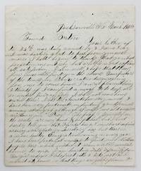
1858ref. 4106Jacksonville Fl: March 15 1858. Very good plus. 4pp. on a single folded sheet. Old mailing folds. An informative dispatch from antebellum Florida from A.C Scranton to "Friend Barton" in 1858. In his letter Scranton reports that despite some problems he is enjoying southern people and general life in Florida: "The people generally in the south are very kind & hospitibal but I need hardly to tell you that Florida has got some hard times as every new state or Territory has but thare is a more healthy Emigration coming in every year I have been fortunate anough to find some Northern people here which makes it seam a little more like home to me. I am boarding with a family from Georgia whome I like first rate & I do just as I would at home so that things are quite pleasant here considering I am amongst strangers." He then provides information on Jacksonville and then two disasters that hit his adopted hometown: "Jacksonville is the largest place in Florida & had at one time about 3000 inhabitants it is not as large as it was once some three years ago it was visited by a very destructive fire & burned nearly half of the town. Last summer there was some kind of Fever here that almost prostrated the place some called it the Yellow Fever & some the African but none could tell for certin.about a hundred & fifteen or twenty that died here in 3 months & a grate many left the town nearly all the stors wer closed not a sound of a hammer was to be heard. When cold weather came it stoped the sickness and it seams quite lively now. It has been for many years a grate resort in the winter season for invaleds but on account of the sickness last summer thare are but few this winter if it continus healthy this summer the place will revive but if not it will kill it entirely." Scranton also discusses the transportation system that served Jacksonville and the recent winding down of the Seminole Wars: "It is situated on the Johns River about 23 miles from the mouth and is connected with Charleston & Savana by a regular line of steamers that runs up the river a hundred miles to a place called Platka whare Emigrants land & then travel by land to the interior to settle the country thare is a railroad building from this place to Tallahasse the capital of the state a distance of a hundred & eighty miles which wen completed will be a little help to this place. There is also another in progress from Fernandina a new town that lays in the North East corner of the state to a place called cedar keys on the gulf side whare they intend to carry the US mail direct from New Orleans to New York insted of going round by Key west & will shorten the time considerable. Florida has cost Uncle Sam a large some of money.the government.will make a treaty with them & send them into the Indian Territory & then close the Indian war in Florida." Almost all of the Seminoles remaining in Florida relocated to Indian Territory in the year this letter was written. A wonderfully-detailed firsthand account of Jacksonville and its development and challenges during the late 1850s. A printed transcription accompanies the letter. March 15 unknown
1858ref. 4106Jacksonville Fl: March 15 1858. Very good plus. 4pp. on a single folded sheet. Old mailing folds. An informative dispatch from antebellum Florida from A.C Scranton to "Friend Barton" in 1858. In his letter Scranton reports that despite some problems he is enjoying southern people and general life in Florida: "The people generally in the south are very kind & hospitibal but I need hardly to tell you that Florida has got some hard times as every new state or Territory has but thare is a more healthy Emigration coming in every year I have been fortunate anough to find some Northern people here which makes it seam a little more like home to me. I am boarding with a family from Georgia whome I like first rate & I do just as I would at home so that things are quite pleasant here considering I am amongst strangers." He then provides information on Jacksonville and then two disasters that hit his adopted hometown: "Jacksonville is the largest place in Florida & had at one time about 3000 inhabitants it is not as large as it was once some three years ago it was visited by a very destructive fire & burned nearly half of the town. Last summer there was some kind of Fever here that almost prostrated the place some called it the Yellow Fever & some the African but none could tell for certin.about a hundred & fifteen or twenty that died here in 3 months & a grate many left the town nearly all the stors wer closed not a sound of a hammer was to be heard. When cold weather came it stoped the sickness and it seams quite lively now. It has been for many years a grate resort in the winter season for invaleds but on account of the sickness last summer thare are but few this winter if it continus healthy this summer the place will revive but if not it will kill it entirely." Scranton also discusses the transportation system that served Jacksonville and the recent winding down of the Seminole Wars: "It is situated on the Johns River about 23 miles from the mouth and is connected with Charleston & Savana by a regular line of steamers that runs up the river a hundred miles to a place called Platka whare Emigrants land & then travel by land to the interior to settle the country thare is a railroad building from this place to Tallahasse the capital of the state a distance of a hundred & eighty miles which wen completed will be a little help to this place. There is also another in progress from Fernandina a new town that lays in the North East corner of the state to a place called cedar keys on the gulf side whare they intend to carry the US mail direct from New Orleans to New York insted of going round by Key west & will shorten the time considerable. Florida has cost Uncle Sam a large some of money.the government.will make a treaty with them & send them into the Indian Territory & then close the Indian war in Florida." Almost all of the Seminoles remaining in Florida relocated to Indian Territory in the year this letter was written. A wonderfully-detailed firsthand account of Jacksonville and its development and challenges during the late 1850s. A printed transcription accompanies the letter. March 15 unknown books
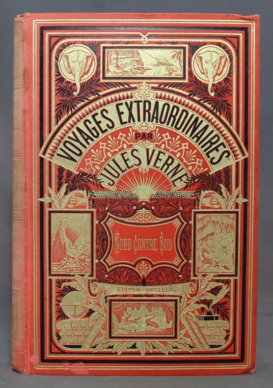
1887ref. 10954Paris, Bibliothèque d'éducation et de récréation - Les Voyages extraordinaires, J. Hetzel et Cie, [1887]. Grand in-8 de [4]-416-7 (catalogue DS) pages, cartonnage rouge d'éditeur "aux deux éléphants" (type 3), second plat de type Lenègre "e" avec macaron central à fond noir. Dos passé, un coin légèrement tapé, 2 petites taches au bord inférieur du premier plat, pâles rousseurs, tampon de possesseur sur garde, faux-titre et page 1.
1959ref. ZB705266Florida Association of Architects / Roger W. Sherman 1959. Volumes 9 through 26 1959-1976 lacking volume 11#11; 12#12; Bound in buckram with original covers included except for the issues for volume 11 & 12 which are unbound in original wrappers. Ex library text clean & bindings tight. - If you are reading this this item is actually physically in our stock and ready for shipment once ordered. We are not bookjackers. Buyer is responsible for any additional duties taxes or fees required by recipient's country. Photos available upon request. Florida Association of Architects / Roger W. Sherman hardcover
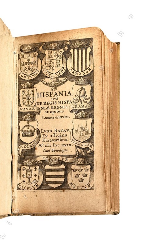
1629ref. 21438Lugd. Batav. (Leyde), ex officina Elzeviriana, 1629 ; in-24 (108 mm), vélin rigide de l’époque, titre manuscrit au dos ; [16], 498 pp., [1] f. de Privilège, titre gravé illustré de blasons.
ref. SONG1565541545Used: Good unknown
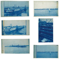
1895ref. 3633601895. Five views of Lake Worth Beach and Palm Beach in 1895. The images are: 1 Ferry at Lake Worth with the Royal Poinciana Hotel in the distance. Captioned in the negative "L.W.B. 9.14.95"; 2 Lake Worth with the Royal Poinciana Hotel in the distance. Captioned in the negative "L.W.B. 9.24.95"; 3 View of Lake Worth with a pier in the foreground possibly taken from a boat. Captioned in the negative "L.W.B. 10.9.95"; 4 Sail boat in front of the Royal Poinciana captioned in the negative "Lake Worth" two versions with different exposure times 5 View of the Palm Beach Inn later renamed The Breakers under construction with the Royal Poinciana in the background not dated but the hotel opened in December 1895. The negatives these views were printed from are of somewhat unusual size measuring roughly 4-3/4 by 7-3/4 inches. All but one view have a horizontal orientation. Given that this size does not seem to conform to the standard halfplate negative usually 5-1/2 to 6-1/2 inches in the long direction one might speculate that the photographer made their own camera. The photographs are handcut with somewhat uneven edges and of varying finished sizes all roughly 5 by 8 inches. They are generally very good or better with some toning and spotting. Uncommon subject matter. unknown
1921ref. 40736Washington D.C.: Published by the United States Coast and Geodetic Survey 1921. Large folding nautical chart printed on heavy paper stock. Colored. A rare original coastal survey of Florida and Alabama from Pensacola Bay showing Perdido Bay including Pensacola Perdido Key and Orange Beach. Established by President Thomas Jefferson in 1807 as the Survey of the Coast the U.S. Coast and Geodetic Survey was the United States' first civilian scientific agency. This agency has followed its mission to survey the U.S. coastline create nautical charts of the coast and help increase maritime safety since its founding and has often played fascinating roles in significant chapters of U.S. history. It served in all theaters of the Civil War in the service of the Union Army and Navy pioneered acoustic exploration in the wake of the sinking of the Titanic and during WWI it worked to detect enemy submarines. In addition this agency worked to survey and produce detailed maps and renderings of the U.S. coast. These nautical survey maps commonly referred to as "T-sheets" provide fascinating insights into the history of the United States coastline which has and will continue to shift. These maps are the most important data source for understanding the physical and ecological characteristics of the U.S. shoreline. The present map is a highly detailed and accurate sea chart of the coastal border between Florida and Alabama and an important historical view of the developing states. Published by the United States Coast and Geodetic Survey unknown