[Great Fire of New York - Commerce - Insurance - New Orleans - Florida Indian Removal] Baker & MooreBiblio.com
2.566 resultados
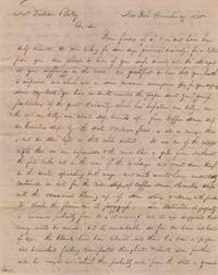
1835ref. BK0025New York City 1835. Autograph letter signed by the merchant firm Baker & Moore 4 pp. addressed to General William Battey care of Dr. Charles Luzenberg at the Franklin Infirmary on the Pontchartrain Railroad New Orleans. Stampless folded letter with red circular "NEW-YORK" December 31 datestamp and manuscript "25" rate. Appx. 1000 words. File folds; otherwise very good. A lengthy commercial letter written thirteen days after the Great Fire of New York describing the destruction of the city's mercantile district and tracing its immediate effects through insurance capital banking commodity prices and trade with New Orleans. Written by the New York firm of Baker & Moore to their associate William Battey the letter provides a near-contemporary account of the fire an assessment of the city's financial resilience and instructions for exploiting the resulting fluctuations in the markets for brandy wine raisins tobacco iron and copper. The fire began on the evening of December 16 during an extraordinary cold spell and northwest gale. Frozen hydrants wells cisterns and hoses left the city's volunteer fire companies largely unable to contain it. By the following day the fire had destroyed much of the commercial district between Wall Street and the East River including the Merchants' Exchange and hundreds of stores and warehouses. Buildings were eventually demolished with gunpowder to create firebreaks at Exchange Place and Coenties Slip. Contemporary estimates varied but approximately 674 buildings were destroyed with losses eventually placed at twenty million dollars or more.1 Baker & Moore begin by describing the extent of the burned district the severe weather and the use of explosives to arrest the flames: "Since my last you have no doubt received the paper sent you giving particulars of the great calamity which has befallen our City. On the 16th our City was about half burned up. From Coffee House Slip to Coenties Slip by the water & William Street is all in ruins. There is but one store left in that whole district. It was one of the coldest nights that we ever experienced & the wind blew a gale from Northwest. The fire broke out in the rear of the Exchange and went down through to the water spreading both ways and would have undoubtedly continued on but for the wide slips of Coffee House & Coenties Slip with the occasional blowing up of some stores & houses with powder to check the flame in its progress" The account quickly turns from the physical destruction to the distribution of its financial losses: "The destruction of property is immense probably from 10 to 15000000$ and it was supposed that many would be ruined but tis remarkable so far we have not heard of one. The Banks have been liberal and there has been a proper and benevolent feeling manifested throughout & should some further aid be brought in which probably will from the State or general government we think there may be no failures. The Insurance companies most of them are ruined and the principal loss is in Insurance capital. The loss will in some instances fall upon those who cannot well afford it. Many widows & orphans have had their all taken from them. The loss is large and New York has met with a great calamity but she is made of such materials & her facilities are so large & varied that the mercantile community will bear up under more than any other place in the Union & we think in one year's time it will be almost forgotten." The confidence expressed here correctly anticipated the city's rapid commercial recovery. Banks and government agencies extended credit and payment terms rebuilding began almost immediately and the burned district was reconstructed with new countinghouses and warehouses. The disaster also exposed the inadequacy of New York's water supply and firefighting arrangements contributing to later infrastructure and institutional reforms. Baker & Moore then apply the disaster to their own trade with New Orleans. Hundreds of warehouses and their contents had been destroyed increasing prices of imported foods wines and spirits. The firm instructs Battey to use the New York price current to obtain higher prices for their consignments: "This fire has advanced most all kinds of goods. Raisins are worth here $3-$3½. Wines such as Mess. Eastman's have advanced with us 4-6 cents. So many hundred casks destroyed must advance it and make it higher through the season. More than one half the Brandy was consumed tis now selling at $1.75 and some are asking $2. We wish what we sent you sold & this will be a favorable time to sell-show N.Y. price current-and get as good a price as you can. There will we think be no want of Brandy. Those raisins we think you had better dispose of at once. We think from N.O. current must pay something handsome for us. In regard to old Iron we find good old iron will always sell for the money for 112½ gross hundred equal to 1c per lb. Cast & wrought are same price. If you can come across a lot to do you may make it answer & pay us well. Copper if you can buy low enough may pay something. We thought hay might pay out but tis so high we cannot buy to send. We are of opinion that goods generally will be higher in consequence of this fire yet when we consign goods we wish them sold when they can to pay and we wish Eastman & Co. to sell and close up our affairs in their hands." The concluding paragraph briefly introduces events in Florida. The Second Seminole War had begun that month following mounting resistance to the forced removal of the Seminole people from Florida. Baker & Moore believed that the conflict might affect the movements of a brig expected in New Orleans: "We observe that trouble is anticipated with the Indians in Florida & if so our Brig may not get a load of them & be in N. Orleans earlier than we anticipated tis uncertain what will be the result they may detain her longer until they can get them on board." The wording appears to indicate that the vessel was expected to transport a group of Native people although the letter does not identify the brig its owners or the precise circumstances of the contemplated voyage. The recipient General William Battey was then in New Orleans apparently acting as Baker & Moore's commercial representative while also attending to his health at the Franklin Infirmary. The firm gave him considerable discretion to supervise consignments collect funds purchase goods when opportunities arose and forward current market information to New York. The address places him in the care of Dr. Charles Aloysius Luzenberg who founded the Franklin Infirmary with municipal support in 1835 and subsequently helped establish the Medical College of Louisiana the forerunner of Tulane's medical school.2 Baker & Moore appear to have been commission or importing merchants whose own affairs escaped direct damage but whose trade was immediately altered by the destruction of competing inventories. The letter thus follows the fire from the burned commercial district into the decisions of a New York firm and its representative in New Orleans. A substantial contemporary account of the Great Fire of 1835 documenting the destruction of New York's commercial center and the disaster's immediate movement through insurance banking commodity markets interregional credit and trade with New Orleans. We find no similar examples on the secondary market or in auction records. 1 Herbert Asbury "The Great Fire of 1835" The New Yorker July 26 1930. 2 Louisiana Historical Association "Luzenberg Charles Aloysius" in Dictionary of Louisiana Biography accessed August 2 2026 https://www.lahistory.org/resources/dictionary-louisiana-biography/dictionary-of-louisiana-biography-l/. . unknown
1835ref. BK0025New York City 1835. Autograph letter signed by the merchant firm Baker & Moore 4 pp. addressed to General William Battey care of Dr. Charles Luzenberg at the Franklin Infirmary on the Pontchartrain Railroad New Orleans. Stampless folded letter with red circular "NEW-YORK" December 31 datestamp and manuscript "25" rate. Appx. 1000 words. File folds; otherwise very good. A lengthy commercial letter written thirteen days after the Great Fire of New York describing the destruction of the city's mercantile district and tracing its immediate effects through insurance capital banking commodity prices and trade with New Orleans. Written by the New York firm of Baker & Moore to their associate William Battey the letter provides a near-contemporary account of the fire an assessment of the city's financial resilience and instructions for exploiting the resulting fluctuations in the markets for brandy wine raisins tobacco iron and copper. The fire began on the evening of December 16 during an extraordinary cold spell and northwest gale. Frozen hydrants wells cisterns and hoses left the city's volunteer fire companies largely unable to contain it. By the following day the fire had destroyed much of the commercial district between Wall Street and the East River including the Merchants' Exchange and hundreds of stores and warehouses. Buildings were eventually demolished with gunpowder to create firebreaks at Exchange Place and Coenties Slip. Contemporary estimates varied but approximately 674 buildings were destroyed with losses eventually placed at twenty million dollars or more.1 Baker & Moore begin by describing the extent of the burned district the severe weather and the use of explosives to arrest the flames: "Since my last you have no doubt received the paper sent you giving particulars of the great calamity which has befallen our City. On the 16th our City was about half burned up. From Coffee House Slip to Coenties Slip by the water & William Street is all in ruins. There is but one store left in that whole district. It was one of the coldest nights that we ever experienced & the wind blew a gale from Northwest. The fire broke out in the rear of the Exchange and went down through to the water spreading both ways and would have undoubtedly continued on but for the wide slips of Coffee House & Coenties Slip with the occasional blowing up of some stores & houses with powder to check the flame in its progress" The account quickly turns from the physical destruction to the distribution of its financial losses: "The destruction of property is immense probably from 10 to 15000000$ and it was supposed that many would be ruined but tis remarkable so far we have not heard of one. The Banks have been liberal and there has been a proper and benevolent feeling manifested throughout & should some further aid be brought in which probably will from the State or general government we think there may be no failures. The Insurance companies most of them are ruined and the principal loss is in Insurance capital. The loss will in some instances fall upon those who cannot well afford it. Many widows & orphans have had their all taken from them. The loss is large and New York has met with a great calamity but she is made of such materials & her facilities are so large & varied that the mercantile community will bear up under more than any other place in the Union & we think in one year's time it will be almost forgotten." The confidence expressed here correctly anticipated the city's rapid commercial recovery. Banks and government agencies extended credit and payment terms rebuilding began almost immediately and the burned district was reconstructed with new countinghouses and warehouses. The disaster also exposed the inadequacy of New York's water supply and firefighting arrangements contributing to later infrastructure and institutional reforms. Baker & Moore then apply the disaster to their own trade with New Orleans. Hundreds of warehouses and their contents had been destroyed increasing prices of imported foods wines and spirits. The firm instructs Battey to use the New York price current to obtain higher prices for their consignments: "This fire has advanced most all kinds of goods. Raisins are worth here $3-$3½. Wines such as Mess. Eastman's have advanced with us 4-6 cents. So many hundred casks destroyed must advance it and make it higher through the season. More than one half the Brandy was consumed tis now selling at $1.75 and some are asking $2. We wish what we sent you sold & this will be a favorable time to sell-show N.Y. price current-and get as good a price as you can. There will we think be no want of Brandy. Those raisins we think you had better dispose of at once. We think from N.O. current must pay something handsome for us. In regard to old Iron we find good old iron will always sell for the money for 112½ gross hundred equal to 1c per lb. Cast & wrought are same price. If you can come across a lot to do you may make it answer & pay us well. Copper if you can buy low enough may pay something. We thought hay might pay out but tis so high we cannot buy to send. We are of opinion that goods generally will be higher in consequence of this fire yet when we consign goods we wish them sold when they can to pay and we wish Eastman & Co. to sell and close up our affairs in their hands." The concluding paragraph briefly introduces events in Florida. The Second Seminole War had begun that month following mounting resistance to the forced removal of the Seminole people from Florida. Baker & Moore believed that the conflict might affect the movements of a brig expected in New Orleans: "We observe that trouble is anticipated with the Indians in Florida & if so our Brig may not get a load of them & be in N. Orleans earlier than we anticipated tis uncertain what will be the result they may detain her longer until they can get them on board." The wording appears to indicate that the vessel was expected to transport a group of Native people although the letter does not identify the brig its owners or the precise circumstances of the contemplated voyage. The recipient General William Battey was then in New Orleans apparently acting as Baker & Moore's commercial representative while also attending to his health at the Franklin Infirmary. The firm gave him considerable discretion to supervise consignments collect funds purchase goods when opportunities arose and forward current market information to New York. The address places him in the care of Dr. Charles Aloysius Luzenberg who founded the Franklin Infirmary with municipal support in 1835 and subsequently helped establish the Medical College of Louisiana the forerunner of Tulane's medical school.2 Baker & Moore appear to have been commission or importing merchants whose own affairs escaped direct damage but whose trade was immediately altered by the destruction of competing inventories. The letter thus follows the fire from the burned commercial district into the decisions of a New York firm and its representative in New Orleans. A substantial contemporary account of the Great Fire of 1835 documenting the destruction of New York's commercial center and the disaster's immediate movement through insurance banking commodity markets interregional credit and trade with New Orleans. We find no similar examples on the secondary market or in auction records. 1 Herbert Asbury "The Great Fire of 1835" The New Yorker July 26 1930. 2 Louisiana Historical Association "Luzenberg Charles Aloysius" in Dictionary of Louisiana Biography accessed August 2 2026 https://www.lahistory.org/resources/dictionary-louisiana-biography/dictionary-of-louisiana-biography-l/. . unknown books
ref. BAY_01_SH_051978Used - Very Good. Wraps are firm page block pristine. Some rubbing/curling to wraps. Well packaged and promptly shipped from California. US veteran operated. paperback
ref. 43989Carte originale en couleurs en bon état avec encadrement doré fin 19ème.51 centimètres de longueur et 38 de hauteur avant marie-louise. Rare.
1921ref. 40714Washington D.C.: Published by the United States Coast and Geodetic Survey 1921. Large folding nautical sea chart printed on heavy paper stock. Colored. A rare coastal survey of Florida from Jupiter to Miami bisected into two parts including Jupiter West Palm Beach Boca Raton Pompano Beach Fort Lauderdale Hollywood Miami and Key Biscayne. Established by President Thomas Jefferson in 1807 as the Survey of the Coast the U.S. Coast and Geodetic Survey was the United States' first civilian scientific agency. This agency has followed its mission to survey the U.S. coastline create nautical charts of the coast and help increase maritime safety since its founding and has often played fascinating roles in significant chapters of U.S. history. It served in all theaters of the Civil War in the service of the Union Army and Navy pioneered acoustic exploration in the wake of the sinking of the Titanic and during WWI it worked to detect enemy submarines. In addition this agency worked to survey and produce detailed maps and renderings of the U.S. coast. These nautical survey maps commonly referred to as "T-sheets" provide fascinating insights into the history of the United States coastline which has and will continue to shift. These maps are the most important data source for understanding the physical and ecological characteristics of the U.S. shoreline. The present map is a highly detailed and accurate sea chart of the Florida coast from Jupiter to Miami and an important historical view the developing state. Published by the United States Coast and Geodetic Survey unknown
1921ref. 40707Washington D.C.: Published by the United States Coast and Geodetic Survey 1921. Large folding nautical chart printed on heavy paper stock. Colored. A rare coastal survey of Florida from Jupiter to Miami bisected into two parts including Jupiter West Palm Beach Boca Raton Pompano Beach Fort Lauderdale Hollywood Miami and Key Biscayne. Established by President Thomas Jefferson in 1807 as the Survey of the Coast the U.S. Coast and Geodetic Survey was the United States' first civilian scientific agency. This agency has followed its mission to survey the U.S. coastline create nautical charts of the coast and help increase maritime safety since its founding and has often played fascinating roles in significant chapters of U.S. history. It served in all theaters of the Civil War in the service of the Union Army and Navy pioneered acoustic exploration in the wake of the sinking of the Titanic and during WWI it worked to detect enemy submarines. In addition this agency worked to survey and produce detailed maps and renderings of the U.S. coast. These nautical survey maps commonly referred to as "T-sheets" provide fascinating insights into the history of the United States coastline which has and will continue to shift. These maps are the most important data source for understanding the physical and ecological characteristics of the U.S. shoreline. The present map is a highly detailed and accurate sea chart of the Florida coast from Jupiter to Miami and an important historical view the developing state. Published by the United States Coast and Geodetic Survey unknown
1921ref. 40714Washington D.C.: Published by the United States Coast and Geodetic Survey 1921. Large folding nautical sea chart printed on heavy paper stock. Colored. A rare coastal survey of Florida from Jupiter to Miami bisected into two parts including Jupiter West Palm Beach Boca Raton Pompano Beach Fort Lauderdale Hollywood Miami and Key Biscayne. Established by President Thomas Jefferson in 1807 as the Survey of the Coast the U.S. Coast and Geodetic Survey was the United States' first civilian scientific agency. This agency has followed its mission to survey the U.S. coastline create nautical charts of the coast and help increase maritime safety since its founding and has often played fascinating roles in significant chapters of U.S. history. It served in all theaters of the Civil War in the service of the Union Army and Navy pioneered acoustic exploration in the wake of the sinking of the Titanic and during WWI it worked to detect enemy submarines. In addition this agency worked to survey and produce detailed maps and renderings of the U.S. coast. These nautical survey maps commonly referred to as "T-sheets" provide fascinating insights into the history of the United States coastline which has and will continue to shift. These maps are the most important data source for understanding the physical and ecological characteristics of the U.S. shoreline. The present map is a highly detailed and accurate sea chart of the Florida coast from Jupiter to Miami and an important historical view the developing state. Published by the United States Coast and Geodetic Survey unknown books
1921ref. 40707Washington D.C.: Published by the United States Coast and Geodetic Survey 1921. Large folding nautical chart printed on heavy paper stock. Colored. A rare coastal survey of Florida from Jupiter to Miami bisected into two parts including Jupiter West Palm Beach Boca Raton Pompano Beach Fort Lauderdale Hollywood Miami and Key Biscayne. Established by President Thomas Jefferson in 1807 as the Survey of the Coast the U.S. Coast and Geodetic Survey was the United States' first civilian scientific agency. This agency has followed its mission to survey the U.S. coastline create nautical charts of the coast and help increase maritime safety since its founding and has often played fascinating roles in significant chapters of U.S. history. It served in all theaters of the Civil War in the service of the Union Army and Navy pioneered acoustic exploration in the wake of the sinking of the Titanic and during WWI it worked to detect enemy submarines. In addition this agency worked to survey and produce detailed maps and renderings of the U.S. coast. These nautical survey maps commonly referred to as "T-sheets" provide fascinating insights into the history of the United States coastline which has and will continue to shift. These maps are the most important data source for understanding the physical and ecological characteristics of the U.S. shoreline. The present map is a highly detailed and accurate sea chart of the Florida coast from Jupiter to Miami and an important historical view the developing state. Published by the United States Coast and Geodetic Survey unknown books
1921ref. 40681Washington D.C.: Published by the United States Coast and Geodetic Survey 1921. Nautical chart printed on heavy paper stock. Colored. A rare coastal survey of Miami. Established by President Thomas Jefferson in 1807 as the Survey of the Coast the U.S. Coast and Geodetic Survey was the United States' first civilian scientific agency. This agency has followed its mission to survey the U.S. coastline create nautical charts of the coast and help increase maritime safety since its founding and has often played fascinating roles in significant chapters of U.S. history. It served in all theaters of the Civil War in the service of the Union Army and Navy pioneered acoustic exploration in the wake of the sinking of the Titanic and during WWI it worked to detect enemy submarines. In addition this agency worked to survey and produce detailed maps and renderings of the U.S. coast. These nautical survey maps commonly referred to as "T-sheets" provide fascinating insights into the history of the United States coastline which has and will continue to shift. These maps are the most important data source for understanding the physical and ecological characteristics of the U.S. shoreline. The present map is a highly detailed and accurate sea chart of the Miami area and an important historical view of a developing Florida. Published by the United States Coast and Geodetic Survey unknown
1921ref. 40681Washington D.C.: Published by the United States Coast and Geodetic Survey 1921. Nautical chart printed on heavy paper stock. Colored. A rare coastal survey of Miami. Established by President Thomas Jefferson in 1807 as the Survey of the Coast the U.S. Coast and Geodetic Survey was the United States' first civilian scientific agency. This agency has followed its mission to survey the U.S. coastline create nautical charts of the coast and help increase maritime safety since its founding and has often played fascinating roles in significant chapters of U.S. history. It served in all theaters of the Civil War in the service of the Union Army and Navy pioneered acoustic exploration in the wake of the sinking of the Titanic and during WWI it worked to detect enemy submarines. In addition this agency worked to survey and produce detailed maps and renderings of the U.S. coast. These nautical survey maps commonly referred to as "T-sheets" provide fascinating insights into the history of the United States coastline which has and will continue to shift. These maps are the most important data source for understanding the physical and ecological characteristics of the U.S. shoreline. The present map is a highly detailed and accurate sea chart of the Miami area and an important historical view of a developing Florida. Published by the United States Coast and Geodetic Survey unknown books
1970ref. 70928Tuscaloosa AL: United Klans of America 1970. Large double-folio partly-printed broadside 22 ½ x 17 ½ inches partly a form completed in large black letter manuscript and signed by Robert Shelton as Imperial Wizard and Lewis Perkins as Imperial Kligrapp nation secretary establishing Klavern 200 Florida in Lake Worth Florida February 10 1976 all enclosed within a wide ornamental red border Klan symbols in corners and at head and with a large red central Klan device showing important Klan dates and phrases two fully robed and masked Klan members on rearing horses at the bottom closing with the word "Honor" beribboned imperial seal affixed. OCLC locates six copies of Klan charters from the 1920s one copy each but apparently does not locate one from the United Klans of America formed in the early 1960s when a number of organizations merged; we haven't found a sales record for a charter from either era but are aware of the sale of a 1920s charter for Belhaven N.C. some years ago. Old fold lines rubbed two inch separation at top; some storage wear and soil a good example. Organized with the merger of several Klan organizations in Tuscaloosa Alabama United Klans of America emerged in the early 1960s with its main leader Robert Shelton quickly rising to become its Imperial Wizard. Over the next two years it became well-known for its opposition to the Civil Rights movement and a number of its members were convicted of heinous crimes; including the lynching of Michael Donald in 1981 by UKA members one of whom confessed to the murder and was sentenced to life in prison. Through the Southern Poverty Law Center Donald's family brought a successful suit against the UKA which was unable to pay the several million dollars awarded; through bankruptcy Donald's mother was awarded the UKA property and sold it the UKA ceasing operations in 1988. United Klans of America unknown
1970ref. 70928Tuscaloosa AL: United Klans of America 1970. Large double-folio partly-printed broadside 22 ½ x 17 ½ inches partly a form completed in large black letter manuscript and signed by Robert Shelton as Imperial Wizard and Lewis Perkins as Imperial Kligrapp nation secretary establishing Klavern 200 Florida in Lake Worth Florida February 10 1976 all enclosed within a wide ornamental red border Klan symbols in corners and at head and with a large red central Klan device showing important Klan dates and phrases two fully robed and masked Klan members on rearing horses at the bottom closing with the word "Honor" beribboned imperial seal affixed. OCLC locates six copies of Klan charters from the 1920s one copy each but apparently does not locate one from the United Klans of America formed in the early 1960s when a number of organizations merged; we haven't found a sales record for a charter from either era but are aware of the sale of a 1920s charter for Belhaven N.C. some years ago. Old fold lines rubbed two inch separation at top; some storage wear and soil a good example. Organized with the merger of several Klan organizations in Tuscaloosa Alabama United Klans of America emerged in the early 1960s with its main leader Robert Shelton quickly rising to become its Imperial Wizard. Over the next two years it became well-known for its opposition to the Civil Rights movement and a number of its members were convicted of heinous crimes; including the lynching of Michael Donald in 1981 by UKA members one of whom confessed to the murder and was sentenced to life in prison. Through the Southern Poverty Law Center Donald's family brought a successful suit against the UKA which was unable to pay the several million dollars awarded; through bankruptcy Donald's mother was awarded the UKA property and sold it the UKA ceasing operations in 1988. United Klans of America unknown books
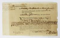
1772ref. 6523West Florida: September 1 1772. About very good. Broadside 7.5 x 12 inches. Lightly tanned old fold lines. Some light chipping at edges slight splitting at some folds. Docketed on verso. A partially-printed form directing Elias Durnford as Surveyor General to survey a tract acquired by William McPherson a British soldier. The parcel in West Florida was to contain "Six hundred acres situate on the River Mississippi adjoining to the southward line of the reserved land near the Natches and between" three other tracts delineated herein. The order is signed by Peter Chester and dated September 1 1772. The docketing on the verso reads "1st September 1772 Warrant of Survey for William Macpherson 600 acres Mississippi." This printed document on watermarked paper is the output of the British press in Pensacola. Peter Chester 1720-1799 was the last British governor of West Florida 1770-1781 and he sought to strengthen British control in the area by offering large land grants to encourage immigration and settlement. Elias Durnford 1739-1794 was a British army officer and civil engineer. He surveyed the town of Pensacola which served as the capitol of British West Florida until the Spanish takeover in 1781. He was also lieutenant governor of West Florida from 1769-1778 and also performed numerous private surveys to supplement his income. A wonderful and early imprint from Pensacola and colonial Florida. September 1 unknown
1772ref. 6523West Florida: September 1 1772. About very good. Broadside 7.5 x 12 inches. Lightly tanned old fold lines. Some light chipping at edges slight splitting at some folds. Docketed on verso. A partially-printed form directing Elias Durnford as Surveyor General to survey a tract acquired by William McPherson a British soldier. The parcel in West Florida was to contain "Six hundred acres situate on the River Mississippi adjoining to the southward line of the reserved land near the Natches and between" three other tracts delineated herein. The order is signed by Peter Chester and dated September 1 1772. The docketing on the verso reads "1st September 1772 Warrant of Survey for William Macpherson 600 acres Mississippi." This printed document on watermarked paper is the output of the British press in Pensacola. Peter Chester 1720-1799 was the last British governor of West Florida 1770-1781 and he sought to strengthen British control in the area by offering large land grants to encourage immigration and settlement. Elias Durnford 1739-1794 was a British army officer and civil engineer. He surveyed the town of Pensacola which served as the capitol of British West Florida until the Spanish takeover in 1781. He was also lieutenant governor of West Florida from 1769-1778 and also performed numerous private surveys to supplement his income. A wonderful and early imprint from Pensacola and colonial Florida. September 1 unknown books
1887ref. 2347741887. 26 leaves with 63 mounted albumen prints most 4-1/2 x 7-7/8 inches all captioned in ink. 1 vols. 4to. Recent red morocco and original red cloth over boards. One photograph with clean split across image no loss. Some fading generally fine and clear. 26 leaves with 63 mounted albumen prints most 4-1/2 x 7-7/8 inches all captioned in ink. 1 vols. 4to. Assembled by a party of men on an extended tour and hunting expedition in the area the album documents numerous locations in southwest Florida in the period immediately following the extension of the Florida Southern Railroad into the Peace River region in 1886. All of the photographs are captioned in ink and all but the first nine which were taken at Interlachen near Gainesville relate to southwest Florida. The album includes scenes of the grounds of Charles Francis Jr. at Interlachen and the residence of Goerge Long; the railway station an office car and a street scene at Trabue; views of the Hotel Punta Gorda under construction; waterfront scenes along the Punta Rassa; views of Fort Myers; a Spanish Fishing village; a "Cracker" family and their orange grove; Judge Ziba King and his house at Fort Ogden; scenes of the Myakka River Bartow and Zolfo Springs and a number of hunting and camping scenes. Nineteenth century photographic albums of Florida are very scarce; the present album shows the rural landscape of southwest Florida at the dawn of the modern age. unknown
1887ref. 2347741887. 26 leaves with 63 mounted albumen prints most 4-1/2 x 7-7/8 inches all captioned in ink. 1 vols. 4to. Recent red morocco and original red cloth over boards. One photograph with clean split across image no loss. Some fading generally fine and clear. 26 leaves with 63 mounted albumen prints most 4-1/2 x 7-7/8 inches all captioned in ink. 1 vols. 4to. Assembled by a party of men on an extended tour and hunting expedition in the area the album documents numerous locations in southwest Florida in the period immediately following the extension of the Florida Southern Railroad into the Peace River region in 1886. All of the photographs are captioned in ink and all but the first nine which were taken at Interlachen near Gainesville relate to southwest Florida. The album includes scenes of the grounds of Charles Francis Jr. at Interlachen and the residence of Goerge Long; the railway station an office car and a street scene at Trabue; views of the Hotel Punta Gorda under construction; waterfront scenes along the Punta Rassa; views of Fort Myers; a Spanish Fishing village; a "Cracker" family and their orange grove; Judge Ziba King and his house at Fort Ogden; scenes of the Myakka River Bartow and Zolfo Springs and a number of hunting and camping scenes. Nineteenth century photographic albums of Florida are very scarce; the present album shows the rural landscape of southwest Florida at the dawn of the modern age. unknown books