[Florida]Biblio.com

2 566 résultats
1916réf. 40717Washington D.C.: Published by the United States Coast and Geodetic Survey 1916. Large folding nautical chart printed on heavy paper stock. Uncolored. Rare original coastal survey of Florida's Apalachee bay. Established by President Thomas Jefferson in 1807 as the Survey of the Coast the U.S. Coast and Geodetic Survey was the United States' first civilian scientific agency. This agency has followed its mission to survey the U.S. coastline create nautical charts of the coast and help increase maritime safety since its founding and has often played fascinating roles in significant chapters of U.S. history. It served in all theaters of the Civil War in the service of the Union Army and Navy pioneered acoustic exploration in the wake of the sinking of the Titanic and during WWI it worked to detect enemy submarines. In addition this agency worked to survey and produce detailed maps and renderings of the U.S. coast. These nautical survey maps commonly referred to as "T-sheets" provide fascinating insights into the history of the United States coastline which has and will continue to shift. These maps are the most important data source for understanding the physical and ecological characteristics of the U.S. shoreline. The present map of the Florida coastline is notable for the inclusion of St Marks light house built at the head of the St Marks River to assist in navigation to and from the important 19th century agricultural port of St Marks. This map is a highly detailed and accurate sea chart of the Apalachee Bay from Fish Creek to Alligator Point and an important historical view of a developing Florida. Published by the United States Coast and Geodetic Survey unknown
1916réf. 40680Washington D.C.: Published by the United States Coast and Geodetic Survey 1916. Large folding nautical chart printed on heavy paper stock. Colored. A rare coastal survey of Apalachee Bay including Alligator Point and St. George Island. Established by President Thomas Jefferson in 1807 as the Survey of the Coast the U.S. Coast and Geodetic Survey was the United States' first civilian scientific agency. This agency has followed its mission to survey the U.S. coastline create nautical charts of the coast and help increase maritime safety since its founding and has often played fascinating roles in significant chapters of U.S. history. It served in all theaters of the Civil War in the service of the Union Army and Navy pioneered acoustic exploration in the wake of the sinking of the Titanic and during WWI it worked to detect enemy submarines. In addition this agency worked to survey and produce detailed maps and renderings of the U.S. coast. These nautical survey maps commonly referred to as "T-sheets" provide fascinating insights into the history of the United States coastline which has and will continue to shift. These maps are the most important data source for understanding the physical and ecological characteristics of the U.S. shoreline. The present map is a highly detailed and accurate sea chart of the Apalachee Bay and an important historical view of a developing Florida. Published by the United States Coast and Geodetic Survey unknown
1916réf. 40717Washington D.C.: Published by the United States Coast and Geodetic Survey 1916. Large folding nautical chart printed on heavy paper stock. Uncolored. Rare original coastal survey of Florida's Apalachee bay. Established by President Thomas Jefferson in 1807 as the Survey of the Coast the U.S. Coast and Geodetic Survey was the United States' first civilian scientific agency. This agency has followed its mission to survey the U.S. coastline create nautical charts of the coast and help increase maritime safety since its founding and has often played fascinating roles in significant chapters of U.S. history. It served in all theaters of the Civil War in the service of the Union Army and Navy pioneered acoustic exploration in the wake of the sinking of the Titanic and during WWI it worked to detect enemy submarines. In addition this agency worked to survey and produce detailed maps and renderings of the U.S. coast. These nautical survey maps commonly referred to as "T-sheets" provide fascinating insights into the history of the United States coastline which has and will continue to shift. These maps are the most important data source for understanding the physical and ecological characteristics of the U.S. shoreline. The present map of the Florida coastline is notable for the inclusion of St Marks light house built at the head of the St Marks River to assist in navigation to and from the important 19th century agricultural port of St Marks. This map is a highly detailed and accurate sea chart of the Apalachee Bay from Fish Creek to Alligator Point and an important historical view of a developing Florida. Published by the United States Coast and Geodetic Survey unknown books
1916réf. 40680Washington D.C.: Published by the United States Coast and Geodetic Survey 1916. Large folding nautical chart printed on heavy paper stock. Colored. A rare coastal survey of Apalachee Bay including Alligator Point and St. George Island. Established by President Thomas Jefferson in 1807 as the Survey of the Coast the U.S. Coast and Geodetic Survey was the United States' first civilian scientific agency. This agency has followed its mission to survey the U.S. coastline create nautical charts of the coast and help increase maritime safety since its founding and has often played fascinating roles in significant chapters of U.S. history. It served in all theaters of the Civil War in the service of the Union Army and Navy pioneered acoustic exploration in the wake of the sinking of the Titanic and during WWI it worked to detect enemy submarines. In addition this agency worked to survey and produce detailed maps and renderings of the U.S. coast. These nautical survey maps commonly referred to as "T-sheets" provide fascinating insights into the history of the United States coastline which has and will continue to shift. These maps are the most important data source for understanding the physical and ecological characteristics of the U.S. shoreline. The present map is a highly detailed and accurate sea chart of the Apalachee Bay and an important historical view of a developing Florida. Published by the United States Coast and Geodetic Survey unknown books
1920réf. 40721Washington D.C.: Published by the United States Coast and Geodetic Survey 1920. Large folding nautical chart printed on heavy paper stock. Uncolored. A rare original coastal survey of Apalachicola Bay and Cape San Blas including St. George Island. Established by President Thomas Jefferson in 1807 as the Survey of the Coast the U.S. Coast and Geodetic Survey was the United States' first civilian scientific agency. This agency has followed its mission to survey the U.S. coastline create nautical charts of the coast and help increase maritime safety since its founding and has often played fascinating roles in significant chapters of U.S. history. It served in all theaters of the Civil War in the service of the Union Army and Navy pioneered acoustic exploration in the wake of the sinking of the Titanic and during WWI it worked to detect enemy submarines. In addition this agency worked to survey and produce detailed maps and renderings of the U.S. coast. These nautical survey maps commonly referred to as "T-sheets" provide fascinating insights into the history of the United States coastline which has and will continue to shift. These maps are the most important data source for understanding the physical and ecological characteristics of the U.S. shoreline. The present map of the Florida coastline precedes the development of the town of Eastpoint and the building of the John Gorrie Memorial Bridge which connects Eastpoint with Apalachicola. The current site of Eastpoint is marked as Godleys Bluff on the present map. This map is a highly detailed and accurate sea chart of the coastal Florida and an important historical view of the developing state. Published by the United States Coast and Geodetic Survey unknown
1920réf. 40721Washington D.C.: Published by the United States Coast and Geodetic Survey 1920. Large folding nautical chart printed on heavy paper stock. Uncolored. A rare original coastal survey of Apalachicola Bay and Cape San Blas including St. George Island. Established by President Thomas Jefferson in 1807 as the Survey of the Coast the U.S. Coast and Geodetic Survey was the United States' first civilian scientific agency. This agency has followed its mission to survey the U.S. coastline create nautical charts of the coast and help increase maritime safety since its founding and has often played fascinating roles in significant chapters of U.S. history. It served in all theaters of the Civil War in the service of the Union Army and Navy pioneered acoustic exploration in the wake of the sinking of the Titanic and during WWI it worked to detect enemy submarines. In addition this agency worked to survey and produce detailed maps and renderings of the U.S. coast. These nautical survey maps commonly referred to as "T-sheets" provide fascinating insights into the history of the United States coastline which has and will continue to shift. These maps are the most important data source for understanding the physical and ecological characteristics of the U.S. shoreline. The present map of the Florida coastline precedes the development of the town of Eastpoint and the building of the John Gorrie Memorial Bridge which connects Eastpoint with Apalachicola. The current site of Eastpoint is marked as Godleys Bluff on the present map. This map is a highly detailed and accurate sea chart of the coastal Florida and an important historical view of the developing state. Published by the United States Coast and Geodetic Survey unknown books
1916réf. 40703Washington D.C.: Published by the United States Coast and Geodetic Survey 1916. Large folding nautical chart printed on heavy paper stock. Colored with minor wear. A rare coastal survey of Florida around Daytona including Ormond Beach Daytona Beach Port Orange New Smyrna Beach and Edgewater. Established by President Thomas Jefferson in 1807 as the Survey of the Coast the U.S. Coast and Geodetic Survey was the United States' first civilian scientific agency. This agency has followed its mission to survey the U.S. coastline create nautical charts of the coast and help increase maritime safety since its founding and has often played fascinating roles in significant chapters of U.S. history. It served in all theaters of the Civil War in the service of the Union Army and Navy pioneered acoustic exploration in the wake of the sinking of the Titanic and during WWI it worked to detect enemy submarines. In addition this agency worked to survey and produce detailed maps and renderings of the U.S. coast. These nautical survey maps commonly referred to as "T-sheets" provide fascinating insights into the history of the United States coastline which has and will continue to shift. These maps are the most important data source for understanding the physical and ecological characteristics of the U.S. shoreline. The present map is a highly detailed and accurate sea chart of the Daytona area and an important historical view of a developing Florida. Published by the United States Coast and Geodetic Survey unknown
1916réf. 40703Washington D.C.: Published by the United States Coast and Geodetic Survey 1916. Large folding nautical chart printed on heavy paper stock. Colored with minor wear. A rare coastal survey of Florida around Daytona including Ormond Beach Daytona Beach Port Orange New Smyrna Beach and Edgewater. Established by President Thomas Jefferson in 1807 as the Survey of the Coast the U.S. Coast and Geodetic Survey was the United States' first civilian scientific agency. This agency has followed its mission to survey the U.S. coastline create nautical charts of the coast and help increase maritime safety since its founding and has often played fascinating roles in significant chapters of U.S. history. It served in all theaters of the Civil War in the service of the Union Army and Navy pioneered acoustic exploration in the wake of the sinking of the Titanic and during WWI it worked to detect enemy submarines. In addition this agency worked to survey and produce detailed maps and renderings of the U.S. coast. These nautical survey maps commonly referred to as "T-sheets" provide fascinating insights into the history of the United States coastline which has and will continue to shift. These maps are the most important data source for understanding the physical and ecological characteristics of the U.S. shoreline. The present map is a highly detailed and accurate sea chart of the Daytona area and an important historical view of a developing Florida. Published by the United States Coast and Geodetic Survey unknown books
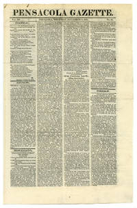
1826réf. 51016Pensacola. Nov. 9 1826. Very Early Florida Newspaper An incredibly early edition of one of the first newspapers in Florida. Founded in 1824 the Pensacola Gazette was issued on a weekly basis for approximately thirty-five years ending in 1861. This four-page issue covers basic interests such as foreign affairs local news and classifieds. Rare. Bifolium. Creases on final page flattened with repair tape. Bright and clean. Very good plus. unknown
1826réf. 51016Pensacola. Nov. 9 1826. Very Early Florida Newspaper An incredibly early edition of one of the first newspapers in Florida. Founded in 1824 the Pensacola Gazette was issued on a weekly basis for approximately thirty-five years ending in 1861. This four-page issue covers basic interests such as foreign affairs local news and classifieds. Rare. Bifolium. Creases on final page flattened with repair tape. Bright and clean. Very good plus. unknown books
1916réf. 40718Washington D.C.: Published by the United States Coast and Geodetic Survey 1916. Large folding nautical chart printed on heavy paper stock. Colored. A rare original coastal survey of the coastline north of Tampa including Tarpon Springs Palm Harbor Hudson and Anclote Keys. Established by President Thomas Jefferson in 1807 as the Survey of the Coast the U.S. Coast and Geodetic Survey was the United States' first civilian scientific agency. This agency has followed its mission to survey the U.S. coastline create nautical charts of the coast and help increase maritime safety since its founding and has often played fascinating roles in significant chapters of U.S. history. It served in all theaters of the Civil War in the service of the Union Army and Navy pioneered acoustic exploration in the wake of the sinking of the Titanic and during WWI it worked to detect enemy submarines. In addition this agency worked to survey and produce detailed maps and renderings of the U.S. coast. These nautical survey maps commonly referred to as "T-sheets" provide fascinating insights into the history of the United States coastline which has and will continue to shift. These maps are the most important data source for understanding the physical and ecological characteristics of the U.S. shoreline. The present map is a highly detailed and accurate sea chart of the Tampa region and an important historical view of a developing Florida. Published by the United States Coast and Geodetic Survey unknown
1916réf. 40718Washington D.C.: Published by the United States Coast and Geodetic Survey 1916. Large folding nautical chart printed on heavy paper stock. Colored. A rare original coastal survey of the coastline north of Tampa including Tarpon Springs Palm Harbor Hudson and Anclote Keys. Established by President Thomas Jefferson in 1807 as the Survey of the Coast the U.S. Coast and Geodetic Survey was the United States' first civilian scientific agency. This agency has followed its mission to survey the U.S. coastline create nautical charts of the coast and help increase maritime safety since its founding and has often played fascinating roles in significant chapters of U.S. history. It served in all theaters of the Civil War in the service of the Union Army and Navy pioneered acoustic exploration in the wake of the sinking of the Titanic and during WWI it worked to detect enemy submarines. In addition this agency worked to survey and produce detailed maps and renderings of the U.S. coast. These nautical survey maps commonly referred to as "T-sheets" provide fascinating insights into the history of the United States coastline which has and will continue to shift. These maps are the most important data source for understanding the physical and ecological characteristics of the U.S. shoreline. The present map is a highly detailed and accurate sea chart of the Tampa region and an important historical view of a developing Florida. Published by the United States Coast and Geodetic Survey unknown books
1763(4) ff., VIII-135-[46]-(1)-136 à 192 pp., (38) ff pour les observations météorologiques, (2) ff d'errata Veau marbré, dos à nerfs ornè, pièce de titre rouge, tranches rouges (Reliure de l'époque) 1763, 1763, in-4, (4) ff, VIII-135-[46]-(1)-136 à 192 pp, (38) ff pour les observations météorologiques, (2) ff d'errata, Veau marbré, dos à nerfs ornè, pièce de titre rouge, tranches rouges (Reliure de l'époque), Édition originale, ornée d'une carte dépliante de la Martinique de cette relation rédigée par le botaniste natif de la Martinique, Thibault de Chanvalon (1723-1788). Membre du conseil supérieur de l'île, il fut chargé d'en dresser la statistique. L'ouvrage renferme des renseignements sur la population, dont une étonnante description des "américains", l'économie, l'esclavage, la géographie, la faune et la flore, le climat, etc. L'année même de la publication de ce volume, Chanvalon sera nommé intendant de la nouvelle colonie de Guyane, là où le royaume plaçait ses espoirs après la perte du Canada ; l'expédition sera un véritable désastre, à la fois sur le plan humain et financier, entraînant la perte de milliers de colons et de plusieurs millions de livres. Bel exemplaire, malgré une trace d'eau sur le plat supérieur et une mouillure peu prononcée dans l'angle inf. des premiers et des derniers cahiers. Provenance : Cachet ancien de la Bibliothèque de Leugny. Chadenat, n°1067. ? Leclerc, n°311. ? Sabin, n°11936
1915réf. 40691Washington D.C.: Published by the United States Coast and Geodetic Survey 1915. Large folding nautical chat printed on heavy paper stock. Colored. A rare coastal survey of Cape Canaveral including the Kennedy Space Center Cocoa Beach Merritt Island and Satellite Beach. Established by President Thomas Jefferson in 1807 as the Survey of the Coast the U.S. Coast and Geodetic Survey was the United States' first civilian scientific agency. This agency has followed its mission to survey the U.S. coastline create nautical charts of the coast and help increase maritime safety since its founding and has often played fascinating roles in significant chapters of U.S. history. It served in all theaters of the Civil War in the service of the Union Army and Navy pioneered acoustic exploration in the wake of the sinking of the Titanic and during WWI it worked to detect enemy submarines. In addition this agency worked to survey and produce detailed maps and renderings of the U.S. coast. These nautical survey maps commonly referred to as "T-sheets" provide fascinating insights into the history of the United States coastline which has and will continue to shift. These maps are the most important data source for understanding the physical and ecological characteristics of the U.S. shoreline. The present map is a highly detailed and accurate sea chart of Cape Canaveral and an important historical view of a developing Florida. Published by the United States Coast and Geodetic Survey unknown
1915réf. 40691Washington D.C.: Published by the United States Coast and Geodetic Survey 1915. Large folding nautical chat printed on heavy paper stock. Colored. A rare coastal survey of Cape Canaveral including the Kennedy Space Center Cocoa Beach Merritt Island and Satellite Beach. Established by President Thomas Jefferson in 1807 as the Survey of the Coast the U.S. Coast and Geodetic Survey was the United States' first civilian scientific agency. This agency has followed its mission to survey the U.S. coastline create nautical charts of the coast and help increase maritime safety since its founding and has often played fascinating roles in significant chapters of U.S. history. It served in all theaters of the Civil War in the service of the Union Army and Navy pioneered acoustic exploration in the wake of the sinking of the Titanic and during WWI it worked to detect enemy submarines. In addition this agency worked to survey and produce detailed maps and renderings of the U.S. coast. These nautical survey maps commonly referred to as "T-sheets" provide fascinating insights into the history of the United States coastline which has and will continue to shift. These maps are the most important data source for understanding the physical and ecological characteristics of the U.S. shoreline. The present map is a highly detailed and accurate sea chart of Cape Canaveral and an important historical view of a developing Florida. Published by the United States Coast and Geodetic Survey unknown books
1916réf. 40723Washington D.C.: Published by the United States Coast and Geodetic Survey 1916. Large folding nautical chart printed on heavy paper stock. Uncolored. A rare original coastal survey of the Cedar Keys and west-central coastline of Florida including Steinhatchee. Established by President Thomas Jefferson in 1807 as the Survey of the Coast the U.S. Coast and Geodetic Survey was the United States' first civilian scientific agency. This agency has followed its mission to survey the U.S. coastline create nautical charts of the coast and help increase maritime safety since its founding and has often played fascinating roles in significant chapters of U.S. history. It served in all theaters of the Civil War in the service of the Union Army and Navy pioneered acoustic exploration in the wake of the sinking of the Titanic and during WWI it worked to detect enemy submarines. In addition this agency worked to survey and produce detailed maps and renderings of the U.S. coast. These nautical survey maps commonly referred to as "T-sheets" provide fascinating insights into the history of the United States coastline which has and will continue to shift. These maps are the most important data source for understanding the physical and ecological characteristics of the U.S. shoreline. The present map is a highly detailed and accurate sea chart of the Cedar Keys region and an important historical view of a developing Florida. Published by the United States Coast and Geodetic Survey unknown
1916réf. 40723Washington D.C.: Published by the United States Coast and Geodetic Survey 1916. Large folding nautical chart printed on heavy paper stock. Uncolored. A rare original coastal survey of the Cedar Keys and west-central coastline of Florida including Steinhatchee. Established by President Thomas Jefferson in 1807 as the Survey of the Coast the U.S. Coast and Geodetic Survey was the United States' first civilian scientific agency. This agency has followed its mission to survey the U.S. coastline create nautical charts of the coast and help increase maritime safety since its founding and has often played fascinating roles in significant chapters of U.S. history. It served in all theaters of the Civil War in the service of the Union Army and Navy pioneered acoustic exploration in the wake of the sinking of the Titanic and during WWI it worked to detect enemy submarines. In addition this agency worked to survey and produce detailed maps and renderings of the U.S. coast. These nautical survey maps commonly referred to as "T-sheets" provide fascinating insights into the history of the United States coastline which has and will continue to shift. These maps are the most important data source for understanding the physical and ecological characteristics of the U.S. shoreline. The present map is a highly detailed and accurate sea chart of the Cedar Keys region and an important historical view of a developing Florida. Published by the United States Coast and Geodetic Survey unknown books
1916réf. 40704Washington D.C.: Published by the United States Coast and Geodetic Survey 1916. Nautical chart printed on heavy paper stock. Colored. A rare coastal survey of the border of Georgia and Florida including Cumberland Island Fernandina and Amelia Island. Established by President Thomas Jefferson in 1807 as the Survey of the Coast the U.S. Coast and Geodetic Survey was the United States' first civilian scientific agency. This agency has followed its mission to survey the U.S. coastline create nautical charts of the coast and help increase maritime safety since its founding and has often played fascinating roles in significant chapters of U.S. history. It served in all theaters of the Civil War in the service of the Union Army and Navy pioneered acoustic exploration in the wake of the sinking of the Titanic and during WWI it worked to detect enemy submarines. In addition this agency worked to survey and produce detailed maps and renderings of the U.S. coast. These nautical survey maps commonly referred to as "T-sheets" provide fascinating insights into the history of the United States coastline which has and will continue to shift. These maps are the most important data source for understanding the physical and ecological characteristics of the U.S. shoreline. The present map is a highly detailed and accurate sea chart of the Fernandina area and an important historical view of a developing Florida. Published by the United States Coast and Geodetic Survey unknown
1916réf. 40704Washington D.C.: Published by the United States Coast and Geodetic Survey 1916. Nautical chart printed on heavy paper stock. Colored. A rare coastal survey of the border of Georgia and Florida including Cumberland Island Fernandina and Amelia Island. Established by President Thomas Jefferson in 1807 as the Survey of the Coast the U.S. Coast and Geodetic Survey was the United States' first civilian scientific agency. This agency has followed its mission to survey the U.S. coastline create nautical charts of the coast and help increase maritime safety since its founding and has often played fascinating roles in significant chapters of U.S. history. It served in all theaters of the Civil War in the service of the Union Army and Navy pioneered acoustic exploration in the wake of the sinking of the Titanic and during WWI it worked to detect enemy submarines. In addition this agency worked to survey and produce detailed maps and renderings of the U.S. coast. These nautical survey maps commonly referred to as "T-sheets" provide fascinating insights into the history of the United States coastline which has and will continue to shift. These maps are the most important data source for understanding the physical and ecological characteristics of the U.S. shoreline. The present map is a highly detailed and accurate sea chart of the Fernandina area and an important historical view of a developing Florida. Published by the United States Coast and Geodetic Survey unknown books
1920réf. 40683Washington D.C.: Published by the United States Coast and Geodetic Survey 1920. Nautical chart printed on heavy paper stock. Colored. A rare coastal survey of Pensacola Bay including Pensacola and Santa Rosa Island. Established by President Thomas Jefferson in 1807 as the Survey of the Coast the U.S. Coast and Geodetic Survey was the United States' first civilian scientific agency. This agency has followed its mission to survey the U.S. coastline create nautical charts of the coast and help increase maritime safety since its founding and has often played fascinating roles in significant chapters of U.S. history. It served in all theaters of the Civil War in the service of the Union Army and Navy pioneered acoustic exploration in the wake of the sinking of the Titanic and during WWI it worked to detect enemy submarines. In addition this agency worked to survey and produce detailed maps and renderings of the U.S. coast. These nautical survey maps commonly referred to as "T-sheets" provide fascinating insights into the history of the United States coastline which has and will continue to shift. These maps are the most important data source for understanding the physical and ecological characteristics of the U.S. shoreline. The present map is a highly detailed and accurate sea chart of the Pensacola Bay and an important historical view of a developing Florida. Published by the United States Coast and Geodetic Survey unknown
1920réf. 40683Washington D.C.: Published by the United States Coast and Geodetic Survey 1920. Nautical chart printed on heavy paper stock. Colored. A rare coastal survey of Pensacola Bay including Pensacola and Santa Rosa Island. Established by President Thomas Jefferson in 1807 as the Survey of the Coast the U.S. Coast and Geodetic Survey was the United States' first civilian scientific agency. This agency has followed its mission to survey the U.S. coastline create nautical charts of the coast and help increase maritime safety since its founding and has often played fascinating roles in significant chapters of U.S. history. It served in all theaters of the Civil War in the service of the Union Army and Navy pioneered acoustic exploration in the wake of the sinking of the Titanic and during WWI it worked to detect enemy submarines. In addition this agency worked to survey and produce detailed maps and renderings of the U.S. coast. These nautical survey maps commonly referred to as "T-sheets" provide fascinating insights into the history of the United States coastline which has and will continue to shift. These maps are the most important data source for understanding the physical and ecological characteristics of the U.S. shoreline. The present map is a highly detailed and accurate sea chart of the Pensacola Bay and an important historical view of a developing Florida. Published by the United States Coast and Geodetic Survey unknown books
1916réf. 40684Washington D.C.: Published by the United States Coast and Geodetic Survey 1916. Nautical chart printed on heavy paper stock. Colored. A rare coastal survey of Florida from Venice Beach to Fort Myers including Cape Coral Boca Grande and Port Charlotte. Established by President Thomas Jefferson in 1807 as the Survey of the Coast the U.S. Coast and Geodetic Survey was the United States' first civilian scientific agency. This agency has followed its mission to survey the U.S. coastline create nautical charts of the coast and help increase maritime safety since its founding and has often played fascinating roles in significant chapters of U.S. history. It served in all theaters of the Civil War in the service of the Union Army and Navy pioneered acoustic exploration in the wake of the sinking of the Titanic and during WWI it worked to detect enemy submarines. In addition this agency worked to survey and produce detailed maps and renderings of the U.S. coast. These nautical survey maps commonly referred to as "T-sheets" provide fascinating insights into the history of the United States coastline which has and will continue to shift. These maps are the most important data source for understanding the physical and ecological characteristics of the U.S. shoreline. The present map is a highly detailed and accurate sea chart of the Fort Myers area and an important historical view of a developing Florida. Published by the United States Coast and Geodetic Survey unknown
1916réf. 40684Washington D.C.: Published by the United States Coast and Geodetic Survey 1916. Nautical chart printed on heavy paper stock. Colored. A rare coastal survey of Florida from Venice Beach to Fort Myers including Cape Coral Boca Grande and Port Charlotte. Established by President Thomas Jefferson in 1807 as the Survey of the Coast the U.S. Coast and Geodetic Survey was the United States' first civilian scientific agency. This agency has followed its mission to survey the U.S. coastline create nautical charts of the coast and help increase maritime safety since its founding and has often played fascinating roles in significant chapters of U.S. history. It served in all theaters of the Civil War in the service of the Union Army and Navy pioneered acoustic exploration in the wake of the sinking of the Titanic and during WWI it worked to detect enemy submarines. In addition this agency worked to survey and produce detailed maps and renderings of the U.S. coast. These nautical survey maps commonly referred to as "T-sheets" provide fascinating insights into the history of the United States coastline which has and will continue to shift. These maps are the most important data source for understanding the physical and ecological characteristics of the U.S. shoreline. The present map is a highly detailed and accurate sea chart of the Fort Myers area and an important historical view of a developing Florida. Published by the United States Coast and Geodetic Survey unknown books
1918réf. 40725Washington D.C.: Published by the United States Coast and Geodetic Survey 1918. Large folding nautical chart printed on heavy paper stock. Colored. A rare original coastal survey of the far Lower Keys region including Marquesas Keys and Boca Grande Key. Established by President Thomas Jefferson in 1807 as the Survey of the Coast the U.S. Coast and Geodetic Survey was the United States' first civilian scientific agency. This agency has followed its mission to survey the U.S. coastline create nautical charts of the coast and help increase maritime safety since its founding and has often played fascinating roles in significant chapters of U.S. history. It served in all theaters of the Civil War in the service of the Union Army and Navy pioneered acoustic exploration in the wake of the sinking of the Titanic and during WWI it worked to detect enemy submarines. In addition this agency worked to survey and produce detailed maps and renderings of the U.S. coast. These nautical survey maps commonly referred to as "T-sheets" provide fascinating insights into the history of the United States coastline which has and will continue to shift. These maps are the most important data source for understanding the physical and ecological characteristics of the U.S. shoreline. The present map is a highly detailed and accurate sea chart of the Lower Keys region and an important historical view of a developing Florida. Published by the United States Coast and Geodetic Survey unknown
1918réf. 40725Washington D.C.: Published by the United States Coast and Geodetic Survey 1918. Large folding nautical chart printed on heavy paper stock. Colored. A rare original coastal survey of the far Lower Keys region including Marquesas Keys and Boca Grande Key. Established by President Thomas Jefferson in 1807 as the Survey of the Coast the U.S. Coast and Geodetic Survey was the United States' first civilian scientific agency. This agency has followed its mission to survey the U.S. coastline create nautical charts of the coast and help increase maritime safety since its founding and has often played fascinating roles in significant chapters of U.S. history. It served in all theaters of the Civil War in the service of the Union Army and Navy pioneered acoustic exploration in the wake of the sinking of the Titanic and during WWI it worked to detect enemy submarines. In addition this agency worked to survey and produce detailed maps and renderings of the U.S. coast. These nautical survey maps commonly referred to as "T-sheets" provide fascinating insights into the history of the United States coastline which has and will continue to shift. These maps are the most important data source for understanding the physical and ecological characteristics of the U.S. shoreline. The present map is a highly detailed and accurate sea chart of the Lower Keys region and an important historical view of a developing Florida. Published by the United States Coast and Geodetic Survey unknown books