[Florida]ABAA

2566 risultati
1917rif. 40734Washington D.C.: Published by the United States Coast and Geodetic Survey 1917. Large folding nautical chart printed on heavy paper stock. Colored. A rare original coastal survey of Florida from Vero Beach to Jupiter including Fort Pierce Port St. Lucie Stuart and the Hobe Sound with an inset map of the Narrows in the upper left corner. Established by President Thomas Jefferson in 1807 as the Survey of the Coast the U.S. Coast and Geodetic Survey was the United States' first civilian scientific agency. This agency has followed its mission to survey the U.S. coastline create nautical charts of the coast and help increase maritime safety since its founding and has often played fascinating roles in significant chapters of U.S. history. It served in all theaters of the Civil War in the service of the Union Army and Navy pioneered acoustic exploration in the wake of the sinking of the Titanic and during WWI it worked to detect enemy submarines. In addition this agency worked to survey and produce detailed maps and renderings of the U.S. coast. These nautical survey maps commonly referred to as "T-sheets" provide fascinating insights into the history of the United States coastline which has and will continue to shift. These maps are the most important data source for understanding the physical and ecological characteristics of the U.S. shoreline. The present map of the Florida coastline was issued before the incorporation of Jupiter Township in 1925 and predates the development of Route 1. A railroad is marked as following the approximate route of the highway. This map is a highly detailed and accurate sea chart of the Jupiter region and an important historical view of a developing Florida. Published by the United States Coast and Geodetic Survey unknown books
1917rif. 40733Washington D.C.: Published by the United States Coast and Geodetic Survey 1917. Large folding nautical chart printed on heavy paper stock. Colored. A rare original coastal survey of the south eastern Florida coastline from Boca Raton to Jupiter encompassing Lake Worth West Palm Beach and Delray Beach. Established by President Thomas Jefferson in 1807 as the Survey of the Coast the U.S. Coast and Geodetic Survey was the United States' first civilian scientific agency. This agency has followed its mission to survey the U.S. coastline create nautical charts of the coast and help increase maritime safety since its founding and has often played fascinating roles in significant chapters of U.S. history. It served in all theaters of the Civil War in the service of the Union Army and Navy pioneered acoustic exploration in the wake of the sinking of the Titanic and during WWI it worked to detect enemy submarines. In addition this agency worked to survey and produce detailed maps and renderings of the U.S. coast. These nautical survey maps commonly referred to as "T-sheets" provide fascinating insights into the history of the United States coastline which has and will continue to shift. These maps are the most important data source for understanding the physical and ecological characteristics of the U.S. shoreline. The present map is a highly detailed and accurate sea chart of the coast of southeast Florida and an important historical view of the developing state. Published by the United States Coast and Geodetic Survey unknown
1917rif. 40733Washington D.C.: Published by the United States Coast and Geodetic Survey 1917. Large folding nautical chart printed on heavy paper stock. Colored. A rare original coastal survey of the south eastern Florida coastline from Boca Raton to Jupiter encompassing Lake Worth West Palm Beach and Delray Beach. Established by President Thomas Jefferson in 1807 as the Survey of the Coast the U.S. Coast and Geodetic Survey was the United States' first civilian scientific agency. This agency has followed its mission to survey the U.S. coastline create nautical charts of the coast and help increase maritime safety since its founding and has often played fascinating roles in significant chapters of U.S. history. It served in all theaters of the Civil War in the service of the Union Army and Navy pioneered acoustic exploration in the wake of the sinking of the Titanic and during WWI it worked to detect enemy submarines. In addition this agency worked to survey and produce detailed maps and renderings of the U.S. coast. These nautical survey maps commonly referred to as "T-sheets" provide fascinating insights into the history of the United States coastline which has and will continue to shift. These maps are the most important data source for understanding the physical and ecological characteristics of the U.S. shoreline. The present map is a highly detailed and accurate sea chart of the coast of southeast Florida and an important historical view of the developing state. Published by the United States Coast and Geodetic Survey unknown books
1990rif. 26721Tallahassee FL: Gallery & Museum School of Visual Arts & Dance Florida State University. New. Paperback. FREE UPGRADE to Courier/Priority Shipping Upon Request - IN STOCK AND IMMEDIATELY AVAILABLE FOR SHIPMENT - FLAWLESS COPY BRAND NEW PRISTINE NEVER OPENED -- with a bonus offer--; T-FLORFIBE; Florida State University Gallery & Museum Arte Textil Fibers USA - Colombia - Florida State University Gallery & Museum Tallahassee - 9/28/90 - 10/22/90 . 1990. Gallery & Museum School of Visual Arts & Dance, Florida State University paperback
1990rif. 26722Tallahassee FL: Florida State University Gallery & Museum. New. Paperback. FREE UPGRADE to Courier/Priority Shipping Upon Request - IN STOCK AND IMMEDIATELY AVAILABLE FOR SHIPMENT - -- with a bonus offer--; T-FLORDESH; Florida State University Gallery & Museum; Hobbs Robert Arthur Deshaies: Casting Doubt - Florida State University Gallery & Museum - 1/12/90 - 2/4/90 . 1990. Florida State University Gallery & Museum paperback
1988rif. 26723Tallahassee FL: Florida State University Institute for Contemporary Art. New. Paperback. FREE UPGRADE to Courier/Priority Shipping Upon Request - IN STOCK AND IMMEDIATELY AVAILABLE FOR SHIPMENT - -- with a bonus offer--; T-FLORATHAN; Florida State University Gallery & Museum Athanor VII - Florida State University - Journal of the Institute for Contemporary Art . 1988. Florida State University Institute for Contemporary Art paperback
1991rif. 26727Tallahassee FL: Florida State University Gallery & Museum. As New. Paperback. FREE UPGRADE to Courier/Priority Shipping Upon Request - IN STOCK AND IMMEDIATELY AVAILABLE FOR SHIPMENT - AS NEW THE TEXT BLOCK IS PRISTINE CLEAN UNMARKED AND IN EXCELLENT CONDITION - -- -- with a bonus offer--; T-FLORHANSON; Hobbs Robert; Florida State University Gallery & Museum Duane Hanson - The New Objectivity - Florida State University Gallery & Museum - Tallahassee FL - 2/8/91 - 3/10/91 . 1991. Florida State University Gallery & Museum paperback
1996rif. 26724Tallahassee FL: Dance. As New. Paperback. FREE UPGRADE to Courier/Priority Shipping Upon Request - IN STOCK AND IMMEDIATELY AVAILABLE FOR SHIPMENT - -- with a bonus offer--; T-FLORMAGIC; Museum of Fine Arts / Florida State University School of Visual Arts & Dance My Magic Pours Secret Libations - Museum of Fine Arts / Florida State University School of Visual Arts & Dance - Tallahassee FL - 2/16/96 - 4/6/96 . 1996. Dance paperback
1969rif. 59289St. Petersburg Florida: Museum of Fine Arts. As New. Paperback. FREE UPGRADE to Courier/Priority Shipping Upon Request – – IN STOCK AND IMMEDIATELY AVAILABLE FOR SHIPMENT - AS NEW THE TEXT BLOCK IS PRISTINE CLEAN UNMARKED AND IN EXCELLENT CONDITION - - 48 pp. With 27 ills. 2 col. . 23 x 27 cm. -- with a bonus offer-- . 1969. Museum of Fine Arts paperback
1978rif. 58098University Gallery University of Florida. As New. Paperback. FREE UPGRADE to Courier/Priority Shipping Upon Request – – IN STOCK AND IMMEDIATELY AVAILABLE FOR SHIPMENT - AS NEW THE TEXT BLOCK IS PRISTINE CLEAN UNMARKED AND IN EXCELLENT CONDITION - - 52 pp. With one text ill. And 28 ills. On 20 pls. One map. 23 x 19 cm. -- with a bonus offer-- . 1978. University Gallery, University of Florida paperback
1970rif. 59605Gainesville Florida U. S. A. : University Gallery University of Florida. As New. Paperback. FREE UPGRADE to Courier/Priority Shipping Upon Request – – IN STOCK AND IMMEDIATELY AVAILABLE FOR SHIPMENT - AS NEW THE TEXT BLOCK IS PRISTINE CLEAN UNMARKED AND IN EXCELLENT CONDITION - - 22 pp. With 16 ills. 23 x 19 cm. -- with a bonus offer-- . 1970. University Gallery, University of Florida paperback
1981rif. 26725Tallahassee FL: University. As New. Paperback. FREE UPGRADE to Courier/Priority Shipping Upon Request - IN STOCK AND IMMEDIATELY AVAILABLE FOR SHIPMENT - -- with a bonus offer--; T-FLORWILE; University Fine Arts Galleries School of Visual Arts - Florida State University William T. Wiley - University Fine Arts Galleries School of Visual Arts - Florida State University - Tallahassee FL - May 2 - 31 1981 . 1981. University paperback
1916rif. 40727Washington D.C.: Published by the United States Coast and Geodetic Survey 1916. Large folding nautical chart printed on heavy paper stock. Colored. A rare original coastal survey of Cape Canaveral to Key West including Jupiter West Palm Beach Boca Raton Fort Lauderdale Hollywood Miami the Keys the Everglades Naples and the Bahamas. Established by President Thomas Jefferson in 1807 as the Survey of the Coast the U.S. Coast and Geodetic Survey was the United States' first civilian scientific agency. This agency has followed its mission to survey the U.S. coastline create nautical charts of the coast and help increase maritime safety since its founding and has often played fascinating roles in significant chapters of U.S. history. It served in all theaters of the Civil War in the service of the Union Army and Navy pioneered acoustic exploration in the wake of the sinking of the Titanic and during WWI it worked to detect enemy submarines. In addition this agency worked to survey and produce detailed maps and renderings of the U.S. coast. These nautical survey maps commonly referred to as "T-sheets" provide fascinating insights into the history of the United States coastline which has and will continue to shift. These maps are the most important data source for understanding the physical and ecological characteristics of the U.S. shoreline. The present map is a highly detailed and accurate sea chart of Florida's Coast and Keys region and an important historical view of the developing state. Published by the United States Coast and Geodetic Survey unknown
1916rif. 40727Washington D.C.: Published by the United States Coast and Geodetic Survey 1916. Large folding nautical chart printed on heavy paper stock. Colored. A rare original coastal survey of Cape Canaveral to Key West including Jupiter West Palm Beach Boca Raton Fort Lauderdale Hollywood Miami the Keys the Everglades Naples and the Bahamas. Established by President Thomas Jefferson in 1807 as the Survey of the Coast the U.S. Coast and Geodetic Survey was the United States' first civilian scientific agency. This agency has followed its mission to survey the U.S. coastline create nautical charts of the coast and help increase maritime safety since its founding and has often played fascinating roles in significant chapters of U.S. history. It served in all theaters of the Civil War in the service of the Union Army and Navy pioneered acoustic exploration in the wake of the sinking of the Titanic and during WWI it worked to detect enemy submarines. In addition this agency worked to survey and produce detailed maps and renderings of the U.S. coast. These nautical survey maps commonly referred to as "T-sheets" provide fascinating insights into the history of the United States coastline which has and will continue to shift. These maps are the most important data source for understanding the physical and ecological characteristics of the U.S. shoreline. The present map is a highly detailed and accurate sea chart of Florida's Coast and Keys region and an important historical view of the developing state. Published by the United States Coast and Geodetic Survey unknown books
1922rif. 40720Washington D.C.: Published by the United States Coast and Geodetic Survey 1922. Large folding nautical chart printed on heavy paper stock. Colored. A rare original coastal survey of Key West Harbor. Established by President Thomas Jefferson in 1807 as the Survey of the Coast the U.S. Coast and Geodetic Survey was the United States' first civilian scientific agency. This agency has followed its mission to survey the U.S. coastline create nautical charts of the coast and help increase maritime safety since its founding and has often played fascinating roles in significant chapters of U.S. history. It served in all theaters of the Civil War in the service of the Union Army and Navy pioneered acoustic exploration in the wake of the sinking of the Titanic and during WWI it worked to detect enemy submarines. In addition this agency worked to survey and produce detailed maps and renderings of the U.S. coast. These nautical survey maps commonly referred to as "T-sheets" provide fascinating insights into the history of the United States coastline which has and will continue to shift. These maps are the most important data source for understanding the physical and ecological characteristics of the U.S. shoreline. The present map of the Florida coastline is notable in displaying the Overseas Railroad as the only main land transportation link between the Keys. At the time this map was published the overseas highway had yet to be built and tourism and travel in the region was limited to boat or train. This map is a highly detailed and accurate sea chart of Key West and an important historical view of a developing Florida. Published by the United States Coast and Geodetic Survey unknown
1922rif. 40720Washington D.C.: Published by the United States Coast and Geodetic Survey 1922. Large folding nautical chart printed on heavy paper stock. Colored. A rare original coastal survey of Key West Harbor. Established by President Thomas Jefferson in 1807 as the Survey of the Coast the U.S. Coast and Geodetic Survey was the United States' first civilian scientific agency. This agency has followed its mission to survey the U.S. coastline create nautical charts of the coast and help increase maritime safety since its founding and has often played fascinating roles in significant chapters of U.S. history. It served in all theaters of the Civil War in the service of the Union Army and Navy pioneered acoustic exploration in the wake of the sinking of the Titanic and during WWI it worked to detect enemy submarines. In addition this agency worked to survey and produce detailed maps and renderings of the U.S. coast. These nautical survey maps commonly referred to as "T-sheets" provide fascinating insights into the history of the United States coastline which has and will continue to shift. These maps are the most important data source for understanding the physical and ecological characteristics of the U.S. shoreline. The present map of the Florida coastline is notable in displaying the Overseas Railroad as the only main land transportation link between the Keys. At the time this map was published the overseas highway had yet to be built and tourism and travel in the region was limited to boat or train. This map is a highly detailed and accurate sea chart of Key West and an important historical view of a developing Florida. Published by the United States Coast and Geodetic Survey unknown books
1864rif. 63452Richmond VA 1864. 4to one-page on blue paper the text in full: "In compliance with your request I have the honor to transmit herewith copy of my letter to the Hon. W. Porcher Miles on the subject of the torpedo boats"; with a "Rebel Archives" stamp on verso. Chambliss 1809-1875; Sussex County Virginia plantation owner and member of the Confederate House of Representatives 1862-1865 was a member of the house Naval Affairs committee and William Porcher Miles 1822-1899; Mayor of Charleston South Carolina 1855-1857 U.S. House of Representatives 1857-1860 Confederate House of Representatives 1862-1865 was chairman of the house Military Affairs committee. This letter was written several months after the Confederacy's first torpedo boat the David made its initial attack against the Union ship New Ironsides in Charleston Harbor 5 October 1863 and two months before its second against the USS Memphis 6 March 1864. After two failed attempts at a sortie in 1863 losing 13 crew members in the process the Hunley became the first torpedo boat to actually sink a war vessel successfully completing its mission against the USS Housatonic in Charleston Harbor on February 17 1864. Very good Mallory's signature strong and black. Folded. 10187. unknown
1864rif. 63452Richmond VA 1864. 4to one-page on blue paper the text in full: "In compliance with your request I have the honor to transmit herewith copy of my letter to the Hon. W. Porcher Miles on the subject of the torpedo boats"; with a "Rebel Archives" stamp on verso. Chambliss 1809-1875; Sussex County Virginia plantation owner and member of the Confederate House of Representatives 1862-1865 was a member of the house Naval Affairs committee and William Porcher Miles 1822-1899; Mayor of Charleston South Carolina 1855-1857 U.S. House of Representatives 1857-1860 Confederate House of Representatives 1862-1865 was chairman of the house Military Affairs committee. This letter was written several months after the Confederacy's first torpedo boat the David made its initial attack against the Union ship New Ironsides in Charleston Harbor 5 October 1863 and two months before its second against the USS Memphis 6 March 1864. After two failed attempts at a sortie in 1863 losing 13 crew members in the process the Hunley became the first torpedo boat to actually sink a war vessel successfully completing its mission against the USS Housatonic in Charleston Harbor on February 17 1864. Very good Mallory's signature strong and black. Folded. 10187. unknown books
1700rif. 17337Amsterdam, de Wit, 1675 (recte um 1700). Ca. 49,5 cm x 57 cm. [4 Warenabbildungen]
1882rif. 678131882. FLORIDA. Illustrated Florida. Buffalo. 1882. Nineteen chromolithographed views. In original illustrated slipcase. Original retail sticker on back cover small previous owner's label to each side. One chromolithograph creased others in excellent condition. A beautiful series of small chromolithographs of vacationing scenes in northern Florida from the early days of its tourist era. Scenes are in and around Jacksonville along the St. John's River Palatka St. Augustine along the Ocklawaha River and generic southern scenes. The Dodge Company of Buffalo made similar portfolios for other vacation spots. unknown
1919rif. 40697Washington D.C.: Published by the United States Coast and Geodetic Survey 1919. Large folding nautical chart printed on heavy paper stock. Colored. A rare coastal survey of Key West Harbor including Key West and several anchorage points for potential naval use complete with a U.S. Navy seal. Established by President Thomas Jefferson in 1807 as the Survey of the Coast the U.S. Coast and Geodetic Survey was the United States' first civilian scientific agency. This agency has followed its mission to survey the U.S. coastline create nautical charts of the coast and help increase maritime safety since its founding and has often played fascinating roles in significant chapters of U.S. history. It served in all theaters of the Civil War in the service of the Union Army and Navy pioneered acoustic exploration in the wake of the sinking of the Titanic and during WWI it worked to detect enemy submarines. In addition this agency worked to survey and produce detailed maps and renderings of the U.S. coast. These nautical survey maps commonly referred to as "T-sheets" provide fascinating insights into the history of the United States coastline which has and will continue to shift. These maps are the most important data source for understanding the physical and ecological characteristics of the U.S. shoreline. The present map is a highly detailed and accurate sea chart of Key West and an important historical view of a developing Florida. Published by the United States Coast and Geodetic Survey unknown
1919rif. 40697Washington D.C.: Published by the United States Coast and Geodetic Survey 1919. Large folding nautical chart printed on heavy paper stock. Colored. A rare coastal survey of Key West Harbor including Key West and several anchorage points for potential naval use complete with a U.S. Navy seal. Established by President Thomas Jefferson in 1807 as the Survey of the Coast the U.S. Coast and Geodetic Survey was the United States' first civilian scientific agency. This agency has followed its mission to survey the U.S. coastline create nautical charts of the coast and help increase maritime safety since its founding and has often played fascinating roles in significant chapters of U.S. history. It served in all theaters of the Civil War in the service of the Union Army and Navy pioneered acoustic exploration in the wake of the sinking of the Titanic and during WWI it worked to detect enemy submarines. In addition this agency worked to survey and produce detailed maps and renderings of the U.S. coast. These nautical survey maps commonly referred to as "T-sheets" provide fascinating insights into the history of the United States coastline which has and will continue to shift. These maps are the most important data source for understanding the physical and ecological characteristics of the U.S. shoreline. The present map is a highly detailed and accurate sea chart of Key West and an important historical view of a developing Florida. Published by the United States Coast and Geodetic Survey unknown books
1723rif. 6495AMadrid, Franco, 1723. 4°. XXX, II, 268 S., XII S. Pergamentband der Zeit.
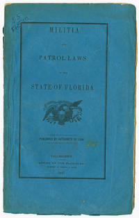
1847rif. 49540Tallahassee: Office of the Floridian 1847. Militia Laws of Florida The first rules governing the militia for the new state of Florida with the first act establishing and organizing the militia in 1846 with subsequent acts laying out the duties of various officers and the rules governing the militia. Very rare. Servies records one copy at the University of Florida's P.K. Yonge Library of Florida History; OCLC records only five others. Original blue printed wrappers. Spine chipped minor soiling old ink call number on front cover. Minor foxing. Else very good. SERVIES 3239. AII FLORIDA 281. McMURTRIE FLORIDA 142. OCLC 28826102. unknown
1847rif. 49540Tallahassee: Office of the Floridian 1847. Militia Laws of Florida The first rules governing the militia for the new state of Florida with the first act establishing and organizing the militia in 1846 with subsequent acts laying out the duties of various officers and the rules governing the militia. Very rare. Servies records one copy at the University of Florida's P.K. Yonge Library of Florida History; OCLC records only five others. Original blue printed wrappers. Spine chipped minor soiling old ink call number on front cover. Minor foxing. Else very good. SERVIES 3239. AII FLORIDA 281. McMURTRIE FLORIDA 142. OCLC 28826102. unknown books