Florida East Coast RailwayBiblio.com
rif. 1162107375.Ghardcover. Good. Access codes and supplements are not guaranteed with used items. May be an ex-library book. hardcover
1890rif. 59940Key West FL: Hunt Photographer 211 Duval St. ca. 1890. Oblong 8vo. One albumen photo sized 4.25 x 6.5 in. mounted on printed 5.25 x 8.5 in. boudoir-sized studio board w/ photographer’s imprint in lower margin of board manuscript pencil title on verso minor chipping & slight tears to upper fore-edge of image still a VG- photo w/ bright strong contrast. A scarce 19th-century albumen boudoir photograph capturing the historic fish market in Key West Florida which at the time held a monopoly on the sponge trade in the United States. Beginning with sponges introduced before the Civil War eventually 1200 spongers on hook boats caught up to 2000 tons of sponges a year. At the time turtling or turtle fishing was a significant industry and the Charter Fishing Boat presence was still quite small and would eventually grow during the Progressive Era drawing ever greater numbers of tourists. Hunt fl. 1880-1900 in Key West Florida operated a photography studio at 211 Duval for over a decade and was originally from Indiana. Hunt, Photographer, 211 Duval St., unknown
1922rif. 40720Washington D.C.: Published by the United States Coast and Geodetic Survey 1922. Large folding nautical chart printed on heavy paper stock. Colored. A rare original coastal survey of Key West Harbor. Established by President Thomas Jefferson in 1807 as the Survey of the Coast the U.S. Coast and Geodetic Survey was the United States' first civilian scientific agency. This agency has followed its mission to survey the U.S. coastline create nautical charts of the coast and help increase maritime safety since its founding and has often played fascinating roles in significant chapters of U.S. history. It served in all theaters of the Civil War in the service of the Union Army and Navy pioneered acoustic exploration in the wake of the sinking of the Titanic and during WWI it worked to detect enemy submarines. In addition this agency worked to survey and produce detailed maps and renderings of the U.S. coast. These nautical survey maps commonly referred to as "T-sheets" provide fascinating insights into the history of the United States coastline which has and will continue to shift. These maps are the most important data source for understanding the physical and ecological characteristics of the U.S. shoreline. The present map of the Florida coastline is notable in displaying the Overseas Railroad as the only main land transportation link between the Keys. At the time this map was published the overseas highway had yet to be built and tourism and travel in the region was limited to boat or train. This map is a highly detailed and accurate sea chart of Key West and an important historical view of a developing Florida. Published by the United States Coast and Geodetic Survey unknown
1919rif. 40697Washington D.C.: Published by the United States Coast and Geodetic Survey 1919. Large folding nautical chart printed on heavy paper stock. Colored. A rare coastal survey of Key West Harbor including Key West and several anchorage points for potential naval use complete with a U.S. Navy seal. Established by President Thomas Jefferson in 1807 as the Survey of the Coast the U.S. Coast and Geodetic Survey was the United States' first civilian scientific agency. This agency has followed its mission to survey the U.S. coastline create nautical charts of the coast and help increase maritime safety since its founding and has often played fascinating roles in significant chapters of U.S. history. It served in all theaters of the Civil War in the service of the Union Army and Navy pioneered acoustic exploration in the wake of the sinking of the Titanic and during WWI it worked to detect enemy submarines. In addition this agency worked to survey and produce detailed maps and renderings of the U.S. coast. These nautical survey maps commonly referred to as "T-sheets" provide fascinating insights into the history of the United States coastline which has and will continue to shift. These maps are the most important data source for understanding the physical and ecological characteristics of the U.S. shoreline. The present map is a highly detailed and accurate sea chart of Key West and an important historical view of a developing Florida. Published by the United States Coast and Geodetic Survey unknown
1919rif. 40697Washington D.C.: Published by the United States Coast and Geodetic Survey 1919. Large folding nautical chart printed on heavy paper stock. Colored. A rare coastal survey of Key West Harbor including Key West and several anchorage points for potential naval use complete with a U.S. Navy seal. Established by President Thomas Jefferson in 1807 as the Survey of the Coast the U.S. Coast and Geodetic Survey was the United States' first civilian scientific agency. This agency has followed its mission to survey the U.S. coastline create nautical charts of the coast and help increase maritime safety since its founding and has often played fascinating roles in significant chapters of U.S. history. It served in all theaters of the Civil War in the service of the Union Army and Navy pioneered acoustic exploration in the wake of the sinking of the Titanic and during WWI it worked to detect enemy submarines. In addition this agency worked to survey and produce detailed maps and renderings of the U.S. coast. These nautical survey maps commonly referred to as "T-sheets" provide fascinating insights into the history of the United States coastline which has and will continue to shift. These maps are the most important data source for understanding the physical and ecological characteristics of the U.S. shoreline. The present map is a highly detailed and accurate sea chart of Key West and an important historical view of a developing Florida. Published by the United States Coast and Geodetic Survey unknown books
1922rif. 40720Washington D.C.: Published by the United States Coast and Geodetic Survey 1922. Large folding nautical chart printed on heavy paper stock. Colored. A rare original coastal survey of Key West Harbor. Established by President Thomas Jefferson in 1807 as the Survey of the Coast the U.S. Coast and Geodetic Survey was the United States' first civilian scientific agency. This agency has followed its mission to survey the U.S. coastline create nautical charts of the coast and help increase maritime safety since its founding and has often played fascinating roles in significant chapters of U.S. history. It served in all theaters of the Civil War in the service of the Union Army and Navy pioneered acoustic exploration in the wake of the sinking of the Titanic and during WWI it worked to detect enemy submarines. In addition this agency worked to survey and produce detailed maps and renderings of the U.S. coast. These nautical survey maps commonly referred to as "T-sheets" provide fascinating insights into the history of the United States coastline which has and will continue to shift. These maps are the most important data source for understanding the physical and ecological characteristics of the U.S. shoreline. The present map of the Florida coastline is notable in displaying the Overseas Railroad as the only main land transportation link between the Keys. At the time this map was published the overseas highway had yet to be built and tourism and travel in the region was limited to boat or train. This map is a highly detailed and accurate sea chart of Key West and an important historical view of a developing Florida. Published by the United States Coast and Geodetic Survey unknown books
1992rif. 39290München [u.a.] : List, 1992. 446 S. 8°. Dt. Ausg. Bibl.- Einbd.
1979rif. 97797Marathon, Florida, Selbstverlag, 1979. 12 S. mit einigen Zeichnungen. 21 cm. OBroschur.
rif. 842273-nnew. unknown
rif. 842273like new. unknown
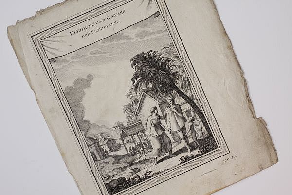
1758rif. 900141AG[Leipzig:, Arkstee und Merkus, 1758]. Kupferstich, Blattmaß: 23,5 x 20 cm. Bildmaß: 19 x 14 cm.
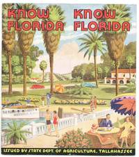
1938rif. 22342Tallahassee Florida: State Department of Agriculture 1938. Very Good/No Dust Jacket As Issued. SELLING THE SUNSHINE STATE THROUGH AGRICULTURE. A well-illustrated pre-World War II promotional booklet presenting Florida not primarily as a vacation destination but as one of America's most productive agricultural and commercial states. Issued by the Florida State Department of Agriculture Know Florida combines colorful cover art with statistical data photographs and concise essays documenting the state's citrus industry vegetable production transportation network state markets inspection services and expanding economy. Unlike the more common tourist brochures emphasizing beaches and resorts this publication focuses on Florida's agricultural infrastructure and commercial opportunities making it an informative snapshot of the state's economic priorities during the late 1930s. PHYSICAL CHARACTERISTICS: Quarto format measuring approximately 8 by 9 inches. Original color pictorial paper wrappers saddle stitched. Thirty-two pages illustrated throughout with numerous black-and-white photographs charts statistical tables and a full-color cover. Includes a full-page color illustration of Florida fruits on the rear cover. Printed on coated paper with photographic halftones throughout. ECONOMIC EMPHASIS RATHER THAN TOURISM. The publication illustrates the State's emphasis on agricultural production and commercial development. Subjects include Florida's physical statistics state inspection services wholesale markets citrus production vegetable farming poultry transportation systems and agricultural marketing accompanied by numerous documentary photographs. CONDITION: Very Good. The bindings are tight and square. Text is clean with light even age-toning. Moderate shelf handling wear to the covers. Typical vertical center fold from storage. Colors remain bright and attractive. A Very Good example. HISTORICAL SIGNIFICANCE: FLORIDA'S NEW DEAL AGRICULTURAL ECONOMY Issued during the closing years of the Great Depression Know Florida reflects the state's effort to promote itself as a modern agricultural powerhouse rather than simply a winter resort. Documenting Florida's extensive investment in state markets inspection programs transportation infrastructure and crop production at a time when citrus vegetables livestock and poultry formed the backbone of its economy. Serving as a valuable primary source for historians of Florida agriculture state-sponsored economic development and regional promotion the statistical tables photographs of markets and packing houses and discussions of inspection and marketing programs preserve information rarely found in conventional tourist ephemera. SUBJECTS: Citrus Industry Florida Agriculture State Markets Florida Ephemera New Deal Era Poultry Vegetable Farming Transportation Economic Development Florida Ephemera State Publications Agricultural History Americana Promotional Literature. State Department of Agriculture unknown
1787Carta geografica, in due fogli, raffigurante i territori di California, Messico, Texas, Luisiana e Florida. Rigobert Bonne (1727-1795) fu uno dei più importanti cartografi del tardo XVIII secolo. Nel 1773 succedette a Jacques Bellin come cartografo reale in Francia.
rif. ABE-1705690581818EN UNE: PHOTO FLORIDE RENAULT (24,5 CM X 12,5 CM, COULEURS)-VOISIN UN "LE CORBUSIER DE LA CARROSSERIE", 6 PHOTOS-PAGES 7 8 8 10 MANQUANTES-A BATZ OPERATION "RIDEAU DE FER" POUR UNE CHAPELLE, QUART DE PAGE, 2 PHOTOS, CHAPELLE DU MURIER-PETITES PLAGES DU GRAND PARIS, 3 PAGES, 7 PHOTOS, CARTE-PAGES 23/24 MANQUANTES-(EM124)
2015En voyage éditions, 2015. In-8 broché de 383 pages. Très bon état
1853rif. 351784Paris: Jannet 1853. One of 100 copies. 4 xvi 228pp. 12mo. Early calf backed marbled paper boards spine abraded. One of 100 copies. 4 xvi 228pp. 12mo. A reprint of the first edition of 1586 one of the earliest books on Florida and one of the first works to describe the native American tribes of Florida. "This rare little volume is dedicated to Sir Walter Raleigh in whose praise there are also several Latin poems; one of them by Hakluyt. It contains an account of Ribault's Voyage in 1562 Laudonniere's in 1564. Ribault's second voyage in 1565 and Gorgues' in 1567" Rich. According to Sabin 100 copies were printed of this edition. Sabin 39235. Sabin 39235 Jannet hardcover
1853rif. 0057281853 Paris, Jannet, 1853. Petit in-12 (157 X 102 mm) demi-veau marron foncé à coins, double filet doré sur les plats, dos à nerfs, caissons dorés, titre doré, tranches marbrées (Reliure de l'époque) ; (2) ff. de faux-titre et titre, XVI-228 pages. Rousseurs claires.
1946rif. 80808Lyon, Conseil historique et héraldique de France, 1946, gr. in-8° (15,3 x 23,5), (20)-(246)-(4) pp, 123 pages doubles, broché sous couverture rempliée titrée au dos, bon état. Reproduction en fac-similé de l'édition de Paris, Guillaume Auray, 1586, tirée à 475 exemplaires numérotés sur pur fil Lafuma à grandes marges non rognées (n° 65)
rif. ABE-17283211455016 PAGES-43 CM X 60 CM-EN UNE: KHROUCHTCHEV: LA PAIX DU MONDE SERA PLUS SOLIDE SI L'URSS ET LES ETATS-UNIS ETABLISSENT DES RAPPORTS D'AMITIE-CYCLISME JOB MORVAN VAINQUEUR DU TOUR DE L'OUEST, PHOTO, SUITE P5, PHOTO-P2: ANNY CORDY ET JEAN RICHARD BONJOUR PARIS, NOUS REVOICI, PHOTO-P6: EN ATTENDANT D'ETRE MAMAN B.B. ESSAIE SA "FLORIDE", PHOTO 9,5 CM X 12,5 CM-UN IMMEUBLE DE 560 METRES DE LONG, PHOTO, ENSEMBLE DES COURTILLIERES, PANTIN, BOBIGNY
1925rif. 51BgBruxelles Imprimerie Industrielle et Financière 1925 In8 32 pages - 17 photographies dans le texte - trés bon etat
1925rif. 51BgBruxelles Imprimerie Industrielle et Financière 1925 In8 32 pages - 17 photographies dans le texte - trés bon etat
1929In-4, brossura, in buono stato di conservazione. In questo numero: "Nella Florida, classica terra di cicloni, s'e abbattuto un nuovo spaventoso uragano che ha scoperchiato o addirittura raso al suolo innumerevoli case e ha distrutto i raccolti. Vi sono state molte vittime." "A un passaggio a livello sulla linea Montebelluna-Padova, un autocarro con rimorchio, carico di barili di birra, è stato investito dal treno. Il conducente e un operaio che si trovava pure sull'autocarro sono rimasti uccisi; il fuochista della locomotiva ha riportato leggiere ferite." .
1950In-4, brossura, in buono stato di conservazione. In questo numero: "Tigri del mare contro naufraghi dell'aria. Al largo della Florida un bimotore con a bordo 65 uomini, quasi tutti braccianti agricoli, e precipitato in Atlantico. Passeggeri ed equipaggio hanno fatto in tempo a uscire dalla carlinga mettendo a mare vari battellini pneumatici di salvataggio. Ma immediatamente le acque si sono popolate di una torma di grossi pescicani che hanno fatto strage. Dalle navi accorse sono state tratte in salvo solo 37 persone." "Fuoco antiaereo in tempo di pace. Nel Bergamasco, tra il Serio e il Cherio, per proteggere vigne e frutteti dalla grandine che ogni anno provoca gravi danni, sono state sparate con successo, all'avvicinarsi di un minaccioso nembo, varie serie di razzi che, scoppiando a grande altezza, hanno interrotto la grandinata e sconvolto la formazione temporalesca che si è sminuzzata e dispersa; cosicche le piantagioni sono state salve.".
1928In-4, brossura, in buono stato di conservazione. In questo numero: "Una brutta sorpresa. Nel porto di Pensacola (Florida), un velivolo, che si era appena staccato da terra, precipitava sopra un battello da diporto. Le tre persone che erano sull'imbarcazione rimasero miracolosamente incolumi. Il tenente che pilotava l'apparecchio riporto ferite lievissime." "Un dramma nella Manica. Una barca di salvataggio uscita da Rye, presso Folkestone, per accorrere in aiuto di un piroscafo, al ritorno, non lontano dalla terra, veniva ingoiata da una formidabile ondata. Tutti i diciassette uomini dell'equipaggio annegarono, sotto gli occhi delle loro famiglie, che si erano raccolte a pregare su una rupe.".
In 8° gr., tela edit. + sovrracop. e custodia, pp. 599. Ill. n.t. Es. fuori commercio della Cassa di Risparmio di Verona Vicenza Belluno. Stato di nuovo.