[Florida]Biblio.com

2555 risultati
1916rif. 40695Washington D.C.: Published by the United States Coast and Geodetic Survey 1916. Large folding nautical chart printed on heavy paper stock. Uncolored. A rare coastal survey of the Fort Myers area including the San Carlos Bay Caloosahatchee River Cape Coral Sanibel Island and Fort Myers Beach. Established by President Thomas Jefferson in 1807 as the Survey of the Coast the U.S. Coast and Geodetic Survey was the United States' first civilian scientific agency. This agency has followed its mission to survey the U.S. coastline create nautical charts of the coast and help increase maritime safety since its founding and has often played fascinating roles in significant chapters of U.S. history. It served in all theaters of the Civil War in the service of the Union Army and Navy pioneered acoustic exploration in the wake of the sinking of the Titanic and during WWI it worked to detect enemy submarines. In addition this agency worked to survey and produce detailed maps and renderings of the U.S. coast. These nautical survey maps commonly referred to as "T-sheets" provide fascinating insights into the history of the United States coastline which has and will continue to shift. These maps are the most important data source for understanding the physical and ecological characteristics of the U.S. shoreline. The present map is a highly detailed and accurate sea chart of Fort Myers area and an important historical view of a developing Florida. Published by the United States Coast and Geodetic Survey unknown
1916rif. 40695Washington D.C.: Published by the United States Coast and Geodetic Survey 1916. Large folding nautical chart printed on heavy paper stock. Uncolored. A rare coastal survey of the Fort Myers area including the San Carlos Bay Caloosahatchee River Cape Coral Sanibel Island and Fort Myers Beach. Established by President Thomas Jefferson in 1807 as the Survey of the Coast the U.S. Coast and Geodetic Survey was the United States' first civilian scientific agency. This agency has followed its mission to survey the U.S. coastline create nautical charts of the coast and help increase maritime safety since its founding and has often played fascinating roles in significant chapters of U.S. history. It served in all theaters of the Civil War in the service of the Union Army and Navy pioneered acoustic exploration in the wake of the sinking of the Titanic and during WWI it worked to detect enemy submarines. In addition this agency worked to survey and produce detailed maps and renderings of the U.S. coast. These nautical survey maps commonly referred to as "T-sheets" provide fascinating insights into the history of the United States coastline which has and will continue to shift. These maps are the most important data source for understanding the physical and ecological characteristics of the U.S. shoreline. The present map is a highly detailed and accurate sea chart of Fort Myers area and an important historical view of a developing Florida. Published by the United States Coast and Geodetic Survey unknown books
1916rif. 40684Washington D.C.: Published by the United States Coast and Geodetic Survey 1916. Nautical chart printed on heavy paper stock. Colored. A rare coastal survey of Florida from Venice Beach to Fort Myers including Cape Coral Boca Grande and Port Charlotte. Established by President Thomas Jefferson in 1807 as the Survey of the Coast the U.S. Coast and Geodetic Survey was the United States' first civilian scientific agency. This agency has followed its mission to survey the U.S. coastline create nautical charts of the coast and help increase maritime safety since its founding and has often played fascinating roles in significant chapters of U.S. history. It served in all theaters of the Civil War in the service of the Union Army and Navy pioneered acoustic exploration in the wake of the sinking of the Titanic and during WWI it worked to detect enemy submarines. In addition this agency worked to survey and produce detailed maps and renderings of the U.S. coast. These nautical survey maps commonly referred to as "T-sheets" provide fascinating insights into the history of the United States coastline which has and will continue to shift. These maps are the most important data source for understanding the physical and ecological characteristics of the U.S. shoreline. The present map is a highly detailed and accurate sea chart of the Fort Myers area and an important historical view of a developing Florida. Published by the United States Coast and Geodetic Survey unknown books
1995rif. 2202210082xbvkBerlin, NAU-Verlag, 1995. 2 dreiblattgrosse doppelt gefaltete Original-Siebdrucke mit 2 doppelblattgr. Seidenschutzblättern, 11 ganzseitige und 1 gefaltete-doppelblattgr. einseitig bedruckte Farbtafeln von abstrakten Ölgemälden Kuckeis, 1 gefalt. doppelbl.-gr. einseitig bedr. fotografische Bildtafel mit 18 Aufnahmen während der Arbeit und einer Ausstellung in San Francisco; 1 doppelt gefalt. beidseitig bedr. dreiblattgr. Textkarton in chinesischer, englischer und deutscher Sprache 'On Peter Kuckei' by Yan Geling, 1 Bl. Kolophon; alles auf 2 unterschiedlichen (Grafik / Bildtafeln) Künstlerkartons gedruckt. - Zusammen lose in den Grafiken entsprechend illustrierter Karton-Mappe mit Innenklappen und Deckeltitel; Folio (ca. 40 x 28,5 cm; ca. 1 kg.).
1918rif. 40725Washington D.C.: Published by the United States Coast and Geodetic Survey 1918. Large folding nautical chart printed on heavy paper stock. Colored. A rare original coastal survey of the far Lower Keys region including Marquesas Keys and Boca Grande Key. Established by President Thomas Jefferson in 1807 as the Survey of the Coast the U.S. Coast and Geodetic Survey was the United States' first civilian scientific agency. This agency has followed its mission to survey the U.S. coastline create nautical charts of the coast and help increase maritime safety since its founding and has often played fascinating roles in significant chapters of U.S. history. It served in all theaters of the Civil War in the service of the Union Army and Navy pioneered acoustic exploration in the wake of the sinking of the Titanic and during WWI it worked to detect enemy submarines. In addition this agency worked to survey and produce detailed maps and renderings of the U.S. coast. These nautical survey maps commonly referred to as "T-sheets" provide fascinating insights into the history of the United States coastline which has and will continue to shift. These maps are the most important data source for understanding the physical and ecological characteristics of the U.S. shoreline. The present map is a highly detailed and accurate sea chart of the Lower Keys region and an important historical view of a developing Florida. Published by the United States Coast and Geodetic Survey unknown
1918rif. 40725Washington D.C.: Published by the United States Coast and Geodetic Survey 1918. Large folding nautical chart printed on heavy paper stock. Colored. A rare original coastal survey of the far Lower Keys region including Marquesas Keys and Boca Grande Key. Established by President Thomas Jefferson in 1807 as the Survey of the Coast the U.S. Coast and Geodetic Survey was the United States' first civilian scientific agency. This agency has followed its mission to survey the U.S. coastline create nautical charts of the coast and help increase maritime safety since its founding and has often played fascinating roles in significant chapters of U.S. history. It served in all theaters of the Civil War in the service of the Union Army and Navy pioneered acoustic exploration in the wake of the sinking of the Titanic and during WWI it worked to detect enemy submarines. In addition this agency worked to survey and produce detailed maps and renderings of the U.S. coast. These nautical survey maps commonly referred to as "T-sheets" provide fascinating insights into the history of the United States coastline which has and will continue to shift. These maps are the most important data source for understanding the physical and ecological characteristics of the U.S. shoreline. The present map is a highly detailed and accurate sea chart of the Lower Keys region and an important historical view of a developing Florida. Published by the United States Coast and Geodetic Survey unknown books
rif. 18-6978Miami Florida: The Art Museum at Florida International University 1990. . Exhibition catalogue. 8vo. 14 pp. Soft stapled white and color illustrated wraps. Very good with marginal crease along top corners of front wrap. Color plates. Includes an essay by Stephen Westfall. Catalogue created on occasion of exhibition “Sandy Winters: Recent Paintings” from June 15 through July 14 1990 in Miami Florida at The Art Museum at Florida International University. Scarce.From the Collection of the Art Historian Peter Selz. Miami, Florida: The Art Museum at Florida International University, 1990. paperback
rif. 5557176-nnew. unknown
rif. 5557176like new. unknown
1950Mm 230x290 Edizione francese / French edition - Brossura editoriale con sovraccoperta illustrata incamiciata e velina protettiva (brunita), 179 pagine splendide tavole a colori applicate e in nero fuori testo. Opera in ottime condizioni. SPEDIZIONE IN 24 ORE DALLA CONFERMA DELL'ORDINE.
rif. 0260888796.Ghardcover. Good. Access codes and supplements are not guaranteed with used items. May be an ex-library book. hardcover
rif. 0260315486.Gpaperback. Good. Access codes and supplements are not guaranteed with used items. May be an ex-library book. paperback
rif. 065651647X.Ghardcover. Good. Access codes and supplements are not guaranteed with used items. May be an ex-library book. hardcover
rif. 1331166616.Gpaperback. Good. Access codes and supplements are not guaranteed with used items. May be an ex-library book. paperback
1986rif. x-0471826456Wiley-Interscience 1986. Hardcover. New. 1st edition. 594 pages. 10.00x7.00x1.50 inches. Wiley-Interscience hardcover
1929Features: A motoris may be asleep even if his eyes are open; Editorials: save Old Ironsides, Humanizing science, Television's future, Submarine safety; Skilled workmanship on organs for church, theater and home; Architects as room designers; The strangest thing in physics; Firsts in aviation; Towers of Hudson River bridge are rising rapidly; The highest known velocity; Prospecting with artificial earthquakes; the month in medical science - punch drunk, u.v. rays, compressed air pranks, posture, yellow fever, rider's legs, tar poison, childhood teeth, food colors; The search for the first American; Education adopts the motion picture; Pointers from a pen maker; Death Valley; Egyptian vandalism 3400 years ago; Aerodynamic wind mills; Television advances; Protecting paintings for posterity; Roman engineering triumphs; Light airplaine design contest; Wasteful cotton baling methods; Early Indians in Florida.Major damage to front cover along spine. Half of spine missing. Back cover features colour Camel cigarette advertisement with the caption "Now it's unanimous. I'd walk a mile for a Camel... So would I" Two-colour "Dodge Brothers Trucks" advertisement inside front cover. Inside back cover is a very attractive colour Packard automobile advertisement with a few small spots of soiling. Ad shows a strapping young man fabricating auto parts. Well-worn. Magazine
1980Features: Tsunami!; Amphipods - Little-Known Crustaceans; The Valuable Alaskan Herring; Seafloor Signals; the Trumpetfish - the advantages of Being Thin; Enewetak Atoll - restoring the environment; Upstaging the Film Stars - tiger shark; The Florida Out-Islands and their unique animals; Ascension. Sound copy. Book
1985Features: Florida artificial reefs - alive and growing; Upside-down jellyfish; Mystery muds of Great Bahamas Bank; Pugnacious bicolor demoiselle; Out on a limb - white-tern style; Lights of the Port of New York - part II; Marine Hatcheries - a myth that survived and thrived; Crossroads of the ancient world - Israel's archaeological heritage. Sound copy. Book
rif. ria9781394216888_inpHardback. New. New Book; Fast Shipping from UK; Not signed; Not First Edition; N/A hardcover
1962rif. 1500Richmond, Va. Effective April 29, 1962. 12 folded pages. With illustrations and a map. 23x20 cm. Good condition.
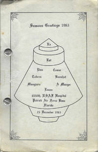
1963rif. 9099Cocoa Beach Florida 1963. Octavo-sized metal post binding 21.5 x 14 cm 100 leaves printed rectos only. Illustrated. Author title and publication information from cover. A community cookbook with recipes attributed from the airmen and airmen's spouses living at Patrick Air Force. Patrick AFB is a significant location in the history of the American space program and 1963 just two years after the first manned space flight Gagarin and the first human-piloted space flight Shephard. Patrick Air Force base is now Space Launch 45 "the premier launch delta of the United States Space Force." Thor and Atlas Missiles as well as the Titan Booster were the stock in trade of PAFB from the time of this cookbook through the 1980s. The illustration of a space capsule on the front wrapper panel is of a Mercury capsule the capsule that carried John Glenn on the first American orbital flight in 1962. A bit of light soiling otherwise fine in publisher's gray card stock titled and illustrated in black. Unrecorded. OCLC locates no copies; no other references found online or otherwise. unknown
1963rif. 9099Cocoa Beach Florida 1963. Octavo-sized metal post binding 21.5 x 14 cm 100 leaves printed rectos only. Illustrated. Author title and publication information from cover. A community cookbook with recipes attributed from the airmen and airmen's spouses living at Patrick Air Force. Patrick AFB is a significant location in the history of the American space program and 1963 just two years after the first manned space flight Gagarin and the first human-piloted space flight Shephard. Patrick Air Force base is now Space Launch 45 "the premier launch delta of the United States Space Force." Thor and Atlas Missiles as well as the Titan Booster were the stock in trade of PAFB from the time of this cookbook through the 1980s. The illustration of a space capsule on the front wrapper panel is of a Mercury capsule the capsule that carried John Glenn on the first American orbital flight in 1962. A bit of light soiling otherwise fine in publisher's gray card stock titled and illustrated in black. Unrecorded. OCLC locates no copies; no other references found online or otherwise. unknown books
2001rif. G1561642266I4N00Pineapple Press Incorporated 2001. Hardcover. Very Good. May have limited writing in cover pages. Pages are unmarked. ~ ThriftBooks: Read More Spend Less.Dust jacket quality is not guaranteed. Pineapple Press, Incorporated hardcover
rif. 0243220758.Gpaperback. Good. Access codes and supplements are not guaranteed with used items. May be an ex-library book. paperback
rif. 0666024456.Ghardcover. Good. Access codes and supplements are not guaranteed with used items. May be an ex-library book. hardcover