935 risultati
rif. 12698Colombo, Alliance Française de Ceylan, 1955. 1 brochure in-8, couvertures souples illustrées 76 pp., enrichie de nombreuses illustrations photographiques en noir et blanc et en couleurs et de nombreuses publicités, très bon état.
rif. 13135Colombo, Alliance Française de Ceylan, 1955. 1 brochure in-8, couvertures souples illustrées 76 pp., enrichie de nombreuses illustrations photographiques en noir et blanc et en couleurs et de nombreuses publicités, très bon état.
rif. 201015197Basel, Druck der schweiz verlag druckerei G. Bohm, 1909 ; in-8, 253 pp., cartonnage de l'éditeur (1er plat illustré). En superbe état.
rif. 201003271Paris, Éditions G.P. presses de la cité - coup d'oeil sur le monde , 1977 ; petit in-4, 110 pp., cartonnage de l'éditeur. Très bon état.
rif. 18344Paris, Dentu, 1884. In-12 de 346 pages, illustrations. Bon état. Toile rouge. Nombreux tampons de Radio France et ORTF.
1997rif. 120197New Delhi, India, Asian Educational Services 1997 In-8 22 x 13,5 cm. Reliure éditeur simili-cuir grenat, dos lisse, pièces auteur & titre noires, report du titre sur le premier plat orné d’un motif dorés, 165 pp.,1 carte & 65 planches hors texte, sommaire, table des planches, index. Exemplaire en très bon état.
rif. 18278Paris, Dentu, 1881. In-12 de 369 pages, illustrations. Toile rouge. Nombreux tampons de Radio France et ORTF.
rif. 11254Colombo, Kandy and Nuwara Eliya, Plété & Co., ca 1925. 1 volume oblong quarto, original printed and illustrated wrappers, a very good copy.
rif. 11255Colombo, Kandy and Nuwara Eliya, Plété & Co., ca 1925. 1 volume oblong quarto, original printed and illustrated wrappers, rebound in modern full bordeaux leather, a very good copy.
rif. 18279Paris, Dentu, 1884. In-12 de 378 pages, illustrations. Toile rouge. Nombreux tampons de Radio France et ORTF.
rif. 18288Paris, Dentu, 1881. In-12 de 350 pages, illustrations. Toile rouge. Nombreux tampons de Radio France et ORTF.
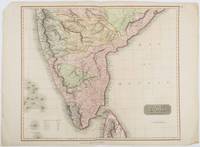
1816rif. 185242London.: Thomson. 1816. Engraved map with full handcolour 50.5 x 59.7 cms ; 53.9 x 73.8 cms sheet central fold a few minor edge tears one intruding into the top border the map unscathed marginal edgewear two corners with some loss but the map in very good crisp condition. An elegant map with great detail prepared for John Thomson's influential "New General Atlas" 1814-1821. Showing India from 20 degrees to 7 degrees north of the equator and includes the northern half of Ceylon with territorial interests attractively coloured. . Thomson. unknown
1947rif. 284821947 P., Les Editions du Panthéon (Collection "Pastels"), 1947, in 8° broché, 283 pages ; petite déchirure sans manque à une page ; couverture illustrée en couleurs (légèrement fanée).
1920rif. 109986Paris, Librairie Hachette, coll. « Bibliothèque d’Art » 1920 In-12 19,5 x 14 cm. Broché, couverture beige, titre en bleu-marine sur le dos et le premier plat, 361 pp. Couverture ternie.
1954rif. 222612Australia. Circa1954. An album of 128 black and white photographs and 12 colour postcards detailing a trip to Ceylon in 1954 cord tie. 25 x 33cm. Few postcards loose leaves trifle friable cloth-covered boards little shelf worn overall in good condition. Although the album begins with aerial shots of the P&O Stratheden in Sydney and includes a few non-contemporary studio photographs of Ceylon the majority of the album is comprised of private photographs with handwritten captions and dates. Loosely inserted at the rear is the original photographic film within a Kodak-branded sleeve a 14-page stapled booklet introducing guests to the Galle Face Hotel in Colombo and an itinerary of a motor tour of Ceylon presumably undertaken by the album's creator. . hardcover
Tre carte litografiche a colori di cm. 20 x 26, prima metà '800 c.a.
1981Un ouvrage de 64 pages, format 120 x 195 mm, illustré, broché couverture couleurs, publié en 1981, Editions Marcus, collection "Guide Poche-Voyage", bon état
1900rif. 316899London: Sampson Low Marston and Company Limited St. Dunstan s House 1900. First Edition. Illustrated with photos by the Author and full-page partially colored map. xii 474 ii pp. 8vo. Bound in half brown polished calf marbled paper sides red leather title label a.e.g. Fine. First Edition. Illustrated with photos by the Author and full-page partially colored map. xii 474 ii pp. 8vo. Sampson Low, Marston and Company, Limited, St. Dunstan s House unknown books
1900rif. 316899London: Sampson Low Marston and Company Limited St. Dunstan s House 1900. First Edition. Illustrated with photos by the Author and full-page partially colored map. xii 474 ii pp. 8vo. Bound in half brown polished calf marbled paper sides red leather title label a.e.g. Fine. First Edition. Illustrated with photos by the Author and full-page partially colored map. xii 474 ii pp. 8vo. Sampson Low, Marston and Company, Limited, St. Dunstan s House unknown
rif. 14157Paris Imprimerie Lemercier et Cie 0 53x72 1 carte marine (à toutes marges) pliée en deux. (N° 2241). Ce plan est la reproduction de celui des Capitaines Dougal et Harris de la Marine Royale d'Angleterre. Carte gravée par J. Geisendörfer (Corrections secondaires en 1870, corrections essentielles en 1871) et imprimée sur beau vergé fort filigrané (tirage ancien, de la fin du XIXème siècle). Bel exemplaire, Marge inférieure légérement effrangée avec un petit manque
rif. 141600 103x69,5 1 carte marine (à toutes marges) pliée en quatre. (N° 2372). Cette carte est dressée d'après les travaux Anglais les plus récents. Carte gravée par Francoz (Corrections secondaires en 1870-1874, corrections essentielles en 1872-1875) et imprimée sur beau vergé fort filigrané (tirage ancien, de la fin du XIXème siècle). Bel exemplaire
rif. 141610 70x103 1 carte marine (à toutes marges) pliée en quatre. (N° 2373). Cette carte est dressée d'après les travaux Anglais les plus récents. Carte gravée par Grenier (Corrections secondaires en 1870) et imprimée sur beau vergé fort filigrané (tirage ancien, de la fin du XIXème siècle). Bel exemplaire
rif. 141560 53x71 1 carte marine (à toutes marges) pliée en deux. (N° 3075). D'après le levé éxécuté en 1860 par le Capitaine W.-J.-S. Pullen de la Marine Royale d'Angleterre. Carte gravée par Erhard (corrections essentielles en 1874) et imprimée sur beau vergé fort filigrané (tirage ancien, de la fin du XIXème siècle). Bel exemplaire
rif. 106.566Bruxelles, Etablissements Vromant, 1924. 15 x 20, 200 pp., frontispice en couleurs, 225 illustrations, broché, très bon état.
1920rif. 7560ALondon, Murray, 1920. Kl. 8°. CLXXV, 726 Seiten. Mit 79 meist farbigen Karten und Plänen. OLeinenband. Rücken etwas verblichen. 10. Auflage.